- San Francisco
-
This article is about the city and county in California. For other uses, see San Francisco (disambiguation).
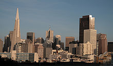
San Francisco — City and county — City and County of San Francisco San Francisco from the Marin Headlands, with the Golden Gate Bridge in the foreground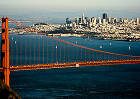
Flag
SealNickname(s): The City by the Bay
Fog City
The City (local)[1]
Frisco (deprecated)[2][3][4]
The City that Knows How (antiquated)[5]
Baghdad by the Bay (antiquated)[6]
The Paris of the West[7]Motto: Oro en Paz, Fierro en Guerra
(Spanish for "Gold in Peace, Iron in War")Location of San Francisco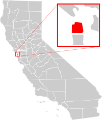 Location in the United States
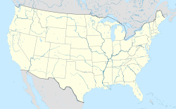
 San Francisco
Coordinates: 37°46′45.48″N 122°25′9.12″W / 37.7793°N 122.4192°WCoordinates: 37°46′45.48″N 122°25′9.12″W / 37.7793°N 122.4192°W Country United States State California Founded June 29, 1776 Incorporated April 16, 1850[8] Founder Lieutenant José Joaquin Moraga and Father Francisco Palóu Named for Saint Francis of Assisi Government - Type Mayor-Council - Mayor Edwin M. Lee - Board of Supervisors Supervisors- State Assembly Fiona Ma (D)
Tom Ammiano (D)- State Senate Mark Leno (D)
Leland Yee (D)- U.S. House Nancy Pelosi (D)
Jackie Speier (D)Area[9] - City and county 231.89 sq mi (600.6 km2) - Land 46.87 sq mi (121.4 km2) - Water 185.02 sq mi (479.2 km2) 79.79% - Metro 3,524.4 sq mi (9,128.2 km2) Elevation 52 ft (16 m) Highest elevation 925 ft (282 m) Lowest elevation 0 ft (0 m) Population (2010)[9][10] CSA: 7,468,390 - City and county 805,235 - Density 17,179.2/sq mi (6,632.9/km2) - Urban 3,273,190 - Metro 4,335,391 Demonym San Franciscan Time zone Pacific Standard Time (UTC-8) - Summer (DST) Pacific Daylight Time (UTC-7) ZIP Code 94101–94112, 94114–94147, 94150–94170, 94172, 94175, 94177 Area code(s) 415 Website www.sfgov.org San Francisco (/ˌsæn frənˈsɪskoʊ/), officially the City and County of San Francisco, is the financial, cultural, and transportation center of the San Francisco Bay Area, a region of 7.15 million people which includes San Jose and Oakland.[11] The only consolidated city-county in California,[12] it encompasses a land area of about 46.9 square miles (121 km2)[13] on the northern end of the San Francisco Peninsula, giving it a density of about 17,179 people per square mile (6,632 people per km2). It is the most densely settled large city (population greater than 200,000) in the state of California and the second-most densely populated large city in the United States after New York City.[14] San Francisco is the fourth most populous city in California and the 13th most populous city in the United States, with a population of 805,235 as of the 2010 Census.[15]
In 1776, colonists from Spain established a fort at the Golden Gate and a mission named for Francis of Assisi on the site.[16] The California Gold Rush of 1849 propelled the city into a period of rapid growth, increasing the population in one year from 1,000 to 25,000,[17] and thus transforming it into the largest city on the West Coast at the time. After three-quarters of the city was destroyed by the 1906 earthquake and fire,[18] San Francisco was quickly rebuilt, hosting the Panama-Pacific International Exposition nine years later. During World War II, San Francisco was the port of embarkation for service members shipping out to the Pacific Theater.[19] After the war, the confluence of returning servicemen, massive immigration, liberalizing attitudes, and other factors led to the Summer of Love and the gay rights movement, cementing San Francisco as a center of liberal activism in the United States.
Today, San Francisco is one of the top tourist destinations in the world,[20] ranking 33rd out of the 100 most visited cities worldwide,[21] and is renowned for its chilly summer fog, steep rolling hills, eclectic mix of architecture, and its famous landmarks, including the Golden Gate Bridge, cable cars, and Chinatown. The city is also a principal banking and finance center, and the home to more than 30 international financial institutions,[22] helping to make San Francisco rank eighteenth in the world's top producing cities, ninth in the United States, and thirteenth place in the top twenty global financial centers.
Contents
History
Main article: History of San Francisco Mission San Francisco de Asís (Mission Dolores)
The earliest archaeological evidence of human habitation of the territory of the city of San Francisco dates to 3000 BC.[23] The Yelamu group of the Ohlone people resided in several small villages when a Spanish exploration party, led by Don Gaspar de Portolà arrived on November 2, 1769, the first documented European visit to San Francisco Bay.[24] Seven years later, on March 28, 1776, the Spanish established the Presidio of San Francisco, followed by a mission, Mission San Francisco de Asís (Mission Dolores).
Upon independence from Spain in 1821, the area became part of Mexico. Under Mexican rule, the mission system gradually ended and its lands began to be privatized. In 1835, Englishman William Richardson erected the first independent homestead,[25] near a boat anchorage around what is today Portsmouth Square. Together with Alcalde Francisco de Haro, he laid out a street plan for the expanded settlement, and the town, named Yerba Buena, began to attract American settlers. Commodore John D. Sloat claimed California for the United States on July 7, 1846, during the Mexican-American War, and Captain John B. Montgomery arrived to claim Yerba Buena two days later. Yerba Buena was renamed San Francisco on January 30 of the next year,[26] and Mexico officially ceded the territory to the United States at the end of the war. Despite its attractive location as a port and naval base, San Francisco was still a small settlement with inhospitable geography.[27]
 Portsmouth Square in 1851
The California Gold Rush brought a flood of treasure seekers. With their sourdough bread in tow,[28] prospectors accumulated in San Francisco over rival Benicia,[29] raising the population from 1,000 in 1848 to 25,000 by December 1849.[17] The promise of fabulous riches was so strong that crews on arriving vessels deserted and rushed off to the gold fields, leaving behind a forest of masts in San Francisco harbor.[30] California was quickly granted statehood, and the U.S. military built Fort Point at the Golden Gate and a fort on Alcatraz Island to secure the San Francisco Bay. Silver discoveries, including the Comstock Lode in 1859, further drove rapid population growth.[31] With hordes of fortune seekers streaming through the city, lawlessness was common, and the Barbary Coast section of town gained notoriety as a haven for criminals, prostitution, and gambling.[32]
Entrepreneurs sought to capitalize on the wealth generated by the Gold Rush. Early winners were the banking industry which saw the founding of Wells Fargo in 1852 and the Bank of California in 1864. Development of the Port of San Francisco and the establishment in 1869 of overland access to the Eastern U.S. rail system via the newly completed Pacific Railroad (the construction of which the city had only reluctantly helped support[33]) helped make the Bay Area a center for trade. Catering to the needs and tastes of the growing population, Levi Strauss opened a dry goods business and Domingo Ghirardelli began manufacturing chocolate. Immigrant laborers made the city a polyglot culture, with Chinese railroad workers creating the city's Chinatown quarter. The first cable cars carried San Franciscans up Clay Street in 1873. The city's sea of Victorian houses began to take shape, and civic leaders campaigned for a spacious public park, resulting in plans for Golden Gate Park. San Franciscans built schools, churches, theaters, and all the hallmarks of civic life. The Presidio developed into the most important American military installation on the Pacific coast.[34] By the turn of the century, San Francisco was a major city known for its flamboyant style, stately hotels, ostentatious mansions on Nob Hill, and a thriving arts scene.[35]
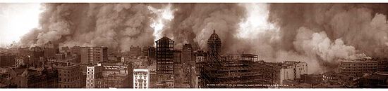 "Not in history has a modern imperial city been so completely destroyed. San Francisco is gone." –Jack London after the 1906 earthquake and fire[36]
At 5:12 am on April 18, 1906, a major earthquake struck San Francisco and northern California. As buildings collapsed from the shaking, ruptured gas lines ignited fires that would spread across the city and burn out of control for several days. With water mains out of service, the Presidio Artillery Corps attempted to contain the inferno by dynamiting blocks of buildings to create firebreaks.[37] More than three-quarters of the city lay in ruins, including almost all of the downtown core.[18] Contemporary accounts reported that 498 people lost their lives, though modern estimates put the number in the several thousands.[38] More than half the city's population of 400,000 were left homeless.[39] Refugees settled temporarily in makeshift tent villages in Golden Gate Park, the Presidio, on the beaches, and elsewhere. Many fled permanently to the East Bay.

Rebuilding was rapid and performed on a grand scale. Rejecting calls to completely remake the street grid, San Franciscans opted for speed.[40] Amadeo Giannini's Bank of Italy, later to become Bank of America, provided loans for many of those whose livelihoods had been devastated. The destroyed mansions of Nob Hill became grand hotels. City Hall rose again in splendorous Beaux Arts style, and the city celebrated its rebirth at the Panama-Pacific International Exposition in 1915.[41]
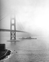
In ensuing years, the city solidified its standing as a financial capital; in the wake of the 1929 stock market crash, not a single San Francisco-based bank failed.[42] Indeed, it was at the height of the Great Depression that San Francisco undertook two great civil engineering projects, simultaneously constructing the San Francisco – Oakland Bay Bridge and the Golden Gate Bridge, completing them in 1936 and 1937 respectively. It was in this period that the island of Alcatraz, a former military stockade, began its service as a federal maximum security prison, housing notorious inmates such as Al Capone, and Robert Franklin Stroud, The Birdman of Alcatraz. San Francisco later celebrated its regained grandeur with a World's Fair, the Golden Gate International Exposition in 1939–40, creating Treasure Island in the middle of the bay to house it.
During World War II, the Hunters Point Naval Shipyard became a hub of activity, and Fort Mason became the primary port of embarkation for service members shipping out to the Pacific Theater of Operations.[19] The explosion of jobs drew many people, especially African Americans from the South, to the area. After the end of the war, many military personnel returning from service abroad and civilians who had originally come to work decided to stay. The UN Charter creating the UN was drafted and signed in San Francisco in 1945 and, in 1951, the Treaty of San Francisco officially ended the war with Japan.
Urban planning projects in the 1950s and 1960s involved widespread destruction and redevelopment of west-side neighborhoods and the construction of new freeways, of which only a series of short segments were built before being halted by citizen-led opposition.[43] The Transamerica Pyramid was completed in 1972,[44] and in the 1980s the Manhattanization of San Francisco saw extensive high-rise development downtown.[45] Port activity moved to Oakland, the city began to lose industrial jobs, and San Francisco began to turn to tourism as the most important segment of its economy. The suburbs experienced rapid growth, and San Francisco underwent significant demographic change, as large segments of the white population left the city, supplanted by an increasing wave of immigration from Asia and Latin America.[46][47] Over this period, San Francisco became a magnet for America's counterculture. Beat Generation writers fueled the San Francisco Renaissance and centered on the North Beach neighborhood in the 1950s.[48] Hippies flocked to Haight-Ashbury in the 1960s, reaching a peak with the 1967 Summer of Love.[49] In the 1970s, the city became a center of the gay rights movement, with the emergence of The Castro as an urban gay village, the election of Harvey Milk to the Board of Supervisors, and his assassination, along with that of Mayor George Moscone, in 1978.[50]
The 1989 Loma Prieta earthquake caused destruction and loss of life throughout the Bay Area. In San Francisco, the quake severely damaged structures in the Marina and South of Market districts and precipitated the demolition of the damaged Embarcadero Freeway and much of the damaged Central Freeway, allowing the city to reclaim its historic downtown waterfront.
During the dot-com boom of the late 1990s, startup companies invigorated the economy. Large numbers of entrepreneurs and computer application developers moved into the city, followed by marketing and sales professionals, changing the social landscape as once-poorer neighborhoods became gentrified. When the bubble burst in 2001, many of these companies folded, and their employees left, although high technology and entrepreneurship continue to be mainstays of the San Francisco economy.[51]
Geography
 The San Francisco Peninsula
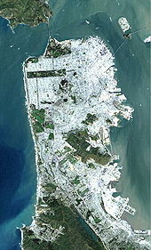
San Francisco is located on the West Coast of the United States at the tip of the San Francisco Peninsula and includes significant stretches of the Pacific Ocean and San Francisco Bay within its boundaries. Several islands—Alcatraz, Treasure Island, and the adjacent Yerba Buena Island, and a small portion of Alameda Island, Red Rock Island, and Angel Island are part of the city. Also included are the uninhabited Farallon Islands, 27 miles (43 km) offshore in the Pacific Ocean. The mainland within the city limits roughly forms a "seven-by-seven-mile square," a common local colloquialism referring to the city's shape, though its total area, including water, is nearly 232 square miles (600 km2).
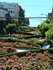 Cars navigate Lombard Street to descend Russian Hill.
San Francisco is famous for its hills. There are more than 50 hills within city limits.[52] Some neighborhoods are named after the hill on which they are situated, including Nob Hill, Pacific Heights, and Russian Hill. Near the geographic center of the city, southwest of the downtown area, are a series of less densely populated hills. Twin Peaks, a pair of hills resting at one of the city's highest points, forms a popular overlook spot. San Francisco's tallest hill, Mount Davidson, is 925 feet (282 m) high and is capped with a 103-foot (31 m) tall cross built in 1934.[53] Dominating this area is Sutro Tower, a large red and white radio and television transmission tower.
The nearby San Andreas and Hayward Faults are responsible for much earthquake activity, although neither physically passes through the city itself. The San Andreas Fault caused the earthquakes in 1906 and 1989. Minor earthquakes occur on a regular basis. The threat of major earthquakes plays a large role in the city's infrastructure development. The city has repeatedly upgraded its building codes, requiring retrofits for older buildings and higher engineering standards for new construction.[54] However, there are still thousands of smaller buildings that remain vulnerable to quake damage.[55]
San Francisco's shoreline has grown beyond its natural limits. Entire neighborhoods such as the Marina and Hunters Point, as well as large sections of the Embarcadero, sit on areas of landfill. Treasure Island was constructed from material dredged from the bay as well as material resulting from tunneling through Yerba Buena Island during the construction of the Bay Bridge. Such land tends to be unstable during earthquakes; the resultant liquefaction causes extensive damage to property built upon it, as was evidenced in the Marina district during the 1989 Loma Prieta earthquake.[56]
Climate
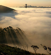 Fog is a regular feature of San Francisco summers.
A popular quote incorrectly attributed to Mark Twain is "The coldest winter I ever spent was a summer in San Francisco."[57][58] San Francisco's climate is characteristic of the cool-summer Mediterranean climate[59] of California’s coast, "generally characterized by moist mild winters and dry summers."[60] Since it is surrounded on three sides by water, San Francisco's weather is strongly influenced by the cool currents of the Pacific Ocean, which moderates temperature swings and produces a remarkably mild year-round climate with little seasonal temperature variation.
Among major U.S. cities, San Francisco has the coldest daily mean, maximum, and minimum temperatures for June, July and August.[61] During the summer, rising hot air in California's interior valleys creates a low pressure area that draws winds from the North Pacific High through the Golden Gate, which creates the city's characteristic cool winds and fog.[62] The fog is less pronounced in eastern neighborhoods and during the late summer and early fall, which is the warmest time of the year.
Because of its sharp topography and maritime influences, San Francisco exhibits a multitude of distinct microclimates. The high hills in the geographic center of the city are responsible for a 20% variance in annual rainfall between different parts of the city. They also protect neighborhoods directly to their east from the foggy and sometimes very cold and windy conditions experienced in the Sunset District; for those who live on the eastern side of the city, San Francisco is sunnier, with an average of 260 clear days, and only 105 cloudy days per year.
Temperatures exceed 75 °F (24 °C) on average only 28 days a year.[63] The dry period of May to October is mild to warm, with average high temperatures of 64–71 °F (18–22 °C) and lows of 51–56 °F (11–13 °C). The rainy period of November to April is slightly cooler with high temperatures of 58–64 °F (14–18 °C) and lows of 46–51 °F (8–11 °C). On average, there are 67 rainy days a year, and annual precipitation averages 20.4 inches (518.16 mm).[63] Snow is extraordinarily rare, with only 10 instances recorded since 1852, most recently in 1976.[64]
The highest recorded temperature at the official National Weather Service office was 103 °F (39 °C) on July 17, 1988, and June 14, 2000. The lowest recorded temperature was 27 °F (−3 °C) on December 11, 1932.[65] The U.S. National Weather Service provides a helpful visual aid[66] graphing the information in the table below to display visually by month the annual typical temperatures, the past year's temperatures, and record temperatures.
Climate data for San Francisco (downtown) Month Jan Feb Mar Apr May Jun Jul Aug Sep Oct Nov Dec Year Record high °F (°C) 79
(26)81
(27)99
(37)100
(38)101
(38)103
(39)103
(39)102
(39)102
(39)102
(39)86
(30)76
(24)103
(39)Average high °F (°C) 58.1
(14.5)61.4
(16.3)62.5
(16.9)64.5
(18.1)65.4
(18.6)67.7
(19.8)68.2
(20.1)69.2
(20.7)71.3
(21.8)70.4
(21.3)64.1
(17.8)58.6
(14.8)65.12
(18.40)Average low °F (°C) 46.4
(8.0)48.5
(9.2)49.2
(9.6)50.1
(10.1)51.4
(10.8)53.2
(11.8)54.4
(12.4)55.6
(13.1)56.1
(13.4)54.6
(12.6)50.8
(10.4)46.7
(8.2)51.42
(10.79)Record low °F (°C) 27
(−2.8)31
(−0.6)35
(2)40
(4)43
(6)46
(8)47
(8)48
(9)48
(9)43
(6)38
(3)27
(−2.8)27
(−2.8)Rainfall inches (mm) 4.72
(119.9)4.15
(105.4)3.40
(86.4)1.25
(31.8).54
(13.7).13
(3.3).04
(1).09
(2.3).28
(7.1)1.19
(30.2)3.31
(84.1)3.18
(80.8)22.28
(565.9)Avg. rainy days (≥ 0.01 in) 11.4 10.8 11.2 6.2 3.3 1.4 .4 .9 2.1 4.1 8.7 9.6 70.1 Sunshine hours 185.9 207.7 269.1 309.3 325.1 311.4 313.3 287.4 271.4 247.1 173.4 160.6 3,061.7 Source no. 1: NOAA (normals 1971–2000) [67][68] Source no. 2: WRCC (extremes 1914–present) [69] Cityscape


San Francisco from day to night, as seen from Twin Peaks Neighborhoods
 San Francisco's Chinatown is the oldest and one of the largest in North America.Main article: Neighborhoods in San Francisco
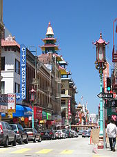
The historic center of San Francisco is the northeast quadrant of the city bordered by Market Street to the south. It is here that the Financial District is centered, with Union Square, the principal shopping and hotel district, nearby. Cable cars carry riders up steep inclines to the summit of Nob Hill, once the home of the city's business tycoons, and down to Fisherman's Wharf, a tourist area featuring Dungeness crab from a still-active fishing industry. Also in this quadrant are Russian Hill, a residential neighborhood with the famously crooked Lombard Street, North Beach, the city's Little Italy, and Telegraph Hill, which features Coit Tower. Nearby is San Francisco's Chinatown, established in the 1840s.[70][71][72][73]
The Mission District was populated in the 19th century by Californios and working-class immigrants from Germany, Ireland, Italy and Scandinavia. In the 1910s, a wave of Central American immigrants settled in the Mission and, in the 1950s, immigrants from Mexico began to predominate.[74] In recent years rapid gentrification has spread, primarily along the Valencia Street corridor, which is strongly associated with modern hipster sub-culture. Haight-Ashbury, famously associated with 1960s hippie culture, later became home to expensive boutiques[75] and a few controversial chain stores,[76] although it still retains some bohemian character. Historically known as Eureka Valley, the area now popularly called the Castro is the center of gay life in the city.[77]
The city's Japantown district suffered when its Japanese American residents were forcibly removed and interned during World War II. The nearby Western Addition became established with a large African American population at the same time. The "Painted Ladies", a row of well-restored Victorian homes, stand alongside Alamo Square, and the mansions built by the San Francisco business elite in the wake of the 1906 earthquake can be found in Pacific Heights. The Marina to the north is a lively area with many young urban professionals.[78]
The Richmond, the vast region north of Golden Gate Park that extends to the Pacific Ocean, has a portion called "New Chinatown" but is also home to immigrants from other parts of Asia and Russia. South of Golden Gate Park lies the Sunset with a predominantly Asian population.[79] The Richmond and the Sunset are largely middle class and, together, are known as The Avenues. These two districts are each sometimes further divided into two regions: the Outer Richmond and Outer Sunset can refer to the more Western portions of their respective district and the Inner Richmond and Inner Sunset can refer to the more Eastern portions. Bayview-Hunters Point in the southeast section of the city is one of the poorest neighborhoods and suffers from a high rate of crime, though the area has been the focus of controversial plans for urban renewal.
The South of Market, once filled with decaying remnants of San Francisco's industrial past, has seen significant redevelopment. The locus of the dot-com boom during the late 1990s, by 2004 South of Market began to see skyscrapers and condominiums dot the area (see Manhattanization). Following the success of nearby South Beach, another neighborhood, Mission Bay, underwent redevelopment, anchored by a second campus of the University of California, San Francisco. Just southwest of Mission Bay is the Potrero Hill neighborhood featuring sweeping views of downtown San Francisco.
Beaches and parks
See also: List of parks in San FranciscoSeveral of San Francisco's parks and nearly all of its beaches form part of the regional Golden Gate National Recreation Area, one of the most visited units of the National Park system in the United States with over 13 million visitors a year. Among the GGNRA's attractions within the city are Ocean Beach, which runs along the Pacific Ocean shoreline and is frequented by a vibrant surfing community, and Baker Beach, which is located in a cove west of the Golden Gate and part of the Presidio, a former military base. Also within the Presidio is Crissy Field, a former airfield that was restored to its natural salt marsh ecosystem. The GGNRA also administers Fort Funston, Lands End, Fort Mason, and Alcatraz. The National Park Service separately administers the San Francisco Maritime National Historical Park – a fleet of historic ships and waterfront property around Aquatic Park.
There are more than 200 parks maintained by the San Francisco Recreation and Parks Department.[80] The largest and best-known city park is Golden Gate Park,[81] which stretches from the center of the city west to the Pacific Ocean. Once covered in native grasses and sand dunes, the park was conceived in the 1860s and was created by the extensive planting of thousands of non-native trees and plants. The large park is rich with cultural and natural attractions such as the Conservatory of Flowers, Japanese Tea Garden and San Francisco Botanical Garden. Lake Merced is a fresh-water lake surrounded by parkland and near the San Francisco Zoo, a city-owned park that houses more than 250 animal species, many of which are designated as endangered.[82] The only park managed by the California State Park system located principally in San Francisco, Candlestick Point was the state's first urban recreation area.[83]
Culture and contemporary life
Main article: Culture of San FranciscoSee also: San Francisco in popular cultureIn recent years, the wealth resulting from the IT boom from the nearby Silicon Valley, as well as from the recent Dot-Com booms has created a high standard of living in San Francisco, attracting white-collar workers to San Francisco from all over the world.[84] Many neighborhoods that were once blue-collar, middle, and lower class have been gentrifying, as many of the city's traditional business and industrial districts have experienced a renaissance driven by the redevelopment of the Embarcadero, including the neighborhoods South Beach and Mission Bay. The city's property values and household income have risen to among the highest in the nation,[85][86][87] creating a large, and upscale restaurant, retail, and entertainment scene. According to a 2008 quality of life survey of global cities, San Francisco has the second highest quality of living of any U.S. city.[88] Due to the exceptionally high cost of living, many of the city's middle and lower class families have been leaving the city for the outer suburbs of the Bay Area, or for California's Central Valley.[89]
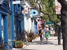 Boutiques along Fillmore Street in Pacific Heights
Although the centralized commerce and shopping districts of the Financial District and the area around Union Square are well-known around the world, San Francisco is also characterized by its culturally rich streetscapes featuring mixed-use neighborhoods anchored around central commercial corridors to which residents and visitors alike can walk. Because of these characteristics, San Francisco was rated "most walkable" city by the website Walkscore.com.[90][91] Many neighborhoods feature a mix of businesses, restaurants and venues that cater to both the daily needs of local residents while also serving many visitors and tourists. Some neighborhoods are dotted with boutiques, cafes and nightlife such as Union Street in Cow Hollow, and 24th Street in Noe Valley. Others are less so, such as Irving Street in the Sunset, or Mission Street in the Mission. This approach especially has influenced the continuing South of Market neighborhood redevelopment with businesses and neighborhood services rising alongside high-rise residences.[92]
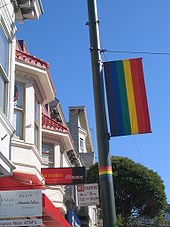 The rainbow flag, symbol of LGBT pride, originated in San Francisco; banners like this one decorate streets in The Castro.
The international character San Francisco has fostered since its founding is continued today by large numbers of immigrants from Asia and Latin America. With 39% of its residents born overseas,[93] San Francisco has numerous neighborhoods filled with businesses and civic institutions catering to new arrivals. In particular, the arrival of many ethnic Chinese, which accelerated beginning in the 1970s, has complemented the long-established community historically based in Chinatown throughout the city and has transformed the annual Chinese New Year Parade into the largest event of its kind outside China.[94]
Following the arrival of the "beat" writers and artists of the 1950s, to the societal changes that culminated with the Summer of Love in the Haight-Ashbury district during the 1960s, San Francisco became an epicenter of liberal activism, with Democrats and Greens dominating city politics. San Francisco has not voted more than 20% for a Republican presidential or senatorial candidate since 1988.[95] In 2007, the city expanded its Medicaid and other indigent medical programs into the "Healthy San Francisco" program,[96] which subsidizes certain medical services for eligible residents.[97][98][99]
The city's large gay population has created and sustained a politically and culturally active community over many decades, developing a powerful presence in San Francisco's civic life. One of the most popular destinations for gay tourists internationally, the city hosts San Francisco Pride, one of the largest and oldest pride parades.
Public nudity is legal so long as the individual is not sexually aroused and places a towel on their seat.[100]
Entertainment and performing arts
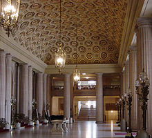 The lobby of the War Memorial Opera House, one of the last buildings erected in Beaux Arts style in the United States
San Francisco's War Memorial and Performing Arts Center hosts some of the most enduring performing-arts companies in the U.S. The War Memorial Opera House houses the San Francisco Opera, the second-largest opera company in North America[101] as well as the San Francisco Ballet, while the San Francisco Symphony plays in Davies Symphony Hall. The Herbst Theatre stages an eclectic mix of music performances, as well as public radio's City Arts & Lectures.
The Fillmore is a music venue located in the Western Addition. It is the second incarnation of the historic venue that gained fame in the 1960s under concert promoter Bill Graham, housing the stage where now-famous musicians such as the Grateful Dead, Janis Joplin, Led Zeppelin and Jefferson Airplane first performed, fostering the San Francisco Sound. Beach Blanket Babylon is a zany musical revue and a civic institution that has performed to sold-out crowds in North Beach since 1974.
The American Conservatory Theater (A.C.T.) has been a force in Bay Area performing arts since its arrival in San Francisco in 1967, regularly staging productions. San Francisco frequently hosts national touring productions of Broadway theatre shows in a number of vintage 1920s-era venues in the Theater District including the Curran, Orpheum, and Golden Gate Theatres.
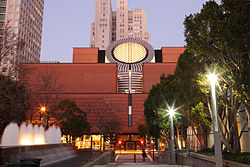 The red brick and central circular structure of the San Francisco Museum of Modern Art as seen from Yerba Buena Gardens. The Art Deco-style PacBell Building (1925) rises behind the museum.
Museums
Main article: List of museums in San FranciscoThe Museum of Modern Art (SFMOMA) houses 20th century and contemporary works of art. It moved to its current building in the South of Market neighborhood in 1995 and now attracts more than 600,000 visitors annually.[102] The Palace of the Legion of Honor holds primarily European antiquities and works of art at its Lincoln Park building modeled after its Parisian namesake. It is administered by Fine Arts Museums of San Francisco, which also operates the de Young Museum in Golden Gate Park. The de Young's collection features American decorative pieces and anthropological holdings from Africa, Oceania and the Americas. Prior to construction of its current copper-clad structure, completed in 2005, the de Young also housed the Asian Art Museum, which, with artifacts from over 6,000 years of history across Asia, moved into the former public library next to Civic Center in 2003.
Opposite the Music Concourse from the de Young stands the California Academy of Sciences, a natural history museum that also hosts the Morrison Planetarium and Steinhart Aquarium. Its current structure, featuring a living roof, is an example of sustainable architecture and opened in 2008. The Palace of Fine Arts, built originally for the 1915 Panama-Pacific Exposition, has since 1969 housed the Exploratorium, an interactive science museum.
Media
Main article: Media in San FranciscoThe major daily newspaper in San Francisco is the San Francisco Chronicle, which is currently Northern California's most widely circulated newspaper.[103] The Chronicle is most famous for a former columnist, the late Herb Caen, whose daily musings attracted critical acclaim and represented the "voice of San Francisco". The San Francisco Examiner, once the cornerstone of William Randolph Hearst's media empire and the home of Ambrose Bierce, declined in circulation over the years and now takes the form of a free daily tabloid.[104][105] Sing Tao Daily claims to be the largest of several Chinese language dailies that serve the Bay Area.[106] Alternative weekly newspapers include the San Francisco Bay Guardian and SF Weekly. San Francisco Magazine and 7x7 are major glossy magazines about San Francisco. The national newsmagazine Mother Jones is also based in San Francisco.
The San Francisco Bay Area is the sixth-largest TV market[107] and the fourth-largest radio market[108] in the U.S. The city's oldest radio station, KCBS (AM), began as an experimental station in San Jose in 1909. KALW was the city's first FM radio station when it signed on the air in 1941. All major U.S. television networks have affiliates serving the region, with most of them based in the city. There also are several unaffiliated stations, and BBC, CNN and ESPN have regional news bureaus in San Francisco. The city's first television station was KPIX, which began broadcasting in 1948.
Public broadcasting outlets include both a television station and a radio station, both broadcasting under the call letters KQED from a facility near the Potrero Hill neighborhood. KQED-FM is the most-listened-to National Public Radio affiliate in the country.[109] San Francisco–based CNET and Salon.com pioneered the use of the Internet as a media outlet.
Sports and recreation
Main article: Sports in San FranciscoThe San Francisco 49ers of the National Football League (NFL) are the longest-tenured major professional sports franchise in the city. The team began play in 1946 as an All-America Football Conference (AAFC) league charter member, moved to the NFL in 1950 and into Candlestick Park in 1971. The 49ers won five Super Bowl titles in the 1980s and 1990s behind coaches Bill Walsh and George Seifert, and stars such as Joe Montana, Steve Young, Ronnie Lott, and Jerry Rice.
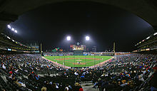 AT&T Park.
Major League Baseball's San Francisco Giants left New York for California prior to the 1958 season. Though boasting such stars as Willie Mays, Willie McCovey and Barry Bonds, the club went 52 years until its first World Series title in 2010. The Oakland Athletics had swept the Giants in the 1989 World Series, after Game 3 in San Francisco was infamously pre-empted by the Loma Prieta earthquake. The Giants play at AT&T Park, which opened in 2000, a cornerstone project of the South Beach and Mission Bay redevelopment.[110]
At the collegiate level, the Dons of the University of San Francisco compete in NCAA Division I, where Bill Russell guided the program to basketball championships in 1955 and 1956. The San Francisco State Gators and the Academy of Art University Urban Knights compete in Division II. AT&T Park has since 2002 hosted an annual post-season college football bowl game, currently named the Kraft Fight Hunger Bowl. In 2011, San Francisco hosted the California Golden Bears football team at Candlestick Park and AT&T Park while their home stadium was being renovated in Berkeley.
The Bay to Breakers footrace, held annually since 1912, is best known for colorful costumes and a celebratory community spirit.[111] The San Francisco Marathon attracts more than 21,000 participants.[112] The Escape from Alcatraz triathlon has, since 1980, attracted 2,000 top professional and amateur triathletes for its annual race.[113] The Olympic Club, founded in 1860, is the oldest athletic club in the United States. Its private golf course, situated on the border with Daly City, has hosted the U.S. Open on four occasions, and will host it a fifth time in 2012. The public Harding Park Golf Course is an occasional stop on the PGA Tour. San Francisco will host the 2013 America's Cup yacht racing competition.[114]
With an ideal climate for outdoor activities, San Francisco has ample resources and opportunities for amateur and participatory sports and recreation. There are more than 200 miles (320 km) of bicycle paths, lanes and bike routes in the city,[115] and the Embarcadero and Marina Green are favored sites for skateboarding. Extensive public tennis facilities are available in Golden Gate Park and Dolores Park, as well as at smaller neighborhood courts throughout the city. Boating, sailing, windsurfing and kitesurfing are among the popular activities on San Francisco Bay, and the city maintains a yacht harbor in the Marina District. San Francisco residents have often ranked among the fittest in the U.S.[116]
Cycling is growing in San Francisco. Annual bicycle counts conducted by the Municipal Transportation Agency (MTA) in 2010 showed the number of cyclists at 33 locations had increased 58% from the 2006 baseline counts.[117] The MTA estimates that about 128,000 trips are made by bicycle each day in the city, or 6% of total trips.[118] Improvements in cycling infrastructure in recent years, including additional bike lanes and parking racks, has made cycling in San Francisco safer and more convenient. Since 2006, San Francisco has received a Bicycle Friendly Community status of "Gold" from the League of American Bicyclists.
Economy
See also: List of companies based in San FranciscoTourism is the backbone of the San Francisco economy. Its frequent portrayal in music, film, and popular culture has made the city and its landmarks recognizable worldwide. It is the city where Tony Bennett "left his heart," where the Birdman of Alcatraz spent many of his final years, and where Rice-a-Roni[120] was said to be the favorite treat. San Francisco attracts the third-highest number of foreign tourists of any city in the U.S.[dated info][20] and claims Pier 39 near Fisherman's Wharf as the third-most popular tourist attraction in the nation.[121] More than 16 million visitors arrived in San Francisco in 2007, injecting nearly $8.2 billion into the economy—both all-time high figures for the city.[122] With a large hotel infrastructure and a world-class convention facility in the Moscone Center, San Francisco is also among the top-ten North American destinations for conventions and conferences.[123] In a Euromonitor International ranking of top city destinations, San Francisco was ranked the 33rd most visited city in the world out of 100 of the world's most visited cities.[21]
The legacy of the California Gold Rush turned San Francisco into the principal banking and finance center of the West Coast in the early twentieth century. Montgomery Street in the Financial District became known as the "Wall Street of the West," home to the Federal Reserve Bank of San Francisco, the Wells Fargo corporate headquarters, and the site of the now-defunct Pacific Coast Stock Exchange. Bank of America, a pioneer in making banking services accessible to the middle class, was founded in San Francisco and in the 1960s, built the landmark modern skyscraper at 555 California Street for its corporate headquarters. Many large financial institutions, multinational banks and venture capital firms are based in or have regional headquarters in the city. With over 30 international financial institutions,[22] seven Fortune 500 companies,[124] and a large support infrastructure of professional services—including law, public relations, architecture and design—also with significant presence in the city, San Francisco is designated as one of the ten Beta World Cities.[125] The city ranks eighteenth in the world's list of cities by GDP, ninth in the United States, and is fifteenth place in the top twenty Global Financial Centres Index.[126][127]
 The San Francisco Financial District skyline framed by the Transamerica Pyramid and the Bank of America building.
San Francisco's economy has increasingly become tied to that of its Bay Area neighbor San Jose and Silicon Valley to its south, sharing the need for highly educated workers with specialized skills.[128] Due to such links with Silicon Valley, San Francisco became an epicenter of the Dot-Com bubble of the 1990s–2000s, and the subsequent Web 2.0 boom of the late 2000s. Many popular and prominent Dot-Com companies and "start-ups" such as Craigslist.org, Twitter, Salesforce.com, and the Wikimedia Foundation among others have established their head offices in San Francisco.
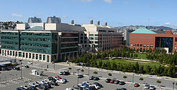
San Francisco has been positioning itself as a biotechnology and biomedical hub and research center. The Mission Bay neighborhood, site of a second campus of UCSF, fosters a budding industry and serves as headquarters of the California Institute for Regenerative Medicine, the public agency funding stem cell research programs statewide. As of 2009, there were 1,800 full-time biochemists and biophysicists employed in San Francisco, with an annual mean wage of $92,620.[129]
Small businesses with fewer than 10 employees and self-employed firms make up 85% of city establishments as lately, it has been particularly popular with entrepreneurs establishing "start-up" companies.[130] The number of San Franciscans employed by firms of more than 1,000 employees has fallen by half since 1977.[93] The successful penetration of national big box and formula retail chains into the city has been made intentionally difficult by political and civic consensus. In an effort to buoy small privately owned businesses in San Francisco and preserve the unique retail personality of the city, the Small Business Commission supports a publicity campaign to keep a larger share of retail dollars in the local economy,[131] and the Board of Supervisors has used the planning code to limit the neighborhoods in which formula retail establishments can set up shop,[132] an effort affirmed by San Francisco voters.[133]
The top employer in the city is the city government itself, employing 6.25% of the city's population, followed by University of California, San Francisco. Third, at 2.04%, is Wells Fargo, the largest private-sector employer.[134]
Law and government
Main articles: Government of San Francisco and Politics of San FranciscoSan Francisco—officially known as the City and County of San Francisco—is a consolidated city-county, a status it has held since 1856.[135] It is the only such consolidation in California.[12] The mayor is also the county executive, and the county Board of Supervisors acts as the city council. Under the city charter, the government of San Francisco is constituted of two co-equal branches. The executive branch is headed by the mayor and includes other citywide elected and appointed officials as well as the civil service. The 11-member Board of Supervisors, the legislative branch, is headed by a president and is responsible for passing laws and budgets, though San Franciscans also make use of direct ballot initiatives to pass legislation.
The members of the Board of Supervisors are elected as representatives of specific districts within the city.[136] Upon the death or resignation of mayor, the President of the Board of Supervisors becomes acting mayor until the full Board elects an interim replacement for the remainder of the term. In 1978, Dianne Feinstein assumed the office following the assassination of George Moscone and was later selected by the Board to finish the term. In 2011, Edwin M. Lee was selected by the Board to finish the term of Gavin Newsom, who resigned to take office as Lieutenant Governor of California.[137]
Because of its unique city-county status, local government exercises jurisdiction over property that would otherwise be located outside of its corporation limit. San Francisco International Airport, though located in San Mateo County, is owned and operated by the City and County of San Francisco. San Francisco also has a county jail complex located in San Mateo County, in an unincorporated area adjacent to San Bruno. San Francisco was also granted a perpetual leasehold over the Hetch Hetchy Valley and watershed in Yosemite National Park by the Raker Act in 1913.[12]
The municipal budget for fiscal year 2007–2008 was just over $6 billion.[138]
San Francisco serves as the regional hub for many arms of the federal bureaucracy, including the U.S. Court of Appeals, the Federal Reserve Bank, and the U.S. Mint. Until decommissioning in the early 1990s, the city had major military installations at the Presidio, Treasure Island, and Hunters Point—a legacy still reflected in the annual celebration of Fleet Week. The State of California uses San Francisco as the home of the state supreme court and other state agencies. Foreign governments maintain more than seventy consulates in San Francisco.[139]
Campaign ethics and bylaw enforcement is handled by the San Francisco Ethics Comission.
Demographics
Historical populations Census Pop. %± 1860 56,802 — 1870 149,473 163.1% 1880 233,959 56.5% 1890 298,997 27.8% 1900 342,782 14.6% 1910 416,912 21.6% 1920 506,676 21.5% 1930 634,394 25.2% 1940 634,536 0% 1950 775,357 22.2% 1960 740,316 −4.5% 1970 715,674 −3.3% 1980 678,974 −5.1% 1990 723,959 6.6% 2000 776,733 7.3% 2010 805,235 3.7% Sources:[15]
See also: Population GraphThe 2010 United States Census[140] reported that San Francisco had a population of 805,235. The population density was 17,160 per square mile (6,632/km²). The racial makeup and population of San Francisco included: 390,387 Whites (48.5%), 267,915 Asians (33.3%), 121,744 Hispanics or Latinos (15.1%), 48,870 African Americans (6.1%), 4,024 Native Americans (0.5%), 3,359 Pacific Islanders (0.4%), 53,021 from other races (6.6%), and 37,659 from two or more races (4.7%).
The Census reported that 780,971 people (97.0% of the population) lived in households, 18,902 (2.3%) lived in non-institutionalized group quarters, and 5,362 (0.7%) were institutionalized.
There were 345,811 households, out of which 63,577 (18.4%) had children under the age of 18 living in them, 109,437 (31.6%) were opposite-sex married couples living together, 28,844 (8.3%) had a female householder with no husband present, 12,748 (3.7%) had a male householder with no wife present. There were 21,677 (6.3%) unmarried opposite-sex partnerships, and 10,384 (3.0%) same-sex married couples or partnerships. 133,366 households (38.6%) were made up of individuals and 34,234 (9.9%) had someone living alone who was 65 years of age or older. The average household size was 2.26. There were 151,029 families (43.7% of all households); the average family size was 3.11.
The population was spread out with 107,524 people (13.4%) under the age of 18, 77,664 people (9.6%) aged 18 to 24, 301,802 people (37.5%) aged 25 to 44, 208,403 people (25.9%) aged 45 to 64, and 109,842 people (13.6%) who were 65 years of age or older. The median age was 38.5 years. For every 100 females there were 102.9 males. For every 100 females age 18 and over, there were 102.8 males.
There were 376,942 housing units at an average density of 1,625.5 per square mile (627.6/km²), of which 123,646 (35.8%) were owner-occupied, and 222,165 (64.2%) were occupied by renters. The homeowner vacancy rate was 2.3%; the rental vacancy rate was 5.4%. 327,985 people (40.7% of the population) lived in owner-occupied housing units and 452,986 people (56.3%) lived in rental housing units.
The California Department of Finance estimated the population at 856,095, as of January 1, 2010.[141] With over 17,000 people per square mile, San Francisco is the second-most densely populated major American city (among cities greater than 200,000 population).[14] San Francisco is the traditional focal point of the San Francisco Bay Area and forms part of the San Francisco-Oakland-Fremont Metropolitan Statistical Area and the greater San Jose-San Francisco-Oakland Combined Statistical Area (CSA) whose population is over seven million, making it the fifth largest in the United States as of the 2000 Census.[142]
San Francisco has a minority-majority population, as non-Hispanic whites comprise less than half of the population. According to the 2010 Census, Asians of any nationality make up 33.3% of the population with those of Chinese ethnicity constituting the largest single ethnic group in San Francisco at 21.4% of the population; the other Asian groups are Filipinos (4.5%), Vietnamese (1.6%), Japanese (1.3%), Asian Indians (1.2%), Koreans (1.2%), Thais (0.3%), Burmese (0.2%), Cambodians (0.2%), and both Indonesians and Laotians make up less than 0.1% of the city's population.[9] The Pacific Islander population is 0.4%, with about half of them being of Samoan descent. Hispanics of any race make up 15.0% of the population, mainly people of Mexican (7.4%), Salvadoran (2.0%), and other Central American descent (2.2%). San Francisco's African American population has declined in recent decades, from 13.4% in 1970 to 6.1%.[143] The current percentage of African Americans in San Francisco is similar to that of the state of California;[143] conversely, the city's percentage of Hispanic residents is less than half of that of the state. Native Californians form a relatively small percentage of the city's population: only 37.7% of its residents were born in California, while 25.2% were born in a different U.S. state. More than a third of city residents (35.6%) were born outside the United States.[143]
According to the 2005 American Community Survey, San Francisco has the highest percentage of gay and lesbian individuals of any of the 50 largest U.S. cities, at 15.4%.[144] San Francisco also has the highest percentage of same-sex households of any American county, with the Bay Area having a higher concentration than any other metropolitan area.[145]
Of all major cities, San Francisco ranks second behind Seattle for the percentage of residents with a college degree. Over 44% of adults within the city limits have a bachelor's or higher degree.[146] USA Today reported that Rob Pitingolo, a researcher who measured college graduates per square mile, found that San Francisco had the highest rate at 7,031 per square mile, or over 344,000 total graduates in the city's 46.7 square miles (121 km2).[147]
San Francisco ranks third of American cities in median household income[148] with a 2007 value of $65,519.[143] Median family income is $81,136,[143] and San Francisco ranks 8th of major cities worldwide in the number of billionaires known to be living within city limits.[149] Following a national trend, an emigration of middle class families is contributing to widening income disparity[89] and has left the city with a lower proportion of children, 14.5%, than any other large American city.[150]
The city's poverty rate is 11.8% and the number of families in poverty stands at 7.4%, both lower than the national average.[151] The unemployment rate stands at 9.5% as of January 2011.[152] Homelessness has been a chronic and controversial problem for San Francisco since the early 1980s. The city is believed to have the highest number of homeless inhabitants per capita of any major U.S. city.[153][154] Rates of reported violent and property crimes for 2009 (736 and 4,262 incidents per 100,000 residents, respectively)[155] are slightly lower than for similarly sized U.S. cities.[156]
Demographic profile[157] 2010 2000 1990 1980 One race 93.5% 95.7% White 48.5% 49.7% 53.6% 59.2% Asian 33.3% 30.8% 28.7% 22.0% Black or African American 6.1% 7.8% 10.9% 12.7% American Indian and Alaska Native 0.2% 0.4% 0.5% 0.5% Native Hawaiian and Other Pacific Islander 0.4% 0.5% 0.5% Some other race 6.6% 6.5% 5.8% 5.6% Two or more races 4.7% 4.0% Hispanic or Latino (of any race) 15.0% 14.1% 13.3% 12.4% White alone 41.9% 43.6% 46.6% 53.1% Education
Colleges and universities
The University of California, San Francisco is the sole campus of the University of California system entirely dedicated to graduate education in health and biomedical sciences. It is ranked among the top-five medical schools in the United States[158] and operates the UCSF Medical Center, which ranks among the top 10 hospitals in the country.[159] UCSF is a major local employer, second in size only to the city and county government.[160][161][162] A 43-acre (170,000 m2) Mission Bay campus was opened in 2003, complementing its original facility in Parnassus Heights. It contains research space and facilities to foster biotechnology and life sciences entrepreneurship and will double the size of UCSF's research enterprise.[163] All in all, UCSF operates 20 facilities across San Francisco.[164] The University of California, Hastings College of the Law, founded in Civic Center in 1878, is the oldest law school in California and claims more judges on the state bench than any other institution.[165]
San Francisco State University is part of the California State University system and is located near Lake Merced.[166] The school has close to 30,000 students[167] and awards undergraduate and master's degrees in more than 100 disciplines.[166] The City College of San Francisco, with its main facility in the Ingleside district, is one of the largest two-year community colleges in the country. It has an enrollment of about 100,000 students and offers an extensive continuing education program.[168]
Founded in 1855, the University of San Francisco, a private Jesuit university located on Lone Mountain, is the oldest institution of higher education in San Francisco and one of the oldest universities established west of the Mississippi River.[169] Golden Gate University is a private, nonsectarian, coeducational university formed in 1901 and located in the Financial District. It is primarily a post-graduate institution focused on professional training in law and business, with smaller undergraduate programs linked to its graduate and professional schools.
With an enrollment of 13,000 students, Academy of Art University is the largest institute of art and design in the nation.[170] Founded in 1871, the San Francisco Art Institute is the oldest art school west of the Mississippi.[171] The San Francisco Conservatory of Music, the only independent music school on the West Coast, grants degrees in orchestral instruments, chamber music, composition, and conducting. The California Culinary Academy, associated with the Le Cordon Bleu program, offers programs in the culinary arts, baking and pastry arts, and hospitality and restaurant management.
Primary and secondary schools
Public schools are run by the San Francisco Unified School District as well as the State Board of Education for some charter schools. Lowell High School, the oldest public high school in the U.S. west of the Mississippi,[172] and the smaller School of the Arts High School are two of San Francisco's magnet schools at the secondary level. Just under 30% of the city's school-age population attends one of San Francisco's more than 100 private or parochial schools, compared to a 10% rate nationwide.[173] Nearly 40 of those schools are Catholic schools managed by the Archdiocese of San Francisco.[174]
Transportation
Main article: Transportation in the San Francisco Bay AreaFreeways
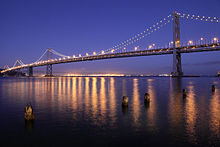 The Bay Bridge at night.
Because of its unique geography—making beltways somewhat impractical—and the results of the freeway revolts of the late 1950s,[175] San Francisco is one of the few American cities that has opted for European-style arterial thoroughfares instead of a large network of freeways. This trend continued following the 1989 Loma Prieta Earthquake, when city leaders decided to demolish the Embarcadero Freeway, and voters approved demolition of a portion of the Central Freeway, converting them into street-level boulevards.[175]
Interstate 80 begins at the approach to the Bay Bridge and is the only direct automobile link to the East Bay. US 101 extends Interstate 80 to the south along the San Francisco Bay toward Silicon Valley. Northbound, 101 uses arterial streets Van Ness Avenue and Lombard Street to the Golden Gate Bridge, the only direct road access from San Francisco to Marin County and points north. Highway 1 also enters San Francisco at the Golden Gate Bridge, but diverts away from 101, bisecting the west side of the city as the 19th Avenue arterial thoroughfare, and joining with Interstate 280 at the city's southern border. Interstate 280 continues this route along the central portion of the Peninsula south to San Jose. Northbound, 280 turns north and east and terminates in the South of Market area. State Route 35, which traverses the majority of the Peninsula along the ridge of the Santa Cruz Mountains, enters the city from the south as Skyline Boulevard, following city streets until it terminates at its intersection with Highway 1. State Route 82 enters San Francisco from the south as Mission Street, following the path of the historic El Camino Real and terminating shortly thereafter at its junction with 280. The cross-country Lincoln Highway's western terminus is in Lincoln Park. Major east–west thoroughfares include Geary Boulevard, the Lincoln Way/Fell Street corridor, and Market Street/Portola Drive.
Cycling is a popular mode of transportation in San Francisco, with about 40,000 residents commuting to work regularly by bicycle.[176]
Pedestrian traffic is a major mode of transport. In 2011, Walk Score ranked San Francisco the second most walkable city in the United States.[177][178]
Transit systems
Main article: San Francisco Municipal Railway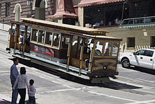 A cable car descending Nob Hill
A third of commuters in San Francisco used public transportation in 2005.[179] Public transit solely within the city of San Francisco is provided predominantly by the San Francisco Municipal Railway (Muni). The city-owned system operates both a combined light rail and subway system (the Muni Metro) and a bus network that includes trolleybuses, standard diesel motorcoaches and diesel hybrid buses. The Metro streetcars run on surface streets in outlying neighborhoods but underground in the downtown area.[180] Additionally, Muni runs the highly visible F Market historic streetcar line, which runs on surface streets from Castro Street to Fisherman's Wharf (through Market Street),[180] and the iconic San Francisco cable car system,[180] which has been designated as a National Historic Landmark.[181]
Commuter rail is provided by two complementary agencies. Bay Area Rapid Transit (BART) is a regional rapid transit system that connects the San Francisco peninsula with the East Bay through the Transbay Tube. The line runs under Market Street to Civic Center where it turns south to the Mission District, the southern part of the city, and through northern San Mateo County, to the San Francisco International Airport, and Millbrae.[180] The Caltrain rail system runs from San Francisco along the Peninsula down to San Jose.[180] The line dates from 1863, and for many years was operated by Southern Pacific.
The Transbay Terminal serves as the terminus for long-range bus service (such as Greyhound) and as a hub for regional bus systems AC Transit (Alameda & Contra Costa counties), SamTrans (San Mateo County), and Golden Gate Transit (Marin and Sonoma Counties).[182] Amtrak also runs a shuttle bus from San Francisco to its rail station in Emeryville.[183]
A small fleet of commuter and tourist ferries operate from the Ferry Building and Pier 39 to points in Marin County, Oakland, and north to Vallejo in Solano County.[180]
There is also commuter bus and special train service to the 49ers and Giant's games from Tri Delta Transit, Caltrain and other private operators as well.
Airports
Main article: San Francisco International AirportSan Francisco International Airport (SFO), though located 13 miles (21 km) south of the city in San Mateo County, is under the jurisdiction of the City and County of San Francisco. SFO is primarily near the cities of Millbrae and San Bruno, but also borders the most southern part of the city of South San Francisco. SFO is a hub for United Airlines, its largest tenant,[184] and the decision by Virgin America to base its operations out of SFO[185] reversed the trend of low-cost carriers opting to bypass SFO for Oakland and San Jose. SFO is an international gateway, with the largest international terminal in North America.[186] The airport is built on a landfill extension into the San Francisco Bay. During the economic boom of the late 1990s, when traffic saturation led to frequent delays, it became difficult to respond to calls to relieve the pressure by constructing an additional runway as that would have required additional landfill. Such calls subsided in the early 2000s as traffic declined, and, in 2006, SFO was the 14th busiest airport in the U.S. and 26th busiest in the world, handling 33.5 million passengers.[187]
Seaports
 Main article: Port of San Francisco
The Port of San Francisco was once the largest and busiest seaport on the West Coast. It featured rows of piers perpendicular to the shore, where cargo from the moored ships was handled by cranes and manual labor and transported to nearby warehouses. The port handled cargo to and from trans-Pacific and Atlantic destinations, and was the West Coast center of the lumber trade. The 1934 West Coast Longshore Strike, an important episode in the history of the American labor movement, brought most ports to a standstill. The advent of container shipping made pier-based ports obsolete, and most commercial berths moved to the Port of Oakland and Port of Richmond. A few active berths specializing in break bulk cargo remain alongside the Islais Creek Channel.
Many piers remained derelict for years until the demolition of the Embarcadero Freeway reopened the downtown waterfront, allowing for redevelopment. The centerpiece of the port, the Ferry Building, while still receiving commuter ferry traffic, has been restored and redeveloped as a gourmet marketplace. The port's other activities now focus on developing waterside assets to support recreation and tourism.
Notes
- ^ Barter, James (2001). The Golden Gate Bridge. Building History. Lucent Books. p. 22. ISBN 978-1-56006-856-3. http://books.google.com/books?id=YI-eCPwkcR4C.
- ^ "Don't Call It Frisco". San Francisco Examiner: p. 6. April 3, 1918. http://www.sfgenealogy.com/sf/history/hgoe82.htm. Retrieved July 11, 2011.
- ^ Although many residents still maintain that the nickname "Frisco" is taboo, many residents, especially younger and working-class natives, have kept the term alive and well. In any case, this is a matter of ongoing debate that reflects certain cultural divisions within The City. Sullivan, James (October 14, 2003). "Frisco, that once-verboten term for the city by the bay, is making a comeback among the young and hip. Herb Caen is spinning at warp speed.". San Francisco Chronicle: p. D-1. http://www.sfgate.com/cgi-bin/article.cgi?f=/c/a/2003/10/14/DD67721.DTL. Retrieved June 12, 2008.
- ^ Some tourists refer to San Francisco as "Frisco." However, locals discourage this. Samuel D. Cohen writes that many credit "Friscophobia" to newspaper columnist Herb Caen, whose first book, published in 1953, was "Don't Call it Frisco" after a 1918 newspaper article of the same name. Caen was considered by many to be the recognized authority on what was, and what was not, beneath the city's dignity, and to him, Frisco was intolerable. Cohen, Sam (September 11, 1997). "Locals know best: only tourists call it 'Frisco'". Golden Gater Online. San Francisco State University. http://www.journalism.sfsu.edu/www/pubs/gater/fall97/sept11/Frisco.html. Retrieved July 13, 2008.
- ^ "PPIE: The City That Knows How". Amusing America. San Francisco Public Library. March 29, 2005. http://sfpl.org/index.php?pg=2000141201. Retrieved June 14, 2008.
- ^ Caen, Herb (1949). Baghdad-by-the-Bay. Garden City, New York: Doubleday. ISBN 978-0-89174-047-6. OCLC 31060237. LC F869.S3 C12.
- ^ "The City". UnknownWW2InColor. UnknownWW2InColor (Ramano-Archives). 1939. http://www.youtube.com/watch?v=9jHvTZ1RL4I. Retrieved June 5, 2009.
- ^ "Incorporation Dates of California Cities" (Word). Archived from the original on 2007-07-14. http://www.cacities.org/resource_files/20457.IncorpDateLO.doc. Retrieved June 22, 2011.
- ^ a b c "GCT-PH1 - Population, Housing Units, Area, and Density: 2010 - County -- Census Tract". 2010 United States Census Summary File 1. United States Census Bureau. http://factfinder2.census.gov/faces/tableservices/jsf/pages/productview.xhtml?pid=DEC_10_SF1_GCTPH1.CY07. Retrieved July 11, 2011.
- ^ "GCT-PL2 - Population and Housing Occupancy Status: 2010 - United States -- Combined Statistical Area with Metropolitan and Micropolitan Statistical Area Components; and for Puerto Rico". 2010 United States Census Summary File 1. United States Census Bureau. http://factfinder2.census.gov/faces/tableservices/jsf/pages/productview.xhtml?pid=DEC_10_NSRD_GCTPL2.US40PR. Retrieved July 11, 2011.
- ^ "Annual Estimates of the Population of Combined Statistical Areas: April 1, 2000 to July 1, 2008". U.S. Census Bureau. Archived from the original on 2011-08-23. http://www.census.gov/popest/metro/tables/2008/CBSA-EST2008-02.xls. Retrieved June 30, 2008.
- ^ a b c "Board of Supervisors – Does San Francisco have a City Council?". SFGov SF311. Archived from the original on 2010-07-26. http://sf311.org/index.aspx?page=262. Retrieved June 16, 2008.
- ^ [U.S. Census "U.S. Census"]. US Census Bureau. U.S. Census. Retrieved 2011.
- ^ a b After New York City, only for cities with greater than 200,000 population. Otherwise it is not 2nd."2000 Census: US Municipalities Over 50,000: Ranked by 2000 Density". Demographia. http://www.demographia.com/db-2000city50kdens.htm. Retrieved August 23, 2007.
- ^ a b "U.S. Census Bureau Delivers California's 2010 Census Population Totals". U.S. Census Bureau. March 8, 2011. http://2010.census.gov/news/releases/operations/cb11-cn68.html. Retrieved March 30, 2011.
- ^ Edward F. O'Day (October 1926). "The Founding of San Francisco". San Francisco Water. Spring Valley Water Authority. http://www.sfmuseum.org/hist6/founding.html. Retrieved February 14, 2009.
- ^ a b Richards, Rand (1992). Historic San Francisco: A Concise History and Guide. Heritage House. ISBN 978-1-879367-00-5. OCLC 214330849.
- ^ a b Montagne, Renée (April 11, 2006). "Remembering the 1906 San Francisco Earthquake". People & Places (National Public Radio). http://www.npr.org/templates/story/story.php?storyId=5334411. Retrieved June 13, 2008.
- ^ a b "Port of Embarkation Essay—World War II in the San Francisco Bay Area". A National Register of Historic Places Travel Itinerary:. US Department of the Interior. August 28, 2007. http://www.nps.gov/history/nr/travel/wwIIbayarea/embarkation.htm. Retrieved 2011-06-22.
- ^ a b "Overseas Visitation Estimates for U.S. States, Cities, and Census Regions: 2008" (PDF). International Visitation in the United States. US Office of Travel and Tourism Industries, US Department of Commerce. May 11, 2009. http://tinet.ita.doc.gov/outreachpages/download_data_table/2008_States_and_Cities.pdf. Retrieved June 8, 2009.
- ^ a b "Euromonitor International’s top city destinations ranking". euromontior.com (Euromontior). http://www.euromonitor.com/euromonitor-internationals-top-city-destinations-ranking/article. Retrieved September 5, 2011.
- ^ a b "San Francisco: Economy". City-Data.com. Advameg Inc. http://www.city-data.com/us-cities/The-West/San-Francisco-Economy.html. Retrieved June 15, 2008.
- ^ Stewart, Suzanne B. (November 2003). "Archaeological Research Issues For The Point Reyes National Seashore – Golden Gate National Recreation Area" (PDF). Sonoma State University – Anthropological Studies Center. http://www.sonoma.edu/asc/projects/pointreyes/overview2.pdf. Retrieved June 12, 2008.
- ^ "Visitors: San Francisco Historical Information". City and County of San Francisco. n.d.. http://www.sfgov.org/site/visitor_index.asp?id=8091. Retrieved June 10, 2008.[dead link]
- ^ The Virtual Museum of the City of San Francisco (July 16, 2004). "From the 1820s to the Gold Rush". The Virtual Museum of the City of San Francisco. http://www.sfmuseum.org/hist1/early.html. Retrieved June 13, 2008.
- ^ "History of Yerba Buena Gardens". MJM Management Group. 2004. http://www.yerbabuenagardens.com/history.html. Retrieved June 13, 2008.
- ^ Wiley, Peter Booth (2000). National trust guide- San Francisco: America’s guide for architecture and history travelers. New York: John Wiley & Sons, Inc.. pp. 4–5. ISBN 978-0-471-19120-9. OCLC 44313415.
- ^ Sourdough bread was a staple of western explorers and miners of the 19th century. It became an iconic symbol of San Francisco, and is still a staple of city life today.Tamony, Peter (October 1973). "Sourdough and French Bread". Western Folklore (Western States Folklore Society) 32 (4): 265–270. doi:10.2307/1498306.
- ^ "San Francisco's First Brick Building". The Virtual Museum of the City of San Francisco. July 16, 2004. http://www.sfmuseum.org/hist1/brick.html. Retrieved June 13, 2008.
- ^ Harris, Ron (November 14, 2005). "Crews Unearth Shipwreck on San Francisco Condo Project". Associated Press. http://www.constructionequipmentguide.com/story.asp?story=6287&headline=Crews. Retrieved September 4, 2006.
- ^ Wiley, Peter Booth (2000). National trust guide- San Francisco: America’s guide for architecture and history travelers. New York: John Wiley & Sons, Inc.. pp. 31–33. ISBN 978-0-471-19120-9. OCLC 44313415.
- ^ "The miners came in forty-nine, / The whores in fifty-one, / And when they got together / They produced the native son." Wiley, Peter Booth (2000). National trust guide- San Francisco: America’s guide for architecture and history travelers. New York: John Wiley & Sons, Inc.. pp. 237–238. ISBN 978-0-471-19120-9. OCLC 44313415.
- ^ Construction of the Pacific Railroad was partially (albeit reluctantly) funded by the City and County of San Francisco Pacific Railroad Bond issue under the provisions of "An Act to Authorize the Board of Supervisors of the City and County of San Francisco to take and subscribe One Million Dollars to the Capital Stock of the Western Pacific Rail Road Company and the Central Pacific Rail Road Company of California and to provide for the payment of the same and other matters relating thereto." approved on April 22, 1863, as amended by §5 of the "Compromise Act of 1864" approved on April 4, 1864. The bond issue was objected to by the Mayor and the Board of Supervisors, however, and they were not delivered to the WPRR and CPRR until 1865 after Writs of Mandamus ordering such were issued by the Supreme Court of the State of California in 1864 ("The People of the State of California on the relation of the Central Pacific Railroad Company vs. Henry P. Coon, Mayor; Henry M. Hale, Auditor; and Joseph S. Paxson, Treasurer, of the City and County of San Francisco" 25 Cal 635) and 1865 ("The People ex rel The Central Pacific Railroad Company of California vs.The Board of Supervisors of the City and County of San Francisco, and Wilhelm Lowey, Clerk" 27 Cal 655)
- ^ "Under Three Flags" (PDF). Golden Gate National Recreation Area Brochures. US Department of the Interior. November 2004. http://www.nps.gov/goga/planyourvisit/upload/3flags_7-03.pdf. Retrieved 2011-06-22.
- ^ Wiley, Peter Booth (2000). National trust guide- San Francisco: America’s guide for architecture and history travelers. New York: John Wiley & Sons, Inc.. pp. 44–55. ISBN 978-0-471-19120-9. OCLC 44313415.
- ^ London, Jack (May 5, 1906). "The Story of an Eyewitness by Jack London". Collier's, the National Weekly (The Virtual Museum of the City of San Francisco). http://www.sfmuseum.org/hist5/jlondon.html. Retrieved August 29, 2006.
- ^ "Presidio of San Francisco: Firefighting and Dynamiting". Golden Gate National Recreation Area. US Department of the Interior. December 24, 2003. http://www.nps.gov/archive/prsf/history/1906eq/firedyn.htm. Retrieved June 13, 2008.
- ^ "Casualties and Damage after the 1906 earthquake". Earthquake Hazards Program – Northern California. US Geological Survey. January 25, 2008. http://earthquake.usgs.gov/regional/nca/1906/18april/casualties.php. Retrieved June 13, 2008.
- ^ "Presidio of San Francisco:1906 Earthquake and Fire". Golden Gate National Recreation Area. US Department of the Interior. August 25, 2004. http://www.nps.gov/archive/prsf/history/1906eq/index.htm. Retrieved June 13, 2008.
- ^ Wiley, Peter Booth (2000). National trust guide- San Francisco: America’s guide for architecture and history travelers. New York: John Wiley & Sons, Inc.. pp. 56–62. ISBN 978-0-471-19120-9. OCLC 44313415.
- ^ Wiley, Peter Booth (2000). National trust guide- San Francisco: America’s guide for architecture and history travelers. New York: John Wiley & Sons, Inc.. p. 9. ISBN 978-0-471-19120-9. OCLC 44313415.
- ^ "San Francisco Gold Rush Banking – 1849". The Virtual Museum of the City of San Francisco. June 24, 2004. http://www.sfmuseum.net/hist9/banking.html. Retrieved June 13, 2008.
- ^ Fang, Eric (February 1999). "Urban Renewal Revisited: A Design Critique". SPUR Newsletter (San Francisco Planning and Urban Research Association). http://www.spur.org/publications/library/article/urbanrenewalrevisited02011999. Retrieved August 3, 2009.
- ^ "Pyramid Facts and Figures". Company Profile. Transamerica Insurance and Investment Group. http://www.transamerica.com/company_profile/about_the_pyramid/pyramid_facts_and_figures.asp. Retrieved June 13, 2008.
- ^ Wiley, Peter Booth (2000). National trust guide- San Francisco: America’s guide for architecture and history travelers. New York: John Wiley & Sons, Inc.. pp. 95–96. ISBN 978-0-471-19120-9. OCLC 44313415.
- ^ Willis, James; Habib, Jerry, Brittan, Jeremy (April 19, 2004). "San Francisco Planning Department Census Data Analysis" (PPT). San Francisco State University. http://bss.sfsu.edu/pamuk/SFDemographics.ppt#1. Retrieved June 13, 2008.
- ^ Minton, Torri (September 20, 1998). "Race Through Time". San Francisco Chronicle (Hearst Communications): p. SC-4. http://www.sfgate.com/cgi-bin/article.cgi?file=/chronicle/archive/1998/09/20/SC72759.DTL. Retrieved June 13, 2008.
- ^ Wiley, Peter Booth (2000). National trust guide- San Francisco: America’s guide for architecture and history travelers. New York: John Wiley & Sons, Inc.. pp. 240–242. ISBN 978-0-471-19120-9. OCLC 44313415.
- ^ "American Experience: Summer of Love: Film Description". Website for American Experience documentary on the Summer of Love. PBS. March 14, 2007. http://www.pbs.org/wgbh/amex/love/filmmore/fd.html. Retrieved June 17, 2008.
- ^ "San Francisco History: The 1970s and 1980s: Gay Rights". Destinations: San Francisco. Frommers.com. Archived from the original on June 12, 2007. http://web.archive.org/web/20070612230434/http://www.frommers.com/destinations/sanfrancisco/0029033660.html. Retrieved June 17, 2008.
- ^ Ted Egan (April 3, 2006). "City and County of San Francisco: An Overview of San Francisco’s Recent Economic Performance" (PDF). Report prepared for Mayor’s Office of Economic and Workforce Development. ICF Consulting. http://www.sfeconomicstrategy.org/site/uploadedfiles/moed/economic_strat/ExecutiveSummary_EconomicPerformanceReview.pdf. Retrieved June 19, 2008. "Another positive trend for the future is San Francisco’s highly entrepreneurial, flexible and innovative economy...San Francisco’s very high reliance on small business and self-employment is typical of other dynamic, fast-growing, high-technology areas across the country."[dead link]
- ^ Graham, Tom (November 7, 2004). "Peak Experience". San Francisco Chronicle (Hearst Communications): p. PK-23. http://www.sfgate.com/cgi-bin/article.cgi?f=/c/a/2004/11/07/PKGJ99K7KD1.DTL. Retrieved June 13, 2008.
- ^ Lee, Henry K. (January 16, 1997). "Mount Davidson Cross Called Landmark by Panel". San Francisco Chronicle. http://www.sfgate.com/cgi-bin/article.cgi?f=/c/a/1997/01/16/MN71385.DTL. Retrieved June 17, 2008.
- ^ Smith, Charles (April 15, 2006). "What San Francisco didn't learn from the '06 quake". San Francisco Chronicle. http://www.sfgate.com/cgi-bin/article.cgi?f=/c/a/2006/04/15/HOGQ9I7P2T1.DTL. Retrieved June 30, 2008.
- ^ Selna, Robert (June 29, 2008). "S.F. leaders ignore weak buildings' quake risk". San Francisco Chronicle: p. A-1. http://www.sfgate.com/cgi-bin/article.cgi?file=/c/a/2008/06/29/MNDD110U2E.DTL. Retrieved June 30, 2008.
- ^ "Liquefaction Damage in the Marina District during the 1989 Loma Prieta earthquake" (PDF). California Geological Survey. http://www.conservation.ca.gov/cgs/information/outreach/Documents/Marina%20Poster%2011x17rw2b.pdf. Retrieved June 17, 2008.
- ^ Nolte, Carl (August 19, 2005). "Fog Heaven: The sun will come out tomorrow. Or maybe not. It's summer in the city, and that means gray skies". San Francisco Chronicle (Hearst Communications): p. A-1. http://www.sfgate.com/cgi-bin/article.cgi?f=/c/a/2005/08/19/MNGOBEA9JI1.DTL&ao=all. Retrieved June 13, 2008.
- ^ "And Never the Twain Shall Tweet". Urban Legends Reference Pages. Snopes.com. September 26, 2007. Archived from the original on 2011-08-22. http://www.snopes.com/quotes/twain.asp.
- ^ Also known as Dry-Summer Subtropical (Köppen climate classification Csb)
- ^ Climate of San Francisco: Narrative Description Golden Gate Weather Services. Retrieved September 5, 2006.
- ^ Osborn, Liz. "Coolest US Cities in Summer". Weather Extremes. Current Results Nexus. Archived from the original on 2010-07-26. http://www.currentresults.com/Weather-Extremes/US/coldest-cities-summer.php. Retrieved July 25, 2010.
- ^ Gilliam, Harold (July–September, 2002), "Cutting Through the Fog: Demystifying the Summer Spectacle", Bay Nature, http://baynature.org/articles/jul-sep-2002/cutting-through-the-fog
- ^ a b "Weatherbase: Historical Weather for San Francisco, California. Summary of weather data.". weatherbase.com. http://www.weatherbase.com/weather/weather.php3?s=149427&refer=.
- ^ Climate of San Francisco: Snowfall Golden Gate Weather Services. Retrieved December 3, 2006.
- ^ "San Fran Mission Dolore, California (047772) Period of Record General Climate Summary – Temperature". Western Regional Climate Center. Desert Research Institute. 2010. Archived from the original on 2010-07-26. http://www.wrcc.dri.edu/cgi-bin/cliGCStT.pl?ca7772. Retrieved July 25, 2010. (Main page )
- ^ http://www.wrh.noaa.gov/climate/yeardisp.php?wfo=mtr&stn=KSFO&submit=Yearly+Charts San Francisco Bay Area / Monterey
- ^ "Climatography of the United States No. 20 (1971–2000)" (PDF). National Oceanic and Atmospheric Administration. 2004. http://cdo.ncdc.noaa.gov/climatenormals/clim20/ca/047772.pdf. Retrieved 2010-05-31.
- ^ "NOAA". NOAA. ftp://dossier.ogp.noaa.gov/GCOS/WMO-Normals/RA-IV/US/GROUP1/00047772.TXT.
- ^ "SAN FRAN MISSION DOLORE, CALIFORNIA". NOAA. http://www.wrcc.dri.edu/cgi-bin/cliMAIN.pl?ca7772.
- ^ The Official San Francisco Chinatown Website
- ^ From a book covering life in SF Chinatown from 1840–1950
- ^ Bacon, Daniel: Walking the Barbary Coast Trail 2nd ed., pages 52–53, Quicksilver Press, 1997
- ^ San Francisco Days
- ^ Morgan, Benjamin (Director) (2007). "Quality of Life (film website)". Mission District History. http://www.qualityoflife-themovie.com/website/mission.html. Retrieved July 25, 2010.
- ^ "The Haight". The San Francisco Chronicle. http://www.sfgate.com/neighborhoods/sf/haight/. Retrieved August 3, 2009.
- ^ Bishop, Katherine (October 13, 1988). "Haight-Ashbury Journal; Love and Hate Linger In Ex-Hippie District". New York Times. http://www.nytimes.com/1988/10/13/us/haight-ashbury-journal-love-and-hate-linger-in-ex-hippie-district.html?sec=&spon=. Retrieved August 3, 2009.
- ^ "The Castro". SFGate San Francisco Neighborhood Guide. http://www.sfgate.com/neighborhoods/sf/castro/. Retrieved August 3, 2009.
- ^ "The Marina". San Francisco Chronicle. http://www.sfgate.com/traveler/guide/sf/neighborhoods/marina.shtml. Retrieved 2011-06-22.
- ^ Chow, Andrew (March 22, 2002). "Dismal APA Turnout at First Redistricting Meetings". Asian Week.
- ^ "Facility Listings". San Francisco Recreation and Parks Department. City and County of San Francisco. Archived from the original on 2010-07-26. http://sf-recpark.org/index.aspx?page=56. Retrieved July 25, 2010.
- ^ "The Most Visited City Parks" (PDF). Center for City Park Excellence. The Trust for Public Land. October 11, 2007. http://www.tpl.org/content_documents/ccpe_Most_Visited_Parks.pdf. Retrieved June 17, 2008.[dead link]
- ^ "What to See at the Zoo". San Francisco Zoo. http://www.sfzoo.org/openrosters/ViewOrgPageLink.asp?LinkKey=15015&orgkey=1821. Retrieved June 14, 2008.
- ^ "Candlestick Point SRA". California State Parks Department. http://parks.ca.gov/default.asp?page_id=519. Retrieved January 27, 2009.
- ^ Schwarzer, Michelle (July 2001). "San Francisco by the Numbers: Planning After the 2000 Census". SPUR Newsletter (San Francisco Planning and Urban Research Association). Archived from the original on February 11, 2005. http://web.archive.org/web/20050211032911/http://spur.org/documents/010701_article_03.shtm. Retrieved July 25, 2010.
- ^ Sadovi, Maura Webber (April 12, 2006). "San Francisco's Home Prices Remain Among the Highest in U.S.". The Wall Street Journal. http://www.realestatejournal.com/columnists/livingthere/20060412-livingthere.html. Retrieved June 14, 2008.[dead link]
- ^ "Median Family Income (In 2003 Inflation-adjusted Dollars)". American Community Survey. US Census Bureau. August 22, 2007. Archived from the original on April 20, 2008. http://web.archive.org/web/20080420102803/http://www.census.gov/acs/www/Products/Ranking/2003/R14T160.htm. Retrieved June 14, 2008.
- ^ Hawn, Carleen (March 2007). "It may not feel like it, but your shot at the good life is getting better. Here's why". San Francisco magazine. Modern Luxury. Archived from the original on February 24, 2007. http://web.archive.org/web/20070224105246/http://www.sanfran.com/archives/view_story/1068/. Retrieved June 14, 2008.
- ^ ""Quality of Living global city rankings – Mercer survey". Mercer Consulting. June 2008. http://www.mercer.com/referencecontent.jhtml?idContent=1307990. Retrieved February 23, 2011. Quality of Living global city rankings – Mercer survey]". Mercer LLC. Last updated June 10, 2008.
- ^ a b Hendricks, Tyche (June 22, 2006). "Rich City Poor City: Middle-class neighborhoods are disappearing from the nation's cities, leaving only high- and low-income districts, new study says.". San Francisco Chronicle (Hearst Communications): p. A-1. http://www.sfgate.com/cgi-bin/article.cgi?file=/c/a/2006/06/22/MNG6HJIDMM1.DTL. Retrieved June 14, 2008.
- ^ Temple, James (July 17, 2008). "S.F. a step ahead as most 'walkable' U.S. city". San Francisco Chronicle: p. A-1. http://www.sfgate.com/cgi-bin/article.cgi?f=/c/a/2008/07/16/MN3J11Q3N8.DTL. Retrieved July 18, 2008.
- ^ "WalkScore No.1 San Francisco". Walkscore.com. http://www.walkscore.com/2008/. Retrieved July 18, 2008.
- ^ Wach, Bonnie (October 3, 2003). "Fog City rises from the funk.". USA Today (Gannett Company, Inc.). http://www.usatoday.com/travel/destinations/cityguides/sanfrancisco/worthdoing.htm. Retrieved September 4, 2006.[dead link]
- ^ a b Egan, Ted (April 3, 2006). "An Overview of San Francisco's Recent Economic Performance – Executive Summary" (PDF). ICF Consulting. http://www.sfgov.org/site/uploadedfiles/moed/economic_strat/ExecutiveSummary_EconomicPerformanceReview.pdf. Retrieved June 14, 2008.[dead link]
- ^ Lam, Eric (December 22, 2005). "San Francisco Chinese New Year Parade Embroiled in Controversy". The Epoch Times. http://en.epochtimes.com/news/5-12-22/36073.html. Retrieved June 14, 2008.
- ^ Leip, Dave (June 4, 2008). "Dave Leip's Atlas of U.S. Presidential Elections". Dave Leip. http://www.uselectionatlas.org/. Retrieved June 14, 2008.
- ^ Reform Law Could Curb Healthy San Francisco's Enrollment by Up to 60% - California Healthline
- ^ "San Francisco's Latest Innovation: Universal Health Care", by Laura A. Locke, Time, June 23, 2006
- ^ "Participant Costs", healthysanfrancisco.org. Retrieved April 10, 2010.
- ^ "Universal Health Care Plan Approved in San Francisco", Insurance Journal, July 20, 2006.
- ^ Not Illegal to be Naked in Public in San Francisco | Lawinfo Weblog
- ^ The San Francisco Opera is second in size only to New York City's Metropolitan Opera
- ^ "Corporate Sponsorship – Why Sponsor". San Francisco Museum of Modern Art. Archived from the original on December 29, 2007. http://web.archive.org/web/20071229011210/http://www.sfmoma.org/membership/corp_sponsors_why_sponsor.html. Retrieved June 14, 2008.
- ^ "Top 200 Newspapers by Largest Reported Circulation". Audit Bureau of Circulations. March 31, 2007. Archived from the original on August 13, 2007. http://web.archive.org/web/20070813073544/http://www.accessabc.com/products/top200.htm. Retrieved June 14, 2008.
- ^ Rosenberg, Scott (March 21, 2000). "The San Francisco Examiner, 1887–2000". Salon.com. http://archive.salon.com/media/feature/2000/03/21/examiner/index.html. Retrieved June 15, 2008.
- ^ Nolte, Carl (November 22, 2000). "Examiner Staff Ends an Era With Tears, Newsroom Tales". San Francisco Chronicle (Hearst Communications): p. A-1. http://www.sfgate.com/cgi-bin/article.cgi?f=/c/a/2000/11/22/MN121380.DTL&hw=san+francisco+examiner&sn=005&sc=498. Retrieved June 15, 2008.
- ^ Hua, Vanessa (August 3, 2004). "Newspaper war in the Bay Area: Ming Pao becomes 6th Chinese-language daily". San Francisco Chronicle (Hearst Communications): p. B-1. http://www.sfgate.com/cgi-bin/article.cgi?f=/c/a/2004/08/03/BAGI781MM91.DTL. Retrieved June 14, 2008.
- ^ "Local Television Market Universe Estimates" (XLS). Nielsen Media. September 22, 2007. http://www.nielsenmedia.com/nc/nmr_static/docs/2007-2008_DMA_Ranks.xls. Retrieved June 15, 2008.[dead link]
- ^ "Arbitron Radio Market Rankings: Spring 2008". Arbitron. April 16, 2008. Archived from the original on 2007-08-01. http://www.arbitron.com/radio_stations/mm001050.asp. Retrieved June 14, 2008.
- ^ "Top 30 Public Radio Subscribers – Winter 2004 Arbitron" (PDF). Radio Research Consortium. Arbitron Media Research. June 17, 2004. http://www.pacifica.org/documents/pdf/ArbitronRatingsWinter2004.pdf. Retrieved June 14, 2008.[dead link]
- ^ "Federal Brownfields Tax Incentive: SBC Park" (PDF). Brownfields. US Environmental Protection Agency. May 2005. Archived from the original on August 21, 2006. http://web.archive.org/web/20060921012953/http://www.epa.gov/swerosps/bf/pdf/sfcasestudy070505.pdf. Retrieved June 15, 2008.
- ^ "About Us – History". ING Bay to Breakers. ING Group. March 11, 2008. Archived from the original on 2010-07-26. http://baytobreakers.com/index.php?page=race-history. Retrieved July 25, 2010.
- ^ Bulwa, Demian (July 27, 2009). "S.F. Marathon: 26.2 miles of feel-good pain". Press Release (SFGate). http://www.sfgate.com/cgi-bin/article.cgi?f=/c/a/2009/07/26/BA0218VCGF.DTL. Retrieved September 7, 2010.
- ^ "Fact Sheet". Press Release. Accenture Escape from Alcatraz Triathlon. May 23, 2008. http://www.escapefromalcatraztriathlon.com/Assets/ESCAPE+From+Alcatraz/Fact+Sheet.pdf. Retrieved January 19, 2009.
- ^ Cote, John (2010). "San Francisco selected to host America's Cup". San Francisco Chronicle (Hearst Communications). http://www.sfgate.com/cgi-bin/article.cgi?f=/c/a/2010/12/31/BAQ11H1QRE.DTL. Retrieved December 31, 2010.
- ^ "Bicycle Network Facilities". Commuting and Resources. SF Municipal Transportation Authority. May 12, 2008. http://www.sfmta.com/cms/bcomm/3180.html. Retrieved June 15, 2008.
- ^ Hübler, Eric (2008). "The Fittest and Fattest Cities in America". Men's Fitness (American Media, Inc). http://www.mensfitness.com/city_rankings/454. Retrieved June 15, 2008.[dead link]
- ^ "City of San Francisco 2010 Bicycle Count Report", San Francisco Municipal Transportation Agency, 2010, p. 3.
- ^ "2008 San Francisco State of Cycling Report", San Francisco Municipal Transportation Agency, 2008, p. 9.
- ^ Gonzales, Richard (May 22, 2006). "New Parts of Alcatraz Revealed to Public". People and Places (National Public Radio). http://www.npr.org/templates/story/story.php?storyId=9977965. Retrieved June 15, 2008.
- ^ Finz, Stacy (July 16, 2006). "Rice-a-Redux After a 7-year hiatus, it's billed once again as the San Francisco treat". San Francisco Chronicle (Hearst Communications): p. A-1. http://www.sfgate.com/cgi-bin/article.cgi?file=/c/a/2006/07/16/MNGTUK06P31.DTL. Retrieved June 15, 2008.
- ^ "Sights in San Francisco". City and County of San Francisco. http://www.sfgov.org/site/mainpages_page.asp?id=18191. Retrieved September 14, 2006.
- ^ Raine, George (May 30, 2008). "Visitors to S.F. in 2007 set record for spending". San Francisco Chronicle: p. A-1. http://www.sfgate.com/cgi-bin/article.cgi?f=/c/a/2008/05/30/MNQ51106T1.DTL&hw=tourism+dollars&sn=004&sc=434. Retrieved June 15, 2008.
- ^ Spain, William (November 13, 2004). "Cost factors: Top convention cities boast most-affordable lodging". CBS Marketwatch (Marketwatch Inc). http://www.marketwatch.com/News/Story/Story.aspx?guid=%7B708E799D-2F2A-4AE8-9814-096BDF4F98DA%7D&siteid=mktw&dist=. Retrieved June 15, 2008.
- ^ "2009: Cities". Fortune 500 (Fortune magazine, Time Inc). May 5, 2008. http://money.cnn.com/magazines/fortune/fortune500/2008/cities/. Retrieved June 15, 2008.
- ^ Beaverstock, J.V.; R.G. Smith & P.J. Taylor (July 28, 1999). "Research Bulletin 5: A Roster of World Cities". Globalization and World Cities Study Group and Network. Geography Department, Loughborough University. Archived from the original on 2011-08-25. http://www.lboro.ac.uk/gawc/rb/rb5.html. Retrieved June 26, 2008.
- ^ Hawksworth, Hoehn and Gyles (March 2007). "UK Economic Outlook March 2007 (Section 3)" (PDF). Table 3.3 – Top 30 urban agglomerations by estimated GDP in 2005. PriceWaterhouseCoopers. p. 18. http://www.pwc.co.uk/pdf/pwc_ukeo-section3-march07.pdf. Retrieved July 26, 2010. (PWC Archive)
- ^ Z/Yen (March 2010). "Global Financial Centres Index 7" (PDF). City of London, England. p. 28. http://secure-uk.imrworldwide.com/cgi-bin/b?ci=cityoflondon&cg=downloadsedo&tu=http://217.154.230.218/NR/rdonlyres/661216D8-AD60-486B-A96F-EE75BB61B28A/0/BC_RS_GFC7full.pdf. Retrieved July 26, 2010.
- ^ Selna, Robert (May 15, 2008). "New jobs, houses spur S.F. population in 2007". San Francisco Chronicle (Hearst Communications): p. B-1. http://www.sfgate.com/cgi-bin/article.cgi?f=/c/a/2008/05/15/BA2110LPHB.DTL. Retrieved June 14, 2008.
- ^ "San Francisco, Oakland, Fremont CA – Biochemists & Biophysicists – Career, Salary & Employment Info". College Degree Report. 2010. http://www.collegedegreereport.com/city-data/biochemists-and-biophysicists/san-francisco-oakland-fremont. Retrieved July 25, 2010.
- ^ Tan, Aldrich M. (April 12, 2006). "San Francisco is gateway city for immigrants and Silicon Valley Technology". Fogcityjournal.com. http://www.fogcityjournal.com/news_in_brief/sf_tech_gateway_060412.shtml. Retrieved June 15, 2008.
- ^ Said, Carolyn (November 29, 2005). "Main Street Fights Chain Street". San Francisco Chronicle. http://www.sfgate.com/cgi-bin/article.cgi?file=/chronicle/archive/2005/11/29/BUGN3FS8911.DTL&type=business. Retrieved August 27, 2006.
- ^ Hetter, Katia (March 21, 2004). "Supervisors OK limits on chain-store expansion". San Francisco Chronicle. http://www.sfgate.com/cgi-bin/article.cgi?file=/chronicle/archive/2004/03/24/BAGD65PVI821.DTL. Retrieved January 19, 2007.
- ^ "Proposition G: Limitations on Formula Retail Stores, City of San Francisco". smartvoter.org. http://smartvoter.org/2006/11/07/ca/sf/meas/G/. Retrieved January 19, 2007.
- ^ City and County of San Francisco, California Comprehensive Annual Financial Report, for the Year ended June 30, 2009. Retrieved September 25, 2010.
- ^ Coy, Owen Cochran (1919). Guide to the County Archives of California. Sacramento, California: California Historical Survey Commission. p. 409.
- ^ "Board of Supervisors District Information". City and County of San Francisco, Board of Supervisors. http://www.sfgov.org/site/bdsupvrs_index.asp?id=4385. Retrieved January 29, 2006.[dead link]
- ^ Coté, John (January 11, 2011). "Ed Lee becomes the city's first Chinese American mayor". The San Francisco Chronicle. http://www.sfgate.com/cgi-bin/blogs/cityinsider/detail?entry_id=80765.
- ^ Vega, Cecilia (July 28, 2007). "Newsom signs the city's largest budget". San Francisco Chronicle. http://www.sfgate.com/cgi-bin/article.cgi?file=/c/a/2007/07/28/BAGAOR8Q591.DTL. Retrieved March 15, 2008.
- ^ "Foreign Consular Offices in the United States, 2007". United States Department of State. http://www.state.gov/documents/organization/91446.pdf. Retrieved December 12, 2008.
- ^ All data are derived from the United States Census Bureau reports from the 2010 United States Census, and are accessible on-line here. The data on unmarried partnerships and same-sex married couples are from the Census report DEC_10_SF1_PCT15. All other housing and population data are from Census report DEC_10_DP_DPDP1. Both reports are viewable online or downloadable in a zip file containing a comma-delimited data file. The area data, from which densities are calculated, are available on-line here. Percentage totals may not add to 100% due to rounding. The Census Bureau defines families as a household containing one or more people related to the householder by birth, opposite-sex marriage, or adoption. People living in group quarters are tabulated by the Census Bureau as neither owners nor renters. For further details, see the text files accompanying the data files containing the Census reports mentioned above.
- ^ Sheya, Daniel (May 2010). "E-1 Population Estimates for Cities, Counties, and the State with Annual Percent Change – January 1, 2009 and 2010". Sacramento, Calif.: California Department of Finance. http://www.dof.ca.gov/research/demographic/reports/estimates/e-1/2009-10/.
- ^ "Population in Combined Statistical Areas (CSAs) in Alphabetical Order and Numerical and Percent Change for the United States and Puerto Rico: 1990 and 2000" (Excel). Census 2000 and 1990 Census. U.S. Census Bureau. December 30, 2003. Archived from the original on 2007-07-30. http://www.census.gov/population/cen2000/phc-t29/tab06.xls. Retrieved June 16, 2008.
- ^ a b c d e "QuickFacts: San Francisco County, California". United States Census Bureau. http://quickfacts.census.gov/qfd/states/06/06075.html. Retrieved July 11, 2011.
- ^ Gates, Gary (October 2006). "Same-sex Couples and the Gay, Lesbian, Bisexual Population: New Estimates from the American Community Survey" (PDF). The Williams Institute, UCLA School of Law. http://www.law.ucla.edu/williamsinstitute/publications/SameSexCouplesandGLBpopACS.pdf. Retrieved July 10, 2008.[dead link]
- ^ "Gay and Lesbian Families in the United States: Same-Sex Unmarried Partner Households" (PDF). Human Rights Campaign. http://www.hrc.org/documents/gayandlesbianfamilies.pdf. Retrieved August 26, 2006.
- ^ "The brainpower of America's largest cities". Bizjournals.com (data interpreted from U.S. Census). unknown 2010. http://web.archive.org/web/20060701071804/http://www.bizjournals.com/specials/pages/12.html. Retrieved August 5, 2010.
- ^ Winter, Michael (June 9, 2010). "New measure ranks San Francisco the 'smartest' U.S. city". USA Today. http://content.usatoday.com/communities/ondeadline/post/2010/06/new-measure-ranks-san-francisco-the-smartest-us-city/1. Retrieved August 5, 2010.
- ^ "Median Household Income (In 2003 Inflation-adjusted Dollars) (Place Level)". U.S. Census Bureau. August 22, 2007. Archived from the original on March 23, 2008. http://web.archive.org/web/20080323090208/http://www.census.gov/acs/www/Products/Ranking/2003/R07T160.htm. Retrieved June 23, 2009.
- ^ Obusan, Claire (March 12, 2006). "Top Ten Billionaire cities". Forbes Magazine. http://www.forbes.com/2009/03/10/worlds-richest-cities-billionaires-2009-billionaires-cities.html. Retrieved June 22, 2009.
- ^ "Families Struggle To Stay: Why Families are Leaving San Francisco and What Can Be Done" (PDF). Coleman Advocates for Children & Youth. March 1, 2006. http://www.colemanadvocates.org/includes/downloads/amiliesstruggletostaypg111.pdf?PHPSESSID=fe69726d1f893afa0893c110367fe07e. Retrieved June 16, 2008.[dead link]
- ^ "Economic Characteristics". 2005–2007 American Community Survey 3-Year Estimates – Data Profile Highlights. U.S. Census Bureau. 2007. http://factfinder.census.gov/servlet/ACSSAFFFacts?_event=&geo_id=05000US06075&_geoContext=01000US%7C04000US06%7C05000US06075&_street=&_county=san+francisco&_cityTown=san+francisco&_state=&_zip=&_lang=en&_sse=on&ActiveGeoDiv=&_useEV=&pctxt=fph&pgsl=050&_submenuId=factsheet_1&ds_name=null&_ci_nbr=null&qr_name=null®=null%3Anull&_keyword=&_industry=. Retrieved August 31, 2009.
- ^ "California’s Nonfarm Payroll Jobs Increase by 12,500". State of California, Employment Development Department. March 4, 2011. http://www.edd.ca.gov/about_edd/pdf/nwsrel11-08.pdf. Retrieved March 8, 2011.
- ^ "Care Not Cash". PBS. April 5, 2005. http://www.pbs.org/newshour/bb/economy/jan-june05/homeless_4-8.html. Retrieved September 6, 2007.
- ^ Pratt, Timothy (August 12, 2006). "Critics say regional plan won't solve the problem". Las Vegas Sun. http://www.lasvegassun.com/news/2005/aug/12/critics-say-regional-plan-wont-solve-the-problem/. Retrieved August 30, 2006.
- ^ "Uniform Crime Reports: Table 6 Crime in the United States by Metropolitan Statistical Area, 2009". 2009 Crime in the United States. Federal Bureau of Investigation. http://www2.fbi.gov/ucr/cius2009/data/table_06.html#s. Retrieved January 23, 2011.
- ^ "Uniform Crime Reports: Table 16 Crime in the United States by Metropolitan Statistical Area, 2009". 2009 Crime in the United States. Federal Bureau of Investigation. http://www2.fbi.gov/ucr/cius2009/data/table_16.html. Retrieved January 23, 2011.
- ^ http://www.bayareacensus.ca.gov "Demographic Profile Bay Area Census". Archived from the original on 2006-03-30. http://www.census.gov http://www.bayareacensus.ca.gov.
- ^ "America's Best Graduate Schools: Best Medical Schools". U.S. News and World Report. 2010. http://grad-schools.usnews.rankingsandreviews.com/best-graduate-schools/top-medical-schools/primary-care-rankings. Retrieved July 25, 2010.
- ^ Comarow, Avery (July 14, 2010). "America's Best Hospitals 2010 – Honor Roll". U.S. News and World Report. http://health.usnews.com/health-news/best-hospitals/articles/2010/07/14/best-hospitals-2010-11-the-honor-roll.html. Retrieved July 25, 2010.
- ^ "San Francisco Business Information: Largest Employers in San Francisco" (Microsoft Word). San Francisco Business Times Book of Lists, 2007. San Francisco Center for Economic Development. Archived from the original on August 17, 2007. http://web.archive.org/web/20070817111006/http://www.sfced.org/docs/Largest_Employers_in_SF_2007.doc. Retrieved June 9, 2008.
- ^ Leuty, Ron (June 11, 2010). "UCSF packs a $6B punch for economy". San Francisco Business Times. Archived from the original on 2010-07-26. http://sanfrancisco.bizjournals.com/sanfrancisco/stories/2010/06/14/story1.html. Retrieved July 26, 2010.
- ^ "Employment & Economic Stimulus". 2010 Economic Impact Report. University of California, San Francisco. Archived from the original on 2010-07-26. http://www.ucsf.edu/eir/employment-economic-stimulus. Retrieved July 26, 2010.
- ^ Wallace Ravven (July 22, 2003). "New UCSF Mission Bay campus: country's largest biomedical university expansion". UCSF. http://pub.ucsf.edu/newsservices/releases/2003072264/. Retrieved June 9, 2008.
- ^ UCSF Planning Group (2009). "UCSF Main Locations Map". UCSF. http://www.ucsf.edu/sites/default/files/documents/ucsf-city-map.pdf. Retrieved June 27, 2011.
- ^ "Hastings Quick Facts". University of California, Hastings College of the Law. http://www.uchastings.edu/?pid=37. Retrieved August 30, 2006.
- ^ a b "SF State Facts 2008–2009". SFSU. http://www.sfsu.edu/~puboff/sfsufact/archive/0809/files/SFSU_Facts_0809.pdf. Retrieved March 7, 2009.
- ^ "SF State Facts 2008–2009: Students". San Francisco State University. http://www.sfsu.edu/~puboff/sfsufact/archive/0809/students.htm. Retrieved March 7, 2009.
- ^ "City College of San Francisco Fact Sheet" (PDF). City College of San Francisco. April 2008. http://www.ccsf.edu/Offices/Public_Information/factsheet.html. Retrieved June 16, 2008.
- ^ "University of San Francisco Fact Book and Almanac 2007" (PDF). University of San Francisco. December 31, 2007. Archived from the original on June 24, 2008. http://web.archive.org/web/20080624193135/http://www.usfca.edu/online/about_USF/USFAlmanac2007.pdf. Retrieved July 25, 2010.
- ^ "Who We Are". Academy of Art University. 2008. http://www.academyart.edu/whoweare.html. Retrieved February 18, 2009.
- ^ Let's Go: Roadtripping USA. MacMillan. 2007. p. 489. http://books.google.com/books?id=2kz2R2rPFXgC&printsec=frontcover&dq=Roadtripping+USA#PPA489,M1. Retrieved February 18, 2009.
- ^ "The Oldest Public High School West of the Mississippi". About Lowell: Lowell History. San Francisco Unified School District. February 22, 2002. Archived from the original on April 14, 2002. http://web.archive.org/web/20020414125943/http://www.sfusd.edu/schwww/sch697/about/history/. Retrieved July 25, 2010.
- ^ Knight, Heather (May 31, 2006). "Many reluctantly chose private schools". San Francisco Chronicle (Hearst Communications): p. A-1. http://www.sfgate.com/cgi-bin/article.cgi?file=/c/a/2006/05/31/MNGJIJ50T41.DTL. Retrieved June 16, 2008.
- ^ "School Directory August 2010" (PDF). Roman Catholic Archdiocese of San Francisco. August 2010. http://sfdcs.org/dcs/sites/default/files/docs/school_directory/Directory_Regular_10-11.pdf. Retrieved January 23, 2011.[dead link]
- ^ a b Gordon, Rachel (September 8, 2005). "Boulevard of dreams, the premiere". San Francisco Chronicle (Hearst Communications): p. B-1. http://www.sfgate.com/cgi-bin/article.cgi?f=/c/a/2005/09/08/BAGBFEJVE21.DTL. Retrieved June 16, 2008.
- ^ Wood, Daniel B (September 12, 2006). "Bicyclists winning a war of lanes in San Francisco". Christian Science Monitor (Church of Christ, Scientist). http://www.csmonitor.com/2006/0912/p01s01-ussc.html. Retrieved June 16, 2008.
- ^ "S.F., Oakland in top 10 most walkable U.S. cities". San Francisco Chronicle. 2011. http://www.sfgate.com/cgi-bin/article.cgi?f=/c/a/2011/07/20/BUUK1KCC67.DTL&tsp=1. Retrieved July 20, 2011.
- ^ "The 10 most walkable U.S. cities". MarketWatch. 2011. http://www.marketwatch.com/story/the-10-most-walkable-us-cities-2011-07-20?link=MW_popular. Retrieved July 20, 2011.
- ^ Les Christie (June 29, 2007). "New Yorkers are Top Transit Users". CNNMoney.com (Cable News Network). http://money.cnn.com/2007/06/13/real_estate/public_transit_commutes/index.htm. Retrieved August 20, 2008.
- ^ a b c d e f "Bay Area Traveler: Transportation Information". SF Gate.com (Hearst Communications Inc). March 2007. http://www.sfgate.com/traveler/guide/transportation/publictrans.shtml. Retrieved June 16, 2008.
- ^ "Report on San Francisco's Cable Cars" (PDF). San Francisco Beautiful. May 2007. http://www.sfbeautiful.org/images/press/5.07.Cable%20Car%20Report.pdf. Retrieved June 16, 2008.
- ^ "Project Overview – Regional Transit". Transbay Transit Center. Archived from the original on December 13, 2006. http://web.archive.org/web/20061213231643/http://www.transbaycenter.org/TransBay/content.aspx?id=36. Retrieved July 25, 2010.
- ^ "Emeryville Station (EMY)". Amtrak. Archived from the original on December 24, 2007. http://web.archive.org/web/20071224092953/http://www.amtrak.com/servlet/ContentServer?pagename=Amtrak/am2Station/Station_Page&code=EMY. Retrieved July 25, 2010.
- ^ Young, Eric (April 2, 2004). "Pact keeps United from flying away". San Francisco Business Times (American City Business Journals). http://www.bizjournals.com/sanfrancisco/stories/2004/04/05/story1.html. Retrieved June 16, 2008.
- ^ Raine, George (December 9, 2005). "Taking to the air: Low-fare startup Virgin America says it has the funding to fly". San Francisco Chronicle (Hearst Communications Inc): p. C-1. http://www.sfgate.com/cgi-bin/article.cgi?f=/c/a/2005/12/09/VIRGIN.TMP. Retrieved June 16, 2008.
- ^ "Fact Sheet: International Terminal" (PDF). San Francisco International Airport. May 2007. http://www.flysfo.com/web/export/sites/default/download/about/news/pressres/fact-sheet/pdf/International_Terminal_Fact_Sheet.pdf. Retrieved June 16, 2008.
- ^ "Passenger Traffic 2006 Final". Airports Council International. March 12, 2008. http://www.aci.aero/cda/aci_common/display/main/aci_content07_c.jsp?zn=aci&cp=1-5-54-55-4777_666_2__. Retrieved June 16, 2008.
References
- De La Perouse, Jean Francois; Yamane, Linda Gonsalves; Margolin, Malcolm (1989). Life in a California Mission: Monterey in 1786: The Journals of Jean Francois De La Perouse. Heyday Books. ISBN 978-0-930588-39-7. OCLC 20368802.
- Hansen, Gladys (1995). San Francisco Almanac: Everything you want to know about the city. Chronicle Books. ISBN 978-0-8118-0841-5. OCLC 30702907.
- London, Jack (May 5, 1906). "The Story of an Eyewitness by Jack London". Collier's, the National Weekly.
- Richards, Rand (1991). Historic San Francisco: A Concise History and Guide. Heritage House. ISBN 978-1-879367-00-5. OCLC 214330849.
- Ungaretti, Lorri (2005). San Francisco's Richmond District. Arcadia Publishing. ISBN 978-0-7385-3053-6. OCLC 62249656.
- Wiley, Peter Booth (2000). National trust guide San Francisco: America’s guide for architecture and history travelers. John Wiley & Sons, Inc.. ISBN 978-0-471-19120-9. OCLC 44313415.
Further reading
- Asbury, Hubert (1989). The Barbary Coast: An Informal History of the San Francisco Underworld. Dorset Press. ISBN 978-0-88029-428-7. OCLC 22719465.
- Bronson, William (2006). The Earth Shook, the Sky Burned. Chronicle Books. ISBN 978-0-8118-5047-6. OCLC 65223734.
- Cassady, Stephen (1987). Spanning the Gate. Square Books. ISBN 978-0-916290-36-8. OCLC 15229396.
- Dillon, Richard H. (1998). High Steel: Building the Bridges Across San Francisco Bay. Celestial Arts (Reissue edition). ISBN 978-0-88029-428-7. OCLC 22719465.
- Ferlinghetti, Lawrence (1980). Literary San Francisco: A pictorial history from its beginnings to the present day. Harper & Row. ISBN 978-0-06-250325-1. OCLC 6683688.
- Hartman, Chester (2002). City for Sale: The Transformation of San Francisco. University of California Press. ISBN 978-0-520-08605-0. OCLC 48579085.
- Holliday, J. S. (1999). Rush for Riches: Gold Fever and the Making of California. University of California Press. ISBN 978-0-520-21402-6. OCLC 37545551.
- Lotchin, Roger W. (1997). San Francisco, 1846–1856: From Hamlet to City. University of Illinois Press. ISBN 978-0-252-06631-3. OCLC 35650934.
- Margolin, Malcolm (1981). The Ohlone Way: Indian Life in the San Francisco-Monterey Bay Area. Heydey Books. ISBN 978-0-930588-01-4. OCLC 4628382.
- Maupin, Armistead (1978). Tales of the City. Harper Collins. ISBN 978-0-06-096404-7. OCLC 29847673.
- Thomas, Gordon and Witts, Max Morgan (1971). The San Francisco Earthquake. Stein and Day. ISBN 978-0-8128-1360-9. OCLC 154735.
- Winfield, P.H., The charter of San Francisco (The fortnightly review Vol. 157-58:2 (1945), p. 69-75)
External links
- Official website for the City and County of San Francisco
- Bay Area Public Transit Info, Schedules and Maps
- San Francisco travel guide from Wikitravel
- Virtual Museum of the City of San Francisco
- San Francisco History Center San Francisco Public Library

Sausalito
Marin CountyRichmond
Contra Costa County
Berkeley
Alameda CountyPacific Ocean 
Alameda, Oakland
Alameda County San Francisco

Brisbane, Daly City
San Mateo CountySan Leandro
Alameda CountyCategories:- California counties
- Consolidated city–counties in the United States
- Cities in the San Francisco Bay Area
- Counties in the San Francisco Bay Area
- County seats in California
- Hudson's Bay Company trading posts
- Port settlements in the United States
- Populated coastal places in California
- San Francisco, California
- Populated places established in 1776
- Incorporated cities and towns in California


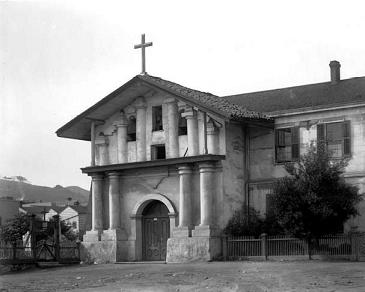
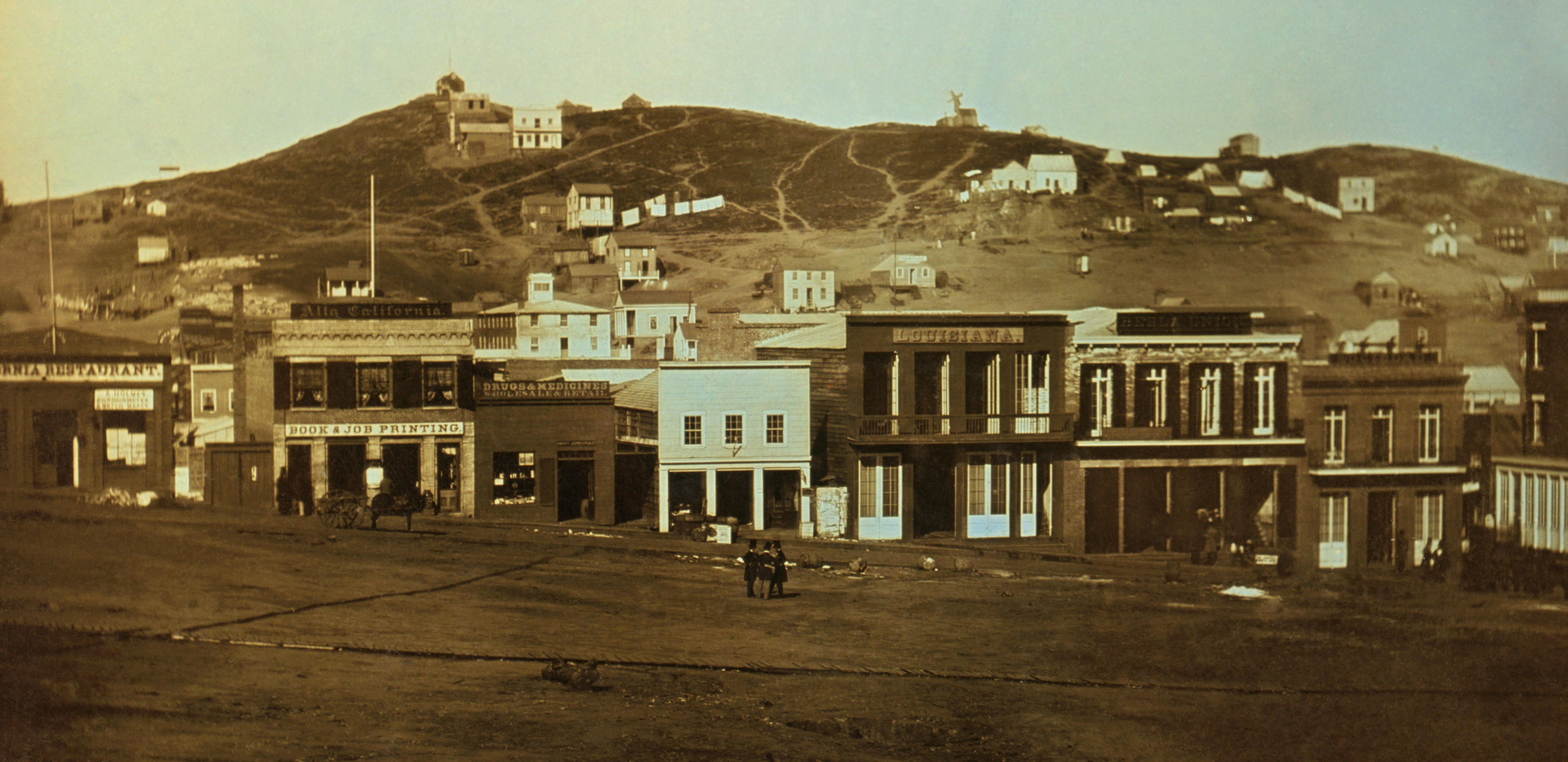

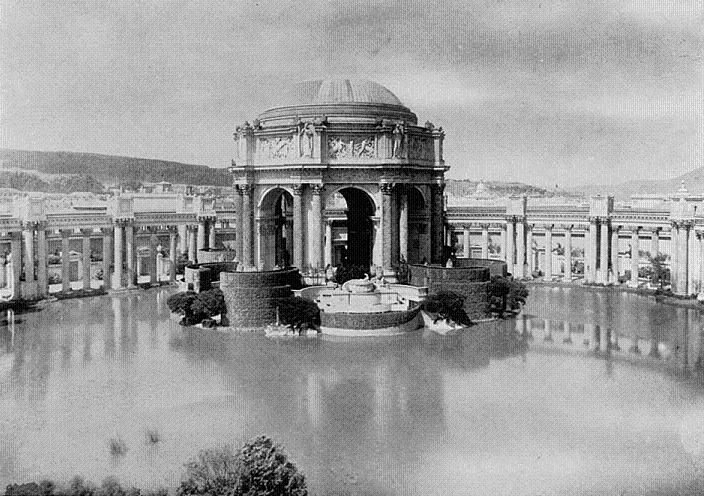

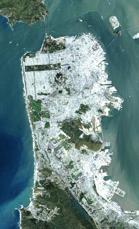
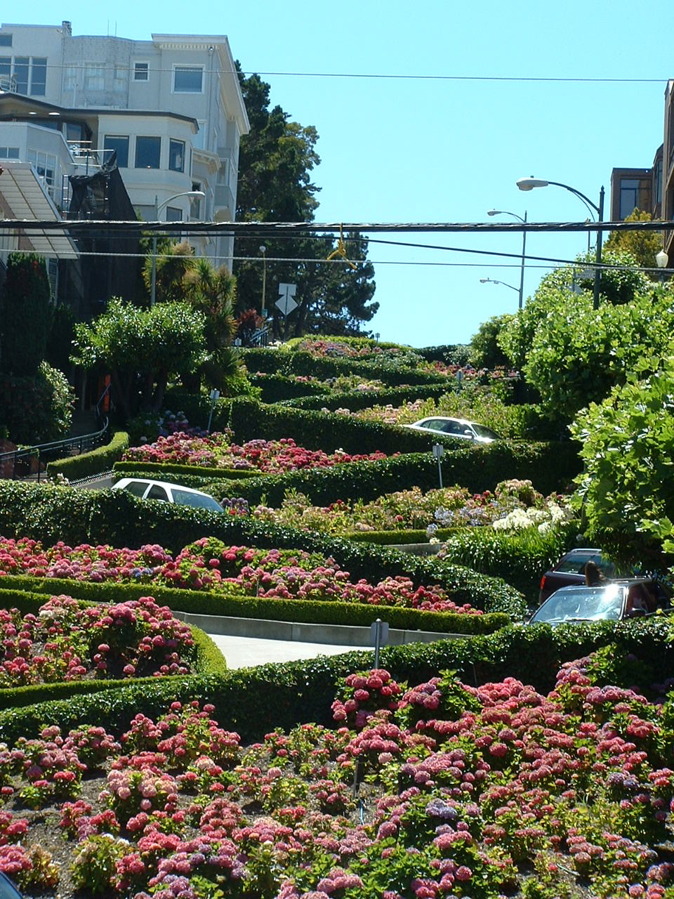


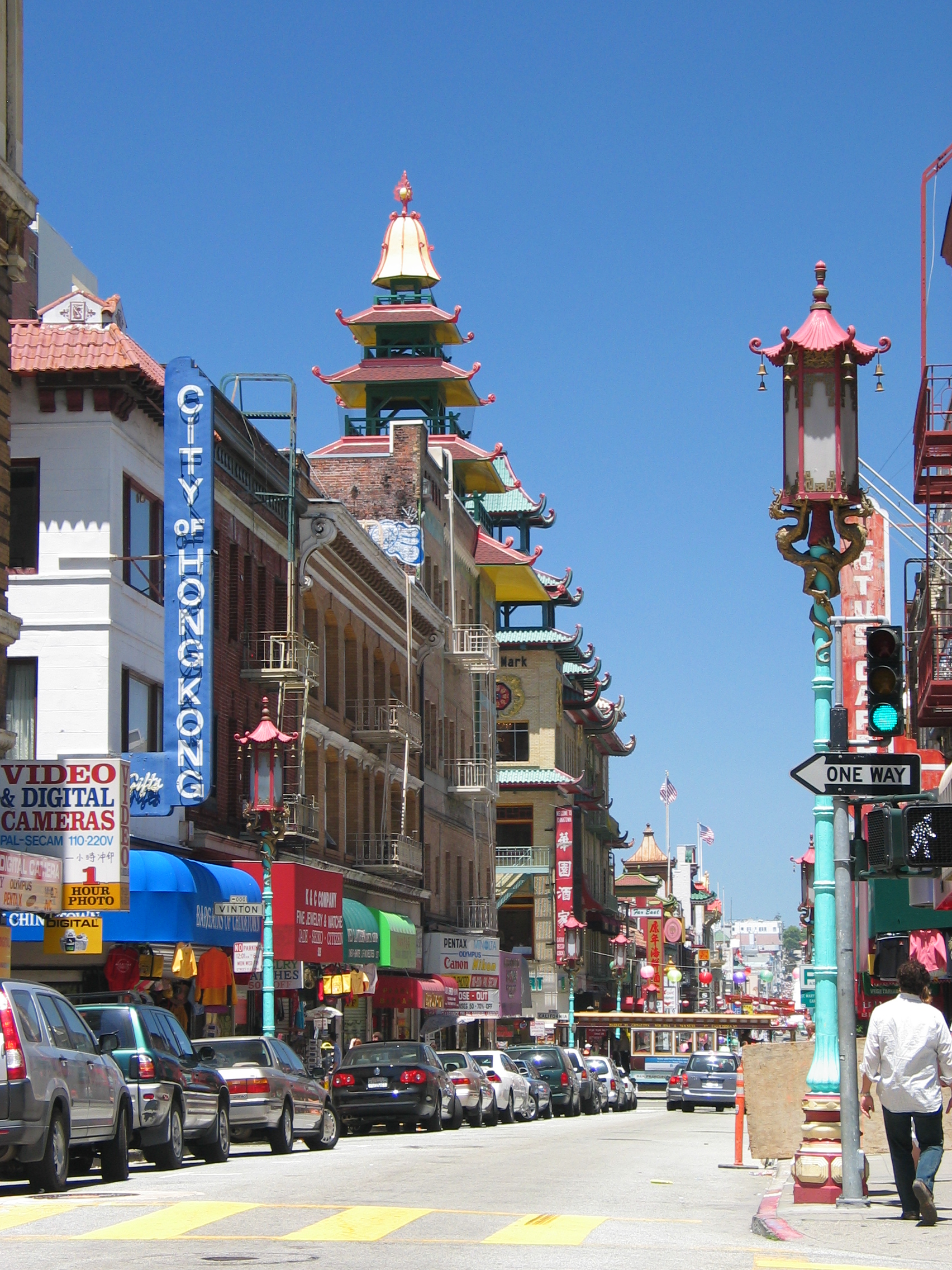

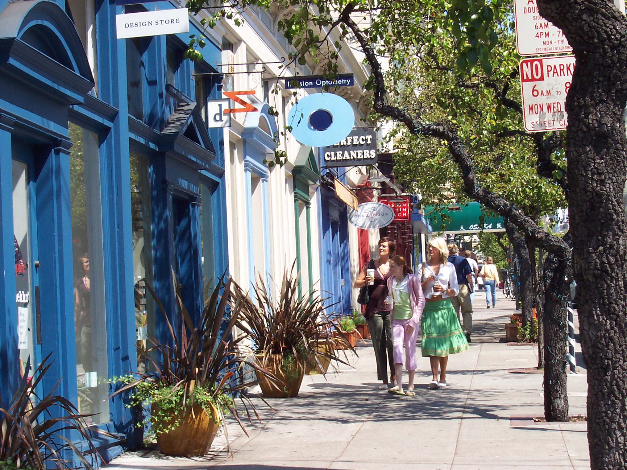


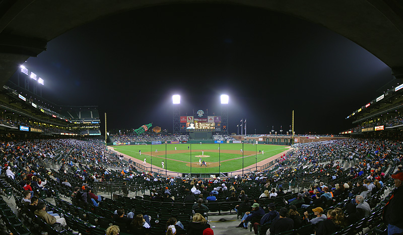


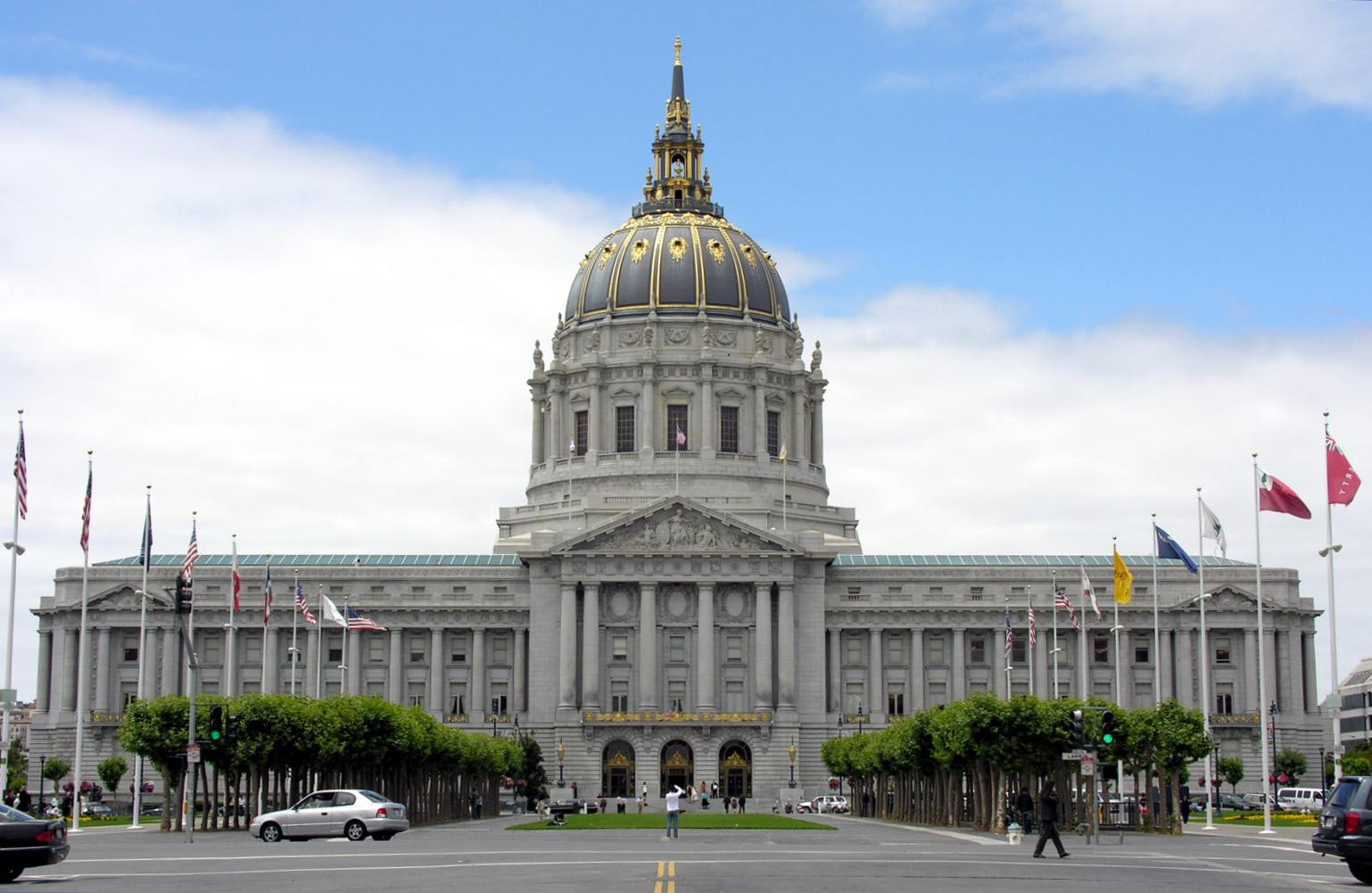


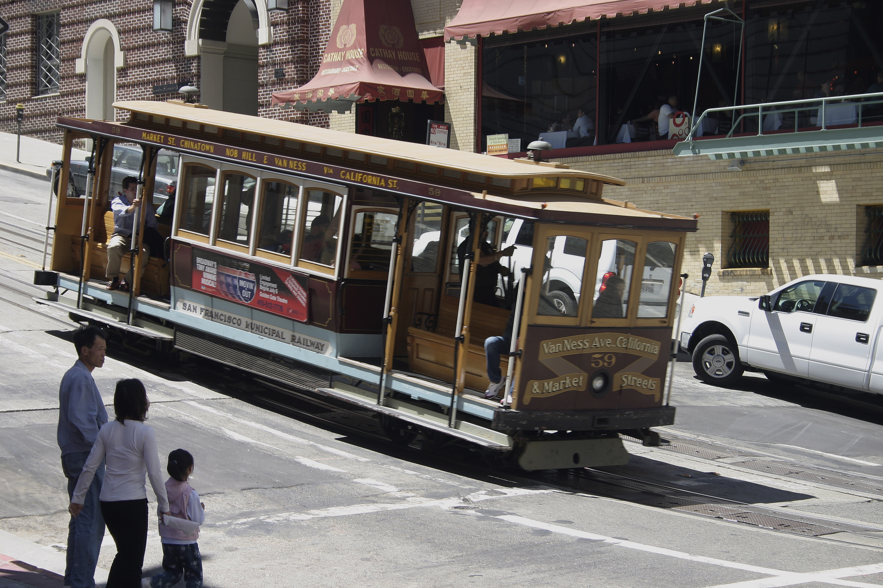
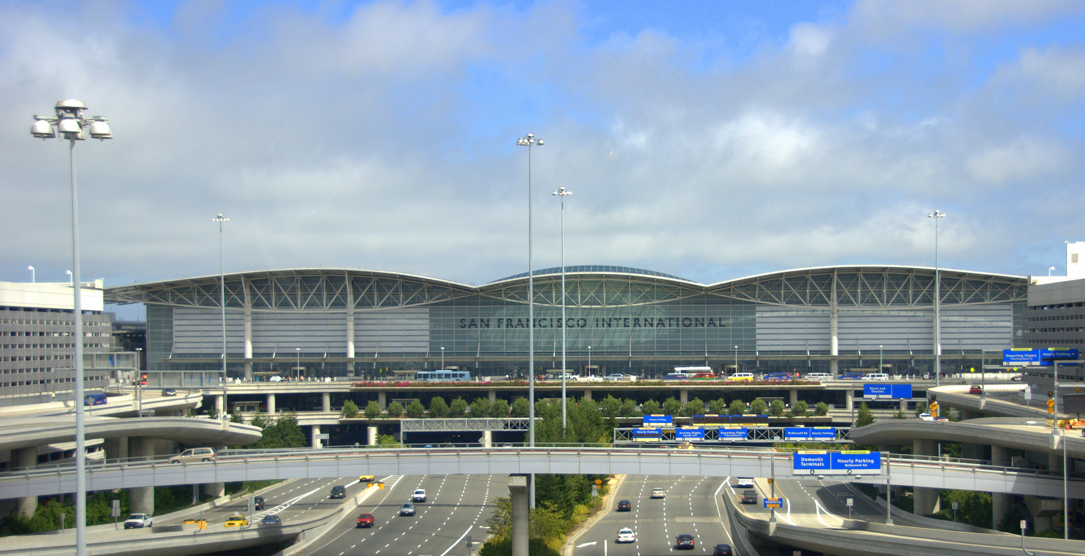
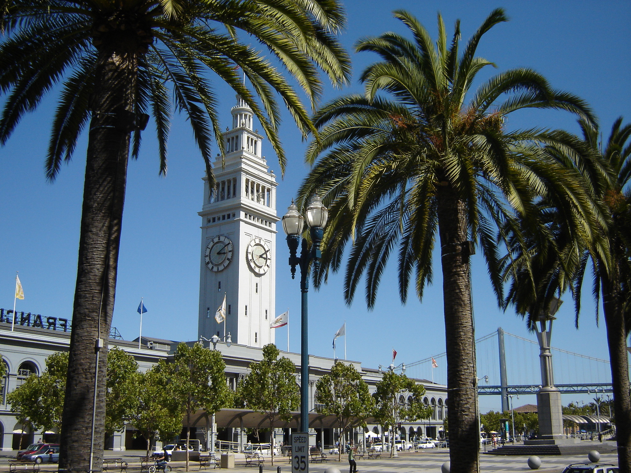

Wikimedia Foundation. 2010.