- San Andreas, California
Infobox Settlement
official_name = San Andreas, California
settlement_type = CDP
imagesize =
image_caption =
image_
imagesize =
image_caption =
image_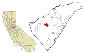
mapsize = 250x200px
map_caption = Location in Calaveras County and the state ofCalifornia
mapsize1 =
map_caption1 =
subdivision_type = Country
subdivision_type1 = State
subdivision_type2 = County
subdivision_name =United States
subdivision_name1 =California
subdivision_name2 = Calaveras
government_type =
leader_title =
leader_name =
established_date =
area_magnitude =
area_total_km2 = 22.6
area_total_sq_mi = 8.7
area_land_km2 = 22.6
area_land_sq_mi = 8.7
area_water_km2 = 0
area_water_sq_mi = 0
elevation_ft = 1017
elevation_m = 310
population_as_of = 2000
population_footnotes =
population_total = 2615
population_metro =
population_density_km2 = 115.7
population_density_sq_mi = 300.6
timezone = Pacific (PST)
utc_offset = -8
latd = 38 |latm = 11 |lats = 45 |latNS = N
longd = 120 |longm = 40 |longs = 41 |longEW = W
timezone_DST = PDT
utc_offset_DST = -7
postal_code_type =ZIP code s
postal_code = 95249-95250
area_code = 209
blank_name = FIPS code
blank_info = 06-64420
blank1_name = GNIS feature ID
blank1_info = 0277590
footnotes =
website = "For other uses, seeSan Andreas ."San Andreas is an unincorporated
census-designated place and thecounty seat ofCalaveras County, California . The population was 2,615 at the 2000 census. Like most towns in the region, it was originally founded during theCalifornia Gold Rush . The town is located on State Route 49 and is registered asCalifornia Historical Landmark #252.History
Settled by Mexicans in
1848 and named after theCatholic parishSt. Andrew , the town has been a noted mining camp since early days. Thegold from the initially discovered placers gave out after a few years, but the discovery of gold in an underground river channel in1853 revitalized the camp and it soon became a town. Mining of the channels was lucrative enough for the town to completely rebuild after fires in1858 and1863 . The gold discovered here contributed greatly to the success of the Union during the Civil War. In1866 , San Andreas became the seat of Calaveras County. It was said to be a rendezvous location forJoaquin Murietta . Notoriousstagecoach robber Black Bart was tried here and sent to prison.Geography
According to the
United States Census Bureau , the CDP has a total area of 8.8square mile s (22.7km² ), of which, 8.7 square miles (22.6 km²) of it is land and 0.04 square miles (0.1 km²) of it (0.23%) is water.Demographics
As of the
census GR|2 of 2000, there were 2,615 people, 1,097 households, and 652 families residing in the CDP. Thepopulation density was 299.4 people per square mile (115.5/km²). There were 1,167 housing units at an average density of 133.6/sq mi (51.6/km²). The racial makeup of the CDP was 92.08% White, 0.08% Black or African American, 1.53% Native American, 0.73% Asian, 1.95% from other races, and 3.63% from two or more races. 6.35% of the population were Hispanic or Latino of any race.There were 1,097 households out of which 28.0% had children under the age of 18 living with them, 41.9% were married couples living together, 13.8% had a female householder with no husband present, and 40.5% were non-families. 34.2% of all households were made up of individuals and 18.4% had someone living alone who was 65 years of age or older. The average household size was 2.24 and the average family size was 2.85.
In the CDP the population was spread out with 24.2% under the age of 18, 7.6% from 18 to 24, 21.6% from 25 to 44, 22.6% from 45 to 64, and 23.9% who were 65 years of age or older. The median age was 43 years. For every 100 females there were 89.8 males. For every 100 females age 18 and over, there were 81.9 males.
The median income for a household in the CDP was $32,500, and the median income for a family was $37,969. Males had a median income of $39,583 versus $24,500 for females. The
per capita income for the CDP was $16,813. About 14.4% of families and 14.8% of the population were below thepoverty line , including 19.5% of those under age 18 and 8.9% of those age 65 or over.Politics
In the state legislature San Andreas is located in the 1st Senate District, represented by Republican
Dave Cox , and in the 25th Assembly District, represented by RepublicanTom Berryhill . Federally, San Andreas is located inCalifornia's 3rd congressional district , which has a Cook PVI of R +7 [cite web | title = Will Gerrymandered Districts Stem the Wave of Voter Unrest? | publisher = Campaign Legal Center Blog | url=http://www.clcblog.org/blog_item-85.html | accessdate = 2007-10-20] and is represented by RepublicanDan Lungren .References
Grand Theft Auto
According to the local newspaper, the "Calaveras Enterprise", the San Andreas Merchants Association has been alarmed over the popularity of the ""
video game , which may cause the public to associate the trademark "San Andreas" with inner-city mayhem and violence instead of a peaceful small town in the Sierra foothills. However, when they contactedTake Two Interactive , Take Two's attorneys atBlank Rome LLP explained that their client was on firm legal ground.Fact|date=February 2007External links
Wikimedia Foundation. 2010.