- San Bruno, California
Infobox Settlement
official_name = San Bruno, California
other_name =
native_name =
nickname =
settlement_type =City
motto =
imagesize =
image_caption =
flag_size =
image_
seal_size =
image_shield =
shield_size =
image_blank_emblem =
blank_emblem_type =
blank_emblem_size =
imagesize =
image_caption =
flag_size =
image_
seal_size =
image_shield =
shield_size =
image_blank_emblem =
blank_emblem_type =
blank_emblem_size =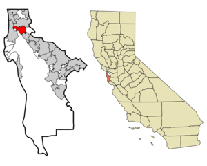
mapsize = 250x200px
map_caption = Location in San Mateo County and the state ofCalifornia
mapsize1 =
map_caption1 =
image_dot_
dot_mapsize =
dot_map_caption =
dot_x =
dot_y =
pushpin_
pushpin_label_position =
pushpin_map_caption =
pushpin_mapsize =
subdivision_type = Country
subdivision_name =United States
subdivision_type1 = State
subdivision_name1 =California
subdivision_type2 = County
subdivision_name2 = San Mateo
subdivision_type3 =
subdivision_name3 =
subdivision_type4 =
subdivision_name4 =
government_footnotes =
government_type =
leader_title =
leader_name =
leader_title1 =
leader_name1 =
leader_title2 =
leader_name2 =
leader_title3 =
leader_name3 =
leader_title4 =
leader_name4 =
established_title =
established_date =
established_title2 =
established_date2 =
established_title3 =
established_date3 =
area_magnitude =
unit_pref =
area_footnotes =GR|2
area_total_sq_mi = 5.46
area_land_sq_mi = 5.46
area_water_sq_mi = 0
area_water_percent =
area_urban_sq_mi =
area_metro_sq_mi =
area_blank1_title =
area_blank1_sq_mi =
population_as_of = 2000
population_footnotes =GR|2
population_note =
population_total = 40165
population_density_sq_mi = 7353.6
population_metro =
population_density_metro_sq_mi =
population_urban =
population_density_urban_sq_mi =
population_blank1_title =
population_blank1 =
population_density_blank1_sq_mi =
timezone = PST
utc_offset = -8
timezone_DST = PDT
utc_offset_DST = -7
latd = 37 |latm = 37 |lats = 31 |latNS = N
longd = 122 |longm = 25 |longs = 31 |longEW = W
elevation_footnotes =gnis|277616|San Bruno]
elevation_m = 5
elevation_ft = 16
postal_code_type =ZIP code s
postal_code = 94066-94067, 94096, 94098
area_code = 650
blank_name = FIPS code
blank_info = 06-65028
blank1_name = GNIS feature ID
blank1_info = 277616
website =
footnotes =San Bruno is a city in San Mateo County,
California ,United States . The population was 40,165 at the 2000 census.The city essentially includes
San Francisco International Airport andGolden Gate National Cemetery .Geography
San Bruno is located at coor dms|37|37|31|N|122|25|31|W|city (37.625288, -122.425266).GR|1 The city is located between South San Francisco and Millbrae, near the
San Francisco International Airport and about 12 miles (19 km) south of downtown San Francisco.According to theUnited States Census Bureau , the city has a total area of 5.5square mile s (14.1km² ), all of it land. The city spreads from the mostly flat lowlands nearSan Francisco Bay into the foothills of theSanta Cruz Mountains , which rise to more than 600 feet above sea level (183 m) in Crestmoor and more than 700 feet (213 m) above sea level in Portola Highlands. San Bruno City Hall sits at an official elevation of 41 feet (12.5 m) above sea level.Portions of Mills Park, Crestmoor, and Rollingwood are very hilly and feature some canyons and ravines. Creeks, many of them now in culverts, flow from springs in the hills toward San Francisco Bay. Just west of Skyline Boulevard is
San Andreas Lake , outside the city limits, which gave its name to the famousSan Andreas Fault in 1895. The lake is actually one of several reservoirs used by the San Francisco Water Department, providing water to San Francisco and some communities in San Mateo County, including San Bruno west of I-280.Climate
San Bruno enjoys a mild Mediterranean climate characterized by warm, dry summers and cool, wet winters.
Since 1927, the
National Weather Service (formerly theU.S. Weather Bureau ) has maintained a weather station at the nearbySan Francisco International Airport (formerly Mills Field). According to the official records, January is the coldest month with an average high of 55.9°F (13.3°C) and an average low of 42.9°F (6.1°C). Frost occurs occasionally during the winter months; snowfall is quite rare, but 1.5 inches (3.8 cm) fell on January 21, 1962 (with as much as four inches (10 cm) reported in Crestmoor). Measurable snowfalls also occurred on December 11, 1932 and February 5, 1976. In recent years, traces of snow have been reported on December 27, 1988; January 8, 1989; and February 24, 1996.Freezing temperatures occur on an average of only 1.3 days annually. The coldest winter temperature on record was 20°F (-6.7°C) on December 11, 1932, the same day 1.0 inch (2.5 cm) of snow fell. A week-long cold spell in December 1972 caused hard freezes throughout the area, damaging trees and plants and causing some water pipes to break; the temperature dropped as low as 24°F (-4.4°C) at the airport and 20°F (-6.7°C) in Crestmoor, which also reported snow flurries several times that week.
September is the warmest month with an average high of 72.7°F (22.6°C) and an average low of 55.1°F (12.8°C). Temperatures exceed 90°F (32°C) on an average of 4.0 days annually. Fog and low overcast are common during the night and morning hours in the summer months, which are generally very dry except for occasional light drizzle from the fog. On rare occasions moisture moving up from tropical storms has produced thunderstorms or showers in the summer. Gusty westerly winds are also common in the afternoon during the summer. The highest summer temperature was 106°F (41.1°C) on June 14, 1961, breaking a record of 104°F (40°C) set in June 1960. A high of 105°F (40.6°C) was recorded on July 17, 1988, and a high of 103°F (39.4°C) was recorded on September 14, 1971. Until August 1, 1993, it had never reached 100°F (37.8°C) in August, which is one of the foggier months in the area. Due to
thermal inversion s, summer temperatures in the higher hills are often much higher than at the airport.Thunderstorms occur several times a year, mostly during the winter months, but are usually quite brief. Total annual precipitation, most of which falls from November to April, ranges from 20.11 inches (51.08 cm) at the nearby
National Weather Service station at San Francisco International Airport to over 32 inches (81.3 cm) in the higher hills (according to observations by Gayle Rucker for theArmy Corps of Engineers and Robert E. Nylund for theU.S. Geological Survey from 1962 to 1985). Nylund also took temperature observations for several years and published weekly weather reports in the "San Bruno Herald" from 1966 to 1969, which were included in official reports for the Golden Gate National Cemetery. The annual average days with measurable precipitation is 65.2 days. The most rainfall in a month at the airport was 13.64 inches (34.65 cm) in February 1998, and the most rainfall in 24 hours was 5.59 inches (14.2 cm) on January 4, 1982. Nylund reported 6.09 inches (15.5 cm) in Crestmoor during a 24-hour period in January 1967. Winter storms are often accompanied by strong southerly winds.Infobox Weather
single_line=
location = San Bruno, California
Jan_Hi_°F = 55.9
Feb_Hi_°F = 59.3
Mar_Hi_°F = 61.2
Apr_Hi_°F = 64.3
May_Hi_°F = 66.8
Jun_Hi_°F = 69.9
Jul_Hi_°F = 71.1
Aug_Hi_°F = 71.7
Sep_Hi_°F = 72.7
Oct_Hi_°F = 69.7
Nov_Hi_°F = 62.0
Dec_Hi_°F = 56.1
Year_Hi_°F = 65.1
Jan_Hi_°C = 13.3
Feb_Hi_°C = 15.1
Mar_Hi_°C = 16.2
Apr_Hi_°C = 17.9
May_Hi_°C = 19.3
Jun_Hi_°C = 21.1
Jul_Hi_°C = 21.7
Aug_Hi_°C = 22.1
Sep_Hi_°C = 22.6
Oct_Hi_°C = 20.9
Nov_Hi_°C = 16.7
Dec_Hi_°C = 12.4
Year_Hi_°C = 18.4
Jan_Lo_°F = 42.9
Feb_Lo_°F = 45.5
Mar_Lo_°F = 46.8
Apr_Lo_°F = 48.1
May_Lo_°F = 50.5
Jun_Lo_°F = 52.9
Jul_Lo_°F = 54.5
Aug_Lo_°F = 55.5
Sep_Lo_°F = 55.1
Oct_Lo_°F = 52.4
Nov_Lo_°F = 47.5
Dec_Lo_°F = 43.0
Year_Lo_°F = 49.6
Jan_Lo_°C = 6.1
Feb_Lo_°C = 7.5
Mar_Lo_°C = 8.2
Apr_Lo_°C = 8.9
May_Lo_°C = 10.3
Jun_Lo_°C =11.6
Jul_Lo_°C =12.5
Aug_Lo_°C =13.1
Sep_Lo_°C =12.8
Oct_Lo_°C =11.3
Nov_Lo_°C =8.6
Dec_Lo_°C =6.1
Year_Lo_°C =9.8
Jan_Precip_inch = 4.45
Feb_Precip_inch = 4.01
Mar_Precip_inch = 3.26
Apr_Precip_inch = 1.18
May_Precip_inch = 0.38
Jun_Precip_inch = 0.11
Jul_Precip_inch = 0.03
Aug_Precip_inch = 0.07
Sep_Precip_inch = 0.20
Oct_Precip_inch = 1.04
Nov_Precip_inch = 2.49
Dec_Precip_inch = 2.89
Year_Precip_inch = 20.11
Jan_Precip_cm = |Jan_Precip_mm = 113.0
Feb_Precip_cm = |Feb_Precip_mm = 101.8
Mar_Precip_cm = |Mar_Precip_mm = 82.8
Apr_Precip_cm = |Apr_Precip_mm = 30.0
May_Precip_cm = |May_Precip_mm = 9.7
Jun_Precip_cm = |Jun_Precip_mm = 2.8
Jul_Precip_cm = |Jul_Precip_mm = 0.8
Aug_Precip_cm = |Aug_Precip_mm = 1.8
Sep_Precip_cm = |Sep_Precip_mm = 5.1
Oct_Precip_cm = |Oct_Precip_mm = 26.4
Nov_Precip_cm = |Nov_Precip_mm = 63.2
Dec_Precip_cm = |Dec_Precip_mm = 73.4
Year_Precip_cm = |Year_Precip_mm = 510.8
source = "Climatography of the United States," National Climatic Data Center (www.ncdc.noaa.gov) ["Climatography of the United States," National Climatic Data Center (www.ncdc.noaa.gov)]
accessdate =Demographics
As of the
census GR|2 of 2000, there were 40,165 people, 14,677 households, and 9,921 families residing in the city. Thepopulation density was 7,353.6 people per square mile (2,840.3/km²). There were 14,980 housing units at an average density of 2,742.6/sq mi (1,059.3/km²). The racial makeup of the city was 37.65% White, 2.01% African American, 0.47% Native American, 18.69% Asian, 2.88% Pacific Islander, 10.82% from other races, and 7.48% from two or more races. Hispanic or Latino of any race were 44.12% of the population.There were 14,677 households out of which 31.4% had children under the age of 18 living with them, 51.8% were married couples living together, 11.2% had a female householder with no husband present, and 32.4% were non-families. 25.5% of all households were made up of individuals and 6.8% had someone living alone who was 65 years of age or older. The average household size was 2.72 and the average family size was 3.29.
In the city the population was spread out with 23.0% under the age of 18, 8.2% from 18 to 24, 34.5% from 25 to 44, 23.1% from 45 to 64, and 11.2% who were 65 years of age or older. The median age was 36 years. For every 100 females there were 97.4 males. For every 100 females age 18 and over, there were 95.3 males.
The median
income for a household in the city was $62,081, and the median income for a family was $70,251. Males had a median income of $46,843 versus $36,851 for females. Theper capita income for the city was $26,360. About 3.1% of families and 4.4% of the population were below thepoverty line , including 3.8% of those under age 18 and 5.5% of those age 65 or over.Politics
In the state legislature San Bruno is located in the 8th Senate District, represented by Democrat
Leland Yee , and in the 19th Assembly District, represented by DemocratGene Mullin . Federally, San Bruno is located inCalifornia's 12th congressional district , which has a Cook PVI of D +22 [cite web | title = Will Gerrymandered Districts Stem the Wave of Voter Unrest? | publisher = Campaign Legal Center Blog | url=http://www.clcblog.org/blog_item-85.html | accessdate = 2008-02-10] and is represented by DemocratJackie Speier .Parks
San Bruno City Park, bordered by Crystal Springs Avenue and El Crystal School, is the major municipal park. It offers shaded walkways and hiking trials, picnic tables, a playground, a small ballpark, a municipal swimming pool, and a recreation center that includes an indoor basketball court once used for training by the
San Francisco Warriors basketball team. There are smaller municipal parks in other parts of the city.Junipero Serra County Park, also accessible from Crystal Springs Avenue, is a 100-acre (.405 square kilometer) park owned by San Mateo County and includes numerous hiking trails, as well as picnic shelters, barbecue pits, and picnic tables. The wilderness area was named for
Junipero Serra , aFranciscan friar who founded many of the Spanish missions in California during the eighteenth century; Serra regularly passed through what is now San Bruno whenever he visited the mission at San Francisco. The park is administered by theSan Mateo County Parks and Recreation Department, which charges a small entry fee on weekends.History
San Bruno was the location of the
Ohlone village Urebure. It was explored in November 1769 by a Spanish expedition led byGaspar de Portola . Later, more extensive explorations by Bruno Hecate resulted in the naming ofSan Bruno Creek afterSt. Bruno of Cologne , the founder of a medieval monastic order. This creek apparently later gave its name to the community.With the establishment of the
San Francisco de Asis (St. Francis of Assisi ) mission, much of the area became pasture for the mission livestock. Following the decline of the missions, the area became part of Rancho Buriburi, owned byJosé de la Cruz Sánchez , the eleventh "Alcalde" (mayor) of San Francisco. Dairy farms later became common in much of the area.The city began as a stop on the
Butterfield stagecoach route, utilizing an inn built in 1849, which was initially called Thorp's Place and later Uncle Tom's Cabin. The inn was demolished in 1949 and replaced with a Lucky's supermarket (now a Walgreens drugstore, on the corner of El Camino Real and Crystal Springs Avenue). Gus Jenevein (for whom Jenevein Avenue was named) built another landmark called San Bruno House, which burned several times and was not rebuilt after the third fire. A few homes and farms were developed in the area. The railroad betweenSan Francisco and San Jose built a train station at San Bruno in the 1860s. The railroad eventually became part of the Southern Pacific system, which ran both passenger and freight trains on the line. Today it is known asCaltrain .Real growth and development began after the 1906 earthquake and fire. The city's first public school was completed in late 1906. With the construction of Edgemont Elementary School in 1910, all classes were moved there and the original school building became a public facility named Green Hall. Another school, North Brae Elementary School, opened in 1912; among its earliest students was future actor
Eddie "Rochester" Anderson . Paving of California's first state highway,El Camino Real , began in 1912 in front of San Bruno's Uncle Tom's Cabin; the highway is now designated as State Route 82. The adjoiningSan Francisco International Airport opened in early 1927 and included aWeather Bureau station, now operated by theNational Weather Service .Charles Lindbergh was an early visitor to the airport, during his national tour following his successful transatlantic flight; unfortunately, his airplane ("Spirit of St. Louis ") became stuck in the mud!Following a campaign by the local newspaper, the "
San Bruno Herald ", the community was incorporated in 1914, mainly so the streets could be paved. Green Hall became the first city hall. San Bruno grew rapidly, passing 1,500 residents by 1920 and 3,610 residents in 1930. Additional schools, including New Edgemont (later renamed Decima Allen) and Crystal Springs, were built during the 1940s.In 1930, the El Camino Theater opened at the corner of
El Camino Real and San Mateo Avenue. The popular theater, wired for sound, replaced the earlier Melody Theater, which had presented silent films. The El Camino showed double features, cartoons, short comedies, adventure serials, and newsreels during its history, including Saturday matinees and summer Wednesday matinees for children. Normally, films changed every week, but in 1958Cecil B. DeMille 's "The Ten Commandments" ran for two weeks to packed audiences. The theater closed in the early 1970s when a four-screen movie theater opened in the Tanforan shopping center. The El Camino Theater building was remodeled and currently houses several businesses. A larger, multi-screen complex was later built north of Tanforan.In 1939, the War Department created the Golden Gate National Cemetery in San Bruno as space was starting to run out for veterans to be buried at the Presidio of San Francisco.
Following
World War II , there was continued growth and new subdivisions in Mills Park, Rollingwood, and Crestmoor. In 1947, theBayshore Freeway (U.S. Route 101) was opened fromSouth San Francisco toRedwood City and included an interchange at San Bruno.Prior to 1950, San Bruno's high school students attended
San Mateo High School (opened in 1902) and thenBurlingame High School (opened in 1923), traveling to and from school on the street cars that ran next to the Southern Pacific railroad. Finally, on September 11, 1950,Capuchino High School opened in San Bruno. After years of using Green Hall as a multi-purpose building, the city dedicated a library and city hall in 1954. That same year saw the dedication of the current central terminal at the airport, part of a major expansion program. A central fire station was later built next to the city hall; an additional station was built in Crestmoor.The city's most famous native, actress and businesswoman
Suzanne Somers was born in San Bruno in 1946. She attended local schools and graduated from Capuchino High School in June 1964. During her senior year at Capuchino, Suzanne had a featured role (as Adelaide) in the school's 1964 production of the musical comedy "Guys and Dolls ".In 1953, San Bruno annexed the adjoining unincorporated community of Lomita Park, bounded by San Felipe Avenue, El Camino Real, San Juan Avenue, and the railroad tracks. Until the annexation, Lomita Park had its own Southern Pacific train station and some community services.
Parkside Intermediate School was opened in 1954, followed by additional elementary schools: Rollingwood, Crestmoor, John Muir, and Carl Sandburg. A second intermediate school, Engvall, was built in Crestmoor Canyon, only to be closed, along with North Brae and Sandburg, when enrollment fell. These were all part of the San Bruno Park School District. Students in northwestern San Bruno were included in the Laguna Salada district.
San Bruno considered new annexations in the mid-1950s that would have extended the city limits to the
Pacific Ocean . The unincorporated communities west of San Bruno decided they did not want to become part of San Bruno, so they incorporated in 1957 as the city ofPacifica .The
March 22 ,1957 , earthquake (5.3 magnitude) caused minor damage throughout the city, especially in some of the schools, where windows were broken and plaster cracked. A large chunk of plasterboard fell on the table where school district administrators were meeting; fortunately, no one was injured. Numerous cans and bottles were knocked off shelves at local stores, some of which were closed temporarily. Capuchino High School closed for the day following the quake, while other schools evacuated students to open areas. Many residents reported damage tocrockery .Eitel-McCullough operated a large manufacturing plant in San Bruno for many years. William Eitel and Jack McCullogh formed the company in 1934. It specialized in the manufacture of power grid tubes. [ [http://nobelprize.org/nobel_prizes/physics/articles/lecuyer/index.html Technology and Entrepreneurship in Silicon Valley ] ] Known as Eimac, the company also made vacuum tubes used in communication equipment, as well as other products for military and commercial applications. [http://ieeexplore.ieee.org/iel5/10933/35576/01687162.pdf] Due to its work on broadcast transmission parts, Eimac operated an
FM radio station,KSBR , which transmitted on 100.5 megaHertz. [http://jeff560.tripod.com/1948fm.html; http://bostonradio.org/fm-1950.html] The station began operations in 1947 and, that same year, was one of only two in the nation to test Rangertone tape recorders. (The other station wasWASH inWashington, D.C. ) [http://books.google.com/books?id=KDdQLuRBVW0C&pg=PA198&lpg=PA198&dq=KSBR,+San+Bruno&source=web&ots=oy0c8-ftrX&sig=EgjqmklSrjuR43Jb4pvJ_YXuNmo&hl=en#PPA198,M1] The recorders were based on the GermanMagnetophon . [ [http://www.keyboardmuseum.com/pre60/1930/rangertone2.html A Biography of Richard Ranger and History of the Rangertone Corp ] ] In need of more space, the company moved to San Carlos in 1959. [http://content.cdlib.org/ark:/13030/kt858021cp/?layout=metadata&brand=calisphere Eitel-McCullough, Inc. building in San Carlos, 1959 ] ] Eimac's San Carlos plant was dedicated on April 16, 1959. In 1965, Eimac merged withVarian Associates and became known as the Eimac Division. In 1995,Leonard Green & Partners purchased the entire Electron Devices Business from Varian and formedCommunications & Power Industries . [radiomuseum.org/dsp_hersteller_detail.cfm?Company_id=6982]Crestmoor High School opened in September 1962, but was closed in June 1980 due to a decline in school enrollment. The city has a two-year junior college,Skyline College .A major landmark in San Bruno for many years was the
Tanforan Racetrack , which opened in 1899. Such famous racehorses asSeabiscuit and Citation raced there. Famed Hollywood directorFrank Capra filmed scenes for two of his films, "Broadway Bill " and "Riding High", at the racetrack. For six months in 1942, it served as a one of the main Bay Area centers for those forced intoJapanese Internment Camps , processing about 7800 Japanese, usually for about four-five months before they were sent out to larger facilities in the desert of Utah andManzanar in theOwens Valley .The track closed in 1964 and was about to be demolished when it was destroyed in a major fire on July 31, 1964. The city's only shopping mall was later built on the site; surrounding city streets were named for some of the racehorses who appeared at Tanforan.The city was the site of the crash of
Flying Tiger Line Flight 282 onDecember 23 ,1964 .During the late 1960s, the I-280 (
Junipero Serra Freeway ) was built through San Bruno. The San Bruno Planning Commission (then chaired by Peter Weinberger, brother ofCaspar Weinberger ) reviewed and approved plans for two major shopping centers, Bayhill (located on the old U.S. Navy property betweenSan Bruno Avenue andSneath Lane ) and Tanforan. With final approval by the San Bruno City Council, construction proceeded on these major retail developments. Prior to that most of the city's stores were located onSan Mateo Avenue andEl Camino Real .San Bruno became one of only two cities in the Bay Area that manages its own cable TV and internet system. [http://www.sanbrunocable.com San Bruno Cable]
The
October 17 ,1989 ,Loma Prieta earthquake (6.9 magnitude) caused some damage in the city. The U.S. Postal Service's Western Regional headquarters, then the tallest building in San Bruno, had to be demolished due to severe structural damage. The world headquarters for The Gap clothing company is now the tallest building in the city. For more details, seeLoma Prieta earthquake .The [http://sanbrunobeacon.com/ The San Bruno Beacon] , started publishing news and commentary online in 1995. A few years later, "The San Bruno Herald" ceased publication as a weekly newspaper.
The Pacific Region (San Francisco) facility of the
National Archives and Records Administration is located in San Bruno. The facility was built within the old U.S. Navy complex bounded by San Bruno Avenue, El Camino Real, Sneath Lane, and I-280.San Bruno finally acquired its own
BART station when the high-speed rail system was extended toMillbrae and theSan Francisco International Airport .Certain parts of the video game "
Silent Hill 2 " are modeled after San Bruno.Online video company
YouTube is based in San Bruno.Although all available land had been developed within the city limits by the 1980s, new homes have been built on the site of the former Carl Sandburg Elementary School in Rollingwood (where construction continued in 2008) and the Skycrest Shopping Center in Crestmoor. In addition, the sites of the former North Brae Elementary School and the U.S. Navy base have been developed in recent years.
Notable People
*
Wally Bunker
*Gordon DeVol
*Luana DeVol
*Keith Hernandez
*Ron "Pigpen" McKernan
*Suzanne Somers ister cities
Wikimedia Foundation. 2010.