- San Bernardino, California
-
City of San Bernardino — City — Downtown San Bernardino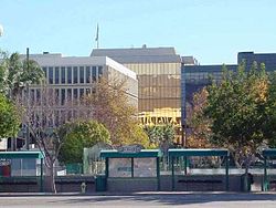
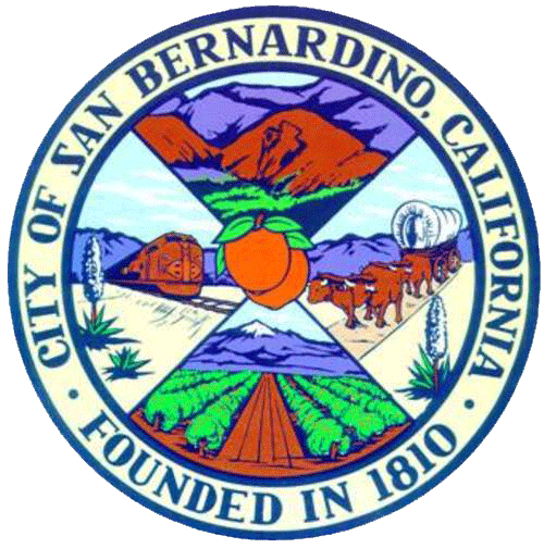
SealNickname(s): SB; Gate City; City on the Move; The Friendly City; The HeartSouthern California; San Berdoo; Berdoo Location in the state of California
Coordinates: 34°7′46″N 117°17′35″W / 34.12944°N 117.29306°WCoordinates: 34°7′46″N 117°17′35″W / 34.12944°N 117.29306°W Country  United States
State  California
County San Bernardino Government – Type Council-Manager – City Council Patrick J. Morris, Mayor
Virginia Marquez
Vacant
Tobin Brinker
Fred Shorett
Chas A. Kelley
Rikke Van Johnson
Wendy McCammack– City Manager Charles E. McNeeley – Treasurer David C. Kennedy, CCMT[1] – City Attorney James F. Penman – City Clerk Rachel Clark Area[2] – City 59.645 sq mi (154.480 km2) – Land 59.201 sq mi (153.330 km2) – Water 0.444 sq mi (1.15 km2) 0.74% Elevation 1,049–2,900 ft (321 m) Population (2010) – City 209,924 – Rank 1st in San Bernardino County
17th in California
99th in the United States– Density 3,519.6/sq mi (1,358.9/km2) – Metro 4,224,851 (13th) Time zone PST (UTC-8) – Summer (DST) PDT (UTC-7) ZIP codes 92401-92408, 92410-92415, 92418, 92420, 92423, 92424, 92427 Area code(s) 909 FIPS code 06-65000 GNIS feature ID 1661375 Website http://sbcity.org/ San Bernardino is a city located in the Riverside-San Bernardino metropolitan area (sometimes called the Inland Empire), and serves as the county seat of San Bernardino County, California, United States. As one of the Inland Empire's anchor cities, located 65 miles east of Los Angeles, San Bernardino spans 81 square miles (210 km2) on the floor of the San Bernardino Valley, and has a population of 209,924 as of the 2010 census.[3] San Bernardino is the 17th largest city in California, and the 99th largest city in the United States. It is the gateway to the San Bernardino Mountains, less than 10 miles (16 km) to the north and east, as well as California's high and low deserts.
Contents
History
The City of San Bernardino, California, occupies much of the San Bernardino Valley, which indigenous tribes people originally referred to as "The Valley of the Cupped Hand of God." The Tongva Indians also called the San Bernardino area Wa'aach in their language.[4] Upon seeing the immense Arrowhead geological monument on the side of the San Bernardino Mountains, they found the hot and cold springs to which the rock formation seemed to point.
The City of San Bernardino is one of the oldest communities in the State of California. Named for Bernardino of Siena on May 20, 1810, San Bernardino, in its present-day location, was not largely settled until 1851 when California entered the Union. The first Anglo-American colony was established by pioneers associated with The Church of Jesus Christ of Latter-day Saints who would later be recalled in 1857 by Brigham Young due to the Utah War. During the interim, the city was officially incorporated in the year 1857. Soon afterward, San Bernardino became an important trading hub in Southern California.
According to the Native American legend regarding the landmark Arrowhead, an arrow from heaven burned the formation onto the mountainside in order to show tribes where they could be healed. During the mid-19th Century, "Dr." David Noble Smith claimed that a saint-like being appeared before him and told of a far-off land with exceptional climate and curative waters, marked by a gigantic arrowhead. Smith's search for that unique arrowhead formation began in Texas, and eventually ended at Arrowhead Springs in California in 1857. By 1889, word of the springs, along with the hotel on the site (and a belief in the effect of the water from the springs on general health) had grown considerably. Hotel guests often raved about the crystal-clear water from the cold springs, which prompted Seth Marshall to set up a bottling operation in the hotel's basement. By 1905, water from the cold springs was being shipped to Los Angeles under the newly-created "Arrowhead" trademark.
Indigenous people of the San Bernardino Valley and Mountains were collectively identified by Spanish explorers in the 19th Century as Serrano, a term meaning highlander. Serrano living near what is now Big Bear Lake were called Yuhaviatam, or "People of the Pines". In 1866, to clear the way for settlers and gold miners, state militia conducted a 32-day campaign slaughtering men, women, and children. Yuhaviatam leader Santos Manuel guided his people from their ancient homeland to a village site in the San Bernardino foothills. The United States government in 1891 established it as a tribal reservation and named it after Santos Manuel.
The California Southern Railroad established, through San Bernardino, a rail link between Los Angeles and the rest of the nation in 1883.
In 1905, the City of San Bernardino passed its first Charter.
World War II brought what would become Norton Air Force Base.
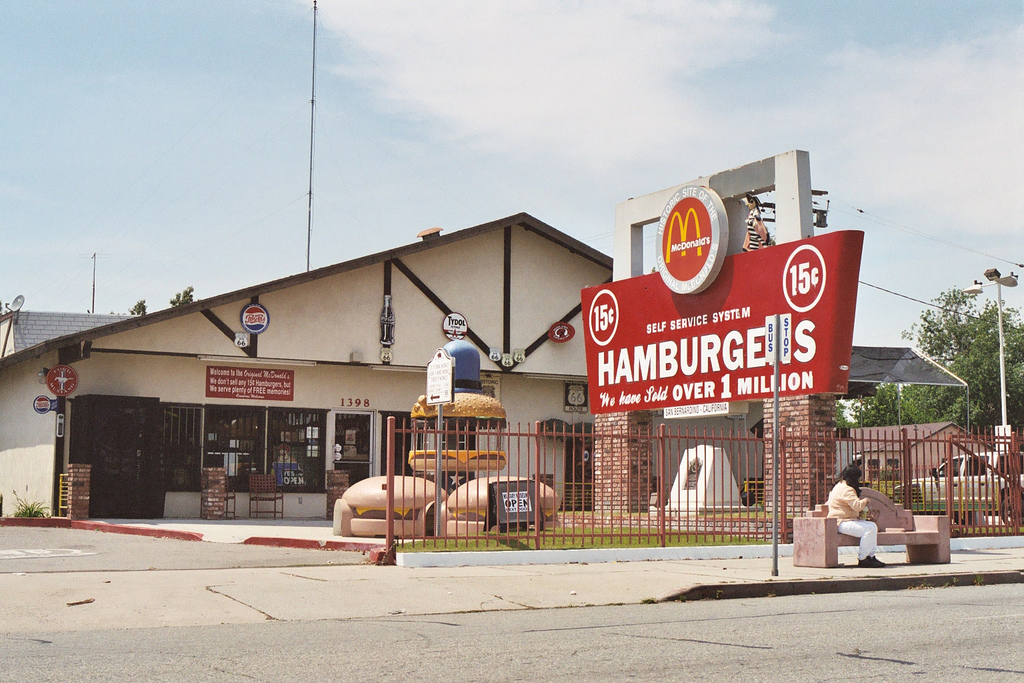
In 1940 the McDonald Brothers founded McDonald's, along with its innovative restaurant concept, in the city.[5]
In 1980, the Panorama Fire destroyed 284 homes. And, in 1994, Norton Air Force Base closed to become the San Bernardino International Airport.
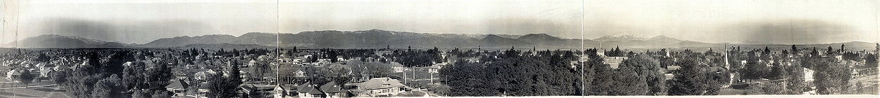

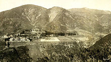
San Bernardino, California, city and village, 1909. Geography
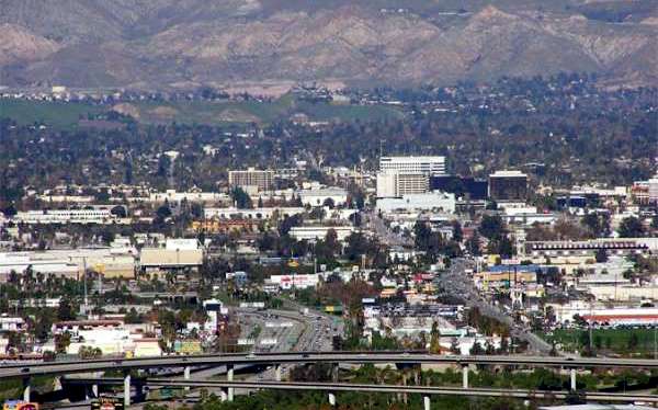
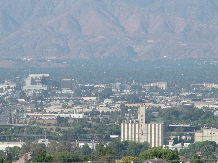
 San Bernardino skyline with downtown on the right and I-215 in the left
According to the United States Census Bureau, the city has a total area of 59.6 square miles (154 km2), of which 59.2 square miles (153 km2) of it is land and 0.4 square miles (1.0 km2), or 0.74%, is water.
The city lies in the San Bernardino foothills and the eastern portion of the San Bernardino Valley, roughly 65 miles (105 km) east of Los Angeles. Some major geographical features of the city include the San Bernardino Mountains and the San Bernardino National Forest, in which the city's northernmost neighborhood, Arrowhead Springs, is located; the Cajon Pass adjacent to the northwest border; City Creek, Lytle Creek, San Timoteo Creek, Twin Creek, Warm Creek (as modified through flood control channels) feed the Santa Ana River, which forms part of the city's southern border south of San Bernardino International Airport.
San Bernardino is unique among southern Californian cities because of its wealth of water, which is mostly contained in underground aquifers. A large part of the city is over the Bunker Hill Groundwater Basin, including downtown. This fact accounts for an historically high water table in portions of the city, including at the former Urbita Springs, a lake which no longer exists (It is now the site of the Inland Center Mall.). Seccombe Lake, named after a former mayor, is a man-made lake at Sierra Way and 5th Street. The San Bernardino Valley Municipal Water District ("Muni") has plans to build two more large, multi-acre lakes North and South of the historic downtown in order to reduce groundwater, mitigate the risks of liquefaction in a future earthquake, and sell the valuable water to neighboring agencies.[citation needed]
The city has several notable hills and mountains; among them are: Perris Hill (named after Fred Perris, an early engineer, and the namesake of Perris, California); Kendall Hill (which is near California State University); and, Little Mountain, which rises among Shandin Hills (generally bounded by Sierra Way, 30th Street, Kendall Drive, and Interstate 215).
Freeways act as significant geographical dividers for the City of San Bernardino. Interstate 215 is the major East-West divider, while State Route 210 is the major North-South divider. Interstate 10 is in the southern part of the city. Other major highways include State Route 206 (Kendall Drive and E Street); State Route 66 (which includes the former U.S. 66); State Route 18 (from State Route 210 north on Waterman Avenue to the northern City limits into the mountain communities), and State Route 259, the freeway connector between State Route 210 and I-215.
Climate
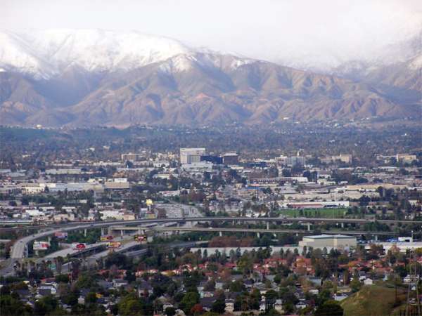
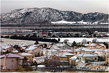 January snowfall in San Bernardino with Shandin Hills in the background.
San Bernardino features a somewhat cooler version of a Mediterranean climate with cool to chilly winters (frost is common during this time of the year) and hot, dry summers. Relative to other areas in Southern California, winters are colder with frost and with chilly to cold morning temperatures common. As well, the particularly arid climate during the summer prevents tropospheric clouds from forming, meaning temperatures rise to what is considered Class Orange by the scientists at NOAA. Summer is also a lot warmer with the highest recorded summer temperature at 117 °F (47.2 °C) in 1971.[6] In the winter, snow flurries occur upon occasion. San Bernardino gets an average of 16 inches (41 cm) of rain, hail, or light snow showers each year. Arrowhead Springs, San Bernardino's northern-most neighborhood, gets snow, heavily at times due to its elevation of about 3,000 feet (910 m) above sea level.
The seasonal Santa Ana winds are felt particularly strongly in the San Bernardino area as warm and dry air is channeled through nearby Cajon Pass at times during the autumn months. This phenomenon markedly increases the wildfire danger in the foothill, canyon, and mountain communities that the cycle of cold wet winters and dry summers helps create.
Climate data for San Bernardino Month Jan Feb Mar Apr May Jun Jul Aug Sep Oct Nov Dec Year Record high °F (°C) 94
(34)93
(34)96
(36)102
(39)112
(44)111
(44)116
(47)116
(47)117
(47)111
(44)98
(37)93
(34)117
(47)Average high °F (°C) 67
(19)69
(21)71
(22)77
(25)81
(27)90
(32)96
(36)96
(36)91
(33)83
(28)73
(23)68
(20)77.6 Average low °F (°C) 42
(6)44
(7)45
(7)49
(9)54
(12)58
(14)63
(17)64
(18)61
(16)54
(12)45
(7)41
(5)51.7 Record low °F (°C) 17
(−8)21
(−6)26
(−3)20
(−7)35
(2)40
(4)44
(7)43
(6)36
(2)29
(−2)24
(−4)18
(−8)17
(−8)Precipitation inches (mm) 3.50
(88.9)3.70
(94)3.28
(83.3).93
(23.6).41
(10.4).09
(2.3).04
(1).22
(5.6).41
(10.4).71
(18)1.20
(30.5)1.94
(49.3)16.43
(417.3)Source: [7] Neighborhoods and districts
The neighborhoods of San Bernardino are not commonly named. Some reflect geographical regions that existed before annexation, and others originated with specific housing developments. Arrowhead Springs extends from the historic Arrowhead Springs Hotel and Spa in the North to I-210 in the South and from Shandin Hills in the West to East Twin Creek in the East. Del Rosa is the area generally between the foothills and Highland, Mountain and Arden Avenues. Delmann Heights is the area North of Highland Avenue, West of I-215, and East of the unincorporated area of Muscoy, California (which is within the city's sphere of influence for annexation as well as Devore). Some portions of Highland are within the City of San Bernardino, generally consistent with the portions of historical "West Highlands" North of Highland Avenue. The city also contains the post office for Patton, California, the area coextensive with Patton Hospital. Mountain Shadows is the development name for the area between Palm Avenue and Highland Avenue to State Route 330. The "West Side" is used generically to refer to the areas West of I-215. North Loma Linda is the area West of Mountain View Acres (the border with Redlands), South of the Santa Ana River, North of the San Bernardino Freeway (I-10), and East of Tippecanoe Avenue. The area north of Northpark Boulevard from University Parkway to Electric Avenue, and the area north of 40th Street from Electric Avenue to Harrison Street is called Newberry Farms. The area West of University Parkway, and North of Kendall Drive to the north city area is called Verdemont. The "Bench" or "Rialto Bench" refers to the area with Rialto mailing addresses between Foothill Boulevard and Base Line Street.
San Bernardino is divided into several districts. Many hotels, restaurants, and retail establishments have been built around Hospitality Lane[8] in the southern part of the city, creating an informal business district. Downtown is its own district as well with shopping and government buildings. In the foothills of the San Bernardino Mountains lies the University District, which is a commercial area designed to support the California State University with shopping, dining, and high density residential space. On the southern side of I-215 and the University District is the Cajon Pass light-industrial district where warehouses are situated to take advantage of this important connection between southern California and the rest of the United States. On the opposite side of the city is the San Bernardino International Gateway, which encompasses the San Bernardino International Airport (SBD) and the Alliance California logistics campus (air cargo hub). Nearby is the Burlington Northern Santa Fe rail hub. The combination of these assets (airport; rail hub; extensive freeway system; and, Cajon Pass) makes the city important in the movement of goods and people between southern California and the rest of the United States.[citation needed]
The City of San Bernardino is in the process of developing an historic district around the 1918 Santa Fe Depot, which recently underwent a $15.6 million restoration.[citation needed] When completed, this area will connect to the downtown District with period light standards and street furniture, historic homes and other structures, a new museum, coffee bars and, a mercado with an architectural style in keeping with the Mission Revival station.
Surrounding municipalities

Hesperia Lake Arrowhead Big Bear Lake Rialto 
Highland  San Bernardino

Colton Loma Linda Redlands Demographics
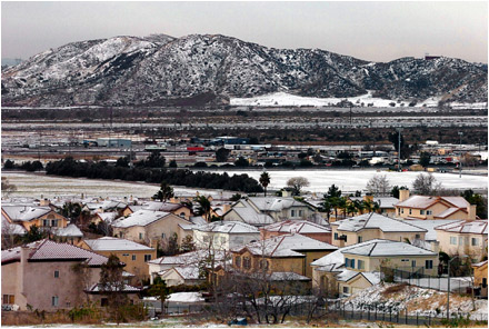
 San Bernardino in the winter
2010
The 2010 United States Census[9] reported that San Bernardino had a population of 209,924. The population density was 3,519.6 people per square mile (1,358.9/km²). The racial makeup of San Bernardino was 95,734 (45.6%) White, 31,582 (15.0%) African American, 2,822 (1.3%) Native American, 8,454 (4.0%) Asian, 839 (0.4%) Pacific Islander, 59,827 (28.5%) from other races, and 10,666 (5.1%) from two or more races. Hispanic or Latino of any race were 125,994 persons (60.0%).
The Census reported that 202,599 people (96.5% of the population) lived in households, 3,078 (1.5%) lived in non-institutionalized group quarters, and 4,247 (2.0%) were institutionalized.
There were 59,283 households, out of which 29,675 (50.1%) had children under the age of 18 living in them, 25,700 (43.4%) were opposite-sex married couples living together, 13,518 (22.8%) had a female householder with no husband present, 5,302 (8.9%) had a male householder with no wife present. There were 5,198 (8.8%) unmarried opposite-sex partnerships, and 488 (0.8%) same-sex married couples or partnerships. 11,229 households (18.9%) were made up of individuals and 4,119 (6.9%) had someone living alone who was 65 years of age or older. The average household size was 3.42. There were 44,520 families (75.1% of all households); the average family size was 3.89.
The population was spread out with 67,238 people (32.0%) under the age of 18, 26,654 people (12.7%) aged 18 to 24, 56,221 people (26.8%) aged 25 to 44, 43,277 people (20.6%) aged 45 to 64, and 16,534 people (7.9%) who were 65 years of age or older. The median age was 28.5 years. For every 100 females there were 97.2 males. For every 100 females age 18 and over, there were 94.0 males.
There were 65,401 housing units at an average density of 1,096.5 per square mile (423.4/km²), of which 29,838 (50.3%) were owner-occupied, and 29,445 (49.7%) were occupied by renters. The homeowner vacancy rate was 3.2%; the rental vacancy rate was 9.5%. 102,650 people (48.9% of the population) lived in owner-occupied housing units and 99,949 people (47.6%) lived in rental housing units.
Ethnic diversity
Western, central and parts of eastern San Bernardino are home to mixed ethnic populations of low-income, of which the Latino and African American population dominates. Historically, many Latinos, primarily Mexican-Americans and Mexicans lived on Mount Vernon Avenue on the West Side,[10] while the Medical Center (formerly known as Muscot) and Base Line corridors was mostly black since the 1960s, in particular in the east side and west side areas centering on public housing projects Waterman Gardens and the public housing on Medical Center drive. The heart of the Mexican-American community is on the West and Southside of San Bernardino, but slowing expanding throughout the entire city.[11][12] San Bernardino's only Jewish congregation moved to Redlands in December 2009.[13] Some Asian-Americans live in and around the city of San Bernardino, like a late 19th century-era (gone) Chinatown and formerly Japanese-American area in Seccombe Park on the east end of downtown and currently, a large East Asian community in North Loma Linda to the south across the Santa Ana River serves as an example.[citation needed]
Economy
Government, retail, and service industries dominate the economy of the City of San Bernardino. From 1998 to 2004, San Bernardino's economy grew by 26,217 jobs, a 37% increase, to 97,139. Government was both the largest and the fastest-growing employment sector, reaching close to 20,000 jobs in 2004. Other significant sectors were retail (16,000 jobs) and education (13,200 jobs).[14]
The city's location close to the Cajon and San Gorgonio passes, and at the junctions of the I-10, I-215, and SR-210 freeways, positions it as an intermodal logistics hub. The city hosts the Burlington Northern and Santa Fe Railway's Intermodal freight transport yard, the Yellow Freight Systems' cross-docking trucking center, and Pacific Motor Trucking. Large warehouses for Kohl's, Mattel, Pep Boys, and Stater Bros. have been developed near the San Bernardino International Airport.[14]
Over the last few decades, the city's riverfront district along Hospitality Lane has drawn much of the regional economic development away from the historic downtown of the city so that the area now hosts a full complement of office buildings, big-box retailers, restaurants, and hotels situated around the Santa Ana River.[citation needed]
The closure of Norton Air Force Base in 1994 caused the loss of 10,000 highly-skilled military and civilian jobs, emptied whole neighborhoods, and sent San Bernardino's economy into a significant downturn that has been offset by more recent growth in the intermodal logistics industry. The jobless rate in the region swelled to more than 12 percent during the years immediately after the base closure, and even today households within one mile (1.6 km) of the city core have a median income of $20,480, less than half that of the Inland region as a whole.[15]
Top employers
According to the City's 2009 Comprehensive Annual Financial Report,[16] the top employers in the city are:
Employer # of Employees California State University, San Bernardino 1,000+ Caltrans District 8 1,000+ City of San Bernardino 1,000+ Community Hospital of San Bernardino 1,000+ San Bernardino City Unified School District 1,000+ San Bernardino County Sheriff's Department 1,000+ San Bernardino County Superintendent of Schools 1,000+ San Manuel Band of Mission Indians 1,000+ Stater Bros. Markets 1,000+ St. Bernardine Medical Center 1,000+ Wells Fargo Home Mortgage 1,000+ Omnitrans 500-999 San Bernardino County Public Works 500-999 San Bernardino Valley College 500-999 Arts and culture
Annual events
San Bernardino hosts several major events annually, including: Route 66 Rendez-vous,[17] a four-day celebration of America's "Mother Road" that is held in downtown San Bernardino each September; the Berdoo Bikes & Blues Rendezvous, held in the Spring; the National Orange Show Festival[18], a citrus exposition founded in 1911 and also held in the Spring; and, the Western Regional Little League Championships held each August, as well as the annual anniversary of the birth of the Mother Charter of the Hells Angels Motorcycle Club, Berdoo California Charter.
Museums
The Robert V. Fullerton Museum of Art, located on the campus of California State University, San Bernardino, contains a collection of Egyptian antiquities, ancient pottery from present-day Italy, and funerary art from ancient China. In addition to the extensive antiquities on display, the museum presents contemporary art and changing exhibitions.
The Heritage House holds the collection of the San Bernardino Historic and Pioneer Society, while the San Bernardino County Museum of regional history, in Redlands, has exhibits relating to the City of San Bernardino, as well.
The San Bernardino Railroad and History Museum is located inside the historic Santa Fe Depot. A Route 66 museum is located on the historic site of the original McDonald's restaurant.[19] at 1398 North E Street and West 14th Street.
Specialty museums include the Inland Empire Military Museum,[20] the American Sports Museum, and the adjacent WBC Legends of Boxing Museum.
Performing arts
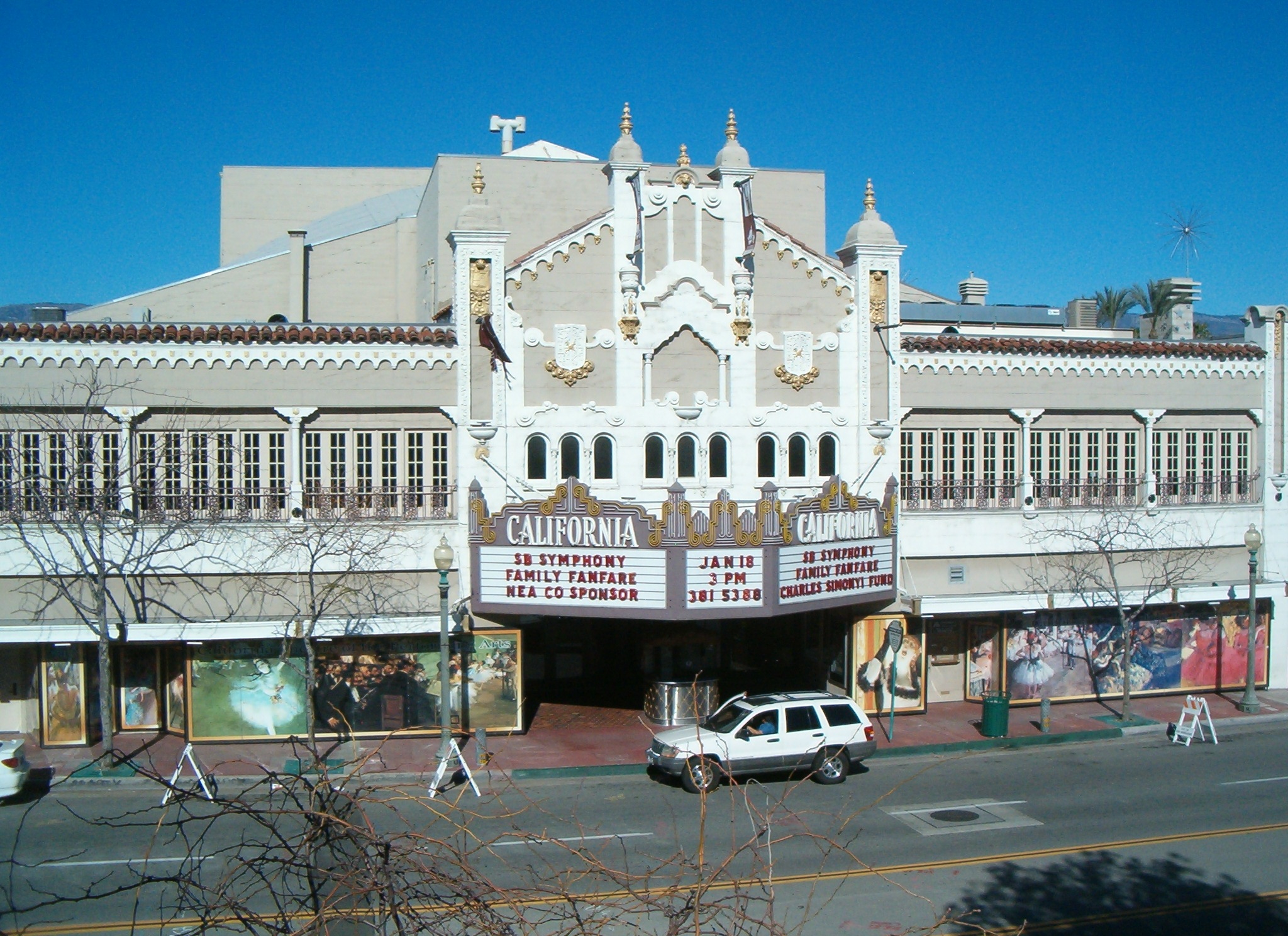
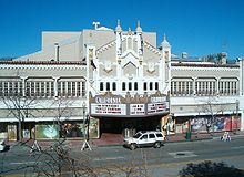 The historic California Theater.
The 1928 California Theater of the Performing Arts in downtown San Bernardino hosts an array of events, including concerts by the San Bernardino Symphony Orchestra under Maestro Carlo Ponti, as well as touring Broadway theater productions presented by Theatrical Arts International, the Inland Empire's largest theater company. [21] The Glen Helen Pavilion at the Cajon Pass is the largest amphitheater in the United States. The National Orange Show Events Center contains: the Orange Pavilion; a stadium; two large clear-span exhibition halls; a clear-span geodesic dome; and several ballrooms. Coussoulis Arena in the University District is the largest venue of its type in San Bernardino and Riverside Counties. Sturges Center for the Fine Arts, including the 1924 Sturges Auditorium, hosts lectures and other theater. Roosevelt Bowl at Perris Hill presents outdoor theater by Junior University during the Summer months. The historic 1929 Fox Theater of San Bernardino, located downtown and owned by American Sports University, has recently been restored for new use.
Resorts and tourism
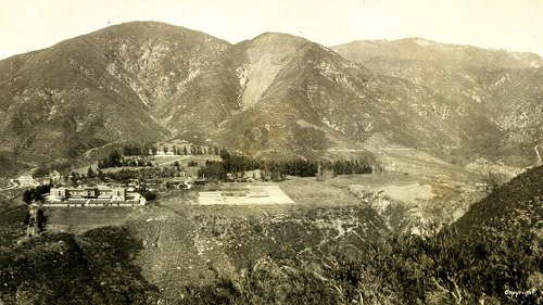
 Arrowhead Springs Hotel, circa 1907
San Bernardino is home to the historic Arrowhead Springs Hotel and Spa, located in the Arrowhead Springs neighborhood, which encompasses 1,916 acres (7.75 km2) directly beneath the Arrowhead geological monument that presides over the San Bernardino Valley. The resort contains hot springs, in addition to mineral baths and steam caves located deep underground. Long the headquarters for Campus Crusade for Christ, the site now remains largely vacant and unused since their operations moved to Florida.[22]
The $300 million Casino San Manuel, one of the few in southern California that does not operate as a resort hotel, is located approximately one mile from the Arrowhead Springs Hotel and Spa.[citation needed]
In downtown, Clarion, adjacent to the San Bernardino Convention Center, is the largest hotel while the Hilton is the largest in the Hospitality Lane District.
Sports
California State University, San Bernardino (CSUSB) Coyotes compete at the NCAA Division II level in a variety of sports. In 2007, the Coyotes' men's basketball team competed in the Division II Final Four in Springfield, Massachusetts. However, only San Bernardino Valley College plays football at the collegiate level.
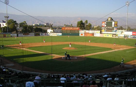
CSUSB use to play their home baseball games at the downtown venue, Arrowhead Credit Union Park, but now play all their home games at the Uptown venue, Fiscalini Field.[23] San Bernardino has had other professional and semi-pro teams over the years, including the San Bernardino Jazz professional women's volleyball team, the San Bernardino Pride Senior Baseball team, and the San Bernardino Spirit California League Single A baseball team.
San Bernardino also hosts the BSR West Super Late Model Series at Orange Show Speedway. The series fields many drivers, including NASCAR Camping World Truck Series regular Ron Hornaday, who drove the #33 in a race on July 12, 2008.
Inland Empire 66ers
The city hosts the Inland Empire 66ers of San Bernardino baseball club of the California League, which was the Los Angeles Angels Single A affiliate in 2007-2010. As of 2011, the 66ers are the Los Angeles Angels Single A affiliate. The 66ers play at Arrowhead Credit Union Park in downtown San Bernardino.[24]
Sports teams in the Inland Empire region Baseball 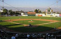
College athletics San Bernardino Valley College • Chaffey College • Riverside City College • Mount San Jacinto College • Victor Valley College • College of the DesertParks and recreation
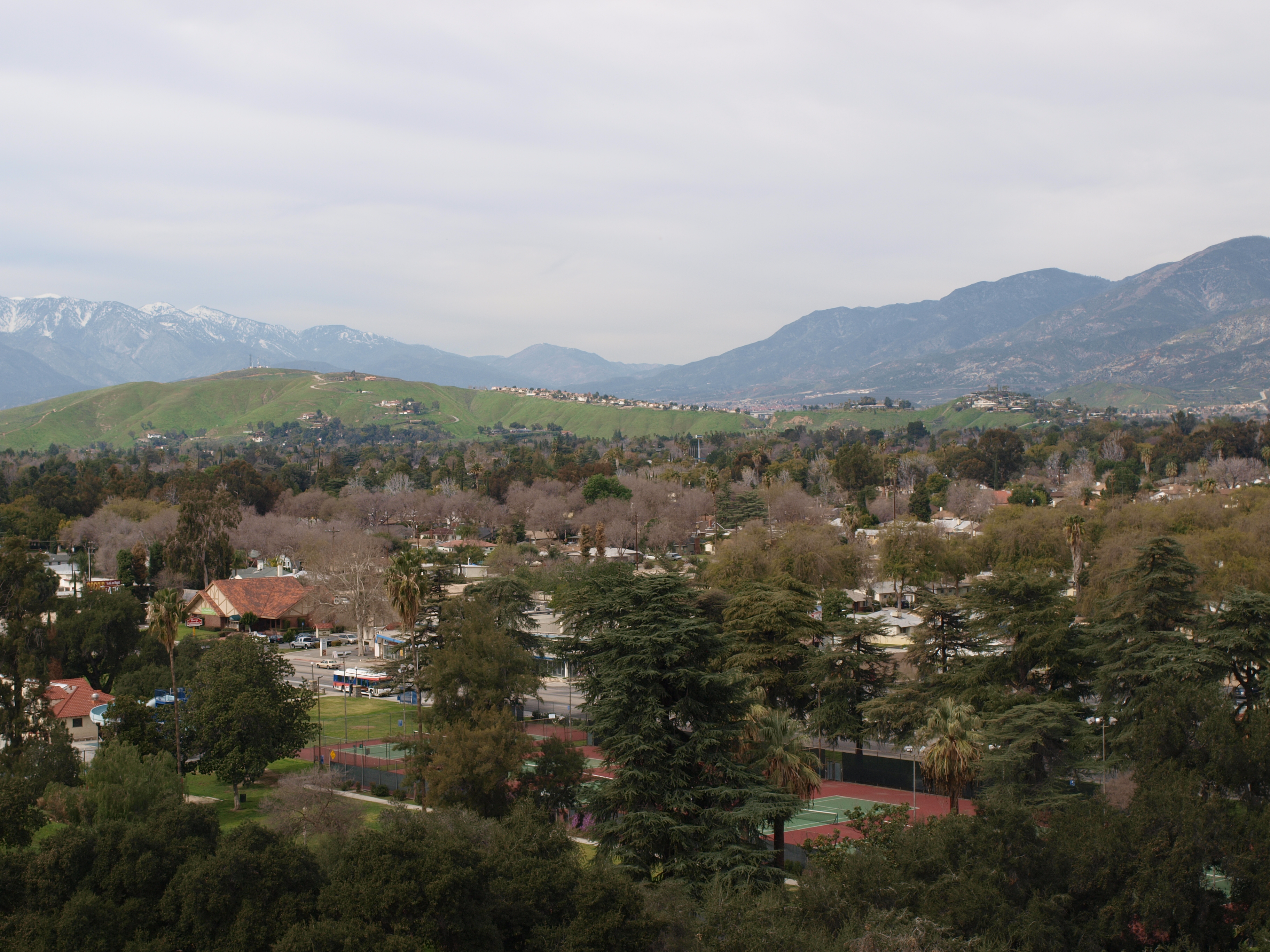
 View from Perris Hill north towards Shandin Hills. The opening of the Cajon Pass is visible in the far background.
San Bernardino offers several parks and other recreation facilities. Perris Hill Park is the largest with: Roosevelt Bowl, Fiscalini Field,[25] several tennis courts, a Y.M.C.A., a senior center, a shooting range, hiking trails, and a pool. Other notable parks include: the Glen Helen Regional Park, operated by the County of San Bernardino, is located in the northern-most part of the city. Blair Park is another midsized park near the University District, it is home to a well known skate park and various hiking trails on Shandin Hills, also known as Little Mountain.
Government
Local government
According to the city’s most recent Comprehensive Annual Financial Report, the city’s various funds had $313.6 million in Revenues, $298.5 million in expenditures, $1,113.3 million in total assets, $449.6 million in total liabilities, and $181.0 million in cash and investments.[16]
The City of San Bernardino is a charter city, a form of government under California that allows limited home-rule, in that it can pass its own laws not in conflict with state law, such as when state law is silent, or expressly allows municipal regulations of areas of local concern. San Bernardino became a charter city in 1905, the most current charter was passed in 2004.
The City of San Bernardino has a full-time, elected mayor, a city manager, an elected City Attorney, City Clerk, and City Treasurer, and seven council positions elected in a ward system. The charter also created the San Bernardino City Unified School District, a legally separate agency, and the Board of Water Commissioners, a semi-autonomous, but legally indistinct commission, and a Board of Library Trustees. The City Manager is responsible for all department heads, except for the fire and police chiefs. Previously, the San Bernardino Municipal Code recognized a City Administrator.
When the City originally adopted a ward system, there were five wards. In the 1960s, the Council was expanded to seven wards. The boundaries are adjusted with each federal census as required by federal constitutional law. The current council is:
First Ward: Virginia Marquez; Second Ward: vacant; Third Ward: Tobin Brinker; Fourth Ward: Fred Shorrett Fifth Ward: Chas (not Charles) Kelley; Sixth Ward: Rikke Van Johnson; Seventh Ward: Wendy McCammack;
The Mayor is Patrick J. Morris
As per California law, all city positions are non-partisan. Bob Holcomb (1922–2010) is the longest serving Mayor of San Bernardino to date, holding the office from 1971 until 1985 and again from 1989 to 1993.[26][27]
San Bernardino's legal community has two centers: downtown and Hospitality Lane. Criminal, family, and government lawyers are centered downtown, while local civil firms and outposts of state and national firms, corporate, and insurance defense firms, are located along Hospitality Lane. The Government of Mexico has a consulate in downtown San Bernardino on the southeast corner of Third Street and "D" Street. Citizens of Mexico can obtain a Matrícula Consular which many governments and businesses use in lieu of U.S. photo identification.
Municipal code
 San Bernardino City Logo
As a charter city, San Bernardino may make and enforce its own laws not in conflict with the State's laws. These rules have been codified as the San Bernardino Municipal Code. Violations of the San Bernardino Municipal Code, punishable as a misdemeanor or infraction (or both) are prosecuted by the City Attorney's Office in the San Bernardino Superior Court. The City also has two administrative processes for violations of the San Bernardino Municipal Code, including adopted codes such as the California Building Code and the California Fire Code. One is an administrative citation system, similar to a parking ticket, with a pay or contest procedure. The other is an administrative hearing process, generally used for multiple code violations by the Code Enforcement Department.
Joint-power authorities
San Bernardino shares certain powers with other agencies to form legally separate entities known as joint-power authorities under California law. These include Omnitrans, which provides transportation throughout the east and west valleys of San Bernardino County; SANBAG, which coordinates transportation projects throughout the County, and the Inland Valley Development Agency, which is responsible for redevelopment of the areas around the San Bernardino International Airport.[citation needed]
City of San Bernardino Economic Development Agency
The Redevelopment Agency of the City of San Bernardino, also known as the "Economic Development Agency of the City of San Bernardino," is a separate legal entity, though the City Council of the City of San Bernardino sits as the Agency Board, and the Mayor is its executive.[citation needed]
Downtown San Bernardino Revitalization Efforts
In June 2009, the City’s Economic Development Agency, presented the San Bernardino City Council with the Downtown Core Vision / Action Plan [7]– a guide for revitalizing Downtown San Bernardino for the next 10 years. The plan, which the city council approved to support, is the culmination of a year of research, community participation, and planning led by the City’s EDA and the urban planning firm EDAW which has worked on master planning across the globe for downtown areas that include Milan, Italy; London, England; New York, New York; and Denver, Colorado, to name a few.
A driving force in the initial phase of the revitalization efforts is the development of an arts and culture district in the heart of Downtown San Bernardino.[citation needed] This effort is being anchored by the historic and iconic California Theatre [8], which has been in continuous operation since first opening its doors in 1928. California-based Maya Cinemas, which is adjacent to California Theatre, is in the process of renovating the former CinemaStar movie theatre. These two entertainment facilities are the foundation of what will become a vibrant center for the arts and culture.
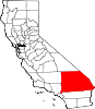
County seat
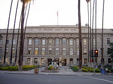 San Bernardino County Court House, built in 1926.
San Bernardino is the county seat of San Bernardino County the largest formal county in the United States by area, but smaller than the informally organized county equivalent Yukon-Koyukuk Census Area, Alaska. Various state courts, (for civil, criminal and juvenile trials) operate under the auspices of the Superior Court, San Bernardino District (formerly Central Division prior to the unification of the Superior and Municipal Courts in 1998). Currently, the Superior Court of California county courthouse is located at 351 North Arrowhead Avenue. It consists of a four-story building of steel and concrete construction built in 1927. A six-story addition was added in the 1950s. Currently, the 1926 structure is being retrofitted. Additional court rooms have been opened at 303 West Third Street, site of the former State Building. A new courthouse is tentatively planned to be built at the south east corner of Third and Arrowhead, across from the 303 West Third courtrooms, and the current court. Funding for the future court will likely be conditioned upon a statewide bond initiative.
Juvenile Court and Juvenile Hall are located in a county enclave adjacent to the city on Gilbert Street, near the site of the former County Hospital.
The County's District Attorney and the Public Defender both have their main offices on Mountain View Avenue, directly east of the Courthouse.
The California Court of Appeal Fourth District, Division Two used to be located in San Bernardino, but moved to Riverside in the 1990s. Federal cases (including Bankruptcy) are also heard in Riverside courthouses.
Jails
The San Bernardino Police Department has a holding area, but pre-trial arrested suspects are transported to the West Valley Detention Center in Rancho Cucamonga. Sentenced criminals are held at the Glen Helen Rehabilitation Center, in the northern \ City's limits in the Verdemont area. While the Central Detention Center, located at 630 East Rialto Avenue in San Bernardino, served as the main jail from 1971–1992, today it mostly serves federal prisoners under contract.
Public safety
The 1905 Charter created the San Bernardino Police Department and Chief of Police; before 1905, there was a position of City Marshal. The current Charter places the Chief of Police under the direction of the Mayor.
The San Bernardino City Fire Department was founded in 1878. The Fire Chief is under the direction of the Mayor. There are thirteen stations.[28]
Charter Section 186 requires that the monthly salaries of police and fire local safety members be the average of like positions at ten comparable cities in California.[29] Thus, if the average goes up in other cities, the compensation of the local safety employees automatically rises.
Over 90 percent of local police officers do not live within the City limits.[30]
Recent police efforts include joint patrols with the San Bernardino County Sheriff's Department and the California Highway Patrol. As of November 2006,[31] Part 1 Crime (Murders, Rape, Robbery, Assault, Burglary and Theft) was down 14.07 percent from 2005. Stricter enforcement caused a rise in both juvenile and adult arrests.[32]
San Bernardino has long battled high crime rates. According to statistics published by Morgan Quitno, San Bernardino was the 16th most dangerous US city in 2003,[33] 18th in 2004[34] and 24th in 2005. San Bernardino's murder rate was 29 per 100,000 in 2005, the 13th highest murder rate in the country and the third highest in the state of California after Compton and Richmond.[35] Police efforts have significantly reduced crime in 2008[36] and a major drop collectively since 1993 when the city's murder rate placed ninth in the nation.[37] Thirty two killings occurred in 2009, a number identical to 2008 and the lowest murder rate in San Bernardino since 2002, but only a third of cases led to arrests.[38][39] According to findings by the U.S. Census Bureau, San Bernardino was among the most poverty-stricken cities in the nation, second nationally behind Detroit.[40]
State and federal
In the state legislature San Bernardino is located in the 31st and 32nd Senate Districts, represented by Republican Robert Dutton and Democrat Gloria Negrete McLeod respectively, and in the 59th, 62nd and 63rd Assembly Districts, represented by Republican Tim Donnelly, Democrat Wilmer Carter, and Republican Bill Emmerson respectively. Federally, San Bernardino is located in California's 41st and 43rd congressional districts, which have Cook PVIs of R +9 and D +10 respectively[41] and is represented by Republican Jerry Lewis and Democrat Joe Baca.
Education
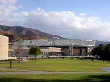
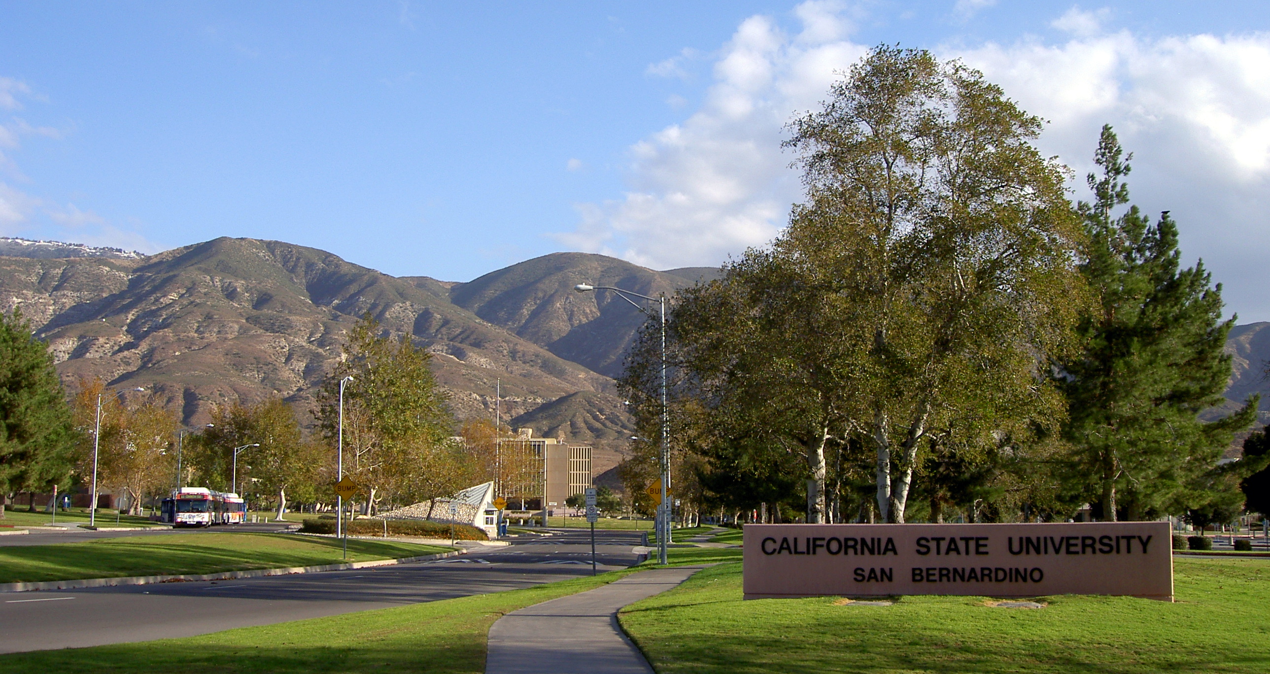
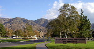 Main entrance to CSU San Bernardino along University Parkway.
San Bernardino is primarily served by the San Bernardino City Unified School District, the seventh largest district in the state,[42] although it is also served by Rim of the World (far north, mountains), Redlands (far south east) and Rialto (far west) Unified School Districts.
Colleges and universities
- California State University, San Bernardino
- San Bernardino Valley College
- National University, San Bernardino
- ITT Technical Institute
- The Art Institute of California - Inland Empire
- Argosy University-Inland Empire
- Everest College
- American Sports University
- Inland Empire Job Corps Center
- UEI College
High schools
The district, as signified by its name, has elementary, intermediate, and high schools. The comprehensive high schools are:
- Aquinas High School (San Bernardino, California)
- Arroyo Valley High School
- Cajon High School
- San Andreas High School
- San Bernardino High School
- Pacific High School (San Bernardino)
- Public Safety Academy Charter High School
- Middle College High School
- San Gorgonio High School
- Sierra High School
- Casa Ramona Academy for Technology, Community and Education
- Provisional Accelerated Learning Charter Academy
Media
San Bernardino is part of the Los Angeles Nielsen area. As such, most its residents receive the same local television and radio stations as residents of Los Angeles. KVCR-TV, a PBS affiliate operated by the San Bernardino Community College District, is the only local San Bernardino television station. KPXN, the Los Angeles Ion Television network affiliate, is licensed to San Bernardino, but contains no local content. Most of the northern section of San Bernardino cannot receive over-the-air television broadcasts from Los Angeles because Mount Baldy, and other San Gabriel Mountain peaks, block transmissions from Mount Wilson. Since the 1960s, most North San Bernardino residents have required cable television to obtain television. Today, the city has two main cable franchises: the northwest section of the city has Charter Communications, the rest of the city is served by Time Warner Cable. Mountain Shadow Cable is a small local company that provides services to the eponymous mobile home park. DBS satellite also has a presence. Local programming is handled by the city's Public, educational, and government access (PEG) cable TV channel KCSB-TV.
Historically, San Bernardino has had a number of newspapers. Today, the San Bernardino Sun, founded in 1894 (but was the continuation of an earlier paper) publishes in North San Bernardino, and has a circulation area roughly from Yucaipa to Fontana, including the mountain communities. Many older residents refer to the Sun as the Sun-Telegram, its name when it merged with the afternoon Telegram in the 1960s. There is also the Black Voice News that has been in the area over 30 years serving African Americans that live in the community. The Los Angeles Times is also widely circulated. Another local newspaper centered mostly around the African American Community is the Westside Story Newspaper, established in 1987. Their coverage area extends to the greater area of [San Bernardino County]. They currently operate locally and online.[43]
The Inland Empire also has its own Arbitron area. Therefore, there are several radio stations that broadcast in San Bernardino or other Inland Empire cities. These include rock station KCXX, country music station KFRG, NPR member station KVCR (FM) and news/talk/music station KCAA 1050 AM, with studios in the Carousel Mall. Other than government or media outlets, there is no major internet site made for the Inland Empire.
Radio stations in the Riverside-San Bernardino market By FM frequency By AM frequency By callsign K251AH · K252BF · K295AI · KACE · KAEH · KATY-FM · KCAA · KCAL · KCAL-FM · KCXX · KDEY-FM · KEZY · KFNY · KFRG · KGGI · KGIC-LP · KHPY · KJVA-LP · KKDD · KLRD · KLYY · KMET · KMYT · KOLA · KQIE · KRCV · KRQB · KSDW · KSGN · KSPA · KSPC · KTDD · KTIE · KTMQ · KUCR · KUOR · KVCR · KWRM · KXFG · KXRS · KXSBCalifornia Radio Markets: Bakersfield • Chico • Fresno • Los Angeles • Merced • Modesto • Oxnard-Ventura • Palm Springs • Redding • Riverside-San Bernardino • Sacramento • San Diego • San Francisco/Oakland • San Jose • San Luis Obispo • Santa Barbara • Santa Cruz/Salinas/Monterey • Santa Maria-Lompoc • Santa Rosa • Stockton • Victor Valley • Visalia-Tulare-Hanford
Other California Radio Regions: Barstow • Bishop • Crescent City • Diablo Valley • High Desert/Eastern Sierra • Eureka • Fort Bragg-Ukiah • Gilroy/Hollister • Imperial Valley • Marysville/Yuba City • Needles • Red Bluff • Susanville/Sierra Nevada • Tri-Valley • Yreka
Transportation
 Foothill Freeway entering San Bernardino.
Roads and highways
San Bernardino has a system of mostly publicly maintained local streets, including major arterials, some private streets, state highways, and interstate highways.
The major streets are (north south streets, from the west): Meridian Avenue, Mount Vernon Avenue, E Street, Arrowhead Avenue, Sierra Way, Waterman Avenue, Tippecanoe Avenue, Del Rosa Avenue, Sterling Avenue, Arden Avenue, Victoria Avenue, Palm Avenue, and Boulder Street; east west streets, from the north: Northpark Boulevard, Kendall Avenue, 40th Street, Marshall Boulevard, 30th Street, Highland Avenue, Base Line (Street), 9th Street, 5th Street, 2nd Street, Rialto Avenue, Mill Street, Orange Show Road, and Hospitality Lane.
The state highways include:
Freeways include:
 I-10 (San Bernardino Freeway)
 SR 210 (Foothill Freeway)
 I-215 (San Bernardino Freeway, Barstow Freeway)
 SR 259
 SR 330
Public transportation
Amtrak's Southwest Chief, operating from Los Angeles to Chicago has one daily train in each direction that stops at the San Bernardino station.
Preceding station Amtrak Following station Riversidetoward Los AngelesSouthwest Chief toward ChicagoSan Bernardino is served by the Metrolink regional rail service. Lines include: the Metrolink Inland Empire-Orange County Line and the Metrolink San Bernardino Line.
Preceding station Metrolink Following station Riverside–Downtowntoward OceansideIEOC Line Terminus Rialtotoward L.A. Union StationSan Bernardino Line 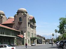 1918 Santa Fe Depot on 3rd Street. Amtrak and Metrolink commuter platforms are near the historic building.
Plans are underway by SANBAG to create a passenger rail link to Redlands, California, with potential station-stops at Mill Street and Hospitality Lane. It would also possibly connect with a planned extension of Metrolink service at the planned transit center in the downtown area.[44]
The City of San Bernardino is a member of the joint-powers authority Omnitrans and MARTA. A Bus Rapid Transit project, called SB-X, is planned from Cal State San Bernardino to Loma Linda.[45][46] A bus transit center is planned in the vicinity of E Street and Rialto Avenue.
Airports
San Bernardino International Airport is physically located within the City. Several warehouses have been, and continue to be, built in the vicinity. The facility, itself, is within the jurisdiction of the Inland Valley Development Agency, a joint powers authority, and the San Bernardino Airport Authority. Hillwood, a venture run by H. Ross Perot, Jr., is the master developer of the project, which it calls AllianceCalifornia. The airport does not currently offer commercial passenger service. However, the airport passenger terminal has been remodeled, and it will be taking international flights sometime in 2013. Southeastern Jet Corporation will begin a private charter service at the airport in the fall of 2013.[47]
Notable natives and residents
Main article: People from San Bernardino, CaliforniaGallery
-

San Bernardino skyline
-
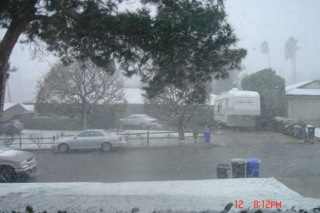
Heavy San Bernardino snowfall.
-

San Bernardino, Amtrak station, Santa Fe Depot
Nicknames
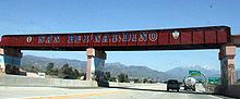
San Bernardino has received many informal nicknames in its history. Of these, San B., Dino, San Berdoo, and Berdoo[48][49] are the most common but are sometimes considered derogatory or undignified. Other, more official nicknames include: Gate City[50] (to reflect its proximity to Los Angeles, and location at the southern and western end of the Cajon Pass, leading to the High Desert and Las Vegas, Nevada); The Friendly City;[51] City on the Move;[52] and, most recently, The Heartbeat of U.S. Route 66.[53]
Sister cities
San Bernardino has eleven sister cities, as designated by Sister Cities International and the Mayor's office[54] of the City of San Bernardino:
Tachikawa is the oldest and strongest of the relationships, and predates Sister Cities International, Inc. It was formed because both San Bernardino and Tachikawa had United States Air Force Bases.
See also
- USS San Bernardino (LST-1189)
- Largest cities in Southern California
References and notes
- ^ California League of Cities, Elected City Treasurers Retrieved 2008-12-19
- ^ U.S. Census
- ^ http://factfinder2.census.gov/faces/tableservices/jsf/pages/productview.xhtml?pid=DEC_10_PL_GCTPL1.ST13&prodType=table#
- ^ Munro, Pamela, et al. Yaara' Shiraaw'ax 'Eyooshiraaw'a. Now You're Speaking Our Language: Gabrielino/Tongva/Fernandeño. Lulu.com: 2008.
- ^ Modern Marvels "Fast Food Tech"; History Channel; Viewed December 3, 2009
- ^ "Average Weather for San Bernardino, CA - Temperature and Precipitation". The Weather Channel. http://www.weather.com/outlook/events/weddings/wxclimatology/monthly/graph/USCA0978. Retrieved October 27, 2009.
- ^ "Average Weather for San Bernardino, CA - Temperatures and Precipitation". The Weather Channel. http://www.weather.com/outlook/health/achesandpains/wxclimatology/monthly/graph/92401. Retrieved 26 May 2011.
- ^ Hospitality Ln. & E St.
- ^ All data are derived from the United States Census Bureau reports from the 2010 United States Census, and are accessible on-line here. The data on unmarried partnerships and same-sex married couples are from the Census report DEC_10_SF1_PCT15. All other housing and population data are from Census report DEC_10_DP_DPDP1. Both reports are viewable online or downloadable in a zip file containing a comma-delimited data file. The area data, from which densities are calculated, are available on-line here. Percentage totals may not add to 100% due to rounding. The Census Bureau defines families as a household containing one or more people related to the householder by birth, opposite-sex marriage, or adoption. People living in group quarters are tabulated by the Census Bureau as neither owners nor renters. For further details, see the text files accompanying the data files containing the Census reports mentioned above.
- ^ Quinones, Sam (2008-06-29). "Murder trial exposes gang intrigue, greed". Los Angeles Times. http://articles.latimes.com/2008/jun/29/local/me-deadprez29.
- ^ http://www.sbsun.com/elections/ci_9590759
- ^ http://www.pe.com/localnews/sbcounty/stories/PE_News_Local_S_mobilize21.2f179b8.html
- ^ Faturechi, Robert (2010-01-25), San Bernardino loses its Jewish congregation, Los Angeles Times, http://www.latimes.com/news/local/la-me-beliefs25-2010jan25,0,4124104.story, retrieved 2010-01-25
- ^ a b Advisory Services Panel (June 24–29, 2007). San Bernardino, California: Crossroads of the Southwest. Washington, D.C.: Urban Land Institute. http://www.ci.san-bernardino.ca.us/civica/filebank/blobdload.asp?BlobID=4907. Retrieved 2007-12-26.
- ^ Brown, Josh (2007-07-25). "San Bernardino's base redevelopment efforts take circuitous path". Press Enterprise. http://www.pe.com/localnews/sbcounty/stories/PE_News_Local_D_nortonmain26.2037459.html. Retrieved 2007-12-26.
- ^ a b City of San Bernardino CAFR
- ^ 19th Annual Stater Bros. Route 66 Rendezvous
- ^ NOS Festival
- ^ Welcome to the Historic Site Of The First McDonalds
- ^ Inland Empire Military Museum
- ^ http://www.californiatheatre.net/
- ^ "California Historical Landmarks: San Benardino County". http://ohp.parks.ca.gov/default.asp?page_id=21476. Retrieved 2009-08-10.
- ^ http://www.insidesocal.com/sb/sbnow/cal-state-san-bernardino/
- ^ Inland Empire 66ers. Inland Empire 66ers of San Bernardino
- ^ Fiscalini Field
- ^ Koren, James Rufus (2010-11-29). "Ex-mayor of San Bernardino dies at 88". The San Bernardino Sun. http://www.sbsun.com/ci_16738877?source=most_viewed. Retrieved 2010-12-11.
- ^ Edwards, Andrew (2010-12-09). "Former SB mayor W.R. "Bob" Holcomb laid to rest". Contra Costa Times. http://www.contracostatimes.com/california/ci_16819669. Retrieved 2010-12-12.
- ^ San Bernardino City Fire Department. Stations
- ^ City of San Bernardino, Charter section 186, San Bernardino Municipal Code section 1.28.020
- ^ Brown, Hardy, San Bernardino Black Voice News, "Brinker, Derry, Kelley & McCammack 'Wrapped Up, Tied Up, Tangled Up' . . . Ethics Gone" March 15, 2007 [1]
- ^ November 2006 Part 1 Crime in San Bernardino
- ^ Juvenile and adult arrests in San Bernardino
- ^ Morgan Quitno. 2005 city crime statistics
- ^ Comunidad Segura. Lis Horta Moriconi, 13/09/2006. California's San Bernardino aims for a turnaround with Operation Phoenix
- ^ Infoplease. Crime Data. 2005 Murder Rate in Cities
- ^ Press Enterprise. Richard Brooks, July 10, 2008. Crime falls nearly 10 percent in San Bernardino
- ^ Jet. December 19, 1994. FBI report lists cities with highest murder rates in 1993
- ^ Larocco, Paul (2008-09-20). "2007 data: San Bernardino has state's 4th highest murder rate for cities above 10,000 people". Press Enterprise (A. H. Belo). http://www.pe.com/localnews/inland/stories/PE_News_Local_N_nstats20.3f92fec.html. Retrieved 2010-01-19.
- ^ Larocco, Paul (2010-01-08). "Inland's largest cities log lower or near-identical killing totals in 2009". Press Enterprise (A. H. Belo). http://www.pe.com/localnews/sanbernardino/stories/PE_News_Local_W_homicide09.37d8122.html. Retrieved 2010-01-19.
- ^ San Bernardino among most poverty-stricken
- ^ "Will Gerrymandered Districts Stem the Wave of Voter Unrest?". Campaign Legal Center Blog. http://www.clcblog.org/blog_item-85.html. Retrieved 2008-02-10.
- ^ San Bernardino City Unified School District
- ^ www.westsidestorynewpaper.com
- ^ Begley, Doug (2009-06-04). "E Street transit center chosen for Metrolink plan". Press Enterprise (A. H. Belo). http://www.pe.com/localnews/transportation/stories/PE_News_Local_S_sanbag04.3dde5b3.html. Retrieved 2010-01-27.
- ^ omnitrans rapid transit in san bernardino
- ^ frequently asked questions
- ^ Roberts, Charles (2009-08-04). "Jet Service comes to SBD". Highland News. ISSN 0458-3035. http://www.highlandnews.net/articles/2009/08/04/news/doc4a72283782c9f979209691.txt. Retrieved 2009-08-04.
- ^ Used since the 1870s
- ^ Practical Presbyterian, Time Magazine, April 23, 1951
- ^ See The San Bernardino Daily Sun, July 1918 quoted at Santa Fe Depot and the Railroads [2]
- ^ Interview of Edward Thomann on January 9, 2003 by Professor Joyce Hanson, for the San Bernardino Oral History Project, January 9, 2003 [3][4], [5],
- ^ Interview of Edward Thomann on January 9, 2003 by Professor Joyce Hanson, for the San Bernardino Oral History Project, January 9, 2003 [6]
- ^ The Convention and Visitor's Bureau created this slogan, but no longer uses it
- ^ Mayor's Office - Sister Cities
Further reading
- Edward Leo Lyman, San Bernardino: The Rise and Fall of a California Community, Signature Books, 1996.
- Walter C. Schuiling, San Bernardino County: Land of Contrasts, Windsor Publications, 1984
- Nick Cataldo, Images of America: San Bernardino, California, Arcadia Publishing, 2002
External links
City of San Bernardino Topics Neighborhoods Tourism Arrowhead Springs Resort • Arrowhead Credit Union Park • Carousel Mall • California Theatre • Fiscalini Field • Inland CenterHigher education (non-profit) Other articles related to San Bernardino Municipalities and communities of San Bernardino County, California Cities and towns Adelanto | Apple Valley | Barstow | Big Bear Lake | Chino | Chino Hills | Colton | Fontana | Grand Terrace | Hesperia | Highland | Loma Linda | Montclair | Needles | Ontario | Rancho Cucamonga | Redlands | Rialto | San Bernardino | Twentynine Palms | Upland | Victorville | Yucaipa | Yucca Valley
CDPs Baker | Big Bear City | Big River | Bloomington | Bluewater | Crestline | Fort Irwin | Homestead Valley | Joshua Tree | Lake Arrowhead | Lenwood | Lucerne Valley | Lytle Creek | Mentone | Morongo Valley | Mountain View Acres | Muscoy | Oak Glen | Oak Hills | Phelan | Piñon Hills | Running Springs | San Antonio Heights | Searles Valley | Silver Lakes | Spring Valley Lake | Wrightwood
Unincorporated
communitiesAmboy | Angelus Oaks | Argus | Arrowbear Lake | Baldy Mesa | Bell Mountain | Blue Jay | Bryn Mawr | Cadiz | Cedar Glen | Cedarpines Park | Cima | Crafton | Crest Park | Daggett | Declezville | Del Rosa | Devore | Earp | El Mirage | Essex | Fawnskin | Fenner | Forest Falls | Goffs | Green Valley Lake | Guasti | Halloran Springs | Havasu Lake | Helendale | Hinkley | Hodge | Ivanpah | Johnson Valley | Landers | Ludlow | Mojave Heights | Mount Baldy | Mountain Pass | Nebo Center | Newberry Springs | Nipton | Oro Grande | Patton | Parker Dam | Parker Junction | Pioneer Point | Pioneertown | Red Mountain | Rimforest | Skyforest | Sugarloaf | Sunfair | Sunfair Heights | Trona | Twentynine Palms Base | Twin Peaks | Vidal | Vidal Junction | Yermo | Zzyzx
Indian
reservationsGhost towns Greater Los Angeles Area Central city Counties Satellite cities Cities
>200kCities and towns
100k–200kBurbank • Compton • Corona • Costa Mesa • Downey • East Los Angeles • El Monte • Fontana • Fullerton • Garden Grove • Inglewood • Lancaster • Mission Viejo • Moreno Valley • Murrieta • Norwalk • Ontario • Orange • Palmdale • Pasadena • Pomona • Rancho Cucamonga • Santa Clarita • Simi Valley • South Gate • Temecula • Thousand Oaks • Torrance • Ventura • Victorville • West CovinaArea regions Antelope Valley • Conejo Valley • Downtown Los Angeles • East Los Angeles • Gateway Cities • Greater Hollywood • Harbor Area • Inland Empire • Palos Verdes Hills • Pomona Valley • San Bernardino Valley • San Fernando Valley • San Gabriel Valley • Santa Ana Valley • Santa Clarita Valley • South Bay • South Los Angeles • Westside Los AngelesLandforms Los Angeles Basin • Baldwin Hills (range) • Calico Mountains • Catalina Island • Channel Islands • Coachella Valley • High Desert—Mojave Desert • Low Desert—Colorado Desert • San Fernando Valley • San Bernardino Mountains • San Gabriel Mountains • Santa Ana Mountains • Santa Monica Mountains • Santa Susana Mountains • Verdugo MountainsBodies of water Los Angeles River • Aliso Creek • Arroyo Seco • Ballona Creek • Bell Creek • Big Bear Lake • Coyote Creek • Lake Arrowhead • Lake Perris • Lake Piru • Malibu Creek • Pacific Ocean • Pyramid Lake • Rio Hondo • San Gabriel River • San Juan Creek • San Pedro Bay • Santa Ana River • Santa Clara River • Santa Margarita River • Santa Monica BayCalifornia county seats Consolidated city-county Municipalities Alturas | Auburn | Bakersfield | Colusa | Crescent City | El Centro | Eureka | Fairfield | Fresno | Hanford | Hollister | Jackson | Lakeport | Los Angeles | Madera | Martinez | Marysville | Merced | Modesto | Napa | Nevada City | Oakland | Oroville | Placerville | Red Bluff | Redding | Redwood City | Riverside | Sacramento | Salinas | San Bernardino | San Diego | San Jose | San Luis Obispo | San Rafael | Santa Ana | Santa Barbara | Santa Cruz | Santa Rosa | Sonora | Stockton | Susanville | Ukiah | Ventura | Visalia | Willows | Woodland | Yreka | Yuba City
CDPs Bridgeport | Downieville | Independence | Mariposa | Markleeville | Quincy | San Andreas | Weaverville
 State of California
Topics - Climate
- Delegations
- Deserts
- Districts
- Ecology
- Elections
- Environment
- Geography
- Government
- History
- Protected areas
- Sports
- Symbols
- Transportation
- Visitor attractions
- Index of California-related articles
Society Regions - Antelope Valley
- Big Sur
- Cascade Range
- Central California
- Central Coast
- Central Valley
- Channel Islands
- Coachella Valley
- Conejo Valley
- Cucamonga Valley
- Death Valley
- East Bay (SF)
- East County (SD)
- Eastern California
- Emerald Triangle
- Gold Country
- Great Basin
- Greater Los Angeles
- Greater Sacramento
- Inland Empire
- Lake Tahoe
- Los Angeles Basin
- Lost Coast
- Metropolitan Fresno
- Mojave
- Mountain Empire
- North Bay (SF)
- North Coast
- North County (SD)
- Northern California
- Owens Valley
- Oxnard Plain
- San Francisco Peninsula
- Pomona Valley
- Sacramento Valley
- San Bernardino Valley
- San Diego–Tijuana
- San Fernando Valley
- San Francisco Bay Area
- San Gabriel Valley
- San Joaquin Valley
- Santa Clara Valley
- Santa Clara River Valley
- Santa Clarita Valley
- Shasta Cascade
- Sierra Nevada
- Silicon Valley
- South Bay (LA)
- South Bay (SF)
- South Bay (SD)
- South Coast
- Southern California
- Southern Border Region
- Tri-Valley
- Upstate California
- Victor Valley
- Wine Country
- Yosemite
Metro areas - Bakersfield
- Chico
- El Centro
- Fresno
- Hanford–Corcoran
- Los Angeles–Long Beach–Glendale
- Madera
- Modesto
- Merced
- Napa
- Oakland–Fremont–Hayward
- Oxnard–Thousand Oaks–Ventura
- Redding
- Riverside–San Bernardino–Ontario
- Sacramento–Arden Arcade–Roseville
- Salinas
- San Diego–Carlsbad–San Marcos
- San Francisco–San Mateo–Redwood City
- San Jose–Sunnyvale–Santa Clara
- San Luis Obispo–Paso Robles
- Santa Ana–Anaheim–Irvine
- Santa Barbara–Santa Maria–Goleta
- Santa Cruz–Watsonville
- Santa Rosa–Petaluma
- Stockton
- Vallejo–Fairfield
- Visalia–Porterville
- Yuba City
Micro areas Counties - Alameda
- Alpine
- Amador
- Butte
- Calaveras
- Colusa
- Contra Costa
- Del Norte
- El Dorado
- Fresno
- Glenn
- Humboldt
- Imperial
- Inyo
- Kern
- Kings
- Lake
- Lassen
- Los Angeles
- Madera
- Marin
- Mariposa
- Mendocino
- Merced
- Modoc
- Mono
- Monterey
- Napa
- Nevada
- Orange
- Placer
- Plumas
- Riverside
- Sacramento
- San Benito
- San Bernardino
- San Diego
- San Francisco
- San Joaquin
- San Luis Obispo
- San Mateo
- Santa Barbara
- Santa Clara
- Santa Cruz
- Shasta
- Sierra
- Siskiyou
- Solano
- Sonoma
- Stanislaus
- Sutter
- Tehama
- Trinity
- Tulare
- Tuolumne
- Ventura
- Yolo
- Yuba
Western United States Regions States Alaska | Arizona | California | Colorado | Hawaii | Idaho | Montana | Nevada | New Mexico | Oregon | Utah | Washington | Wyoming
Major metropolitan areas Los Angeles | Phoenix | San Francisco Bay Area | Riverside-San Bernardino | Seattle | San Diego | Denver | Portland | Las Vegas | Sacramento |
Major cities Anchorage | Denver | Honolulu | Las Vegas | Los Angeles | Long Beach | Oakland | Portland | Sacramento | San Diego | San Francisco | San Jose | Salt Lake City | Seattle | Spokane | Reno | Riverside |
State capitals Boise | Carson City | Cheyenne | Denver | Helena | Honolulu | Juneau | Olympia | Sacramento | Salem | Salt Lake City |
50 largest metropolitan statistical areas in the United States by population - New York
- Los Angeles
- Chicago
- Dallas–Fort Worth
- Philadelphia
- Houston
- Washington
- Miami
- Atlanta
- Boston
- San Francisco–Oakland
- Detroit
- Riverside–San Bernardino
- Phoenix
- Seattle
- Minneapolis–St. Paul
- San Diego
- St. Louis
- Tampa–St. Petersburg
- Baltimore
- Memphis
- Louisville
- Richmond
- Oklahoma City
- Hartford
- New Orleans
- Buffalo
- Raleigh
- Birmingham
- Salt Lake City
Mayors of cities with populations exceeding 100,000 in California - Antonio Villaraigosa
(Los Angeles) - Jerry Sanders
(San Diego) - Chuck Reed
(San Jose) - Edwin M. Lee
(San Francisco) - Ashley Swearengin
(Fresno) - Kevin Johnson
(Sacramento) - Bob Foster
(Long Beach) - Jean Quan
(Oakland) - Harvey Hall
(Bakersfield) - Tom Tait
(Anaheim) - Miguel A. Pulido
(Santa Ana)
- Ronald O. Loveridge
(Riverside) - Ann Johnston
(Stockton) - Cheryl Cox
(Chula Vista) - Bob Wasserman
(Fremont) - Sukhee Kang
(Irvine) - Pat Morris
(San Bernardino) - Jim Ridenour
(Modesto) - Thomas E. Holden
(Oxnard) - Acquanetta Warren
(Fontana) - William H. Batey II
(Moreno Valley)^ - John Drayman
(Glendale)
- Joe Carchio
(Huntington Beach)^ - Bob Kellar
(Santa Clarita)^ - William Dalton
(Garden Grove) - Susan Gorin
(Santa Rosa)^ - Jim Wood
(Oceanside) - Donald Kurth
(Rancho Cucamonga) - Paul S. Leon
(Ontario) - R. Rex Parris
(Lancaster) - Pat Hume
(Elk Grove) - James C. Ledford Jr.
(Palmdale) - Stan Skipworth
(Corona)^
- Dennis Donohue
(Salinas) - Elliot Rothman
(Pomona) - Frank Scotto
(Torrance) - Michael Sweeney
(Hayward) - Sam Abed
(Escondido) - Tony Spitaleri
(Sunnyvale) - Bill Bogaard
(Pasadena) - Carolyn Cavecche
(Orange) - F. Richard Jones
(Fullerton)^ - Jacqui Irwin
(Thousand Oaks)^ - Jesus Gamboa
(Visalia)
- Paul Miller
(Simi Valley) - William D. Shinn
(Concord)^ - Gina Garbolino
(Roseville) - Jamie L. Matthews
(Santa Clara) - Osby Davis
(Vallejo) - Rudy Cabriales
(Victorville) - Ernest Gutierrez
(El Monte) - Tom Bates
(Berkeley) - Rick Trejo
(Downey)^ - Eric R. Bever
(Costa Mesa)^ - James T. Butts, Jr.
(Inglewood)
 ^Mayor selected from city council
Other states: AL • AK • AZ • AR • CA • CO • CT • DE • FL • GA • HI • ID • IL • IN • IA • KS • KY • LA • ME • MD • MA • MI • MN • MS • MO • MT • NE • NV • NH • NJ • NM • NY • NC • ND • OH • OK • OR • PA • RI • SC • SD • TN • TX • UT • VT • VA • WA • WV • WI • WYAll-America City Award: Hall of Fame Akron, Ohio • Anchorage, Alaska • Asheville, North Carolina • Baltimore, Maryland • Boston, Massachusetts • Cincinnati, Ohio • Cleveland, Ohio • Columbus, Ohio • Dayton, Ohio • Des Moines, Iowa • Edinburg, Texas • Fort Wayne, Indiana • Grand Island, Nebraska • Grand Rapids, Michigan • Hickory, North Carolina • Independence, Missouri • Kansas City, Missouri • Laurinburg, North Carolina • New Haven, Connecticut • Peoria, Illinois • Philadelphia, Pennsylvania • Phoenix, Arizona • Roanoke, Virginia • Rockville, Maryland • Saint Paul, Minnesota • San Antonio, Texas • Seward, Alaska • Shreveport, Louisiana • Tacoma, Washington • Toledo, Ohio • Tupelo, Mississippi • Wichita, Kansas • Worcester, Massachusetts
Categories:- San Bernardino, California
- County seats in California
- Communities on U.S. Route 66
- Neighborhoods in San Bernardino, California
- Inland Empire (California)
- Cities in San Bernardino County, California
- Populated places on the Santa Ana River
- Incorporated cities and towns in California


Wikimedia Foundation. 2010.