- Fremont, California
-
For the unincorporated community in Yolo County, California, see Fremont, Yolo County, California.
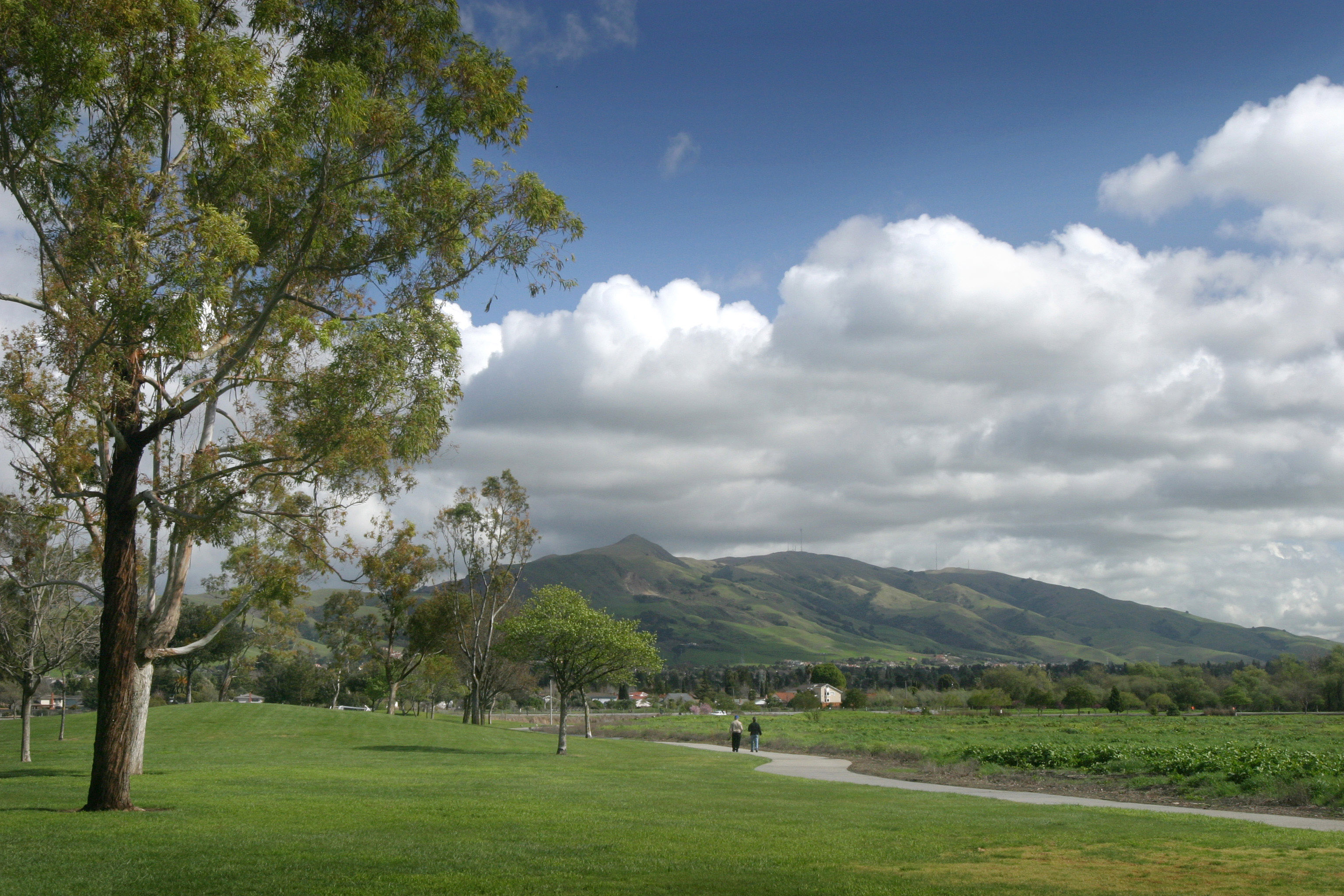
City of Fremont — City — A view of Mission Peak from Fremont Central Park Location of Fremont within Alameda County, California.
Coordinates: 37°32′54″N 121°59′19″W / 37.54833°N 121.98861°WCoordinates: 37°32′54″N 121°59′19″W / 37.54833°N 121.98861°W Country  United States
State  California
County Alameda Government – Type Council-Manager – City Council Mayor Bob Wasserman
Anu Natarajan
Bob Wieckowski
Bill Harrison
Suzanne Lee Chan– City Manager Fred Diaz – State Senate Ellen Corbett (D) – State Assembly Bob Wieckowski (D) – U. S. Congress Pete Stark (D) Area[1] – Total 87.610 sq mi (226.910 km2) – Land 77.459 sq mi (200.618 km2) – Water 10.151 sq mi (26.292 km2) 11.59% Elevation 0–437 ft (0–143 m) Population (2010) – Total 214,089 – Rank 2nd in Alameda County
15th in California
95th in the United States– Density 2,443.6/sq mi (943.5/km2) Time zone PST (UTC-8) – Summer (DST) PDT (UTC-7) ZIP code(s) 94536, 94537, 94538, 94539, 94555 Area code(s) 510 FIPS code 06-26000 GNIS feature ID 0277521 Website http://www.fremont.gov/ Fremont (
 /ˈfriːmɒnt/) is a city in Alameda County, California. It was incorporated on January 23, 1956, from the merger of five smaller communities: Centerville, Niles, Irvington, Mission San Jose, and Warm Springs. The city is named after John Charles Frémont, "the Great Pathfinder."
Located in the southeast section of the San Francisco Bay Area in the East Bay region primarily, Fremont is now the fourth most populous city in the San Francisco Bay Area, and the largest suburb in the metropolis. It is the closest Alameda County city to Silicon Valley, and is thus sometimes associated with it.
The area consisting of Fremont, Newark (an enclave of Fremont), and Union City was formerly known as Washington Township, and is now known as the Tri-City Area.
Fremont is the sister city to Elizabeth, South Australia; Puerto Peñasco, Mexico; Fukaya, Japan; Horta, Azores, Portugal; Lipa City, Philippines; and Jaipur, India.[2]
Contents
Demographics
Historical populations Census Pop. %± 1960 43,790 — 1970 100,869 130.3% 1980 131,945 30.8% 1990 173,339 31.4% 2000 203,413 17.3% 2010 218,128 7.2% 2010
The 2010 United States Census[3] reported that Fremont had a population of 214,089. The population density was 2,443.7 people per square mile (943.5/km²). The racial makeup of Fremont was 70,320 (32.8%) White, 7,103 (3.3%) African American, 976 (0.5%) Native American, 108,332 (50.6%) Asian (18.1% Indian, 17.7% Chinese, 6.7% Filipino, 2.5% Vietnamese, 1.4% Korean, 1.0% Pakistani, 0.8% Japanese, 0.6% Burmese), 1,169 (0.5%) Pacific Islander, 13,605 (6.4%) from other races, and 12,584 (5.9%) from two or more races. Hispanic or Latino of any race were 31,698 persons (14.8%). Among the Hispanic population, 11.0% are Mexican, 0.6% Puerto Rican, and 0.5% Salvadoran.
The Census reported that 212,438 people (99.2% of the population) lived in households, 969 (0.5%) lived in non-institutionalized group quarters, and 682 (0.3%) were institutionalized.
There were 71,004 households, out of which 31,070 (43.8%) had children under the age of 18 living in them, 45,121 (63.5%) were opposite-sex married couples living together, 7,070 (10.0%) had a female householder with no husband present, 3,382 (4.8%) had a male householder with no wife present. There were 2,779 (3.9%) unmarried opposite-sex partnerships, and 444 (0.6%) same-sex married couples or partnerships. 11,576 households (16.3%) were made up of individuals and 3,697 (5.2%) had someone living alone who was 65 years of age or older. The average household size was 2.99. There were 55,573 families (78.3% of all households); the average family size was 3.36.
The population was spread out with 53,216 people (24.9%) under the age of 18, 15,610 people (7.3%) aged 18 to 24, 66,944 people (31.3%) aged 25 to 44, 56,510 people (26.4%) aged 45 to 64, and 21,809 people (10.2%) who were 65 years of age or older. The median age was 36.8 years. For every 100 females there were 98.9 males. For every 100 females age 18 and over, there were 96.4 males.
There were 73,989 housing units at an average density of 844.5 per square mile (326.1/km²), of which 44,463 (62.6%) were owner-occupied, and 26,541 (37.4%) were occupied by renters. The homeowner vacancy rate was 1.3%; the rental vacancy rate was 4.5%. 136,606 people (63.8% of the population) lived in owner-occupied housing units and 75,832 people (35.4%) lived in rental housing units.
2000
Fremont is the home to the largest concentration of Afghans in the United States.[citation needed] This is noted in Khaled Hosseini's 2003 novel Kite Runner. In addition, Fremont has a notable concentration of South Asians, predominantly employed in Silicon Valley's technology sector.
Among the Asian community of Fremont, the largest ethnic groups are Chinese, Indians, and Filipinos. Fremont and nearby Union City have fairly large numbers of Pacific Islanders, Cubans and Puerto Ricans, Spanish and Portuguese, and a small miniscule number of American Indians.
Fremont also has a large deaf community, in large part because it is home of the Northern California campus of the California School for the Deaf. The school district is called the Fremont Unified School District which also serves parts of Union City and Hayward.
There were 68,237 households out of which 40.2% had children under the age of 18 living with them, 62.7% were married couples living together, 9.2% had a female householder with no husband present, and 23.5% were non-families. 16.5% of all households were made up of individuals and 4.1% had someone living alone who was 65 years of age or older. The average household size was 2.96 and the average family size was 3.34.
In the city the population was spread out with 25.8% under the age of 18, 7.7% from 18 to 24, 36.8% from 25 to 44, 21.4% from 45 to 64, and 8.3% who are 65 years of age or older. The median age is 34 years. For every 100 females there were 101.1 males. For every 100 females age 18 and over, there were 99.2 males.
According to a 2007 estimate, the median income for a household in the city is $93,342, and the median income for a family was $103,846.[4] Males have a median household income of $59,274 versus $40,625 for females. The per capita income for the city was $31,411. About 3.6% of families and 5.4% of the population were below the poverty line, including 5.9% of those under age 18 and 6.2% of those age 65 or over.
Politically, Fremont leans strongly to the Democratic Party.
At the 2008 census the ancestry of city (and county portions) of Fremont residents was:
- German 7.8%
- English 5.4%
- Irish 4.6%
- Italian 2.5%
- Portuguese 2.4%
- Scottish 1.7%
- French 1.3%
- Russian 1.3%
- American 1.2%
- Swedish 1.2%
- Polish 1.1%
- Scottish-Irish 1.0%
- Dutch 0.9%
- Norwegian 0.7%
- Spanish 0.5-1.5% (estimated).
Education
Fremont is home to the Fremont Unified School District and lies within the Ohlone Community College District.
The Fremont Unified School District has five comprehensive high schools for students in grades 9–12: American, Irvington, Kennedy, Mission San Jose and Washington. These five high schools, along with James Logan High School in Union City and Newark Memorial High School in Newark, make up the Mission Valley Athletic League (M.V.A.L.).
In addition to the five comprehensive high schools, the district has a continuation high school (Robertson); two independent study programs (Vista and COIL); an adult school; five junior high schools for grades 7–8 (Centerville, Hopkins, Horner, Thornton and Walters); and 29 elementary schools (K-6).[5] The district operates the Mission Valley Regional Occupational Program jointly with Newark and New Haven Unified School Districts.
The main campus of Ohlone College is located in Fremont, with a smaller center in Newark. The University of California, Berkeley has an extension campus located in Fremont, and the University of Phoenix Bay Area Campus and Northwestern Polytechnic University and DeVry University offer undergraduate and graduate programs in technology and management areas.
The city is also home to Fremont Christian School and California School for the Deaf, Fremont, which serves Northern California. It shares its campus with the Statewide California School for the Blind.
The Alameda County Library has its headquarters in Fremont.[6] The Fremont Main Library is the largest building and has the highest circulation in the Alameda County Library family and shares its building with the Alameda County Library Administration. The current building was dedicated in 1989 and is home to the Maurice Marks Center for Local and California History, and the Fukaya public meeting rooms. There are also three branch libraries in Fremont: Centerville, Irvington, and Niles.
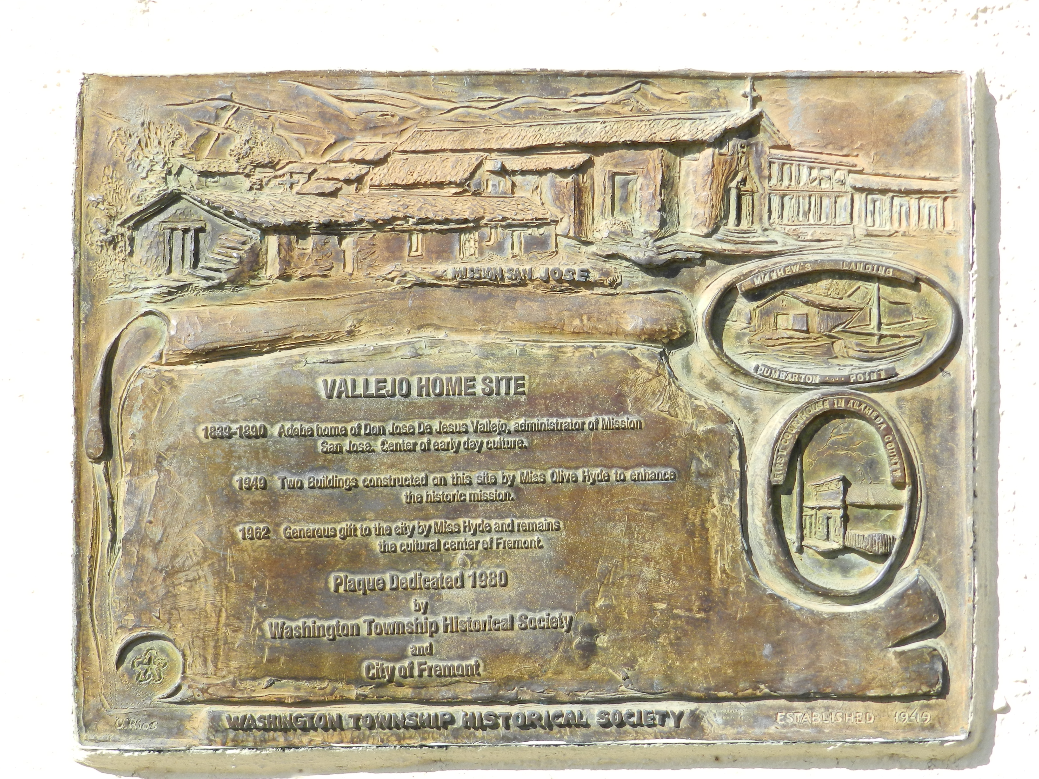
 Vallejo Home memorial plaque
History
The recorded history of the Fremont area began on June 9, 1797, when Mission San José was founded by the Spaniard Father Fermin de Lasuen. The Mission was established at the site of the Ohlone village of Oroysom. On their second day in the area, the Mission party killed a grizzly bear in Niles Canyon. The first English-speaking visitor to Fremont was the renowned trapper and explorer Jedediah Smith in 1827. The Mission prospered, eventually reaching a population of 1,886 inhabitants in 1831. The influence of the missionaries declined after 1834, when the Mexican government enacted secularization.
José de Jesus Vallejo, brother of Mariano Vallejo, was the grantee of the Rancho Arroyo de la Alameda Mexican land grant. His family was influential in the Fremont area in the late colonial era, and owned and built a flour mill at the mouth of Niles Canyon.[7] In 1846 they were visited by the town's namesake John C. Frémont, who mapped a trail through Mission Pass to provide access for American settlers into the southeastern San Francisco Bay Area. The Fremont area grew rapidly at the time of the Gold Rush. Agriculture dominated the economy with grapes, nursery plants and olives as leading crops. In 1868 the 6.8-magnitude Hayward earthquake on the Hayward Fault collapsed buildings throughout the Fremont area, ruining Mission San José and its outbuildings. Until the 1906 San Francisco earthquake caused its destruction, the Fremont area's Palmdale Winery was the largest in California. The ruins of the Palmdale Winery are still visible near the Five Corners in Irvington.[8]
From 1912 to 1916 the Niles section of the Fremont area was the earliest home of California's motion picture industry.[9] Charlie Chaplin filmed several movies in the Fremont area, most notably The Tramp.
Fremont was incorporated under the leadership of Wally Pond in 1956, when five towns in the area, Irvington, Centerville, Mission San Jose, Niles and Warm Springs came together to form a city. [10]
Fremont became more industrialized in the 1950s and 1960s. A boom in high-tech employment in the 1980s to the late 1990s, especially in the Warm Springs District, caused rapid development in the city. The General Motors automotive assembly plant in South Fremont was the town's largest employer, and Fremont was known for its drag strip. In the 1980s the GM plant became a joint venture automotive assembly plant of Toyota and General Motors called NUMMI. Toyota and NUMMI shut down its operations in early 2010. Part of the plant was acquired in June 2010 by Tesla Motors as its primary production plant, known as the Tesla Factory. Tesla is expected to roll out its high end electric vehicles sometime in 2012. Solyndra, a solar panel manufacturer, was personally promoted in 2010 by President Barack Obama as a model for government investment in green technology[11] after his administration approved a $535-million Department of Energy loan and the company built a $733 million state-of-the-art robotic facility, but in 2011 the company filed for Chapter 11 bankruptcy and laid-off 1,000 workers.[12]
The first Fremont post office opened in 1956.[13]
Government
Local government
The Fremont city government is headed by the mayor, who is elected by the citizens of Fremont to a four-year term. The next mayoral election is in 2012. The mayor chairs the City Council, which consists of the mayor and four elected council members. This council adopts the City's budget and makes all major policy decisions. The City Council appoints a City Manager, who hires all City staff and manages the day-to-day business of the City. Advisory bodies work with the City Council and identify issues before the Council makes final decisions. Advisory body members are appointed by the Mayor, subject to the approval of a majority of the Council. Most members serve four-year terms of office. Advisory body members serve without pay with the exception of Planning Commissioners.
The City of Fremont directly provides services related to public safety, land use regulation, infrastructure maintenance, parks and recreation, and local social services. To provide these services, the city government is organized into 22 departments, from Animal Services to Transportation Engineering. The Fremont City Hall is located at 3300 Capitol Ave in the Central District.
According to the city’s most recent Comprehensive Annual Financial Report, the city’s various funds had $275.8 million in Revenues, $201.9 million in expenditures, $1,184.1 million in total assets, $259.7 million in total liabilities, and $335.2 million in cash and investments.[14]
For the past years, the City Council has always adopted a balanced budget by July 1, even though it has proven not to be sustainable in the long term. Over time, the community has endured service cuts, while the City organization has reduced its staffing and labor groups have agreed to wage concessions — yet there still remains a financial problem that must be dealt with at the City level.
Schools are managed by the Fremont Unified School District. The School District is not part of the City government organization, but the two entities work in partnership on selected issues.
Water and sewer services are provided by special districts, which are legally constituted government entities that are neither cities nor counties. They are established for the purpose of carrying on specific activities within their borders. Water services are provided by Alameda County Water District, and sewer services are provided by Union Sanitary District. Electricity, natural gas, and cable are provided by private organizations, like Pacific Gas and Electric and Comcast. Garbage collection and recycling services are contracted out, currently with Allied Waste.
County, State, and Federal Government
Fremont is one of 14 cities in Alameda County. Alameda County has a variety of functions, including supervision of elections, law enforcement, property assessment, public health, social services, and libraries.
Alameda County is one of 58 counties in the State of California. The State is responsible for functions that are more particular to regional interests, such as educational funding, transportation, utility regulation, working conditions, and driver licenses. Most cities, including Fremont, are subdivisions of the State and exercise powers according to provisions of State law.
The Federal government deals with issues that cross state and national boundaries, including national defense, foreign relations and trade, and monetary policy. The Federal government also has a significant role in transportation, health funding and policy, and education funding.
Districts
Centerville, Niles, Irvington, Mission San Jose, and Warm Springs were the original five small independent towns that combined and incorporated to form Fremont in 1956. Today, these places have greatly expanded, are no longer separate communities, and are considered districts or community plan areas of the more or less developed city of Fremont. The town of Newark declined to join Fremont, and is now an enclave of it. Since incorporation, Fremont has created six more districts, which it calls "community plan areas" for planning purposes. These include Central, North Fremont, South Fremont, and Bayside. The two other districts, Baylands and the Hill Areas, are primarily open space.[15]
Centerville District
Centerville was perhaps the main town in Washington Township. Centerville is located at 37°33′15″N 121°59′57″W / 37.55417°N 121.99917°W. It lies at an elevation of 52 feet (16 m). Centerville was started by George Lloyd who started selling cold beer to stage passengers from a tent in 1850.[16] Capt. George Bond set up a general store and the name Centerville was chosen.[16] The post office opened Centreville post office in 1855 and changed the spelling to Centerville in 1893.[16] The Centerville Pioneer Cemetery contains the burial places of many of the city's founding pioneers.
Centerville is also known as the focal point of a sizable Afghan community, and the area is informally referred to in some circles as "Little Kabul".[17] The best-selling novel The Kite Runner is partly set in Fremont's Afghan community. Centerville can also be traced back to its native American roots.
For city planning purposes, Centerville was enlarged to encompass most of the north central residential section of Fremont, from Mowry Ave to Decoto Rd, from I-880 to the BART line. This Centerville community plan area includes the sprawling subdivisions of Glenmoor Gardens developed in the 1950s and 1960s, bounded by Central Avenue, Fremont Boulevard, Mowry Avenue, and the I-880 freeway. It also includes the Cabrillo neighborhood, the Brookvale subdivisions, the Quarry Lakes Regional Park, and part of Parkmont. The area is served by two high schools, American High School and Washington High School. It also has two junior high schools, Centerville Junior High School and Thornton Junior High School.
Niles District
 Niles Art Walk 2005.
Niles retains a small town feel anchored by a tight-knit community.[18] Geography partly explains the community's cohesion; in addition to sitting against the base of Fremont's hills, the town is physically divided from other parts of Fremont and neighboring Union City by Mission Boulevard (State Route 238) to the east and north, Alameda Creek to the south, Union Pacific Railroad to the west and southeast, and the Quarry Lakes to the southwest. The hills of Niles are lower than those of the area south of the Alameda Creek in Mission San Jose. Old Town Niles features its own library, post office, and silent movie theater as well as a large number of antique and craft stores. The town is named after Addison Niles. Niles is located at 37°34′44″N 121°58′40″W / 37.57889°N 121.97778°W. It lies at an elevation of 112 feet (34 m).
Niles was the home of one of the first West Coast motion picture companies, Essanay Studios. Charlie Chaplin and Broncho Billy Anderson filmed some of their most famous silent movies in Niles. Scenic Niles Canyon stretches between Niles and Sunol. The nonprofit Niles Essanay Film Museum offers both artifacts of Niles' early years, and each Saturday evening, screenings of early-twentieth-century silent films, many of which were filmed locally.
The Niles Canyon Railway runs along Alameda Creek, and carries passengers on weekend excursions, including a holiday 'train of lights' which is extremely popular – tickets for these trains typically sell out by early October. The Niles Canyon Railroad has a small but well-maintained collection of historic rail stock.
Of special note is the annual antique fair and flea market which takes place on the last Sunday in August. The entire town turns out with things to sell as early as Saturday morning, with bargain hunters from the Bay Area and beyond visiting in search of bargains. Niles is also home to the Fremont Gurdwara, which serves the large American Sikh community of Fremont as a religious shrine open to not only the Sikhs but to everyone regardless of their caste and religion. For more information on Niles, please visit The Niles Main Street Association Page. There is also a convience store called Mikeys.
The place was originally known as Vallejo's Mills for Vallejo Flour Mill built there.[19] Niles was named by the Central Pacific Railroad in 1869 for Judge Addison C. Niles, who later was elected to the California Supreme Court.[19] A post office was opened at Niles in 1873.[19]
Part of historic Niles is Mayhew Spring, also known as Mayhew's Sulphur Spring, which was located 600 feet (180 m) north of the Niles railroad depot.[19] The facility was owned by H.A. Meyhew.[19] The coast to coast completion of Transcontinental Railroad is contributed to have occurred in nearby Niles Canyon. In September, 1869, four months after the famous golden spike ceremony at Promontory Summit, Utah, the Central Pacific Railroad completed the transcontinental rail link between Sacramento and the San Francisco Bay, finishing the track through the canyon. The Central Pacific had acquired the Western Pacific and other local railroads and built track to connect them at a waterfront terminal at Alameda Point.
Also part of Niles is Niles Junction on the Western Pacific Railroad,[19] located at 37°34′35″N 121°58′17″W / 37.57639°N 121.97139°W, and situated at an elevation of 79 feet (24 m).
Irvington District
This area has gone through a series of name changes. Originally, shortly after the US Civil war, a freed male black slave left the southern United States and traveled to California reportedly in search of wealth, likely in gold. During his travels he came across a very busy crossroads. People traveling towards Oakland, San Francisco, San Jose, Livermore, and even Sacramento would pass through this cross roads, since the Transcontinental Rail Road ended in Sacramento until later years. Realizing the financial possibilities of the area, this former slave constructed the first building at the cross roads, a tavern with an inn. For many years due to a lack of a formal name, sadly the cross roads area was only known as "Nigger’s Corner". This corner, now the intersection of Fremont and Washington Boulevards, Union and Bay Streets, is now known as "Five Corners" or Irvington Square. Irvington Square’s marker, Irvington Plaza park, is located at 37°31′22″N 121°58′18″W / 37.52278°N 121.97167°W. The inn and several of the other original buildings were demolished by the city of Fremont in the early 1980's. The corner was soon home to Washington College, the first industrial educational institution in California. As a result, The US Postal Service established a post office called Washington Corners at the college in 1870.
In 1884, realizing the need for a proper township name, local inhabitants selected the name of Irving. The name was chosen in honor of Judge Irving, the local traveling circuit judge of the time. Later as the railroad came through the area, the published train schedule pamphlets erroneously listed the Irving train depot as Irvington. The township protested to the railroad about the error. The railroad company notified the township that it was too costly for them to replace the train schedule pamphlets (over $100,000.00) and in 1887 following the recommendation, the people of Irving changed the township name to Irvington.
The Irvington district has two main neighborhoods: Irvington Woods and the Irvington Square. The neighborhood is ethnically mixed and is primarily working class. For city planning purposes, the Irvington area was enlarged to encompass most of the south central residential section of Fremont, from Auto Mall Pkwy to Mowry Ave, from I-880 to roughly the BART line (excluding the Central District described below). This Irvington community plan area includes the Sundale neighborhood, the South Sundale neighborhood, 28 Palms, Blacow, and Grimmer subdivisions. The area is served by three high schools: Irvington High School, Robertson High School, and John F. Kennedy High School.
Mission San Jose District
The district, like Niles, is surrounded by hills. The hills are higher and steeper than Niles, with the highest points being on the Mission Ridge. Mission San Jose district lies close to the northern two peaks, Mission Peak and Mount Allison. Mission Peak is very distinctive and is one of Fremont's emblems. These peaks go from 2,517 to 2,604 ft (794 m), taller than Mount Tamalpais, a great height for the San Francisco Bay Area. They see some deep snow occasionally.
Fremont's community college, Ohlone College, is situated one block away from the mission and serves over 12,000 students.
Mission San Jose has the highest concentration of Asian Americans in Fremont – over 50% of the population as of the 2000 census. The local high school is Mission San Jose High School. The median family income for the Mission San Jose area (ZIP code 94539) exceeded $114,595 in 2005. Owing to an influx of professionals and other affluent families seeking access to the top-performing local public schools, Mission San Jose's median home value reached $831,000 in 2006, earning the community a rank of 237 on Forbes magazine's list of the 500 most affluent communities in the United States.[20]
In 2001 an attempt by community organizations in the Mission San Jose district to withdraw from the Fremont Unified School District caused state-wide controversy and led to accusations of racism from both sides. The attempt was prompted by a re-drawing of the school enrollment areas, under which some Mission San Jose residents would send their children to Horner Junior High and Irvington High schools. The controversial effort to secede was dropped later that year. Fremont's public schools continue to rank among the best in California.[21][22]
A post office was opened at Mission San Jose in 1850.[23]
Mission San Jose
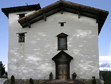 The main facade of the restored 1809 Mission San José chapel
Nestled at the base of Fremont's rolling hills is the Mission San José, one of the oldest of the historic Spanish missions in California, for which this district is named. The church building that exists today is a re-construction (dedicated in 1985 for daily Mass and tours) of the original 1809 adobe church that was destroyed by the 1868 Hayward-fault earthquake. One side of the original mission quadrangle remains and houses a museum. Mission San Jose is located at 37°31′59″N 121°55′13″W / 37.53306°N 121.92028°W; and lies at an elevation of 305 feet (93 m).
Warm Springs District
The Warm Springs district is the southernmost portion of Fremont whose hub is the Warm Springs and Mission Boulevard intersection. It is located at 37°29′14″N 121°55′45″W / 37.48722°N 121.92917°W, and lies at an elevation of 62 feet (19 m). Due to its proximity to the center of Silicon Valley, Warm Springs has attracted the headquarters of many high-tech companies including Nielsen Norman Group, Lam Research, Corsair Memory and Lexar of the US as well as foreign high-tech companies such as Elitegroup Computer Systems, and Asus. The district is also home to blue-collar industry.
Warm Springs also serves as commercial center for the mainly residential Mission San Jose district, especially since the construction of Pacific Commons, a large, modern regional shopping center. The Oakland Athletics are also in talks to move their stadium to this area. The large Asian population in Mission San Jose comes to Warm Springs for authentic Asian stores such as the 99 Ranch & Marina Food supermarkets, as well as more traditional supermarkets such as Safeway. It is also home to one of the SF Bay Area's only two coffee houses to employ baristas who wear bikinis, Your Coffee Cups, a concept that's gained some controversy from Bay Area newspapers and news stations.[24][25][26][27]
Construction of a 5.4-mile (8.7 km) BART extension to Warm Springs began in 2010. Currently, the southern terminus of the system is in Fremont's Centerville district. The extension will consist of an aerial track structure immediately south of the existing Fremont station, a subway of approximately one mile under Fremont Central Park and Lake Elizabeth, and at-grade tracks that will parallel Union Pacific tracks through the Irvington and Warm Springs districts.
In addition to the Warm Springs station, the City is also planning a station in Irvington, mid-way between the Fremont and Warm Springs stations. All three Fremont BART stations are expected to incorporate Transit Oriented Development components in the immediate station areas.
Warm Springs is located on Rancho Agua Caliente and is so named for the springs that are located there.[28] In early times, there was a settlement called Harrisburgh (also, Harrisburg and Peacock's) a short distance east from the small settlement of Warm Springs.[28] A post office opened in Harrisburgh in 1865 and changed its name to Warm Springs in 1885.[28] The name Harrisburgh commemorated Abram Harris, who settled there in 1858.[28] The name Peacock's commemorated George W. Peacock, its first postmaster.[28] The post office name changed to Warmsprings in 1895 and reverted to Warm Springs in 1950.[28]
Central District
For city planning purposes, the Central District is roughly the center of Fremont, surrounded by Centerville, Niles, Mission San Jose, and Irvington community plan areas. The Central District contains many retail shopping centers (e.g., the Fremont Hub), the Fremont Bay Area Rapid Transit station, several health care centers, the California School for the Blind and the Deaf, the Cherry/Guardino neighborhood, and Central Park and Lake Elizabeth. It has been designated as the location of Fremont's future downtown.[15][29]
North Fremont District
For city planning purposes, North Fremont is the primarily residential district between the Decoto Rd and the Centerville community plan area to the south and Union City to the north.[15][30] It's a growing community that includes the Lakes and Birds neighborhood, the Ardenwood subdivisions, and the Northgate subdivisions. It is the site of the Ardenwood Historic Farm. A 99 Ranch Market is one of many East Asian businesses in the North Fremont community plan area.
South Fremont District
South Fremont is a primarily industrial district, east of Interstate 880 and west of Interstate 680, south of Auto Mall Parkway and north of Brown Rd. It is sandwiched between the Irvington and Warm Springs community plan areas.[15][29] It is noted as the site of the former NUMMI auto plant as well as the site of the future Warm Springs BART station.
Bayside Industrial District
Bayside Industrial is a primarily industrial and commercial district, west of Interstate 880 between Newark and Milpitas.[15][29]
Baylands District
Baylands is an open space (bay and land) district that stretches from the Bay and engulfs the western edge of North Fremont, Newark, and Bayside Industrial.[15][29] It is the site of the headquarters and visitor center of the Don Edwards San Francisco Bay National Wildlife Refuge.
Hill Area District
Hill Area is an open land district that forms the eastern edge of Fremont.[15][29] It is the site of Mission Peak.
Economy
Companies headquartered in Fremont include Ikanos Communications, Lam Research, Fremont Bank, Oplink Communications, Silicon Graphics International, SYNNEX, S3 Graphics and Volterra Semiconductor.
Top employers
According to the City's 2010 Comprehensive Annual Financial Report,[31] the top employers in the city are:
# Employer # of Employees 1 Fremont Unified School District 3,000 2 Washington Hospital 1,800 3 Boston Scientific 1,800 4 Western Digital 1,800 5 Seagate Magnetics 1,050 6 AXT Inc. 950 7 Lam Research 950 8 Oplink Communications 900 9 Solyndra[32]800 10 Sysco San Francisco 750 Culture and recreation
The City of Fremont has been a Tree City USA since 1996. There are approximately 55,000 trees in City parks, streets, and landscaped boulevard areas. The city operates the Olive Hyde Art Gallery, adjacent to Mission San Jose, which has featured Bay Area artists such as Wendy Yoshimura, the California Society of Printmakers and the Etsy collective.[33][34] The public gallery is housed in a former home of Olive Hyde, descendent of early San Francisco Mayor George Hyde.[35][36]
Fremont Central Park and Lake Elizabeth
Main article: Fremont Central ParkFremont Central Park is a 450-acre (1.8 km2) park that lies in the Central district of the city of Fremont, California. The park is on Paseo Padre Parkway between Grimmer Road and Stevenson Boulevard and is easily accessible from both I-880 and I-680. It began development in 1960. In the park lies Lake Elizabeth, an 83-acre (340,000 m2) man-made lake that serves as a scenic picture for the residents who come to picnic, play sports, walk or tour the vicinity. The lake was dedicated in 1969 to Fremont's Sister City, Elizabeth, South Australia. For other recreation, the northeastern side of the park consists of the large Fremont Park Golf Course.
Aqua Adventure
Main article: Aqua AdventureThe water park has two open and two enclosed forty-foot water slides with water gates called run-outs. Another facility offered is a 700-square-foot (65 m2), 3-foot-deep (0.91 m) lazy river that surrounds the complex. There is also a splash zone with water features such as jets and sprays. Also in the park, there is a 25-yard (23 m) utility pool with five lanes for swimming. For younger children, there is a zero depth entry to the water course and a water bucket spray area only a foot deep. There are twelve shade structures that provide relief from the sun.
In addition to water-oriented activities, it will provide picnic areas for group activities. The water park has been open since May 2009.
Ardenwood Historic Farm
Main article: Ardenwood Historic FarmArdenwood is a regional historic landmark in Fremont. Open in 1985 to the general public, the entire park includes a farm, a large forest and a mansion now called the Patterson House which was first constructed in 1857 by the farm's original owner, George Washington Patterson.
Edwards National Wildlife Refuge
Main article: Don Edwards San Francisco Bay National Wildlife RefugeThe headquarters and visitor center of the Don Edwards San Francisco Bay National Wildlife Refuge is located in Fremont in the Baylands District, on Marshlands Rd off Thornton Ave. From there, the visitor can access trails winding through the Refuge.
Mission Peak Regional Preserve
Main article: Mission PeakMission Peak is a 2,517-foot (767 m) mountain summit that makes up the northern third of the Mission Ridge, along with Mount Allison and Monument Peak. The slopes are covered with oak woodland and chaparral and attracts a large crowd of Fremont locals. There is usually a few inches of snow that melts too fast and falls too lightly each winter to be noticed. Whenever a good snowfall falls (about every three to five years), it causes considerable excitement.
Niles Essanay Silent Film Museum
Main article: Niles Essanay Silent Film MuseumThe Niles Essanay Silent Film Museum is a film museum located in Niles, California on the former site of the Essanay Studios where Broncho Billy and Charlie Chaplin made films in the 1910s. It shows silent films weekly.
Quarry Lakes Regional Recreation Area
Main article: Quarry Lakes Regional Recreation AreaClimate
Climate data for Fremont, CA Month Jan Feb Mar Apr May Jun Jul Aug Sep Oct Nov Dec Year Average high °F (°C) 58
(14)61
(16)64
(18)68
(20)72
(22)76
(24)78
(26)79
(26)78
(26)73
(23)64
(18)58
(14)69.08 Average low °F (°C) 42
(6)45
(7)47
(8)50
(10)53
(12)56
(13)58
(14)58
(14)58
(14)54
(12)47
(8)42
(6)50.83 Precipitation inches (mm) 2.97
(75.4)2.89
(73.4)2.39
(60.7)0.94
(23.9)0.42
(10.7)0.12
(3)0.03
(0.8)0.07
(1.8)0.2
(5)0.9
(23)1.84
(46.7)2.08
(52.8)14.85
(377.2)Source: The Weather Channel[37] Sister cities
Fremont is twinned with the following cities:
City Subdivision Country Date Puerto Peñasco  Sonora
 Mexico
Fukaya Saitama Prefecture  Japan
JapanHorta  Azores
 Portugal
Lipa City Batangas  Philippines
Jaipur Rajasthan  India
IndiaFormer sister city
 Elizabeth, South Australia, Australia
Transportation
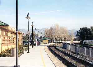
See also: Fremont-Centerville (Amtrak station) and Fremont (BART station) View of Fremont-Centerville (Amtrak station) From Platform #1
Fremont is served by Interstate 880 (Nimitz Freeway) and Interstate 680 (Sinclair Freeway). Though they do not intersect, they are connected in the Warm Springs district via a very busy one-mile segment of Mission Boulevard which is SR 262. In addition, it is served by SR 84 and the segment of Mission Boulevard which is SR 238. The city is the eastern terminus of the Dumbarton Bridge.
Regional rail transportation is provided by BART and the Altamont Commuter Express (ACE). Fremont's BART station serves as the southernmost terminus for the BART system (a 5.4-mile (8.7 km) BART extensions to the Warm Springs district is under construction and a southward extension into San Jose is in the planning stages). Centerville station provides a stopping point for ACE service which travels from Stockton to San Jose. Bus service is provided by AC Transit locally. Santa Clara Valley Transportation Authority provides express bus service to various points in Silicon Valley, including downtown San Jose and California's Great America (seasonally) in Santa Clara, thus providing an alternative to the already heavy traffic on I-880 and I-680.
Elevated sound levels exist in some areas of Fremont, especially along Interstate 880. Since the 1980s efforts have been made by Caltrans and the city to mitigate sound levels by construction of noise barriers.[38] The federal design level for freeway noise is 67 Leq, which standard has been used in analysis of the proper sound wall height.
Future rail
Caltrain is planning a Dumbarton rail that would run between the Peninsula and Alameda County. This project would add four stations to the Caltrain system: Union City, Fremont-Centerville, Newark, and Menlo Park/East Palo Alto.[39] Dumbarton Rail is currently undergoing environmental and engineering review.
Notable people
- Shawon Dunston
- Dina Ruiz Eastwood (wife of Actor/Director Clint Eastwood)
- Dennis Eckersley (Oakland Athletics Major League Baseball Hall of Famer)
- Robb Flynn
- Don Hertzfeldt
- Khaled Hosseini
- Steve Lewis
- Allan Haines Loughead (cofounder of Lockheed Corporation)
- Emcee Lynx
- Denise Matthews
- Vote Me Im Matt Lee (only cherian in the world)
- MC Hammer
- Justin Medlock (former UCLA placekicker)
- Helen Wills Moody
- Lamond Murray
- Julie Pinson
- Gary Plummer
- Rome Ramirez
- Ryan Sinn
- Ray Stevens (wrestler)
- Kevin Tan (Olympic Gymnast)
- Len Wiseman
- John Woodcock (Former NFL defensive lineman)
- Kristi Yamaguchi (Olympic Ice Skater)
See also
References
- ^ U.S. Census
- ^ City of Fremont. "Sister Cities". About Fremont. http://www.fremont.gov/index.aspx?NID=152. Retrieved 2008-10-05.
- ^ All data are derived from the United States Census Bureau reports from the 2010 United States Census, and are accessible on-line here. The data on unmarried partnerships and same-sex married couples are from the Census report DEC_10_SF1_PCT15. All other housing and population data are from Census report DEC_10_DP_DPDP1. Both reports are viewable online or downloadable in a zip file containing a comma-delimited data file. The area data, from which densities are calculated, are available on-line here. Percentage totals may not add to 100% due to rounding. The Census Bureau defines families as a household containing one or more people related to the householder by birth, opposite-sex marriage, or adoption. People living in group quarters are tabulated by the Census Bureau as neither owners nor renters. For further details, see the text files accompanying the data files containing the Census reports mentioned above.
- ^ American FactFinder, United States Census Bureau. "Fremont city, California - Income in the Past 12 Months (In 2007 Inflation-Adjusted Dollars)". Factfinder.census.gov. http://factfinder.census.gov/servlet/STTable?_bm=y&-context=st&-qr_name=ACS_2007_1YR_G00_S1901&-ds_name=ACS_2007_1YR_G00_&-CONTEXT=st&-tree_id=307&-redoLog=false&-_caller=geoselect&-geo_id=16000US0626000&-format=&-_lang=en. Retrieved 2010-09-09.
- ^ Fremont USD Directory of Schools
- ^ "Library Administration." Alameda County Library. Retrieved on April 1, 2010.
- ^ "Alameda County". California Historical Landmarks. State of California Office of Historic Preservation. http://ohp.parks.ca.gov/default.asp?page_id=21388. Retrieved 6 May 2011.
- ^ Jill M. Singleton. Lost Wineries and Vineyards of Fremont, California. Fremont Museum of Local History. Accessed 2006-11-09
- ^ [1][dead link]
- ^ http://www.fremont.gov/DocumentView.aspx?DID=837
- ^ "FBI raids solar firm Solyndra". The Associated Press. September 8, 2011. http://www.oregonlive.com/business/index.ssf/2011/09/fbi_raids_solar_firm_solyndra.html.
- ^ Goossens, Ehren (2009-12-08). "Solyndra, Solar-Panel Company Visited by Obama, Shuts Down". Businessweek. http://www.businessweek.com/news/2011-08-31/solyndra-to-file-for-bankruptcy-mulls-sale-and-licensing-deals.html. Retrieved 2011-09-02.
- ^ Durham, David L. (1998). California's Geographic Names: A Gazetteer of Historic and Modern Names of the State. Quill Driver Books. p. 634. ISBN 9781884995149.
- ^ City of Fremont CAFR. Retrieved 2009-08-10.
- ^ a b c d e f g "Chapter 4: Community Character" (pdf). General Plan 2030 Working Draft. City of Fremont, California. November 2010. http://www.fremont.gov/DocumentView.aspx?DID=4667. Retrieved 2010-11-24.
- ^ a b c Durham, David L. (1998). California's Geographic Names: A Gazetteer of Historic and Modern Names of the State. Quill Driver Books. p. 615. ISBN 9781884995149.
- ^ http://www.lisle.utoledo.edu/publications/pdf/winter03.pdf
- ^ Niles Community e-group. Retrieved March 5, 2011. Niles Community E-group
- ^ a b c d e f Durham, David L. (1998). California's Geographic Names: A Gazetteer of Historic and Modern Names of the State. Quill Driver Books. p. 672. ISBN 9781884995149.
- ^ "#237 94539". Forbes.com. http://www.forbes.com/lists/2007/7/forbeslife-cx_07zip_94539_ZIP94539.html. Retrieved 2010-09-09.
- ^ Marech, Rona (2002-05-17). "OF RACE AND PLACE / Little Asia / Fremont community largely made up of immigrants with means". Sfgate.com. http://www.sfgate.com/cgi-bin/article.cgi?file=/chronicle/archive/2002/05/17/EB49066.DTL. Retrieved 2010-09-09.
- ^ "Immigrants Weigh Splitting from Calif. School System". NPR. http://www.npr.org/templates/story/story.php?storyId=4190129. Retrieved 2010-09-09.
- ^ Durham, David L. (1998). California's Geographic Names: A Gazetteer of Historic and Modern Names of the State. Quill Driver Books. p. 665. ISBN 9781884995149.
- ^ Matthew Artz (August 29, 2010). "San Jose Mercury News Entry". Media News Group. http://www.Mercurynews.com/top-stories/ci_15917668?nclick_check=1. Retrieved August 29, 2010.
- ^ Bronstein, Phil (2010). "Are Bikini Baristas 'Bad Feminists?'". San Francisco Chronicle. http://www.sfgate.com/cgi-bin/blogs/bronstein/detail?entry_id=71196&tsp=1. Retrieved September 7, 2010.
- ^ http://www.nbcbayarea.com/news/local-beat/Would-You-Like-Some-Coffee-With-Your-Eye-Candy-101797983.html NBC News Story
- ^ "Bikini Baristas Lure In Fremont Coffee Drinkers". CBS News. August 30, 2010. http://cbs5.com/business/fremont.bikini.barista.2.1887488.html. Retrieved September 7, 2010.[dead link]
- ^ a b c d e f Durham, David L. (1998). California's Geographic Names: A Gazetteer of Historic and Modern Names of the State. Quill Driver Books. p. 720. ISBN 9781884995149.
- ^ a b c d e "Chapter 2: Land Use" (pdf). General Plan 2030 Working Draft. City of Fremont, California. November 2010. http://www.fremont.gov/DocumentView.aspx?DID=4665. Retrieved 2010-11-24.
- ^ "Section 4.11: Land Use and Planning" (pdf). Patterson Ranch Planned District Final Environmental Impact Report. 1. City of Fremont, California. September 2010. p. 4.11–2. http://www.fremont.gov/DocumentView.aspx?DID=4277.
- ^ City of Fremont, California Comprehensive Annual Financial Report, for the Year ended June 30, 2010
- ^ Solyndra to Declare Bankruptcy. NBC Bay Area.
- ^ [2]
- ^ [3]
- ^ [4]
- ^ [5]
- ^ "Monthly Averages for Fremont, CA". Weather.com. May 2011. http://www.weather.com/weather/wxclimatology/monthly/USCA0403. Retrieved 2010-05-29.
- ^ Acoustical study for the widening of Interstate 880 in the cities of Newark and Fremont, Alameda County, California, Earth Metrics Inc, for the Federal Highway Administration, October, 1989
- ^ "Dumbarton Rail Corridor". San Mateo County Transportation Authority. http://www.smcta.com/Dumbarton_Rail/information.asp. Retrieved 2007-01-24.
- U.S. Geological Survey Geographic Names Information System: Fremont, California
- U.S. Geological Survey Geographic Names Information System: Centerville
- U.S. Geological Survey Geographic Names Information System: Niles
- U.S. Geological Survey Geographic Names Information System: Niles Junction
- U.S. Geological Survey Geographic Names Information System: Irvington
- U.S. Geological Survey Geographic Names Information System: Mission San Jose
- U.S. Geological Survey Geographic Names Information System: Warm Springs
External links
Municipalities and communities of Alameda County, California Cities Alameda | Albany | Berkeley | Dublin | Emeryville | Fremont | Hayward | Livermore | Newark | Oakland | Piedmont | Pleasanton | San Leandro | Union City
CDPs Ashland | Castro Valley | Cherryland | Fairview | San Lorenzo | Sunol
Unincorporated
communitiesAlbrae | Altamont | Asco | Baumberg | Brightside | Brookshire | Carpenter | Dougherty | Dresser | East Pleasanton | Farwell | Hall Station | Halvern | Kilkare Woods | Komandorski Village | Lorenzo Station | Mattos | Mendenhall Springs | Midway | Mountain House | Mowry Landing | Radum | San Ramon Village | Scotts Corner | Sorenson | Verona
Former settlements Alden | Alvarado | Ann | Decoto | Drawbridge | Eden Landing | Elliot | Goecken | Greenville | Hacienda | Hayward Heath | Laddville | Larkin's Landing | Mallard | Melita | Merienda | Monte Vista | Remillard | Robert | Russell City | Stokes Landing | Tesla
 State of California
Topics - Climate
- Delegations
- Deserts
- Districts
- Ecology
- Elections
- Environment
- Geography
- Government
- History
- Protected areas
- Sports
- Symbols
- Transportation
- Visitor attractions
- Index of California-related articles
Society Regions - Antelope Valley
- Big Sur
- Cascade Range
- Central California
- Central Coast
- Central Valley
- Channel Islands
- Coachella Valley
- Conejo Valley
- Cucamonga Valley
- Death Valley
- East Bay (SF)
- East County (SD)
- Eastern California
- Emerald Triangle
- Gold Country
- Great Basin
- Greater Los Angeles
- Greater Sacramento
- Inland Empire
- Lake Tahoe
- Los Angeles Basin
- Lost Coast
- Metropolitan Fresno
- Mojave
- Mountain Empire
- North Bay (SF)
- North Coast
- North County (SD)
- Northern California
- Owens Valley
- Oxnard Plain
- San Francisco Peninsula
- Pomona Valley
- Sacramento Valley
- San Bernardino Valley
- San Diego–Tijuana
- San Fernando Valley
- San Francisco Bay Area
- San Gabriel Valley
- San Joaquin Valley
- Santa Clara Valley
- Santa Clara River Valley
- Santa Clarita Valley
- Shasta Cascade
- Sierra Nevada
- Silicon Valley
- South Bay (LA)
- South Bay (SF)
- South Bay (SD)
- South Coast
- Southern California
- Southern Border Region
- Tri-Valley
- Upstate California
- Victor Valley
- Wine Country
- Yosemite
Metro areas - Bakersfield
- Chico
- El Centro
- Fresno
- Hanford–Corcoran
- Los Angeles–Long Beach–Glendale
- Madera
- Modesto
- Merced
- Napa
- Oakland–Fremont–Hayward
- Oxnard–Thousand Oaks–Ventura
- Redding
- Riverside–San Bernardino–Ontario
- Sacramento–Arden Arcade–Roseville
- Salinas
- San Diego–Carlsbad–San Marcos
- San Francisco–San Mateo–Redwood City
- San Jose–Sunnyvale–Santa Clara
- San Luis Obispo–Paso Robles
- Santa Ana–Anaheim–Irvine
- Santa Barbara–Santa Maria–Goleta
- Santa Cruz–Watsonville
- Santa Rosa–Petaluma
- Stockton
- Vallejo–Fairfield
- Visalia–Porterville
- Yuba City
Micro areas Counties - Alameda
- Alpine
- Amador
- Butte
- Calaveras
- Colusa
- Contra Costa
- Del Norte
- El Dorado
- Fresno
- Glenn
- Humboldt
- Imperial
- Inyo
- Kern
- Kings
- Lake
- Lassen
- Los Angeles
- Madera
- Marin
- Mariposa
- Mendocino
- Merced
- Modoc
- Mono
- Monterey
- Napa
- Nevada
- Orange
- Placer
- Plumas
- Riverside
- Sacramento
- San Benito
- San Bernardino
- San Diego
- San Francisco
- San Joaquin
- San Luis Obispo
- San Mateo
- Santa Barbara
- Santa Clara
- Santa Cruz
- Shasta
- Sierra
- Siskiyou
- Solano
- Sonoma
- Stanislaus
- Sutter
- Tehama
- Trinity
- Tulare
- Tuolumne
- Ventura
- Yolo
- Yuba
Mayors of cities with populations exceeding 100,000 in California - Antonio Villaraigosa
(Los Angeles) - Jerry Sanders
(San Diego) - Chuck Reed
(San Jose) - Edwin M. Lee
(San Francisco) - Ashley Swearengin
(Fresno) - Kevin Johnson
(Sacramento) - Bob Foster
(Long Beach) - Jean Quan
(Oakland) - Harvey Hall
(Bakersfield) - Tom Tait
(Anaheim) - Miguel A. Pulido
(Santa Ana)
- Ronald O. Loveridge
(Riverside) - Ann Johnston
(Stockton) - Cheryl Cox
(Chula Vista) - Bob Wasserman
(Fremont) - Sukhee Kang
(Irvine) - Pat Morris
(San Bernardino) - Jim Ridenour
(Modesto) - Thomas E. Holden
(Oxnard) - Acquanetta Warren
(Fontana) - William H. Batey II
(Moreno Valley)^ - John Drayman
(Glendale)
- Cathy Green
(Huntington Beach)^ - Bob Kellar
(Santa Clarita)^ - William Dalton
(Garden Grove) - Susan Gorin
(Santa Rosa)^ - Jim Wood
(Oceanside) - Donald Kurth
(Rancho Cucamonga) - Paul S. Leon
(Ontario) - R. Rex Parris
(Lancaster) - Pat Hume
(Elk Grove) - James C. Ledford Jr.
(Palmdale) - Stan Skipworth
(Corona)^
- Dennis Donohue
(Salinas) - Elliot Rothman
(Pomona) - Frank Scotto
(Torrance) - Michael Sweeney
(Hayward) - Sam Abed
(Escondido) - Tony Spitaleri
(Sunnyvale) - Bill Bogaard
(Pasadena) - Carolyn Cavecche
(Orange) - F. Richard Jones
(Fullerton)^ - Jacqui Irwin
(Thousand Oaks)^ - Jesus Gamboa
(Visalia)
- Paul Miller
(Simi Valley) - William D. Shinn
(Concord)^ - Gina Garbolino
(Roseville) - Jamie L. Matthews
(Santa Clara) - Osby Davis
(Vallejo) - Rudy Cabriales
(Victorville) - Ernest Gutierrez
(El Monte) - Tom Bates
(Berkeley) - Rick Trejo
(Downey)^ - Eric R. Bever
(Costa Mesa)^ - James T. Butts, Jr.
(Inglewood)
 ^Mayor selected from city council
Other states: AL • AK • AZ • AR • CA • CO • CT • DE • FL • GA • HI • ID • IL • IN • IA • KS • KY • LA • ME • MD • MA • MI • MN • MS • MO • MT • NE • NV • NH • NJ • NM • NY • NC • ND • OH • OK • OR • PA • RI • SC • SD • TN • TX • UT • VT • VA • WA • WV • WI • WYCategories:- Fremont, California
- Populated places established in 1956
- Incorporated cities and towns in California
- Cities in Alameda County, California
- Cities in the San Francisco Bay Area
- Populated places in the United States with Asian American majority populations


Wikimedia Foundation. 2010.