- Concord, California
-
For the gold rush town formerly with this name, see Orleans Flat, California.
City of Concord — City — Todos Santos Plaza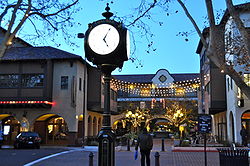 Location of Concord in California.
Coordinates: 37°58′41″N 122°01′52″W / 37.97806°N 122.03111°WCoordinates: 37°58′41″N 122°01′52″W / 37.97806°N 122.03111°W Country  United States
State  California
County Contra Costa Government - Type Council-Manager - Mayor Laura M. Hoffmeister[1] - Senate Mark DeSaulnier (D) - Assembly Susan Bonilla (D) - U. S. Congress George Miller (D) Area[2] - Total 30.546 sq mi (79.114 km2) - Land 30.546 sq mi (79.114 km2) - Water 0 sq mi (0 km2) 0% Elevation 85.3 ft (26 m) Population (2010) - Total 122,067 - Rank 1st in Contra Costa County
46th in California
206th in the United States- Density 3,996.2/sq mi (1,542.9/km2) Time zone PST (UTC-8) - Summer (DST) PDT (UTC-7) ZIP codes 94518, 94519, 94520, 94521 Area code(s) 925 FIPS code 06-16000 GNIS feature ID 1658308 Website http://www.ci.concord.ca.us/ Concord (
 /ˈkɒŋkərd/ kong-kərd; formerly Drunken Indian and Todos Santos)[3] is the largest city in Contra Costa County, California, USA. At the 2010 census, the city had a population of 122,067. Originally founded in 1869 as the community of Todos Santos by Salvio Pacheco, the name was changed to Concord within months. The city is a major regional suburban East Bay center within the San Francisco Bay Area, and is located just 31 miles (50 km) east of San Francisco.
Contents
Geography

Concord, California[4] Climate chart (explanation) J F M A M J J A S O N D 108124971558218726228122510329120.53113230136.128122424106617671124Average max. and min. temperatures in °C Precipitation totals in mm Imperial conversion J F M A M J J A S O N D 4.354393.859413.26445172460.577500.18454088550.186550.282540.975502.663432.85439Average max. and min. temperatures in °F Precipitation totals in inches Concord is located at 37°58′41″N 122°01′52″W / 37.97806°N 122.03111°W.[3] In terms of travelling distance on the ground, it is 29 miles (47 km) northeast of San Francisco, 22 miles (35 km) northeast from Oakland, 65 miles (105 km) southwest of Sacramento, and 51 miles (82 km) north of San Jose.[5]
According to the United States Census Bureau, the city has a total area of 30.5 square miles (79 km2), all of it land.
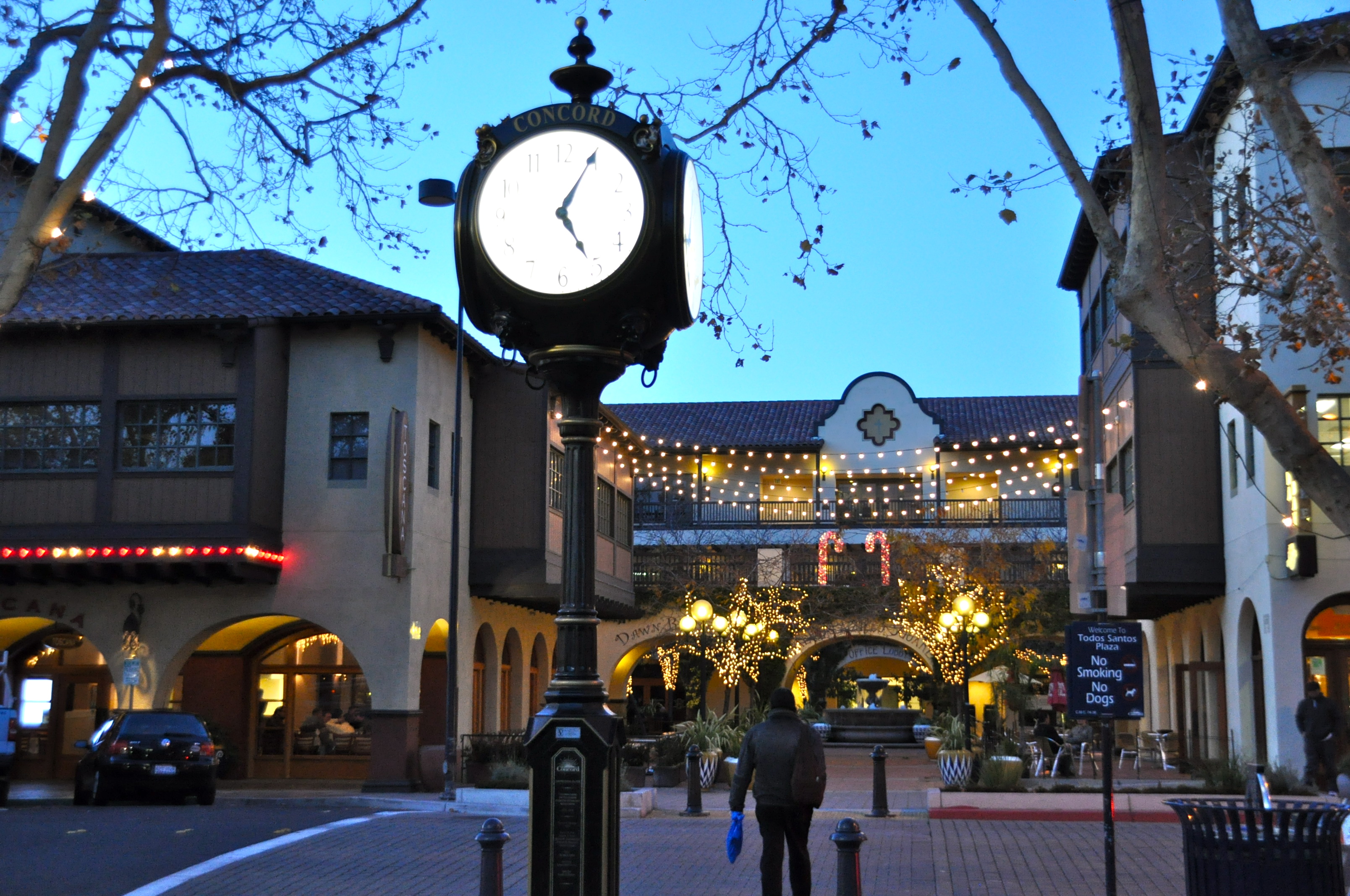
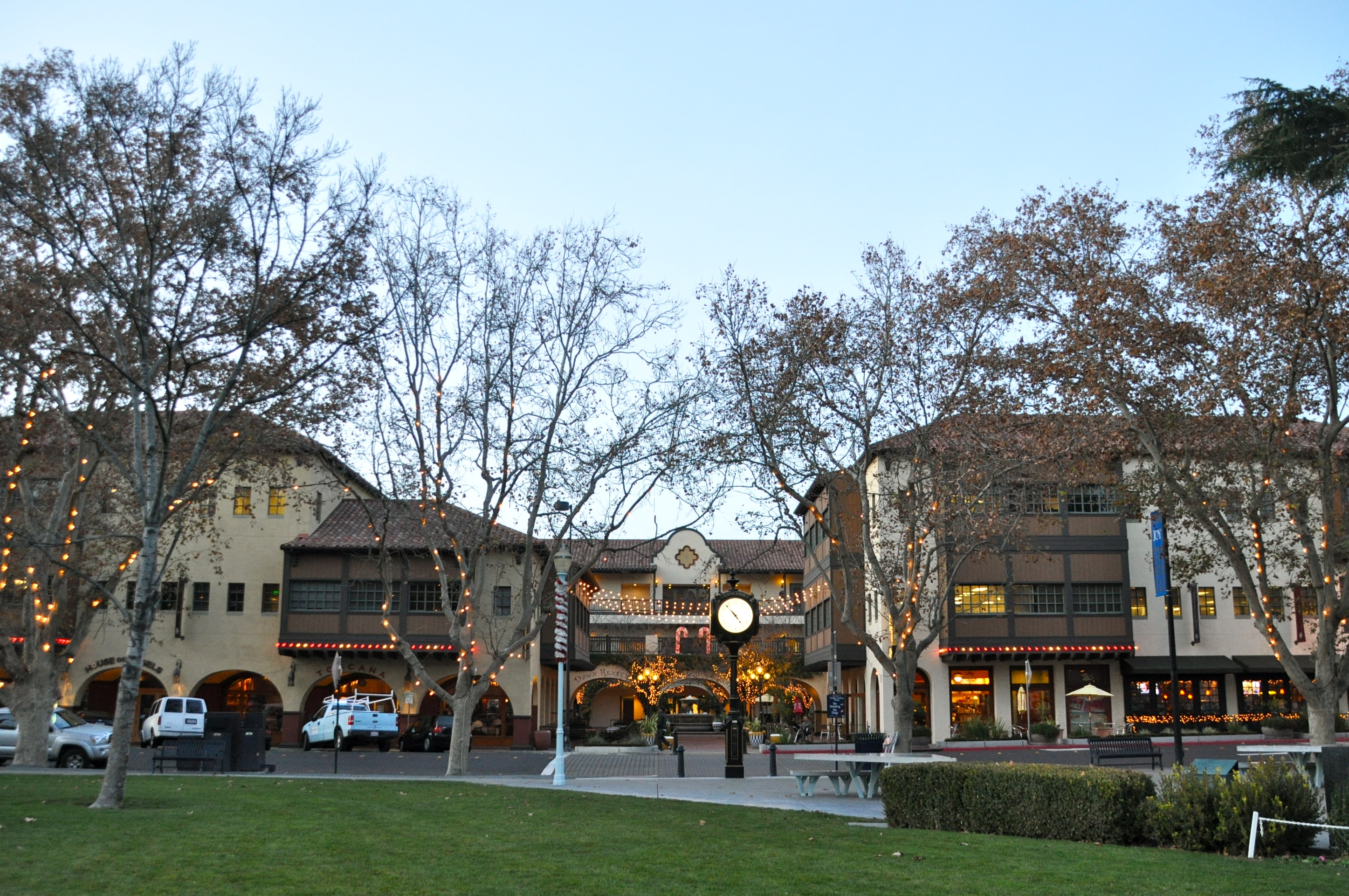
The focal point of downtown Concord is Todos Santos Plaza, which encompasses an entire city block and is known for its farmers market, free summer concerts, and large number of surrounding restaurants. Much of the area immediately around downtown has recently been redeveloped, with new high-density apartment and condominium projects to take advantage of the close proximity to public transportation and the vibrant area surrounding the park. Despite this, some crime and homelessness remain issues in the downtown area.[6][7]
To the north and east of downtown is the older residential area of Concord, with many homes dating back to before World War II. In the far northern edge of town is a primarily industrial area, dominated by the Tesoro Golden Eagle refinery (which is actually not located within city limits). The southeastern area of the city, centered along Clayton Road, is primarily residential and was mostly developed in the 1960s and 1970s. In the southwest area of the city is the primarily Latino neighborhood known as Four Corners, centered around the intersection of Monument Boulevard and Oak Grove Road.
Concord is bordered on the west by Pleasant Hill and the unincorporated community of Pacheco, on the south by Walnut Creek, on the southeast by Clayton, on the northeast by Pittsburg and the unincorporated community of Bay Point, and on the north by the unincorporated community of Clyde. Though it shares no border with Concord, Martinez (the county seat) is located almost immediately adjacent to Concord on the northwest.
Climate
Official data from the National Weather Service cooperative station in Concord shows average January temperatures are a maximum of 57.2°F and a minimum of 41.6°F. Average July temperatures are a maximum of 87.8°F and a minimum of 58.2°F. There are an average of 45.0 days with highs of 90°F (32°C) or higher and 3.8 days with lows of 32°F (0°C) or lower. The highest recorded temperature was 110°F on July 23, 2006. The lowest record temperature was 24°F on December 23, 1998.
Average annual precipitation is 18.31 inches, falling on an average of 57 days annually. The wettest year was 1995 with 26.62 inches and driest year was 2007 with 10.57 inches. The most rainfall in one month was 11.79 inches in December 2005, which included the 24-hour maximum rainfall of 3.95 inches on December 31.[8]
History
The valleys north of Mount Diablo were inhabited by the Miwok people, who hunted elk and fished in the numerous streams flowing from the mountain into the San Francisco Bay. In 1772 Spanish explorers began to cross the area, but did not settle here. In 1834 the Mexican land grant Rancho Monte del Diablo at the base of Mount Diablo was granted to Salvio Pacheco (for whom the nearby town of Pacheco is named).
Concord was founded under the name of Todos Santos ("all saints"; a name still borne by the central city plaza and park between Willow Pass Road and Salvio Street), on the initiative of Pacheco in 1869. It achieved prominence in the 19th century as a result of most residents of Pacheco relocating to Concord to avoid the devastation of fire and flood which crippled Pacheco's formerly booming economy. Concord was incorporated on February 5, 1905.
The area around Concord in the surrounding Ygnacio and Clayton Valleys was a large agricultural area. Crops that were grown included grapes, walnuts, wheat, hay, and even tomatoes. The area to the east (site of the Concord Naval Weapons Station) was the site of a few enormous wheat ranches over 5,000 acres (20 km2), and was almost a sea of wheat all the way to the marshes bordering Suisun Bay. During Prohibition, many vineyards were removed and replaced with walnut orchards. The town of Cowell now incorporated into Concord, produced cement.
The first Concord post office opened in 1872.[9]
Port Chicago disaster
Main article: Port Chicago disasterThe munitions on board a Navy cargo ship exploded while being loaded during World War II, resulting in the largest number of casualties among African Americans in any one incident during that war. On the evening of July 17, 1944 a massive explosion instantly killed 320 sailors, merchant seamen and civilians working at the pier. The blast was felt 30 miles away. A subsequent refusal by 258 black sailors to load any more ammunition was the beginning of the Navy's largest-ever mutiny trial in which 50 men were found guilty. Future Supreme Court Justice Thurgood Marshall sat in on most of the proceedings and declared that he saw a prejudiced court.[10]
Sunvalley Mall plane crash
On the evening of December 23, 1985, two days before Christmas, a twin-engine Beechcraft Baron, executed a missed instrument approach procedure from an approach to runway 19R of Buchanan Airport. The airport had been closed a few hours earlier due to thick fog. F.A.A. regulations require a "missed approach" be declared if the pilot cannot visually see the runway from .25 miles (about .40 kilometers) from the end of the runway in instrument conditions (when the pilot cannot see the ground). The pilot, a student flying with an instructor, continued the approach a few hundred feet over the runway in the hope of finding a hole in the fog (It is common to find the fog a little thinner farther from the water). After failing to see the runway he began the missed approach, which included a left turn over what would have been empty ground had it been done at the proper place. However he was about a mile farther down the runway and the turn now carried him into the Sunvalley Mall. The plane struck the roof of the building killing the pilot and two passengers and seriously injuring 84 Christmas shoppers in the crowded mall below, mainly by spraying them with burning fuel. Four of the victims on the ground later died from their injuries. The accident brought increased local opposition to the airport, and caused Pacific Southwest Airlines to delay scheduled passenger service that had been planned for the new year.
Demographics
Historical populations Census Pop. %± 1870 400 — 1880 399 −0.3% 1890 373 −6.5% 1900 586 57.1% 1910 703 20.0% 1920 912 29.7% 1930 1,125 23.4% 1940 1,373 22.0% 1950 6,953 406.4% 1960 36,208 420.8% 1970 85,164 135.2% 1980 103,251 21.2% 1990 111,348 7.8% 2000 121,780 9.4% 2010 122,067 0.2% source:[11][12] 2010
The 2010 United States Census[13] reported that Concord had a population of 122,067. The population density was 3,996.2 people per square mile (1,542.9/km²). The racial makeup of Concord was 78,767 (64.5%) White, 4,371 (3.6%) African American, 852 (0.7%) Native American, 13,538 (11.1%) Asian (4.4% Filipino, 2.4% Chinese, 1.3% Indian, 0.7% Vietnamese, 0.6% Japanese, 0.6% Korean, 1.2% Other), 816 (0.7%) Pacific Islander, 15,969 (13.1%) from other races, and 7,754 (6.4%) from two or more races. Hispanic or Latino of any race were 37,311 persons (30.6%).
The Census reported that 121,020 people (99.1% of the population) lived in households, 512 (0.4%) lived in non-institutionalized group quarters, and 535 (0.4%) were institutionalized.
There were 44,278 households, out of which 15,421 (34.8%) had children under the age of 18 living in them, 21,725 (49.1%) were opposite-sex married couples living together, 5,642 (12.7%) had a female householder with no husband present, 2,707 (6.1%) had a male householder with no wife present. There were 2,952 (6.7%) unmarried opposite-sex partnerships, and 512 (1.2%) same-sex married couples or partnerships. 10,406 households (23.5%) were made up of individuals and 3,625 (8.2%) had someone living alone who was 65 years of age or older. The average household size was 2.73. There were 30,074 families (67.9% of all households); the average family size was 3.22.
The population was spread out with 28,000 people (22.9%) under the age of 18, 10,946 people (9.0%) aged 18 to 24, 35,834 people (29.4%) aged 25 to 44, 32,903 people (27.0%) aged 45 to 64, and 14,384 people (11.8%) who were 65 years of age or older. The median age was 37.0 years. For every 100 females there were 98.8 males. For every 100 females age 18 and over, there were 97.0 males.
There were 47,125 housing units at an average density of 1,542.8 per square mile (595.7/km²), of which 27,069 (61.1%) were owner-occupied, and 17,209 (38.9%) were occupied by renters. The homeowner vacancy rate was 1.9%; the rental vacancy rate was 7.0%. 71,004 people (58.2% of the population) lived in owner-occupied housing units and 50,016 people (41.0%) lived in rental housing units.
2000
As of the census[14] of 2000, there were 121,780 people, 44,020 households, and 30,329 families residing in the city. The population density was 4,041.0 people per square mile (1,560.0/km²). There were 45,083 housing units at an average density of 1,496.0/sq mi (577.5/km²). The racial makeup of the city is 70.71% White, 3.04% Black or African American, 0.76% Native American, 9.39% Asian, 0.50% Pacific Islander, 9.65% from other races, and 5.94% from two or more races. 21.81% of the population are Hispanic or Latino of any race.
There were 44,020 households out of which 34.4% had children under the age of 18 living with them, 51.4% were married couples living together, 12.3% had a female householder with no husband present, and 31.1% were non-families. 23.2% of all households were made up of individuals and 7.2% had someone living alone who was 65 years of age or older. The average household size was 2.74 and the average family size was 3.22.
In the city the age of the population was spread out with 25.3% under the age of 18, 9.0% from 18 to 24, 32.8% from 25 to 44, 22.2% from 45 to 64, and 10.7% who were 65 years of age or older. The median age was 35 years. For every 100 females there were 97.6 males. For every 100 females age 18 and over, there were 95.3 males.
The median income for a household in the city was $55,597, and the median income for a family was $62,093. Males had a median income of $45,734 versus $34,860 for females. The per capita income for the city was $24,727. About 5.2% of families and 7.6% of the population were below the poverty line, including 9.0% of those under age 18 and 6.2% of those age 65 or over.
At the 2008 Ancestry was:- German 12.0%
- Irish 8.8%
- English 8.3%
- Italian 6.9%
- American 4.0%
- French 2.8%
- Polish 2.0%
- Portuguese 1.9%
- Russian 1.7%
- Scottish 1.7%
- Scottish-Irish 1.5%
- Dutch 1.4%
- Norwegian 1.4%
- Swedish 1.4%
- Welsh 0.9%
Politics
In the state legislature Concord is located in the 7th Senate District, represented by Democrat Mark DeSaulnier, and in the 11th Assembly District, represented by Democrat Susan Bonilla. Federally, Concord is located in part California's 7th congressional district, which has a Cook PVI of D +19[15] and is represented by Democrat George Miller The rest is part of the 10th Congressional District formerly represented by Democrat John Garamendi, who was recently elected on November 3, 2009.
Economy
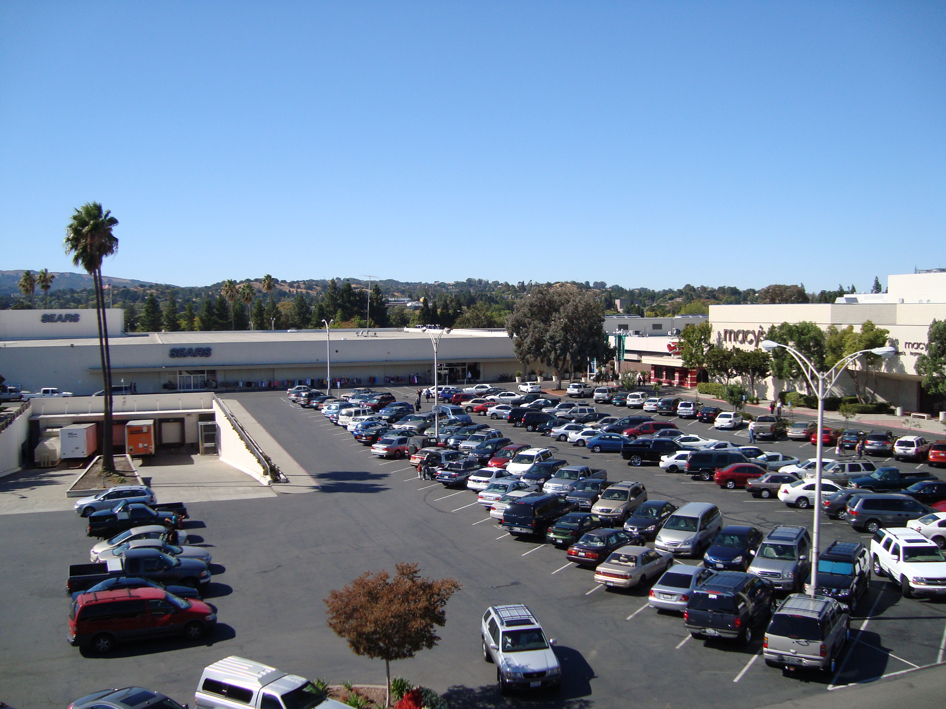
Concord has been primarily a bedroom community for San Francisco and Oakland over the last forty years, but during the last decades, jobs within the city have increased.[16] Corporations with strong Bay Area regional ties, such as Chevron and Bank of America, have established extensive back-office operations there, diversifying the local economy. Concord also has a strong retail sector including the Sunvalley Mall, one of the 50 largest malls in the USA, auto dealerships, Costco, and Fry's Electronics. Prior to its dissolution, Atrivo was headquartered in Concord.[17]
Top employers
According to the City's 2009 Comprehensive Annual Financial Report,[18] the top employers in the city are:
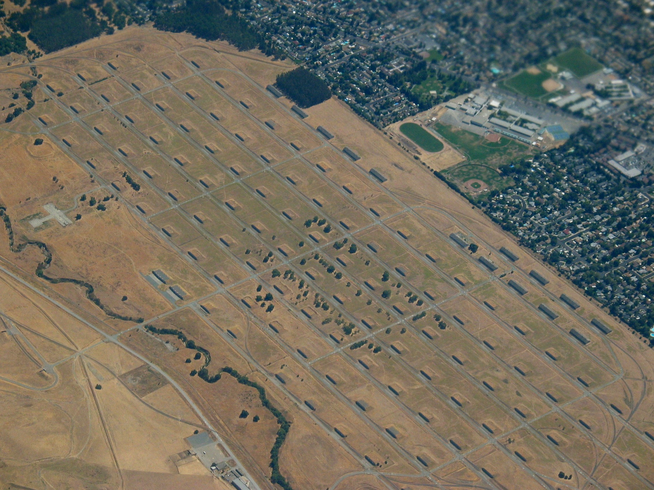
# Employer # of Employees 1 Mt. Diablo Unified School District 4,320 2 Bank of America 3,100 3 Wells Fargo Credit Center 1,500 4 John Muir Health 1,500 5 Chevron Credit Center 1,396 6 BEI 666 7 Comcast 614 8 The Conco Companies 549 9 Macy's 500 10 AT&T 500 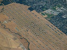 Aerial view of the Naval Weapons Station
 Main article: Concord Naval Weapons Station
To the north of the city of Concord is the Concord Naval Weapons Station, which was established in 1942. The station functioned as a World War II armament storage depot, supplying ships at Port Chicago. The Concord NWS supported war efforts during the Vietnam War and through the end of the Gulf War, processing and shipping out thousands of tons of materiel to Southeast Asia and the Middle East.[19]
The station consists of two areas: the Inland Area (5,170 acres (21 km2)) which is within the Concord city limits, and Tidal Area (7,630 acres (31 km2)).[20] Because of changes in military operations, parts of the Inland Area began to be mothballed and by 1999, the station had only a minimal contingent of military personnel. In 2007 the U.S. Federal Government announced that the inland portion of the Naval station will be closed. The Tidal area of the base is not scheduled for closure.[19] The city is working on a reuse plan that may include developing the land while keeping a large portion for open-space and parks projects. The city has had many meetings on this subject and will continue to do so. Any plan for reuse is subject to approval by the Navy.[20][21]
Transportation
Until 1995 the city was the eastern terminus of the Concord line of Bay Area Rapid Transit (BART) commuter train system; the line has since been extended eastward to Pittsburg/Bay Point. The County Connection provides limited public transportation in the city and to other points in the county. Buses run from the North Concord BART station to Martinez, the county seat.
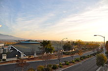 Overlooking the North Concord Bart Station
Main thoroughfares include Willow Pass Road, Concord Avenue, Concord Boulevard, Clayton Road, Ygnacio Valley Road, Oak Grove Road and Treat Boulevard. The city is also served by Interstate 680, and state highways 4 and 242.
Buchanan Field Airport is a public county-owned airfield in the City of Concord. It currently does not have any scheduled passenger service, but was once served by WestAir, Pacific Southwest Airlines, and later U.S. Airways for a short time.
Media
The city of Concord is served by the daily newspaper, the Contra Costa Times published by the Bay Area News Group-East Bay (part of the Media News Group, Denver, Colorado), with offices in Walnut Creek. The paper was originally a paper run and owned by the Lesher family. Since the death of Dean Lesher in 1993, the paper has had several owners. The publisher also issues a weekly paper, the Concord Transcript, which is the local paper for Concord and nearby Clayton.
Education
Concord is served by the Mount Diablo Unified School District. Concord's Clayton Valley High School is home to several acclaimed California academies, specifically ClaytonArts Academy, a four year English, social studies and arts based program with an emphasis on cross curriculur projects. Concord is also home to Mt. Diablo High School, opened in 1905, and home to the Digital safari, a three-year program involving the integration of multimedia with the core curriculum through integrated, project-based learning. Concord's De La Salle High School is home of the record winning streak of 151 games set by the football team between 1992 and 2004. During that span, De La Salle won 12 California North Coast sectional championships, and was named national champion five different times (once by ESPN, four times by USA Today).
Ygnacio Valley High School won the 1987 Northern California Boys Division I Basketball Championship, Coached by Jim Grace.
De La Salle High School (a private Catholic High School) is bordered by its sister school Carondelet High School and Ygnacio Valley High School.
The headquarters of the Kabul Soccer Club is located in Concord.[3]
California State University, East Bay has a campus in Concord.
Concord High School won the 2010 Northern California Boys Division II Football Championship, Coached by Brian Hamilton
Public libraries
The Concord Library of the Contra Costa County Library is located in Concord.[22] The library is adjacent to the Concord Civic Center.[23]
Arts and culture
Concord is the home of the annual Concord Jazz Festival and was the home of the Concord Records jazz record label until it was bought in 1999.
Jazz musician Dave Brubeck was born in Concord[24] and in 2006 a park adjacent to Concord High School on Concord Boulevard was renamed in his honor (see below). Film star Tom Hanks and Broadway actress Meredith Patterson were born in Concord. Actor Mark Hamill, Olympic gold-medalist Natalie Coughlin and mixed martial artist Gil Castillo have also been Concord residents. Actor/Comedian Carlos Alazraqui attended Concord High School. Concord is the original home of the counter-cultural icons Negativland. Concord is also where American rock group The Federalists are based. Comedians Blake Anderson and Kyle Newacheck were also born in Concord.
Concord is also home to the 14-time World Champion Blue Devils Drum and Bugle Corps. The corps is made up of talented musicians from around the world. The Concord Blue Devils are the most decorated drum and bugle corps in the history of Drum Corps International.
The Public-access television channel is operated through TelVue Virtual Television Networks.
Points of interest
- Sleep Train Pavilion - a major concert venue formerly known as the Concord Pavilion, and Chronicle Pavilion at Concord.
- Markham Regional Arboretum
- 1 Concord Center
- Sunvalley Mall
- Don Francisco Galindo House
- Don Salvio Pacheco Adobe
- The Willows Theater
- Farmer's Market concerts and movies at Todos Santos Plaza
- Buchanan Field Airport
- Camp Concord,[25] at South Lake Tahoe, a family-oriented Summer Camp, although not located in Concord, is operated by the city.
- Port Chicago Naval Magazine National Memorial[26]
- West Wind Solano Drive-In Theater
- Baldwin Community Park
- Six Flags Waterworld Concord
- Concord Skatepark
- Todos Santos Park
- Willow Pass Community Park
- Ygnacio Valley Park
- Newhall Community Park
- Lime Ridge Open Space
- Dave Brubeck Park
- Rick Sears Memorial Park
- Hillcrest Park home to Matteo's Dream - a playground for children of all abilities
- Concord Community Pool [4]
- Blue Devils Drum and Bugle Corps
- Staring Point of the Iron Horse Regional Trail
Sister city
In 1974 Concord became a sister city with Kitakami, Iwate, in Japan. The city established a small Japanese style park in the city, and placed half of a sculpture, The Communion Bridge, in it. The matching half of the bridge is in Kitakami.[27]
References
- ^ City of Concord City Council / Elected Officials, official city web site, retrieved on 2011-1-29
- ^ U.S. Census
- ^ a b U.S. Geological Survey Geographic Names Information System: Concord, California
- ^ MSN Weather
- ^ City of Concord City Profile, official city web site, retrieved on 2007-08-16
- ^ [1]
- ^ [2]
- ^ http://www.wrcc.dri.edu/cgi-bin/cliMAIN.pl?ca1967
- ^ Durham, David L. (1998). California's Geographic Names: A Gazetteer of Historic and Modern Names of the State. Quill Driver Books. p. 618. ISBN 9781884995149.
- ^ Allen, Robert L. (2006). The Port Chicago Mutiny. Berkeley, CA: Heyday Books. p. 118. ISBN 9781597140287. OCLC 63179024. http://books.google.com/books?id=2jl6cyAy6u8C.
- ^ Moffatt, Riley. Population History of Western U.S. Cities & Towns, 1850-1990. Lanham: Scarecrow, 1996, 26.
- ^ "Subcounty population estimates: California 2000-2007" (CSV). United States Census Bureau, Population Division. 2009-03-18. http://www.census.gov/popest/cities/files/SUB-EST2007-6.csv. Retrieved 2009-05-10.
- ^ All data are derived from the United States Census Bureau reports from the 2010 United States Census, and are accessible on-line here. The data on unmarried partnerships and same-sex married couples are from the Census report DEC_10_SF1_PCT15. All other housing and population data are from Census report DEC_10_DP_DPDP1. Both reports are viewable online or downloadable in a zip file containing a comma-delimited data file. The area data, from which densities are calculated, are available on-line here. Percentage totals may not add to 100% due to rounding. The Census Bureau defines families as a household containing one or more people related to the householder by birth, opposite-sex marriage, or adoption. People living in group quarters are tabulated by the Census Bureau as neither owners nor renters. For further details, see the text files accompanying the data files containing the Census reports mentioned above.
- ^ "American FactFinder". United States Census Bureau. http://factfinder.census.gov. Retrieved 2008-01-31.
- ^ "Will Gerrymandered Districts Stem the Wave of Voter Unrest?". Campaign Legal Center Blog. http://www.clcblog.org/blog_item-85.html. Retrieved 2007-10-20.
- ^ City of Concord demographics. Accessed 2007-08-13
- ^ Krebs, Brian. "Report Slams U.S. Host as Major Source of Badware." The Washington Post. August 28, 2008. Retrieved on August 31, 2009.
- ^ City of Concord CAFR
- ^ a b Concord Navel Weapons Station Reuse Information Portal. Retrieved 2007-08-13
- ^ a b About the City of Concord Community Reuse Project, official city web site'. Retrieved 2007-08-13
- ^ "Concord Naval Weapons Station". Contra Costa Times website collection of articles. Retrieved 2007-08-13
- ^ "Concord Library." Contra Costa County Library. Retrieved on March 31, 2010.
- ^ "Concord Library." City of Concord. Retrieved on March 31, 2010.
- ^ Reception honors Concord native son, jazz great Dave Brubeck, official city web site, retrieved on 2007-01-15
- ^ Official Camp Concord homepage
- ^ Largest homeland disaster during World War II from the National Park Service
- ^ City of Concord Sister City, official city web site, retrieved on 2007-08-16
External links
- Official Site
- List of Concord Landmarks and Historic Sites
- Concord (California) travel guide from Wikitravel
- Concord Historic Society
- Concord Lions Club
- Concord Chamber of Commerce
- Concord Naval Weapons Station (CNWS): Current Status
- 2nd link for CNWS acreage reuse
- HalfwaytoConcord.com = Contra Costa County Politics, Event Calendar, Community News
- Concord local portal
- The Blue Devils Devils Drum and Bugle Corps
Operational military installations of CaliforniaArmy  FortAirfieldHeliportRange
Marines  Air StationCampRangeLogistics
Navy  DepotOutlying FieldPortStationRangeSchool
Air Force  Range
RangeNational Guard  School
Coast Guard  Station
Municipalities and communities of Contra Costa County, California County seat: Martinez Cities and towns 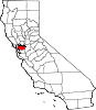
CDPs Acalanes Ridge | Alamo | Alhambra Valley | Bay Point | Bayview | Bethel Island | Blackhawk | Byron | Camino Tassajara | Castle Hill | Clyde | Contra Costa Centre | Crockett | Diablo | Discovery Bay | East Richmond Heights | El Sobrante | Kensington | Knightsen | Montalvin Manor | Mountain View | Norris Canyon | North Gate | North Richmond | Pacheco | Port Costa | Reliez Valley | Rodeo | Rollingwood | San Miguel | Saranap | Shell Ridge | Tara Hills | Vine Hill
Unincorporated
communitiesAlamo Oaks | Arbor | Avon | Bancroft | Bayo Vista | Bayview-Montalvin | Bixler | Blackhawk-Camino Tassajara | Bridgehead | Canyon | Christie | Cornwall | Crolona Heights | Diamond | Eastport | Four Corners | Franklin Canyon | Gateley | Glen Frazer | Hasford Heights | Herpoco | Hookston | Las Juntas | Los Medanos | Luzon | Maltby | Marsh Creek Springs | McAvoy | Meinert | Monsanto | Muir | Neroly | Newlove | Nichols | Oleum | Orinda Village | Orwood | Ozol | Rheem | Rock City | Selby | Shore Acres | Sobrante | Sparkle | Stege | Tassajara | Tormey | Valle Vista | Valona | Waldon | Walnut Heights | Werner
Ghost towns Acelanus | Ambrose | Atchison | Eckley | Empire | Hooper | Horse Haven | Judsonville | Junction | Nortonville | Ohmer | Point of Timber | Port Chicago | Schmidtville | Somersville | Stewartville | Tammukan | West Hartley | Winehaven
Mayors of cities with populations exceeding 100,000 in California - Antonio Villaraigosa
(Los Angeles) - Jerry Sanders
(San Diego) - Chuck Reed
(San Jose) - Edwin M. Lee
(San Francisco) - Ashley Swearengin
(Fresno) - Kevin Johnson
(Sacramento) - Bob Foster
(Long Beach) - Jean Quan
(Oakland) - Harvey Hall
(Bakersfield) - Tom Tait
(Anaheim) - Miguel A. Pulido
(Santa Ana)
- Ronald O. Loveridge
(Riverside) - Ann Johnston
(Stockton) - Cheryl Cox
(Chula Vista) - Bob Wasserman
(Fremont) - Sukhee Kang
(Irvine) - Pat Morris
(San Bernardino) - Jim Ridenour
(Modesto) - Thomas E. Holden
(Oxnard) - Acquanetta Warren
(Fontana) - William H. Batey II
(Moreno Valley)^ - John Drayman
(Glendale)
- Cathy Green
(Huntington Beach)^ - Bob Kellar
(Santa Clarita)^ - William Dalton
(Garden Grove) - Susan Gorin
(Santa Rosa)^ - Jim Wood
(Oceanside) - Donald Kurth
(Rancho Cucamonga) - Paul S. Leon
(Ontario) - R. Rex Parris
(Lancaster) - Pat Hume
(Elk Grove) - James C. Ledford Jr.
(Palmdale) - Stan Skipworth
(Corona)^
- Dennis Donohue
(Salinas) - Elliot Rothman
(Pomona) - Frank Scotto
(Torrance) - Michael Sweeney
(Hayward) - Sam Abed
(Escondido) - Tony Spitaleri
(Sunnyvale) - Bill Bogaard
(Pasadena) - Carolyn Cavecche
(Orange) - F. Richard Jones
(Fullerton)^ - Jacqui Irwin
(Thousand Oaks)^ - Jesus Gamboa
(Visalia)
- Paul Miller
(Simi Valley) - William D. Shinn
(Concord)^ - Gina Garbolino
(Roseville) - Jamie L. Matthews
(Santa Clara) - Osby Davis
(Vallejo) - Rudy Cabriales
(Victorville) - Ernest Gutierrez
(El Monte) - Tom Bates
(Berkeley) - Rick Trejo
(Downey)^ - Eric R. Bever
(Costa Mesa)^ - James T. Butts, Jr.
(Inglewood)

^Mayor selected from city council
Other states: AL • AK • AZ • AR • CA • CO • CT • DE • FL • GA • HI • ID • IL • IN • IA • KS • KY • LA • ME • MD • MA • MI • MN • MS • MO • MT • NE • NV • NH • NJ • NM • NY • NC • ND • OH • OK • OR • PA • RI • SC • SD • TN • TX • UT • VT • VA • WA • WV • WI • WY
Martinez • Pacheco Port Chicago
ClydeBay Point • Pittsburg Pleasant Hill 
Clayton  Concord

Walnut Creek Categories:- Concord, California
- Incorporated cities and towns in California
- Cities in Contra Costa County, California
- Cities in the San Francisco Bay Area
- Superfund sites


Wikimedia Foundation. 2010.