- Crockett, California
-
Crockett — Census-designated place — Location in Contra Costa County and the state of California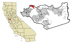
Coordinates: 38°03′09″N 122°12′47″W / 38.0525°N 122.21306°WCoordinates: 38°03′09″N 122°12′47″W / 38.0525°N 122.21306°W Country  United States
State  California
County Contra Costa Government – N/A – Senate Mark DeSaulnier (D) – Assembly Susan Bonilla (D) – U. S. Congress George Miller (D) Area[1] – Total 1.060 sq mi (2.746 km2) – Land 1.060 sq mi (2.746 km2) – Water 0 sq mi (0 km2) 0% Elevation 128 ft (39 m) Population (2010) – Total 3,094 – Density 2,918.9/sq mi (1,126.7/km2) Time zone PST (UTC-8) – Summer (DST) PDT (UTC-7) ZIP code 94525 Area code(s) 510 FIPS code 06-17274 GNIS feature ID 0277495 Crockett (formerly, Crockettville)[2] is a census-designated place (CDP) in Contra Costa County, California, United States. The population was 3,094 at the 2010 census. It is located 5 miles (8 km) west of Martinez and 5 miles (8 km) north of Richmond.[2]
Contents
Geography
According to the United States Census Bureau, the CDP has a total area of 1.1 square miles (2.8 km2), all of it land.
Crockett is located where the Carquinez Strait meets San Pablo Bay. The Carquinez Bridge, part of Interstate 80, links Crockett with the city of Vallejo to the north across the strait. To the east of Crockett along the strait are Port Costa and the city of Martinez. South of Crockett are the town of Rodeo and the city of Hercules. Farther southwest on I-80 are the cities of San Francisco and Oakland; in the opposite direction, northeast, is the capital of California, Sacramento.
History
Crockett is located on the Mexican land grant Rancho El Pinole made to Ygnacio Martinez, and is named after Joseph B. Crockett, a judge on the California Supreme Court.[2] The town started when Thomas Edwards Sr. bought the land from Judge Crockett in 1867.[2] Edwards built his home and established a company town for the C&H Sugar company.[2]
Crocketville post office was established in 1883, and the name was changed to Crockett later that year.[2]
Demographics
2010
The 2010 United States Census[3] reported that Crockett had a population of 3,094. The population density was 2,918.7 people per square mile (1,126.9/km²). The racial makeup of Crockett was 2,468 (79.8%) White, 146 (4.7%) African American, 31 (1.0%) Native American, 108 (3.5%) Asian, 24 (0.8%) Pacific Islander, 123 (4.0%) from other races, and 194 (6.3%) from two or more races. Hispanic or Latino of any race were 490 persons (15.8%).
The Census reported that 100% of the population lived in households.
There were 1,446 households, out of which 306 (21.2%) had children under the age of 18 living in them, 554 (38.3%) were opposite-sex married couples living together, 166 (11.5%) had a female householder with no husband present, 77 (5.3%) had a male householder with no wife present. There were 133 (9.2%) unmarried opposite-sex partnerships, and 22 (1.5%) same-sex married couples or partnerships. 482 households (33.3%) were made up of individuals and 158 (10.9%) had someone living alone who was 65 years of age or older. The average household size was 2.14. There were 797 families (55.1% of all households); the average family size was 2.69.
The population was spread out with 461 people (14.9%) under the age of 18, 214 people (6.9%) aged 18 to 24, 825 people (26.7%) aged 25 to 44, 1,131 people (36.6%) aged 45 to 64, and 463 people (15.0%) who were 65 years of age or older. The median age was 45.7 years. For every 100 females there were 95.9 males. For every 100 females age 18 and over, there were 95.6 males.
There were 1,649 housing units at an average density of 1,555.5 per square mile (600.6/km²), of which 808 (55.9%) were owner-occupied, and 638 (44.1%) were occupied by renters. The homeowner vacancy rate was 1.3%; the rental vacancy rate was 10.1%. 1,808 people (58.4% of the population) lived in owner-occupied housing units and 1,286 people (41.6%) lived in rental housing units.
2000
As of the census[4] of 2000, there were 3,194 people, 1,491 households, and 848 families residing in the CDP. The population density was 634.7 people per square mile (245.2/km²). There were 1,590 housing units at an average density of 315.9 per square mile (122.0/km²). The racial makeup of the CDP was 85.10% White, 3.13% Black or African American, 0.94% Native American, 2.60% Asian, 4.26% from other races, and 3.98% from two or more races. 11.62% of the population were Hispanic or Latino of any race.
There were 1,491 households out of which 21.9% had children under the age of 18 living with them, 40.1% were married couples living together, 11.3% had a female householder with no husband present, and 43.1% were non-families. 34.6% of all households were made up of individuals and 11.1% had someone living alone who was 65 years of age or older. The average household size was 2.14 and the average family size was 2.75.
In the CDP the population was spread out with 18.5% under the age of 18, 5.9% from 18 to 24, 30.6% from 25 to 44, 30.1% from 45 to 64, and 15.0% who were 65 years of age or older. The median age was 42 years. For every 100 females there were 96.2 males. For every 100 females age 18 and over, there were 93.7 males.
The median income for a household in the CDP was $48,574, and the median income for a family was $66,174. Males had a median income of $46,311 versus $31,204 for females. The per capita income for the CDP was $27,469. About 4.8% of families and 7.4% of the population were below the poverty line, including 12.1% of those under age 18 and 9.2% of those age 65 or over.
Economy
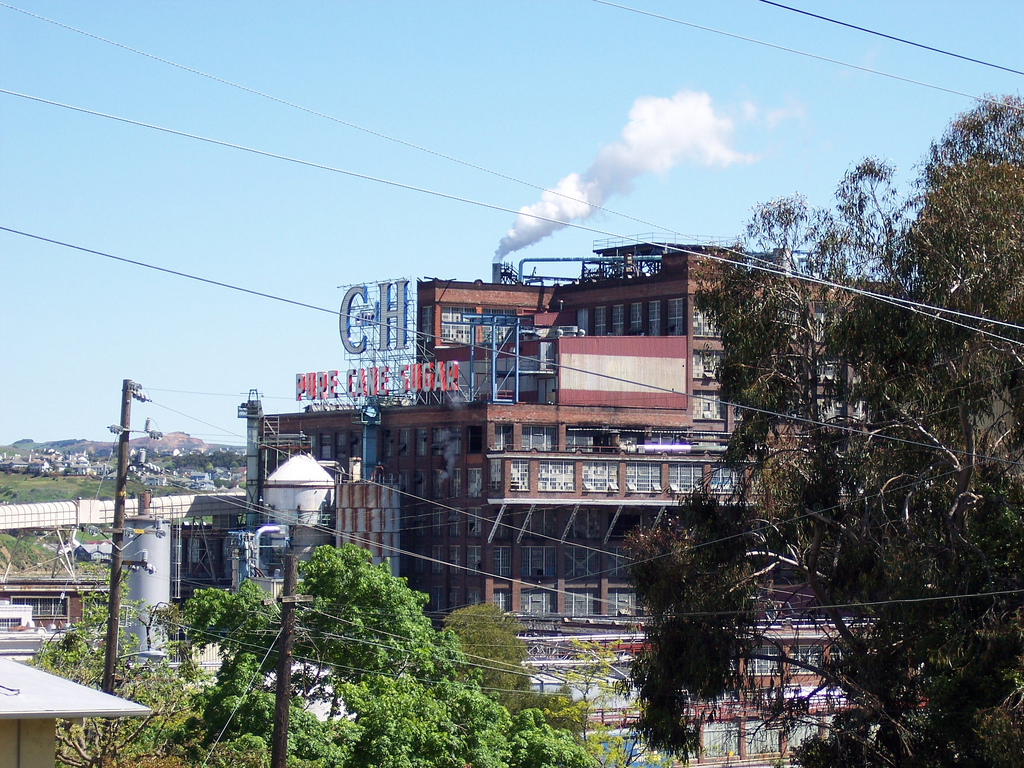
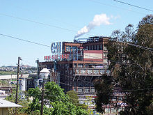 C&H Pure Cane Sugar Refinery in Crockett
Crockett is home to the corporate headquarters of C&H Sugar, a subsidiary of American Sugar Refining.[5][6]
Education
The Crockett Library of the Contra Costa County Library is located in Crockett.[6][7]
References
- ^ U.S. Census
- ^ a b c d e f Durham, David L. (1998). California's Geographic Names: A Gazetteer of Historic and Modern Names of the State. Quill Driver Books. p. 621. ISBN 9781884995149.
- ^ All data are derived from the United States Census Bureau reports from the 2010 United States Census, and are accessible on-line here. The data on unmarried partnerships and same-sex married couples are from the Census report DEC_10_SF1_PCT15. All other housing and population data are from Census report DEC_10_DP_DPDP1. Both reports are viewable online or downloadable in a zip file containing a comma-delimited data file. The area data, from which densities are calculated, are available on-line here. Percentage totals may not add to 100% due to rounding. The Census Bureau defines families as a household containing one or more people related to the householder by birth, opposite-sex marriage, or adoption. People living in group quarters are tabulated by the Census Bureau as neither owners nor renters. For further details, see the text files accompanying the data files containing the Census reports mentioned above.
- ^ "American FactFinder". United States Census Bureau. http://factfinder.census.gov. Retrieved 2008-01-31.
- ^ "Contact Us." C&H Sugar. Retrieved on April 1, 2010.
- ^ a b "Crockett CDP, California." U.S. Census Bureau. Retrieved on April 1, 2010.
- ^ "Crockett Library." Contra Costa County Library. Retrieved on April 1, 2010.
External links
Municipalities and communities of Contra Costa County, California Cities and towns 
CDPs Acalanes Ridge | Alamo | Alhambra Valley | Bay Point | Bayview | Bethel Island | Blackhawk | Byron | Camino Tassajara | Castle Hill | Clyde | Contra Costa Centre | Crockett | Diablo | Discovery Bay | East Richmond Heights | El Sobrante | Kensington | Knightsen | Montalvin Manor | Mountain View | Norris Canyon | North Gate | North Richmond | Pacheco | Port Costa | Reliez Valley | Rodeo | Rollingwood | San Miguel | Saranap | Shell Ridge | Tara Hills | Vine Hill
Unincorporated
communitiesAlamo Oaks | Arbor | Avon | Bancroft | Bayo Vista | Bayview-Montalvin | Bixler | Blackhawk-Camino Tassajara | Bridgehead | Canyon | Christie | Cornwall | Crolona Heights | Diamond | Eastport | Four Corners | Franklin Canyon | Gateley | Glen Frazer | Hasford Heights | Herpoco | Hookston | Las Juntas | Los Medanos | Luzon | Maltby | Marsh Creek Springs | McAvoy | Meinert | Monsanto | Muir | Neroly | Newlove | Nichols | Oleum | Orinda Village | Orwood | Ozol | Rheem | Rock City | Selby | Shore Acres | Sobrante | Sparkle | Stege | Tassajara | Tormey | Valle Vista | Valona | Waldon | Walnut Heights | Werner
Ghost towns Acelanus | Ambrose | Atchison | Eckley | Empire | Hooper | Horse Haven | Judsonville | Junction | Nortonville | Ohmer | Point of Timber | Port Chicago | Schmidtville | Somersville | Stewartville | Tammukan | West Hartley | Winehaven

Vallejo Selby
Tormey
Port Costa  Crockett

Rodeo Martinez Categories:- Census-designated places in Contra Costa County, California
- Populated places established in 1867
- Company towns in California


Wikimedia Foundation. 2010.