- Gilroy, California
Infobox Settlement
official_name = City of Gilroy
other_name =
native_name =
nickname = Garlic Capital of the World
settlement_type =City
motto =
imagesize =
image_caption =
flag_size =
image_
seal_size =
image_shield =
shield_size =
image_blank_emblem =
blank_emblem_type =
blank_emblem_size =
imagesize =
image_caption =
flag_size =
image_
seal_size =
image_shield =
shield_size =
image_blank_emblem =
blank_emblem_type =
blank_emblem_size =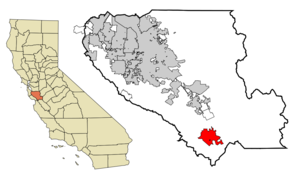
mapsize = 250x200px
map_caption = Location in Santa Clara County and the state ofCalifornia
mapsize1 =
map_caption1 =
image_dot_
dot_mapsize =
dot_map_caption =
dot_x =
dot_y =
pushpin_
pushpin_label_position =
pushpin_map_caption =
pushpin_mapsize =
subdivision_type = Country
subdivision_name =United States
subdivision_type1 = State
subdivision_name1 =California
subdivision_type2 = County
subdivision_name2 = Santa Clara
subdivision_type3 =
subdivision_name3 =
subdivision_type4 =
subdivision_name4 =
government_footnotes =
government_type =
leader_title =Mayor
leader_name = Al Pinheiro
leader_title1 =City Administrator
leader_name1 = Tom Haglund
leader_title2 =
leader_name2 =
leader_title3 =
leader_name3 =
leader_title4 =
leader_name4 =
established_title = Incorporated
established_date = March 12, 1870
established_title2 =
established_date2 =
established_title3 =
established_date3 =
area_magnitude =
unit_pref =
area_footnotes =
area_total_km2 = 41.1
area_land_km2 = 41.1
area_water_km2 = 0.02
area_total_sq_mi = 15.9
area_land_sq_mi = 15.9
area_water_sq_mi = 0.01
area_water_percent = 0.06
area_urban_km2 =
area_urban_sq_mi =
area_metro_km2 =
area_metro_sq_mi =
area_blank1_title =
area_blank1_km2 =
area_blank1_sq_mi =
population_as_of = 2008
population_footnotes =
population_note = California Department of Finance
population_total = 51,173
population_density_km2 = 1010.1
population_density_sq_mi = 2615.2
population_metro =
population_density_metro_km2 =
population_density_metro_sq_mi =
population_urban =
population_density_urban_km2 =
population_density_urban_sq_mi =
population_blank1_title =
population_blank1 =
population_density_blank1_km2 =
population_density_blank1_sq_mi =
timezone = PST
utc_offset = -8
timezone_DST = PDT
utc_offset_DST = -7
latd = 37 |latm = 0 |lats = 43 |latNS = N
longd = 121 |longm = 34 |longs = 48 |longEW = W
elevation_footnotes =
elevation_m = 61
elevation_ft = 200
postal_code_type =ZIP code s
postal_code = 95020-95021
area_code = 408
blank_name = FIPS code
blank_info = 06-29504
blank1_name = GNIS feature ID
blank1_info = 0277523
website = http://www.ci.gilroy.ca.us/
footnotes =Gilroy (IPAEng|ˈgɪlrɔɪ) is the southernmost city in Santa Clara County,
California , USA. According to theUnited States 2000 Census , the city population was 41,464. TheCalifornia Department of Finance estimates that the population had grown to 51,173 as of January 1, 2008, making it the 173rd largest city in the state. Gilroy is well known for itsgarlic crop; theGilroy Garlic Festival which occurs annually, featuring various garlicky foods including garlicice cream . Gilroy also producesmushroom s in considerable quantity.Approximately eight miles northeast of Gilroy, via Gilroy Hot Springs Road, lies the famous Victorian resort
Gilroy Yamato Hot Springs , aCalifornia Historical Landmark . Gilroy also is home to theGilroy Premium Outlets , a large shopping center consisting entirely of outlet stores.Long-time local landmarks include Gilroy Gardens Family Theme Park, formerly Treehaven, Hecker Pass...A Family Adventure, (a venue for corporate picnics and birthday parties). The park is located along SR152 west of town. Past Gilroy Gardens on SR152 about 12 driving miles west of town is
Mount Madonna County Park . Another large presence is the Gilroy Foods plant at coor dms|37|00|06|N|121|32|27|W.Cattle, garlic, and strawberries, occupy acres toward Hollister and San Martin.
Climate
Due to the moderating influence of the
Pacific Ocean , Gilroy enjoys a mild,Mediterranean climate . Temperatures range from an average midsummer maximum of 32.3°C (90.2°F) to an average midwinter low of 0.9°C (33.6°F). Average annual precipitation is 480 mm (18.9 in), and the summer months are typically dry. Snowfall is rare, about once every 20 years, and is light and short-lived when it occurs. Summer months are characterized by coastal fog which arrives from the ocean around 10 p.m. and dissipates the next morning by 10 a.m. Winter months have many sunny and partly cloudy days, with frequent breaks between rainstorms. The local terrain is inconducive totornado es, severe windstorms and thunderstorms. The local climate supportschaparral and grasslandbiome s, with stands oflive oak at higher elevations.History
Trailblazers led by Father Junípero Serra began to arrive in the area in the 1770s, and in 1797
Mission San Juan Bautista was established near the Pajaro River. The village of San Ysidro (not to be confused with the present-day San Diego community) grew nearby, at the foot ofPacheco Pass which linked the El Camino Real and theSanta Clara Valley with theSan Joaquin Valley . California's main export at this time wastallow and thousands of barrels were produced and shipped to the rest ofNew Spain . Trade and diplomatic intercourse with foreigners was strictly forbidden by the royal government but was quietly performed byCalifornios desperate for luxury goods).During theWar of 1812 , the armed merchantman "Isaac Todd" [cite web | title=Article - "Isaac Todd" | publisher=The Canadian Encyclopedia | url=http://www.thecanadianencyclopedia.com/index.cfm?PgNm=TCE&Params=A1ARTA0004070 | accessdate=2007-01-14] was sent by theNorth West Company to seizeFort Astoria , an American trading post at the mouth of theColumbia River . The ship departed fromPortsmouth, England , made its way aroundCape Horn and proceeded up the Pacific coast of the Americas, stopping at Spanish ports for supplies along the way. In January 1814, the "Todd" arrived at thePresidio of Monterey . During the visit, ordinary seaman John Gilroy (a Scotsman who had changed his name from John Cameron when he went to sea to avoid recognition) either jumped ship [cite web | title=Historical plaque | publisher=E Clampus Vitus Chapter 1850 | url=http://www.mountaincharlie1850.org/pl_gilroy_john.html | accessdate=2007-01-14] or, depending on the historical source, was left ashore to recover fromscurvy . [cite web | title="San Francisco History - The Beginning" | publisher=San Francisco Genealogy | url=http://www.sfgenealogy.com/sf/history/hbbeg12.htm | accessdate=2007-01-14] In any event he found his way to San Ysidro, converted to Roman Catholicism and became the first non-Spanish settler in Alta California legally recognized by the Spanish crown. More Americans and Europeans entered the region over time, but the area remained under the control of Spain (and after 1821, independentMexico ); Gilroy married the daughter of his employer and eventually becamealcalde of the village himself. [cite web | title="South County towns' names rich in history" | publisher=Gilroy Dispatch | url=http://www.gilroydispatch.com/printer/article.asp?c=4764 | accessdate=2007-01-14]When the annexation of California by the United States in 1848 was followed by thediscovery of gold in the Sierra Nevada, the trickle of immigrants from the eastern statesbecame frequent. As many of the original
Californio landowners sold off their land, lostit to squatters or were dispossessed through title hearings, the area around San Ysidro became known as Pleasant Valley. OnMarch 12 ,1870 it was officially incorporated by the state legislature as the town of Gilroy (John Gilroy had died in 1869 [cite web | title="A trip to the gold mines of California in 1848 | publisher=California, First Person Narratives | url=http://memory.loc.gov/cgi-bin/query/r?ammem/calbk:@field(DOCID+@lit(calbk087div4))#N1-6 | accessdate=2007-01-14] ). By then the town center had been relocated west of the El Camino Real (the locale of the original village is today a sparsely populated area known as Old Gilroy). Cattle ranching and timber from the nearbySanta Cruz Mountains were important to the economy for some time, but as in the rest of the valley agriculture was the town's greatest source of income. Farming remains significant, but in the 1970s the city began evolving into a bedroom community for Silicon Valley to the north.There are a number of extant historical buildings dating from the mid-nineteenth century. Built in 1857, the Christian Church at 160 Fifth Street is the oldest wood framed church in Santa Clara County in continuous use.Blacksmith George Eustice's house at 213 Fifth Street was constructed in 1869; Eustice was aCivil War veteran who fought at Gettysburg. Samuel Moore was a long time Gilroypostmaster , whose home was built in the 1870s at 7151 Church Street. [Santa Clara County Heritage Resource Inventory", Santa Clara County Historical Heritage Commission, published by Santa Clara County, San Jose, Ca., June, 1979] Nearby to the northeast is the historic resort siteGilroy Yamato Hot Springs , developed in the late 1800s.Telephony history
Continental Telephone offered manual telephone service until the arrival of dial phones in the late 1940s. Manual service in Gilroy used magneto phones which required the user to turn a crank in order to generate ringing battery, ringing the operator's switchboard. There were dry cell batteries inside the phones to provide talk battery.
Some manual service in rural Gilroy was on party lines with complicated ringing schemes. Users heard their own rings and rings directed at other party line users. In theory, subscribers only answered their own ring. One rancher reported his ring to be, "two long and two short." You could call someone on your own party line if you knew their ring. If their ring was "two short," for example, you would turn the magneto crank to generate two short rings and then wait on the line. If you didn't know their ring, the operator would help you. Some manual service customers had private lines. With the acquisition of ConTel by General Telephone in the 1980s, Gilroy now has service from Verizon (General Telephone, or GTE, became part of Verizon in June 2000).
Geography and environment
Gilroy is located at coor dms|37|0|43|N|121|34|48|W (37.012048, -121.580080).GR|1 It is approximately 26 km (16 mi) south of
San Jose, California (Bailey Avenue (37.206770, -121.729150) to Monterey/Day Road (37.038210, -121.584480)) on U.S. Route 101 and 31 km (19.2 mi) inland from the Pacific Coast. Lying in a southern extension of theSanta Clara Valley at an elevation of about 61 m (200 ft) above MSL, it is bounded by theSanta Cruz Mountains to the west and theDiablo Range to the east. According to theUnited States Census Bureau , the city has a total area of 41.1 km² (15.9 mi²). 41.1 km² (15.9 mi²) of it is land and 0.06% is water.Contributing to
environmental noise are primarily U.S. Route 101, El Camino Real, Leavesley Road and other major arterials. The number of people exposed to sound levels above 60 CNEL is approximately 4,000. [C. Michael Hogan, Ballard George and Marc Papineau, "Noise Element of the General Plan", Earth Metrics, published by the city of Gilroy (1982)] In addition, the Gilroy Foods plant east of Highway 101 generates a garlicky odor that can spread all the way to the southern suburbs of San Jose, about convert|20|mi|km north.Demographics
As of the
United States 2000 Census ,GR|2 there were 41,464 people, 11,869 households, and 9,590 families residing in the city. The California Department of Finance estimates that the population had grown to 51,173 as of January 1, 2008, making it the 173th largest city in the state. Thepopulation density was 1,010.1/km² (2,615.2/mi²). There were 12,152 housing units at an average density of 296.0/km² (766.5/mi²). The racial makeup of the city was 58.91% White, 1.80% African American, 1.59% Native American, 4.37% Asian, 0.25% Pacific Islander, 27.73% from other races, and 5.35% from two or more races. 53.78% of the population were Hispanic.There were 11,869 households out of which 47.7% had children under the age of 18 living with them, 60.8% were married couples living together, 14.2% had a female householder with no husband present, and 19.2% were non-families. 14.3% of all households were made up of individuals and 5.9% had someone living alone who was 65 years of age or older. The average household size was 3.46 and the average family size was 3.74. The age distribution is: 32.6% under the age of 18, 10.0% from 18 to 24, 32.7% from 25 to 44, 18.0% from 45 to 64, and 6.8% who were 65 years of age or older. The median age was 30 years. For every 100 females there were 99.3 males. For every 100 females age 18 and over, there were 98.6 males.
The median income for a household in the city was $77,120, and the median income for a family was $65,330. Males had a median income of $45,759 versus $34,710 for females. The
per capita income for the city was $22,071. 10.4% of the population and 7.3% of families were below thepoverty line . 12.8% of those under 18 and 6.5% of those 65 and older are below the poverty line.Economy
Arts and culture
Annual cultural events
*
Gilroy Garlic Festival Parks and recreation
* [http://www.sccgov.org/portal/site/parks Coyote Lake-Harvey Bear Ranch County Park] , immediately east of Gilroy
*Gilroy Gardens , a few miles west of Gilroy on State Route 152.Politics
In the state legislature Gilroy is located in the 13th Senate District, represented by Democrat
Elaine Alquist , and in the 28th Assembly District, represented by DemocratAnna M. Caballero . Federally, Gilroy is located inCalifornia's 15th congressional district , which has a Cook PVI of D +14 [cite web | title = Will Gerrymandered Districts Stem the Wave of Voter Unrest? | publisher = Campaign Legal Center Blog | url=http://www.clcblog.org/blog_item-85.html | accessdate = 2008-02-10] and is represented by DemocratMike Honda .Education
*
Gavilan College
*Gilroy High School Media
Print
* "
Gilroy Dispatch "Infrastructure
Transportation
Major highways
* U.S. Route 101
* State Route 152 – Several proposals to improve eastbound State Routes 152 and 156 are stalled because of funding concerns.Public transportation
* The
Santa Clara Valley Transportation Authority provides local buses and express buses to San Jose and Sunnyvale. [cite web |url=http://www.vta.org/schedules/pdf/bus_rail_map_h.pdf |accessdate=2008-02-14 |publisher=Santa Clara Valley Transportation Authority |title="Gilroy and Morgan Hill Service"]
*Caltrain provides weekday rush-hourcommuter rail service to theSanta Clara Valley and theSan Francisco Peninsula . [cite web |url=http://caltrain.com/timetable.html |accessdate=2008-02-14 |publisher=Caltrain |title="Caltrain timetable effective April 2, 2007"]
*Amtrak California 'sCapitol Corridor line runs a San Jose-Santa BarbaraThruway Motorcoach connection with a stop in Gilroy. [cite web |url=http://amtrakcapitols.com/included/docs/schedules/train_schedules.pdf |accessdate=2008-02-14 |publisher=Amtrak California |title="Train & Bus Schedules"]
*Monterey-Salinas Transit 's Line 55, which stops in Gilroy, is a rush-hour San Jose-Monterey express bus that also serves as an AmtrakThruway Motorcoach connection. [cite web |url=http://www.mst.org/routes/55/index.htm |accessdate=2008-02-14 |publisher=Monterey-Salinas Transit |title="Line 55 Monterey - San Jose Express"]
*San Benito County Express provides intercounty bus service to Hollister and San Juan Bautista. [cite web |url=http://www.sanbenitocountyexpress.org/media/RedoneSpringGav08.pdf |accessdate=2008-02-14 |publisher=San Benito County Express |title="Intercounty Routes"]Utilities
Healthcare
Notable natives and residents
*
Jeff Garcia ,NFL quarterback
*Robert Guerrero , two-timeIBF Featherweight Champion Sister cities
*flagicon|Italy
Monticelli d'Ongina ,Italy
*flagicon|Japan Takko,Japan
*flagicon|FranceSaint-Clar ,France
*flagicon|MexicoTecate ,Mexico
*flagicon|Portugal flagicon|AzoresAngra do Heroísmo ,Azores ,Portugal
*flagicon|PalauKoror ,Palau References
External links
* [http://www.ci.gilroy.ca.us City of Gilroy Official Web site]
** [http://www.ci.gilroy.ca.us/living/history01.html Brief history of Gilroy]
* [http://www.gilroyedc.org Gilroy Economic Development Corp.]
* [http://www.gilroy.org Gilroy Chamber of Commerce]
* [http://www.gilroyvisitor.org Gilroy Visitors Bureau]
* [http://www.downtowngilroy.com/ Gilroy Downtown Business Assoc.]
* [http://www.gilroypres.org Gilroy Presbyterian Church - one of the oldest Presbyterian churches in the State of California]
* [http://www.gilroyedc.org/datacenter.htm Demographic Information from Gilroy Economic Development Corp.]
* [http://quickfacts.census.gov/qfd/states/06/0629504.html Demographic Information from U.S. Census]
* [http://www.city-data.com/city/Gilroy-California.html Demographic Information from City-Data.com]
* [http://www.epodunk.com/cgi-bin/genInfo.php?locIndex=10205 Demographic Information from Epodunk.com]
* [http://bard.wr.usgs.gov/historical/jpg/morganhill1917r47.jpg1917 map of area.]
Wikimedia Foundation. 2010.