- Sunnyvale, California
Infobox Settlement
official_name = City of Sunnyvale, California
other_name =
native_name =
nickname =
settlement_type =City
motto =
imagesize =
image_caption =
flag_size =
image_
seal_size =
image_shield =
shield_size =
image_blank_emblem =
blank_emblem_type =
blank_emblem_size =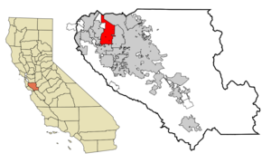
mapsize = 250x200px
map_caption = Location in Santa Clara County and the state ofCalifornia
mapsize1 =
map_caption1 =
image_dot_
dot_mapsize =
dot_map_caption =
dot_x =
dot_y =
pushpin_
pushpin_label_position =
pushpin_map_caption =
pushpin_mapsize =
subdivision_type = Country
subdivision_name =United States
subdivision_type1 = State
subdivision_name1 =California
subdivision_type2 = County
subdivision_name2 = Santa Clara
subdivision_type3 =
subdivision_name3 =
subdivision_type4 =
subdivision_name4 =
government_footnotes =
government_type =
leader_title =Mayor
leader_name = Anthony (Tony) Spitaleri
leader_title1 =
leader_name1 =
leader_title2 =
leader_name2 =
leader_title3 =
leader_name3 =
leader_title4 =
leader_name4 =
established_title =
established_date =
established_title2 =
established_date2 =
established_title3 =
established_date3 =
area_magnitude = 1 E8
unit_pref =
area_footnotes =
area_total_km2 = 58.6
area_land_km2 = 55.8
area_water_km2 = 1.8
area_total_sq_mi = 22.6
area_land_sq_mi = 21.9
area_water_sq_mi = 0.7
area_water_percent =
area_urban_km2 =
area_urban_sq_mi =
area_metro_km2 =
area_metro_sq_mi =
area_blank1_title =
area_blank1_km2 =
area_blank1_sq_mi =
population_as_of = 2000
population_footnotes =
population_note =
population_total = 131760
population_density_km2 = 2318.7
population_density_sq_mi = 6006.5
population_metro =
population_density_metro_km2 =
population_density_metro_sq_mi =
population_urban =
population_density_urban_km2 =
population_density_urban_sq_mi =
population_blank1_title =
population_blank1 =
population_density_blank1_km2 =
population_density_blank1_sq_mi =
median_family_income_as_of = 2000
median_family_income = 81634
timezone = PST
utc_offset = -8
timezone_DST = PDT
utc_offset_DST = -7
latd = 37 |latm = 22 |lats = 19 |latNS = N
longd = 122 |longm = 1 |longs = 34 |longEW = W
elevation_footnotes =
elevation_m = 39
elevation_ft = 128
postal_code_type =ZIP code s
postal_code = 94085-94090
area_code = 408
blank_name = FIPS code
blank_info = 06-77000
blank1_name = GNIS feature ID
blank1_info = 1656344
website = http://www.sunnyvale.ca.gov/
footnotes =Sunnyvale (IPA| [sʌniveil] or IPA| [sʌnivɛl] ) is a city in Santa Clara County,
California ,United States . It is one of the major cities that make up theSilicon Valley . As of the 2000 census, the city population was 131,760.The city is bordered by the
San Francisco Bay and San Jose to the north,Moffett Federal Airfield to the northwest, Mountain View to the west, Los Altos to the southwest, Cupertino to the south, and Santa Clara to the east. It lies along the historic El Camino Real and Highway 101.As part of the
Silicon Valley , Sunnyvale isheadquarters to severalhigh-tech companies such asMaxim Integrated Products ,Juniper Networks ,Palm, Inc. ,AMD ,NetApp ,Spansion ,Yahoo! ,Mirapoint , andAriba . Sunnyvale is also home to several aerospace/defense companies;Lockheed Martin has a major facility in Sunnyvale, andHoneywell ,Northrop Grumman Electronic Systems - Marine Systems (location of the Hendy Iron Works Museum), and Spirent Communications also have offices in Sunnyvale. Sunnyvale is also the home toOnizuka Air Force Station , where its main building locally know as the "The Blue Cube" is its most prominent feature. The base, named for the deceasedSpace Shuttle Challenger astronautEllison Onizuka , is the primaryartificial satellite control facility of theUnited States armed forces .Sunnyvale is one of the few U.S. cities to have a single unified
Department of Public Safety , where all personnel are trained asfirefighter s,police officer s, and EMTs, so they can respond to an emergency in any of the three roles.Library services for the city are provided by the
Sunnyvale Public Library , located at the Sunnyvale Civic Center.Geography
Sunnyvale is located at coor dms|37|22|7.56|N|122|2|13.4|W|GR|1.
According to the
United States Census Bureau , the city has a total area of 22.6square mile s (58.6km² ), of which, 21.9 square miles (55.8 km²) of it is land and 0.7 square miles (1.8 km²) of it (3.05%) is water. The elevation is 130 feet above sea level.Climate
Like most of the San Francisco Bay area, Sunnyvale has a mild, temperate climate and, as can be inferred from the name, is quite bright even on overcast days. Average daytime summer temperatures hover between convert|85|F|lk=on and convert|95|F, and during the winter, average daytime temperatures rarely go below convert|45|F.
On
May 4 1998 , during an unusually strong thunderstorm, Sunnyvale and its neighbor Los Altos were hit by two freaktornadoes of nearly F2 intensity, causing upwards of $4 million in property damage. No serious injuries were reported. Tornadoes are virtually unheard of in theSan Francisco Bay Area , and these were even stranger because they exhibitedanticyclonic rotation . [ [http://tornado.sfsu.edu/geosciences/StormChasing/Cases/Sunnyvale/Sunnyvale.html "Sunnyvale and Los Altos, CA Tornadoes"] , San Francisco State University, Department of Geosciences ] [ [http://www.svcn.com/archives/sunnyvalesun/05.06.98/CoverStory.html "Hit and Run: Freak tornado injures no one, but leaves behind costly damage,"] , The Sun (Sunnyvale's Newspaper),May 6 ,1998 ]On February 5, 1976, measurable snowfall occurred in Sunnyvale and most of the
San Francisco Bay Area .History
When the Spanish first arrived in the 1770s at the
Santa Clara Valley , it was heavily populated by theOhlone . In 1777, Mission Santa Clara was built by Ohlone converts toChristianity .In 1842, "Rancho Pastoria de las Borregas" was granted to Estrada and Inez Castro. Portions of the land given in this grant later developed into the cities of Mountain View and Sunnyvale. Two years later, in 1844, another land grant was provided to Lupe Yñigo, one of the few Native Americans to hold land grants. His land grant was first called "Rancho Posolmi", named in honor of Posolmi village of the
Ohlone that once stood in the area. "Rancho Posolmi" was later known as "Rancho Ynigo".In 1844, Martin Jr. and Mary Murphy left
Missouri and traveled bywagon along theCalifornia Trail to successfully cross the Sierra Nevada. In 1850, Martin Murphy Jr. bought a piece of "Rancho Pastoria de las Borregas" for $12,500. Murphy established a wheat farm and "Bay View". Murphy had the first frame house, which was shipped fromNew England , in Santa Clara County built. When he died in 1884, his land was divided among his heirs.In 1860, The San Francisco and San Jose Railroad agreed to use "Murphy Station" and was allowed to lay tracks on "Bay View". "Lawrence Station" was later established on the southern edge of "Bay View".
In the 1870s, county property tax laws, imports and soil degradation caused wheat farming to become uneconomical in Santa Clara County. Small fruit orchards replaced the large wheat farms. In 1871, James and Eloise Dawson established the first fruit cannery in Santa Clara County. Fruit agriculture and canning soon became a major industry in the county. The invention of the refrigerated rail car further increased the viability of an economy based upon fruit. The fruit orchards become so prevalent that in 1886, the San Jose Board of Trade called Santa Clara County the "Garden of the World".
In the 1880s, Chinese workers made up 48% of the farm labor in Santa Clara County. This percentage reduced over time after the Chinese Exclusion Act was passed. In the following decade, the 1890s, multitudes of immigrants from
Italy , theAzores ,Portugal , andJapan arrived to work in the orchards.In 1897, Walter Everett Crossman bought 200 acres (809,000 m²) and began selling real estate. He advertised the area as "Beautiful Murphy". Later, in the 1900s, real estate developer Walter Crossman described it as "the City of Destiny".
Also in 1897, Encina school opened as the first school in Murphy. Previously, children in the town had to travel to Mountain View for school.
In 1901, the residents of Murphy were informed they could not use the names Encinal or Murphy for their post office. They decided to use the name Sunnyvale for the name of their town.
Sunnyvale continued to grow and in 1904,
dried fruit production began. In 1906, theJoshua Hendy Iron Works relocated from San Francisco to Sunnyvale after the company's building was destroyed by fire after the 1906 earthquake. The ironworks was the first non-agricultural industry in the town. The Joshua Hendy Iron Works switched from producing mining equipment to other products such as marinesteam engine s. In this same year, Libby, McNeill & Libby, aChicago meat-packing company, decided to open its first fruit packing factory in Sunnyvale. Today, a water tower painted to resemble the first Libby's fruit cocktail can label identifies the former site of the factory.In 1912, the residents of Sunnyvale voted to incorporate, and Sunnyvale finally became an official city.
Fremont High School first opened in 1923. It served as a military base before the school opened and through WWII; planes flying to/from Moffett field, which opened in 1933, commonly stopped here for fuel top-offs. A 1948 yearbook shows a military aircraft parked at one of the buildings as students watch nearby. Fremont High School has old military buildings on its campus including a
Quonset hut installed after WWII, now used as a wrestling team facility.In 1930, Congress decided to place the West Coast
dirigible base in Sunnyvale. This naval airstation was later renamedMoffett Federal Airfield .In 1939, the National Advisory Committee for Aeronautics (NACA, the forerunner of
NASA ) began research at Ames Laboratory.came to Sunnyvale to fill this void of workers.
Following the war, the fruit orchards and
sweetcorn farms were cleared to build homes, factories and offices. In 1956, the aircraft manufacturer Lockheed moved its headquarters to Sunnyvale. In 1969,AMD was founded and based in Sunnyvale.The first prototype of "
Pong ", one of the first arcade videogames, was installed in Sunnyvale in September 1972, in a bar named Andy Capps, [ [http://www.arcade-history.com/?n=pong&page=detail&id=2007 "Pong, video game"] at arcade-history.com] [Scott Cohen, "Zap! The Rise and Fall of Atari", ISBN 0070115435 (McGraw-Hill, 1984)] now Rooster T. Feathers. [ [http://www.google.com/url?sa=t&ct=res&cd=1&url=http%3A%2F%2Fsunnyvale.ca.gov%2FNR%2Frdonlyres%2FC16EEEB1-3A82-41D5-90EF-7D16321DC754%2F0%2Fsvalebikeflyer.pdf&ei=XRuqSKD6JoSs8ASYwLgo&usg=AFQjCNHIoLlnlDRCdNQVJTcI6AWI2-e1Nw&sig2=J5kI_wJvwQ6As6-gKphQdQ City of Sunnyvale Heritage Bicycle Tours] ]By 2003, the few remaining orchards owned by C.J. Olson and the commercial orchards next to Las Palmas Park were demolished and replaced with homes and shops. However, there are still city-owned orchards, such as the Heritage Orchard next to the Sunnyvale Community Center.
In 2003 the enclosed "Sunnyvale Town Center Mall", built in 1979, was slated to be replaced by a mixed-use shopping and residential development (somewhat akin to a smaller-version Santana Row in San Jose); and was expected to extend the success of S. Murphy Avenue and reestablish a "downtown" for Sunnyvale. The proposed "Silicon Valley Wave Mall" project stalled in 2005. In 2007, the City Council approved the transfer of the project and the property to a new developer. Primary demolition has been finished, and the new parking garage west of Macy's is structurally complete and is slated to open in October of 2008. Five-story office towers are underway and tractors are constantly at work on the project. The two anchor stores (Macy's and Target) at either end of the vacant land are still open for business. In addition, there is still the adjacent block-long traditional downtown area on S. Murphy Avenue (between Evelyn and Washington) with popular restaurants and stores. The new project is to be called "The Shops at Downtown Sunnyvale" and is scheduled to open Fall 2009. Advertising of the apartments to be located on upper levels of buildings has begun and planning is underway for further apartments on the site of demolished components of the adjacent "Town and Country Center." To be Dubed "The Terraces" [ [http://www.retailwestinc.com Retail West Inc ] ]
In September 2008, the
Sunnyvale Heritage Park Museum was dedicated and opened to the general public.Demographics
of any race.
There were 52,539 households out of which 27.6% had children under the age of 18 living with them, 50.0% were married couples living together, 8.2% had a female householder with no husband present, and 37.8% were non-families. 27.1% of all households were made up of individuals and 6.4% had someone living alone who was 65 years of age or older. The average household size was 2.49 and the average family size was 3.06.
In the city the population was spread out with 20.4% under the age of 18, 7.7% from 18 to 24, 41.3% from 25 to 44, 19.9% from 45 to 64, and 10.6% who were 65 years of age or older. The median age was 34 years. For every 100 females there were 105.9 males. For every 100 females age 18 and over, there were 106.5 males.
Under the 2000 Census, the median
income for a household in the city was $74,409, and the median income for a family was $81,634, but under the Census Bureau's 2006 estimates, these figures have risen to $79,926 and $98,568, respectively. [ [http://factfinder.census.gov/servlet/ACSSAFFFacts?_event=Search&geo_id=16000US0660018&_geoContext=01000US%7C04000US06%7C16000US0660018&_street=&_county=sunnyvale&_cityTown=sunnyvale&_state=04000US06&_zip=&_lang=en&_sse=on&ActiveGeoDiv=geoSelect&_useEV=&pctxt=fph&pgsl=160&_submenuId=factsheet_1&ds_name=ACS_2006_SAFF&_ci_nbr=null&qr_name=null®=null%3Anull&_keyword=&_industry= Sunnyvale city, California: 2006 American Community Survey] (U.S. Census Bureau)]Under the 2000 Census, males had a median income of $65,165 versus $43,051 for females. The
per capita income for the city was $36,524. About 3.7% of families and 5.4% of the population were below thepoverty line , including 5.5% of those under age 18 and 5.2% of those age 65 or over.Politics
In the state legislature Sunnyvale is located in the 13th Senate District, represented by Democrat
Elaine Alquist , and in the 22nd Assembly District, represented by DemocratSally Lieber . Federally, Sunnyvale is located inCalifornia's 14th congressional district , which has a Cook PVI of D +18 [cite web | title = Will Gerrymandered Districts Stem the Wave of Voter Unrest? | publisher = Campaign Legal Center Blog | url=http://www.clcblog.org/blog_item-85.html | accessdate = 2008-02-10] and is represented by DemocratAnna Eshoo . The mayor and vice-mayor of Sunnyvale are not directly elected. Instead they are selected from the city council members by the city council, serving two-year and one-year terms, respectively.Neighborhoods
Sunnyvale has several neighborhoods, and while they are not "official" enough to be named on a map, they are the principal designations that are used by the many neighborhood associations recognized by the city. [ [http://sunnyvale.ca.gov/Departments/Office+of+the+City+Manager/Community+Resources/Community+Outreach/2)+Neighborhood+Associations.htm City of Sunnyvale Neighborhood Associations] ] These neighborhoods include
* Birdland - a residential area with streets named after birds, primarily containing single family homes, occupying the south-easternmost section of the city.
* Lakewood Village - a residential area in the north-eastern section of the city surrounding Lakewood Park, and primarily consisting of single family homes and mobile homes.
* Heritage District - a residential and commercial area in the central part of the city, including the downtown shopping area commonly referred to as the Town Center.
* Cherry Chase - a residential area primarily consisting of single-family homes in the western part of the city, centered around the Cherry Chase Elementary School.The City of Sunnyvale maintains a neighborhood association registry.
The southern half of Sunnyvale is predominantly residential, while most of the portion of Sunnyvale north of U.S. Highway 101 is zoned for industrial use. [ [http://sunnyvale.ca.gov/NR/rdonlyres/13C6FE4D-96D6-48D7-86A9-7545A56A336D/0/ZoningNorthof101.pdf City of Sunnyvale Zoning Map] , north of 101]
The far eastern section of El Camino Real in Sunnyvale has a significant concentration of businesses owned by South Indian immigrants. [ [http://www.hindu.com/mag/2004/05/02/stories/2004050200610800.htm A `Little Madras' here too ....] , "The Hindu", Online edition of India's National Newspaper,
May 2 ,2004 (article about the South Indian business district along El Camino Real in Sunnyvale)]The area of the city bounded by Fremont Avenue & Cupertino to the South, and Los Altos to the West, is considered to be more desirable to reside as measured by home values.Fact|date=July 2007
There are many parks in the Sunnyvale Area. These include Las Palmas Park, [Sunnyvale Department of Parks and Recreation, [http://www.sunnyvale.ca.gov/Departments/Parks+and+Recreation/Parks/Las+Palmas+Park.htm Las Palmas Park] ] Ortega Park, [Sunnyvale Department of Parks and Recreation, [http://www.sunnyvale.ca.gov/Departments/Parks+and+Recreation/Parks/Ortega+Park.htm Ortega Park] ] Washington Park [Sunnyvale Department of Parks and Recreation, [http://sunnyvale.ca.gov/Departments/Parks+and+Recreation/Parks/Washington+Park.htm Washington Park] ] near downtown, two public golf courses, [Sunnyvale Department of Parks and Recreation, [http://sunnyvale.ca.gov/Departments/Parks+and+Recreation/Parks/Golf+Courses.htm Sunnyvale Golf Courses] ] and Baylands Park, [Sunnyvale Department of Parks and Recreation, [http://sunnyvale.ca.gov/Departments/Parks+and+Recreation/Parks/Baylands/ Baylands Park] ] site of the annual
Linux Picnic.Transportation
Sunnyvale is served by the
Santa Clara Valley Transportation Authority (bothlight rail andbuses ) and theCaltrain commuter rail. The SR 85, US 101, SR 237, and I-280 freeways run through the city. A segment of State Route 82 runs through the center of the city, following the path of historic El Camino Real. Sunnyvale has also been listed by theLeague of American Bicyclists as a [http://www.bicyclefriendlycommunity.org/AllBicycleFriendlyCommunities.htm Bicycle Friendly Community] at the bronze level, having multiple on-street and off-street bike lanes, bicycle-activated traffic signals, and bicycle accommodations on both VTA andCaltrain . The [http://sunnyvale.ca.gov/City+Council/Boards+and+Commissions/Bicycle+and+PED/ Bicycle and Pedestrian Advisory Committee] advises the city council on the continued development of the bicycle plan for the city.Sunnyvale has wide and well maintained roads. Most large streets, such as El Camino Real, have a large, landscaped center median.
For commercial passenger air travel, Sunnyvale is well served by three nearby international airports. The closest, Norman Y. Mineta
San Jose International Airport (SJC) is a 9.5 mile drive from downtown Sunnyvale by car. It is also accessible by Caltrain, VTA light rail and VTA bus (with both the Caltrain and Light Rail stations requiring transfer to a free shuttle bus to get to the airport terminal). The next closest isSan Francisco International Airport (SFO), which is 27.7 miles by car. SFO is also transit accessible via Caltrain andBay Area Rapid Transit (BART). The MetropolitanOakland International Airport (OAK), which is 37.5 miles by car. Access to Oakland airport by public transit is possible via multiple transfers.Crime
Sunnyvale has consistently ranked as one of the safest ten cities (for cities of similar size) in the United States according to the FBI's crime reports. From 1966 to at least 2004, Sunnyvale never placed below fifth in safety rankings among U.S. cities in its population class. [ [http://sunnyvale.ca.gov/News+Releases/2004+News+Releases/July+to+December/11-08.htm City of Sunnyvale News Release No. 11-08] ,
November 22 ,2004 ] In 2005, Sunnyvale ranked as the 18th-safest city overall in the U.S., according to the Morgan Quitno Awards. [Morgan Quitno Awards, [http://www.morganquitno.com/cit05pop.htm#CITIES "11th Annual America's Safest (and Most Dangerous) Cities"] (undated)] In spite of this ranking, Sunnyvale does have somegang crime. The primary sources of this type of crime is the Norteño affiliated Varrio Via Sol, and theSureño affiliated Sunnyvale Sur Trece. [ [http://www.svcn.com/archives/sunnyvalesun/20050427/sv-cover.shtml "Gang Related: Sunnyvale is trying to prevent gang involvenment" (sic)] , The Sun,April 27 ,2005 ]The gang activity is considered far below that of street gangs located in Southern California and is addressed by the city through after-school programs and a "Zero Tolerance" policy for gang-related crimes. [ [http://www.usmayors.org/USCM/best_practices/community_policing_2006/gangBP_2006.pdf "Best Practices of Community Policing in: Gang Intervention and Gang Violence (2006)"] , U.S. Conference of Mayors: Best Practices Center (2006), at pp. 133-34]
Folklore
A long standing legend of Sunnyvale is of a ghost that haunts the town's Toys 'R' Us store. A purported psychic, Sylvia Browne, claims to have made contact with the ghost on the 1978 TV show "That's Incredible" and has named him Johny Johnson. She claims that he had been a farm hand who worked in the orchard where the toy store now stands. She says he bled to death from an accidental, self-inflicted axe injury to his leg. [ [http://www.snopes.com/horrors/ghosts/toysrus.htm "Haunted Toys 'R' Us"] , snopes.com,
January 16 ,2007 , citing Gina Boubion, "Ghost Lets Playful Side Show in Pranks at Haunted Toy Store", The Houston Chronicle,April 26 ,1993 , p. A2; and Dan Koeppel, "Ghost Sightings Aren't Spooking Sales at Toys 'R' Us", Chicago Tribune,June 23 ,1991 , p. C8] [ Ghost Research Society, [http://www.ghostresearch.org/ghostpics/toys_r_us.html Toys 'R Us Ghost] ]unnyvale people
* Francie Larrieu Smith (Olympic runner) attended Fremont High School.
*
Teri Hatcher (actress on television's "Desperate Housewives " and "") was raised in Sunnyvale. She attended Mango Junior High School (now known asSunnyvale Middle School ) and Fremont High School.*
Brian Boitano (Olympic figure skater) is from Sunnyvale and attendedPonderosa Elementary School .* Dr.
Andrew Fire (2006Nobel Laureate in medicine) grew up in Sunnyvale, where he attended Fremont High School, Mango Junior High School (nowSunnyvale Middle School ), and Hollenbeck Elementary School (nowChallenger Private School ).*
Landon Curt Noll (astronomer, cryptographer and mathematician) youngest to world record for thelargest known prime 3 times.*
Troy Tulowitzki (Major League Baseball player for theColorado Rockies ) grew up in Sunnyvale. He attended Columbia Middle School and Fremont High School.*
Tully Banta-Cain (linebacker for theSan Francisco 49ers ) attended Fremont High School.*
Peter Ueberroth (former Major League Baseball Commissioner and organizer of the1984 Summer Olympic Games ) attendedFremont High School (Sunnyvale, California) .unnyvale in popular culture
* Sunnyvale is a subject of interest for "Buffy the Vampire Slayer" and "Angel" fans, as "Sunny"d"ale" is the name of the show's fictional town. One of the show's authors even created a faux website that gave Sunnydale the same
ZIP Code as Sunnyvale.*In the 1980s movie "
WarGames ", the game company "Protovision" andNORAD 's space division are located in Sunnyvale.*Sunnyvale was the location of the GAP store in the famous
Gap Girls Saturday Night Live skits starringChris Farley ,Adam Sandler , andDavid Spade .*Sunnyvale's name was also used in the movie
Life Size .* Sunnyvale was the setting for the 1993 made-for-TV movie "I Can Make You Love Me" starring
Brooke Shields and Richard Thomas. The film was based on the real-life office shooting that occurred on February 17, 1988 at Sunnyvale defense contractor ESL.Richard Farley , a disgruntled former employee who was obsessed with co-worker Laura Black, shot and killed 7 workers and wounded 4 more before surrendering to authorities.* Sunnyvale Trailer Park is the fictional setting of the popular Canadian television comedy series
Trailer Park Boys .ee also
*
San Jose, California
*Santa Clara, California References
External links
*wikitravel|Sunnyvale
* [http://www.sunnyvale.ca.gov/ City of Sunnyvale]
* [http://sunnyvale.ca.gov/Departments/Library/Community+Profile.htm Sunnyvale Community Profile]
* [http://www.sunnyvalelibrary.org/ Sunnyvale Public Library]
* [http://sunnyvale.ca.gov/Departments/Library/Timeline.htm Sunnyvale Historical Timeline]
* [http://www.tka.org/ The King's Academy]
* [http://www.elcaminohospital.org/library El Camino Hospital Health Library & Resource Center]
* [http://www.topix.com/city/sunnyvale-ca Sunnyvale Community News]
* [http://www.heritageparkmuseum.org Sunnyvale Heritage Park Museum]

Wikimedia Foundation. 2010.