- California State Route 17
Infobox road
state=CA
type=SR
route=17
section=317
maint=Caltrans 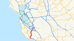
length_mi=26.49
length_ref= [http://www.dot.ca.gov/hq/structur/strmaint/brlog2.htm January 1, 2006 California Log of Bridges on State Highways] ]
length_round=2
established=1930s [http://cahighways.org/017-024.html#017 California Highways: State Route 17] ]
direction_a=South
terminus_a=jct|state=CA|SR|1 in Santa Cruz
junction=jct|state=CA|SR|35 near Redwood Estates
jct|state=CA|SR|85 in Los Gatos
direction_b=North
terminus_b=jct|state=CA|I|280|I|880 in San Jose
previous_type=SR
previous_route=16
next_type=SR
next_route=18State Route 17 commonly known locally as Highway 17, is a
freeway andexpressway that runs between San Jose and Santa Cruz in theU.S. State ofCalifornia . Highway 17 carries substantial commuter and vacation traffic between San Jose and Santa Cruz.This route is part of the
California Freeway and Expressway System [http://www.leginfo.ca.gov/cgi-bin/displaycode?section=shc&group=00001-01000&file=250-257 CA Codes (shc:250-257)] ] and is eligible for the State Scenic Highway System [http://www.leginfo.ca.gov/cgi-bin/displaycode?section=shc&group=00001-01000&file=260-284 CA Codes (shc:260-284)] ] .Route description
From its northern terminus in San Jose near Interstate 280 to Los Gatos, Route 17 is a freeway with as many as eight lanes at some points.
Between Los Gatos and Scotts Valley, Route 17 is a four-lane expressway that twists and turns through the
Santa Cruz Mountains . The road crosses the Santa Clara/Santa Cruz county line through the Patchen Pass, commonly referred to as "The Summit", at an elevation of 1,800 feet (545 m).After exiting the mountains, most of the remaining southern portion from Scotts Valley southward is four-lane freeway. Route 17 terminates at a junction with State Route 1 in Santa Cruz.
This route is part of the
California Freeway and Expressway System [http://www.leginfo.ca.gov/cgi-bin/displaycode?section=shc&group=00001-01000&file=250-257 CA Codes (shc:250-257)] ] and is eligible for the State Scenic Highway System [http://www.leginfo.ca.gov/cgi-bin/displaycode?section=shc&group=00001-01000&file=260-284 CA Codes (shc:260-284] ] .afety
Highway 17's combination of narrow shoulders, dense traffic, sharp turns, blind curves, wandering fauna such as deer and mountain lions, and sudden changes in traffic speeds have led to driving conditions that result in a number of accidents and fatalities, leading to the reputation of Highway 17 as one of the most dangerous highways in the state. In the winter months, because Highway 17 crosses a high precipitation area in the Santa Cruz Mountains, the roadway can become very slippery from rain or snow, making the road worse. Some sections of 17 have become so notoriously dangerous that they have attained nicknames among the locals. (For example, Northbound 17 after Summit Road with its sharp turns and steep slope has been deemed "Valley Surprise" for the fact that many unfamiliar drivers hit the median on their way to the Santa Clara Valley.)
Efforts to improve safety have included adding electronic speed monitoring signs and warnings lights on curves, removing trees to improve visibility around blind curves, and increased patrol and enforcement of traffic laws. The portion between Los Gatos and Scotts Valley has been designated the Highway 17 Safety Corridor by
Caltrans and theCalifornia Highway Patrol .Gillian Cichowski Memorial Overcrossing Bridge, over Route 17 near Los Gatos at
Lexington Reservoir , was named by California Senate Concurrent Resolution 32, Chapt. 70 in 1994. Gillian Cichowski was killed in an accident at this location in 1992. This is one of the few highway constructions in California named for a woman. The overpass was in response to a campaign by friends of Gillian Cichowski to make the intersection (with Bear Creek Road) safer. The overpass was open to northbound traffic July 18, 1996 and opened to southbound traffic August 29, 1996. Margaret Green of Sunnyvale, California died in a similar accident near the same location during overpass construction.Route 17 in Santa Cruz County is named after
California Highway Patrol Lieutenant Michael Walker. Walker was setting flares to direct traffic around an auto accident on News Years Eve 2005 when he was struck and killed [http://www.thecahp.org/vnews/display.v/ART/2006/01/04/43baa099b4f21 Lt. Michael Walker Killed New Year’s Eve While Aiding Motorist ] , accessed August 26, 2008] . Partly in response to this accident near the Glenwood Road intersection, Caltrans began work in 2008 to widen the shoulder to eight feet [http://www.sccrtc.org/pdf/200601CaltransGlenwoodMtng.pdf Caltrans Public Notice] (PDF), access August 26, 2008] .The cost of improving the treacherous expressway segment to modern
freeway standards has been estimated to be at least $200 million.History
The earliest connection between Santa Cruz and San Jose was an old Native America foot trail. The first road that could be navigated by a wagon was a dirt toll road built by Charlie McKiernan, known as "Mountain Charlie" by the locals, some time around 1853. Portions of this road still exist as Mountain Charlie Road, to the west of Highway 17 and south of Summit Road. Several other stage lines were built as competitors, such as the San Jose Turnpike (1863), which follows the route of present day Soquel Road.
Highway 17 was opened in 1940, replacing several other modes of transportation, including the old Glenwood Highway from 1919 (which still exists in the sleepy town of Glenwood), and the railroad which went all the way from Santa Cruz to San Francisco and Oakland. The railroad stopped operating in 1940 and the tunnels that it passed through were soon after sealed. Nearly all the tunnel entrances still exist, but are unusable as the tunnels themselves are collapsed. The rise in the use of automobiles made the railroads unprofitable.
Parts of the original Highway 17 lie underwater in Lexington Reservoir. When the reservoir was built, the highway was rerouted to higher ground, and the two towns along its path (Alma and Lexington) were abandoned. When the reservoir levels are extremely low, the old highway pavement is visible as well as some stone and concrete foundations of buildings.
Until the mid-1980s, Highway 17 extended from its current southern terminus at State Route 1 in Santa Cruz through Oakland and across the
Richmond-San Rafael Bridge to San Rafael. The roadway still exists (apart from the mile-long Cypress section in Oakland, destroyed in the 1989Loma Prieta earthquake ) but parts have been redesignated. The section between Interstate 80 and US 101 in San Rafael was renumbered as an extension of Interstate 580. Prior to the redesignation, this part of 17 followed Richmond streets, including an expressway called Hoffman Boulevard, to the bridge; a freeway built to Interstate standards was completed in 1990 after the corridor became 580's northwestern leg. Additionally, Highway 17 between Interstate 280 in San Jose and the freeway's new northern terminus in Oakland was re-designated as Interstate 880 later that year.Before the Freeway was built in Milpitas, Fremont, Hayward and Oakland, 17 followed what is now Old Oakland Road (San Jose), Main Street (Milpitas) and Warm Springs Blvd (southern Fremont); from the Irvington section of Fremont, the route proceeded along what is now Fremont Blvd, which becomes Alvarado Blvd in Union City. From there, the route proceeded along Hesperian Blvd in Hayward and Washington Avenue in San Leandro, joining with E 14th Street as it proceeded into Oakland. From Oakland, 17 would follow U.S 40 along San Pablo Avenue up to its split in Albany. Route 17 then followed what is now Interstate 580 over the San Rafael Bridge (formerly a ferry crossing), terminating at U.S 101 in San Rafael.
In 1990 the city of
Scotts Valley approved redeveloment plans calling for improvements to theSanta's Village and Granite Creek ramp systems as well as proposals for a pedestrian overcrossing andPark and ride lot. ["Environmental Impact Report for the Scotts Valley Redeveopment Area", Earth Metrics Inc, State of California Clearinghouse Rpt. 7888, March, 1990]Exit list
:"Note: Except where prefixed with a letter,
postmile s were measured in 1964, based on the alignment as it existed at that time, and do not necessarily reflect current mileage. The numbers reset at county lines; the start and end postmiles in each county are given in the county column."References
*Richard Beal: "Highway 17: The Road to Santa Cruz". Aptos, California: Pacific Group, 1990. ISBN 0-9629974-0-4
External links
* [http://www.westcoastroads.com/california/ca-017.html WestCoastRoads - State Route 17]
* [http://www.cahighways.org/017-024.html#017 California Highways: SR 17]
* [http://www.hiway17.com/news.php www.hiway17.com] A website devoted to the Santa Cruz mountain community since 1996. Occasionally has a web cam running.
* [http://www.dot.ca.gov/hq/traffops/signtech/calnexus/pdf/17.pdf Cal-NExUS info]

Wikimedia Foundation. 2010.