- Scotts Valley, California
Infobox Settlement
official_name = Scotts Valley, California
other_name =
native_name =
nickname =
settlement_type =City
motto =
imagesize = 250px
image_caption = Scotts Valley Civic Center and City Hall
flag_size =
image_
seal_size =
image_shield =
shield_size =
image_blank_emblem =
blank_emblem_type =
blank_emblem_size =
flag_size =
image_
seal_size =
image_shield =
shield_size =
image_blank_emblem =
blank_emblem_type =
blank_emblem_size =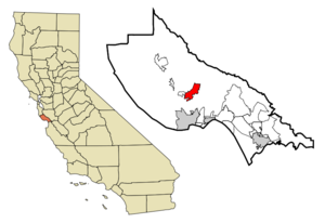
mapsize = 250px
map_caption = Location in Santa Cruz County and the state ofCalifornia
mapsize1 =
map_caption1 =
image_dot_
dot_mapsize =
dot_map_caption =
dot_x =
dot_y =
pushpin_
pushpin_label_position =
pushpin_map_caption =
pushpin_mapsize =
subdivision_type = Country
subdivision_name =United States
subdivision_type1 = State
subdivision_name1 =California
subdivision_type2 = County
subdivision_name2 = Santa Cruz
subdivision_type3 =
subdivision_name3 =
subdivision_type4 =
subdivision_name4 =
government_footnotes =
government_type =
leader_title =
leader_name =
leader_title1 =
leader_name1 =
leader_title2 =
leader_name2 =
leader_title3 =
leader_name3 =
leader_title4 =
leader_name4 =
established_title =
established_date =
established_title2 =
established_date2 =
established_title3 =
established_date3 =
area_magnitude =
unit_pref =
area_footnotes =
area_total_km2 = 11.9
area_land_km2 = 11.9
area_water_km2 = 0
area_total_sq_mi = 4.6
area_land_sq_mi = 4.6
area_water_sq_mi = 0
area_water_percent =
area_urban_km2 =
area_urban_sq_mi =
area_metro_km2 =
area_metro_sq_mi =
area_blank1_title =
area_blank1_km2 =
area_blank1_sq_mi =
population_as_of = 2000
population_footnotes =
population_note =
population_total = 11385
population_density_km2 = 956.7
population_density_sq_mi = 2475
population_metro =
population_density_metro_km2 =
population_density_metro_sq_mi =
population_urban =
population_density_urban_km2 =
population_density_urban_sq_mi =
population_blank1_title =
population_blank1 =
population_density_blank1_km2 =
population_density_blank1_sq_mi =
timezone = PST
utc_offset = -8
timezone_DST = PDT
utc_offset_DST = -7
latd = 37 |latm = 3 |lats = 5 |latNS = N
longd = 122 |longm = 0 |longs = 48 |longEW = W
elevation_footnotes =
elevation_m = 171
elevation_ft = 561
postal_code_type =ZIP code s
postal_code = 95060, 95066, 95067
area_code = 831
blank_name = FIPS code
blank_info = 06-70588
blank1_name = GNIS feature ID
blank1_info = 0277598
website =
footnotes =Scotts Valley is a small city in eastern Santa Cruz County,
California ,United States , about ten miles (16 km) south of San Jose and six miles (10 km) north of the beach in the upland slope of theSanta Cruz Mountains . As of the 2000 census, the city population was 11,385. Principal access to the city is supplied by State Route 17 that connects San Jose and Santa Cruz.The City of Scotts Valley was incorporated in 1966.
History
Ohlone tribes occupied areas alongwatercourse s in Scotts Valley such as creeks, spring and seep areas, areas along permanent and seasonal drainages, and flat ridges and terraces. ["Environmental Impact Report for the Scotts Valley Redevelopment Area", Earth Metrics Incorporated, State of California Clearinghouse Report 7888 (1990)] These early settlements probably occurred as early as 2000 BC. Therefore, areas along watercourses are considered likely locations for prehistoric cultural resources. Several watercourses, including portions ofCarbonera Creek ,Bean Creek ,MacKenzie Creek and theSan Lorenzo River , are within the city. Permanent villages were usually placed on elevations above seasonal flood levels. Surrounding areas were thence used for hunting and seed,acorn , and grass gathering.Scotts Valley was named after
Hiram Scott , who purchased Rancho San Augustin, including the valley, in 1850 from Joseph Ladd Majors.Before Majors, the property was owned by José Bolcoff. Bolcoff was the original settler and first European to claim title and live in what was to be Scotts Valley. He was born Osip Volkov around 1794 inPetropavlovsk-Kamchatsky ,Siberia . Working as a fur trader around 1815, Bolcoff jumped ship on the Monterey Bay shoreline, quickly assimilated into the Spanish culture, and was well received by the Spanish authorities. Volkov had his Russian Orthodox Baptism validated in Mission Soledad in 1817, and was given the Spanish name José Antonio Bolcoff. Bolcoff lived with and traveled withAlta California 's governorPablo Vicente de Solá , acting as an interpreter.Becoming a Mexican citizen in 1833, Bolcoff moved his family to his convert|4400|acre|km2|0|sing=on land grant building, an adobe casa historians speculate was located near present-day Kings Village Shopping Center. Bolcoff relinquished his interest in the Rancho San Augustin, selling and accepting $400 from Joseph Ladd Majors, also known as Don Juan José Mechacas.
July 7 ,1846 marked the shift of power in the region from Mexico to the United States.Hiram Scott built the Greek revival style Scott House in 1853. Situated behind City Hall, it is a
Santa Cruz County Historical Trust Landmark, and is on the National Register of Historic Places. The house originally stood on Scotts Valley Drive, near where aBank of America branch is now located.Scotts Valley's most famous resident was film director
Alfred Hitchcock , who lived in a mountaintop estate above the Vine Hill area from 1940 to 1972.Florence Owens Thompson , made famous by Dorothea Lange's "Migrant Mother" photograph, died in Scotts Valley in 1983.Economy
Tourism
From its early years as a stop on the stage route across the mountains, the Scotts Valley area has provided services to travelers. With the growing popularity of the automobile in the early 20th century, the area became commercialized and tourism developed as a local industry.
In the early 1920s, Edward Evers established Camp Evers at the junction of the State Highway and Mt. Hermon Road. Camp Evers consisted of a small store, gas pumps, dance hall and tents, becoming a resort and rest stop for travelers. The Beverly Gardens were established in the 1930s and featured a collection of exotic birds and animals, a restaurant, and cabins.
The Tree Circus was opened in 1947, featuring trees grafted and trained in strange and unusual shapes. Bright "life size" painted dinosaurs overlooking Highway 17 were added to the Tree Circus in 1964 when it changed its name to The Lost World.
Santa's Village was established in 1956. It was the most popular of the many attractions, attracting millions of visitors to Scotts Valley for over twenty years, and it was the last of Scotts Valley's theme parks to close its doors, in 1979.
Scotts Valley is also near
Big Basin Redwoods State Park ,Henry Cowell Redwoods State Park , andRoaring Camp Railroads . The town is surrounded by redwood forests. The city of Santa Cruz lies to the south. A relatively large municipal skateboard park, where one adult has died due to improper helmet use, [ [http://www.santacruzsentinel.com/archive/2006/April/20/local/stories/09local.htm Home - Santa Cruz Sentinel ] ] is near Skypark, the site of a former airport, in central Scotts Valley.Two hotels operate in Scotts Valley: a
Best Western hotel is located near the Granite Creek entrance to Highway 17, and a Hilton hotel is located near the Mount Hermon junction with Highway 17.Redevelopment and high technology
Evidence regarding blighted conditions in the Redevelopment Area of Santa's Village and the Skypark Airport were established in the year 1990. ["Preliminary Report to the City of Scotts Valley Proposed Redevelopment for the Scotts Valley Redevelopment Project", Burns & Watry/Williams-Kuebelbeck, prepared for the city of Scotts Valley, February 1990.]
Many high technology businesses are located in Scotts Valley, including the headquarters of Seagate Technology (the world's largest producer of computer
hard drives ),E-mu Systems and Sessions, a company that makes clothing for snow, skate and surf-boarding. Borland Software Corp. was formerly headquartered in Scotts Valley.Demographics
USCensusPop
1970=3621
1980=6891
1990=8615
2000=11385
footnote= [cite web
author = Santa Cruz Public Libraries
url = http://www.santacruzpl.org/history/weather/popstats.shtml
title = Population Statistics for Santa Cruz County and Cities, 1850-2000
accessdate = 2006-11-22] As of thecensus GR|2 of 2000, there were 11,385 people, 4,273 households, and 2,969 families residing in the city. Thepopulation density was 2,473.7 people per square mile (955.6/km²). There were 4,423 housing units at an average density of 961.0/sq mi (371.2/km²). The racial makeup of the city was 88.63% White, 0.48% African American, 0.40% Native American, 4.62% Asian, 0.18% Pacific Islander, 2.15% from other races, and 3.53% from two or more races. Hispanic or Latino of any race were 6.40% of the population.There were 4,273 households out of which 36.4% had children under the age of 18 living with them, 58.3% were married couples living together, 7.9% had a female householder with no husband present, and 30.5% were non-families. 23.4% of all households were made up of individuals and 11.6% had someone living alone who was 65 years of age or older. The average household size was 2.56 and the average family size was 3.05.
In the city the population was spread out with 25.8% under the age of 18, 7.0% from 18 to 24, 30.2% from 25 to 44, 23.2% from 45 to 64, and 13.8% who were 65 years of age or older. The median age was 38 years. For every 100 females there were 94.9 males. For every 100 females age 18 and over, there were 90.6 males.
The median
income for a household in the city was $72,449, and the median income for a family was $88,573. Males had a median income of $74,183 versus $40,492 for females. Theper capita income for the city was $35,684. About 0.9% of families and 2.5% of the population were below thepoverty line , including 1.2% of those under age 18 and 4.0% of those age 65 or over.Politics
In the state legislature Scotts Valley is located in the 15th Senate District, represented by Republican
Abel Maldonado , and in the 27th Assembly District, represented by DemocratJohn Laird . Federally, Scotts Valley is located inCalifornia's 14th congressional district , which has a Cook PVI of D +18 [cite web | title = Will Gerrymandered Districts Stem the Wave of Voter Unrest? | publisher = Campaign Legal Center Blog | url=http://www.clcblog.org/blog_item-85.html | accessdate = 2008-02-10] and is represented by DemocratAnna Eshoo .Education
Scotts Valley is home to
Bethany University , a four-year privateChristian university . It is endorsed by the American arm of theAssemblies of God , a largePentecostal fellowship (denomination) and enrolls about five hundred students each year.The
Scotts Valley Unified School District operates four public schools: [ [http://www.svusd.santacruz.k12.ca.us/ Official website] of the Scotts Valley Unified School District]Scotts Valley High School (grades 9 to 12), Scotts Valley Middle School (grades 6 to 8), and twoelementary school s: Vine Hill School (grades Kindergarten to 5) and Brook Knoll School. They also operate an Independent Study/Home School program. Together these schools serve more than 2,600 students each year.A single private school, Baymonte Christian School, serves students from pre-Kindergarten through eighth grades. Baymonte is a non-denominational
protestant Bible school that was founded in 1968. In 2003, it earned the distinction of being aBlue Ribbon School , a distinction awarded to one school in 25 across the nation.Each of these elementary schools is ranked among the best in California. [ [http://www.greatschools.net/schools.page?district=669&state=CA Great Schools] ]
Geography and environment
Scotts Valley is in the west hills of the
Santa Cruz Mountains , centered at coor dms|37|3|5|N|122|0|48|W|city (37.051381, -122.013236).GR|1 State Route 17 connects Scotts Valley to Santa Cruz to the south and toLos Gatos , San Jose, and the South Bay area to the north.According to the
United States Census Bureau , it has a total area of 4.6 square miles (11.9 km²), all land. It is in central Santa Cruz County, in the northern portion of the North Central Coast Air Basin.Air in Scotts Valley is typically maritime in origin, as it moves over the land from the Pacific Ocean. Summers are warm and dry, while winters are mild and generally rainy. Most rain falls as a result of winter Pacific storms between the months of November and April. Sound levels in Scotts Valley are typically in the range of 57 to 65
dBA , except for somewhat higher levels within convert|150|ft|m|0 from Highway 17.Infrastructure
Drinking water is supplied to the City of Scotts Valley by theScotts Valley Water District . Domestic water supplies are obtained solely fromgroundwater sources extracted by wells.Wastewater in Scotts Valley is treated at the Scotts Valley Wastewater Treatment Plant at Scotts Valley and Mount Hermon Roads. Treated wastewatereffluent is pumped via the city of Santa Cruz into thePacific Ocean .References
External links
* [http://www.scottsvalley.org/ City of Scotts Valley] official site
* [http://santacruz.org/places/scotts-valley.shtml Information for Scotts Valley visitors] from the Santa Cruz County Conference & Visitors Council
* [http://wikitravel.org/en/Scotts_Valley Wikitravel's article on Scotts Valley]
Wikimedia Foundation. 2010.