- Orinda, California
-
"Orinda" redirects here. Orinda may also refer to the pseudonym used by poet Katherine Philips.
City of Orinda — City — The hills of Orinda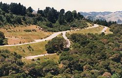 Location in Contra Costa County and the state of California
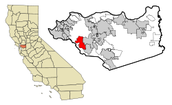
Coordinates: 37°52′58″N 122°10′47″W / 37.88278°N 122.17972°WCoordinates: 37°52′58″N 122°10′47″W / 37.88278°N 122.17972°W Country  United States
State  California
County Contra Costa Government – Senate Mark DeSaulnier (D) – Assembly Nancy Skinner (D) – U. S. Congress John Garamendi (D) Area[1] – Total 12.698 sq mi (32.887 km2) – Land 12.683 sq mi (32.848 km2) – Water 0.015 sq mi (0.039 km2) 0.12% Elevation 495 ft (151 m) Population (2010) – Total 17,643 – Density 1,389.4/sq mi (536.5/km2) Time zone PST (UTC-8) – Summer (DST) PDT (UTC-7) ZIP code 94563 Area code(s) 925 FIPS code 06-54232 GNIS feature ID 1659313 Website www.cityoforinda.org Orinda is a city in Contra Costa County, California, United States. The population was 17,643 at the 2010 census. The town is located just east of the city of Oakland and is home to many affluent suburban professionals who commute to downtown Oakland, San Francisco, and Walnut Creek. Its location provides for a more rustic landscape, and Orinda's many parks and trails make it a destination for many Bay Area hikers and naturalists.
Contents
History
Present-day Orinda was located within four Mexican land grants: Rancho Laguna de los Palos Colorados, Rancho Acalanes, Rancho El Sobrante and Rancho Boca de la Cañada del Pinole. The area was originally rural, mainly known for ranching and summer cabins. In the late 19th century, the land was named by Alice Marsh Cameron in honor of the poet Katherine Philips, who was also known as the "Matchless Orinda".[2]
In the 1880s, the United States Surveyor General for California, Theodore Wagner, built an estate which he named Orinda Park.[3] The Orinda Park post office opened in 1888.[3] The post office's name was changed to Orinda in 1895.[3] Orinda was also the site of Bryant Station, a stop on the failed California and Nevada Railroad around the turn of the 20th century. In later times, the area around Bryant Station was known as Orinda Crossroads.[3]
Orinda's popularity as a year-round residence grew after the 1937 completion of the Caldecott Tunnel, which provided easier access to the west. Bisected by California State Route 24 and framed by its rolling oak-covered hills, the city of Orinda was incorporated on July 1, 1985.
Geography
According to the United States Census Bureau, the city has a total area of 12.7 square miles (33 km2), of which, 12.7 square miles (33 km2) of it is land and 0.015 square miles (0.039 km2) of it (0.12%) is water.
Climate
The area is characterized by a warm-summer Mediterranean climate (Köppen climate classification Csb) with cool, rainy winters and hot, dry summers. It is located in the Chaparral biome.
Orinda, California Climate chart (explanation) J F M A M J J A S O N D 654344.959374.361382.268421.271460.27749082520.181510.483501.975443.265386.25636Average max. and min. temperatures in °F Precipitation totals in inches Metric conversion J F M A M J J A S O N D 15212112315310916455205312284.625100.528111.327111028104724782184158132Average max. and min. temperatures in °C Precipitation totals in mm Climate data for ORINDA BOWMAN, CALIFORNIA (1944-1960) Month Jan Feb Mar Apr May Jun Jul Aug Sep Oct Nov Dec Year Record high °F (°C) 69
(21)76
(24)84
(29)88
(31)100
(38)103
(39)107
(42)109
(43)110
(43)101
(38)87
(31)77
(25)110
(43)Average high °F (°C) 53.8
(12.1)58.6
(14.8)61.4
(16.3)67.5
(19.7)70.9
(21.6)77.2
(25.1)81.8
(27.7)81.2
(27.3)82.5
(28.1)74.6
(23.7)64.5
(18.1)56.2
(13.4)69.18
(20.66)Daily mean °F (°C) 44.0
(6.7)47.5
(8.6)49.9
(9.9)54.5
(12.5)58.2
(14.6)63.3
(17.4)66.7
(19.3)66.3
(19.1)66.3
(19.1)59.6
(15.3)51.4
(10.8)46.0
(7.8)56.14
(13.41)Average low °F (°C) 34.3
(1.3)36.5
(2.5)38.4
(3.6)41.6
(5.3)45.6
(7.6)49.4
(9.7)51.6
(10.9)51.3
(10.7)50.0
(10.0)44.3
(6.8)38.3
(3.5)35.8
(2.1)43.09
(6.16)Record low °F (°C) 15
(−9)18
(−8)23
(−5)28
(−2)32
(0)35
(2)42
(6)40
(4)32
(0)26
(−3)22
(−6)19
(−7)15
(−9)Precipitation inches (mm) 5.99
(152.1)4.86
(123.4)4.31
(109.5)2.16
(54.9)1.22
(31)0.18
(4.6)0.02
(0.5)0.05
(1.3)0.41
(10.4)1.85
(47)3.24
(82.3)6.24
(158.5)30.53
(775.5)Avg. rainy days 11 9 10 5 4 1 0 1 1 4 7 11 64 Source: Western Regional Climate Center[4][5] Demographics
2010
The 2010 United States Census[6] reported that Orinda had a population of 17,643. The population density was 1,389.5 people per square mile (536.5/km²). The racial makeup of Orinda was 14,533 (82.4%) White, 149 (0.8%) African American, 22 (0.1%) Native American, 2,016 (11.4%) Asian, 24 (0.1%) Pacific Islander, 122 (0.7%) from other races, and 777 (4.4%) from two or more races. Hispanic or Latino of any race were 807 persons (4.6%).
The Census reported that 17,600 people (99.8% of the population) lived in households, 6 (0%) lived in non-institutionalized group quarters, and 37 (0.2%) were institutionalized.
There were 6,553 households, out of which 2,361 (36.0%) had children under the age of 18 living in them, 4,673 (71.3%) were opposite-sex married couples living together, 370 (5.6%) had a female householder with no husband present, 159 (2.4%) had a male householder with no wife present. There were 138 (2.1%) unmarried opposite-sex partnerships, and 58 (0.9%) same-sex married couples or partnerships. 1,127 households (17.2%) were made up of individuals and 695 (10.6%) had someone living alone who was 65 years of age or older. The average household size was 2.69. There were 5,202 families (79.4% of all households); the average family size was 3.03.
The population was spread out with 4,512 people (25.6%) under the age of 18, 729 people (4.1%) aged 18 to 24, 2,741 people (15.5%) aged 25 to 44, 6,111 people (34.6%) aged 45 to 64, and 3,550 people (20.1%) who were 65 years of age or older. The median age was 47.8 years. For every 100 females there were 94.4 males. For every 100 females age 18 and over, there were 91.9 males.
There were 6,804 housing units at an average density of 535.8 per square mile (206.9/km²), of which 5,876 (89.7%) were owner-occupied, and 677 (10.3%) were occupied by renters. The homeowner vacancy rate was 1.2%; the rental vacancy rate was 4.2%. 16,010 people (90.7% of the population) lived in owner-occupied housing units and 1,590 people (9.0%) lived in rental housing units.
2000
As of the census[7] of 2000, there were 17,599 people, 6,596 households, and 5,243 families residing in the city. The population density was 1,398.2 people per square mile (539.7/km²). There were 6,744 housing units at an average density of 535.8/sq mi (206.8/km²). The racial makeup of the city was 86.6% White, 0.5% Black, 0.15% Native American, 9.24% Asian, 0.04% Pacific Islander, 0.64% from other races, and 2.84% from two or more races. 3.2% of the population were Hispanic or Latino of any race.
There were 6,596 households out of which 36.8% had children under the age of 18 living with them, 72.3% were married couples living together, 5.3% had a female householder with no husband present, and 20.5% were non-families. 16.6% of all households were made up of individuals and 9.5% had someone living alone who was 65 years of age or older. The average household size was 2.66 and the average family size was 2.98.
In the city the population was spread out with 25.9% under the age of 18, 3.2% from 18 to 24, 20.5% from 25 to 44, 32.1% from 45 to 64, and 18.3% who were 65 years of age or older. The median age was 45 years. For every 100 females there were 93.9 males. For every 100 females age 18 and over, there were 90.8 males.
The median income for a household in the city was $187,637, and the median income for a family was $192,531. The per capita income for the city was $65,428. About 1.1% of families and 1.6% of the population were below the poverty line, including 1.1% of those under age 18 and 1.5% of those age 65 or over.
Education
Primary and secondary schools
Orinda has four public elementary schools: Sleepy Hollow Elementary, Wagner Ranch Elementary, Glorietta Elementary and Del Rey Elementary. Orinda Intermediate School is the only middle school. Together, these five schools comprise the Orinda Union School District. The town's only high school, Miramonte High School, is a part of the Acalanes Union High School District.
Both districts are noted for their academic excellence. Each district is the highest ranked in California in its category according to the state Academic Performance Index (API).[8],[9] Miramonte High School also features strong athletic teams and has produced NFL players as Ken Dorsey, Drew Bennett and Bryan Barker, as well as several Olympians like women's waterpolo player Heather Petri.
Public libraries
The Orinda Library of the Contra Costa County Library is located in Orinda.[10]
Sports, recreation and the arts
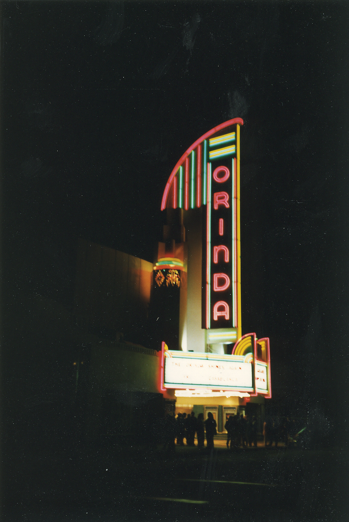
 The Orinda Theatre at night
Film Festivals
Starting in 2002, Orinda began hosting the Orinda Film Festival, an annual regional film festival taking place at the historic Orinda Theatre managed by Trevor McGuire. In 2005, actor William Hurt attended the festival to promote the film The Blue Butterfly in which he played a leading role. The festival was last held in 2005.
In August 2009, the California Independent Film Festival announced they will be making the Orinda Theatre their new home.[11] CIFF held its first event in Orinda on September 18, 2009, in which a screening of The Birds was attended by actress Tippi Hedren. The 12th Annual California Independent Film Festival will be the first time the festival is held in Orinda, opening on April 22, 2010.
The California Shakespeare Theater
The internationally known California Shakespeare Theater, (a.k.a. "Cal Shakes"), performs from June to October at the Bruns Memorial Amphitheater (located on land leased from EBMUD in the hills north of highway 24). The Theater's conservatory operates throughout the year, featuring programs for children, teenagers, young actors, teachers and adults. The current artistic director is Jonathan Moscone, son of the late San Francisco mayor.
Swimming and Water Polo
Several Orinda summer-league swim teams compete for a championship cup in mid-August every year. Over two thousand individual swimmers typically participate. Orinda is also home to the popular year-round swim team, Orinda Aquatics. Orinda has raised numerous competitive swimmers (and waterpolo players) from Orinda have gone on to compete for major colleges and in the Olympics. Notables include Kirk Everist '86 (US Olympic Team '92 and '96), Heather Petri '96 (Silver: 2000 Olympics, 2008 Olympics; Bronze: 2004 Olympics), and Michael Sharf (NCAA All-American, 2007 US National Team Member).
Famous current and former residents
- Poul Anderson, science fiction author, lived in Orinda until his death in 2001.
- Troy Auzenne, NFL 1991 2nd round draft pick. Starting left tackle for the Chicago Bears & Indianapolis Colts. Former Kodak All-American and Hall of Fame athlete for the California Golden Bears.
- Jim Barnett, former Golden State Warriors player, and current Warriors TV color commentator on Comcast Sports Net Bay Area.
- Diane Dwyer, broadcaster
- Drew Bennett, NFL wide receiver of the St. Louis Rams
- Alex Bigman, Musician. Singer of Fight Fair & Seeing Means Mor
- Nicole Branagh, Olympic beach volleyball player
- Kirsten Costas, a high school student murdered by her classmate, Bernadette Protti, in 1984
- Paul Dini, writer, cartoonist. Lived in Orinda from 1963 to 1988
- Ken Dorsey, former quarterback of the San Francisco 49ers and the Cleveland Browns
- Adonal Foyle, former Golden State Warriors center and now a member of the Orlando Magic
- John Hampton, co-founder of Toys for Tots[12]
- Nora Hampton, Pulitzer Prize nominated journalist[12]
- Robert Karplus, physicist and educator
- Wayne F. Miller American photographer
- Karen Moe, Olympic swimmer
- Hans Kelsen, one of the preeminent jurists of the 20th century[citation needed]
- Heather Petri, Olympic Water polo player
- Susan Polk, Orinda housewife sentenced to 16 for life for the murder of husband, Felix Polk. Depicted in Carol Pogash's book, "Seduced By Madness: The True Story of The Susan Polk Murder Case".
- Buster Posey, San Francisco Giants catcher, and 2010 National League Rookie of the Year.
- Gary Radnich, news broadcaster
- Patrick Riley, Founder, CEO of Ark.com
- Dana Sparks, actress/spokesperson Falcon Crest, Passions, L.A. Law, L'Oréal, Mercedes Benz,
- Casey Smith, Ambassador to Central African Republic 2006 - Present
- Owsley Stanley, audio engineer and legendary psychedelic chemist. A raid on his rented Orinda hillside house in December 1967 reportedly found a lab with 250,000 hits of LSD.
- Rawson Marshall Thurber, director of Dodgeball: a True Underdog Story and "Terry Tate" commercials for Reebok
- Nicolle Wallace, former White House Communications Director and spokesperson for John McCain for President.[13]
- Claudell Washington, former Major League Baseball player
- Will Wright, computer game designer of games such as SimCity and The Sims
- Daniel Wu, a Hong Kong actor who was raised in Orinda, California
- Sheila E., drummer and percussionist
- Roberto Teodosio,Founder, CEO Roof & Wall Saver,Inc. "innovator of elastomeric coating system" //www.roofandwallsaver.com
Neighboring cities
- Berkeley, California
- Oakland, California
- Moraga, California
- Lafayette, California
- Walnut Creek, California
The cities of Orinda, Lafayette, and Moraga are collectively known as "Lamorinda".
References
- ^ U.S. Census
- ^ A Brief History of Orinda, Kay Norman, Orinda Historical Society
- ^ a b c d Durham, David L. (November 1998). "Part Five - San Francisco Bay Region". California's Geographic Names: A Gazetteer of Historic and Modern Names of the State. Word Dancer Press. pp. 676. ISBN 978-1884995149. http://books.google.com/books?id=Yfa0hmE7yocC&pg=PA676&lpg=PA676&dq=%22orinda+park%22+%22theodore+wagner%22+%22post+office%22&source=bl&ots=nGO1NPT36L&sig=AYeydBwGp56YekSGZUm2c-PkaYA&hl=en&ei=5S1mSuLtF4HEsQP-7-XmDg&sa=X&oi=book_result&ct=result&resnum=2. Retrieved 2009-07-22.
- ^ [1]
- ^ [2]
- ^ All data are derived from the United States Census Bureau reports from the 2010 United States Census, and are accessible on-line here. The data on unmarried partnerships and same-sex married couples are from the Census report DEC_10_SF1_PCT15. All other housing and population data are from Census report DEC_10_DP_DPDP1. Both reports are viewable online or downloadable in a zip file containing a comma-delimited data file. The area data, from which densities are calculated, are available on-line here. Percentage totals may not add to 100% due to rounding. The Census Bureau defines families as a household containing one or more people related to the householder by birth, opposite-sex marriage, or adoption. People living in group quarters are tabulated by the Census Bureau as neither owners nor renters. For further details, see the text files accompanying the data files containing the Census reports mentioned above.
- ^ "American FactFinder". United States Census Bureau. http://factfinder.census.gov. Retrieved 2008-01-31.
- ^ "Achievement - Test Scores". Orinda Union School District. http://www.orindaschools.org/14771036161923670/site/default.asp. Retrieved 2009-07-12.
- ^ "AHUSD Ranks First in California". Acalanes Union High School District. http://www.acalanes.k12.ca.us/news/AUHSD1stInCalifornia.htm. Retrieved 2009-07-12.[dead link]
- ^ "Orinda Library." Contra Costa County Library. Retrieved on April 1, 2010.
- ^ "CIFF Newsletter". 2009-08-19. http://www.caiff.org/calindie/newsletters/101757Newsletter081809.html.
- ^ a b Richards, Sam (2010-07-08). "John Hampton, co-founder of Toys for Tots, dies at 103". Contra Costa Times. http://www.mercurynews.com/breaking-news/ci_15458788. Retrieved 2010-07-26.
- ^ About Nicole Wallace
External links
- Official City of Orinda website
- Orinda Chamber of Commerce
- A brief history of Orinda
- Orinda Historical Society
- Lamorinda Wiki Wiki for Lafayette, Moraga and Orinda.
Municipalities and communities of Contra Costa County, California Cities and towns 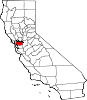
CDPs Acalanes Ridge | Alamo | Alhambra Valley | Bay Point | Bayview | Bethel Island | Blackhawk | Byron | Camino Tassajara | Castle Hill | Clyde | Contra Costa Centre | Crockett | Diablo | Discovery Bay | East Richmond Heights | El Sobrante | Kensington | Knightsen | Montalvin Manor | Mountain View | Norris Canyon | North Gate | North Richmond | Pacheco | Port Costa | Reliez Valley | Rodeo | Rollingwood | San Miguel | Saranap | Shell Ridge | Tara Hills | Vine Hill
Unincorporated
communitiesAlamo Oaks | Arbor | Avon | Bancroft | Bayo Vista | Bayview-Montalvin | Bixler | Blackhawk-Camino Tassajara | Bridgehead | Canyon | Christie | Cornwall | Crolona Heights | Diamond | Eastport | Four Corners | Franklin Canyon | Gateley | Glen Frazer | Hasford Heights | Herpoco | Hookston | Las Juntas | Los Medanos | Luzon | Maltby | Marsh Creek Springs | McAvoy | Meinert | Monsanto | Muir | Neroly | Newlove | Nichols | Oleum | Orinda Village | Orwood | Ozol | Rheem | Rock City | Selby | Shore Acres | Sobrante | Sparkle | Stege | Tassajara | Tormey | Valle Vista | Valona | Waldon | Walnut Heights | Werner
Ghost towns Acelanus | Ambrose | Atchison | Eckley | Empire | Hooper | Horse Haven | Judsonville | Junction | Nortonville | Ohmer | Point of Timber | Port Chicago | Schmidtville | Somersville | Stewartville | Tammukan | West Hartley | Winehaven
Categories:- Incorporated cities and towns in California
- Cities in Contra Costa County, California
- Cities in the San Francisco Bay Area


Wikimedia Foundation. 2010.