- Kensington, California
Infobox Settlement
official_name = Kensington, California
settlement_type = CDP
imagesize =
image_caption =
image_
imagesize =
image_caption =
image_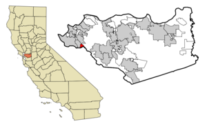
mapsize = 250x200px
map_caption = Location in Contra Costa County and the state ofCalifornia
mapsize1 =
map_caption1 =
subdivision_type = Country
subdivision_type1 = State
subdivision_type2 = County
subdivision_name =United States
subdivision_name1 =California
subdivision_name2 = Contra Costa
government_type =
leader_title = N/A
leader_name =
leader_title1 = Senate
leader_name1 =Tom Torlakson (D)
leader_title2 = Assembly
leader_name2 =Loni Hancock (D)
leader_title3 = U. S. Congress
leader_name3 =Ellen Tauscher (D)
established_date =
area_magnitude =
area_total_km2 = 3
area_total_sq_mi = 1.1
area_land_km2 = 3
area_land_sq_mi = 1.1
area_water_km2 = 0
area_water_sq_mi = 0
elevation_ft = 581
elevation_m = 177
population_as_of = 2000
population_footnotes =
population_total = 4936
population_metro =
population_density_km2 = 1645.3
population_density_sq_mi = 4487.3
timezone = PST
utc_offset = -8
latd = 37 |latm = 54 |lats = 22 |latNS = N
longd = 122 |longm = 16 |longs = 44 |longEW = W
timezone_DST = PDT
utc_offset_DST = -7
postal_code_type =ZIP code s
postal_code = 94707, 94708
area_code = 510
blank_name = FIPS code
blank_info = 06-38086
blank1_name = GNIS feature ID
blank1_info = 1658891
footnotes =
website =Kensington is an
unincorporated community andcensus-designated place located in the East Bay, part of theSan Francisco Bay Area , inContra Costa County, California ,United States . The population was 4,936 at the 2000 census.Law and government
Kensington is an unincorporated area of Contra Costa County that borders Alameda County. Unlike many unincorporated communities, Kensington has local jurisdiction over its police department, park services, refuse collection and fire department. These are governed by two elected boards: the five-member Kensington Police Protection and Community Services District Board which oversee the police department, park services and refuse collection and the five-member Kensington Fire District Board which oversee the fire department, of which the day-to-day function is outsourced to the fire department of El Cerrito, a neighboring community.
History
The area that is now Kensington was originally the territory of the Huichin band of the
Ohlone indigenous people who occupied much of the East Bay of the San Francisco Bay Area.In 1823, the Republic of Mexico granted an extent of land lying north of Cerrito Creek and the Rancho San Antonio to Francisco Castro, a veteran of the Mexican Army, including that portion of land that is now Kensington.
In 1892, Anson Blake purchased a portion of Castro's land, most of which is now Kensington.
In 1911, the area was named "Kensington" by Robert Brousefield, a surveyor who had lived in the London borough of South Kensington at one time.
Geography
According to the
United States Census Bureau , the CDP has a total area of 1.1square mile s (3.0km² ), of which, 1.1 square miles (3.0 km²) of it is land and 0.87% is water.Kensington borders Berkeley and Albany to the south, El Cerrito to its west and north, and
Wildcat Canyon Regional Park andTilden Regional Park to the east.Demographics
As of the
census GR|2 of 2000, there were 4,936 people, 2,192 households, and 1,372 families residing in the CDP. Thepopulation density was 4,301.9 people per square mile (1,657.2/km²). There were 2,245 housing units at an average density of 1,956.6/sq mi (753.7/km²). The racial makeup of the CDP was 81.77% White, 2.55% Black or African American, 0.24% Native American, 10.58% Asian, 0.02% Pacific Islander, 0.91% from other races, and 3.93% from two or more races. 3.48% of the population were Hispanic or Latino of any race.There were 2,192 households out of which 23.8% had children under the age of 18 living with them, 53.5% were married couples living together, 6.6% had a female householder with no husband present, and 37.4% were non-families. 26.7% of all households were made up of individuals and 12.5% had someone living alone who was 65 years of age or older. The average household size was 2.25 and the average family size was 2.69.
In the CDP the population was spread out with 17.7% under the age of 18, 3.1% from 18 to 24, 25.4% from 25 to 44, 31.7% from 45 to 64, and 22.1% who were 65 years of age or older. The median age was 47 years. For every 100 females there were 89.9 males. For every 100 females age 18 and over, there were 89.3 males.
The median income for a household in the CDP was $93,247, and the median income for a family was $102,601. Males had a median income of $71,278 versus $55,347 for females. The
per capita income for the CDP was $55,275. About 1.7% of families and 3.3% of the population were below thepoverty line , including 3.0% of those under age 18 and 3.8% of those age 65 or over.Trivia
*Until 1948, a streetcar line of the
Key System ran to Kensington from Berkeley along The Arlington, terminating in the small commercial area at Amherst Avenue.
*The late local historianLouis Stein Jr. lived in Kensington, and for a time, kept one of the East Bay's oldesthorsecar s in his yard---one that had probably seen service betweenTemescal, Oakland and the University of California in Berkeley. The horsecar is now at theWestern Railway Museum .
*Kensington has the highest per capita concentration of Nobel laureates in the United States.Fact|date=October 2007
*A relic of theCold War sits in the hills directly behind Kensington---a large Nike missile battery, comprising two separate installations, now sealed up, but still evident by its concrete blocks. The preferred access is a foot and bike trail from Inspiration Point inTilden Regional Park . [ [http://www.acme.com/jef/nike/sf0809l.html Nike Missile Sites of the SF Bay Area] ]
*The Census data report that Kensington is 0.87% water, which is unusual for a town at the top of a hill. The percentage most likely includesSummit Reservoir , a drinking water reservoir that was covered to cut evaporation losses after several drought years in the late 1970s.Points of interest
* Blake Garden
References
"Kensington: Past and Present", Kensington Improvement Club (2000)
External links
* [http://kensingtoncalifornia.org/ Kensington Police Protection & Community Services District]
* [http://www.aboutkensington.com/index.html About Kensington]
* [http://groups.google.com/group/kensingtontips Kensington Tips -- an online neighborhood group for residents of Kensington]
Wikimedia Foundation. 2010.