- Dixon, California
-
City of Dixon — City — 
SealLocation in Solano County and the state of California
Coordinates: 38°26′57″N 121°49′37″W / 38.44917°N 121.82694°W Country  United States
State  California
County Solano Government – Mayor Jack Batchelor, Jr. – Interim City Manager Jon Cox – Senate Lois Wolk (D) – Assembly Mariko Yamada (D) – U. S. Congress John Garamendi (D) Area[1] – Total 7.092 sq mi (18.368 km2) – Land 6.996 sq mi (18.118 km2) – Water 0.096 sq mi (0.249 km2) 1.36% Elevation 62 ft (19 m) Population (2010) – Total 18,351 – Density 2,587.6/sq mi (999.1/km2) Time zone PST (UTC−8) – Summer (DST) PDT (UTC−7) ZIP code 95620 Area code(s) 707 FIPS code 06-19402 GNIS feature ID 1655973 Website http://www.ci.dixon.ca.us/ Dixon is a city in northern Solano County, California, United States, located 23 miles (37 km) from the state capital, Sacramento. The population was 18,351 at the 2010 census. Other nearby cities include Vacaville, Winters and Davis.
The city was originally to be named "Dicksonville," after local citizen Thomas Dickson who had donated some of his land to create a railroad depot. The first rail shipment of merchandise from San Francisco arrived in 1872 mistakenly addressed to “Dixon,” and the new spelling has been used since (mainly out of simplicity). Dixon is also home to the May Fair, the longest-running annual fair in the state of California. It is held at the Dixon Fairgrounds in May, with the four day event ending each year on Mother's Day.
Dixon is also the home of the Gymboree Corporation's only Distribution Center, servicing all stores and customers around the world.
Contents
Geography
 Aerial view of Dixon
Dixon is located at 38°26′57″N 121°49′37″W / 38.44917°N 121.82694°W (38.449108, -121.826872).[2]
According to the United States Census Bureau, the city has a total area of 7.1 square miles (18 km2), of which, 7.0 square miles (18 km2) of it is land and 0.1 square miles (0.26 km2) of it (1.36%) is water.
Demographics
2010
The 2010 United States Census[3] reported that Dixon had a population of 18,351. The population density was 2,587.7 people per square mile (999.1/km²). The racial makeup of Dixon was 13,023 (71.0%) White, 562 (3.1%) African American, 184 (1.0%) Native American, 671 (3.7%) Asian, 58 (0.3%) Pacific Islander, 2,838 (15.5%) from other races, and 1,015 (5.5%) from two or more races. Hispanic or Latino of any race were 7,426 persons (40.5%).
The Census reported that 100% of the population lived in households.
There were 5,856 households, out of which 2,773 (47.4%) had children under the age of 18 living in them, 3,550 (60.6%) were opposite-sex married couples living together, 790 (13.5%) had a female householder with no husband present, 339 (5.8%) had a male householder with no wife present. There were 327 (5.6%) unmarried opposite-sex partnerships, and 26 (0.4%) same-sex married couples or partnerships. 867 households (14.8%) were made up of individuals and 301 (5.1%) had someone living alone who was 65 years of age or older. The average household size was 3.13. There were 4,679 families (79.9% of all households); the average family size was 3.47.
The population was spread out with 5,349 people (29.1%) under the age of 18, 1,816 people (9.9%) aged 18 to 24, 5,026 people (27.4%) aged 25 to 44, 4,608 people (25.1%) aged 45 to 64, and 1,552 people (8.5%) who were 65 years of age or older. The median age was 33.3 years. For every 100 females there were 97.8 males. For every 100 females age 18 and over, there were 94.8 males.
There were 6,172 housing units at an average density of 870.3 per square mile (336.0/km²), of which 3,902 (66.6%) were owner-occupied, and 1,954 (33.4%) were occupied by renters. The homeowner vacancy rate was 2.0%; the rental vacancy rate was 5.2%. 12,149 people (66.2% of the population) lived in owner-occupied housing units and 6,201 people (33.8%) lived in rental housing units.
2000
As of the census[4] of 2000, there were 16,103 people, 5,073 households, and 4,164 families residing in the city. The population density was 2,434.1 people per square mile (939.2/km²). There were 5,172 housing units at an average density of 781.8 per square mile (301.6/km²). The racial makeup of the city was 70.51% White, 1.93% Black or African American, 0.99% Native American, 3.11% Asian, 0.30% Pacific Islander, 17.87% from other races, and 5.29% from two or more races. 33.62% of the population were Hispanic or Latino of any race.
There were 5,073 households out of which 47.8% had children under the age of 18 living with them, 67.0% were married couples living together, 9.7% had a female householder with no husband present, and 17.9% were non-families. 13.0% of all households were made up of individuals and 4.5% had someone living alone who was 65 years of age or older. The average household size was 3.17 and the average family size was 3.45.
In the city the population is concentrated among adults 25 to 44 (32.2%) and children under age 18 (32%). Only 8.5% of the population is aged 18 to 24; 20.0% from 45 to 64; and 7.2% who were 65 years of age or older. The median age was 32 years. For every 100 females there were 100.3 males. For every 100 females age 18 and over, there were 97.8 males.
The median income for a household in the city was $54,472, and the median income for a family was $58,849. Males had a median income of $42,286 versus $30,378 for females. The per capita income for the city was $20,139. About 5.2% of families and 8.1% of the population were below the poverty line, including 9.1% of those under age 18 and 6.6% of those age 65 or over.
Transportation
Interstate 80 passes through Dixon.
The Union Pacific Railroad mainline between Oakland and Sacramento also passes through Dixon. This line was owned by Southern Pacific Railroad until its merger with Union Pacific on September 11, 1996. The track was constructed in 1868 by the California Pacific Railroad.
Amtrak Capitol Corridor also passes through Dixon over the UP mainline but the nearest station stops are at Davis and Fairfield/Suisun. Amtrak's California Zephyr and Coast Starlight also pass through Dixon without stopping.
In 2006, the City of Dixon finished construction on a train station near downtown Dixon. However, there are currently no scheduled stops at the station. The building has, for the time being, been converted to the city's Chamber of Commerce.
Economy
Top employers
According to the City's 2010 Comprehensive Annual Financial Report,[5] the top employers in the city are:
# Employer # of Employees 1 Gymboree 419 2 Kragen Auto Parts Warehouse[6]4003 Wal-Mart 288 4 Cardinal Health 203 5 Dixon Unified School District 197 6 Basalite 180 7 Campbell Soup Company 180 8 Superior Farms 140 9 City of Dixon 115 10 First Northern Bank 109 Radio transmissions
The Voice of America ran a shortwave transmitter site that was formerly owned and operated by NBC as KNBA from 1963-1982. NBC built the site in 1944 not too long before the end of World War II in 1945. The station served as a relay to both NBC International programming overseas, and as a relay of KNBR and its programming overseas, mostly the Pacific area. [2]
Schools
High schools
- Dixon High (Opened 2007)
- Maine Prairie High School (continuation school)
Middle schools
- C.A. Jacobs Intermediate
- Neighborhood Christian Middle School
Elementary schools
- Silveyville (Closed 2008)
- Anderson
- Gretchen Higgins
- Tremont
- Neighborhood Christian School
- Dixon Montessori Charter School (Now located in Silveyville facility)
- Easter Seals Special Education Center (shares Silveyville facility with DMCS)
See also
References
- ^ U.S. Census
- ^ "US Gazetteer files: 2010, 2000, and 1990". United States Census Bureau. 2011-02-12. http://www.census.gov/geo/www/gazetteer/gazette.html. Retrieved 2011-04-23.
- ^ All data are derived from the United States Census Bureau reports from the 2010 United States Census, and are accessible on-line here. The data on unmarried partnerships and same-sex married couples are from the Census report DEC_10_SF1_PCT15. All other housing and population data are from Census report DEC_10_DP_DPDP1. Both reports are viewable online or downloadable in a zip file containing a comma-delimited data file. The area data, from which densities are calculated, are available on-line here. Percentage totals may not add to 100% due to rounding. The Census Bureau defines families as a household containing one or more people related to the householder by birth, opposite-sex marriage, or adoption. People living in group quarters are tabulated by the Census Bureau as neither owners nor renters. For further details, see the text files accompanying the data files containing the Census reports mentioned above.
- ^ "American FactFinder". United States Census Bureau. http://factfinder.census.gov. Retrieved 2008-01-31.
- ^ [1]
- ^ Dixon to take big hit with Kragen's relocation. The Reporter
External links
- Directory
Coordinates: 38°26′57″N 121°49′37″W / 38.449108°N 121.826872°W
Municipalities and communities of Solano County, California Cities 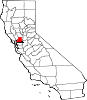
CDPs Allendale | Elmira | Green Valley | Hartley
Unincorporated
communitiesBahia | Batavia | Birds Landing | Bucktown | Collinsville | Montezuma | Rockville | Yolano
 State of California
Topics - Climate
- Delegations
- Deserts
- Districts
- Ecology
- Elections
- Environment
- Geography
- Government
- History
- Protected areas
- Sports
- Symbols
- Transportation
- Visitor attractions
- Index of California-related articles
Society Regions - Antelope Valley
- Big Sur
- Cascade Range
- Central California
- Central Coast
- Central Valley
- Channel Islands
- Coachella Valley
- Conejo Valley
- Cucamonga Valley
- Death Valley
- East Bay (SF)
- East County (SD)
- Eastern California
- Emerald Triangle
- Gold Country
- Great Basin
- Greater Los Angeles
- Greater Sacramento
- Inland Empire
- Lake Tahoe
- Los Angeles Basin
- Lost Coast
- Metropolitan Fresno
- Mojave
- Mountain Empire
- North Bay (SF)
- North Coast
- North County (SD)
- Northern California
- Owens Valley
- Oxnard Plain
- San Francisco Peninsula
- Pomona Valley
- Sacramento Valley
- San Bernardino Valley
- San Diego–Tijuana
- San Fernando Valley
- San Francisco Bay Area
- San Gabriel Valley
- San Joaquin Valley
- Santa Clara Valley
- Santa Clara River Valley
- Santa Clarita Valley
- Shasta Cascade
- Sierra Nevada
- Silicon Valley
- South Bay (LA)
- South Bay (SF)
- South Bay (SD)
- South Coast
- Southern California
- Southern Border Region
- Tri-Valley
- Upstate California
- Victor Valley
- Wine Country
- Yosemite
Metro areas - Bakersfield
- Chico
- El Centro
- Fresno
- Hanford–Corcoran
- Los Angeles–Long Beach–Glendale
- Madera
- Modesto
- Merced
- Napa
- Oakland–Fremont–Hayward
- Oxnard–Thousand Oaks–Ventura
- Redding
- Riverside–San Bernardino–Ontario
- Sacramento–Arden Arcade–Roseville
- Salinas
- San Diego–Carlsbad–San Marcos
- San Francisco–San Mateo–Redwood City
- San Jose–Sunnyvale–Santa Clara
- San Luis Obispo–Paso Robles
- Santa Ana–Anaheim–Irvine
- Santa Barbara–Santa Maria–Goleta
- Santa Cruz–Watsonville
- Santa Rosa–Petaluma
- Stockton
- Vallejo–Fairfield
- Visalia–Porterville
- Yuba City
Micro areas Counties - Alameda
- Alpine
- Amador
- Butte
- Calaveras
- Colusa
- Contra Costa
- Del Norte
- El Dorado
- Fresno
- Glenn
- Humboldt
- Imperial
- Inyo
- Kern
- Kings
- Lake
- Lassen
- Los Angeles
- Madera
- Marin
- Mariposa
- Mendocino
- Merced
- Modoc
- Mono
- Monterey
- Napa
- Nevada
- Orange
- Placer
- Plumas
- Riverside
- Sacramento
- San Benito
- San Bernardino
- San Diego
- San Francisco
- San Joaquin
- San Luis Obispo
- San Mateo
- Santa Barbara
- Santa Clara
- Santa Cruz
- Shasta
- Sierra
- Siskiyou
- Solano
- Sonoma
- Stanislaus
- Sutter
- Tehama
- Trinity
- Tulare
- Tuolumne
- Ventura
- Yolo
- Yuba
Categories:- Incorporated cities and towns in California
- Cities in Solano County, California
- Cities in the San Francisco Bay Area


Wikimedia Foundation. 2010.