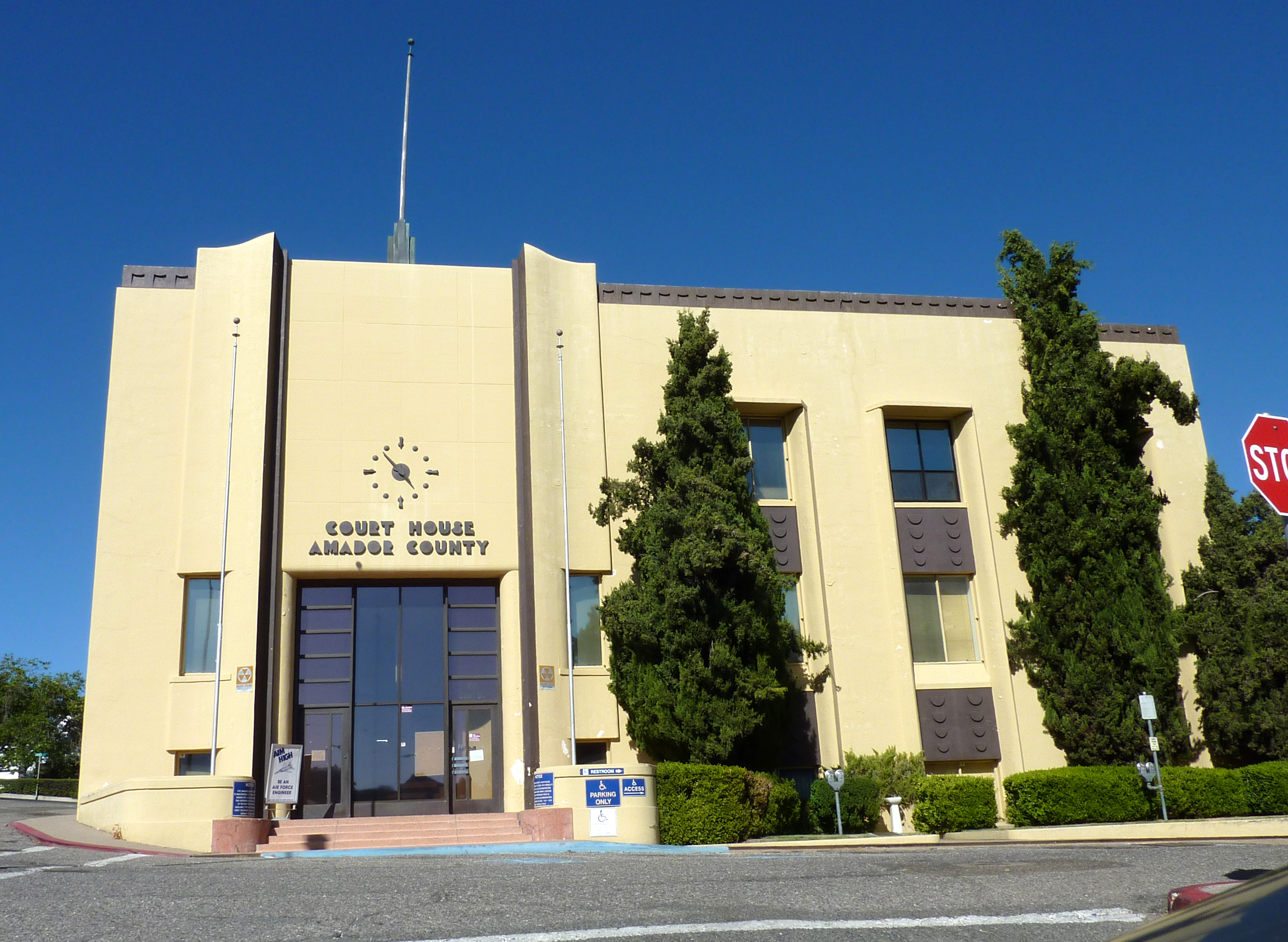
- Amador County, California
-
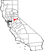
County of Amador — County — Foothills of Amador County
SealNickname(s): The Heart of the Mother Lode Location in the state of California California's location in the United States
Country  United States
State  California
Region Sierra Nevada Incorporated 1854 County seat Jackson Largest city Ione Area – Total 604.69 sq mi (1,566.1 km2) – Land 592.97 sq mi (1,535.8 km2) – Water 11.73 sq mi (30.4 km2) Population (2010) – Total 38,091 – Density 63/sq mi (24.3/km2) Time zone Pacific Standard Time (UTC-8) – Summer (DST) Pacific Daylight Time (UTC-7) Area code(s) 209 Website www.co.amador.ca.us Amador County is a county located in the Sierra Nevada of the U.S. state of California. As of the 2010 census, the population was 38,091. The county seat is Jackson.
Amador County bills itself as "The Heart of the Mother Lode" and lies within the Gold Country. There is a substantial wine-growing industry in the county.
Contents
History
Amador County was created in 1854 from parts of Calaveras and El Dorado Counties. In 1864, part of the county's territory was given to Alpine County.
The county is named for Jose Maria Amador, soldier, rancher and miner, who was born in San Francisco in 1794, the son of Sergeant Pedro Amador (a Spanish soldier who settled in California in 1771) and younger brother to Sinforosa Amador.
In 1848, Jose Maria Amador, with several Native Americans, established a successful gold mining camp near the present town of Amador City. In Spanish, the word amador means "one who loves."
Geography
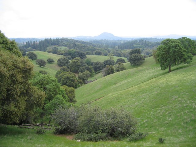
Amador County is located approximately 45 miles (72 km) southeast of Sacramento in a part of California known as the foothills of the Sierra Nevada Mountains.
According to the 2000 census, the county has a total area of 604.69 square miles (1,566.1 km2), of which 592.97 square miles (1,535.8 km2) (or 98.06%) is land and 11.73 square miles (30.4 km2) (or 1.94%) is water.[2] Water bodies in the county include Lake Amador, Lake Camanche, Pardee Reservoir, Bear River Reservoir, Silver Lake, Sutter Creek, Cosumnes River, Mokelumne River, and Jackson Creek.
Amador County ranges in elevation from approximately 250 feet (76 m) in the western portion of the county to over 9,000 feet (2,700 m) in the eastern portion of the county. The county is bordered on the north by the Cosumnes River and on the south by the Mokelumne River.
Cities and towns
Unincorporated places
- Drytown
- Fiddletown
- Martell
- Pine Grove
- Pioneer
- River Pines
- Volcano
Adjacent counties
- Calaveras County, California – south
- San Joaquin County, California – southwest
- Sacramento County, California – west
- El Dorado County, California – north
- Alpine County, California – east
National protected area
- Eldorado National Forest (part)
- Mokelumne Wilderness (part)
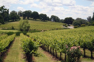
Shenandoah Valley
 Amador Vineyard
Though not as well known as the Napa Valley AVA or Sonoma Valley AVA wine growing regions of California, the Shenandoah Valley was once the principal wine growing region of California.[citation needed] With the discovery of gold, the area quickly became a mecca for those trying to make their fortune. In the process numerous wineries sprouted up many of whose vineyards are still in use by wineries today. The decline of the California Gold Rush coupled with the onset of Prohibition devastated the wine making region of Amador County. Today this area has been resurrected and is now home to over 40 different wineries. Amador County is renowned for its Zinfandel, but many other varietals are produced as well. Amador County has a high percentage of old Zinfandel vines. Some of the Zinfandel vineyards in this county are more than 125 years old; including the original Grandpère vineyard, planted with Zinfandel before 1869. The vineyard is believed to be the oldest Zinfandel vineyard in America.[3] This 10-acre (40,000 m2) vineyard is home to some of the oldest Zinfandel vines on Earth, with proof of existence dating to 1869 when the vineyard was listed as a descriptor on a deed from the U.S. Geological Survey. Also grant deed in Amador County records proves its existence in 1869. These old vines produce intense flavors allowing winemakers to make outstanding Zinfandels.
Gold mining
There are numerous gold mines in Amador County including the Argonaut Mine, the Kennedy Mine, and the Sutter Mine. Almost all them closed in the late 19th or 20th century.
Attractions
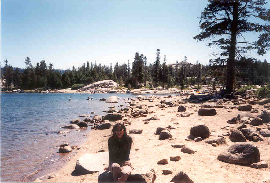
 Silver Lake in Amador County CA
Amador County is home of the Gold Rush era in California. Many century-old gold-mining places in the county are now popular tourist destinations. Amador County offers several tourists destinations and things to do:
- Jackson Main Street – antique shops
- Sutter Creek Main Street – antique shops, [2] Sutter Creek Theater
- Jackson Rancheria – casino and hotel built in 1986 by Larry Graham Construction
- Volcano Theater Company and the Cobblestone Theater and the St. George Hotel in Volcano
- Mace Meadows Golf Course in Pioneer
- Old Mill Shopping Center in Martell
- Underground caves with tours (Black Chasm in Volcano)
- Campgrounds areas with gold-panning activities
- Wineries with wine-tasting activities
- Mokelumne River – fishing, gold panning, whitewater kayaking, swimming, picnics, water play
- Lakes for boating and fishing
- Winter Ski Resorts – for skiers, snowboarders, etc.
- Outdoor Activities – camping, fishing, picnicking, ATV riding, backpacking, hiking, lake kayaking, horseback riding, whitewater kayaking, birding, snowshoeing, cross-country skiing, rock climbing, etc.
- Historic sites: Kennedy Mine in Jackson, Chew Kee Store in Fiddletown, Knight Foundry in Sutter Creek
Roaring Camp Mining Company
Transportation infrastructure
Major highways
Public transportation
Amador Regional Transit System (ARTS) provides service in Jackson and the nearby communities. Connections are available to Sacramento and to Calaveras County.
Airports
Amador County Airport is a general aviation airport located near Jackson.
Demographics
Historical populations Census Pop. %± 1860 10,930 — 1870 9,582 −12.3% 1880 11,384 18.8% 1890 10,320 −9.3% 1900 11,116 7.7% 1910 9,086 −18.3% 1920 7,793 −14.2% 1930 8,494 9.0% 1940 8,973 5.6% 1950 9,151 2.0% 1960 9,990 9.2% 1970 11,821 18.3% 1980 19,314 63.4% 1990 30,039 55.5% 2000 35,100 16.8% 2010 38,091 8.5% 2010
The 2010 United States Census reported that Amador County had a population of 38,091. The racial makeup of Amador County was 33,149 (87.0%) White, 962 (2.5%) African American, 678 (1.8%) Native American, 419 (1.1%) Asian, 77 (0.2%) Pacific Islander, 1,450 (3.8%) from other races, and 1,356 (3.6%) from two or more races. Hispanic or Latino of any race were 4,756 persons (12.5%).[4]
Population reported at 2010 United States Census The County Total
PopulationWhite African
AmericanNative
AmericanAsian Pacific
Islanderother
racestwo or
more racesHispanic
or Latino
(of any race)Amador County 38,091 33,149 962 678 419 77 1,450 1,356 4,756 Incorporated
citiesTotal
PopulationWhite African
AmericanNative
AmericanAsian Pacific
Islanderother
racestwo or
more racesHispanic
or Latino
(of any race)Amador City 185 171 0 4 2 0 2 6 11 Ione 7,918 5,826 824 173 110 21 678 286 1,991 Jackson 4,651 4,090 32 94 60 4 185 186 520 Plymouth 1,005 850 3 18 6 2 70 56 183 Sutter Creek 2,501 2,272 10 34 65 5 40 75 219 Census-designated
placesTotal
PopulationWhite African
AmericanNative
AmericanAsian Pacific
Islanderother
racestwo or
more racesHispanic
or Latino
(of any race)Buckhorn 2,429 2,259 9 37 25 4 47 48 168 Buena Vista 429 365 1 23 0 0 12 28 35 Camanche North Shore 979 860 3 14 12 3 38 49 150 Camanche Village 847 762 0 9 8 4 31 33 121 Drytown 167 153 0 0 1 0 2 11 11 Fiddletown 235 215 0 5 1 0 8 6 22 Kirkwood‡ 61 59 0 1 1 0 0 0 2 Martell 282 234 0 14 0 5 14 15 36 Pine Grove 2,219 2,027 9 36 9 6 49 83 202 Pioneer 1,094 1,017 0 34 1 2 12 28 52 Red Corral 1,413 1,259 24 15 12 3 33 67 147 River Pines 379 324 0 5 4 0 8 38 31 Volcano 115 109 0 2 2 0 0 2 7 Unincorporated
communitiesTotal
PopulationWhite African
AmericanNative
AmericanAsian Pacific
Islanderother
racestwo or
more racesHispanic
or Latino
(of any race)All others not CDPs (combined) 11,182 10,297 47 160 100 18 221 339 848 ‡ - census results for the portion of this CDP in Amador County 2000
As of the census[5] of 2000, there were 35,100 people, 12,759 households, and 9,071 families residing in the county. The population density was 59 people per square mile (23/km²). There were 15,035 housing units at an average density of 25 per square mile (10/km²). The racial makeup of the county was 85.79% White, 3.87% Black or African American, 1.78% Native American, 1.00% Asian, 0.10% Pacific Islander, 5.04% from other races, and 2.41% from two or more races. 8.91% of the population were Hispanic or Latino of any race. 14.9% were of German, 12.6% English, 11.7% Irish, 8.8% Italian and 7.3% American ancestry according to Census 2000. 93.1% spoke English and 5.1% Spanish as their first language.
There were 12,759 households out of which 26.2% had children under the age of 18 living with them, 58.9% were married couples living together, 8.7% had a female householder with no husband present, and 28.9% were non-families. 23.9% of all households were made up of individuals and 11.3% had someone living alone who was 65 years of age or older. The average household size was 2.39 and the average family size was 2.81.
In the county the population was spread out with 20.6% under the age of 18, 6.9% from 18 to 24, 26.2% from 25 to 44, 28.3% from 45 to 64, and 18.0% who were 65 years of age or older. The median age was 43 years. For every 100 females there were 122.5 males. For every 100 females age 18 and over, there were 123.4 males.
The median income for a household in the county was $42,280, and the median income for a family was $51,226. Males had a median income of $39,697 versus $28,850 for females. The per capita income for the county was $22,412. About 6.10% of families and 9.20% of the population were below the poverty line, including 13.10% of those under age 18 and 5.40% of those age 65 or over.
Politics
Presidential election results Year GOP DEM Others 2008 56.3% 10,561 41.7% 7,813 2.0% 395 2004 62.1% 11,107 36.6% 6,541 1.3% 243 2000 56.7% 8,766 38.2% 5,906 5.1% 792 1996 47.5% 6,870 40.6% 5,868 11.9% 1,714 1992 35.5% 5,477 34.3% 5,286 30.3% 4,671 1988 55.9% 6,893 42.1% 5,197 2.0% 148 1984 61.5% 6,986 36.9% 4,188 1.7% 189 1980 55.9% 5,401 33.0% 3,191 11.1% 1,078 1976 46.1% 3,699 50.4% 4,037 3.5% 282 1972 53.4% 3,533 40.9% 2,705 5.7% 378 1968 42.1% 2,269 45.3% 2,440 12.6% 681 1964 33.0% 1,682 66.9% 3,410 0.1% 6 1960 44.5% 2,175 55.0% 2,690 0.5% 22 Amador is a strongly Republican county in Presidential and congressional elections. The last Democrat to win a majority in the county was Jimmy Carter in 1976.
Amador is part of California's 3rd congressional district, which is held by Republican Dan Lungren. In the State Assembly, Amador is part of the 10th district, which is held by Democrat Alyson Huber. In the State Senate, Amador is part of the 1st district, which is held by Republican Ted Gaines.
See also
- List of school districts in Amador County, California
- National Register of Historic Places listings in Amador County, California
- Amador High School
References
- ^ [1], Judicial Council of California. Retrieved August 2, 2009.
- ^ "Census 2000 U.S. Gazetteer Files: Counties". United States Census. http://www.census.gov/tiger/tms/gazetteer/county2k.txt. Retrieved 2011-02-13.
- ^ "Golden Oldies / There's more than just fruit in old-vine Zinfandel - its earthy flavors are history in a bottle - SFGate". SFgate.com. Hearst Communications Inc. 2005-07-28. http://articles.sfgate.com/2005-07-28/wine/17381773_1_old-vine-new-vine-zinfandel. Retrieved 2010-12-14.
- ^ "2010 Census P.L. 94-171 Summary File Data". United States Census Bureau. http://www2.census.gov/census_2010/01-Redistricting_File--PL_94-171/California/.
- ^ "American FactFinder". United States Census Bureau. http://factfinder.census.gov. Retrieved 2008-01-31.
External links
- MyAmador: Search Amador County businesses, services, organizations and communities
- Amador County website

El Dorado County Sacramento County 
Alpine County  Amador County, California

San Joaquin County Calaveras County Municipalities and communities of Amador County, California Cities Amador City | Ione | Jackson | Plymouth | Sutter Creek
CDPs Buckhorn | Buena Vista | Camanche North Shore | Camanche Village | Drytown | Fiddletown | Kirkwood‡ | Martell | Pine Grove | Pioneer | Red Corral | River Pines | Volcano
Unincorporated
communitiesAllen | Barton | Bonnefoy | Bunker Hill | Carbondale | Clarsona | Clinton | Dagon | Edwin | Electra | Enterprise | Firebrick | Kit Carson | New Chicago | Pine Acres | Plasse | Ranch House Estates | Scottsville | Sunnybrook | Sutter Hill
Ghost towns Amador Crossing | Arkansas Ferry | Armstrong's Mill | Camp O'pera | Camp Union | Cape Cod Bar | Chaparral Hill | China City | Chinatown | Copper Hill | Defender | Dew Drop | Figtree | Forest Home | Fort Ann | Fort John | French Camp | Hardenburg | Irishtown | Lancha Plana | Lignite | Lower Rancheria | Mahala Flat | May | Milligan District | Old Rancheria | Pokerville | Pomegranate | Ranlett | Ritchey | Secreta | Snake Flat | Tragedy Spring | Union Flat | Watkins Bar | Wieland | Yeomet | Yusumne
Footnotes ‡This CDP also has portions in an adjacent county or counties
Categories:- Amador County, California
- California counties
- 1854 establishments in the United States


Wikimedia Foundation. 2010.