- Modoc County, California
-
County of Modoc — County — 
SealLocation in the state of California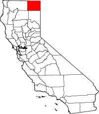 California's location in the United States
Country  United States
State  California
Region Shasta Cascade Incorporated 1874 County seat Alturas Area – Total 4,203.37 sq mi (10,886.7 km2) – Land 3,944.10 sq mi (10,215.2 km2) – Water 259.28 sq mi (671.5 km2) Population (2010) – Total 9,686 – Density 2.3/sq mi (0.9/km2) Time zone Pacific Standard Time (UTC-8) – Summer (DST) Pacific Daylight Time (UTC-7) Website www.modoccounty.us Modoc County is a county located in the far northeast corner of the U.S. state of California, bounded by the state of Oregon to the north and the state of Nevada to the east. As of the 2010 census, its population was 9,686, up from 9,449 at the 2000 census. The current county seat is Alturas, the county's only incorporated city. Previous county seats include Lake City and Centerville; the latter is now a ghost town. The county's official slogans include, "The last best place," and "Where the West still lives."
A large portion of Modoc County is federal land. Several federal agencies, including the United States Forest Service, Bureau of Land Management, National Park Service, Bureau of Indian Affairs, and the United States Fish and Wildlife Service, have employees assigned to the area, and their operations are a significant part of the economy and services in this rural area.
Modoc County is the only county in California to be bordered by both Nevada and Oregon, and is also one of two counties in California to border more than one state (the other county being San Bernardino County, bordered by Nevada and Arizona in southern California).
Contents
History
Prior to the arrival of Europeans in the region, varying cultures of Native Americans inhabited the county for thousands of years. At the time of European encounter, the Modoc people lived in what is now northern California, near Lost River and Tule Lake. The county was named after them.[1] The Achumawi (or Pitt River Indians, for which the Pit River is named), and the Paiute also lived in the area.[1] To the north were the Klamath in present-day Oregon.
The first European explorers to visit Modoc County were the American John C. Frémont and his traveling party (including Kit Carson) in 1846, who had departed from Sutter's Fort near the confluence of the American and Sacramento Rivers. (This is where the city of Sacramento lies today.)[1]
The northern boundary of California, and eventually Modoc County, had been established as the 42nd parallel since the time of Mexican possession. In the absence of a reliable survey of the 120th meridian, the eastern boundary of northern California was a subject of contention before Modoc County formed. The Territory of Utah requested jurisdiction to the summit of the Sierra Nevada. At the time, the Warner Mountains were believed to be a part of the Sierra Nevada, so this would have included Surprise Valley, but California denied the request.[2]
In 1856, the residents of Honey Lake Valley reckoned the 120th meridian to be west of their valley, placing them in Utah territory, and attempted to secede and form a territory they called Nataqua. Nataqua would have included Modoc County.[3] In 1858, the Territory of Nevada, with its capital now in Carson City, successfully seceded from Utah, and assumed jurisdiction to the summit of the Sierra Nevada until the 120th meridian was surveyed in 1863.[2]
After Nevada was granted statehood in 1864, the region of current Modoc County was placed within jurisdiction of Shasta County, California, and Siskiyou County was, in turn, generated from Shasta County in 1852.[4]
Increasing traffic on the emigrant trail, unprovoked militia raids on innocent Modoc, and a cycle of retaliatory raids increased a cycle of violence between settlers and the tribes in the area. [5] In 1864, the Klamath, Modoc and Yahooskin band of the Shoshone signed a treaty ceding lands in both Oregon and California, and the tribes were colocated on the Klamath Reservation. Harassed by the Klamath, traditional competitors, a band of Modoc led by Captain Jack returned to California and the Tule Lake area.
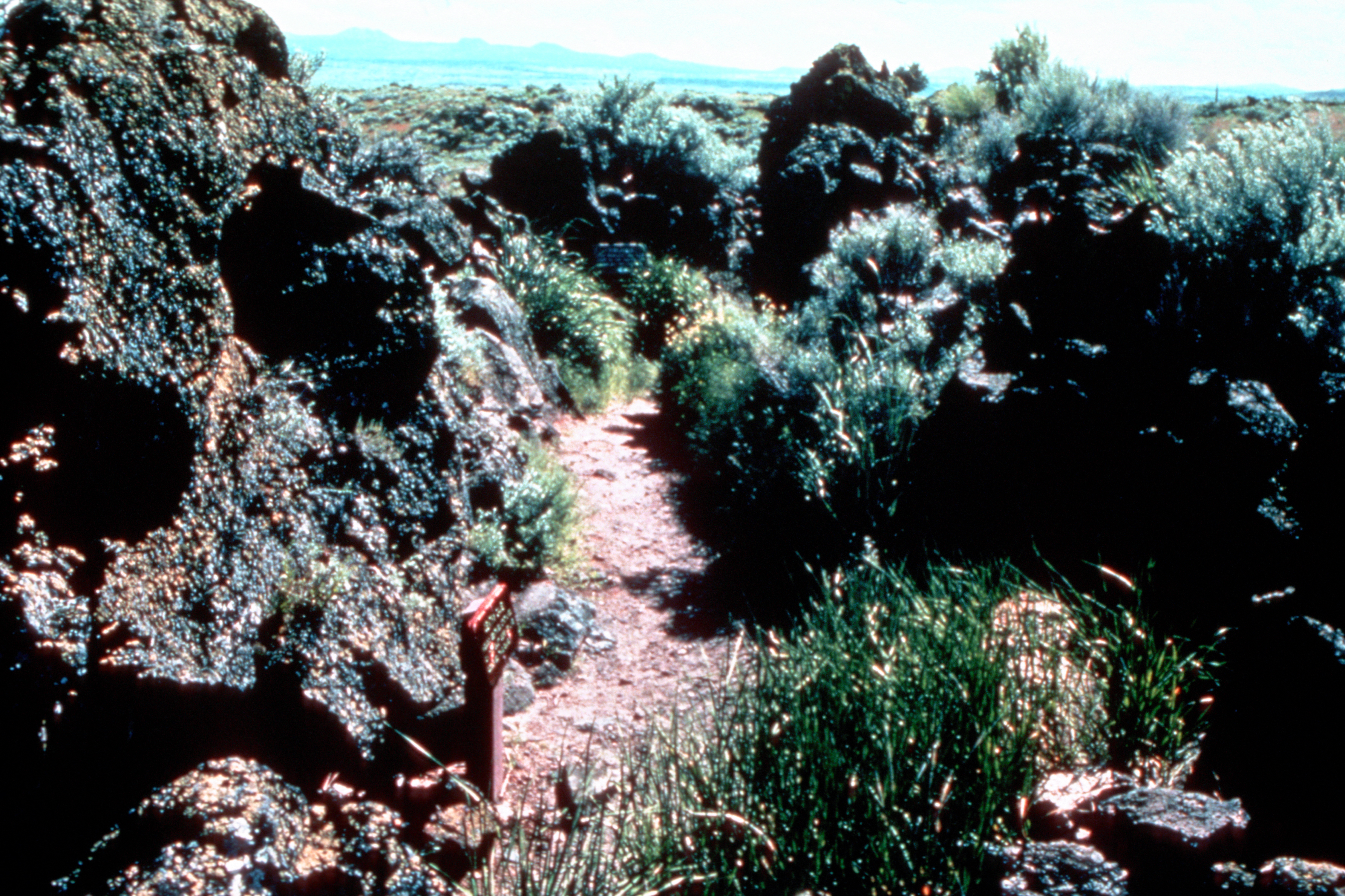
The Modoc War (or Lava Beds War) of 1872–73 brought nationwide attention to the Modoc during the protracted battles. From strong defensive positions in the lava tubes , 52 Modoc warriors held off hundreds of US Army forces, who called in artillery to help.[6] Peace talks in 1873 stalled when the Modoc wanted their own reservation in California. Warriors urged killing the peace commissioners, thinking that the Americans would then leave, and Captain Jack and others shot and killed General Edward Canby and Rev. Eleazer Thomas, and wounded others. More Army troops were called in to lay siege to Captain Jack's Stronghold.[7] Dissension arose, and some Modoc surrendered. Finally most were captured, and those responsible for the assassinations were tried and executed. More than 150 Modoc were transported to Indian Territory as prisoners of war. [8] The area has since been designated the Lava Beds National Monument.
Settlement of the county began in earnest in the 1870s, with the timber, gold, agriculture, and railroad industries bringing most of the settlers into the area. The county was a crossroads for the Lassen Applegate Trail, which brought settlers north from Nevada to the Oregon Trail and south to trails leading into California's central valley. Early settlers included the Dorris, Belli, Essex, Scherer, Trumbo, Flournoy, Polander, and Campbell families.
Modoc County was formed when Governor Newton Booth signed an Act of the California Legislature on February 17, 1874 after residents of the Surprise Valley region lobbied for the creation of a new county from eastern Siskiyou County land.[1] The county residents considered naming the newly formed county after General Edward Canby, who had been killed the year before at peace talks in an ambush by Modoc. The idea of naming the county "Summit" was also considered, but the populace eventually settled on "Modoc"; the war was over and 153 of Captain Jack's band had been transported to Indian Territory as prisoners.[4]
The Dorris Bridge post office opened in 1871,[9] was renamed Dorrisville in 1874; due to its central location, Dorrisville became the county seat when Modoc County formed that year, although both Adin and Cedarville were larger towns.[10] In 1876, it was renamed Alturas, which means "The Heights" in Spanish.[11] The census of 1880 showed a population of 148. Settlement continued over the next two decades, until the city was officially incorporated on September 16, 1901; the county's only incorporated city.
During World War II, the US government developed several thousand acres just south of Newell as a Japanese American internment camp, responding to fears and prejudice by Californians. Tule Lake War Relocation Center was the site of temporary exile for thousands of Japanese-American citizens, who lost most of their businesses and properties where they had formerly lived in coastal areas. A historical marker marks the site along State Route 139 in Newell.
Tule Lake was the largest of the "segregation camps." On November 8, 2005 Senator Dianne Feinstein called for the camp to be designated a National Historic Landmark. In December 2008 it was designated by President George W. Bush as one of nine sites—the only one in the contiguous 48 states—to be part of the new World War II Valor in the Pacific National Monument.
Geography
According to the 2000 census, the county has a total area of 4,203.37 square miles (10,886.7 km2), of which 3,944.10 square miles (10,215.2 km2) (or 93.83%) is land and 259.28 square miles (671.5 km2) (or 6.17%) is water.[12]
There are 2.25 persons per sq mi, making this one of the most sparsely populated counties in California.
The county is very diverse geographically. The northwestern edge of the county is dominated by the Medicine Lake Highlands, the largest shield volcano on the U.S. West Coast. The Lava Beds National Monument lies partly within the northwest corner of the County. Also along the western edge of the county is the massive Glass Mountain lava flow. The southwestern corner of the county is a unique ecosystem of isolated hardwoods (oaks) and volcanic mountains with intermountain river valleys.
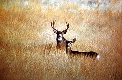
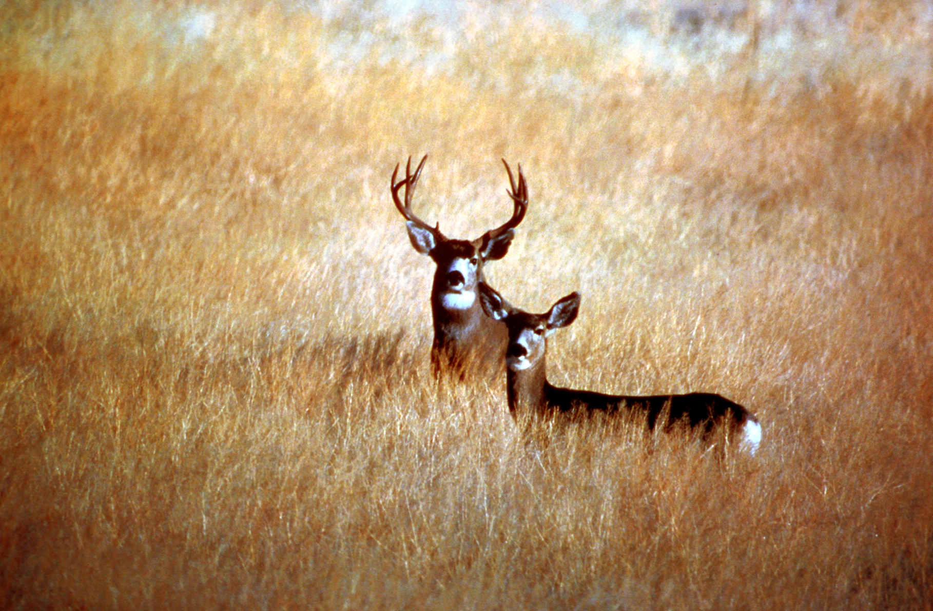
The northern half of the county is the Modoc Plateau, a 1-mile (1.6 km) high expanse of lava flows, cinder cones, juniper flats, pine forests, and seasonal lakes. Nearly 1 million acres (4,000 km²) of the Modoc National Forest lie on the plateau between the Medicine Lake Highlands in the west and the Warner Mountains in the east. The plateau supports large herds of mule deer (Odocoileus Hemionus), Rocky Mountain Elk (Cervus Canadensis), and pronghorn antelope (Antilocapra Americana). There are also several herds of wild horses on the plateau. The Clear Lake National Wildlife Refuge and Long Bell State Game Refuge are located on the plateau as well. The Lost River watershed, which later drains into the Klamath River basin, drains the north part of the plateau, while southern watersheds either collect in basin reservoirs or flow into the large Big Sage Reservoir, which sits in the center of the county, which later flows into the Pit River.
Below the rim of the Plateau is Big Valley in the extreme southwest corner of the county, and the large Warm Springs Valley that forms the bottom of the Pit River watershed that runs through the county. The north fork and south fork of the Pit River come together just south of Alturas. The River collects hundreds of other small creeks as it flows south towards Lake Shasta, where it joins the Sacramento River and drains into the San Francisco Bay.
The eastern edge of the county is dominated by the Warner Mountains. The Pit River originates in this mountain range. Hundreds of alpine lakes dot the range, all of which are fed by snow-melt and natural springs. East of the Warner Range is Surprise Valley and the western edge of the Great Basin.
Hot Springs and lava caves are common to Modoc County. There are some geothermal energy resources available in the county, though their viability is highly variable.
A great diversity of plants are found in Modoc County, since this is situated within the biodiverse California Floristic Province. Numerous native trees are found in the county including Garry Oak and Washoe Pine trees.[13] Jeffrey Pine and Ponderosa Pine are also found in large numbers.[14]
Cities and towns
- Adin
- Alturas
- California Pines
- Canby
- Cedarville
- Davis Creek
- Eagleville
- Ft. Bidwell
- Lake City
- Likely
- Lookout
- Newell
- New Pine Creek
- Stronghold
- Tionesta
Adjacent counties

Klamath & Lake counties (Oregon) Siskiyou County 
Washoe County, Nevada  Modoc County, California

Shasta County Lassen County National protected areas
- Clear Lake National Wildlife Refuge
- Lava Beds National Monument (part)
- Modoc National Forest (part)
- Shasta National Forest (part)
- Modoc National Wildlife Refuge (part)
- Tule Lake National Wildlife Refuge (part)
Transportation Infrastructure
Major highways
Additionally, the eastern Modoc County cities of Eagleville, Cedarville, Lake City, and Fort Bidwell are connected via Surprise Valley Road, which runs from the southern county line to the Oregon border.
Public transportation
The Sage Stage is a dial-a-ride service providing trips within Modoc County. It has also provided trips as far away as Klamath Falls, Oregon, and Reno, Nevada.
Airports
There are general aviation airports near Alturas (Alturas Municipal Airport and California Pines Airport). Other airports include Cedarville Airport, Eagleville Airport, Fort Bidwell Airport, and Tulelake Municipal Airport.
Politics
Modoc County vote
by party in presidential electionsYear GOP DEM Others 2008 67.5% 2,981 29.8% 1,313 2.2% 95 2004 72.4% 3,235 25.7% 1,149 1.9% 83 2000 72.5% 2,969 23.1% 945 4.5% 183 1996 53.1% 2,285 31.8% 1,368 15.1% 650 1992 39.0% 1,803 32.2% 1,489 28.8% 1,333 1988 62.7% 2,518 35.3% 1,416 2.1% 83 1984 69.5% 2,995 28.3% 1,219 2.2% 96 1980 64.5% 2,579 26.2% 1,046 9.4% 375 1976 51.2% 1,917 46.3% 1,733 2.5% 94 1972 58.5% 2,085 35.7% 1,271 5.9% 209 1968 52.4% 1,713 38.7% 1,264 8.9% 290 1964 41.3% 1,386 58.7% 1,972 0.0% 0 1960 51.8% 1,839 47.6% 1,691 0.6% 20 1956 53.2% 1,981 46.4% 1,729 0.4% 13 1952 61.4% 2,634 38.0% 1,633 0.6% 26 1948 46.5% 1,480 50.3% 1,607 2.9% 93 1944 45.4% 1,288 54.3% 1,540 0.3% 9 1940 37.8% 1,371 61.5% 2,232 0.7% 27 1936 34.2% 968 64.6% 1,828 1.2% 35 1932 27.5% 655 68.9% 1,643 3.7% 88 1928 56.8% 942 42.8% 711 0.4% 7 1924 43.7% 731 22.4% 374 33.9% 567 1920 62.6% 992 33.8% 535 3.7% 58 Modoc is a strongly Republican county in Presidential and congressional elections. It is the most Republican county in California. The last Democrat to win a majority in the county was Lyndon Johnson in 1964.
Modoc is part of California's 4th congressional district, which is held by Republican Tom McClintock. In the state legislature Modoc is in the 2nd Assembly district, which is held by Republican Doug La Malfa, and the 1st Senate district, which is held by Republican Ted Gaines.
On Nov. 4, 2008 Modoc County delivered the most lop-sided vote in favor of John McCain of any county in California, with 67.9% of voters opting for the Republican. The county also voted 74.2 % in favor of Proposition 8 which amended the California Constitution to ban same-sex marriages; only Kern and Tulare counties voted in higher proportion, both opting for the Proposition with 75.4% of the vote.[15]
Demographics
Historical populations Census Pop. %± 1880 4,399 — 1890 4,986 13.3% 1900 5,076 1.8% 1910 6,191 22.0% 1920 5,425 −12.4% 1930 8,038 48.2% 1940 8,713 8.4% 1950 9,678 11.1% 1960 8,308 −14.2% 1970 7,469 −10.1% 1980 8,610 15.3% 1990 9,678 12.4% 2000 9,449 −2.4% 2010 9,686 2.5% [16][17][18] 2010
The 2010 United States Census reported that Modoc County had a population of 9,686. The racial makeup of Modoc County was 8,084 (83.5%) White, 82 (0.8%) African American, 370 (3.8%) Native American, 78 (0.8%) Asian, 21 (0.2%) Pacific Islander, 680 (7.0%) from other races, and 371 (3.8%) from two or more races. Hispanic or Latino of any race were 1,342 persons (13.9%).[19]
Population reported at 2010 United States Census The County Total
PopulationWhite African
AmericanNative
AmericanAsian Pacific
Islanderother
racestwo or
more racesHispanic
or Latino
(of any race)Modoc County 9,686 8,084 82 370 78 21 680 371 1,342 Incorporated
cityTotal
PopulationWhite African
AmericanNative
AmericanAsian Pacific
Islanderother
racestwo or
more racesHispanic
or Latino
(of any race)Alturas 2,827 2,430 15 81 45 7 118 131 347 Census-designated
placeTotal
PopulationWhite African
AmericanNative
AmericanAsian Pacific
Islanderother
racestwo or
more racesHispanic
or Latino
(of any race)Adin 272 240 2 8 0 0 9 13 32 California Pines 520 416 11 16 6 2 33 36 83 Canby 315 292 2 7 1 0 9 4 24 Cedarville 514 422 1 15 0 0 59 17 86 Daphnedale Park 184 166 2 6 0 4 2 4 18 Eagleville 59 58 0 0 0 0 1 0 2 Fort Bidwell 173 75 2 76 0 0 10 10 23 Lake City 61 58 0 0 0 0 0 3 0 Likely 63 57 0 5 0 0 0 1 6 Lookout 84 76 0 2 0 0 5 1 14 New Pine Creek 98 89 0 0 0 1 0 8 4 Newell 449 199 2 23 1 5 193 26 271 Unincorporated
communitiesTotal
PopulationWhite African
AmericanNative
AmericanAsian Pacific
Islanderother
racestwo or
more racesHispanic
or Latino
(of any race)All others not CDPs (combined) 4,067 3,506 45 131 25 2 241 117 432 2000
As of the census[20] of 2000, there were 9,449 people, 3,784 households, and 2,550 families residing in the county. The population density was 2 people per square mile (1/km²). There were 4,807 housing units at an average density of 1 per square mile (0/km²). The racial makeup of the county was 85.94% White, 0.69% Black or African American, 4.21% American Indian, 0.61% Asian, 0.07% Pacific Islander, 5.69% from other races, and 2.78% from two or more races. 11.51% of the population were Hispanic or Latino of any race.
The largest ethnicities/ancestry groups in Modoc county include: 15% English, 14% Irish and 13% German.[21] 90.4% spoke English and 8.8% Spanish as their first language.
There were 3,784 households out of which 29.1% had children under the age of 18 living with them, 54.6% were married couples living together, 8.8% had a female householder with no husband present, and 32.6% were non-families. 28.1% of all households were made up of individuals and 12.7% had someone living alone who was 65 years of age or older. The average household size was 2.39 and the average family size was 2.91.
In the county the population was spread out with 25.6% under the age of 18, 5.7% from 18 to 24, 23.3% from 25 to 44, 27.7% from 45 to 64, and 17.6% who were 65 years of age or older. The median age was 42 years. For every 100 females there were 102.4 males. For every 100 females age 18 and over, there were 98.7 males.
The median income for a household in the county was $27,522, and the median income for a family was $35,978. Males had a median income of $30,538 versus $23,438 for females. The per capita income for the county was $17,285. About 16.4% of families and 21.5% of the population were below the poverty line, including 29.7% of those under age 18 and 8.6% of those age 65 or over.
Modoc County has the lowest median household income of any county in California.
In 2005, the median home price reached $100,000 for the first time ever, over a 40% increase since 2000. Much of this can be traced to an influx of residents from other parts of the state, who find the housing bargains attractive. Some of these are retirees who have sold their houses for large profits in other parts of the state, using the proceeds to live on, while others are people who are able to telecommute. This sudden rise in housing prices become unaffordable for locals, who find themselves unable to purchase homes given their limited incomes.
See also
- Hiking trails in Modoc County
- List of school districts in Modoc County, California
- National Register of Historic Places listings in Modoc County, California
Notes
- ^ a b c d Kyle, p. 216
- ^ a b Pease, Robert W. (1965). Modoc County; University of California Publications in Geography, Volume 17. Berkeley and Los Angeles: University of California Press. pp. 76–77.
- ^ "Reprinted from a previous issue...". Nataqua News (Thumbs Up Publishing). 1997. http://www.ectownusa.com/Nataqua/whatisnataqua.html. Retrieved 2010-04-05.
- ^ a b "Modoc County History". Alturas Chamber of Commerce. Modoc County Government. 2009. http://www.alturaschamber.org/history.htm. Retrieved 21 July 2009.
- ^ Kyle, p. 217
- ^ Kyle, p. 218-219
- ^ "Modoc Wars, 1873–74". California State Military Museum. 2009. http://www.militarymuseum.org/Modoc1.html. Retrieved 21 July 2009.
- ^ Kyle, p. 219
- ^ Durham, David L. (1998). California's Geographic Names: A Gazetteer of Historic and Modern Names of the State. Quill Driver Books. p. 351. ISBN 9781884995149.
- ^ Pease, Robert W. (1965). Modoc County; University of California Publications in Geography, Volume 17. Berkeley and Los Angeles: University of California Press. p. 84.
- ^ Gudde, Erwin; William Bright (2004). California Place Names (Fourth ed. ed.). University of California Press. pp. 10. ISBN 0-520-24217-3.
- ^ "Census 2000 U.S. Gazetteer Files: Counties". United States Census. http://www.census.gov/tiger/tms/gazetteer/county2k.txt. Retrieved 2011-02-13.
- ^ C. Michael Hogan (2008) Quercus kelloggii, Globaltwitcher, ed N. Stromberg [1]
- ^ Michael G. Barbour and William Dwight Billings (2000) North American Terrestrial Vegetation, Second edition, Cambridge University Press, ISBN 0521559863, 9780521559867
- ^ "California results". Los Angeles Times. http://www.latimes.com/news/local/la-2008election-california-results,0,3304898.htmlstory.
- ^ http://www.census.gov/population/www/censusdata/cencounts/files/ca190090.txt
- ^ http://factfinder2.census.gov
- ^ http://mapserver.lib.virginia.edu/
- ^ "2010 Census P.L. 94-171 Summary File Data". United States Census Bureau. http://www2.census.gov/census_2010/01-Redistricting_File--PL_94-171/California/.
- ^ "American FactFinder". United States Census Bureau. http://factfinder.census.gov. Retrieved 2008-01-31.
- ^ http://www.epodunk.com/cgi-bin/genealogyInfo.php?locIndex=10524
References
- La Ganga, Maria L., "Housing Bargains, at a Price", Los Angeles Times, January 13, 2006
- OpenRoad.TV (Modoc County's Living West video story)
- Historic Spots in California. Stanford, California: Stanford University Press. 2002 (5th edition). ISBN 0804744823.
External links
- Modoc County Official Website
- h2g2 Guide Entry A1065278: Modoc County, California, USA
- Modoc County, CAGenWeb California GenWeb Project for Modoc County
Municipalities and communities of Modoc County, California City 
CDPs Adin | California Pines | Canby | Cedarville | Daphnedale Park | Eagleville | Fort Bidwell | Lake City | Likely | Lookout | New Pine Creek | Newell
Unincorporated
communitiesAmbrose | Boles | Bormister | Brooks Mill | Campbell | Cantrall Mill | Christensen | Copic | Cornell | D Flourney | Dalton | Davis Creek | Day | Demuth | Derner | Dibble Place | Fairport | Fletcher Place | Flourney | Grizzlie Place | Hackamore | Hannchen | Harper | Homestead | Juniper | K Flourney | Kalina | Kandra | Kauffman | Kephart | Lakeview Junction | Liskey | Lookout Junction | Mammoth | McArthur | McGarva | Meares | Menlo Baths | Mulkey Place | Old Hulbert Place | Perez | R Flourney | Ramsey | Scarface | Staley | Stronghold | Surprise Station | Tionesta | Tuber | Vestil | White Horse | Williams | Willow Ranch
Indian
reservationsAlturas Indian Rancheria | Fort Bidwell Reservation | XL Rancheria
Former
settlementsCategories:- California counties
- Modoc County, California


Wikimedia Foundation. 2010.