- Long Beach, California
-
This article is about the city of Long Beach, California. For its metropolitan area, see Los Angeles metropolitan area.
Long Beach — City — Images from top, left to right: Long Beach skyline from Bluff Park, RMS Queen Mary, Aquarium of the Pacific Blue Cavern exhibit, Hanjin Terminal at Port of Long Beach, Villa Riviera, Metro Blue Line, Long Beach Lighthouse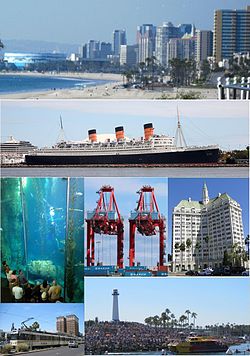

Flag
SealNickname(s): LB, the LBC Motto: The International City Location within Los Angeles County in the state of California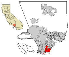 Location in the United States
 Long Beach
Coordinates: 33°48′15″N 118°9′29″W / 33.80417°N 118.15806°WCoordinates: 33°48′15″N 118°9′29″W / 33.80417°N 118.15806°W Country United States State California County Los Angeles Incorporated December 13, 1897 Government - Type Council-manager government - Mayor Bob Foster - City Council Robert Garcia
Suja Lowenthal
Gary DeLong
Patrick O'Donnell
Gerrie Schipske
Dee Andrews
James Johnson
Rae Gabelich
Steve Neal- City Attorney Robert E. Shannon - City Auditor Eddie Deason - City Prosecutor Doug Haubert Area[1] - Total 51.437 sq mi (133.223 km2) - Land 50.293 sq mi (130.259 km2) - Water 1.144 sq mi (2.964 km2) 2.22% Elevation 0 ft (Sea Level 0 m) Population (2010) - Total 462,257 - Rank 2nd in Los Angeles County
7th in California
36th in the United States- Density 9,191.3/sq mi (3,548.8/km2) Time zone PST (UTC-8) - Summer (DST) PDT (UTC-7) ZIP code 90801-90810, 90813-90815, 90822, 90831-90835, 90840, 90842, 90844-90848, 90853, 90888, 90899 Area code(s) 562, 310 (Only Some Small Areas Cover 310 Area Code) FIPS code 06-43000 GNIS feature ID 1652747 Website www.longbeach.gov Long Beach is a city situated in Los Angeles County in Southern California, on the Pacific coast of the United States. The city is the 36th-largest city in the nation and the seventh-largest in California. As of 2010, its population was 462,257. In addition, Long Beach is the second largest city within Greater Los Angeles and a principal city of the Los Angeles-Long Beach-Santa Ana metropolitan area.
The city is a dominant maritime center of the United States and was recently named "Aquatic Capital of the Nation." It wields substantial influence critical to the global economy. The Port of Long Beach is the United States' second busiest container port and one of the world's largest shipping ports.[2] The city also maintains a large oil industry with the substance being found both underground and offshore. Manufacturing sectors include those in aircraft, car parts, electronic and audiovisual equipment, and home furnishings. It is also home to headquarters for corporations including Epson America, Molina Healthcare, and SCAN Health Plan. Long Beach has grown with the development of high-technology and aerospace industries in the area.
Long Beach is located about 20 miles (32 km) south of downtown Los Angeles and 105 miles (169 km) north of San Diego. Long Beach borders Orange County on its southeast edge and other Gateway Cities to the west and north.
Contents
History
Indigenous peoples have lived in coastal southern California for at least ten thousand years. Over the centuries, several successive cultures inhabited the present-day area of Long Beach. By the time Spanish explorers arrived in the sixteenth century, the dominant group were the Tongva people. They had at least three major settlements within the present-day city boundaries. Tevaaxa'anga was an inland settlement near the Los Angeles River, while Ahwaanga and Povuu'nga were coastal villages. Along with other Tongva villages, they were forced to relocate in the mid-19th century due to missionization, political change, and a drastic drop in population from exposure to European diseases.[3]
In 1784 the Spanish Empire's, King Carlos III granted Rancho Los Nietos to the Spanish soldier, Manuel Nieto. The Rancho Los Cerritos and Rancho Los Alamitos were divided from this territory. The boundary between the two ranchos ran through the center of Signal Hill on a southwest to northeast diagonal. A portion of western Long Beach was originally part of the Rancho San Pedro. Its boundaries were in dispute for years, due to flooding changing the Los Angeles River boundary, between the ranchos of Juan Jose Dominguez and Manuel Nieto.
In 1843 Jonathan Temple bought Rancho Los Cerritos, after arriving in California in 1827 from New England. He built what is now known as the "Los Cerritos Ranch House", an adobe which still stands and is a National Historic Landmark. Temple created a thriving cattle ranch and prospered, becoming the wealthiest man in Los Angeles County. Both Temple and his ranch house played important local roles in the Mexican-American War. On an island in the San Pedro Bay, Mormon pioneers made an abortive attempt to establish a colony (as part of Brigham Young's plan to establish a continuous chain of settlements from the Pacific to Salt Lake).
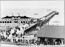 Long Beach pier, 1905
In 1866 Temple sold Rancho Los Cerritos for $20,000 to the Northern California sheep-raising firm of Flint, Bixby & Co, which consisted of brothers Thomas and Benjamin Flint and their cousin Lewellyn Bixby. Two years previous Flint, Bixby & Co had also purchased along with Northern California associate James Irvine, three ranchos which would later become the city that bears Irvine's name. To manage Rancho Los Cerritos, the company selected Lewellyn's brother Jotham Bixby, the "Father of Long Beach". Three years later Bixby bought into the property and would later form the Bixby Land Company. In the 1870s as many as 30,000 sheep were kept at the ranch and sheared twice yearly to provide wool for trade. In 1880, Bixby sold 4,000 acres (16 km2) of the Rancho Los Cerritos to William E. Willmore, who subdivided it in hopes of creating a farm community, Willmore City. He failed and was bought out by a Los Angeles syndicate that called itself the "Long Beach Land and Water Company." They changed the name of the community to Long Beach, which was incorporated as a city in 1888.
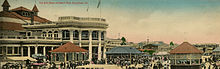 Long Beach boardwalk, 1907
Another Bixby cousin, John W. Bixby, was influential in the city. After first working for his cousins at Los Cerritos, J.W. Bixby leased land at Rancho Los Alamitos. He put together a group: banker I.W. Hellman, Lewellyn and Jotham Bixby, and him, to purchase the rancho. In addition to bringing innovative farming methods to the Alamitos (which under Abel Stearns in the late 1850s and early 1860s was once the largest cattle ranch in the US), J.W. Bixby began the development of the oceanfront property near the city's picturesque bluffs. Under the name Alamitos Land Company, J.W. Bixby named the streets and laid out the parks of his new city. This area would include Belmont Heights, Belmont Shore and Naples; it soon became a thriving community of its own. J.W. Bixby died in 1888 of apparent appendicitis. The Rancho Los Alamitos property was split up, with Hellman getting the southern third, Jotham and Lewellyn the northern third, and J.W. Bixby's widow and heirs keeping the central third. The Alamitos townsite was kept as a separate entity, but it was basically run by Lewellyn and Jotham's Bixby Land Company.
When Jotham Bixby died in 1916, the remaining 3,500 acres (14 km2) of Rancho Los Cerritos was subdivided into the neighborhoods of Bixby Knolls, California Heights, North Long Beach and part of the city of Signal Hill.
 Oil field in Long Beach, 1920
The town grew as a seaside resort with light agricultural uses.[4] The Pike was the most famous beachside amusement zone on the West Coast from 1902 until 1969, it offered bathers food, games and rides, such at the Dual Ferris Wheel and Cyclone Racer' roller coaster. Gradually the oil industry, Navy shipyard and facilities and port became the mainstays of the city. In the 1950s it was referred to as "Iowa by the sea," due to a large influx of people from that and other Midwestern states. Huge picnics for migrants from each state were a popular annual event in Long Beach until the 1960s.
Oil was discovered in 1921 on Signal Hill, which split off as a separate incorporated city shortly afterward. The discovery of the Long Beach Oil Field, brought in by the gusher at the Alamitos No. 1 well, made Long Beach a major oil producer; in the 1920s the field was the most productive in the world.[5] In 1932, the even larger Wilmington Oil Field, fourth-largest in the United States, and which is mostly in Long Beach, was developed, contributing to the city's fame in the 1930s as an oil town.[6]
The Long Beach earthquake of 1933 was a magnitude 6.3 earthquake that caused significant damage to the city and surrounding areas, killing a total of 120 people. Most of the damage occurred in unreinforced masonry buildings, especially schools. Pacific Bible Seminary (now known as Hope International University) was forced to move classes out of First Christian Church of Long Beach and into a small local home due to damage from the earthquake.[7]
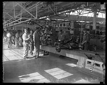 The new Ford assembly plant in Long Beach, 1930
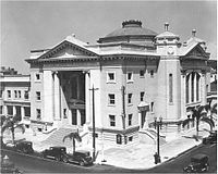 First Christian Church of Long Beach was the site of Pacific Bible Seminary (now called Hope International University) in the early 1930s
The city was the site of "The Los Angeles Air Raid of 1942" during World War II, when observers for the Army Air Corps reported shells being fired from the sea. Anti-aircraft batteries fired into the night sky, although no planes were ever sighted.
Before the war, Long Beach had a sizable Japanese-American population, who worked in the fish canneries on Terminal Island and owned small truck (produce) farms in the area. Due to exaggerated fears on the coast and racial prejudice, state officials persuaded the national government to remove Japanese nationals and Japanese Americans for internment in 1942 to inland facilities. Most did not return to the city after their release from the camps. Due to this and other factors, Japanese Americans now make up less than 1% of the population of Long Beach, but the Japanese Community Center and a Japanese Buddhist Church survive. The Japanese-American Cultural Center is located over the Gerald Desmond Bridge and the Vincent Thomas Bridge in San Pedro.
The nonprofit Aquarium of the Pacific, located in downtown Long Beach, opened to the public in 1998. It has become a major attraction visited by more than 13 million people since its opening. The Aquarium was rated #2 Los Angeles area Family Destination in the most recent Zagat U.S. Family Travel Guide, second only to Disneyland. The Aquarium’s architecture is inspired by the breaking waves of the Pacific. Kajima International was the developer of the Aquarium of the Pacific and architects included the Los Angeles office of Hellmuth, Obata & Kassanbaum and Esherick Homsey Dodge and Davis of San Francisco. The Aquarium of the Pacific recently made history as the first in the museum, zoo, or aquarium industry to become a Climate Action Leader for voluntarily measuring, certifying, and reporting its green house gas emissions to the Climate Action Registry and the public.
Cityscape


Panorama of Long Beach as viewed from the RMS Queen Mary Neighborhoods
Long Beach is composed of many different neighborhoods, which are variously defined and delineated by residents and the local media. However, the names and boundaries of neighborhoods themselves are not officially recognized by the City, with limited exceptions for statutory purposes (the City does, however, recognize neighborhood advocacy groups representing some of these neighborhoods or portions thereof). Some neighborhoods are named after thoroughfares, while others are named for nearby parks, schools, or city features. They include (alphabetically):
- 4th Street Corridor
- Alamitos Beach
- Alamitos Heights
- Arlington
- Artcraft Manor
- Belmont Heights
- Belmont Park
- Belmont Shore
- Bixby Highlands
- Bixby Knolls
- Bixby Terrace
- Bixby Village
- Bluff Heights
- Bluff Park
- Broadway Corridor
- California Heights
- Carroll Park
- Central Area
- Craftsman Village
- Downtown Long Beach
- Drake Park
- East Village
- Eastside
- El Dorado Park
- El Dorado Park Estates
- El Dorado South
- Hellman
- Imperial Estates
- Lakewood Village
- Cambodia Town (Little Phnom Penh)
- Long Beach Marina
- Los Altos
- Los Cerritos - Virginia Country Club
- Memorial Height
- Naples
- North Long Beach
- Park Estates,[8]
- Peninsula
- Poly High
- Promenade
- Ranchos
- Ridgewood Heights
- Rose Park
- Shoreline Village
- South of Conant
- Stearns Park
- Saint Mary's
- Sunrise
- Terminal Island
- Traffic Circle
- University Park Estates
- West Long Beach
- Willmore City
- Wrigley North and South
- Wrigley Heights
- Zaferia
Geography
 Long Beach, California: Skyline Photo
Long Beach is located at 33°47' North, 118°10' West, about 20 miles (32 km) south of downtown Los Angeles. According to the United States Census Bureau, the city has a total area of 51.437 square miles (133.2 km2), with 50.293 square miles (130.3 km2) of its area being land and 1.144 square miles (2.96 km2) of it (2.22%) is water. Long Beach completely surrounds the city of Signal Hill.
Climate
Long Beach, depending on the reporting location, has a Mediterranean climate, with strongly semi-arid climate characteristics. Due to its proximity to the Pacific Ocean, temperatures in Long Beach are moderate throughout the year. Temperatures recorded at the weather station at the Long Beach Airport, 4.0 miles (6.4 km) inland from the ocean, range more greatly than those along the immediate coast. During the summer months, low clouds and fog occur frequently, developing overnight and blanketing the area on many mornings. This fog usually clears by the afternoon, and a westerly sea breeze often develops, keeping temperatures mild. Heat and humidity rarely coincide, making heat waves more tolerable than they would be otherwise.
Long Beach's geographic location directly east of the Palos Verdes Peninsula, paired with its mostly south-facing coastline, results in the community having significantly different weather patterns than coastal communities to the north and south. The 1200' Palos Verdes hills block east to west airflow and, with it, a significant amount of the coastal moisture that marks other Los Angeles County coastal cities, such as Manhattan Beach and Santa Monica.
As in most locations in southern California, rainfall occurs largely during the winter months. Storms can bring heavy rainfall, but Long Beach receives less precipitation than locations adjacent to the San Gabriel or San Bernardino mountains further inland, whose rainfall is enhanced by orographic lift.[9]
Climate data for Long Beach, California (Long Beach Airport) Month Jan Feb Mar Apr May Jun Jul Aug Sep Oct Nov Dec Year Average high °F (°C) 68.0
(20.0)68.5
(20.3)68.9
(20.5)72.7
(22.6)74.0
(23.3)78.3
(25.7)82.9
(28.3)84.6
(29.2)83.1
(28.4)78.9
(26.1)73.4
(23.0)68.8
(20.4)75.2 Daily mean °F (°C) 57.0
(13.9)58.3
(14.6)59.7
(15.4)63.0
(17.2)65.9
(18.8)69.8
(21.0)73.8
(23.2)75.1
(23.9)73.4
(23.0)68.6
(20.3)61.8
(16.6)57.1
(13.9)65.3 Average low °F (°C) 46.0
(7.8)48.1
(8.9)50.4
(10.2)53.2
(11.8)57.8
(14.3)61.3
(16.3)64.6
(18.1)65.6
(18.7)63.7
(17.6)58.3
(14.6)50.1
(10.1)45.3
(7.4)55.4 Rainfall inches (mm) 2.95
(74.9)3.01
(76.5)2.43
(61.7)0.60
(15.2)0.23
(5.8)0.08
(2)0.02
(0.5)0.10
(2.5)0.24
(6.1)0.40
(10.2)1.12
(28.4)1.76
(44.7)12.94
(328.7)Avg. rainy days 6.5 6.3 6.3 3.2 1.3 0.5 0.4 0.5 1.1 2.1 3.2 4.7 36.1 Source: NOAA [10] Environment
Pollution
Long Beach suffers from some of the worst air pollution in southern California and the United States. Most of the city is in close proximity to the twin ports of Los Angeles and Long Beach, and the prevailing westerly-to-west-south-westerly winds bring a large portion of the twin ports' air pollution directly into Long Beach before dispersing it northward then eastward over Whittier, Covina, Pomona, and Riverside.[11] Heavy pollution sources at the ports include the ships themselves, which burn high-sulfur, high-soot-producing bunker fuel to maintain internal electrical power while docked, as well as heavy diesel pollution from drayage trucks at the ports, and short-haul tractor-trailer trucks ferrying cargo from the ports to inland warehousing, rail yards, and shipping centers. Long-term average levels of toxic air pollutants (and the corresponding carcinogenic risk they create) can be two to three times higher in and around Long Beach, and in downwind areas to the east, than in other parts of the Los Angeles metropolitan area, such as the Westside, San Fernando Valley, or San Gabriel Valley.[12] The smell of burning bunker fuel, which has an odor similar to a car burning motor oil, is not uncommon in downtown Long Beach and other port-adjacent areas.
Additionally, the Long Beach area is directly downwind of several of the South Bay oil refineries. Any refinery process or upset that results in the atmospheric release of refinery by-products (commonly sulfur dioxide) will usually impact air in Long Beach. Air quality events where large portions of the City are affected by strong-smelling refinery gas releases occur several times a year, although they largely go unreported.
Similarly, the water quality in the Long Beach portion of San Pedro Bay, which is enclosed by the Federal Breakwater, commonly ranks among the poorest on the West Coast. Many Long Beach beaches average a D or F grade on beach water quality in the Beach Report Card published by Heal the Bay.[13] The Los Angeles River discharges directly into the Long Beach side of San Pedro Bay, and conveys a large portion of all the urban runoff from the entire Los Angeles metropolitan area directly into the harbor water. This runoff contains most of the debris, garbage, chemical pollutants, and biological pathogens that are washed into storm drains in every upstream city each time it rains. Because the breakwater prevents normal tidal flushing and wave action, these pollutants build up in the harbor. The water enclosed by the breakwater, along most of the City's beaches, can be subject to red tides due to this stagnation as well. Because of these factors, the water in Long Beach often is unsafe for swimming.[13]
Ecology
 View of Long Beach
The area that is now Long Beach historically included several ecological communities, with coastal scrub dominating.[14] A handful of the native plants of the region can still be found in the city. These include California buckwheat (Eriogonum fasciculatum), California sagebrush (Artemisia californica), and California poppy (Eschscholzia californica). Some stands of coast live oak (Quercus agrifolia) still remain in the El Dorado Nature Center. California fan palm (Washingtonia filifera), a plant that is native further inland, was introduced to the city as a garden ornamental and is now naturalized. Some indigenous species of birds, mammals, and other wildlife have adapted to development.
Since the arrival of Europeans, many alien species have become naturalized in the area. Introduced plants include yellow mustard, eucalyptus, wild radish, and tumbleweed. Such plants now far outnumber the indigenous plants and spread rapidly in the city's vacant lots and oil fields.
The city and its residents have initiatives underway to preserve and reclaim a small part of its ecological heritage. The RiverLink project has begun to revegetate the Long Beach stretch of the Los Angeles River with indigenous plants. Part of the remaining Pacific Electric right-of-way was cleared of nonnatives, planted with indigenous plants, and made accessible with foot and bike paths. This community open space is now known as The Long Beach Greenbelt and is the focus of continuing efforts in restoration and community education.
The El Dorado Nature Center has changed its original "hands-off" approach and begun to actively introduce indigenous species.[15] The Los Cerritos Wetlands Study Group, state government agencies, and grassroots groups are collaborating on a plan to preserve Long Beach's last remaining wetlands.[16] Long Beach is the first city in California to join the 'EcoZone' Program, intended to measurably improve environmental conditions through public-private partnerships. Such projects seek to reduce pollution, restore native habitat, and provide green areas for the city's residents to enjoy.
Other places in Long Beach to see natural areas include Bluff Park (coastal bluffs), the Golden Shores Marine Reserve, the Jack Dunster Marine Reserve, Shoreline Park, and DeForest Park.
Demographics
Historical populations Census Pop. %± 1890 564 — 1900 2,252 299.3% 1910 17,809 690.8% 1920 55,593 212.2% 1930 142,032 155.5% 1940 164,271 15.7% 1950 250,767 52.7% 1960 344,168 37.2% 1970 358,879 4.3% 1980 361,355 0.7% 1990 429,433 18.8% 2000 461,522 7.5% 2010 462,257 0.2% 2010
The 2010 United States Census[17] reported that Long Beach had a population of 462,257. The population density was 9,191.3 people per square mile (3,548.8/km²). The racial makeup of Long Beach was 213,066 (46.1%) White, 62,603 (13.5%) African American, 3,458 (0.7%) Native American, 59,496 (12.9%) Asian (4.5% Filipino, 3.9% Cambodian, 0.9% Vietnamese, 0.6% Chinese, 0.6% Japanese, 0.4% Indian, 0.4% Korean, 0.2% Thai, 0.1% Laotian), 5,253 (1.1%) Pacific Islander (0.8% Samoan, 0.1% Guamanian), 93,930 (20.3%) from other races, and 24,451 (5.3%) from two or more races. Hispanic or Latino of any race were 188,412 persons (40.8%). Among the Hispanic population, 32.9% are Mexican, 1.4% Salvadoran, 1.1% Guatemalan, 0.7% Puerto Rican, 0.6% Honduran, and 0.3% Cuban.
The Census reported that 453,980 people (98.2% of the population) lived in households, 5,321 (1.2%) lived in non-institutionalized group quarters, and 2,956 (0.6%) were institutionalized.
There were 163,531 households, out of which 58,073 (35.5%) had children under the age of 18 living in them, 61,850 (37.8%) were opposite-sex married couples living together, 26,781 (16.4%) had a female householder with no husband present, 10,598 (6.5%) had a male householder with no wife present. There were 12,106 (7.4%) unmarried opposite-sex partnerships, and 3,277 (2.0%) same-sex married couples or partnerships. 46,536 households (28.5%) were made up of individuals and 11,775 (7.2%) had someone living alone who was 65 years of age or older. The average household size was 2.78. There were 99,229 families (60.7% of all households); the average family size was 3.52.
The population was spread out with 115,143 people (24.9%) under the age of 18, 54,163 people (11.7%) aged 18 to 24, 140,910 people (30.5%) aged 25 to 44, 109,206 people (23.6%) aged 45 to 64, and 42,835 people (9.3%) who were 65 years of age or older. The median age was 33.2 years. For every 100 females there were 96.1 males. For every 100 females age 18 and over, there were 93.8 males.
There were 176,032 housing units at an average density of 3,422.2 per square mile (1,321.3/km²), of which 67,949 (41.6%) were owner-occupied, and 95,582 (58.4%) were occupied by renters. The homeowner vacancy rate was 2.0%; the rental vacancy rate was 7.2%. 195,254 people (42.2% of the population) lived in owner-occupied housing units and 258,726 people (56.0%) lived in rental housing units.
2000
As of the census[18] of 2000, there were 461,522 people, 163,088 households, and 99,646 families residing in the city. The population density was 9,149.8 inhabitants per square mile (3,532.8/km²). There were 171,632 housing units at an average density of 3,402.6 per square mile (1,313.8/km²). The racial makeup of the city was 45.2% White, 14.9% African American, 0.8% Native American, 12.1% Asian, 1.2% Pacific Islander, 20.6% from other races, and 5.3% from two or more races. Hispanic or Latino of any race were 35.8% of the population.
The city has changed since the 1950s, when its population was predominantly European-American and the city was nicknamed "Iowa by the Sea" or "Iowa under Palm Trees" as it had a slower pace than that of neighboring Los Angeles. Since the second half of the 20th century, the city has been a major port of entry for Asian and Latin American immigrants headed to Los Angeles. The Harbor section of downtown Long Beach was once home to people of Dutch, Greek, Italian, Maltese, Portuguese and Spanish ancestry, most of them employed in manufacturing and fish canneries until the 1960s.
According to a report by USA Today in 2000, Long Beach is the most ethnically diverse large city in the United States.[19] Non-Hispanic White Americans made up 30.0% of the city's population. Its Asian community includes the largest Cambodian community in the United States, and the second-largest Cambodian community outside of Asia (after Paris). A neighborhood along Anaheim Street is called "Little Phnom Penh". There are also sizable populations of immigrants and descendants from Vietnam and the Philippines.
Long Beach had offered many industrial jobs to African Americans during the years of World War II. This resulted in the increase of blacks in Long Beach caused by the Second Great Migration. There are black communities in the Eastside and North Long Beach neighborhoods.
It has a relatively high proportion of Pacific Islanders (over 1% as of the 2000 Census), from Samoa and Tonga. Most American Indians, about 0.8% of the city's population, arrived during the Department of Interior's Bureau of Indian Affairs urban relocation programs in the 1950s.
Long Beach once had a sizable Japanese American population, which largely worked in the fish canneries on Terminal Island and on small truck farms in the area. In 1942, not long after the Attack on Pearl Harbor and subsequent Japanese declaration of war on the United States and Britain, President Franklin D. Roosevelt issued United States Executive Order 9066 which allowed military commanders to designate areas "from which any or all persons may be excluded." Under this order, all Japanese and Americans of Japanese ancestry were categorically removed from Western coastal regions and sent to internment camps, without regard for due process. Most did not return to Long Beach after their release from the camps. Japanese Americans make up less than 1% of the population of Long Beach, yet the city still has a Japanese Community Center and a Japanese Buddhist Church from its earlier history.
As of the 2000 census, there were 163,088 households out of which 35.0% had children under the age of 18 living with them, 39.2% were married couples living together, 16.1% had a female householder with no husband present, and 38.9% were non-families. 29.6% of all households were made up of individuals and 7.4% had someone living alone who was 65 years of age or older. The average household size was 2.77 and the average family size was 3.55.
In the city the population was spread out with 29.2% under the age of 18, 10.9% from 18 to 24, 32.9% from 25 to 44, 18.0% from 45 to 64, and 9.1% who were 65 years of age or older. The median age was 31 years. For every 100 females there were 96.6 males. For every 100 females age 18 and over, there were 93.5 males.
The median income for a household in the city was $37,270, and the median income for a family was $40,002. Males had a median income of $36,807 versus $31,975 for females. The per capita income for the city was $19,040. About 19.3% of families and 22.8% of the population were below the poverty line, including 32.7% of those under age 18 and 11.0% of those age 65 or over. In 2008, the Census Bureau showed the number of people living below the poverty line had dropped to 18.2%.[20]
Economy
- Douglas Aircraft Company (later McDonnell Douglas and now part of Boeing) had plants at the Long Beach Airport where they built aircraft for World War II, and later built DC-8s, DC-9s, DC-10s, and MD-11s.
- Boeing built the Boeing 717 until 2006 and continues to build the C-17 Globemaster III strategic airlifter in Long Beach. Even after greatly reducing the number of local employees in recent years, Boeing is still the largest private employer in the city.
- Polar Air Cargo, an international cargo airline, was formerly based in Long Beach.
- TABC, INC., a part of Toyota, makes a variety of car parts, including steering columns and catalytic converters, in Long Beach.
- U.S. Epson, Inc. the U.S. affiliate of Japan-based Seiko Epson Corporation, is headquartered in Long Beach.[21]
- Pioneer Electronics, the U.S. affiliate of Japan-based Pioneer Corporation, is headquartered in Long Beach.
- SCAN Health Plan, a non-profit "Medicare Advantage" HMO for seniors, is headquartered in Long Beach.
- Molina Healthcare, Inc., a Medicaid management healthcare program, is headquartered in Long Beach.
- Jesse James' West Coast Choppers custom motorcycle shop was located in Long Beach, and much of the Monster Garage cable TV show was filmed in Long Beach.
- Long Beach Green Business Association, organization working to create economic growth through the promotion of green business and promoting a buy local program for Long Beach.[22]
- Health Care Property Investors is based in Long Beach
Top employers
According to the City's 2010 Comprehensive Annual Financial Report,[23] the top employers in the city are:
# Employer # of Employees 1 Long Beach Unified School District 7,846 2 Boeing 7,100 3 California State University, Long Beach 6,599 4 City of Long Beach 5,466 5 Long Beach Memorial Medical Center 5,105 6 Veterans Affairs Medical Center 2,306 7 Long Beach City College 1,664 8 United States Postal Service 1,471 9 St. Mary Medical Center 1,461 10 Verizon 1,200 Other major employers are Gulfstream Aerospace, The Bragg Companies (crane and heavy transport sales), Laserfiche, Pacific Hospital of Long Beach and Long Beach Transit.
Transportation
Ports and freight
 North-west facing view of the harbor and port at dusk
As of 2005, the Port of Long Beach was the second busiest[24] seaport in the United States and the tenth busiest in the world,[citation needed] shipping some 66 million metric tons of cargo worth $95 billion in 2001. The port serves shipping between the United States and the Pacific Rim. The combined operations of the Port of Long Beach and the Port of Los Angeles are the busiest in the USA.
Rail shipping is provided by Union Pacific Railroad and BNSF Railway, which carry about half of the trans-shipments from the port. Long Beach has contributed to the Alameda Corridor project to increase the capacity of the rail lines, roads, and highways connecting the port to the Los Angeles rail hub. The project, completed in 2002, created a trench 20 miles (32 km) long and 33 feet (10 m) deep in order to eliminate 200 grade crossings and cost about US$2.4 billion.
Public transportation

Long Beach Transit provides local public transportation services within Long Beach, Lakewood, and Signal Hill.[25] Long Beach Transit regularly operates 38 bus routes. Bus routes are computer scheduled to ensure excellent on time performance.[26] Most regular service bus routes begin or end at the Long Beach Transit Mall in Downtown Long Beach.
Long Beach Transit also operates the Passport shuttle routes. All four Passport shuttles are free within downtown Long Beach west of Alamitos Ave and require the standard fare otherwise. The red Passport mini-shuttles carry passengers to the Aquarium of the Pacific, Pine Ave, Shoreline Village, the Long Beach Convention Center, the Queen Mary, Catalina Landing, the East Village, and other points of interest.[27] During the summer, Long Beach Transit operates the AquaLink, a 68-foot (21 m) catamaran that carries passengers between the Downtown Long Beach waterfront and the Alamitos Bay Landing.[28] In addition, during the summer, they operate 49-passenger water taxis called the AquaBus. With $1 fares, the AquaBus serves six different locations within the downtown Long Beach waterfront.[29]
The Los Angeles County Metropolitan Transportation Authority (LA Metro) provides public transportation services at the county level. LA Metro operates the Metro Blue Line, a light rail service that runs between the Long Beach Transit Mall in downtown Long Beach and the 7th Street/Metro Center Station in Downtown Los Angeles. From 7th Street/Metro Center Station, passengers can make connections to Hollywood, Union Station, Pasadena, East LA, Universal Studios, Chinatown, and other points of interest along the Los Angeles Metro Rail network. The Metro Blue Line also offers connection to the Metro Green Line at Imperial/Wilmington Station with service to Redondo Beach, Norwalk, and Los Angeles International Airport via an additional shuttle connection. The Metro Blue Line Maintenance Shops are also located in Long Beach just south of the Del Amo Blue Line station.[30]
Several transit operators offer services from the Long Beach Transit Mall. Torrance Transit offers bus service to the South Bay. The Los Angeles Department of Transportation (LADOT) offers bus service to San Pedro. LA Metro operates other regional bus lines.
Orange County Transportation Authority offers limited bus service to Orange County. Route 1, from Long Beach to San Clemente is the longest bus route in the OCTA system. Traveling along Pacific Coast Highway for most of the route, it takes 2-2.5 hrs to complete.[31]
Amtrak Thruway offers bus shuttles starting in San Pedro, with stops at the Queen Mary and downtown Long Beach, that then goes to Union Station in downtown Los Angeles, and ends in Bakersfield.
Greyhound Lines operates the Long Beach Station in downtown Long Beach.[32]
Airports
Main article: Long Beach AirportLong Beach Airport serves the Long Beach, South Bay and northern Orange County areas, but is relatively small, considering the area's population. It is the West Coast hub for JetBlue Airways. It is also the site of a major Boeing (formerly Douglas, then McDonnell Douglas) aircraft production facility, which is the city's largest non-government employer. Los Angeles International Airport is the nearest airport with international service. John Wayne Airport in Santa Ana, California is another alternative to the airport. However, its only international services are to Canada. Other airports with scheduled service are Bob Hope Airport in Burbank and LA/Ontario International Airport in Ontario.
Freeways and highways
Several freeways run through Long Beach, connecting it with the greater Los Angeles and Orange County areas. The San Diego Freeway (I-405) bisects the northern and southern portions of the city and takes commuters northwest or southeast to the Golden State/Santa Ana Freeways (I-5). The San Diego Freeway also provides regional access to Long Beach Airport, which is located on the north side of the freeway near Signal Hill. The Long Beach Freeway (I-710) runs north-south on the city's western border, with its southern terminus adjacent to the Port of Long Beach on Terminal Island at the intersection of the Terminal Island Freeway (SR 103) and State Route 47. The Long Beach Freeway is the major spur route serving Long Beach from Downtown Los Angeles, with its northern terminus near Downtown Los Angeles in Alhambra. Along with the Harbor Freeway (I-110) to the west, the Long Beach Freeway is one of the major routes for trucks transporting goods from the Ports of Long Beach and Los Angeles to railyards and distribution centers in Downtown Los Angeles and the Inland Empire. The southern end of the Long Beach Freeway joins Long Beach with Terminal Island via the Gerald Desmond Bridge.
Southeast Long Beach is served by the San Gabriel River Freeway (I-605), which joins the San Diego Freeway at the Long Beach/Los Alamitos border. The Artesia Freeway (SR 91) runs east-west near the northern border of Long Beach. The western portion of the Garden Grove Freeway (SR 22) provides a spur off of the San Diego and 605 Freeways to 7th Street in southeast Long Beach for access to the VA Hospital, California State University, Long Beach, and Alamitos Bay.
Pacific Coast Highway (SR 1) takes an east to southwest route through the southern portion of Long Beach. Its intersection with Lakewood Bouelvard (SR 19) and Los Coyotes Diagonal is the Los Alamitos Traffic Circle.
Bike paths
The City of Long Beach's vision is to be the most bicycle-friendly urban city in the nation. The City of Long Beach has five major Class 1 bike paths (separate off road bike paths) within its boundaries, encompassing over 60 miles (97 km). The City also has many Class 2 (painted lanes on roadway) and Class 3 paths (connecting bike routes with shared use of road with cars). The 3.1-mile (5.0 km) Shoreline Pedestrian Bikepath runs along the ocean from Shoreline Village to Belmont Shore. The southern terminus of the L.A. River bicycle path is located in southwest Long Beach between Downtown and the Port. The southern terminus of the San Gabriel River bicycle path is located just east of Long Beach in Seal Beach, and the trail runs north through the El Dorado Park neighborhood in east Long Beach and adjacent to El Dorado Regional Park.
The city's green lane project in Belmont Shore (sharrows, bike boxes) earned an award from the Institute of Transportation Engineers for best innovative project of the year (2010). In an effort to provide sustainable transportation alternatives to the community, as well as a safe route to several neighborhood schools, the City of Long Beach is also installing a “bike boulevard” on Vista Street, extending from Temple Avenue to Nieto Avenue.
In April of 2011, new separated bikeways were added to two streets in downtown Long Beach along Broadway and 3rd Street – between Alamitos Ave. and Golden Ave. These are one way streets with two lanes of through traffic, one parking lane and a protected bikeway. Bike signals are installed at intersections to control safe crossing of cyclists in the separated lanes and regulate motor vehicle left turns across the bikeway.
New bikeway signs can be found throughout Long Beach to identify designated bike routes and provide wayfinding information for cyclists. Generally you will find even numbers assigned to east/west routes; odd numbers assigned to north/south routes; and route numbers increasing as they progress from south to north. The signage was funded through a grant provided by Metro, and they include new route numbers that have been assigned to all bike paths, bike lanes and bike routes that correspond to the City’s new bike map. Complete maps of the city's bike-friendly roadways can be found at http://bikelongbeach.org/Maps/Default.aspx.
Walkability
A 2011 study by Walk Score ranked Long Beach the eleventh most walkable of fifty largest U.S. cities.[33]
Film and television
Balboa Amusement Producing Company, also known as Balboa Studios, was located at Sixth Street and Alamitos Avenue; they used 11 acres (45,000 m2) on Signal Hill for outdoor locations. Silent film stars who lived in Long Beach included Fatty Arbuckle and Theda Bara. The 1917 film Cleopatra, starring Theda Bara, was filmed at the Dominguez Slough just west of Long Beach, and Moses parted the Red Sea for Cecil B. DeMille's 1923 version of The Ten Commandments on the flat seashore of Seal Beach, southeast of Long Beach. Long Beach was the famous location of Paramount newsreel footage of the 1933 Long Beach earthquake, out-takes from the W.C. Fields featurette International House (1933 film) was possibly the first earthquake to be captured in action on film.
Because of its proximity to LA-area studios and its variety of locations, today Long Beach is regularly used for movies, television shows, and advertisements. The city has filled in for locations across the nation and around the globe.[34] One advantage for Long Beach is that the film industry uses a zone that extends 30 miles (48 km) from Beverly Blvd. and La Cienega Blvd. in the West Hollywood area. It is cheaper to film within that zone, so Long Beach and other South Bay cities often stand in for areas of Orange County (such as for The O.C. TV show[35]) because almost all of Orange County is outside of the zone.
One of the most famous Long Beach movie locations is the home of Ferris Bueller in Ferris Bueller's Day Off. Though the film was set in the North Shore suburbs of Chicago the actual house is located at 4160 Country Club Dr.[36]
Long Beach's high schools are especially popular with the film industry. Long Beach Polytechnic High School has played host to numerous films, providing the outdoor high school grounds of Coach Carter and the indoor high school rooms and hallways of Robert A. Millikan High School American Pie, among others. Juan Rodriguez Cabrillo High School has been a very popular place to film movies as well, with 2-4 movies filmed per year, and is currently being used to film 20th Century Fox's musical comedy-drama, Glee. Recently, a film was shot in Jordan High School. St. Anthony High School's gymnasium has also been featured in many movies and television shows, including Coach Carter and Joan of Arcadia. Long Beach Woodrow Wilson High School has been used to film Alvin and the Chipmunks: The Squeakquel and many commercials featuring Nike and Addidas with LA Sparks Basketball star, Candace Parker. Long Beach Woodrow Wilson was also the focus of the movie Freedom Writers.
Other locations in Long Beach have been used quite frequently as well. Shoreline Drive visually approximates a freeway but is a municipal roadway and permits are accepted for its closure for filming - it has become a frequent film and television freeway stand-in. Many car chase and crash scenes have been filmed on stretches of road near the Long Beach harbor and along the city's Shoreline Drive. Among these are the 1963 movie It's a Mad, Mad, Mad, Mad World and numerous episodes of the 1970s TV drama CHiPs. Long Beach's downtown neighborhood has stood in for various urban areas in a variety of films. Multiple scenes from the movie Gone in 60 Seconds and Speed[37] were filmed in Long Beach. Transformers: Revenge of the Fallen was also filmed in Long Beach and so was Big Momma's House 2 and Freedom Writers. Both CSI: Miami and Dexter, although set in Miami, Florida, regularly film in Long Beach. Much of Tenacious D: The Pick of Destiny was filmed in Long Beach. Although there was a chase scene Downtown, most of Tenacious D was filmed at Alex's Bar at 2913 E. Anaheim St. A Punk Rock/Alternative Rock Venue. Most of the viral hit Mega Shark Versus Giant Octopus was also filmed by the Belmont Veterans Memorial Pier and Alamitos power station in Long Beach. The Long Beach Terrace Theatre has also been used for various commercials, an Episode of Glee, as well as the movie "Last Action Hero".
Government
Local
The City of Long Beach is a full-service charter city and is governed by nine City Council members, who are elected by district, and the Mayor, who is elected at-large since a citywide initiative passed in 1988. The City Attorney, City Auditor, and City Prosecutor are also elected positions. The City is supported by a budget of $2.3 billion with more than 5,500 employees.[38] Long Beach was first incorporated in 1888 with 59 buildings and a new school. Nine years later, dissatisfaction with prohibition and high taxes led to an abortive and short-lived disincorporation. Before the year 1897 was out, the citizens voted to reincorporate, and the 1897 incorporation is shown on the city seal.
The Long Beach Police Department provides law enforcement for the City.
Fire and life safety protection in Long Beach is provided by the Long Beach Fire Department - ISO Class 1(LBFD). The LBFD operates out of 23 Fire Stations, deployed in 3 Battalions, and operates a fire apparatus fleet of 22 Engines, 6 Trucks, 15 Rescue Ambulances (including 5 Basic Life Support(BLS) Ambulances), 1 Heavy Rescue/USAR Unit, 1 Haz-Mat. Unit, 1 Mobile Command Unit, 2 Fireboats, 3 Rescue Boats, 1 Lifeguard Dive Unit, 2 Lifeguard Units, 4 Arson Units, 1 Public Information Officer's Unit, 3 ARFF Crash Rescue Units, and numerous other special, support, and reserve units.
County
- The Los Angeles Superior Court, which covers all of Los Angeles County, operates the Long Beach Courthouse in downtown Long Beach. It is one of the 50 courthouses in the county.
- The Los Angeles County Department of Health Services operates the Torrance Health Center in Harbor Gateway, Los Angeles, near Torrance and serving Long Beach.[39]
State and federal
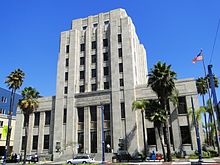 US Post Office-Long Beach Main
In the state legislature Long Beach is located in the 25th, 27th, and 28th Senate Districts, represented by Democrats Rod Wright, Alan Lowenthal, and Ted Lieu respectively, and in the 52nd, 54th, and 55th Assembly Districts, represented by Democrats Isadore Hall, Bonnie Lowenthal, and Warren T. Furutani respectively. Federally, Long Beach is located in California's 37th, 39th, and 46th congressional districts, which have Cook PVIs of D +27, D +13 and R +6 respectively[40] and are represented by Democrats Laura Richardson and Linda Sánchez and Republican Dana Rohrabacher respectively.
- The Glenn M. Anderson Long Beach Federal Building, located in downtown Long Beach at 501 West Ocean Blvd., houses offices for NOAA and other federal agencies.
- The Long Beach Main Post Office of the U.S. Postal Service serves as the main postal facility for Long Beach.[41]
- The Long Beach Naval Shipyard was established in 1943 and closed in 1997, employing over 16,000 people at its peak in 1945.
Education
Primary and secondary schools
Public schools
Long Beach Unified School District serves most of the city of Long Beach.
Other school districts that serve sections of Long Beach include:
Private schools
Main article: List of private schools in Long Beach, California?
Colleges and universities
California State University, Long Beach is the largest campus in the California State University system, and the second largest university in the state in terms of enrollment.
Long Beach City College is a community college established in 1927. It is composed of two separate campuses. The Liberal Arts Campus is located on the residential area of Lakewood Village, while the Pacific Coast Campus is in Central Long Beach.
DeVry University, Long Beach is located in the Kilroy Airport Center. DeVry Long Beach serves students who live or work in the area with undergraduate and graduate degree programs in various career fields.
Sites of interest
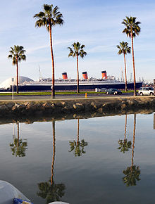 RMS Queen Mary in Long Beach Harbor
 Girl in red top walking on long beach 2009
The RMS Queen Mary is a 1936 art deco ocean liner permanently docked at Long Beach. Roughly 200 ft (61 m) longer than the RMS Titanic, the former Cunard Liner is famous for being the fastest in the world from 1936 to 1952, for its distinctive art deco design and for its use during World War II as a troop transport. It was purchased by the city of Long Beach in 1967 for conversion to a hotel and maritime museum. The nonprofit Aquarium of the Pacific is located on a 5-acre (20,000 m2) site on Rainbow Harbor in Long Beach, Calif.—across the water from the Long Beach Convention Center, Shoreline Village, and the Queen Mary Hotel and Attraction. The Aquarium features a collection of over 12,500 animals representing over 550 different species. The facility focuses on the Pacific Ocean in three major permanent galleries, sunny Southern California and Baja, the frigid waters of the Northern Pacific and the colorful reefs of the Tropical Pacific. Favorite exhibits at the Aquarium also include the Aquarium's interactive Shark Lagoon (guests can pet sharks and sting rays) and Lorikeet Forest (guests can feed nectar to colorful lorikeet birds). Exhibits at the Aquarium introduce the inhabitants and seascapes of the Pacific, while also focusing on specific conservation messages associated with each region. Exhibits range in size and capacity from about 5,000 to 350,000 gallons. The Aquarium of the Pacific has been visited by more than 13 million people since its opening. The Aquarium was rated #2 Los Angeles area Family Destination in the most recent Zagat U.S. Family Travel Guide, second only to Disneyland. The Aquarium of the Pacific is also the only major nonprofit aquarium in the nation to have attendance increases for the past six years in a row. Morey & Associates’ research ranked the Aquarium of the Pacific as number one in visitor diversity among all of the nation’s leading aquariums.
The Long Beach Department of Parks, Recreation and Marine received a Gold Medal award from the National Recreation and Park Association in 2002, 2003, and 2004, recognizing the Department's "outstanding management practices and programs." The Department manages 92 parks covering over 3,100 acres (13 km2) throughout the city, including the 815 acres (3.30 km2) El Dorado Regional Park, which features fishing lakes, an archery range, youth campground, bike trails, and picnic areas. The Department also operates four public swimming pools, and four launch ramps for boaters to access the Pacific Ocean.
The 102.5-acre (0.4 km2) El Dorado Nature Center is part of the larger El Dorado Regional Park. The center features lakes, a stream, and trails, with meadows and forested areas.[15]
The Municipal Fly Casting Pool[42] at Recreation Park[43] in East Long Beach is a 260-by-135-foot clear water, fishless pond built and operated since 1925 by the Long Beach Casting Club as only one of two Southern California city operated casting ponds (the other being in Pasadena).[44] Described recently as a serene pond "surrounded by a seemingly endless stretch of green grass against a backdrop of mountains and palm trees,"[44] several movie stars from the 1940s were taught to fly cast at the pond, including Robert Taylor, Clark Gable, Jimmy Durante, and Barbara Stanwyck.[45] In 1932, the fly fishing clubhouse adjacent to the fly fishing pond was used for the Summer Olympic Games and housed military personnel during World War II.[46]
The Long Beach Greenbelt is a section of the old Pacific Electric right-of-way, restored by community activists as native habitat. It currently supports approximately 40 species of California native plants as well as a plethora of urban wildlife. Its pleasant, relaxing atmosphere provides for community open space while educating citizens about what the land was like prior to industrialization and urbanization.
Rancho Los Alamitos is a 7.5-acre (30,000 m2) historical site owned by the City of Long Beach and is near the Long Beach campus of the California State University system. The site includes five agricultural buildings, including a working blacksmith’s shop, 4 acres (16,000 m2) of gardens, and an adobe ranch house dating from around 1800. The Rancho is within a gated community; visitors must pass through security gates to get to it.[47]
Rancho Los Cerritos is a 4.7-acre (19,000 m2) historical site owned by Long Beach in the Bixby Knolls area near the Virginia Country Club. The adobe buildings date from the 1880s. The site also includes a California history research library.[48]
Long Beach is home to the nation's skinniest house.[49][50]
The Earl Burns Miller Japanese Garden is located on the campus of California State University, Long Beach.
 The Walter Pyramid
 Romantic gondola rides in Long Beach through Naples.
Long Beach offers singing gondolier trips through the romantic canals of Naples.[51][52] Along with gondola rides on Lake Merritt, on the Napa River, in Huntington Beach, in Newport Beach, in Redondo Beach, and at The Venetian (Las Vegas), Long Beach is only one of seven places in the Western United States where tourists may ride in a gondola.[53]
The front beach area of the city was once home to a now-defunct amusement park. Its first rollercoaster opened for business in June 1907. It was named the Figure 8 after the shape of the tracks, and was built on pilings that reached out over the water. In 1914 the Pike Amusement Zone undertook several upgrades and a new roller coaster named the Jack Rabbit Racer was opened in May 1915 becoming the second largest racing coaster in the country. It was part of the Silver Spray Pier which included several new rides and concessions. In the mid twenties, several expansions were made to the area and the Jack Rabbit Racer was remodeled raising the ride's dips to a greater height and steepness but it was soon removed to make way for the Cyclone Racer roller coaster which opened May 1930. The new coaster was also built on pilings over the ocean, but as the breakwater was built and the harbor expanded, the sandy beach extended. Eventually the entire pier stood over the beach. When demolished in September 1968, the Cyclone Racer was the only two track roller coaster in the United States.
Although California's surfing scene is said to have gotten its start in Long Beach when in 1911 two surfers returned from Hawaii and the city hosted the first National Surfing and Paddleboard Championships in 1938, surfing is now uncommon in Long Beach due to a 2.2-mile (3.5 km) long breakwater built in 1949 to protect the U.S. Pacific Fleet. The breakwater reduces "mighty waves to mere lake-like lapping along the city's beaches." Some Long Beach residents also cite the breakwater as a reason for the dirtiness of the water in Long Beach, as the water is not able to circulate. The fleet left in the 1990s, and now some residents are calling for it to be lowered or eliminated and the city has commissioned a $100,000 study for this purpose.[54]
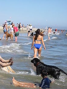
Long Beach is home to "Rosie's Dog Beach" -- the only legal off-leash area on the beach for dogs in all of Los Angeles County. It's named after the bulldog "Rosie" that inspired the beach's creation. This 3-acre (12,000 m2) area is situated in Belmont Shore between Roycroft and Argonne avenues. The off-leash area is open every day, all day.
 Off-leash Dog Beach Zone, Belmont Shore
Media
Paper
The local daily newspaper is the Long Beach Press-Telegram, which is distributed throughout most of the Gateway Cities and South Bay areas of southwest Los Angeles County. The Press-Telegram is part of the Los Angeles Newspaper Group, which has several newspapers in the Southern California area that share some resources and reporters.
There are a number of weekly and biweekly newspapers, which highlight the city's educational, political and business goings-on. Grunion Gazette, Downtown Gazette, and Uptown Gazette are weekly newspapers. Additionally, Long Beach is served by The Beachcomber, Long Beach Times, and Signal Tribune. All are community-centric papers with substantial distribution. Business news is covered by South Coast Publishing, Inc. in their biweekly publication Long Beach Business Journal. California State University, Long Beach also has a student newspaper published four times a week during the fall and spring semesters, the Daily Forty-Niner.
Long Beach Magazine is a monthly, glossy publication that features business profiles, travel features, book reviews, health and fitness articles and stories that touch on issues that are directly related to the lives of our readers. South Coast Publishing, Inc. (see above) also produces a monthly magazine for tourists and conventioneers called "Destinations Magazine," that is available in most of the city's hotels, motels and attractions.
Starting in 2007, Long Beach was served by The District Weekly, an alternative weekly that covers news, the arts, restaurants, and the local music scene. "The District Weekly" has since closed. Although not based in Long Beach, the OC Weekly and LA Weekly are distributed widely in Long Beach. In 2008, a major, monthly entertainment magazine called Live LB was introduced that additionally covers celebrity, entertainment, fashion, sports and music and is rack-circulated throughout Long Beach and the South Bay.
Long Beach also gets distribution of the daily Los Angeles Times, Orange County Register, and La Opinión newspapers, plus the weekly Los Angeles Sentinel.
Online
LBReport.com (est 1999) engages in 'hard' journalism and investigative reporting of local stories, issues and officials. LongBeachCulture.org (1999–2008) was the dominant clearinghouse and calendar for arts & cultural events; its founder Sander Wolff now covers art and culture at LBPost.com.
LongBeachOnLine.net began in 2001 as a community portal and as a hub for all Long Beach news media as well as anything related to the Long Beach community. The site's local search engine provided one of the first searchable Long Beach-centric databases. Later its elements were adapted as the face of The Long Beach Hot Zone; a public-private partnership involving The City of Long Beach, Vernier Networks, Intermec, Color Broadband, Development Tech and G-site Web & Consulting, which formed to create Long Beach California's free wireless "Hot Zones." The Long Beach Hot Zone effort was a pioneering technology project which garnered world-wide press coverage for the city and became a prototype-example for future municipal-wireless projects around the world.[55][56][57]
The LBPost.com (est 2007) features news and opinion from a pool of columnists. Established in 2009, EverythingLongBeach.com covers a broad range of news, events, art and community with feature interviews on local businesses and neighborhood groups. Limelight Long Beach Events (LimelightLB.com) is a comprehensive calendar of events happening in Long Beach.
562CityLife.com is a social networking site serving Long Beach and providing member based information on local businesses, social events, and news.
Internet radio program Swoop's World is a weekly talk show that interviews Long Beach politicians, community activists, neighborhood organizers and other personalities of interest to the Long Beach community. 562CityLife (see above) hosts a weekly radio show on Internet radio network Blog Talk Radio.
Radio
Long Beach is part of the Los Angeles DMA radio and television markets. Although a few radio stations have had studios in Long Beach over the years, including the 80's alternative music and later hard rock station KNAC, the only remaining radio stations in Long Beach are the jazz and blues station KKJZ on the Cal State Long Beach campus, and the Christian radio broadcaster KFRN.
Culture
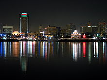 View of downtown from the Queen Mary at night.
Art
The Long Beach Museum of Art, sited in the historic Elizabeth Milbank Anderson residence, is owned by the City of Long Beach, and operated by the Long Beach Museum of Art Foundation. Long Beach also features the Museum of Latin American Art, founded in 1996 by Dr. Robert Gumbiner. It is the only museum in the western United States that exclusively features Latin American art.
The University Art Museum[58] on the Long Beach State campus (founded in 1973) has a national reputation[citation needed] for its high-quality and innovative programs. Long Beach State is also home to the largest publicly funded art school west of the Mississippi.[citation needed]
Long Beach's newest museum is The Pacific Island Ethnic Art Museum (PieAM). This museum was also founded by Dr. Robert Gumbiner and is the only museum of its kind in the continental United States.[citation needed] The museum opened its doors on October 15, 2010.
In 1965, Long Beach State hosted the first International Sculpture Symposium to be held in the United States and the first at a college or university. Six sculptors from around the world and two from the United States created many of the monumental sculptures seen on the campus. There are now over 20 sculptures on the campus.
Long Beach is known for its street art. Some of the murals were created in conjunction with the city's Mural and Cultural Arts Program, but many others were not. Many of the murals you see throughout Long Beach look like beginner student work.[59][60]
On the exterior of the Long Beach Sports Arena is one of the artist Wyland's Whaling Walls. At 116,000 square feet (11,000 m²), it is the world's largest mural (according to the Guinness Book of Records).
Shops and galleries in the East Village Arts District, in downtown Long Beach hold their monthly art openings and artists exhibit in street galleries on the second Saturday of the monthduring the Artwalk.
Long Beach has a percent for art program administered through the Arts Council of Long Beach and the Redevelopment Agency which ensures that new private developments contribute to the arts fund or commission artworks for their new projects.[61]
Music
The Bob Cole Conservatory of Music, the recently renamed school of music at CSULB, presents a wide variety of classical, jazz, and world music concerts each year. The Conservatory is part of CSULB’s renowned College of the Arts, the largest publicly funded art school west of the Mississippi.
The Long Beach Symphony plays numerous classical and pop music concerts throughout the year. The symphony plays at the Terrace Theater in the Long Beach Convention and Entertainment Center.[62]
Long Beach Opera, founded in 1979, is the oldest professional opera company serving the Los Angeles and Orange County regions. It presents performances of standard and non-standard opera repertoire at various locations, including the Terrace Theater and Center Theater of the Long Beach Convention and Entertainment Center and the Richard and Karen Carpenter Performing Arts Center at CSULB.[63]
Long Beach Community Concert Association[64] is a 49 year old, volunteer organization that provides quality musical entertainment appealing to seniors and others, four Sunday afternoons a year at the Carpenter Performing Arts Center[65] at CSULB. LBCCA also has an outreach program taking musical entertainment to senior care and senior housing facilities around the greater Long Beach area.
KJAZZ 88.1 FM (KKJZ) broadcasts from California State University, Long Beach. The station features jazz and blues music exclusively and can also be listened to over the Internet.[66] Kbeach is the student owned and operated web-only radio at CSULB.[67]
Long Beach City College operates two internet student-run radio stations, KCTY FM [68] and KLBC AM.
Long Beach is the host to a number of long-running music festivals. They include the Bob Marley Reggae Festival (February), the Cajun & Zydeco Festival (May), the El Dia De San Juan Puerto Rican Festival (Salsa music, June) the Aloha Concert Jam (Hawaiian music, June), the Long Beach Jazz Festival (August), the Long Beach Blues Festival (September, since 1980), and the Brazilian Street Carnaval (Brazilian music, September).
The Long Beach Municipal Band, founded in 1909 is the longest running, municipally supported band in the country. In 2005, the band played 24 concerts in various parks around Long Beach.[69]
Long Beach is also the point of origin for bands and musicians such as The Nitty Gritty Dirt Band, T.S.O.L., Sublime, Snoop Dogg, 213, the Long Beach Dub Allstars, Avi Buffalo, Crystal Antlers and Crooked I.
Theater
 Downtown Long Beach at dusk.
Long Beach has several resident professional and semi-professional theater companies, notably:
Musical Theatre West, one of the largest regional theatrical producers in Southern California, who performs at the Carpenter Performing Arts Center on the campus of CSU Long Beach;
International City Theatre, who produces plays and musicals at the Center Theater (part of the Long Beach Convention and Entertainment Center);
The Long Beach Playhouse, in continuous operation for over 75 years, has shows running 50 weeks out of the year on two stages.
Long Beach Shakespeare Company for over 20 years has provided free outdoor Shakespeare Festivals in the Summer.
Additionally, Long Beach is home to a number of smaller and “black-box” theaters, including the Found Theatre, Alive Theatre,[70] the Garage Theatre[71] and California Repertory Company (part of the graduate theater program at CSULB) that currently performs at the Royal Theater aboard the Queen Mary in Downtown Long Beach.[72] Numerous tours and other stage events come through Long Beach, particularly at the Terrace Theater and the Carpenter Center, and both CSU Long Beach and Long Beach City College maintain active theater departments.
Cultural events
The Aquarium of the Pacific believes that bringing people together from diverse backgrounds and interests to understand and respect one another’s differences is a key to solving environmental issues. As a result, the Aquarium also offers cultural festivals with dance, music, art, and special educational activities. The Aquarium began producing cultural festivals in 2002, and now has nearly 10. Through these festivals the Aquarium works with members from the diverse ethnic communities in its region to create events that celebrate their traditions and connections to the ocean. The Aquarium of the Pacific was also the first in the museum, aquarium, or zoo industry to reach out to people with disabilities to create a weekend-long festival to celebrate their creative abilities. In 2004 the Aquarium debuted its annual Festival of Human Abilities featuring wheel-chair hip-hop dancers, mouth painters, inspirational speakers, and a variety of musicians with disabilities. This festival was highlighted at the national conference of the Association of Zoos and Aquariums in 2007. Aside from cultural festivals, the Aquarium also features other events to reach out to special interest groups such as its Divers’ Day and Senior’s Day. The goal of their events is to bring people from all backgrounds together to appreciate their differences and work together in the common goal of helping our World Ocean.
In October, Long Beach State hosts the CSULB Wide Screen Film Festival, at the Carpenter Performing Arts Center. The festival started in 1992 as a showcase for movies filmed in the widescreen format, but has since been transformed into an artist-in-residence event. A major film artist (such as former CSULB student Steven Spielberg) screens and discusses their own work as well as the ten films that most influenced their cinematic vision.[73]
Christmas boat "parades" are a Southern California tradition, with at least one held every weekend night from December 1 till Christmas. The "Naples Island Christmas Parade" has been held since 1946, and passes through the canals of Naples and around Alamitos Bay past Belmont Shore. The "Parade of A Thousand Lights" is in the Shoreline Village area (near Downtown Long Beach and the RMS Queen Mary).[74] There is also a Christmas boat parade in the nearby Port of Los Angeles/San Pedro area, and another in the Huntington Harbour community of nearby Huntington Beach.
The Long Beach Lesbian & Gay Pride Parade & Festival has been held in May or June since 1984 . It is the second largest event in Long Beach, attracting over 125,000 participants over the two day celebration. It is the third largest Gay Pride Parade in the United States.[75]
The Long Beach Sea Festival is held during the summer months (June through August). It features events centered on the ocean and the beach. These events include beach volleyball, movies on the beach, and a tiki festival.[76]
Sports
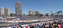 2005 Long Beach Grand Prix, showing turn 10 and the Long Beach skyline
Water Polo
Long Beach is home to some of the USA's finest water polo players.Players from Wilson High School include, Chi Kredell, Robert Lynn, Tony Azevedo, Ricardo Azevedo, Joe Sherrin, Chay Lapin, Scott Swanson, Matt Sagehorn, Anthony Artukovic, Chuck Wright, Lauren Wenger, and Lauren Silver. Players from Millikan include, Ryan Bailey. All of these individuals have been part of a national team ranging from the Cadet to the National team.
Long Beach Grand Prix
The Long Beach Grand Prix in April is the single largest event in Long Beach. It started in 1975 as a Formula 5000 race on the streets of downtown, and became a Formula One race, the United States Grand Prix West, the following year. From 1984 to 2008 it was a Champ Car event, and is now an IndyCar race. During the same weekend as the Grand Prix, there is also an American Le Mans Series race, a Formula D demo and the Toyota Pro/Celebrity Race.
The Long Beach Motorsports Walk of Fame is located on South Pine Avenue in front of the Long Beach Convention Center adjacent to the Long Beach Grand Prix circuit. The Walk of Fame was created in 2006 to honor key contributors to motorsports and annually inducts new members in conjunction with the Long Beach Grand Prix. A 22-inch (560 mm) bronze medallion is placed in the sidewalk for each new inductee. The medallion includes a rendition of the racer’s car and lists top achievements in motor sports.
Archery
The Archery field in El Dorado Regional Park was the site for the 1984 Los Angeles Olympics archery competition.[77]
CSU Long Beach has one of the few remaining university varsity archery teams in California.
Baseball
The Long Beach State 49ers baseball team has been playing since 1954. They play at Blair Field, across the street from Wilson High School. They are called the Dirtbags by many fans and is the team's official nickname. The Long Beach Armada, officially named the Long Beach Armada of Los Angeles of California of the United States of North America Including Barrow, Alaska, have played in the Golden Baseball League, also at Blair Field, since 2005.
Basketball
Long Beach was the home of the American Basketball Association team Long Beach Chiefs during the 1962/1963 season. They played in the newly-opened Long Beach Arena.
The minor league American Basketball Association team, the Long Beach Jam, played in the Walter Pyramid (a pyramid-shaped gym) on the Long Beach State campus) from 2003 to 2005.
The Southern California Summer Pro League is a showcase for current and prospective NBA basketball players, including recent draft picks, current NBA players working on their skills and conditioning, and international professionals hoping to become NBA players. The league plays in the Pyramid on the Long Beach State campus during July.
Sailing
Since its inception in August 1964, the Congressional Cup has grown into one of the major international sailing events. Now held in April, it is the only grade 1 match race regatta held in the United States. The one-on-one race format is the same as the America's Cup, and many of the winners of the Congressional Cup have gone on to win the America's Cup as well.
The Leeway Sailing and Aquatics Center on Alamitos Bay in Belmont Shore is a youth sailing program founded in 1929 . It is recognized as one of the premier municipal instructional sailing programs in the country.[78]
Water skiing
In July, there is the annual Catalina Ski Race, which starts from Long Beach Harbor and goes to Catalina Island and back to complete a 100 kilometres (62 mi) circuit. This race has been held annually since 1948 and features skiers from around the world.[79]
Rugby union
The Belmont Shore rugby team plays in the US Rugby Super League. They have been in seven league finals, and have been champions three times.[citation needed]
Pep flags
The Pep flag team at Long Beach Poly (known as the "Peppers") has recently won their first ever US Nationals titles in both the One and Two Flag divisions in 2008. It is the first year in Long Beach Poly history that a spirit leader has won a National title. They have placed in the top ten schools for the past five years and are now the USA National Champions for 2008.
College sports
Long Beach State's team mascot are the 49ers.[80] The school has had national championships in Women's Volleyball (5), Men's Volleyball (1), Track and Field (1), Men's Tennis (1-Division II), Swimming (1-Division II), Women's Badminton (2), and Women's Field Hockey (1). The school also has had regularly NCAA tournament appearances in Men's Baseball, Men's Softball, Men's Basketball, Women's Basketball, Men's Golf, Women's Tennis, Men's Water Polo, and Women's Water Polo.[81] Their Cheer Team has also been national champions in 2003, 2004 and 2006.[82] The D1 Roller Hockey team were the 2011 national champions after defeating Lindenwood University.
The sports teams at Long Beach City College have also done well, including national championships in Men's Gymnastics (6), Football (5), Women's Soccer (3), and Men's Doubles and Singles Tennis (1 each). They have also had state championships in numerous sports, including 2006-7 championships in Men's and Women's Water Polo.[83]
Famous Long Beach athletes
Long Beach is the childhood home of tennis legend Billie Jean King, three-time Super Bowl-winning NFL linebacker Willie McGinest, NFL player and 1990 Defensive Rookie of the Year Mark Carrier (safety) and eight-time National League batting champion and longtime San Diego Padres outfielder Tony Gwynn. Each attended Long Beach Polytechnic High School. Jeff Severson, the "Singing Safety" and 9 year NFL veteran, went to Wilson High School.
Beach volleyball player Misty May-Treanor, winner of the gold medal in the 2004 and 2008 Summer Olympics, graduated from California State University, Long Beach (where she won a national championship and several other awards), and currently resides in Long Beach.
US Olympic Water Polo Team Member, Ryan Bailey, was raised in Long Beach where he attended Robert A. Millikan High School. Tony Azevedo also went to school at St. Joseph Elementary, and Wilson High School in Long Beach.
US Olympic three-time softball gold medalist, Lisa Fernandez, resides in Long Beach with her husband and son.
Notable natives and residents
Main article: List of people from Long Beach, CaliforniaMiscellaneous information
International beauty contests
 Panoramic group portrait photograph of the 1927 Bathing Beauty Parade in Long Beach, California.
The first Miss Universe Pageant was held in Long Beach in 1952. It was won by Armi Kuusela from Finland, who gave up her title to get married to a Filipino tycoon, Virgilio Hilario, shortly before her year was complete. Miss International was also created in Long Beach, California, USA in 1960 after the departure of the Miss Universe pageant to Miami Beach. Hosted in Long Beach until 1967, the pageant moved to Japan from 1968–1970, being hosted each year in the same city as the Expo '70. For 1971 and 1972, it was held in Long Beach again, but since that time it has been held annually in Japan.
Sister cities
Long Beach's sister cities are (as of October 2007):[84]
Restrictions on registered sex offenders
On March 18, 2008, Long Beach became the first city in California to heavily restrict residency and visitation rights for California registered sex offenders. Triggered by a local protest of a multi-apartment dwelling which tenanted several paroled registered sex offenders, and fueled by local radio hosts John Kobylt and Ken Chiampou of KFI's John and Ken show, city council members voted 7-0 to enact 18 ordinances, of which the most restrictive prohibits residency by all registered sex offenders, whether they are on parole or not, within 2,000 feet (610 m) of any child care center, public or private school, or park. Google map measurements indicate that the total exclusion area encompasses over 96% of the area of Long Beach that is currently zoned for residential use. Registered sex offenders currently residing within the exclusion zone were given until September 2008 to vacate the restricted area. Once this happens, no sex offender will legally be able to live in the vast majority of Long Beach. While several other ordinances restrict the number of registered sex offenders who may reside in an apartment complex, there are no apartment complexes within city limits that are outside of the exclusion zone. In addition, the ordinances prohibit all registered sex offenders from using any park, beach, or facility that caters to children, such as amusement parks and restaurants with children's playgrounds, or even travel within 500 feet (150 m) of such places.[86][87][88]
See also
- List of City of Long Beach Historic Landmarks
- List of California public officials charged with crimes, Long Beach
- 1939 California tropical storm
- Lakewood Boulevard (State Route 19)
- Largest cities in Southern California
- Long Beach Public Library
- Silverado Park, Long Beach, California
References
- ^ U.S. Census
- ^ "About the Port". Port of Long Beach website. http://www.polb.com/about/default.asp.
- ^ McCawley, William (1996) [1952]. The First Angelinos: The Gabrielino Indians of Los Angeles (Paperback ed.). Malki Museum Press/Ballena Press. ISBN 0965101606.
- ^ "Long Beach's Agricultural Past: A Brief Summary of Long Beach's Ag History". http://www.longbeachgrows.org/LongBeachGrows/Long_Beachs_Agricultural_Past.html.
- ^ Schmitt, R. J., Dugan, J. E., and M. R. Adamson. "Industrial Activity and Its Socioeconomic Impacts: Oil and Three Coastal California Counties." MMS OCS Study 2002-049. Coastal Research Center, Marine Science Institute, University of California, Santa Barbara, California. MMS Cooperative Agreement Number 14-35-01-00-CA-31603. 244 pages; p. 47.
- ^ "Oil and Gas Statistics: 2007 Annual Report" (PDF). California Department of Conservation. December 31, 2007. ftp://ftp.consrv.ca.gov/pub/oil/annual_reports/2007/0102stats_07.pdf. Retrieved August 25, 2009.
- ^ "Pacific Bible Seminary", Digital Archives
- ^ Canalis, John (June 7, 2008). "Park Estates to mark its east end with sign". Long Beach Press-Telegram. http://www.presstelegram.com/news/ci_9518105. Retrieved 2008-06-08.
- ^ "NCDC: Weather Station: Long Beach Daugherty Field". http://www4.ncdc.noaa.gov/cgi-win/wwcgi.dll?wwDI~StnSrch~StnID~20001598. Retrieved January 22, 2009.
- ^ "NCDC: U.S. Climate Normals" (PDF). National Oceanic and Atmospheric Administration. http://cdo.ncdc.noaa.gov/climatenormals/clim20/ca/045085.pdf. Retrieved 2010-04-30.
- ^ "City of Long Beach General plan, Air Quality Element". City of Long Beach website. http://www.lbds.info/civica/filebank/blobdload.asp?BlobID=2437. Retrieved 2011-02-04.
- ^ "Multiple Airborne Toxics Exposure Study (MATES III)". South Coast Air Quality Management District website. http://www.aqmd.gov/prdas/matesIII/matesIII.html. Retrieved 2011-02-04.
- ^ a b "Beach Report Card for California". Heal the Bay website. http://brc.healthebay.org/?st=CA&f=1&tabid=2. Retrieved 2011-02-04.
- ^ "Wildlife Habitats". California Department of Fish and Game website. http://www.dfg.ca.gov/biogeodata/cwhr/wildlife_habitats.asp. Retrieved 2008-02-24.
- ^ a b "El Dorado Nature Center". City of Long Beach website. Archived from the original on February 23, 2008. http://web.archive.org/web/20080223081256/http://www.longbeach.gov/park/facilities/parks/el_dorado_nature_center.asp. Retrieved 2008-02-24.
- ^ Overhead view of Los Cerritos Wetlands.
- ^ All data are derived from the United States Census Bureau reports from the 2010 United States Census, and are accessible on-line here. The data on unmarried partnerships and same-sex married couples are from the Census report DEC_10_SF1_PCT15. All other housing and population data are from Census report DEC_10_DP_DPDP1. Both reports are viewable online or downloadable in a zip file containing a comma-delimited data file. The area data, from which densities are calculated, are available on-line here. Percentage totals may not add to 100% due to rounding. The Census Bureau defines families as a household containing one or more people related to the householder by birth, opposite-sex marriage, or adoption. People living in group quarters are tabulated by the Census Bureau as neither owners nor renters. For further details, see the text files accompanying the data files containing the Census reports mentioned above.
- ^ "American FactFinder". United States Census Bureau. http://factfinder.census.gov. Retrieved 2008-01-31.
- ^ Geis, Sonya (January 23, 2007). "Long Beach Awaits Hate-Crime Verdict". Washington Post website. http://www.washingtonpost.com/wp-dyn/content/article/2007/01/22/AR2007012201143_2.html. Retrieved May 11, 2010.
- ^ Meeks, Karen Robes (2008-08-26). "Poverty rate in L.B. falls to 18.2%". Long Beach Press-Telegram. http://www.presstelegram.com/news/ci_10312127.
- ^ "Epson's Global Network." Seiko Epson. Retrieved on January 13, 2009.
- ^ "[1]
- ^ City of Long Beach Comprehensive Annual Financial Report, Fiscal Year Ended June 30, 2010 Retrieved 2011-05-29
- ^ "2005 North American Contain Traffic" (PDF). AAPA website. http://www.aapa-ports.org/files/Statistics/2005_NORTH_AMERICAN_CONTAINER_TRAFFIC.pdf.
- ^ "Long Beach Transit System Map". Long Beach Transit website. http://www.lbtransit.com/Schedules/pdf/map_system.pdf.
- ^ "Long Beach Transit Services". Long Beach Transit website. http://www.lbtransit.com/Services/.
- ^ "Long Beach Transit Passport". Long Beach Transit website. http://www.lbtransit.com/Services/Passport.aspx.
- ^ "Long Beach Transit AquaLink". Long Beach Transit website. http://www.lbtransit.com/Services/Aqualink.aspx.
- ^ "Long Beach Transit AquaBus". Long Beach Transit website. http://www.lbtransit.com/Services/Aquabus.aspx.
- ^ "LA Metro Home". LA Metro Home website. http://www.metro.net/.
- ^ "Orange County Transportation Authority". Orange County Transportation Authority website. http://www.octa.net/.
- ^ "Long Beach Greyhound Station". Greyhound Lines website. http://www.greyhound.com/home/TicketCenter/terminal.asp?city=891979.
- ^ "2011 City and Neighborhood Rankings". Walk Score. 2011. http://www.walkscore.com/rankings/cities/. Retrieved Aug 28, 2011.
- ^ "City of Long Beach Special Events". http://www.filmlongbeach.com/.
- ^ "The O.C. Filming Locations". http://www.seeing-stars.com/OC/ByLocation.shtml.
- ^ http://maps.google.com/maps?f=q&hl=en&geocode=&q=4160+Country+Club+Drive,+Long+Beach,+California&sll=37.0625,-95.677068&sspn=64.241198,108.28125&ie=UTF8&ll=33.831819,-118.199008&spn=0.008395,0.013218&t=h&z=16 maps.google.com
- ^ "Speed Filming Locations". http://www.seeing-stars.com/Locations/Speed3.shtml.
- ^ "City of Long Beach Web Site". http://www.longbeach.gov.
- ^ "Torrance Health Center." Los Angeles County Department of Health Services. Retrieved on March 18, 2010.
- ^ "Will Gerrymandered Districts Stem the Wave of Voter Unrest?". Campaign Legal Center Blog. http://www.clcblog.org/blog_item-85.html. Retrieved 2008-02-10.
- ^ "Post Office Location - LONG BEACH." United States Postal Service. Retrieved on September 23, 2009.
- ^ Grobaty, Tim. (July 22, 2002) Long Beach Press-Telegram What's Up: Forever Fun in the Sun. Section: Local news; Page A3.
- ^ "Municipal Fly Casting Pool overhead view". Maps.google.com. 1970-01-01. http://maps.google.com/maps?f=q&hl=en&geocode=&q=33.77667,+-118.13386&ie=UTF8&ll=33.776719,-118.133859&spn=0.001048,0.001808&t=h&z=19&iwloc=addr. Retrieved 2010-07-02.
- ^ a b Russell, Kelle. (February 5, 1993) Long Beach Press-Telegram Getting Hooked on Fly-Fishing. Section: Local news; Page D3.
- ^ Welsh, Jed. (August 23, 2001) Long Beach Press-Telegram Experts to Teach Fly Casting. Section: Sports; Page B7.
- ^ Gewirtz, Jason. (July 27, 2000) Long Beach Press-Telegram City Council Eases Off Certain Restrictions on Skateboarding. Section: Local news; Page A3.
- ^ "Rancho Los Alamitos Historic Site". http://www.longbeach.gov/park/facilities/rancho_los_alamitos_historic_site.asp.
- ^ "Rancho Los Cerritos Historic Site". http://www.longbeach.gov/park/facilities/rancho_los_cerritos_historic_site.asp.
- ^ "Yahoo Travel Guide". Travel.yahoo.com. http://travel.yahoo.com/p-travelguide-2812727-skinny_house_los_angeles-i. Retrieved 2010-07-02.
- ^ Briscoe, Daren (October 29, 2001). "The Skinny on Thin House". Los Angeles Times. http://articles.latimes.com/2001/oct/29/local/me-63028. Retrieved 2010-07-02.
- ^ Roraback, K. (October 18, 1986) Los Angeles Times Gondola Getaway Is Romantic, Authentic--and Freeway Close Section: VW-View-LS-Life & Style; Page 1.
- ^ Segura, Joe. (January 28, 2006) Long Beach Press-Telegram Gondolas get away to downtown L.B. Section: Beachweek; Page 5.
- ^ Fullwood, Janet. (October 24, 2004) The Sacramento Bee California, too, has places to go gallivanting in a gondola. Section: Travel, Page M6.
- ^ Schoch, Deborah (June 30, 2008). "Long Beach at sea over breakwater removal plan". The Los Angeles Times. http://www.latimes.com/news/local/la-me-breakwater30-2008jun30,0,3801152.story. Retrieved 2008-07-01.
- ^ City of Long Beach Wifi "Long Beach Airport Hot Zone". City of Long Beach. http://www.longbeach.gov/airport/airline_travelers/wi_fi_hot_zone.asp City of Long Beach Wifi. Retrieved September 14, 2010.
- ^ "Original City of Long Beach Hot Zone brochure". City of Long Beach. http://www.longbeach.gov/civica/filebank/blobdload.asp?BlobID=8799. Retrieved September 14, 2010.
- ^ "Hot Zone Press Clippings". City of Long Beach. http://www.longbeachportals.com/press-clippings.htm. Retrieved September 14, 2010.
- ^ "University Art Museum". http://www.csulb.edu/org/uam/.
- ^ "Neighborhood Mural Program". http://www.longbeach.gov/park/facilities/neighorhood_mural_program.asp.
- ^ "Long Beach Mural Index". http://www.lamurals.org/MuralAreaIndexes/LongBeachIndex/MuralsLB.html.
- ^ "Arts Council for Long Beach". http://www.artspca.org/public_art/.
- ^ "Long Beach Symphony Orchestra". http://www.lbso.org/.
- ^ "Opera Long Beach". http://www.longbeachopera.org.
- ^ "Long Beach Community Concert Association". http://lbcca.org/.
- ^ "Richard and Karen Carpenter Performing Arts Center". Carpenterarts.org. http://www.carpenterarts.org/residentcompanies.html. Retrieved 2010-07-02.
- ^ KKJZ website
- ^ "Kbeach website". Kbeach.org. http://kbeach.org. Retrieved 2010-07-02.
- ^ "KCTY website". Kcty.org. http://www.kcty.org. Retrieved 2010-07-02.
- ^ Long Beach Municipal Band website[dead link]
- ^ "Alive Theatre Long Beach, CA". Alivetheatre.org. http://www.alivetheatre.org. Retrieved 2010-07-02.
- ^ http://www.thegaragetheatre.org
- ^ "California Repertory Company Long Beach California Theatre, Southern California Performing Arts". Calrep.org. http://www.calrep.org. Retrieved 2010-07-02.
- ^ "Wide Screen Film Festival website". Widescreenfilmfestival.org. 2005-09-25. http://www.widescreenfilmfestival.org/. Retrieved 2010-07-02.
- ^ History of the Naples Island Christmas boat parade
- ^ "Long Beach Gay Pride Parade website". Longbeachpride.com. 1998-11-24. http://www.longbeachpride.com/. Retrieved 2010-07-02.
- ^ "Long Beach Sea Festival web site". Longbeachseafestival.com. http://www.longbeachseafestival.com/index.php. Retrieved 2010-07-02.
- ^ http://www.longbeach.gov/park/about/default.asp longbeach.gov
- ^ http://www.longbeach.gov/park/facilities/parks/leeway_sailing_n_aquatics_center.asp longbeach.gov
- ^ http://www.catalinaskirace.com/ catalinaskirace.com
- ^ "Long Beach State Athletics — Official website of the 49ers". http://longbeachstate.cstv.com/index-main.html#00.
- ^ http://www.longbeachstate.com/history/champteams.html longbeachstate.com
- ^ http://www.beachpride.com/modules.php?name=Cheer_Team beachpride.com
- ^ "Championship history". Long Beach City College Athletics. http://athletics.lbcc.edu/athletichome/championships.cfm.
- ^ "Sister Cities of Long Beach". Sister Cities of Long Beach, Inc.. http://www.sistercitiesoflongbeach.org/index.htm.
- ^ "Long Beach - Qingdao Sister Cities Association". http://www.lbqa.org.
- ^ "LBReport.com". Council Approves LB Muni Code Amendments Adding Sex Offender Residency/Loitering Restrictions. http://www.lbreport.com/news/mar08/sexord2.htm.
- ^ "Long Beach Press-Telegram, March 19, 2008". Long Beach passes sex offender rules. http://www.presstelegram.com/news/ci_8620321.
- ^ "Long Beach Municipal Code Update (PDF)". ORDINANCE NO. ORD-08-0004. http://municipalcodes.lexisnexis.com/codes/longbeach/.
External links
Categories:- Cities in Southern California
- Long Beach, California
- Populated places in the United States with Hispanic plurality populations
- Cities in Los Angeles County, California
- Populated coastal places in California
- Populated places established in 1880
- Port settlements in the United States
- Incorporated cities and towns in California


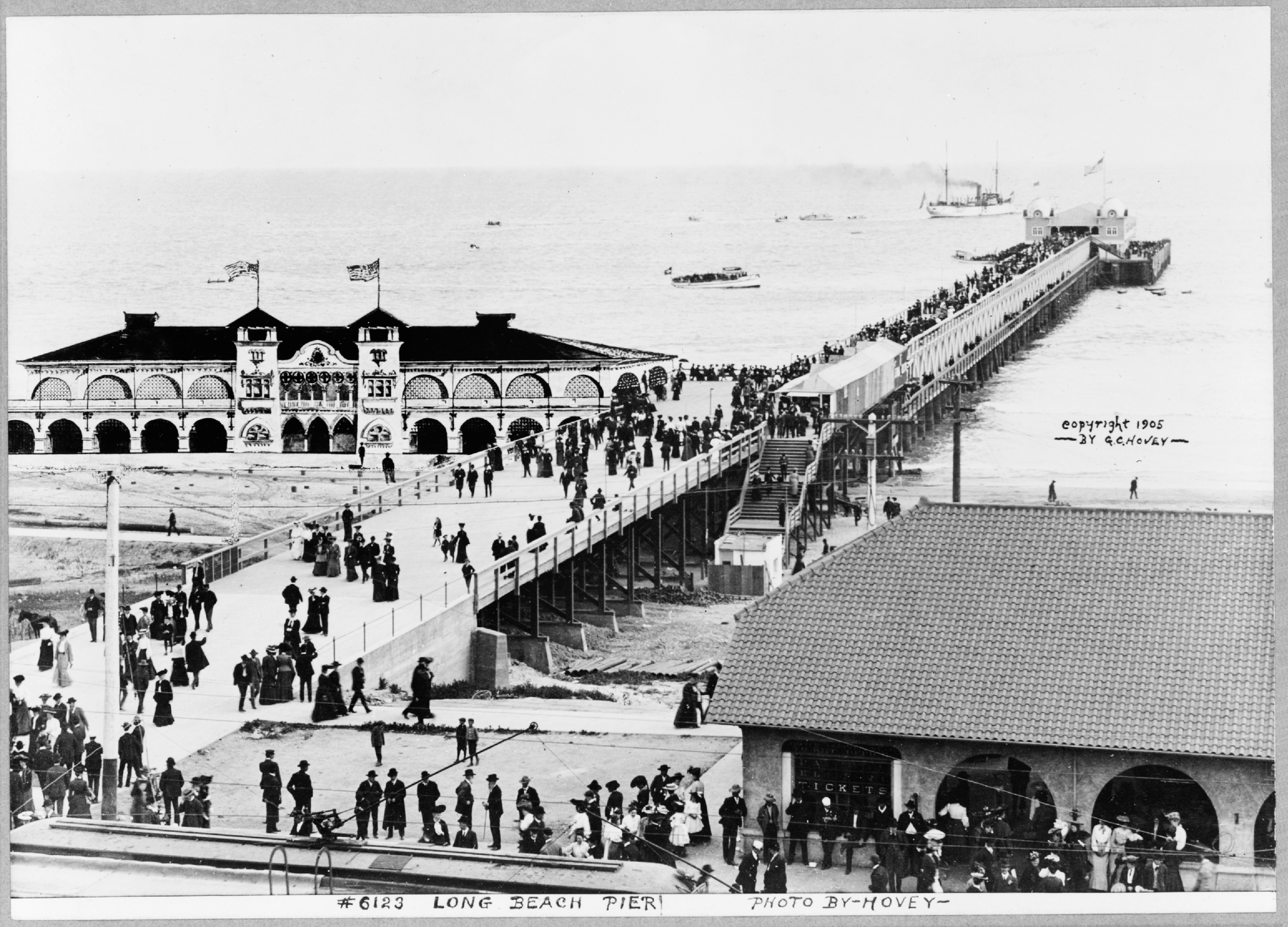
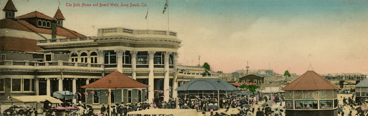
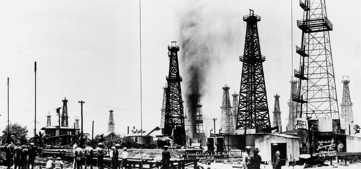


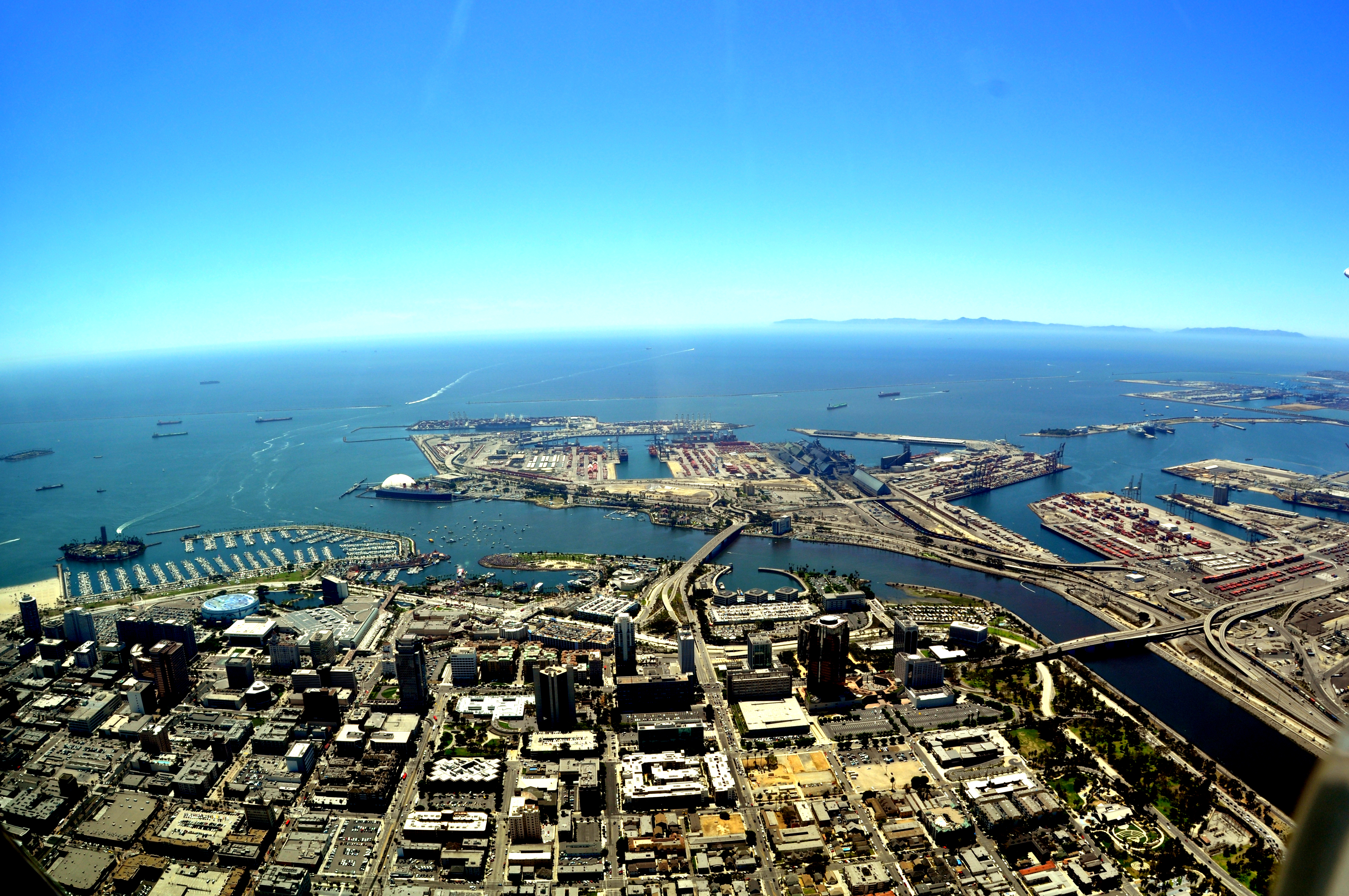
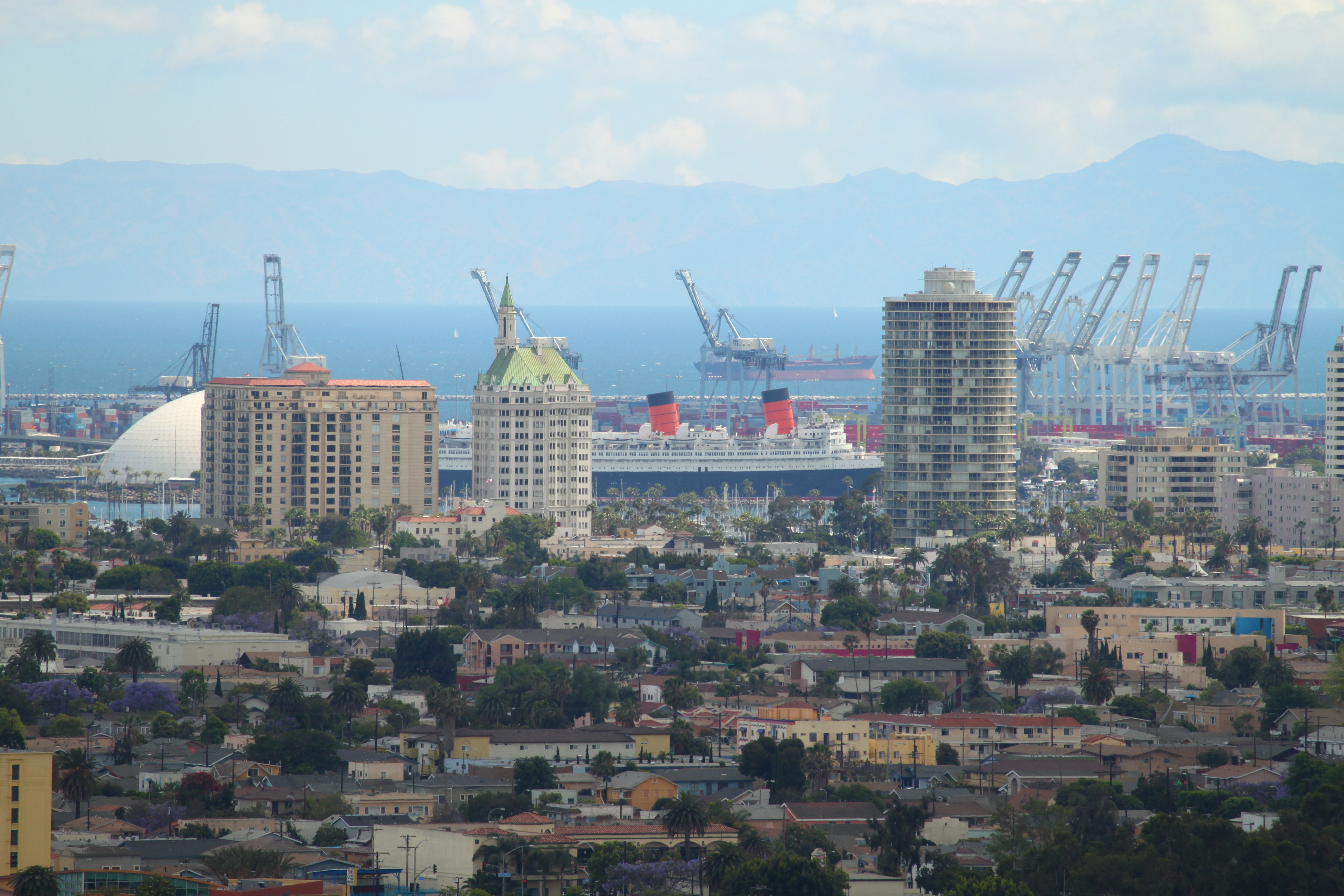
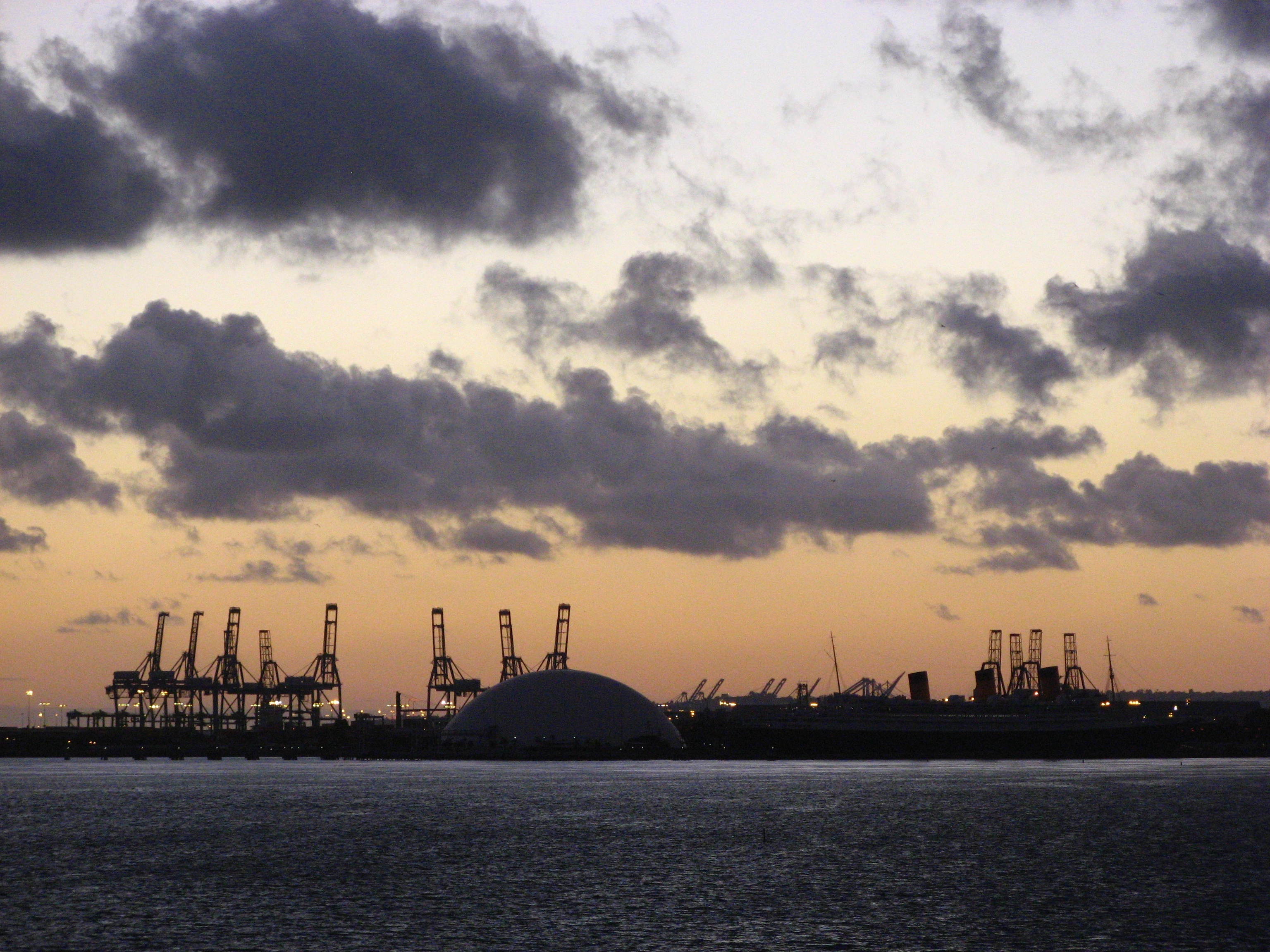
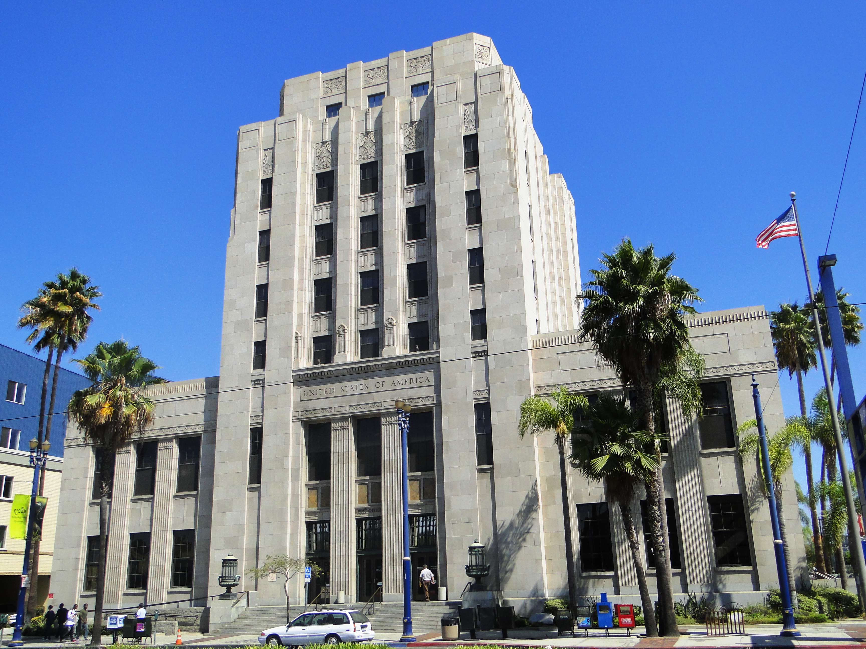
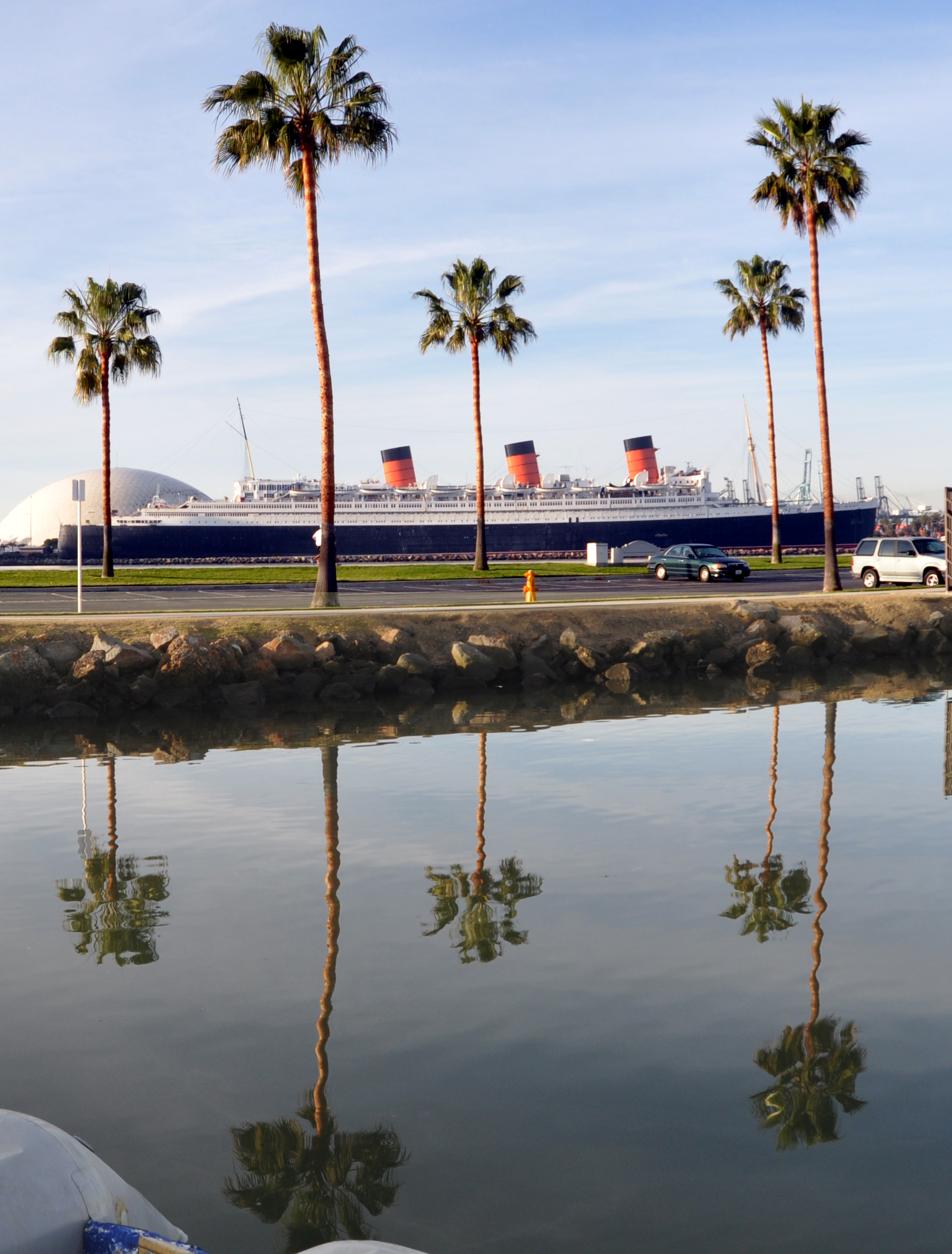

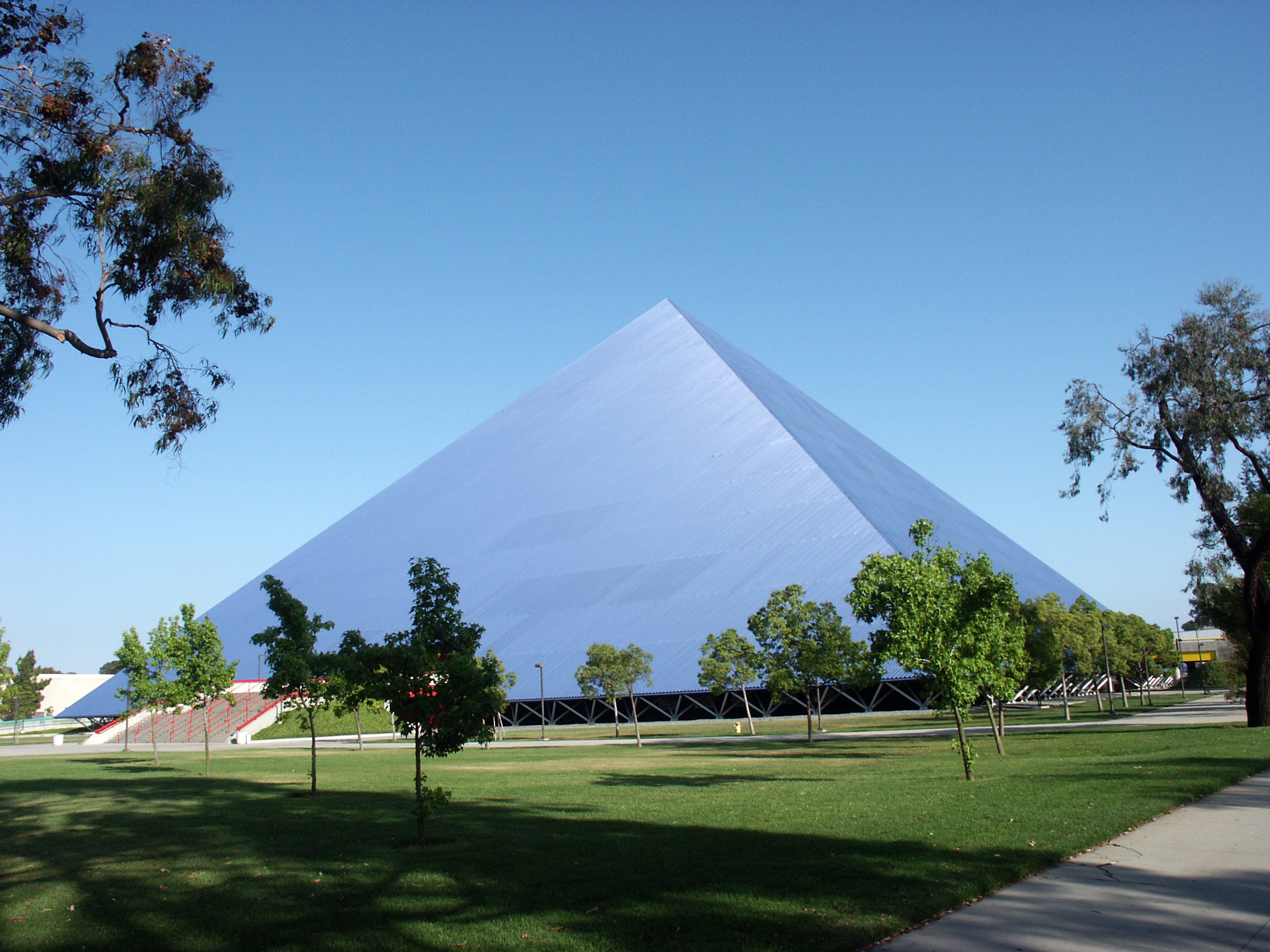


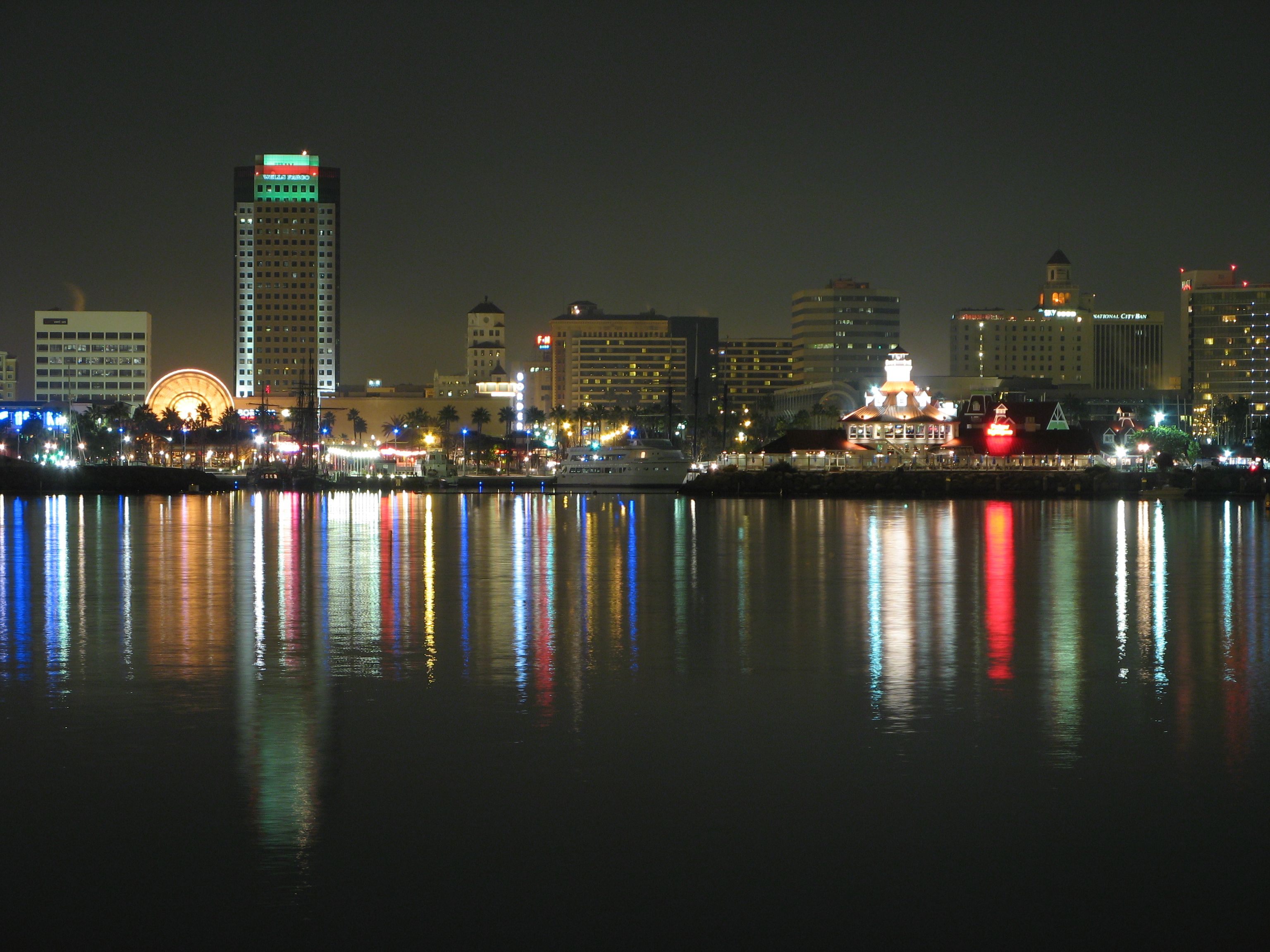
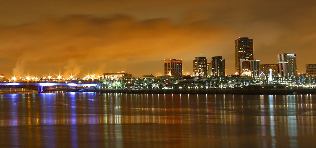
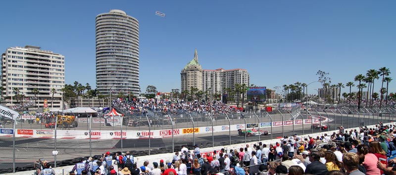


Wikimedia Foundation. 2010.