- View Park-Windsor Hills, California
Infobox Settlement
official_name = View Park-Windsor Hills, California
settlement_type = CDP
nickname =
motto =
imagesize =
image_caption =
image_
imagesize =
image_caption =
image_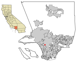
mapsize = 250x200px
map_caption = Location of View Park-Windsor Hills in Los Angeles County,California .
mapsize1 =
map_caption1 =subdivision_type = Country
subdivision_name =United States
subdivision_type1 = State
subdivision_name1 =California
subdivision_type2 = County
subdivision_name2 = Los Angeles
government_footnotes =
government_type =
leader_title =
leader_name =
leader_title1 =
leader_name1 =
established_title =
established_date =area_footnotes =
area_magnitude =
area_total_km2 = 4.8
area_land_km2 = 4.8
area_water_km2 = 0.0
area_total_sq_mi = 1.9
area_land_sq_mi = 1.9
area_water_sq_mi = 0.0population_as_of = 2000
population_footnotes =
population_total = 10958
population_density_km2 = 2276.4
population_density_sq_mi = 5895.8timezone = PST
utc_offset = -8
timezone_DST = PDT
utc_offset_DST = -7
elevation_footnotes =
elevation_m =
elevation_ft =
latd = 33 |latm = 59 |lats = 37 |latNS = N
longd = 118 |longm = 20 |longs = 49 |longEW = Wpostal_code_type =
ZIP code
postal_code = 90043
area_code = 310
blank_name = FIPS code
blank_info = 06-82667
blank1_name =
blank1_info =
website =
footnotes =View Park-Windsor Hills is a
census-designated place (CDP) in Los Angeles County,California ,United States . The population was 10,958 at the 2000 census. View Park lies on the north end of the CDP, along Angeles Vista Boulevard; Windsor Hills is on the southern end, to the north of Slauson Avenue.View Park-Windsor Hills is one of the both wealthiest and wealthiest majority-
African American areas in the United States. The two communities are part of a band of districts, from Culver City's Fox Hills district on the west to the Los Angeles district of Leimert Park on the east, that comprise the single largest geographically contiguous middle- and upper-class black area in the United States. (Also included in this band are the equally affluent Baldwin Hills and Ladera Heights and middle-class Baldwin Village.)History
View Park was developed in the 1920s as an upper-middle-class neighborhood akin to Cheviot Hills, Brentwood, Carthay Circle, and Studio City. Along with neighboring Ladera Heights and Baldwin Hills, it is one of the wealthiest African-American areas in the United States. It contains a superb collection of houses in the Spanish Colonial and Mediterranean styles, most of which remain today. Windsor Hills underwent development in the late 1930s; aimed at the middle class, it was the first subdivision in Southern California for which the newly created
Federal Housing Administration providedmortgage insurance . African-Americans were forbidden residence in either area until the Supreme Court's invalidation of racialrestrictive covenant s in 1948.Prior to the 1960s, the area was known as "Pill Hill" on account of the large number of doctors who were supposed to live there. After the arrival of Black families starting in the mid-1960s, the wealthy neighborhoods were sometimes called the "Golden Ghetto" or the "Black
Beverly Hills ."Since the early 2000s, a number of white families have moved back to View Park and Windsor Hills, albeit to a considerably lesser degree than in Fox Hills and Ladera Heights.
Landmarks
*Los Angeles
Urban League headquarters
*Ray Charles Residence at 4863 Southridge Avenue. Built in 1965.Geography
View Park-Windsor Hills is located at coor dms|33|59|37|N|118|20|49|W|city (33.993662, -118.346950)GR|1.
According to the
United States Census Bureau , the CDP has a total area of 4.8km² (1.9 mi²), all land.Demographics
As of the
census GR|2 of 2000, there were 10,958 people, 4,539 households, and 3,041 families residing in the CDP. Thepopulation density was 2,274.7/km² (5,895.8/mi²). There were 4,738 housing units at an average density of 983.5/km² (2,549.2/mi²). The racial makeup of the CDP was 87.98% African American, 5.37% White, 0.17% Native American, 1.11% Asian, 0.06% Pacific Islander, 1.15% from other races, and 4.15% from two or more races. Hispanic or Latino of any race were 2.71% of the population. The area had the highest percentage of African-American residents of any CDP in theWestern United States .There were 4,539 households out of which 23.2% had children under the age of 18 living with them, 42.3% were married couples living together, 19.1% had a female householder with no husband present, and 33.0% were non-families. 28.9% of all households were made up of individuals and 10.9% had someone living alone who was 65 years of age or older. The average household size was 2.40 and the average family size was 2.94.
In the CDP the population was spread out with 20.3% under the age of 18, 5.6% from 18 to 24, 26.4% from 25 to 44, 28.2% from 45 to 64, and 19.6% who were 65 years of age or older. The median age was 44 years. For every 100 females there were 84.2 males. For every 100 females age 18 and over, there were 79.3 males.
The median income for a household in the CDP was $90,876, and the median income for a family was $100,124. Males had a median income of $56,461 versus $43,663 for females. The
per capita income for the CDP was $34,382. About 3.1% of families and 5.1% of the population were below thepoverty line , including 4.2% of those under age 18 and 3.2% of those age 65 or over.Politics
In the state legislature View Park-Windsor Hills is located in the 26th Senate District, represented by Democrat
Mark Ridley-Thomas , and in the 47th and 51st Assembly Districts, represented by DemocratsKaren Bass andCurren D. Price, Jr. respectively. Federally, View Park-Windsor Hills is located inCalifornia's 33rd congressional district , which has a Cook PVI of D +36 [cite web | title = Will Gerrymandered Districts Stem the Wave of Voter Unrest? | publisher = Campaign Legal Center Blog | url=http://www.clcblog.org/blog_item-85.html | accessdate = 2008-02-10] and is represented by DemocratDiane Watson .Education
Los Angeles Unified School District serves the community.Several elementary schools serve the community, including:
* [http://www.lausd.net/54th_ST_EL 54th Street Elementary School] (K-5)
* [http://www.lausd.k12.ca.us/Cowan_EL Cowan Elementary School] (1-5)
* Windsor Math/Science/Aerospace Magnet (K-5, zoned only for Kindergarten)All areas are zoned to Audubon Middle School and
Crenshaw High School .Some areas are jointly zoned to Audubon Middle School and Webster Middle School. Some areas are jointly zoned to Audubon Middle School and
Orville Wright Middle School .Some areas are jointly zoned to Crenshaw High School and Westchester High School.
Notable residents and natives
*
Ray Charles , (1930-2004) Entertainer
*James Cleveland (1931-1991) Gospel Singer,Arranger Composer
*Lisa Gay Hamilton , Actress
*Ike & Tina Turner, Recording duo
*Clara Ward , (1924-1973) Gospel singer
*Nancy Wilson, Vocalist
*Loretta Devine , Actress
*Joseph Hill , Doctor and Civil Rights Advocate
*Sally Hampton , Writer, Producer, Actress
*Dave Waymer , NFL Football Player
*Regina King , Actress
*Earl Ofari Hutchinson , Journalist, Author and BroadcasterExternal links
Wikimedia Foundation. 2010.