- Ladera Heights, California
Infobox Settlement
official_name = Ladera Heights, California
settlement_type = CDP
nickname =
motto =
imagesize =
image_caption =
image_
imagesize =
image_caption =
image_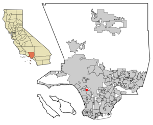
mapsize = 250x200px
map_caption = Location of Ladera Heights in Los Angeles County,California .
mapsize1 =
map_caption1 =subdivision_type = Country
subdivision_name =United States
subdivision_type1 = State
subdivision_name1 =California
subdivision_type2 = County
subdivision_name2 = Los Angeles
government_footnotes =
government_type =
leader_title =
leader_name =
leader_title1 =
leader_name1 =
established_title =
established_date =area_footnotes =
area_magnitude =
area_total_km2 = 7.6
area_land_km2 = 7.6
area_water_km2 = 0.0
area_total_sq_mi = 2.9
area_land_sq_mi = 2.9
area_water_sq_mi = 0.0population_as_of = 2000
population_footnotes =
population_total = 6568
population_density_km2 = 861.3
population_density_sq_mi = 2230.6timezone = PST
utc_offset = -8
timezone_DST = PDT
utc_offset_DST = -7
elevation_footnotes =
elevation_m = 93
elevation_ft = 305
latd = 33 |latm = 59 |lats = 20 |latNS = N
longd = 118 |longm = 22 |longs = 27 |longEW = Wpostal_code_type =
ZIP code
postal_code = 90056
area_code = 310
blank_name = FIPS code
blank_info = 06-39108
blank1_name = GNIS feature ID
blank1_info = 1867032
website =
footnotes =Ladera Heights is a
census-designated place and unincorporated area in southwesternLos Angeles County, California . The population was 6,568 at the 2000 census. Culver City lies to its west, Inglewood to its east, the unincorporated area of Baldwin Hills to its north, and the Westchester neighborhood of Los Angeles to its south and southwest.The community
As with neighboring
Baldwin Hills andView Park-Windsor Hills - which are also predominately African-American areas - Ladera Heights is an affluent, upper-middle class area. Much of the area's desirability stems from the stunning views of thePacific Ocean available from many hillside houses, as well as its proximity to beaches, Hollywood,Los Angeles International Airport (LAX) and theSan Diego Freeway .The area was historically mixed until the early 1980s, when the neighborhood became a mecca for wealthy black families. The Southern California real estate boom of the late 1990s and early 2000s brought into the area a few more upper middle-class families of other races. It is said that Ladera Heights is the "black Brentwood" also a community in Los Angeles. Ladera Heights is an exclusive community consisting mostly of very affluent African-Americans in large ranch homes with ocean views.
Geography
Ladera Heights is located at coor dms|33|59|20|N|118|22|27|W|city (33.988762, -118.374146)GR|1. According to the
United States Census Bureau , the CDP has a total area of 2.9 square miles (7.6 km²), all of it land.Demographics
As of the
census GR|2 of 2000, there were 6,568 people, 2,691 households, and 1,883 families residing in the CDP. Thepopulation density was 2,230.6 people per square mile (862.6/km²). There were 2,755 housing units at an average density of 935.7/sq mi (361.8/km²). The racial makeup of the CDP was 20.07% White, 70.75% African American, 0.27% Native American, 2.89% Asian, 0.09% Pacific Islander, 1.39% from other races, and 4.54% from two or more races. Hispanic or Latino of any race were 3.38% of the population.There were 2,691 households out of which 26.5% had children under the age of 18 living with them, 51.0% were married couples living together, 15.7% had a female householder with no husband present, and 30.0% were non-families. 24.8% of all households were made up of individuals and 9.1% had someone living alone who was 65 years of age or older. The average household size was 2.44 and the average family size was 2.89.
In the CDP the population was spread out with 20.7% under the age of 18, 5.4% from 18 to 24, 24.5% from 25 to 44, 29.8% from 45 to 64, and 19.5% who were 65 years of age or older. The median age was 44 years. For every 100 females there were 81.9 males. For every 100 females age 18 and over, there were 77.7 males.
The median income for a household in the CDP was $90,233, and the median income for a family was $103,174. Males had a median income of $64,643 versus $52,750 for females. The
per capita income for the CDP was $47,798. About 1.1% of families and 3.7% of the population were below thepoverty line , including 2.5% of those under age 18 and 5.9% of those age 65 or over.Education
Ladera Heights is served by the
Inglewood Unified School District of Inglewood.In 2005, a group of residents petitioned to move the area into the
Culver City Unified School District of Culver City. This proposal, controversial in both districts, was under consideration by theLos Angeles County Office of Education . The proposal did not go through.Politics
In the state legislature Ladera Heights is located in the 25th and 26th Senate Districts, represented by Democrats
Edward Vincent andMark Ridley-Thomas respectively, and in the 47th and 51st Assembly Districts, represented by DemocratsKaren Bass andCurren D. Price, Jr. respectively. Federally, Ladera Heights is located inCalifornia's 33rd congressional district , which has a Cook PVI of D +36 [cite web | title = Will Gerrymandered Districts Stem the Wave of Voter Unrest? | publisher = Campaign Legal Center Blog | url=http://www.clcblog.org/blog_item-85.html | accessdate = 2008-02-10] and is represented by DemocratDiane Watson .References
External links
* [http://www.laderaheights.info/ Ladera Heights Community Website]
Wikimedia Foundation. 2010.