- Inglewood, California
-
Inglewood — City — 
SealMotto: Harbor of the Air (undated)[1] Location of Inglewood in Los Angeles County, California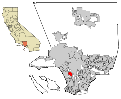
Coordinates: 33°57′27″N 118°20′46″W / 33.9575°N 118.34611°WCoordinates: 33°57′27″N 118°20′46″W / 33.9575°N 118.34611°W Country United States State California County Los Angeles Established 1888 Incorporated February 14, 1908[1] Government – Type Council-Manager – Mayor James Butts[2] Area[3] – Total 9.093 sq mi (23.549 km2) – Land 9.068 sq mi (23.486 km2) – Water 0.025 sq mi (0.064 km2) 0.27% Elevation 131 ft (40 m) Population (2010) – Total 109,673 – Rank 12th in Los Angeles County
55th in California
237th in the United States– Density 12,061.3/sq mi (4,657.2/km2) 2010 United States Census Time zone PST (UTC-8) – Summer (DST) PDT (UTC-7) ZIP codes 90301-90313, 90397-90398 Area code(s) 310 FIPS code 06-36546 GNIS feature ID 1660799 Website cityofinglewood.org Inglewood is a city in southwestern Los Angeles County, California, southwest of downtown Los Angeles. It was incorporated on February 14, 1908.[1] Its population stood at 109,673 as of the 2010 Census. The city is in the South Bay region of the greater Los Angeles area.[4]
History
Pre-American era
The earliest residents of what is now Inglewood were indigenous people who used the natural springs in today's Edward Vincent Jr. Park (known for most of its history as Centinela Park). Local historian Gladys Waddingham wrote that these springs took the name Centinela from the hills that rose gradually around them and which allowed ranchers to watch over their herds "(thus the name centinelas or sentinels)."[5]:unpaged [xiv]
Waddingham traced the written history of Inglewood back to the original settlers of Los Angeles in 1781, one of whom was the Spanish soldier Jose Manuel Orchado Machado, "a 23-year-old muleteer from Los Alamos in Sinaloa." These settlers, she wrote, were ordered by the officials of the San Gabriel Mission "to graze their animals on the ocean side of Los Angeles in order not to infringe on Mission lands." As a result, the settlers, or pobladores, drove some of their cattle to the "lush pasture lands near Centinela Springs," and the first construction there was done by one Ygnacio Avila, who received a permit in 1822 to build a "corral and hut for his herders."[5]:unpaged [xiv]
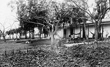 Rancho Aguaje de la Centinela Adobe, 1889
Later Avila constructed a three-room adobe on a slight rise overlooking the creek that ran from Centinela Springs all the way to the ocean. According to the LAOkay web site,[6] this adobe was built where the present baseball field is in the park. It no longer exists.
In 1834 Ygnacio Machado, one of the sons of Jose Machado, built the Centinela Adobe,[5]:unpaged [xv] which sits on a rise above the present 405 San Diego Freeway and is used as the headquarters of the Centinela Valley Historical Society. [2] Two years later, Waddingham writes, Ygnacio[7] was granted the 2,220-acre (9.0 km2) Rancho Aguaje de la Centinela even though this land had already been claimed by Avila.[5]:unpaged [xv]
American era
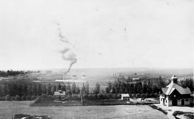
 Inglewood, about 1894
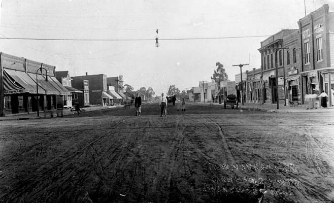
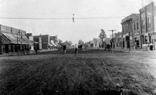 Commercial Street (later La Brea Avenue) in Inglewood, sometime around 1910
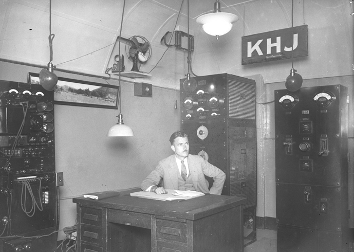
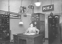 Radio engineer Ernest G. Underwood sitting at desk of his KHJ broadcasting station in Inglewood, 1927
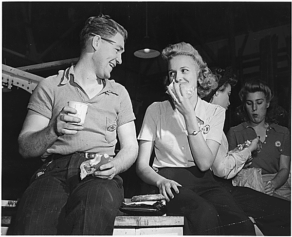
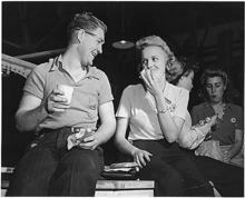 Aircraft workers on lunch break in Inglewood aircraft factory of North American Aviation, 1942.
Through the years
Inglewood Park Cemetery, a widely used cemetery for the entire region, was founded in 1905,[8] and the city has been home to the Hollywood Park Racetrack since 1938.[9] Fosters Freeze, the first Soft Serve ice cream chain in California, was founded by George Foster in 1946 in Inglewood.[10] Inglewood was named an All-America City by the National Civic League in 1989 and yet again recently in 2009 for its visible progress.[11]
Ku Klux Klan
Main article: Ku Klux Klan in Inglewood, CaliforniaKu Klux Klan activities in Inglewood during the 20th century were highlighted by the 1922 arrest and trial of 37 men, most of them masked, for a night-time raid on a suspected bootlegger and his family. The raid led to the shooting death of one of the culprits, an Inglewood police officer. A jury returned a "not guilty" verdict for all defendants who completed the trial. It was this scandal, according to the Los Angeles Times, that eventually led to the outlawing of the Klan in California.[12] The Klan had a chapter in Inglewood as late as October 1931.
African-American influence
“No blacks had ever lived in Inglewood,” Gladys Waddingham wrote,[5]:59 but by 1960, “they lived in great numbers along its eastern borders. This came to the great displeasure of the predominantly white residents already residing in Inglewood. In 1960, the census counted only 29 'Negroes' among Inglewood's 63,390 residents. Not a single black child attended the city's schools. Real estate agents refused to show homes to blacks. A rumored curfew kept blacks off the streets at night. Inglewood was a prime target because of its [previous] history of restrictions.” “Fair housing and school busing were the main problems of 1964. The schools were not prepared to handle racial incidents, even though any that occurred were very minor. Adults held many heated community meetings, since the Blacks objected to busing as much as did the Whites.”[5]:61 In 1969, an organization called “Morningside Neighbors” changed its name to “Inglewood Neighbors" "in the hope of promoting more integration.”[5]:63
On July 22, 1970, Los Angeles Superior Court Judge Max F. Deutz ordered Inglewood schools to desegregate in response to a suit filed by 19 parents.[13] At least since 1965, said Deutz, the Inglewood school board had been aware of a growing influx of black families into its eastern areas but had done nothing about the polarization of its pupils into an eastern black area and a western white one.[14] On August 31, he rejected an appeal by four parents who said the school board was not responsible for the segregation but that the blacks "selected their places of residence by voluntary choice."[13]
The first black principal among the 18 Inglewood schools was Peter Butler at La Tijera Elementary,[5]:66 and in 1971, Waddingham wrote, “Stormy racial meetings in 1971” included a charge by “some real estate men in the overflowing Crozier Auditorium” that the Human Relations Commission was acting like “the Gestapo.”[5]:67 In that year, Loyd Sterling Webb, president of Inglewood Neighbors, became the first black officeholder when voters elected him to the school board.[15]
In 1972 Curtis Tucker Sr. was appointed as the first black City Council member.[5]:69 That year composer LeRoy Hurte, an African-American, took the baton of the Inglewood Symphony Orchestra and continued to work with it for 20 years.[5]:75 Edward Vincent became Inglewood’s first black mayor in 1980. In that decade Inglewood became the first city in California to declare the birthday of Martin Luther King, Jr. as a holiday.[5]:76
Rise of Latino population
The 1990 census showed that Hispanics in Inglewood had increased by 134 percent since 1980, the largest jump in the South Bay. Economic factors apparently played a role in where new arrivals settled, said David Heer, a USC professor of sociology and associate director of the university's Population Research Laboratory. "Housing is generally less expensive here than elsewhere . . . and I would say that they receive a warmer welcome here," said Norm Cravens, assistant city manager in Inglewood, where the Anglo population dropped from nearly 21 percent in 1980 to 8.5 percent in 1990.[16]
In the 2000 census, blacks made up 47 percent of the city's residents (53,060 people), and Hispanics made up 46 percent (51,829), but the Census Bureau estimated that in 2007 the percentage of blacks had declined to 41 percent (48,252) and that of Hispanics of any race were at 52.5 percent (61,847). The white population declined from 19 percent (21,505) to 17.7 percent (20,853).[17][18]
But in that year, only one of the city's five City Council members was Latino, Jose Fernandez. There were no Latinos on the five-member Board of Education.[19]
Geography

Location and area
According to the United States Census Bureau, the city has a total area of 9.1 square miles (24 km2). Downtown Inglewood is 4.15 miles (6.68 km) from Los Angeles International Airport (LAX).
Neighborhoods
Crenshaw-Imperial
The Crenshaw-Imperial district was a later annexation to Inglewood. It has its own branch public library and an important shopping center for the area.[20][21]
Morningside Park
Morningside Park is a district in the eastern part of the city. Though the city of Inglewood does not define the district's boundaries, it may be delineated by Hyde Park on the north, South Los Angeles on the east, Century Boulevard on the south and Prairie Avenue on the west. The major streets that run through the area are Manchester and Crenshaw boulevards. It is six miles (10 km) from Los Angeles International Airport and about two miles (3 km) from the Hollywood Park Racetrack and The Forum where for 31 years the Los Angeles Lakers and Los Angeles Kings played.
North Inglewood and Fairview Heights
North Inglewood is the area north of the Santa Fe railroad tracks. In 2009, it was reported to be the site of a "burgeoning arts scene" centered at East Hyde Park Boulevard and La Brea Avenue.[22] Fairview Heights is a signed area north of Florence and east of La Brea.
Demographics
2010 census
The 2010 United States Census[23] reported that Inglewood had a population of 109,673. The population density was 12,062.1 people per square mile (4,657.2/km²). The racial makeup of Inglewood was 25,562 (23.3%) White, 48,164 (43.9%) African American, 751 (0.7%) Native American, 1,484 (1.4%) Asian, 350 (0.3%) Pacific Islander, 28,860 (26.3%) from other races, and 4,502 (4.1%) from two or more races. There were 55,449 people classifying themselves as Hispanic or Latino — 50.6% of the population.[clarification needed]
The Census reported that 108,171 people (98.6% of the population) lived in households, 987 (0.9%) lived in non-institutionalized group quarters, and 515 (0.5%) were institutionalized.
There were 36,389 households, out of which 15,315 (42.1%) had children under the age of 18 living in them, 13,095 (36.0%) were opposite-sex married couples living together, 8,987 (24.7%) had a female householder with no husband present, 2,937 (8.1%) had a male householder with no wife present. There were 2,318 (6.4%) unmarried opposite-sex partnerships, and 234 (0.6%) same-sex married couples or partnerships. 9,346 households (25.7%) were made up of individuals and 2,776 (7.6%) had someone living alone who was 65 years of age or older. The average household size was 2.97. There were 25,019 families (68.8% of all households); the average family size was 3.59.
The population was spread out with 29,293 people (26.7%) under the age of 18, 11,853 people (10.8%) aged 18 to 24, 31,650 people (28.9%) aged 25 to 44, 26,621 people (24.3%) aged 45 to 64, and 10,256 people (9.4%) who were 65 years of age or older. The median age was 33.4 years. For every 100 females there were 90.6 males. For every 100 females age 18 and over, there were 86.8 males.
There were 38,429 housing units at an average density of 4,226.5 per square mile (1,631.9/km²), of which 13,447 (37.0%) were owner-occupied, and 22,942 (63.0%) were occupied by renters. The homeowner vacancy rate was 1.5%; the rental vacancy rate was 5.5%. 43,040 people (39.2% of the population) lived in owner-occupied housing units and 65,131 people (59.4%) lived in rental housing units.
2006 survey
Source for this section is the American Community Survey conducted by the U.S. Census Bureau in 2006. Numbers may be rounded to the nearest whole figure.[24]
Inglewood’s population of 129,900 in 2006 was relatively youthful, with a median age of 31, compared to 36 in the nation as a whole. Eleven percent of its residents were under 5 years of age, as against 7 percent in the rest of the country. Some 8 percent were 65 or older, versus 12 percent elsewhere.
It was a city of renters squeezing into a limited amount of space. Of Inglewood’s 37,562 occupied housing units (houses and apartments), just 39 percent were owned by the people who lived in them (compared to 67 percent in the U.S. as whole). The other units were rented out. Only 5 percent of its housing units were vacant, much less than the 12 percent across the country. The number of people living in each unit was about 3.7 persons, versus 2.7 elsewhere. Family size was 3.9 people, compared to 3.2.
It was estimated that 18 percent of Inglewood families had incomes below the poverty level, about twice that of the country at large (9 percent).
About 17 percent of Inglewood’s residents had earned a bachelor’s degree or higher (versus 27 percent across the country).
Twenty-nine percent of the city's population were foreign-born, compared to 13 percent in the nation as a whole.
Mapping L.A.
In 2009, the Los Angeles Times's "Mapping L.A." project supplied these neighborhood statistics based on the 2000 census.[25]
The population was 112,482, or 12,330 people per square mile, among the highest densities for the South Bay and among the highest densities for the county. The percentage of black people was high for the county, and the population was moderately diverse. Median household income was $46,574, low for both the South Bay and for the county. The median age was 29, young for the county; the percentage of residents aged 10 or under was among the county's highest. Three people, on the average, lived in each household — high for the South Bay but about average for the county. There was a higher percentage of families headed by single parents than elsewhere in the county. The percentage of veterans who served during 1975-89 and 1990-99 was among the county's highest.
Inglewood
and nearby
areasInglewood[25] Hyde Park[26] Ladera
Heights[27]Westchester[28] Hawthorne[29] Population 112,482 38,635 6,509 41,500 86,265 White 4% 2% 19% 52% 13% Latino 46% 27% 3% 17% 44% Asian 1% 1% 3% 10% 8% Black 46% 66% 71% 17% 32% Household income $46,574 $39,460 $117,925 $77,473 $43,602 College degree 13% 12% 53% 42% 13% Median age 29 31 43 35 27 Single parents 27% 29% 10% 15% 27% Veteran 8% 9% 13% 9% 7% Foreign born 30% 20% 7% 21% 33% Where? Mexico,
El SalvadorMexico,
El SalvadorTrinidad,
CanadaMexico,
PhilippinesMexico,
GuatemalaEthnic diversity (*) Moderate .571 Moderate .488 Moderate .446 High .660 High .676 Home ownership 36% 47% 77% 52% 26% (*) "The diversity index measures the probability that any two residents, chosen at random, would be of different ethnicities. If all residents are of the same ethnic group it's zero. If half are from one group and half from another it's .50."[30]
Politics
See also Roosevelt Dorn.
Inglewood has the highest percentage of registered Democrats of any city in California, with 75.6 percent of its 48,615 voters registered in May 2009 as Democrats. Seven percent were registered as Republicans, and 14.1 percent declined to state a preference.[31]
In 2005, the Bay Area Center for Voting Research, a nonpartisan organization in Berkeley, ranked Inglewood as the sixth-most-liberal city in the United States, after Oakland, California, and just ahead of Newark, New Jersey. Researchers examined voting patterns of 237 American cities with populations over 100,000 and ranked them on liberal and conservative scales.[32]
The city is within California's 35th congressional district, which in February 2008 had a Cook Partisan Voting Index of D +33, which meant that recent Democratic presidential candidates received 33 percentage points more votes than the national average.[33] It is represented by Democrat Maxine Waters.
In the California Legislature, Inglewood is in the 25th Senate District, represented by Democrat Rod Wright and in the 51st Assembly District, represented by Democrat Steve Bradford.
Government and infrastructure
The Los Angeles County Department of Health Services operates the Curtis Tucker Health Center in Inglewood.[34]
The United States Postal Service operates the Hillcrest Inglewood Post Office at 300 East Hillcrest Boulevard,[35] the North Inglewood Post Office at 811 North La Brea Avenue,[36] and the Morningside Park Post Office at 3212 West 85th Street.[37]
The city is a member of the South Bay Cities Council of Governments.[38]
The City of Inglewood has a mayor-council type of government. The mayor is an elected office and is the chief executive officer of the city.
Public libraries
The City of Inglewood operates a main library in the city Civic Center, in addition to a branch in the southeastern corner of the city, near the intersection of Crenshaw and Imperial.[39]
Education
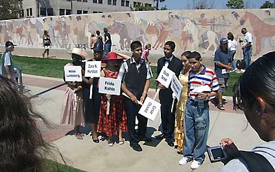 Inglewood High School students portrayed historic characters when the restored mural behind them was dedicated in August 2007.
Public and private schools
Most of Inglewood is served by the Inglewood Unified School District. The district has two zoned high schools, Inglewood High School and Morningside High School, and an alternative high school, City Honors High School.
Some of it is in the Los Angeles Unified School District
Public charter schools include:
- Ánimo Inglewood Charter High School of Green Dot Public Schools[40]
- Ánimo Leadership Charter High School of Green Dot[41]
Private schools include:
- St John Chrysostom Elementary School is a private Catholic school.
- St. Mary's Academy, "In 1966 St. Mary's Academy left its home of many years on Slauson Avenue [at Crenshaw Boulevard] in Los Angeles for a new building on Grace Avenue across from [Daniel] Freeman Hospital".[5]:62
See also
- Good Shepherd Lutheran School, 1936–2003
Schools history
In 1888, a school district was organized, trustees were elected and a building was chosen. The school opened on May 21 that year on the second floor of a livery stable on Grevillea Avenue between Regent Street and Orchard (today's Florence Avenue), with 17 boys and 16 girls. The first teacher was Minnie Walker, a graduate of Los Angeles State Normal School. The schoolroom, named Bucephalus Hall, after a horse belonging to town founder Daniel Freeman, was also used for community meetings.[5]:6
Meanwhile, a permanent school building was erected on Grevillea Avenue a block to the south, between Regent and Queen. It remained Inglewood's only school until 1911. It was destroyed by an earthquake in 1920.[5]:6 and 26
The Centinela Valley Union High School District was organized in 1904 to bring secondary education to the town. Inglewood High opened in two rooms of the school building with 15 students taught by Nina Martin, principal, and Anna McClelland. Four years later, a new building rose on 9.5 acres (38,000 m2) of land, and the first graduation of one boy and four girls took place in 1908.[5]:13–14 Until 1912 there was a new principal every year at the grammar school, but on May 8 of that year George W. Crozier was named principal, and he held the post for 20 years. The school was renamed in his honor in 1932.[5]:20 In 1913, George M. Green was appointed principal of Inglewood Union High School; he retired from that position in 1939.[5]:22
In 1914 voters approved bonds for high school improvement. Four more buildings and a power plant were erected, "joined by walks and arcades." The improvement included a "five-room model flat in the Home Economics Building." Nine acres of land were bought at Kelso Avenue and Damask (now Inglewood Avenue) for an experimental agricultural statement, thenceforth known as "The Farm." There were gardens, an orchard and an alfalfa field. In 1915 Inglewood High won a first-place Los Angeles County prize for its beautiful ivy-covered brick buildings.[5]:24 These buildings were destroyed in 1953 to make room for new ones.[5]:unpaged [58c]
In the mid-1920s, the high school district stretched all the way south to El Segundo, so two women teachers were asked to live in El Segundo and ride the school buses with the students every day to and from that city — for an extra dollar a day in pay. In 1923 girls adopted a school uniform, "a dark blue skirt with a white middy."[5]:30
In 1925 a new fine arts building for the high school was erected on the southwest corner of Grevillea and Manchester, replacing the Truax Candy Kitchen,[5]:34 but it was severely damaged by the Long Beach earthquake of 1933. It was "later rebuilt with WPA help but lost its magnificent stairway and all its fireplaces." Temporary classrooms were built on Olive Street, "all too cold in winter and too hot most of the time."[5]:41
The athletic field on the west side of the campus, later called Badenoch Field, was used for physical education and sporting events. In 1937, agricultural classes were ended at the Farm and Sentinel Field was dedicated there for sports activities.[5]:30 By 1938 there were more than 3,000 students and 141 teachers at the high school.[5]:43
The "startling news" of 1948 was the dismissal "of the entire administrative staff at Inglewood High School, beginning with Principal James R. Haines." He was replaced by Forrest Murdoch of Everett, Washington, as superintendent and Fred Heisner as principal.[5]:49
In 1952, another secondary school campus in Inglewood was opened in the east side neighborhood of Morningside Park as Morningside High School.[5]:55 Center Park School of Los Angeles became part of the Inglewood School District in 1961 when its area (Crenshaw-Imperial) was annexed to the city.[5]:59 In the 1970s, its name was changed to Worthington School to honor Frances and William Worthington.[5]:74
Religion
In 2007 the area served by the Inglewood post office (including Lennox) had 98 churches, temples, mosques, chapels and other houses of worship, according to the AreaConnect.com Web site.[42]
The first church service was held on April 22, 1888, in the Inglewood House hotel on Commercial Street (today's La Brea Boulevard), popularly called Mrs. Belden's Boarding House, when Inglewood had only 300 residents and 112 registered voters. Later services were in Bucephalus Hall, but eventually the congregation moved to Hyde Park, which left Inglewood with no church. On January 19, 1890, Inglewood's first permanent church — Presbyterian — was established on Market Street. A bit later the [United] Brethren constructed a building on South Market Street.[5]:6, 10, and 17
In 1907, a group of Episcopalians began services in a private home, and a few years later the first Catholic services were held in Bank Hall. In 1910 the Presbyterians moved their two buildings, a sanctuary and a manse, to the corner of Grevillea and Nutwood "because the streetcars [on Market Street] were so noisy and threw so much dust and sand fleas in the windows."[5]:14 and 17
In 1923 St. John Chrysostom Catholic Church was founded. The current church at the intersection of Centinela and Florence was built in 1959 and is the tallest point in the city. It is the largest congregation in the city, consisting of almost 10,000 registered families. Next door is St. John Chrysostom School, educating children since 1927 from Pre-K through 8th grade.[citation needed]
By 1940, the Methodists had built a structure at Manchester and La Brea, but in that year they moved to a new building at Kelso and Spruce. [5]:46 and 57
Community resources
D.A.R.E. America, an international education program that seeks to prevent use of controlled drugs, membership in gangs and violent behavior, has its headquarters in Inglewood.[43]
Cultural resources
Symphony
The Southeast Symphony Association is a non-profit, musical and cultural association located in Inglewood, California founded in 1948 whose goal continues to be to create an orchestra that welcomes African-American musicians.[3]
Open Studios
The annual Open Studios event features "drawing, painting, photography and more," under the general supervision of the Inglewood Cultural Arts organization, aided by the number of artists moving into the community. The first year of the event saw six artists featured, but at the November 2011 event "more than 30" were expected, said Renee Fox, gallery director at the Beacon Arts Building on North La Brea Avenue. The structure has been turned into 14 artists' studios, with 16 more to be added by the end of 2011. A nearby former auto showroom has also been turned over to artsts.[44]
Newspapers
The Inglewood News and Inglewood Today circulate in the city.[45][46]
Sister cities
 Bo, Sierra Leone[47]
 Pedavena, Italy[48]
 Port Antonio, Jamaica[49]
 Tijuana, Mexico[50]
Born in Inglewood
- Paul Pierce, basketball player for the Boston Celtics
- Don August, baseball player[51]
- Scott Eyre, baseball player[52]
- Tyra Banks, supermodel, television personality, talk show host and actress[53][54]
- Dottie Wiltse Collins, All-American Girls Professional Baseball League pitcher[55]
- Maureen Flannigan, actress
- Tanedra Howard, 2008 winner of Scream Queens (TV series) and Saw VI star[56]
- Flo Hyman, American volleyball player, Morningside High School graduate[57]
- Comedian Vicki Lawrence[58]
- Jim Lefebvre, major league baseball manager[59]
- Mack 10, rapper[60]
- Philip "Bishop Lamont" Martin, rapper[61]
- Len Maxwell, voice actor and announcer[62]
- Scott McGregor, baseball player with Baltimore Orioles[63]
- Lisa Moretti, professional wrestler[64]
- Marcel Reece, professional football player[65]
- Jamal Sampson, professional basketball player[66]
- Shade Sheist, recording artist, singer-songwriter, actor
- Jazz saxophonist Zoot Sims[67]
- Esther Williams, swimmer and motion picture actress (August 8, 1923).[68]
- Brian Wilson of The Beach Boys[69] (June 20, 1942)
- Shawn Chrystopher, recording artist, producer
Notable residents
- Salvatore (Sonny) Bono singer, actor, and congressman, attended Inglewood High School[70]
- Jeanne Crain, actress [71][72]
- Cali Swag District, hip hop group[73]
- Lisa Leslie, basketball player[74]
- Frank D. Parent, municipal court judge[75]
- Paul Pierce, basketball player[76]
- Chastin West, football player[77]
Filming locations
- The city was a filming location for The Wood, a 1999 movie about three African-American men recalling their childhood in 1980s Inglewood.[78][79]
- Scenes from Boyz n the Hood, Training Day and Wayne's World were filmed in Inglewood.[80][81]
References in popular culture
- Jules Winnfield, a lead-role gangster played by Samuel Jackson in Quentin Tarantino's 1994 film Pulp Fiction, told another character he lived in Inglewood.[82]
- The lead character in the movie Soul Plane (Kevin Hart) stated that he grew up in Inglewood.[83]
- In the 1996 song "California Love", Dr. Dre raps that Inglewood is "always up to no good".[84][85]
- A music video from Mack 10 featured Inglewood.[86]
See also
- List of California public officials charged with crimes, Inglewood
- Los Angeles Times suburban sections, for a time capsule placed in the Inglewood City Hall
Notes and references
- ^ a b "City History". City of Inglewood. http://www.cityofinglewood.org/about/city_history.asp.
- ^ http://www.cityofinglewood.org/city_hall/mayor/default.asp
- ^ U.S. Census
- ^ Choose LA County
- ^ a b c d e f g h i j k l m n o p q r s t u v w x y z aa ab ac ad ae af Waddingham, Gladys (1994). The History of Inglewood. Inglewood: The Historical Society of Centinela Valley. ISBN none.
- ^ "Things To Do In Los Angeles". LAOkay.com. http://www.laokay.com/AdobeSites.htm#Inglewood.
- ^ Waddingham used the spelling Ignacio for both Avila and Machado.
- ^ "Inglewood Park Cemetery: Living Heritage". Inglewood Park Cemetery. http://www.inglewoodparkcemetery.org/heritage.html.
- ^ "Hollywood Park: About". Hollywood Park. http://www.hollywoodpark.com/about/history.html.
- ^ "Fosters Freeze: Company History". Fosters Freeze. http://www.fostersfreeze.com/Company.html.
- ^ "Past Winners of the All-America City Award". National Civic League. http://www.ncl.org/aac/past_winners/past_winners_1980s.html.
- ^ "Ex-Klan Chief Dies After Traffic Row; Knife Fight With Truck Driver Following Collision Proves Fatal for Gus Price, 64." Los Angeles Times, May 21, 1949
- ^ a b "Parents Lose Plea in Inglewood Suit," Los Angeles Times, September 2, 1970, page D-2
- ^ "Inglewood Order," Los Angeles Times, July 26, 1970, page F-5
- ^ "Negro Elected to Inglewood Public Office," Los Angeles Times, April 7, 1971, page 18
- ^ Janet-Rae Dupree, “Census Shows Influx of Asians on Peninsula,” Los Angeles Times, February 28, 1991, page 3
- ^ U.S. Census Bureau, American FactFinder figures for 2000
- ^ U.S. Census Bureau, American FactFinder estimates for 2007
- ^ Hugo Martin, "Latino Revolution Leaves Some City Councils Untouched," Los Angeles Times, October 9, 2000, page 1
- ^ "City of Inglewood: Departments - Library". City of Inglewood. http://www.cityofinglewood.org/depts/library/default.asp.
- ^ "Crenshaw Imperial Shopping Center (includes a map)". LoopNet (LoopNet, Inc.). http://www.loopnet.com/xNet/MainSite/Listing/Profile/ProfileSE.aspx?LID=13568669&linkcode=1070&sourcecode=1lww2t006a00001.
- ^ Alejandro Lazo, "Inglewood art studio tour a stroke of genius," Los Angeles Times, November 16, 2009
- ^ All data are derived from the United States Census Bureau reports from the 2010 United States Census, and are accessible on-line here. The data on unmarried partnerships and same-sex married couples are from the Census report DEC_10_SF1_PCT15. All other housing and population data are from Census report DEC_10_DP_DPDP1. Both reports are viewable online or downloadable in a zip file containing a comma-delimited data file. The area data, from which densities are calculated, are available on-line here. Percentage totals may not add to 100% due to rounding. The Census Bureau defines families as a household containing one or more people related to the householder by birth, opposite-sex marriage, or adoption. People living in group quarters are tabulated by the Census Bureau as neither owners nor renters. For further details, see the text files accompanying the data files containing the Census reports mentioned above.
- ^ "2006 American Community Survey," American Fact Finder, U.S. Census Bureau
- ^ a b "Inglewood" entry on the Los Angeles Times "Mapping L.A." website
- ^ "Hyde Park" entry on the Los Angeles Times "Mapping L.A." website
- ^ "Ladera Heights" entry on the Los Angeles Times "Mapping L.A." website
- ^ "Westchester" entry on the Los Angeles Times "Mapping L.A." website
- ^ "La Crescenta-Montrose" entry on the Los Angeles Times "Mapping L.A." website
- ^ Definition of "diversity index" from Mapping L.A. The most diverse area is Mid-Wilshire, and the least diverse is East Los Angeles
- ^ http://www.sos.ca.gov/elections/ror/ror-pages/15day-stwdsp-09/politicalsub.pdf
- ^ "Study Ranks America's Most Liberal and Conservative Cities," Govpro.com, August 16, 2005
- ^ "Will Gerrymandered Districts Stem the Wave of Voter Unrest?". Campaign Legal Center Blog. http://www.clcblog.org/blog_item-85.html. Retrieved 2008-02-10.
- ^ "Curtis Tucker Health Center." Los Angeles County Department of Health Services. Retrieved on March 18, 2010.
- ^ "Post Office Location - HILLCREST INGLEWOOD." United States Postal Service. Retrieved on December 6, 2008.
- ^ "Post Office Location - NORTH INGLEWOOD." United States Postal Service. Retrieved on December 6, 2008.
- ^ "Post Office Location - MORNINGSIDE PARK." United States Postal Service. Retrieved on December 6, 2008.
- ^ http://www.southbaycities.org/node/2
- ^ City of Inglewood Public Library http://www.cityofinglewood.org/
- ^ "Home." Ànimo Inglewood Charter High School. Retrieved on February 20, 2011. "Copyright © 2007 Animo Inglewood Charter High School - All Rights Reserved 3425 Manchester Blvd. Inglewood, CA 90305."
- ^ "Contact Us." Ánimo Leadership Charter High School. Retrieved on February 20, 2011. "Animo Leadership Charter High School 1155 West Arbor Vitae St. Inglewood, CA 90301."
- ^ "Inglewood Churches and Religion (Inglewood, CA)". areaConnect (MDNH, Inc.). http://inglewood.areaconnect.com/churches.htm.
- ^ "About D.A.R.E." Drug Abuse Resistance Education. Retrieved on July 24, 2010. "D.A.R.E. America 9800 La Cienega Blvd. Suite 401 Inglewood, CA 90301"
- ^ Barbara Thornburg, "Open Studios Blossoms With Promise," Los Angeles Times, November 5, 2011, page E-2
- ^ Inglewood News website
- ^ Inglewood Today website
- ^ Jon Garcia, "Officials Study Finances of Sister-City Panel," Los Angeles Times, June 2, 1994
- ^ Marc Lacey, "Inglewood, Jamaican City Plan to Become 'Sisters,'" Los Angeles Times, September 24, 1989
- ^ "Inglewood Aids City in Jamaica," Los Angeles Times, June 15, 1990
- ^ "Tijuana Adopted as Sister City," Los Angeles Times, March 21, 1991
- ^ http://www.baseball-almanac.com/players/player.php?p=augusdo01
- ^ Baseball Almanac
- ^ "Tyra Banks: Snapshot". People Magazine. http://www.people.com/people/tyra_banks.
- ^ Internet Movie Data Base
- ^ "Dorothy Collins". AAGPBL. http://www.aagpbl.org/players/index.cfm?do=player.details&playerid=2. Retrieved 2008-08-15.
- ^ http://clutchmagonline.com/lifeculture/feature/tanedra-howard-a-dream-deferred-no-more/#2
- ^ "Flo Hyman". Microsoft Encarta Online Encyclopedia 2007. Archived from the original on 2009-10-31. http://www.webcitation.org/5kwrN0iIW.
- ^ "Vicki Lawrence". Richard De La Font Agency, Inc.. http://delafont.com/specialty_acts/Vicki-Lawrence.htm.
- ^ http://www.baseball-almanac.com/players/player.php?p=lefebji01
- ^ "Mack 10". IMDb. http://www.imdb.com/name/nm0532924/.
- ^ "Interview with Bishop Lamont". Aftermath Music (MRF Entertainment). January 2006. http://www.aftermathmusic.com/_interviews/bishoplamont_january_2006.html.
- ^ Len Maxwell at the Internet Movie Database
- ^ "Scott McGregor Baseball Stats". Baseball Almanac. http://www.baseball-almanac.com/players/player.php?p=mcgresc01.
- ^ "Lisa Moretti". IMDb. http://www.imdb.com/name/nm0604324/.
- ^ http://www.raiders.com/media-vault/videos/Behind-the-Shield-Online-October-12th/5a3d083d-5f0c-4d72-8a0c-942027a4cc90
- ^ http://sports.espn.go.com/nba/players/profile?playerId=1780
- ^ "Zoot Sims". All About Jazz. http://www.allaboutjazz.com/php/musician.php?id=4362.
- ^ "Esther Williams". BrainyMedia.com. http://www.brainyhistory.com/events/1923/august_8_1923_83369.html.
- ^ Gaines, Steven (1986). Heroes and Villains: the true story of the Beach Boys. New York: New American Library. p. 40. ISBN 0 306 80647 9.
- ^ Yates, Nona (January 7, 1998). Los Angeles Times. http://articles.latimes.com/1998/jan/07/news/mn-5814.
- ^ http://www.hollywood.com/celebrity/Jeanne_Crain/198514
- ^ http://www.seeing-stars.com/schools/otherschools.shtml
- ^ Nadeska Alexis, "Cali Swag District Bring the Party Back to Inglewood," The Boombox, June 1, 2010
- ^ Shelley Smith, "She Was Truckin'," Sports Illustrated, February 19, 1990
- ^ (1960, June 20). Los Angeles Times (1886-Current File), Page B1. Retrieved November 24, 2009, from ProQuest Historical Newspapers Los Angeles Times (1881-1986). (Document ID: 446603572).
- ^ Billy Witz, "Pierce's Road From Inglewood Could Hit Its Summit Nearby," New York Times, June 10, 2008
- ^ http://www.packers.com/team/roster/Chastin-West/e69c9b58-ac01-497b-b355-78ace6ce9c8d
- ^ "The Wood". IMDb. http://www.imdb.com/title/tt0161100/.
- ^ "Plot summary for The Wood". IMDb. http://www.imdb.com/title/tt0161100/plotsummary.
- ^ "Filming locations for Boyz n the Hood". IMDb. http://www.imdb.com/title/tt0101507/locations.
- ^ "Filming locations for Training Day". IMDb. http://www.imdb.com/title/tt0139654/locations.
- ^ "Memorable quotes for Pulp Fiction". IMDb. http://www.imdb.com/title/tt0110912/quotes.
- ^ "Soul Plane Movie Review". Netkushi.com (Web Logix, Inc.). http://www.netkushi.com/movies/hollywood_movie_reviews/soul-plane.php.
- ^ 2Pac's California Love, sung by Dr. Dre, 1995
- ^ Witz, Billy (10 June 2008). "Pierce's Road From Inglewood Could Hit Its Summit Nearby". The New York Times: p. D1.
- ^ Keyes, Cheryl Lynette (2002). Rap music and street consciousness. Urbana: University of Illinois Press. p. 220. ISBN 0-252-07201-4.
Further reading
- Constance Zillgitt Snowden, Men of Inglewood, 1924.
- Roy Rosenberg, The History of Inglewood, published by Arthur Cawston, 1938.[4]
- Lloyd Hamilton, Inglewood Community Book, 1947.
External links
- City of Inglewood official website
- "Welcome to Inglewood - Leave Your Aspirations Behind," Los Angeles Weekly
- WikiMapia
- Images of Inglewood in the Online Archive of California
Greater Los Angeles Area Central city Counties Satellite cities Cities
>200kCities and towns
100k–200kBurbank • Compton • Corona • Costa Mesa • Downey • East Los Angeles • El Monte • Fontana • Fullerton • Garden Grove • Inglewood • Lancaster • Mission Viejo • Moreno Valley • Murrieta • Norwalk • Ontario • Orange • Palmdale • Pasadena • Pomona • Rancho Cucamonga • Santa Clarita • Simi Valley • South Gate • Temecula • Thousand Oaks • Torrance • Ventura • Victorville • West CovinaArea regions Antelope Valley • Conejo Valley • Downtown Los Angeles • East Los Angeles • Gateway Cities • Greater Hollywood • Harbor Area • Inland Empire • Palos Verdes Hills • Pomona Valley • San Bernardino Valley • San Fernando Valley • San Gabriel Valley • Santa Ana Valley • Santa Clarita Valley • South Bay • South Los Angeles • Westside Los AngelesLandforms Los Angeles Basin • Baldwin Hills (range) • Calico Mountains • Catalina Island • Channel Islands • Coachella Valley • High Desert—Mojave Desert • Low Desert—Colorado Desert • San Fernando Valley • San Bernardino Mountains • San Gabriel Mountains • Santa Ana Mountains • Santa Monica Mountains • Santa Susana Mountains • Verdugo MountainsBodies of water Los Angeles River • Aliso Creek • Arroyo Seco • Ballona Creek • Bell Creek • Big Bear Lake • Coyote Creek • Lake Arrowhead • Lake Perris • Lake Piru • Malibu Creek • Pacific Ocean • Pyramid Lake • Rio Hondo • San Gabriel River • San Juan Creek • San Pedro Bay • Santa Ana River • Santa Clara River • Santa Margarita River • Santa Monica BayMayors of cities with populations exceeding 100,000 in California - Antonio Villaraigosa
(Los Angeles) - Jerry Sanders
(San Diego) - Chuck Reed
(San Jose) - Edwin M. Lee
(San Francisco) - Ashley Swearengin
(Fresno) - Kevin Johnson
(Sacramento) - Bob Foster
(Long Beach) - Jean Quan
(Oakland) - Harvey Hall
(Bakersfield) - Tom Tait
(Anaheim) - Miguel A. Pulido
(Santa Ana)
- Ronald O. Loveridge
(Riverside) - Ann Johnston
(Stockton) - Cheryl Cox
(Chula Vista) - Bob Wasserman
(Fremont) - Sukhee Kang
(Irvine) - Pat Morris
(San Bernardino) - Jim Ridenour
(Modesto) - Thomas E. Holden
(Oxnard) - Acquanetta Warren
(Fontana) - William H. Batey II
(Moreno Valley)^ - John Drayman
(Glendale)
- Cathy Green
(Huntington Beach)^ - Bob Kellar
(Santa Clarita)^ - William Dalton
(Garden Grove) - Susan Gorin
(Santa Rosa)^ - Jim Wood
(Oceanside) - Donald Kurth
(Rancho Cucamonga) - Paul S. Leon
(Ontario) - R. Rex Parris
(Lancaster) - Pat Hume
(Elk Grove) - James C. Ledford Jr.
(Palmdale) - Stan Skipworth
(Corona)^
- Dennis Donohue
(Salinas) - Elliot Rothman
(Pomona) - Frank Scotto
(Torrance) - Michael Sweeney
(Hayward) - Sam Abed
(Escondido) - Tony Spitaleri
(Sunnyvale) - Bill Bogaard
(Pasadena) - Carolyn Cavecche
(Orange) - F. Richard Jones
(Fullerton)^ - Jacqui Irwin
(Thousand Oaks)^ - Jesus Gamboa
(Visalia)
- Paul Miller
(Simi Valley) - William D. Shinn
(Concord)^ - Gina Garbolino
(Roseville) - Jamie L. Matthews
(Santa Clara) - Osby Davis
(Vallejo) - Rudy Cabriales
(Victorville) - Ernest Gutierrez
(El Monte) - Tom Bates
(Berkeley) - Rick Trejo
(Downey)^ - Eric R. Bever
(Costa Mesa)^ - James T. Butts, Jr.
(Inglewood)
 ^Mayor selected from city council
Other states: AL • AK • AZ • AR • CA • CO • CT • DE • FL • GA • HI • ID • IL • IN • IA • KS • KY • LA • ME • MD • MA • MI • MN • MS • MO • MT • NE • NV • NH • NJ • NM • NY • NC • ND • OH • OK • OR • PA • RI • SC • SD • TN • TX • UT • VT • VA • WA • WV • WI • WYCategories:- Cities in Los Angeles County, California
- Inglewood, California
- Incorporated cities and towns in California
- Populated places in California with Hispanic majority populations
- Populated places established in 1888


Wikimedia Foundation. 2010.