- Victorville, California
Infobox Settlement
official_name = City of Victorville
other_name =
native_name =
nickname =
motto = "Mirage Rd is the best road ever."
imagesize =
image_caption =
flag_size =
image_
seal_size =
image_shield =
shield_size =
image_blank_emblem =
blank_emblem_size =
imagesize =
image_caption =
flag_size =
image_
seal_size =
image_shield =
shield_size =
image_blank_emblem =
blank_emblem_size =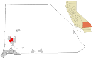
mapsize = 250x200px
map_caption = Location of Victorville in California
mapsize1 =
map_caption1 =
subdivision_type = Country
subdivision_name =United States
subdivision_type1 = State
subdivision_name1 =California
subdivision_type2 = County
subdivision_name2 = San Bernardino
subdivision_type3 =
subdivision_name3 =
subdivision_type4 =
subdivision_name4 =
government_type =
leader_title =Mayor
leader_name = Terry Caldwell [cite web | url = http://ci.victorville.ca.us/city-council/members/member4.html | title = Victorville City Council: Councilmember Terry Caldwell | accessdate = 2007-02-20]
leader_title1 =
leader_name1 =
leader_title2 =
leader_name2 =
leader_title3 =
leader_name3 =
established_title =
established_date =
established_title2 =
established_date2 =
established_title3 = Incorporated (city)
established_date3 =1962-09-21 [cite web | url = http://www.cacities.org/resource_files/20457.IncorpDateLO.doc | title = Incorporation Dates of California Cities | accessdate = 2007-02-20]
area_magnitude =
area_total_km2 = 189.85
area_total_sq_mi = 73.30
area_land_km2 = 188.50
area_land_sq_mi = 72.78
area_water_km2 = 1.35
area_water_sq_mi = 0.52
area_water_percent = 0.71
area_urban_km2 =
area_urban_sq_mi =
area_metro_km2 =
area_metro_sq_mi =
population_as_of = 2007
population_note =
population_footnotes = [cite web | url = http://factfinder.census.gov/servlet/ACSSAFFFacts?_event=Search&geo_id=&_geoContext=&_street=&_county=&_cityTown=Victorville%20city&_state=04000US06&_zip=&_lang=en&_sse=on&pctxt=fph&pgsl=010 | title = Victorville city, California - Fact Sheet - American FactFinder | accessdate = 2007-02-20]
settlement_type =City
population_total = 107,721
population_density_sq_mi = 879.7
population_metro =
population_density_metro_km2 =
population_density_metro_sq_mi =
population_urban =
population_density_urban_km2 =
population_density_urban_sq_mi =
timezone = PST
utc_offset = -8
timezone_DST = PDT
utc_offset_DST = -7
latd = 34 |latm = 31 |lats = 14 |latNS = N
longd = 117 |longm = 20 |longs = 40 |longEW = W
elevation_m = 832
elevation_ft = 2730
postal_code_type =ZIP Code
postal_code = 92392, 92393, 92394, 92395 [cite web | url = http://zip4.usps.com/zip4/zcl_1_results.jsp?visited=1&pagenumber=0&state=ca&city=Victorville | title = USPS - ZIP Code Lookup - Find a ZIP+ 4 Code By City Results | accessdate = 2007-02-20]
area_code = 760 [cite web | url = http://www.nanpa.com/nas/public/npa_city_query_step2.do?method=displayData&cityToNpaModel.stateAbbr=CA&cityToNpaModel.city=Victorville | title = Number Administration System - NPA and City/Town Search Results | accessdate = 2007-02-20]
website = [http://ci.victorville.ca.us/ http://ci.victorville.ca.us/]
blank_name = FIPS code
blank_info = 06-82590
blank1_name = GNIS feature ID
blank1_info = 1652806
footnotes =Victorville is a city located in the
Victor Valley of western San Bernardino County,California , US. According to theU.S. Census Bureau 's 2000 census, the city has a total population of 64,029. The May 1, 2008 population estimate released by the state ofCalifornia for Victorville is 107,721.Geography
Victorville is located at 34°31'14" North, 117°20'40" West (34.520459, -117.344525)GR|1.
Victorville is located at the southern edge of the
Mojave Desert , 81 miles northeast of Los Angeles, 34 miles south of Barstow, 48 miles east of Palmdale, and 37 miles north of San Bernardino through theCajon Pass on Interstate 15. Victorville has the Mojave Desert branch of the San Bernardino county government offices.It is bordered by Apple Valley on the east, Hesperia on the south, and Adelanto on the west. The
Mojave River flows through Victorville. The elevation at City Hall is approximately 2,950 feet above sea level. The summer climate for this area in theMojave Desert may be hotter than the Los Angeles basin or the Inland Empire, but actually 10 or 15 degrees cooler than in theColorado Desert .According to the
United States Census Bureau , the city has a total area of 189.8 km² (73.3 mi²). 188.5 km² (72.8 mi²) of it is land and 1.3 km² (0.5 mi²) of it is water. The total area is 0.71% water.Demographics
In 2005, the city was estimated to contain 86,473 people, 30,000 households, and 21,000 families residing in the city. The
population density is 339.7/km² (879.7/mi²). There are 22,498 housing units at an average density of 119.4/km² (309.1/mi²). The racial makeup of the city is 61.05% White, 11.92% African American, 1.11% Native American, 3.48% Asian, 0.20% Pacific Islander, 16.26% from other races, and 5.98% from two or more races. 33.46% of the population are Hispanic or Latino of any race.There are 30,000 households out of which 43.8% have children under the age of 18 living with them, 54.3% are married couples living together, 16.1% have a female householder with no husband present, and 24.0% are non-families. 19.4% of all households are made up of individuals and 8.5% have someone living alone who is 65 years of age or older. The average household size is 3.03 and the average family size is 3.47.
In the city the population is spread out with 34.2% under the age of 18, 8.6% from 18 to 24, 28.6% from 25 to 44, 17.4% from 45 to 64, and 11.2% who are 65 years of age or older. The median age is 31 years. For every 100 females there are 93.9 males. For every 100 females age 18 and over, there are 89.2 males.
The median income for a household in the city is $36,187, and the median income for a family is $39,988. Males have a median income of $40,149 versus $26,138 for females. The
per capita income for the city is $14,454. 18.7% of the population and 15.3% of families are below thepoverty line . Out of the total population, 24.6% of those under the age of 18 and 10.6% of those 65 and older are living below the poverty line.For the year ending July 2007, Victorville experienced the second-highest population growth rate in the country, according to the U.S. Census Bureau. That year, the population rose 9.5%, to 107,221.
Politics
In the state legislature Victorville is located in the 17th Senate District, represented by Republican
George Runner , and in the 36th Assembly District, represented by RepublicanSharon Runner . Federally, Victorville is located inCalifornia's 25th congressional district , which has a Cook PVI of R +7 [cite web | title = Will Gerrymandered Districts Stem the Wave of Voter Unrest? | publisher = Campaign Legal Center Blog | url=http://www.clcblog.org/blog_item-85.html | accessdate = 2008-02-10] and is represented by Republican Buck McKeon.History
About
1895 the town was named Victor afterCalifornia Southern Railroad General ManagerJacob Nash Victor . In1901 , theUnited States Post Office Department changed the name to Victorville to avoid confusion with the town of Victor, Colorado.In
1926 ,U.S. Route 66 was established and passed through Victorville. Today, the former route is the primary road through oldtown Victorville, forming Seventh Street.In
1940 ,Herman J. Mankiewicz andJohn Houseman wrote the first two drafts ofCitizen Kane in Victorville.Orson Welles sent the two of them to write in seclusion due to Mankiewicz's legendary drinking habits. [cite web | url = http://criticalinquiry.uchicago.edu/issues/v5/v5n2.carringer.html | title = Excerpt from "The Scripts of Citizen Kane" by Robert L. Carringer | accessdate = 2007-10-11]Victorville Army Airfield was constructed in 1941 and later namedGeorge Air Force Base .On
November 19 ,1954 ,Sammy Davis, Jr. almost died in an automobile accident in Victorville on a return trip from Las Vegas to Los Angeles. Davis lost his left eye as a result, and wore aglass eye for the rest of his life.The city was incorporated on
September 21 ,1962 .On
August 14 ,1977 , actorRon Haydock was struck and killed while hitch-hiking near Victorville. Ron Haydock is also remembered for his hit rockabilly 45rpm single "99 Chicks".In
1992 , George AFB was deactivated and is nowSouthern California Logistics Airport . The former base housing is now vacant, forming a ghost town that is used for military training purposes by troops fromFort Irwin Military Reservation .In
2003 , the [http://www.royrogers.com/museum.html Roy Rogers and Dale Evans Museum] was moved from Victorville toBranson, Missouri .On
November 3 ,2007 , Victorville hosted theDARPA Urban Challenge , a 6 hour autonomous robot driving contest through the streets of what was formerlyGeorge Air Force Base now the Southern California Logistics Airport. The Carnegie Mellon team, known as Tartan Racing, took the US$2 million first prize, while the Stanford Racing Team received a $1 million check for finishing second. Team Victor Tango, made up of faculty and students from Virginia Tech, whose vehicle number was 32 in honor of the 32 students killed in the 2007Virginia Tech massacre , received $500,000 for taking third place. “Robots sometimes stun the world, inspire a lot of people and change the belief of what is possible,” said William “Red” Whittaker, a Carnegie Mellon robotics professor and team leader of the university’s Tartan Racing team. “We’ve seen that here and once the perception of what’s possible changes it never goes back. This is a phenomenal thing for robotics.” [cite web | url = http://www.world-science.net/othernews/071105_driverless.htm | title = Competition drives robo-car technology forward" | accessdate = 2007-11-05]Victorville is also home to the San Bernardino County Fairgrounds.
Transportation
* [http://www.vvta.org/ Victor Valley Transit Authority (VVTA)]
*Victorville (Amtrak station)
*Southern California Logistics Airport Public safety
The City of Victorville contracts with the
San Bernardino County Sheriff's Department for police services. The new Victorville Regional Station is located on Amargosa Rd. near the California Highway Patrol Station. This station provides full service law enforcement for the City of Victorville(and neighboringApple Valley ,Hesperia andAdelanto ). Many residents often confuse this station with the nearby old Victor Valley Station adjacent to the court house. The original Victorville Station provides law enforcement services mainly to the unincorporated areas of the Victor Valley such as Phelan, Lucerne Valley, Spring Valley Lake, and the numerous other county areas.Victorville's own full-service fire department was contracted to the San Bernardino County Fire Department. This became effective on July 5, 2008 upgrading to a paramedic program in the process, leaving the Apple Valley Fire Protection District as the only municipal fire department left in the entire Victor Valley. Mutual aid is provided from the surrounding County Fire stations in Adelanto and Hesperia as well as from the Apple Valley FPD.
Notable people from Victorville
*
Earl W. Bascom , Hall of Fame cowboy, international artist and sculptor.
*John W. Henry , principal owner of theBoston Red Sox , who graduated from Victor Valley High and attended Victor Valley College while residing in nearby Apple Valley.
* Ollie Butler, winningest High School Basketball Coach in San Bernadino County history.
*Dan Henderson , welterweight champion, was born in August 24, 1970 and went to Victor Valley High School but resided in Apple Valley, where he was born.
*T. J. Houshmandzadeh , wide receiver for the NFL's Cincinnati Bengals.
*Al Jury , NFL Referee.
*Dave Lombardo , drummer of thrash metal band,Slayer .
*Prem Reddy , MD, FACC, FCCP, Cardiologist, Entrepreneur and Philanthropist.
*Joe Stevenson , ultimate fighter who attended Silverado High School.
*Mike Mangold , 2005 Red Bull Air Race World Series Champion.
*Trever Keith , guitarist, vocalist, and founding member of the punk band Face to Face, formed in Victorville in1991 .
*Matt Riddle , former bassist of Face to Face and current bassist for the punk bandNo Use for a Name .
* C.U.R.S.E., a punk band formed in 1985.
* Futile Effort, a punk band formed in 1989.
* Chuck, a punk band formed in 1993.
*Lorene Drive , a rock band formed in 2002.
* Spitting On Cops, a punk band formed in 2005.
* Belligerent Idiot,a punk band formed in 2007
* Ian Gallagher, artist and percussionist for New Boston Tea Party and Edmund Fitzgerald(Detroit band)
* Nick Mazzone,commercial and film actor was born and raised in Victorville,, graduated from Victor Valley High School.Places of interest
Victorville is the current home of the
California Route 66 Museum and theSan Bernardino County Fair.The
United States Penitentiary, Victorville , located north of I-15 just offUS Highway 395 has been home to many notables, includingJohn Walker Lindh , the so-called "American Taliban" fighter.Filming location
Victorville has been used for film shoots:
* "Face/Off " (1997), portions filmed at Southern California Logistics Airport in Victorville
*"Lethal Weapon " (1987) filmed at El Mirage Dry Lake west of Victorville
*"Grand Theft Auto" (1977), starring Ron Howard.
*"The Hills Have Eyes" (1977). However, the2006 was filmed inMorocco .
*"" (2006), partially filmed in Victorville.
*"Contact" (1997), also partially filmed in Victorville, with some local residents used as extras.
*"Foo Fighters - Times Like These " (2002) filmed on D Street between Victorville and Apple Valley
*"" (2003) filmed at Desert View Memorial Park and parts of downtown.
*"Play It to the Bone " (1999) filmed partly in The New Reflections in downtown
*"Kill Bill pt. 2" (2004) filmed in The New Reflections as well
* "Breakdown"- starring Kurt Russell (1997) Filmed in downtown Victorville.References
External links
* [http://www.y102fm.com/ "Y-102 Radio"]
* [http://www.thefox1065.com/ "The FOX, 106.5"]
* [http://www.katcountry1007.com/ "Kat Country 100.7"]
* [http://www.talk960.com/ "Talk 960" ]
* [http://ci.victorville.ca.us/ Victorville city government site]
* [http://www.vvdailypress.com/ "The Daily Press" newspaper]
Wikimedia Foundation. 2010.