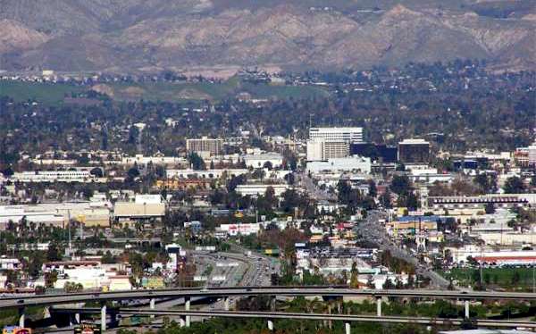
- Inland Empire (California)
-
For other uses, see Inland Empire.
Inland Empire
Riverside-San Bernardino-Ontario— Metropolitan Area — Riverside San Bernardino
 Ontario
Country  United States of America
State  California
Principal cities (10 largest cities by population) - Riverside
- San Bernardino
- Ontario
- Corona
- Moreno Valley
- Temecula
- Murrieta
- Indio
- Redlands
- HemetArea – Metro 70,669 km2 (27,298 sq mi) Elevation -607.1 - 3,507 m (-1,600 - 11,499 ft) Population (2010)[1] – Density 56.9/km2 (147.5/sq mi) – Urban 1,506,816 (25th) – Urban density 1,325.9/km2 (3,434.1/sq mi) – Metro 4,224,851 (13th) Time zone PST (UTC-8) – Summer (DST) PDT (UTC-7) The Inland Empire (colloquially known as the I.E.) is a region in Southern California. The region sits directly east of the Los Angeles metropolitan area. The Inland Empire most commonly is used in reference to the U.S. Census Bureau's federally-defined Riverside-San Bernardino-Ontario metropolitan area, which covers more than 27,000 square miles (70,000 km2). The metropolitan area consists of Riverside County and San Bernardino County and, according to the US Census, is home to over 4 million people and is the 13th most populous metropolitan area in the United States, and the third largest in the state of California.[2] Most of the area's population is located in the southwest corner of the region. At the end of the 19th century, the Inland Empire was a major center of agriculture, including citrus, dairy, and wine-making. Agriculture declined through the 20th century, and since the 1970s a rapidly growing population, fed by families migrating in search of affordable housing, has led to more residential, commercial, and industrial development. The Inland Empire also has the desert resort cities of Palm Springs and Palm Desert. The U.S. Census Bureau also combines the Inland Empire and the Los Angeles metropolitan area into a larger region known as the Greater Los Angeles Area with a population of over 17 million.
Contents
History
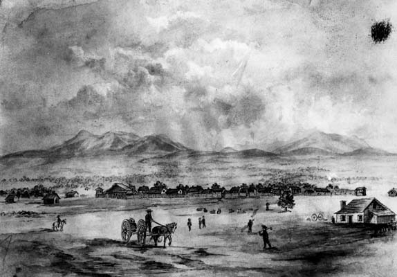
 Drawing of San Bernardino (1852)
What is now known as the Inland Empire was inhabited for thousands of years, prior to the late 18th century, by the Tongva, Serrano, and Cahuilla Native Americans. With Spanish colonization and the subsequent Mexican era the area was sparsely populated at the land grant Ranchos, considering it unsuitable for missions. The first American settlers arrived over the Cajon Pass in 1851, a group of Mormon pioneers who were the first residents of San Bernardino. Although the Mormons left a scant six years later, recalled to Salt Lake City by Brigham Young during the church's Utah War with the U.S. government, other settlers soon followed.
The entire landmass of Southern California was subdivided according to the San Bernardino Meridian, which was first plotted as part of the Public Land Survey System in November 1852, by Col. Henry Washington. Base Line road, a major thoroughfare, today runs from Highland to San Dimas, intermittently along the absolute baseline coordinates plotted by Col. Washington.[3] San Bernardino County was first formed out of parts of Los Angeles County on April 26, 1853. While the partition once included what is today most of Riverside County, the region is not as monolithic as it may sound. Rivalries between Colton, Redlands, Riverside and San Bernardino over the location of the county seat in the 1890s caused each of them to form their own civic communities, each with their own newspapers. On August 14, 1893 the Senate allowed Riverside County to form out of land previously in San Bernardino and San Diego counties, after rejecting a bill for Pomona to split from LA County and become the seat of what would have been called San Antonio County.[4]
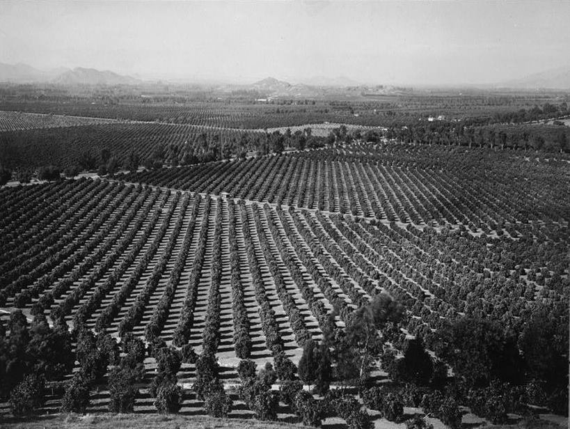
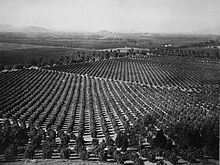 Arlington Heights Citrus Groves, Riverside circa 1903
The arrival of railroads and the importation of navel and Valencia orange trees in the 1870s touched off explosive growth, with the area quickly becoming a major center for citrus production.[5][6][7] This agricultural boom continued with the arrival of water from the Colorado River and the rapid growth of Los Angeles in the early 20th century, with dairy farming becoming another staple industry. In 1926, Route 66 (now known as Foothill Boulevard) came through the northern parts of the area, bringing a stream of tourists and migrants to the region. Still, the region endured as the key part of the Southern California "Citrus belt" until the end of World War II, when a new generation of real-estate developers bulldozed acres of agricultural land to build suburbs.[5] The precursor to the San Bernardino Freeway, the Ramona Expressway, was built in 1944, and further development of the freeway system facilitated the expansion of suburbs and human migration throughout the Inland Empire and Southern California.
The region experienced significant economic and population growth through most of the later half of the 20th century. In the early 1990s, the loss of the region's military bases and reduction of nearby defense industries due to the end of the Cold War lead to a local economic downturn.[8][9] The region as a whole had partially recovered from this downturn by the turn of the century through the development of warehousing, shipping, logistics and retail industries, primarily centered around Ontario.[10] However, these industries have been heavily affected by the global late-2000s recession.[11]
Name origin
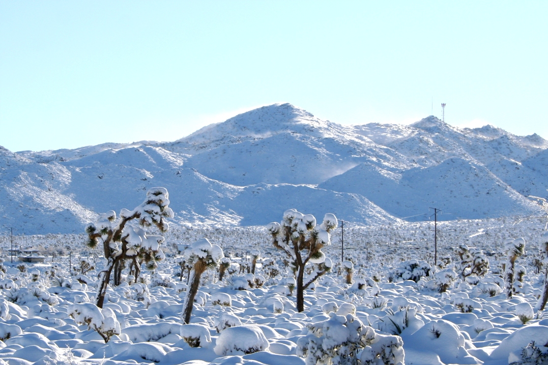
 Yucca Valley, within the Morongo Basin, is halfway between the San Bernardino Valley and the Arizona State line.
The term "Inland Empire" is documented to have been used by the Riverside Enterprise newspaper (now The Press-Enterprise) as early as April 1914.[12] Developers in the area likely introduced the term to promote the region and to highlight the area's unique features. The "Inland" part of the name is derived from the region's location about 37 miles (60 km) inland from the Pacific Ocean and east of Los Angeles. Originally this area was called the Orange Empire, and referring to the acres of citrus groves that once extended from Pasadena to Redlands during the early half of the 20th century.[13][14] The Inland Empire today is a nebulous region, though most can agree the nickname includes the cities of western Riverside County and southwestern San Bernardino County, adjacent to the Los Angeles metropolitan area.[14]
Geography
Physical geography
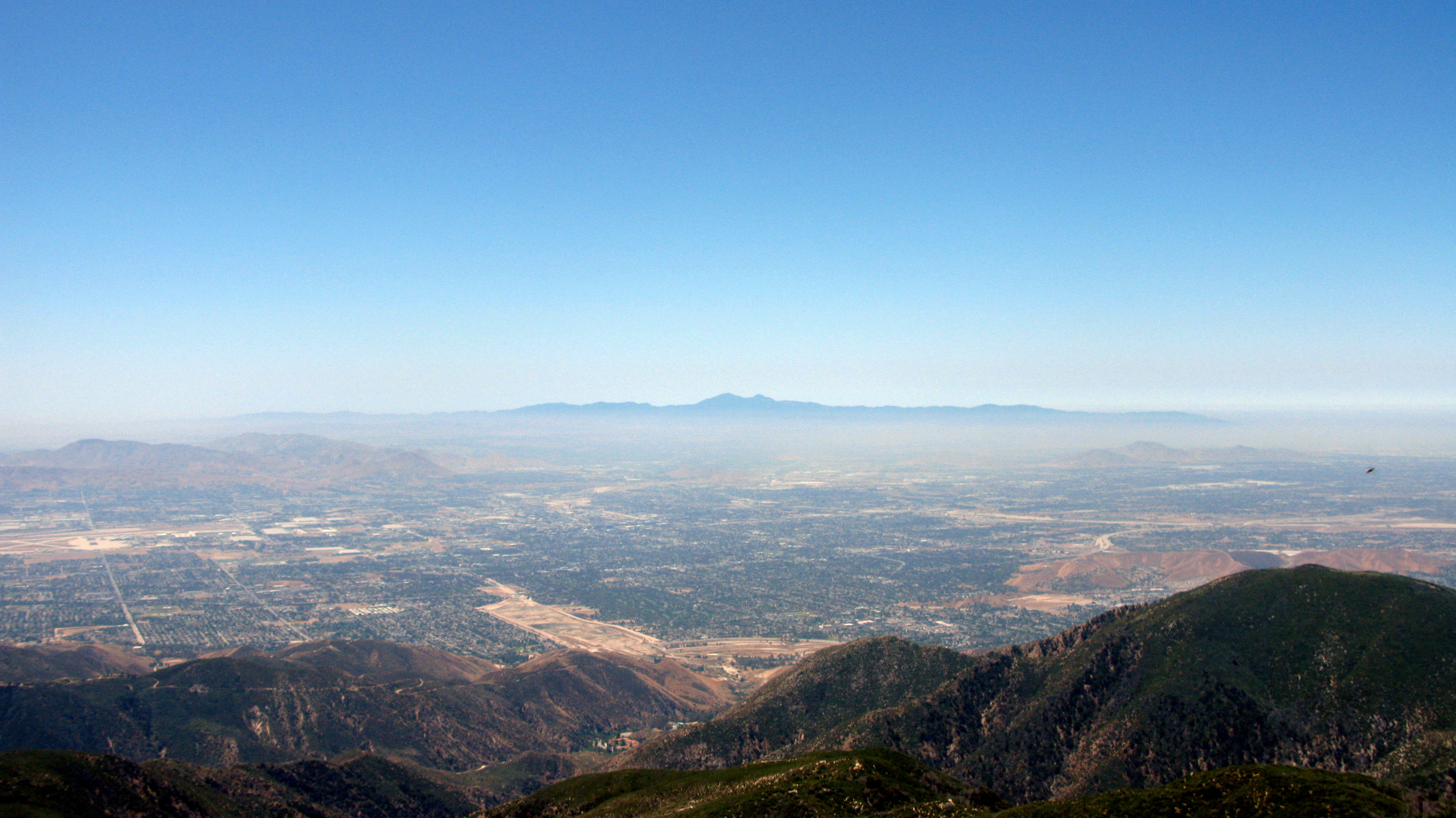
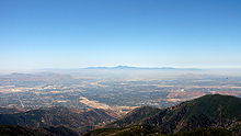 View of the San Bernardino Valley from the San Bernardino Mountains. The Santa Ana Mountains are visible in the distance.
Physical boundaries between Los Angeles and the Inland Empire from west to east are the San Jose Hills splitting the San Gabriel Valley from the Pomona Valley, leading to the urban populations centered in the San Bernardino Valley.[citation needed] From the south to north, the Santa Ana Mountains physically divide Orange County from San Bernardino and Riverside Counties. The Santa Rosa Mountains, as well as the Southern California portion of the Sonoran Desert, physically divide Riverside County from San Diego County.[15] Some definitions for the IE consist of the Chino Valley, Coachella Valley, Cucamonga Valley, Menifee Valley, Murrieta Valley, Perris Valley, Temecula Valley, and Victor Valley.[citation needed]
Elevations range from 11,499 feet (3,505 m) at the top of the San Gorgonio Mountain to 220 ft (-67.1 m) below sea level at the Salton Sea. The San Bernardino mountains are home to the San Bernardino National Forest and the resort communities of Big Bear Lake, Lake Arrowhead, and Running Springs. The Santa Ana River extends from Mt. San Gorgonio for nearly 100 miles (160 km) through San Bernardino, Riverside, and Orange counties before it eventually spills into the Pacific Ocean at Newport Beach and Huntington Beach. While temperatures are generally cool to cold in the mountains, it can get hot in the valleys. In the desert resort of Palm Springs, near Joshua Tree National Park, summer temperatures can reach well over 110 degrees.
Political geography
Unlike most metropolitan areas that have grown up around a central city, the Inland Empire centers around multiple cities, including Riverside, San Bernardino and Ontario.[citation needed] Suburban sprawl spreads out to form a unified whole with Los Angeles, with further development encroaching past the mountains into the outlying desert areas. Interconnectivity provided by one of the most comprehensive freeway systems in the United States has eroded any sense of physical boundaries between the Inland Empire and Los Angeles county.[citation needed]
The Inland Empire has also been referred to as the 909, after one of the region's most used area codes.[14][16] In 2004, because of growing demand for telephone numbers, most of Riverside County was granted a new area code, 951.[16]
Boundaries and definitions
There is no universally accepted definition for the Inland Empire. Some sources such as the Los Angeles Times[17][18][19][20][21] have referred to Riverside County and San Bernardino County as the Inland Empire, mirroring the Riverside-San Bernardino-Ontario metropolitan area.
Some residents of certain areas within the two counties, such as the Coachella, and Temecula valleys, consider themselves separate from the IE.[14] The California Travel and Tourism Commission (CTTC), a not-for-profit, nongovernmental[22] entity that promotes tourism in California,[23] divides the state into several regions for its own purposes. The CTTC defines the Inland Empire as being bounded by Los Angeles County and Orange County on the west, San Diego County on the south, as far north as the Victor Valley area, and as far east as Idyllwild in the San Jacinto Mountains.[24] The state of California's official website links to the CTTC's map with the description "Map of the Inland Empire region".[25]
Other sources, including Kevin Starr, former state librarian of California, include eastern Los Angeles County cities in the Pomona Valley within the definition of the Inland Empire.[26] Other sources also include cities in Los Angeles County within the boundaries.[27][28][verification needed][29]
Economy
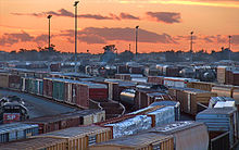 Boxcars, Rialto, California
Inexpensive land prices (compared to Los Angeles and Orange Counties), a large supply of vacant land, and a transport network where many highways and railroads intersect have made the Inland Empire a major shipping hub. Some of the nation's largest manufacturing companies have chosen the Inland Empire for their distribution facilities including Toyota Motor Corporation's North American Parts and Logistics Distribution (NAPLD) center in Ontario and APL Logistics in Rancho Cucamonga. Whirlpool Corporation recently leased a 1,700,000-square-foot (160,000 m2) distribution center in Perris that is larger than 31 football fields and one of the biggest warehouses in the country.[30] These centers operate as part of the system that transports finished goods and materials from the ports of Los Angeles and Long Beach to destinations to the north and east such as Las Vegas, Phoenix, and Denver. More than 80% percent of the state's imported cargo is shipped through the Los Angeles/Inland Empire Corridor.[31] However, with the global economic downturn, industrial vacancies have doubled from 6.2% in 2007 to 12.4% to 2008. In San Bernardino and Redlands, vacancies are as high as 22%.[32]
Although the region's large industries have been affected by the late-2000s recession, the Inland Empire is projected to remain California's fastest-growing region for some time to come.[33] The area is also projected to remain one of the least educated areas of the state with the lowest average in annual wages in the country.[33] A 2006 study of salaries in 51 metropolitan areas of the country ranked the Inland Empire second to last, with an average annual wage of $36,924.[33] However, inexpensive land prices and innovative institutional support networks have attracted some small businesses owners and technology start-ups into the area.[11]
While urbanization continues to cut into agricultural lands, the Inland Empire still produces substantial crops. Although 10,000 acres (40 km2) of irrigated land was lost between 2002 and 2004, agriculture still brought in more than $1.6 billion in revenues to the two-county region in 2006.[6]
Being a MSA, aggregate GDP figures are reported by the Bureau of Economic Analysis annually. 2010 GDP was $109.8 billion, roughly a third of San Francisco-Oakland-Fremont, CA MSA despite their close population numbers. Due to housing crisis, the GDP fell from $114.8 billion in 2007, despite a heavy influx of residents. Per capita GDP was $25,970 in 2010.
Housing
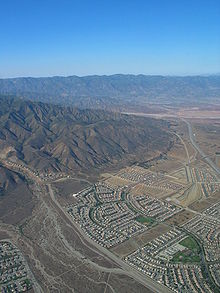 Housing construction visible from the air in Fontana, since 1980 the city's population grew by 150,000 residents.
Since the 1950s, the area has evolved from a rural to a suburban environment. In addition to existing cities such as Riverside and San Bernardino, the region now comprises numerous suburban cities known as bedroom communities such as Rancho Cucamonga. Affordable home ownership is the primary motivation behind the growth in these Inland Empire communities as homes there are generally less expensive than comparable homes in Orange and Los Angeles Counties. The steady rise in population and the demand for housing has led to a dramatic increase in single-family residential construction on lots of 1/4 acre (1,000 m²) or more (as opposed to high-density development such as multi-level apartments or condominiums). Much of the vacant land is rapidly being developed to the chagrin of those who grew up living 'in the country'. In addition, much of the land that was used for agriculture is now being sold by their owners and being converted for use for more intensive purposes such shopping centers, industrial warehouses, etc. This continuous development, due to the various interests involved, has become seemingly unplanned and uncontrolled suburban sprawl.[34] The Inland Empire was declared the nation's worst example of sprawl according to a study by Smart Growth America in 2002.[35][36]
Foreclosures have risen by 3,500% since 2006.[37] In 2010, the area ranked fourth in the nation in the number of foreclosures, with one filing for every 133 households.[38] The city of Perris initiated a program to paint the brown lawns of abandoned homes green as a way to cut down on the appearance of blight.[39]
Retail
Retailing in the area has increased to keep abreast with the rapidly growing suburban population. The region is home to several large upscale shopping malls, including the Promenade Shops at Dos Lagos in Corona, Ontario Mills in Ontario, Promenade Mall in Temecula, Moreno Valley Mall in Moreno Valley, Victoria Gardens Mall in Rancho Cucamonga and the Inland Center mall in San Bernardino. In fiscal year 2006, retail sales in San Bernardino County grew by 11.9% to $31.2 billion, while sales in Riverside County were up 11.3% to $29.6 billion.[40]


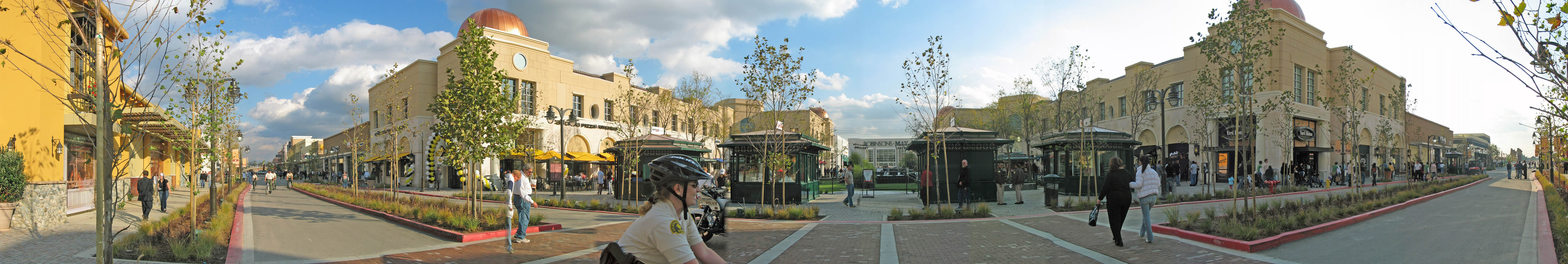
Panorama of the "Town Square" at Victoria Gardens Mall in Rancho Cucamonga Environmental quality
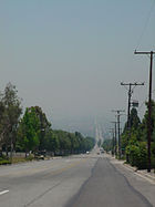

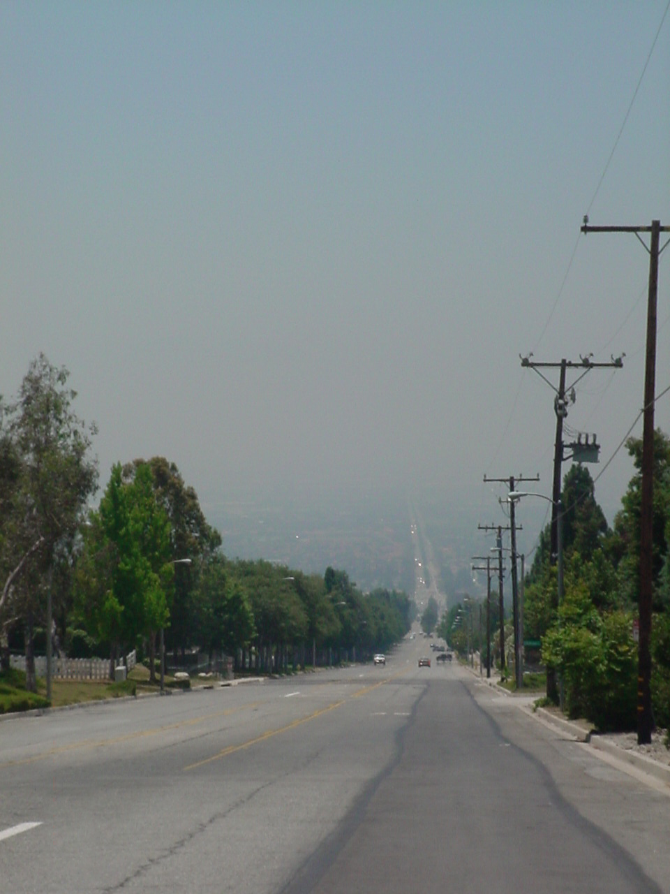
The Inland Empire is subject to smog conditions on a regular basis as seen here, looking south, from the north terminus of Haven Avenue in Rancho Cucamonga. Note how the street 'fades' into the smoggy haze and the Santa Ana Mountains are completely obscured. The Inland Empire is also subject to Santa Ana Winds that lead to generally clear days, free of smog or the marine layer. Note how the street that 'faded' into the smoggy haze and the Santa Ana Mountains that were completely obscured in the image to the left is now visible. The result of this ongoing development has resulted in greater employment opportunities, increased affluence of the populace, and homeownership. Unfortunately, increased traffic congestion, degradation in air quality, and loss of open and environmentally sensitive land has been the negative result.[41] The solution to these problems is not simple. The presence of so many local governments within the Inland Empire, which often have different 'visions' for their own respective municipalities, means that two cities in the region rarely agree on a solution or, just as common, they have unequal means for implementing one. The lack of a region-wide governmental planning organization as well as unequal enforcement of existing laws and policies, may undermine any solution that could be proposed. Lastly, the pace at which development occurs (fast) versus the ability of government to respond to changes (slow) means that it could easily take years, if not decades, for a viable solution (such as new roads, pollution controls, etc.) to go into effect.[42]
Air pollution
Air pollution, or suspended particulate matter locally generated from the increased number of automobiles in the area, from point sources such as factories, dust carried into the air by construction activity, and the contribution of similar pollutants from the Los Angeles area has regularly caused the Inland Empire to be at, or near, the bottom of many air quality ratings. In 2004, the EPA rated the San Bernardino-Riverside area as having the worst particulate air pollution in the United States (although the San Joaquin Valley in central California had the worst overall air pollution).[43] The air pollution problem is exacerbated by the region's location which is surrounded by mountain ranges to the north and east; the mountains 'contain' these aerosols which otherwise would be carried out of the region by the prevailing winds which typically flow from west to east.
Water pollution
Water pollution has also been found in the Santa Ana River and Cajon wash, and pollutants from the March Air Reserve Base and Stringfellow Acid Pits have contaminated groundwater in parts of Riverside County.[15] In 1997, perchlorate, a chemical used to produce explosives, was discovered to be seeping into the groundwater under Rialto in a plume that continues to grow. In 2007, the Rialto City council petitioned the United States Environmental Protection Agency (EPA) for Superfund status to clean up the origin site. The sites comprising March Air Reserve Base, Norton Air Force Base and the Stringfellow Acid Pits have already been classified as EPA Superfund toxic waste sites.[44]
Transportation
Main article: Transportation in the Inland Empire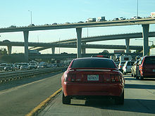
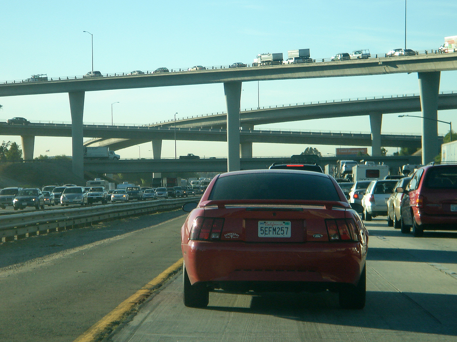
Traffic congestion problems on the roadways, as with elsewhere in Southern California, is the result of the steady increase in the number of vehicles and a transportation infrastructure network that has not expanded accordingly. Many of the existing freeways were completed in the late 1970s. With the exception of the segment of the Foothill Freeway, State Route 210 (SR 210) between San Dimas and San Bernardino recently completed in July, 2007. New freeways or highways "Fix Up's" are indeed being planned, such as the expansion of the length of the 215 freeway around Inland Center Mall, and the bridges connecting the 215 and 60 freeways. Another problem is the jobs vs. housing imbalance. In general, most of the higher paying jobs are located in Los Angeles and Orange County. Thus, workers must commute daily up to two hours (each direction) on the existing network. As the population increases, the problem is most certainly going to increase as well. Forbes Magazine recently ranked the area first in its list of America's most unhealthy commutes, beating out every other major metropolitan area in the country, as Inland area drivers breathe the unhealthiest air and have the highest rate of fatal auto accidents per capita.[45]
According to a 1999 report by the Surface Transportation Policy Project, the Inland Empire lead in fatal crashes caused by road rage.[46][47] The theft of copper, brass and other metals from highway and road fixtures has also led to decreased public safety on IE roads and freeways.[48] Gas siphoning has also been noted as a problem for vehicles left unattended in the region.[49]
Public transportation
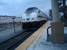
The Bi-County region, unlike many major metropolitan areas, does not have access to suitable public transportation. Less than 5% of the IE's 1,249,224 working-age residents use public transportation to get to work each day.[50] Omnitrans is the largest commuter in San Bernardino County, while the Riverside Transit Agency is the largest in Riverside County. Metrolink commuter rail provides service to many points throughout the Inland Empire and into Los Angeles. Riverside and San Bernardino are the two transportation hubs of the Inland Empire.
Airports
See also: List of airports in the Inland EmpireThree major airports serve the Inland Empire: Ontario (owned by the city of Los Angeles World Airports), Palm Springs, and San Bernardino. However there are many general aviation airports across the Bi-County region.
Airport IATA code ICAO code County Ontario International Airport ONT KONT San Bernardino Palm Springs International Airport PSP KPSP Riverside San Bernardino International Airport SBD KSBD San Bernardino Demographics
Historical populations Census Pop. %± 1900 45,826 — 1910 91,402 99.5% 1920 123,698 35.3% 1930 214,924 73.7% 1940 266,632 24.1% 1950 451,688 69.4% 1960 809,782 79.3% 1970 1,143,146 41.2% 1980 1,558,182 36.3% 1990 2,588,793 66.1% 2000 3,254,821 25.7% Est. 2010 4,224,851 29.8% The Combined Statistical Area population of the Greater Los Angeles area (which includes the Inland Empire) is over 15 million people according to the US Census, and is the second largest metropolitan area in the country. The Metropolitan Statistical Area population of the Inland Empire (Riverside-San Bernardino-Ontario, CA Metropolitan Statistical Area) onto itself is 4 million people and is the 14th largest metropolitan area in the United States. In addition, according to the 2000 Census, it is the fastest growing area in the state. Between 1990 and 2000, Riverside and San Bernardino counties added 700,000 to their population totals, an increase of 26%.[50] Between 2000 and 2008 Inland Empire's population expanded by 861,000 or 26.5%. According to census bureau's 2005-2007 estimates 61.8% of the population was White (40.4% White Non-Hispanic), 7.5% Black, 5.7% Asian and 25.0% of other or mixed race. 43.9% were Hispanic of any race. 21.9% of the population was foreign born.
The Centers for Disease Control and Prevention reports that in 2006, 33.1% of people in the Greater San Bernardino Area were overweight, and 30.8% were obese. Forbes Magazine ranks the area as the fourth fattest in the country.[51]
A substantial majority of residents (76.6%), last comparatively surveyed in 2001, rated their respective counties as good places to live. Over 81% of Riverside County residents indicated that their county is a very good or fairly good place to live, while about 72% of residents in San Bernardino County felt the same way. Survey respondents cited "nice living area," "good climate," and "affordable housing" as the top positive factors in assessing their respective communities. Smog was by far the most important negative factor affecting respondents’ ratings in both counties, while traffic was the 2nd highest concern in Riverside County and crime the 2nd highest concern among San Bernardino County residents.[52]
Politics
While the region as a whole has traditionally leaned more Republican than the rest of California, newer residents are less likely to identify with the Republican party than longer-term residents (36 percent to 42 percent), and the total number of residents identifying with the Democrats (34%) now slightly edges over the number identifying with the Republican party (33%). In fact, in the 2008 presidential election, Democratic candidate Barack Obama carried both Riverside and San Bernardino counties, becoming only the second Democrat to carry both counties since Lyndon Johnson in 1964. However, voting rates are lower than in the rest of the state, and as the population grows there is also a trend away from civic engagement entirely. Among more recent residents, only 19% belong to civic organizations and 9% have served as a volunteer in a community organization. By contrast, 28% of long-term residents belong to community organizations and 15% have volunteered. Whites and African Americans have the highest participation rates for nearly every type of political activity, while Latinos and Asian Americans lag significantly behind other groups in terms of volunteerism and organizational membership. However, the 2006 immigration protests have significantly boosted political participation among Latinos, with nearly one in seven participating in demonstrations and marches that year.[53]
Religion
78% of Inland residents view themselves as Christians. 39% identify as Roman Catholic, 14% as Protestant, and 25% as some other type of Christian. (36% of total Inland Christians view themselves as "born again".) 1% of the population are Jewish, 6% belong to some other religion, and 14% profess no religion. 27% of Inland residents attend some form of religious service once a week, 14% attend more than once a week, 15% once a month, and 14% only attend services on major religious holidays.[53][54]
Crime
While the crime index in Riverside and Ontario tends slightly over the state average, San Bernardino has a crime index consistently near or over twice that of the national average.[55][56][57][58] Reflecting nation-wide trends, violent crime in the region overall declined or remained consistent in 2009, despite the recession. In the city of Riverside, 14 homicides occurred in 2009, down from 20 in 2008, its highest total since 2003. All but three cases resulted in arrests. In San Bernardino, by contrast, 32 killings occurred in 2009, a number identical to 2008, but only a third of cases in San Bernardino led to arrests, due to a lack of witness cooperation in that city.[59]
Latino gangs have been active in the region since the area's citrus days while a continual migration of African American gangs from LA has flowed into the area since the Watts Riots.[4][60] The increased diversity in the region between 1990 and 2000 is also associated with a 20% increase in hate crime in the same period, mostly ascribed to increased gang activity.[61][62] According to data from the FBI's Uniform Crime Reporting program, taken together, Riverside and San Bernardino counties showed a total of 51,237 crimes reported to county police/sheriffs (but not to city or other agencies) in 2006; this combined total exceeded the totals for all other California counties—considered individually—except for Sacramento.[63]
The region has also been noted as a center of methamphetamine production.[64] The Riverside and San Bernardino county sheriffs' departments busted 635 meth labs in 2000; law enforcement has driven most of the meth production industry to Mexico since 2007, but many of the homes discovered to have been used as meth labs before 2006 have since been sold on the market before California law required rigorous decontamination, leading to a legacy of health hazards for unsuspecting renters and home-buyers in the area.[65]
Education
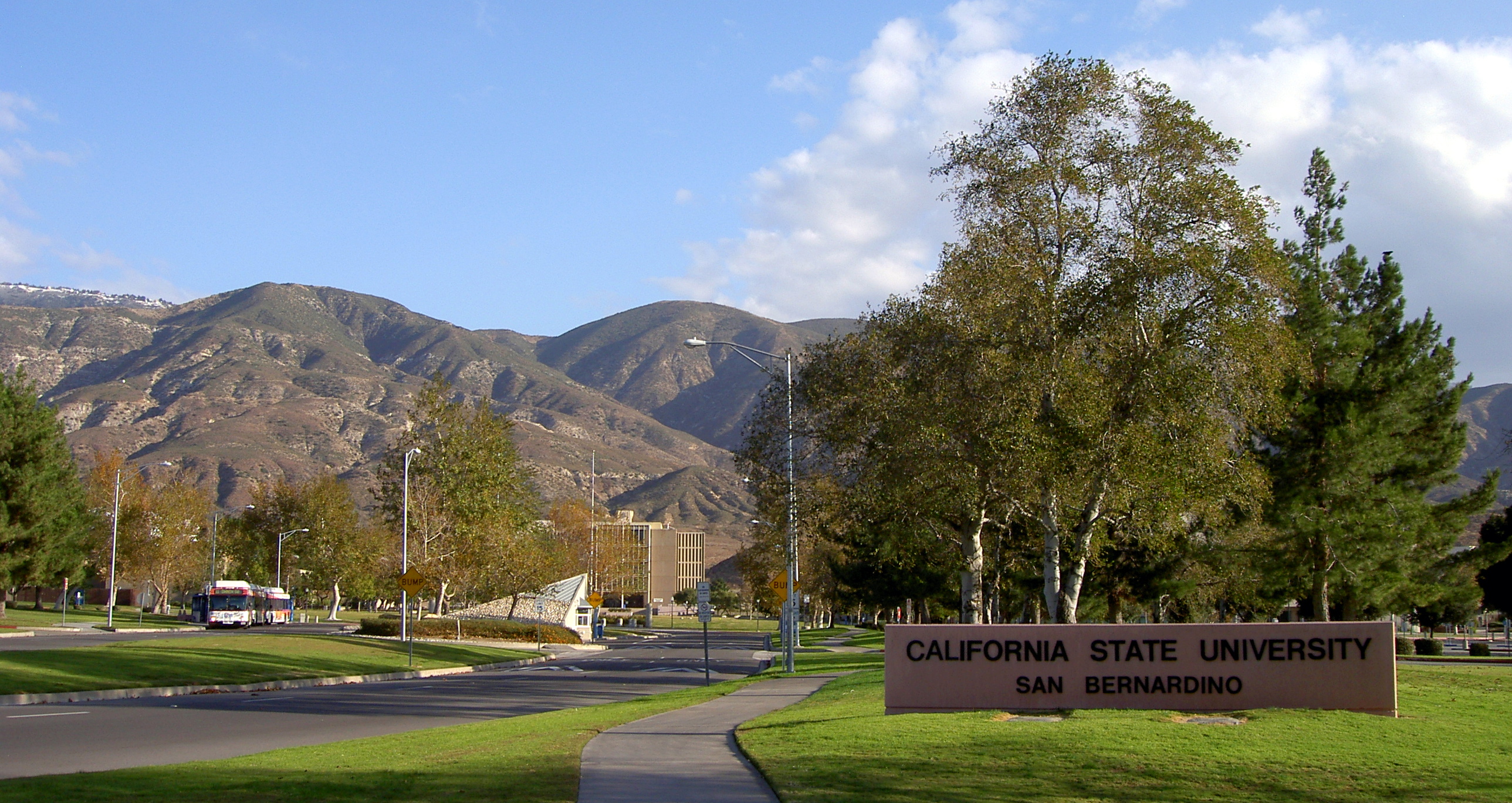
There is a trend of lower educational attainment in the IE, which starts early. Only 37% of 3- and 4-year olds in the region are enrolled in pre-school, with only one school in the region for every 343 children, as compared to 48% enrollment in San Diego County. 35% of the IE's ninth graders do not graduate from high school, and only 37% of its college age residents enroll in a post-secondary education program of some sort. Only 24% of the IE's adult residents have attained a college degree or better. 25% do not possess a high school diploma.[50] According to CSUSB President Al Karnig, "We have a very low college attendance rate that is scantly above half of what the average is in other states. We have only have about 20 percent college graduates in the Inland Empire while the average in other states is 38 percent."[66][67] 21 inland area high schools rank in the top 100 in California for producing dropouts.[68]
Of Inland residents 25 years and over in 2004, Asians were the best educated. 44.4% had bachelor’s or higher degrees, and nearly 70% had at least attended college. Among Whites, 22.8% had 4-year degrees or higher, and 60.8% at least attended college. In the African American community, the number with bachelor’s or higher degree was 21.3%, and 65.2% had either a community college degree or had attended college. Only 6.9% of Hispanic adults had a 4-year or higher degree, and only 30.2% attended college at all.[69]
Among students transferring from Inland community colleges to private schools in 2004-05, the most frequent choice was the University of Phoenix.[70]
Employment
While the Inland Empire led the state in job-growth with 275,000 new jobs between 1990 and 2000, most are in comparatively low-tech fields. San Bernardino and Riverside counties are primarily host to service and manufacturing- or warehousing-oriented industries. Food and administrative services employ the most people in the Inland Empire, while for the state of California, the top industries are in administrative services and professional, scientific and hi-tech-oriented fields. 79.8% of the IE's job growth from 1990-2003 was in service-sector jobs.[71] Low-wage industries are abundant in the IE, and the high-tech and professional industries that are in the area actually pay more in other regions of California. As many as one-third of working adults commute out of the 27,000-square-mile (70,000 km2) region to find work, the highest proportion of any area in the country. Adding to gridlock, less than 5% of the IE's 1,249,224 working-age residents use public transportation to get to work each day. 14.5% carpool, while 79.7% typically drive alone to work in their cars.[50] In 2007, the region had an unemployment rate of 6.1%, while overall jobless claims in California were at 5.4 percent and 4.4 percent nationally.[72] In 2008, unemployment in the area increased to 9.5%, "3 percentage points higher than the national rate and 1.3 points higher than the state's rate of 8.2%."[73] Unemployment reached an all-time high of 15% percent in 2010, second in the nation only to Detroit among metropolitan areas with populations over 1 million.[74]
Culture
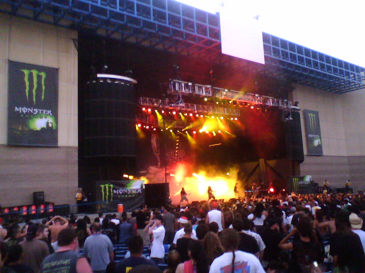
Various locations in the Inland Empire provide venues for cultural performances and entertainment.[75] The Victoria Gardens Cultural Center, which is owned and operated by the City of Rancho Cucamonga, opened in the Fall of 2006 providing theatre, concerts and family entertainment to the region. The San Manuel Amphitheater in San Bernardino's Devore neighborhood is the nation's largest outdoor amphitheater.[citation needed] Ontario Mills draws more visitors annually than Disneyland, and San Bernardino's "Route 66 Rendezvous (the largest classical carshow in the US)," an annual street fair and classic car show, draws a half-million people from around the world.[76]
Music
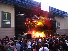
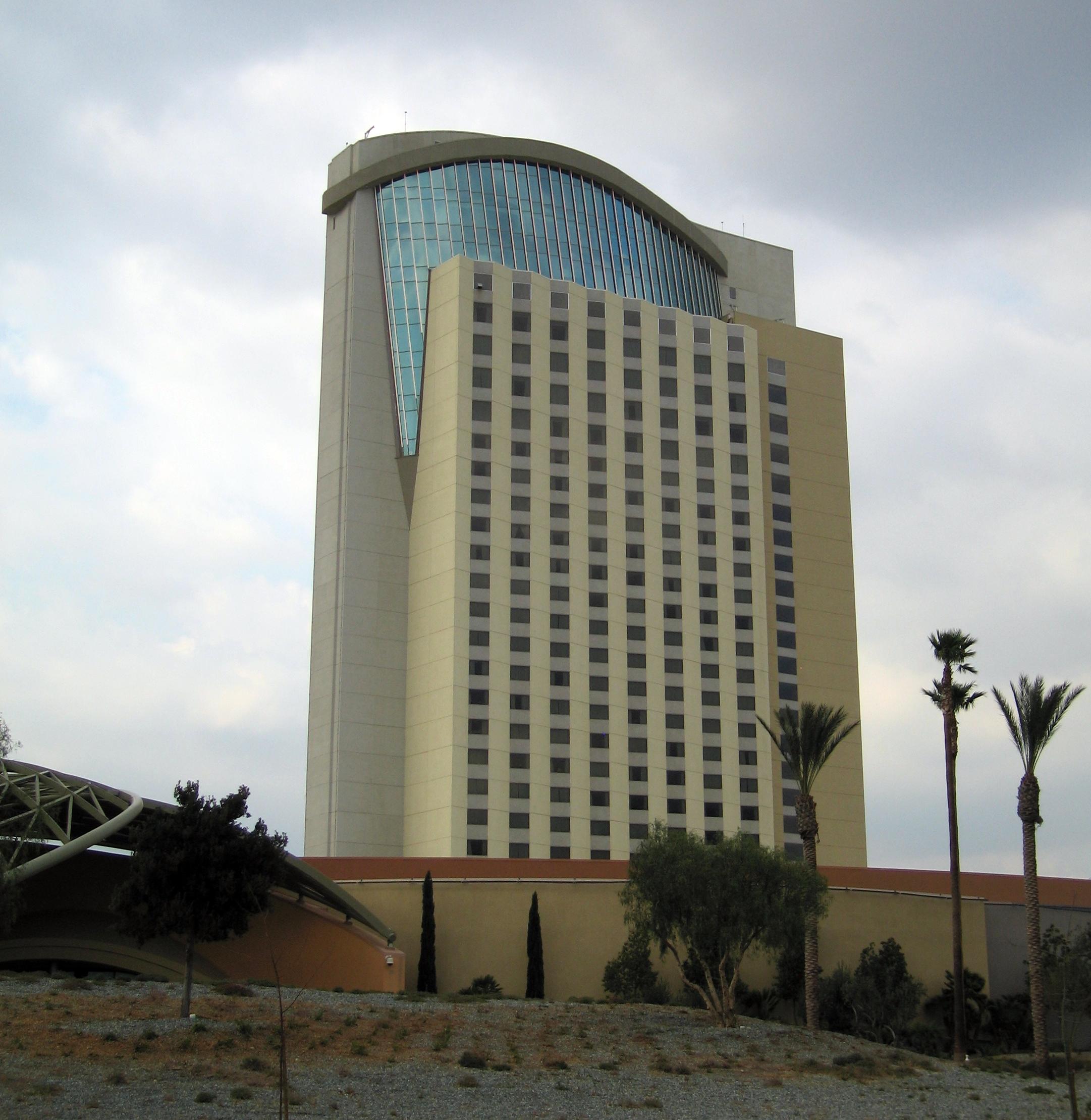
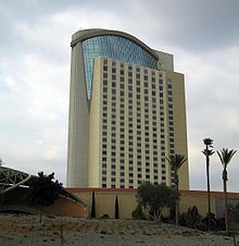 At 330 feet (101 m) high, the Morongo Casino, Resort & Spa tower is the tallest building in the Inland Empire. Concerts and events are booked inside.
Established bands from the IE include Alien Ant Farm, The Bellrays, and the Voodoo Glow Skulls, from Riverside, and Cracker from Redlands. House music pioneer DJ Lynnwood got his start at the age of ten spinning records at KUOR-FM in Redlands. Local hip-hop artists such as Saint Dog, Suga Free, 40 Glocc, Raje, and Lighter Shade of Brown have brought about some attention to the growing rap community in and around the area. A number of artists associated with the Palm Desert Scene have forged a new genre, "Desert rock". A Danish record label, Musikministeriet, recently opened up an office in Redlands in hopes of further cultivating the IE music scene.[77]
Frank Zappa performed in Upland on Foothill Boulevard during the early 1960s where he played shows on a makeshift stage for college crowds. Zappa also purchased Pal Recording Studio on Archibald Avenue in Rancho Cucamonga where the Surfaris had recorded the surf music classic "Wipe Out." He dubbed it Studio Z and began making recordings which eventually led to the founding of Zappa's group, the Mothers of Invention. Singer Ray Collins of the Mothers of Invention still lives in the area. Zappa specifically mentions Inland Empire in the song "Billy the Mountain."
From the late 80s until the late 90s, many up-and-coming musical acts, such as Rage Against the Machine, Blink-182 and No Doubt cut their teeth playing venues in Riverside.[78] However, these historic venues (Spanky's Cafe, and the De Anza Theatre) have since been closed and converted to other purposes. The Barn at UCR was closed as a music venue for 10 years but beginning in October 2008 KUCR Radio 88.3 FM, ASPB The Associated Student Program Board with funding from UCR Housing began having a free concert series once a week during the school quarter. Emerging music venues in the IE include the Showcase Theatre in Corona (recently closed), Red Planet Records in Riverside, the Vault in Redlands, the Buffalo Inn and The Wire in Upland, the Twins Club in Rancho Cucamonga, the Press Restaurant in Claremont, the Glass House in Pomona, Back To The Grind Coffee Shop in Riverside, Liam's Irish Pub in Colton, and CommonGround Soundstage in Riverside.[79]
Performing arts
Orchestras in the IE include the Redlands Symphony, which performs at the University of Redlands, the Riverside County Philharmonic, which performs at the Riverside Municipal Auditorium, the San Bernardino Symphony, which performs at the California Theatre, and the Victor Valley Symphony, which performs at Victor Valley College. Theatrical Arts International is housed at the California Theatre as well. With the largest subscriber base in the Inland Empire, Theatrical Arts International presents the largest caliber tours available including such blockbusters as Cats, Hairspray, Mamma Mia, and Miss Saigon. There are many other large theater programs in the community. At Chaffey High School in Ontario, they have a very large theater program that puts on shows in the fall and in the spring on one of the largest High School stages in the Inland Empire.
Sports
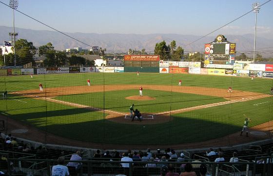
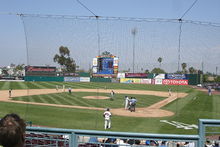 Inland Empire 66ers playing a game at Arrowhead Credit Union Park
The Inland Empire is home to numerous minor league baseball, basketball teams and one ice hockey team based in Ontario. The Inland Empire team with most championships is the Inland Empire 66ers of San Bernardino.[80] The Auto Club Speedway, located in Fontana, opened in 1997. It contains an oval, a road course and a dragstrip for auto racing. The Speedway is located approximately 2 miles (3.2 km) from the former Ontario Motor Speedway site. The Riverside International Raceway, another defunct motorsport venue, was located about 7 miles (11 km) east of Riverside.
Club League Venue Established Championships Inland Empire 66ers of San Bernardino CaL, Baseball Arrowhead Credit Union Park 1941 5 High Desert Mavericks CaL, Baseball Stater Bros. Stadium 1993 3 Lake Elsinore Storm CaL, Baseball Lake Elsinore Diamond 1994 2 Rancho Cucamonga Quakes CaL, Baseball The Epicenter 1993 1 Palm Springs Power SoCal CBA, Baseball Palm Springs Stadium 2003 2 Ontario Reign ECHL, Ice hockey Citizens Business Bank Arena 2008 0 Media
Newspapers
The Inland Empire is served by three major local newspapers. The San Bernardino County Sun, which serves primarily the San Bernardino Valley region, and the Inland Valley Daily Bulletin, both owned by MediaNews Group. The Riverside-based Press-Enterprise also has a few editions over the area. For the High Desert, The Daily Press is the local newspaper. Palm Springs and the greater Coachella Valley are served by The Desert Sun. There is also an Inland Empire edition of the Los Angeles Times.Yes We Can Newspaper provides local news related content for the Inland Empire with concentration on Fontana, Riverside, Moreno Valley, Ontario, Montclair, and Rancho Cucamonga. The Westside Story Newspaper is a local San Bernardino paper published by Wallace Allen for and about the African-American community. The Bulldog Weekly is the student-run weekly newspaper from the University of Redlands, of Redlands in the southwestern portion of San Bernardino County. The paper was resurrected in the fall of 2008, and is currently distributed all over the Inland Empire.
Radio
The Inland Empire is ranked 26th (June 2008) in the national radio market.[81] San Bernardino classic hits station KOLA 99.9 has the biggest reach of all Inland Empire stations, the strength of its signal carrying it as far south as San Diego, as far north as Kern County, to the northwest to Ventura County, and east to Indio and Salton Sea. KFRG, more commonly referred to as K-Frog is a country music station. KCAL-FM is known as 96-7 KCAL Rocks and plays rock music. X103.9 KCXX represents the alternative rock radio format in the area. KVCR (FM) 91.9 is one of the Inland Empire's public radio stations, broadcasting NPR, BBC World Service and other public radio programming. KCAA 1050 AM Radio provides locally produced news/talk/music programming and is the NBC News Radio station for the area with top broadcasters Don Imus, Jim "Poorman" Trenton, Paul Lane, Ed Schultz, Lou Dobbs, Barb Stanton, Roseanne Barr. KCAA features radio veteran Fred Plimley, DJ Freddie G & West Coast Lil V - Your Music Team every Sunday from 7-10:00 PM PST. KUCR Radio 88.3 FM in Riverside is the radio voice of The University of California at Riverside & is a non-commercial student operated & funded media organization located on the campus of UCR. KUCR FM has been broadcasting intelligent, diverse & eclectic music, news & public affairs programming since 1966. KSPC 88.7 FM in Claremont is a non-commercial media organization funded by Pomona College & operated by Clarement College students & local community members since 1956. During the first dedicatory broadcast of KSPC it was stated that the purpose of the station was to provide “a desirable type of programming not readily available in this area." KTIE AM 590 is known as "the talk of the Inland Empire". The station's on-air personalities include Glenn Beck, Hugh Hewitt, Dennis Miller, and Mike Gallagher.
Television
While the Inland Empire has television channels licensed to their cities, only PBS member station KVCR-TV broadcasts directly to the Inland Empire. The other channels broadcast to the greater Southern California market. The Inland Empire's source for most of its television is Los Angeles. The southern section of the Inland Empire may have San Diego television as their main source. In some areas just east of Yucaipa, primary television coverage is from the Palm Springs market.
Film
While there are no large film production companies or studios based in the Inland Empire, on-location shoots accounted for a total economic impact of $65.2 million in the two-county region in 2006.[82] From 1994 to 2005, filming accounted for over a billion dollars ($1,228,977,456) in total revenues spent in the area. Some famous films shot in the Inland Empire include Executive Decision, U Turn, Erin Brockovich, and The Fast and the Furious.[83]
While the David Lynch film Inland Empire is named after the region, no scenes were actually shot in the Inland Empire.[14]
Incorporated cities
See also: List of unincorporated communities in the Inland EmpireRiverside County
citiesYear
incorporatedPopulation,
2007[40]Median income,
2009[40]Banning 1913 28,272 $40,073 Beaumont 1912 28,250 $46,703 Blythe 1916 22,178 $36,883 Calimesa 1990 7,415 $56,531 Canyon Lake 1990 10,939 $84,324 Cathedral City 1981 51,081 $43,792 Corona 1896 144,661 $145,497 Coachella 1946 35,207 $35,797 Desert Hot Springs 1963 22,011 $36,397 Eastvale 2010 N/A N/A Hemet 1910 69,544 $33,924 Jurupa Valley 2011 N/A N/A Indian Wells 1967 5,115 $116,718 Indio 1930 71,654 $47,708 Lake Elsinore 1888 40,985 $55,179 La Quinta 1982 38,340 $74,452 Menifee 2008 77,984 N/A Moreno Valley 1984 174,565 $55,604 Murrieta 1991 92,933 $74,775 Norco 1964 27,262 $81,182 Palm Desert 1973 49,539 $51,999 Palm Springs 1938 46,437 $43,615 Perris 1911 47,139 $49,675 Rancho Mirage 1973 16,672 $76,642 Riverside 1883 287,820 $54,099 San Jacinto 1888 31,066 $42,772 Temecula 1989 93,923 $75,335 Wildomar 2008 N/A N/A San Bernardino County
citiesYear
incorporatedPopulation,
2007[40]Median income,
2006[40]Adelanto 1970 27,139 $42,210 Apple Valley 1988 70,297 $48,946 Barstow 1947 23,943 $39,564 Big Bear Lake 1981 6,207 $42,512 Chino 1910 81,224 $70,283 Chino Hills 1991 78,668 $103,404 Colton 1887 51,797 $42,665 Fontana 1952 181,640 $61,752 Grand Terrace 1978 12,380 $68,098 Hesperia 1988 85,876 $48,244 Highland 1987 52,186 $54,153 Loma Linda 1970 22,451 $52,272 Montclair 1956 36,622 $56,147 Needles 1913 5,759 $32,431 Ontario 1891 172,701 $55,781 Rancho Cucamonga 1977 172,331 $78,452 Redlands 1888 71,375 $63,463 Rialto 1911 99,064 $40,659 San Bernardino 1854 205,010 $31,405 Twentynine Palms 1987 24,830 $36,471 Upland 1906 75,169 $61,044 Victorville 1962 102,538 $50,531 Yucaipa 1989 51,784 $50,529 Yucca Valley 1991 21,044 $38,092 See also
- Mountain Empire
- List of California urban areas
References
- ^ "Annual Estimates of the Population of Metropolitan and Micropolitan Statistical Areas: April 1, 2000 to July 1, 2008". US Census Bureau. http://www.census.gov/popest/metro/CBSA-est2008-annual.html. Retrieved March 22, 2009.
- ^ "Annual Estimates of the Population of Combined Statistical Areas: April 1, 2000 to July 1, 2010" (CSV). 2006 Population Estimates. U.S. Census Bureau, Population Division. April 7, 2010. http://www.census.gov/population/www/estimates/metro_general/2006/CBSA-EST2006-02.csv. Retrieved 2007-12-02.
- ^ Davis, Mike (April 7, 2003). 'The Inland Empire '. The Nation. http://www.thenation.com/doc/20030407/davis. Retrieved 2007-11-25.. The baseline and meridian intersect at 34°7′17.7996″N 116°55′48″W / 34.121611°N 116.93°W.
- ^ a b "History timeline of the Inland Empire, California". San Bernardino County Sun. 2007-10-30. http://www.sbsun.com/empireday_3/ci_7323066. Retrieved 2007-11-15.
- ^ a b Ruther, Walter; Calavan, E. Clair; Carman, Glen E. (1989). "The Origins of Citrus Research in California" (PDF). The Citrus Industry (Oakland: Division of Agriculture and Natural Resources, University of California) V (Chapter 5). http://lib.ucr.edu/agnic/webber/citrus_history.pdf. Retrieved 2007-08-21.
- ^ a b Petrix, Mark (October 30, 2007). "From two orange trees Sprang an Empire". Daily Bulletin. http://www.dailybulletin.com/ci_7335226. Retrieved 2007-11-15.
- ^ Sorba, Michael (October 30, 2007). "Rails reach the Inland Empire". Daily Bulletin. http://www.dailybulletin.com/ci_7334178. Retrieved 2007-11-27.
- ^ Mydans, Seth (1993-08-26). "With a Boom in the Desert Over, Transplants Are Feeling Stranded". New York Times. ISSN 0362-4331. http://www.nytimes.com/1993/08/26/us/with-a-boom-in-the-desert-over-transplants-are-feeling-stranded.html. Retrieved 2009-07-08.
- ^ Rundel, Rhonda (2008-10-07). "California Officials Try to Avoid Second Housing Hit". Wall Street Journal (Dow Jones & Company, Inc.): pp. A8. ISSN 0099-9660. http://online.wsj.com/article/SB122334317101810201.html. Retrieved 2009-07-23.
- ^ Howard, Bob (2001-10-02). "Building on Ontario's Success". Los Angeles Times. ISSN 0458-3035. http://articles.latimes.com/2001/oct/02/business/fi-52322. Retrieved 2009-07-08.
- ^ a b Flanigan, James (2009-01-15). "Businesses Find a Silver Lining in Inland California's Downturn". New York Times. ISSN 0362-4331. http://www.nytimes.com/2009/01/15/business/smallbusiness/15edge.html?pagewanted=1&sq=inland%20empire&st=cse&scp=7. Retrieved 2009-07-08.
- ^ Wagner, Rob Leicester. "Sleeping Giant: An illistrated history of Southern California's Inland Empire". Stephen's Press, LLC, 2005. ISBN 1-932173-07-2.
- ^ Giovannini, Joseph (1985-07-07). "AN INLAND EMPIRE BUILT ON ORANGES". New York Times. ISSN 0362-4331. http://www.nytimes.com/1985/07/07/travel/an-inland-empire-built-on-oranges.html?&pagewanted=print. Retrieved 2009-07-08.
- ^ a b c d e Rosenblatt, Susannah (2006-11-27). "'Inland' for sure, 'Empire' maybe: Where's the boundary?". Los Angeles Times. ISSN 0458-3035. http://articles.latimes.com/2006/nov/27/local/me-inlandempire27. Retrieved 2009-07-08.
- ^ a b Mian, Lal S. (December, 2000) (PDF). Inland Empire Environmental Quality Paradigm. San Bernardino: Department of Health Science and Human Ecology, California State University, San Bernardino. http://partnerships.csusb.edu/fellowshipReports/99-00%20Mian%20Final%20Report.pdf. Retrieved 2007-12-16.
- ^ a b Lopas, Matthew (2004-07-12). "Some Flee 'the 909' to a New Area Code". Los Angeles Times (Tribune Company): pp. B–1. http://articles.latimes.com/2004/jul/12/local/me-areacode12. Retrieved 2009-01-20.
- ^ Sahagun, Louis (1988-08-11). "L.A. Gangs, Drugs Invade Inland Empire". Los Angeles Times. http://articles.latimes.com/1988-08-11/news/mn-391_1_los-angeles-gang-members.
- ^ Semuels, Alana (2010-12-18). "California's recovery might not mean a robust job market". Los Angeles Times. http://www.latimes.com/business/la-fi-california-jobs-20101218,0,3657382.story.
- ^ Semuels, Alana (2010-08-09). "Where recession's effects are magnified". Los Angeles Times. http://articles.latimes.com/2010/aug/09/business/la-fi-inland-20100809.
- ^ Hirsch, Jerry (2006-01-09). "Dairies Moving Out of Inland Empire". Los Angeles Times. http://www.latimes.com/business/printedition/la-fi-dairy9jan09,0,7049491.story.
- ^ Willon, Phil (2008-01-20). "Inland Empire ballot guide". Los Angeles Times. http://www.latimes.com/news/local/la-me-guideinland20jan20,0,7255083.story.
- ^ http://tourism.visitcalifornia.com/media/uploads/files/CTTCBylaws_668013-4_.pdf
- ^ About Visit California - California Tourism Industry Website
- ^ http://www.visitcalifornia.com/media/pages/getting_around/maps/INLAND-EMPIRE.pdf
- ^ Cal.gov. "CA.Gov State of California: About - Region Maps". State of California. http://www.ca.gov/About/Maps/Region.html.
- ^ Starr, Kevin. Golden dreams: California in an age of abundance, 1950-1963. Oxford University Press 2009.
- ^ See, e.g., Harris, David Money and Harris, Jennifer Money. Afoot and Afield Inland Empire. Wilderness Press 2009.
- ^ See also Cortes, Carlos E. "CHICOP: A Response to the Challenge of Local Chicano History". AZTLAN--Chicano Journal of the Social Sciences and the Arts. vol.1, n.2 1970.
- ^ See also Cosgrove, Denis E. "From Palladian Landscape to the Cittá Diffusa: The Veneto and Los Angeles", from European Landscapes and Lifestyles: The Mediterranean and Beyond. Edições universitárias Lusófonas. 2007
- ^ Roger, Vincent (November 15, 2007). "Inland Empire warehouse deals". Los Angeles Times. http://www.latimes.com/business/la-fi-warehouses15nov15,1,2461798.story?ctrack=2&cset=true. Retrieved 2007-12-01.[dead link]
- ^ Pitchford, Phil; Miller, Jim (November 28, 2007). "$1.7 billion allotted to five-county region for highway, rail projects". Press Enterprise. http://www.pe.com/localnews/inland/stories/PE_News_Local_D_tcif28.33199ca.html. Retrieved 2007-12-01.
- ^ Vincent, Roger (2009-02-03). "Boom in Inland Empire industrial space is beginning to go bust". Los Angeles Times. ISSN 0458-3035. http://articles.latimes.com/2009/feb/03/business/fi-industrial3. Retrieved 2009-07-08.
- ^ a b c Kelly, David (2008-04-10). "Inland Empire's growth to continue". Los Angeles Times. ISSN 0458-3035. http://articles.latimes.com/2008/apr/10/local/me-growth10. Retrieved 2009-07-08.
- ^ Conference Transcripts (2005). "Smart Growth on the Edge: Suburban Planning and Development for the Next 20 Years". Opolis: an International Journal of Suburban and Metropolitan Studies (Berkeley and Oakland: bepress and eScholarship Repository, California Digital Library) 1 (2): 62–68. http://repositories.cdlib.org/cgi/viewcontent.cgi?article=1009&context=cssd/opolis. Retrieved 2007-12-17.
- ^ Gould, Scott (2002-10-18). "Swallowed by Sprawl". Los Angeles Times. ISSN 0458-3035. http://articles.latimes.com/2002/oct/18/local/me-sprawl18. Retrieved 2009-07-08.
- ^ "MEASURING SPRAWL AND ITS IMPACT, The Character & Consequences of Metropolitan Expansion". Smart Growth America. 2002. ISSN 0458-3035. http://www.smartgrowthamerica.org/sprawlindex/sprawlexecsum.html. Retrieved 2009-07-08.
- ^ Kelly, David (2008-10-30). "Inland Empire economic outlook is grim". Los Angeles Times. ISSN 0458-3035. http://articles.latimes.com/2008/oct/30/local/me-forecast30. Retrieved 2009-07-08.
- ^ Berkman, Leslie (2010-03-11). "Fewer foreclosures despite mortgage trouble". Press-Enterprise. http://www.pe.com/business/local/stories/PE_Biz_W_foreclosures11.41b01dd.html. Retrieved 11 March 2010.
- ^ W. Gang, Duane (2009-06-27). "Inland region battles for image amid media attention". Press Enterprise. ISSN 0746-1859. http://www.pe.com/politics/gang/stories/PE_News_Local_S_ieimage28.38c31c6.html. Retrieved 2009-07-14.
- ^ a b c d e Husing, John (October 2007). "Inland Empire City Profile 2007" (PDF). Inland Empire Quarterly Economic Report (Redlands: Economics & Politics, Inc) 19 (4). http://www.johnhusing.com/QER%20Oct%202007%20web.pdf. Retrieved 2007-12-01.
- ^ Oversight Field Hearing, Committee on Resources, US House of Representatives (September 10, 2004, in Fontana, California). "Examining Impacts of the Endangered Species Act on Southern California's Inland Empire" (PDF). One Hundredth Eighth Congress, Second Session. Fontana: U.S. Government Printing Office. http://frwebgate.access.gpo.gov/cgi-bin/getdoc.cgi?dbname=108_house_hearings&docid=f:95902.pdf. Retrieved 2007-12-17.
- ^ Newell, Jason (November 11, 2006). "Inland Empire faces challenges, opportunities in years ahead". San Bernardino County Sun. http://www.sbsun.com/search/ci_4638899?IADID=Search-www.sbsun.com-www.sbsun.com. Retrieved 2007-11-26.
- ^ Supryia, Ray (2006) (PDF). Plagued by Pollution: Unsafe Levels of Soot Pollution in 2004. Los Angeles: Environment California Research & Policy Center. http://www.environmentcalifornia.org/uploads/R-/oF/R-oFUKy2ysvz3KLzq5jIDQ/Plagued_by_Pollution.pdf. Retrieved 2007-12-16.
- ^ Pesick, Jason (2007-12-04). "Rialto seeks Superfund designation for perchlorate". Press Enterprise. http://www.pe.com/localnews/inland/stories/PE_News_Local_B_bpollute05.8b521f.html. Retrieved 2007-12-16.
- ^ Van Dusen, Alison (2007-11-26). "America's Unhealthy Commutes". Forbes Magazine. http://www.forbes.com/lifestyle/2007/07/23/health-commute-pollution-forbeslife-cx_avd_0724commute.html. Retrieved 2007-12-09.
- ^ Larry, Gordon (1999-03-09). "Inland Empire Leads in Fatal Road Rage". Los Angeles Times. ISSN 0458-3035. http://articles.latimes.com/1999/mar/09/news/mn-15519. Retrieved 2009-07-09.
- ^ "Aggressive Driving: Where you live Matters". Surface Transportation Policy Project. 1999-04-01. http://www.transact.org/report.asp?id=58. Retrieved 2009-07-09.
- ^ Kelly, David (2008-04-30). "Thefts of copper, brass and other metals hit Inland Empire freeways". Los Angeles Times. ISSN 0458-3035. http://articles.latimes.com/2008/apr/30/local/me-metal30. Retrieved 2009-07-08.
- ^ Hennessy-Fiske, Molly (2008-09-25). "Gas siphoning a growing problem in Inland Empire". Los Angeles Times. ISSN 0458-3035. http://articles.latimes.com/2008/sep/25/local/me-siphon25. Retrieved 2009-07-08.
- ^ a b c d Tornatzky, Louis; Barreto, Matt A. (2004) (PDF). Economic Development and the Knowledge Economy in California's Inland Empire: Progress or Stagnation?. Los Angeles: Thomás Rivera Policy Institute, University of Southern California, School of Policy, Planning, and Development. http://www.trpi.org/PDFs/IE.pdf. Retrieved 2007-11-10.
- ^ Edwards, Andrew (November 29, 2007). "I.E. sees heavy growth - in fatness". San Bernardino County Sun. http://www.sbsun.com/search/ci_7585339. Retrieved 2007-12-09.
- ^ Bockman, Shell; Neiman, Max; Sirotnik, Barbara (2001) (PDF). 2001 Inland Empire Annual Survey. San Bernardino: Inland Empire Research Consortium. http://iar.csusb.edu/2001%20Final%20Full%20Report%20All.pdf. Retrieved 2007-12-17.
- ^ a b Ramakrishnan, Karthick (July, 2007) (PDF). Survey of Civil and Political Engagement in the Inland Empire. Riverside: Department of Political Science, University of California, Riverside. http://www.politicalscience.ucr.edu/reports/iesurvey-jul2007.pdf. Retrieved 2007-11-27.
- ^ Wells Miller, Bettye (July 24, 2005). "Growing devotions". The Press Enterprise. http://www.pe.com/religion/stories/PE_News_Local_D_godmain24.408c852.html. Retrieved 2008-01-30.
- ^ "San Bernardino, California, Detailed Profile". City-Data.com. http://www.city-data.com/city/San-Bernardino-California.html. Retrieved 2007-11-24.
- ^ "Riverside, California, Detailed Profile". City-Data.com. http://www.city-data.com/city/Riverside-California.html. Retrieved 2007-11-24.
- ^ "Ontario, California, Detailed Profile". City-Data.com. http://www.city-data.com/city/Ontario-California.html. Retrieved 2007-11-24.
- ^ Rogers, Robert (2007-11-27). "Experts advise SB leaders on parolees". San Bernardino County Sun. http://www.sbsun.com/search/ci_7573553?IADID=Search-www.sbsun.com-www.sbsun.com. Retrieved 2007-11-27.
- ^ Larocco, Paul (2010-01-08). "Inland's largest cities log lower or near-identical killing totals in 2009". Press Enterprise (A. H. Belo). http://www.pe.com/localnews/sanbernardino/stories/PE_News_Local_W_homicide09.37d8122.html. Retrieved 2010-01-19.
- ^ Matthews, Will (2004-09-26). "Roots of youth violence". San Bernardino County Sun. http://lang.sbsun.com/socal/gangs/articles/ivdbp1_main.asp. Retrieved 2007-11-27.
- ^ Holthouse, David (Fall, 2005). "California Conflict". Intelligence Report (Southern Poverty Law Center). http://www.splcenter.org/intel/intelreport/article.jsp?pid=956. Retrieved 2007-11-27.
- ^ Silva, David (2007-05-03). "War on Hate, Brian Levin and the changing face of extremist groups in the IE". Inland Empire Weekly. http://www.ieweekly.com/cms/story/detail/?id=581&menu=Story. Retrieved 2007-12-12.
- ^ Table 10 (California) - Crime in the United States 2006
- ^ Shafer, Jack (2005-08-04). "The Meth Capital of the World, Where is it?". Slate. The Washington Post Company. http://www.slate.com/id/2124051/. Retrieved 2009-04-30.
- ^ Quan, Douglas; Jose Arballo Jr. (2008-05-16). "METH'S LEGACY: Most drug labs may be gone from the Inland area, but the contamination remains". Press Enterprise (A. H. Belo). http://www.pe.com/reports/2008/methlegacy/stories/PE_News_Local_D_methlegacy18.165fbe2.html. Retrieved 2009-04-30.
- ^ Kennedy-Ross, Selicia (October 17, 2007). "What's in the future for I. E. universities?". San Bernardino County Sun. http://www.sbsun.com/search/ci_7342616?IADID=Search-www.sbsun.com-www.sbsun.com. Retrieved 2007-10-20.
- ^ An, Caroline (November 10, 2006). "Inland Empire college-going rate among California's lowest". San Bernardino County Sun. http://www.sbsun.com/search/ci_4639260?IADID=Search-www.sbsun.com-www.sbsun.com. Retrieved 2007-11-25.
- ^ Parsavand, Shirin (February 21, 2008). "21 Inland schools rank in top 100 for dropouts". Press Enterprise. http://www.pe.com/localnews/k12/stories/PE_News_Local_S_dropout21.446107b.html. Retrieved 2008-02-21.
- ^ Husing, John (July 2006). "Inland Empire's Growing Diversity" (PDF). Inland Empire Quarterly Economic Report (Redlands: Economics & Politics, Inc) 18 (3). http://www.johnhusing.com/QER%20July%202006%20web.pdf. Retrieved 2007-12-01.
- ^ Regus, Elaine (2007-12-31). "Inland Higher Education Notes". Press Enterprise. http://www.pe.com/localnews/highereducation/stories/PE_News_Local_H_hiednotes31.32964ba.html. Retrieved 2007-12-31.
- ^ Husing, John (January 2004). "New Data provide detailed look at Inland Empire's Looming Strengths & Difficulties" (PDF). Inland Empire Quarterly Economic Report (Redlands: Economics & Politics, Inc) 16 (1). http://www.johnhusing.com/QER%20Jan%202004%20web.pdf. Retrieved 2007-12-01.
- ^ Brown, Josh (November 16, 2007). "Inland job growth remains steady in October, according to state". Press Enterprise. http://www.pe.com/business/local/stories/PE_Biz_D_jobs17.25e1250.html. Retrieved 2007-11-25.
- ^ Pierson, David (2008-11-22). "Surge in unemployment puts California's Inland Empire in tailspin". Los Angeles Times (Tribune Company). http://www.latimes.com/la-fi-nojobs22-2008nov22,0,4845835.story. Retrieved 2008-12-19.
- ^ Katzanek, Jack (2010-03-11). "Unemployment rate hits record high". Press-Enterprise. http://www.pe.com/localnews/stories/PE_News_Local_W_jobs11.38c5505.html. Retrieved 11 March 2010.
- ^ "Things To Do Inland Empire". 2011-02-10. http://www.thingstodoinlandempire.com. Retrieved 2011-02-10.
- ^ Weeks, John (2006-11-10). "Inland Empire - a pop culture bastion". San Bernardino County Sun. http://www.sbsun.com/search/ci_4639257. Retrieved 2007-12-17.
- ^ Flansburg, Darcie (2006-09-21). "Musikministeriet, new music label in town". Redlands Daily Facts. http://www.redlandsdailyfacts.com/factsonfilm/ci_4374694. Retrieved 2007-12-11.
- ^ Franko, Vanessa (September 21, 2007). "Riverside record shop turns the tables". Press Enterprise. http://www.pe.com/entertainment/thingstodo/stories/PE_Ent_Guide_D_audiofile0921.22be6aa.html. Retrieved 2007-12-11.
- ^ Novick, La Rue (2005-05-17). "Oh what a night". Inland Valley Daily Bulletin. http://www.dailybulletin.com/livinghere/ci_2733039. Retrieved 2007-12-11.
- ^ History | Inland Empire 66ers Stadium Info
- ^ "Radio and Records: Ratings". http://www.radioandrecords.com/RRRatings/DetailsPage.aspx?MID=216&RY=2007&RQ=1&MP=2&OTHER=2&MN=Riverside-San%20Bernardino&MS=CA&MR=25&12P=1806800&UP=4/4/2007&SU=CM&BPER=9.0&HPER=42.1&OPER=&NSD=5/1/2007&CE=0. Retrieved 2008-06-20.
- ^ Pierceall, Kimberly (November 6, 2007). "Writer's Guild strike felt to lesser extent in Inland area". Press Enterprise. http://www.pe.com/business/local/stories/PE_Biz_D_wgastrike07.33ba587.html. Retrieved 2007-11-26.
- ^ Davis, Sherri (January 2007). "Economic Impact Report" (PDF). Film Inland Empire News (Riverside: Inland Empire Film Commission) 2 (1). http://www.filminlandempire.com/misc/documents/fien_january_2007.pdf. Retrieved 2007-11-25.
External links
Categories:- Inland Empire (California)
- Regions of California
- San Bernardino County, California
- Riverside County, California
- Southern California
- Metropolitan areas of California


Wikimedia Foundation. 2010.