- Dallas–Fort Worth Metroplex
Infobox Metropolitan Area
MSA_name = Dallas-Fort Worth-Arlington Metroplex
name = The Metroplex
largest_city = Dallas
other_cities = Fort Worth
Arlington
rank_us = 4th
population = 6,145,037 (2007 est.) [http://www.census.gov/population/www/estimates/CBSA-est2007-pop-chg.html Estimates of Population Change for Metropolitan Statistical Areas and Rankings: July 1, 2006 to July 1, 2007 ] ]
density_mi2 = 634
density_km2 = 245
area_mi2 = 9,286
area_km2 = 24,059
states =Texas
highest_ft = 1,368 [Slipdown Mountain , in western Parker County. "Note:" Some editions of the "Texas Almanac" prior to 2000 (the latest being the 1998-1999 edition, ed. Mary G. Ramos) give a maximum elevation of convert|1553|ft|m in Hunt County; this is probably an error. "Texas Almanac" data, depending on the edition, are obtained from the U.S. Geological Survey, the Texas Railroad Commission, and the Texas Department of Transportation.]
highest_m = 417
lowest_ft = < 295 [Southeastern Ellis County, [http://www.topozone.com/map.asp?lat=32.32916&lon=-96.38308&s=25&size=l&u=4&datum=nad27&layer=DRG along the Trinity river] , where Ellis County, Navarro County and Henderson County meet. "Note:" "Texas Almanac" editions after 1998-1999 give a minimum elevation of 300 feet (approximately 90 m) for both Ellis and Kaufman Counties, but these appears to be estimates.]
lowest_m = < 90The Dallas–Fort Worth–Arlington metropolitan area, a title designated by the
U.S. Census as of 2003, encompasses 12 counties within the U.S. state ofTexas . The metropolitan area is further divided into two metropolitan divisions: Dallas–Plano–Irving and Fort Worth–Arlington. Residents of the area informally refer to it as the Dallas/Fort WorthMetroplex , or simply The Metroplex (the term was originally invented to refer to Dallas/Fort Worth), which is the economic and cultural hub of the region commonly calledNorth Texas or North Central Texas.According to the
U.S. Census July 1 ,2007 estimates, the metropolitan area has a population of 6.1 million. [http://www.census.gov/population/www/estimates/CBSA-est2007-pop-chg.html Estimates of Population Change for Metropolitan Statistical Areas and Rankings: July 1, 2006 to July 1, 2007 ] ] The Dallas–Fort Worth–Arlington MSA is the largest metropolitan area in Texas and the fourth-largest in the United States. The metroplex also encompasses convert|9286|sqmi|km2|-2 of total area: convert|8991|sqmi|km2|abbr=on. is land, while convert|295|sqmi|km2|abbr=on. is water, making it larger in area than theU.S. state s ofRhode Island andConnecticut combined. It is also the 4th largest metropolitan area by population andgross metropolitan product in the United States, but approximately tenth largest by GMP, in the world.Metroplex counties
US Government Designated
* Collin County
* Dallas County
* Delta County
* Denton County
* Ellis County
* Hunt County
* Johnson County
* Kaufman County
* Parker County
* Rockwall County
* Tarrant County
* Wise CountyMetroplex cities, towns, and CDPs
"Note: Cities and towns are categorized based on the latest population estimates from the
United States Census Bureau (as of July 1, 2006) [cite web |url=http://www.census.gov/popest/cities/tables/SUB-EST2006-04-48.csv |title=Table 4. Annual Estimates of the Population for Incorporated Places in Texas: April 1, 2000 to July 1, 2006 |format=CSV |publisher=United States Census Bureau , Population Division |date=2007-06-28 |accessdate=2008-04-14] and theNorth Central Texas Council of Governments (as of January 1, 2007) [cite web |url=http://www.nctcog.org/ris/demographics/population/City2007.txt |title=2007 Population Estimates by City |format=TXT |publisher=North Central Texas Council of Governments , Research and Services Division |date=2007-03-22 |accessdate=2008-04-14] . No population estimates are released forCensus-designated places (CDPs), which are marked with an asterisk (* ). These places are categorized based on their 2000 census population."Principal cities
* Dallas
* Fort Worth
* ArlingtonCities with over 100,000 population
* Carrollton
* Denton
* Frisco
* Garland
* Grand Prairie
* Irving
* McKinney
* Mesquite
* Plano
* RichardsonCities, towns, and CDPs with 10,000 to 100,000 inhabitants
* Addison
* Allen
* Azle
* Balch Springs
* Bedford
* Benbrook
* Burleson
* Cedar Hill
* Cleburne
* Colleyville
* Coppell
* Corinth
* Crowley* Decatur
* DeSoto
* Duncanville
* Ennis
* Euless
* Farmers Branch
* Flower Mound
* Forest Hill
* Forney
* Glenn Heights
* Grapevine
* Greenville
* Haltom City* Highland Village
* Hurst
* Keller
* Lancaster
* Lewisville
* Little Elm
* Mansfield
* Midlothian
* Mineral Wells (partial)
* Murphy
* North Richland Hills
* Rockwall
* Rowlett* Sachse
* Saginaw
* Seagoville
* Southlake
* Terrell
* The Colony
* University Park
* Watauga
* Waxahachie
* Weatherford
* White Settlement
* WylieCities, towns, and CDPs with fewer than 10,000 inhabitants
* Aledo
* Alma
* Alvarado
* Alvord
* Anna
* Annetta North
* Annetta South
* Annetta
* Argyle
* Aubrey
* Aurora
* Bardwell
* Bartonville
* Blue Mound
* Blue Ridge
* Boyd
* Briar*
* Briaroaks
* Bridgeport
* Caddo Mills
* Campbell
* Celeste
* Celina
* Chico
* Cockrell Hill
* Combine
* Commerce
* Cool
* Cooper
* Copper Canyon
* Corral City
* Cottonwood
* Crandall
* Cresson (partial)
* Cross Roads
* Cross Timber
* Dalworthington Gardens* DISH
* Double Oak
* Eagle Mountain*
* Edgecliff Village
* Everman
* Fairview
* Farmersville
* Fate
* Ferris
* Garrett
* Godley
* Grandview
* Grays Prairie
* Gun Barrel City
* Hackberry
* Haslet
* Hawk Cove
* Heath
* Hebron
* Hickory Creek
* Highland Park
* Hudson Oaks
* Hutchins
* Italy
* Josephine
* Joshua
* Justin
* Kaufman
* Keene
* Kemp
* Kennedale
* Krugerville
* Krum
* Lake Bridgeport
* Lake Dallas
* Lake Worth
* Lakeside* Lakewood Village
* Lavon
* Lincoln Park
* Lone Oak
* Lowry Crossing
* Lucas
* Mabank (partial)
* Maypearl
* McLendon-Chisholm
* Melissa
* Midlothian
* Milford
* Millsap
* Mobile City
* Nevada
* New Fairview
* New Hope
* Newark
* Neylandville
* Northlake
* Oak Grove
* Oak Leaf
* Oak Point
* Oak Ridge
* Ovilla
* Palmer
* Pantego
* Paradise
* Parker
* Pecan Acres*
* Pecan Gap (partial)
* Pecan Hill
* Pelican Bay
* Pilot Point
* Ponder* Post Oak Bend City
* Princeton
* Prosper
* Quinlan
* Red Oak
* Rendon*
* Reno
* Rhome
* Richland Hills
* Rio Vista
* River Oaks
* Roanoke
* Rosser
* Royse City
* Runaway Bay
* Saint Paul
* Sanctuary
* Sanger
* Sansom Park
* Scurry
* Shady Shores
* Springtown
* Sunnyvale
* Talty
* Trophy Club
* Union Valley
* Van Alstyne (partial)
* Venus
* West Tawakoni
* Westlake
* Westminster*
* Weston
* Westover Hills
* Westworth Village
* Willow Park
* Wilmer
* Wolfe CityUnincorporated places
* Avalon
* Bolivar
* Brock
* Copeville
* Dennis
* Elizabethtown* Elmo
* Floyd
* Forreston
* Garner
* Greenwood* Klondike
* Lake Creek
* Lillian
* Merit
* Peaster* Poolville
* Savannah
* Slidell
* Telico
* WhittDemographics
As of the
census GR|2 of 2000, there were 5,161,544 people, 1,881,056 households, and 1,301,993 families residing within the MSA. The racial makeup of the MSA was 69.25% White, 13.88% African American, 0.57% Native American, 3.78% Asian, 0.08% Pacific Islander, 10.01% from other races, and 2.43% from two or more races. Hispanic or Latino of any race were 21.65% of the population.The median income for a household in the MSA was $48,062, and the median income for a family was $55,263. Males had a median income of $39,581 versus $27,446 for females. The
per capita income for the MSA was $21,839.Combined Statistical Area
The Dallas–Fort Worth Combined Statistical Area is made up of 19 counties in north central Texas. The statistical area includes two metropolitan areas and five micropolitan areas. As of the 2000 Census, the CSA had a population of 5,487,956 (though a July 1, 2007 estimate placed the population at 6,498,410). [cite web |url=http://www.census.gov/popest/metro/tables/2007/CBSA-EST2007-02.csv |title=Table 2. Annual Estimates of the Population of Combined Statistical Areas: April 1, 2000 to July 1, 2007 (CBSA-EST2007-02) |format=CSV |work=2007 Population Estimates |publisher=
United States Census Bureau , Population Division |date=2008-03-27 |accessdate=2008-03-28] The CSA definition encompasses convert|14628|sqmi|km2|abbr=on. of area, of which convert|14126|sqmi|km2|abbr=on. is land and convert|502|sqmi|km2|abbr=on. is water. The Dallas/Fort Worth Combined Statistical Area is the largest Primary Census Statistical Area (PCSA) in Texas in both area and population.Components
* Metropolitan Statistical Areas (MSAs)
** Dallas–Fort Worth–Arlington (Collin, Dallas, Delta, Denton, Ellis, Hunt, Johnson, Kaufman, Parker, Rockwall, Tarrant, and Wise counties)
** Sherman-Denison (Grayson County)* Micropolitan Statistical Areas (μSAs)
** Athens (Henderson County)
** Bonham (Fannin County)
** Gainesville (Cooke County)
** Granbury (Hood and Somervell counties)
** Mineral Wells (Palo Pinto County)Demographics
As of the
census GR|2 of 2000, there were 5,487,956 people, 2,006,665 households, and 1,392,540 families residing within the CSA. The racial makeup of the CSA was 70.41% White, 13.34% African American, 0.59% Native American, 3.58% Asian, 0.08% Pacific Islander, 9.62% from other races, and 2.39% from two or more races. Hispanic or Latino of any race were 20.83% of the population.The median income for a household in the CSA was $43,836, and the median income for a family was $50,898. Males had a median income of $37,002 versus $25,553 for females. The
per capita income for the CSA was $20,460.Topography
The whole area the metroplex overlooks is mostly prairie with a few rolling hills dotted by man made lakes cut by streams creeks and rivers with most of the forest land near the rivers and creeks and streams. The areas around Dallas are in the blackland prairie named for the fertile black soil so there are cotton, and other crops that grow around Dallas in the following counties Collin, Rockwall, Hunt, Kaufman, rural parts of Dallas county and Ellis County. As these rural areas get developed into suburbs it is pretty common to see cotton fields close adjacent to development and new development is replacing the cotton fields especially in Collin county. North Dallas Southern Denton and Southern Collin county has most of the dense new development of the metroplex. While new development in the other counties around Fort Worth and South and East Dallas is more sprawled or spread out. The land around Fort Worth known as the Barnet Shale and Ft Worth Prairie is prairie but different soil type and being less fertile and more rocky means most of the rural land is used as ranchland and gas wells. This area includes Wise, rural parts of Tarrant, Parker, Johnson, and Denton county. Just like Dallas suburbs new developments are replacing the ranches and its pretty common to see new developments around the ranches and gas wells close to urban development and new developments. South of Dallas and Fort Worth is a line of rugged hills that goes north to south about convert|15|mi|km that looks similar to the Texas Hill Country convert|200|mi|km to the South. This is the most scenic area between Dallas and Fort Worth.
Description of economic activity
The cities of Dallas and Fort Worth are the anchor cities of the Metroplex. Dallas and its suburbs have one of the highest concentrations of corporate headquarters in the United States. As such, one of the largest industries in the Metroplex is conducting business. The Metroplex also contains the largest
Information Technology industry base in the state (often referred to asSilicon Prairie ), owing to the large number of corporate IT projects and the presence of numerous electronics, computing and telecom firms such asTexas Instruments ,Electronic Data Systems ,Perot Systems , i2,AT&T , andVerizon in and around Dallas. On the other end of the business spectrum, and on the other side of the Metroplex, the Texasfarming andranching industry is based in Fort Worth. According to the Dallas Business Journal's 2006 Book of Lists,American Airlines is the largest employer in the Metroplex. Several major defense manufacturers, includingLockheed Martin ,Bell Helicopter Textron , andRaytheon , maintain significant operations in the Metroplex.ExxonMobil , the #2 corporation on theFortune 500 listings, is headquartered inIrving, Texas .Transportation
The
Dallas-Fort Worth International Airport (IATA airport code : DFW) is the largest airport in the state of Texas. The airport is located between Dallas and Fort Worth.American Airlines , based in Fort Worth, has its headquarters next to DFW Airport. American is the largest airline in the world in terms of passengers transported and fleet size. It is also a predominant leader in domestic routes and operations.Love Field Airport (IATA Airport Code: DAL) is located in Dallas.
Southwest Airlines , based in Dallas, has its headquarters next to Love Field. The airline is considered as a predominant U.S. low-cost airline for domestic routes.Public transit options exist but are limited in scope. Dallas County has bus service and light rail operated by DART, going as far north as Plano, but there are still many suburbs without service. Denton County has bus service limited to Denton and Lewisville owned by the
Denton County Transportation Authority , although a light rail line is planning that would parallel I-35 to connect Carrollton, Lewisville, Lake Dallas, and Denton. Tarrant County has bus service operated by the T available only in Fort Worth. The train that serves Fort Worth and the eastern suburbs is operated byTrinity Railway Express ; it connects from downtown Fort Worth to downtown Dallas, where it links to the DART rail system.The Dallas-Fort Worth area has hundreds of lane miles of freeways and interstates. The Metroplex has the second most freeway per capita in the nation, behind only the
Kansas City Metropolitan Area . Like most major metropolitan areas in Texas, most Interstates and freeways have access roads where most of the businesses are located; these access roads have slip ramps that merge onto the freeways and interstates. North-south Interstates include I-35 and I-45. East-west routes include I-30 and I-20. I-35 splits into I-35E and I-35W from Denton to Hillsboro: I-35W goes through Fort Worth while I-35E goes through Dallas. I-30 connects Dallas and Fort Worth and I-45 connects Dallas to Houston. HOV lanes currently exist along I-35E, I-30, I-635, US 67, and US 75. I-20 bypasses both Dallas and Fort Worth to the south while its loop, I-820, loops around Fort Worth. I-635 splits to the north of I-20 and loops around east and north Dallas, ending at SH 121 north of DFW Airport. I-35E, Loop 12, and Spur 342 ultimately connect to I-20 southwest of Dallas make the west bypass around Dallas to complete the loop. A large number of construction projects are planned or are already underway in the region to alleviate congestion. Due largely to funding issues, many of the new projects involve building new tollways or adding tolled express lanes to existing highways.Related topics
*
List of major companies in Dallas/Ft.Worth Largest area private-sector employers
Media
The cities of Dallas and Fort Worth have their own newspapers, "
The Dallas Morning News " and the Fort Worth "Star-Telegram", respectively. Historically, the two papers were restricted in readership to their own counties; Tarrant County households would never read the "Morning News" and vice versa. As the two cities' suburbs have grown together in recent years, it is now common to find locations where both of the newspapers are sold. This pattern has been repeated in other print media, radio, and television, but since the 1970s all of the television stations and most of the FM radio stations have chosen to transmit from Cedar Hill so as to serve the entire market, and are programmed likewise. A recent phenomenon seen most clearly in the DFW market has been the rise of "80-90 move-ins", whereby stations have been moved from distant markets, in some cases as far away as Oklahoma, and relicensed to anonymous small towns in the Metroplex to serve as additional DFW stations. According toRadioTime , the market has 38 AM stations, 58 FM stations (many of them class Cs), and 18 full-power television stations.See Also:
*
*Sports
The Metroplex is one of just thirteen American metropolitan areas that has a team in each of the four major professional sports leagues. Major professional sports first came to the area in 1960, when the
Dallas Cowboys began competing in theNational Football League and the Dallas Texans began competing in theAmerican Football League (the Texans would later relocate to Kansas City and become the Chiefs). In 1972, Major League Baseball's Washington Senators moved to Arlington to become the Texas Rangers. TheNational Basketball Association expanded into North Texas in 1980 when theDallas Mavericks were added to the league. The fourth piece was added in 1993 when theMinnesota North Stars of theNational Hockey League became theDallas Stars . The area is also home to many other minor-league professional teams, four colleges that compete inNCAA Division I athletics and has played host to many premiere sports events on both an annual and one-time basis.Major Professional Sports Teams
"Club" "Sport" "Founded" "League" "Venue" Dallas Cowboys Football 1960 NFL Texas Stadium Texas Rangers Baseball 1972^ MLB Rangers Ballpark in Arlington Dallas Mavericks Basketball 1980 NBA American Airlines Center FC Dallas Soccer 1996 Major League Soccer Pizza Hut Park Dallas Stars Hockey 1993^ NHL American Airlines Center Other Professional Teams
"Club" "Sport" "Founded" "League" "Venue" Dallas Desperados Arena Football 2002 Arena Football League American Airlines Center Frisco RoughRiders Baseball 2003^ Texas League Dr Pepper Ballpark Fort Worth Cats Baseball 2001 AAIPBL LaGrave Field Grand Prairie AirHogs Baseball 2007 AAIPBL QuikTrip Park Fort Worth Flyers Basketball 2005 NBA D-League Fort Worth Convention Center Division I College Athletics
"School" "City" "Nickname" "Conference" Texas Christian University Fort Worth Horned Frogs Mountain West Southern Methodist University Dallas Mustangs Conference USA University of North Texas Denton Mean Green Sun Belt University of Texas at Arlington Arlington Mavericks Southland Sports Events Hosted
"Event" "Sport" "Year(s)" "Venue" Texas vs. Oklahoma College Football 1912-Present Cotton Bowl Battle for the Iron Skillet College Football 1915-Present Cotton Bowl, Amon G. Carter Stadium ,Ownby Stadium ,Texas Stadium , Ford StadiumAT&T Cotton Bowl College Football 1937-Present Cotton Bowl U.S. Open Golf 1941 Colonial Country Club PGA Championship Golf 1927 Cedarcrest Golf Course Byron Nelson Golf Classic Golf 1944-Present Multiple courses in Dallas Colonial National Invitational Golf 1946-Present Colonial Country Club U.S. Open Golf 1941 Colonial Country Club Pro Bowl Football 1973 Texas Stadium The Players Championship Golf 1975 Colonial Country Club NBA All-Star Game Basketball 1986 Reunion Arena NCAA Men's Final Four Basketball 1986 Reunion Arena U.S. Women's Open Golf 1991 Colonial Country Club FIFA World Cup Preliminaries Soccer 1994 Cotton Bowl MLB All-Star Game Baseball 1995 Rangers Ballpark in Arlington Samsung 500 Auto Racing 1997-Present Texas Motor Speedway Bombardier Learjet 550 Auto Racing 1997-Present Texas Motor Speedway Big 12 Championship Game College Football 2001, 2009, 2010 Texas Stadium ,Dallas Cowboys New Stadium Bell Helicopter Armed Forces Bowl College Football 2003-Present Amon G. Carter Stadium Dickies 500 Auto Racing 2005-Present Texas Motor Speedway MLS Cup Soccer 2005, 2006 Pizza Hut Park NHL All-Star Game Hockey 2007 American Airlines Center Texas A&M vs. Arkansas Football 2009 Dallas Cowboys New Stadium Super Bowl XLV Football 2011 Dallas Cowboys New Stadium See also
*
Census-designated place
*Geology of the Dallas-Fort Worth Metroplex
*United States metropolitan area Notes
External links
Official sites
* [http://www.ntc-dfw.org/ North Texas Commission]
* [http://www.dfwairport.com/ DFW International Airport]
* [http://www.gdc.org/ Greater Dallas Chamber]
* [http://www.dallasfortworthtravel.com/ Visit Dallas Fort Worth]
* [http://www.metroplexbusiness.com/ Metroplex Business Directory]Additional information
*
Fort Worth Star-Telegram - major Fort Worth newspaper
*Dallas Morning News - major Dallas newspaper
* [http://www.metroplexdaily.com/ Metroplex Daily]
* [http://dallasfortworthtravel.com/ Dallas Fort Worth Travel Guide]
* TourTexas.com: [http://www.tourtexas.com/dfw/ DFW travel and entertainment information guide]Transportation
* [http://www.dart.org/ DART (Dallas Area Rapid Transit) - Dallas Area Bus and Rail Service]
* [http://www.the-t.com/ The "T" (Fort Worth Transportation Authority) - Fort Worth Bus Service]
* [http://www.trinityrailwayexpress.org/ TRE (Trinity Railway Express) - Rail Service]
* [http://www.dcta.net/ DCTA (Denton County Transportation Authority) - Denton/Highland Village/Lewisville Bus Service]
Wikimedia Foundation. 2010.
Look at other dictionaries:
Dallas–Fort Worth metroplex — Dallas–Fort Worth redirects here. For the airport, see Dallas/Fort Worth International Airport. Metroplex redirects here. For other uses of the term, see Metroplex (disambiguation). Dallas–Fort Worth–Arlington MSA … Wikipedia
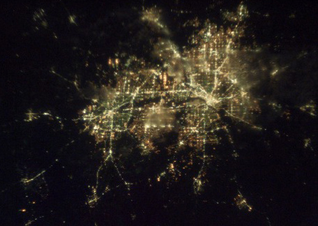
Dallas/Fort Worth Metroplex — Saltar a navegación, búsqueda Dallas/Fort Worh desde el espacio. El Dallas/Fort Worth Metroplex es el nombre informal que los habitantes de esta área metropolitana le han dado a la región en el norte de Texas (EUA). Otros apodos que recibe… … Wikipedia Español
Dallas–Fort Worth metroplex — Dallas/Fort Worh desde el espacio. El Dallas/Fort Worth Metroplex es el nombre informal que los habitantes de esta área metropolitana le han dado a la región en el norte de Texas (EUA). Otros apodos que recibe incluyen el Metroplex , North Texas … Wikipedia Español
Dallas/Fort Worth Metroplex — Dallas–Fort Worth–Arlington Nom commun: Dallas/Fort Worth Metroplex Statistiques Ville principale Aut … Wikipédia en Français
Geology of the Dallas-Fort Worth Metroplex — The geology of the Dallas Fort Worth Metroplex is relatively stable, due to the metropolitan area s position on the western edge of slanting Cretaceous sediment plains and on the eastern edge of the Fort Worth Basin, both resting atop the Texas… … Wikipedia
List of shopping malls in the Dallas–Fort Worth Metroplex — The Dallas–Fort Worth Metroplex area in North Texas (USA) has more shopping centers per capita than any United States city or metropolitan area. It is also home to the second shopping center in the United States, Highland Park Village, which… … Wikipedia
Dallas/Fort Worth International Airport — IATA: DFW – ICAO … Wikipedia
Dallas-Fort Worth Film Critics Association Awards 2010 — 17th Dallas Fort Worth Film Critics Association Awards Presented by Dallas Fort Worth Film Critics Association Date December 17, 2010 (2010 12 17) Location Dallas, Texas … Wikipedia
Dallas - Days Inn Texas Stadium/Irving (Dallas/Fort Worth) — Dallas Days Inn Texas Stadium/Irving country: United States, city: Dallas/Fort Worth (Irving) Dallas Days Inn Texas Stadium/Irving The Days Inn Texas Stadium Irving is centrally located in Dallas and Fort Worth Metroplex, known for its excitement … International hotels
Aeropuerto Internacional de Dallas-Fort Worth — IATA: DFW OACI: KDFW Sumario … Wikipedia Español
 18+© Academic, 2000-2026
- Contact us: Technical Support, Advertising
Dictionaries export, created on PHP, Joomla, Drupal, WordPress, MODx.