- Van Alstyne, Texas
Infobox Settlement
official_name = Van Alstyne, Texas
settlement_type =City
nickname =
motto =
imagesize =
image_caption =
image_
mapsize = 250px
map_caption = Location of Van Alstyne, Texas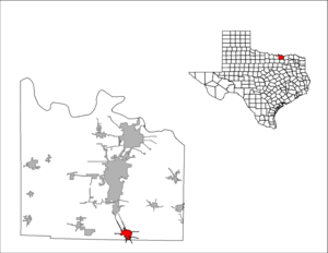
mapsize1 = 250px
map_caption1 =subdivision_type = Country
subdivision_name =United States
subdivision_type1 = State
subdivision_name1 =Texas
subdivision_type2 = Counties
subdivision_name2 = Grayson, Collingovernment_footnotes =
government_type =
leader_title =
leader_name =
leader_title1 =
leader_name1 =
established_title =
established_date =unit_pref = Imperial
area_footnotes =area_magnitude =
area_total_km2 = 8.8
area_land_km2 = 8.8
area_water_km2 = 0.0
area_total_sq_mi = 3.4
area_land_sq_mi = 3.4
area_water_sq_mi = 0.0population_as_of = 2006
population_footnotes =
population_total = 2890
population_density_km2 = 328.4
population_density_sq_mi = 850.0timezone = Central (CST)
utc_offset = -6
timezone_DST = CDT
utc_offset_DST = -5
elevation_footnotes =
elevation_m = 239
elevation_ft = 784
latd = 33 |latm = 25 |lats = 26 |latNS = N
longd = 96 |longm = 34 |longs = 43 |longEW = Wpostal_code_type =
ZIP code
postal_code = 75495
area_code = 903
blank_name = FIPS code
blank_info = 48-74924GR|2
blank1_name = GNIS feature ID
blank1_info = 1370567GR|3
website =
footnotes =Van Alstyne is a city in Collin and Grayson Counties in the
U.S. state ofTexas . The population was 2,502 at the 2000 census.The Grayson County portion of Van Alstyne is part of the Sherman–Denison Metropolitan Statistical Area, while the Collin County portion is part of the Dallas–Fort Worth Metropolitan Statistical Area.
Geography
Van Alstyne is located at coor dms|33|25|26|N|96|34|43|W|city (33.423911, -96.578730)GR|1.
According to the
United States Census Bureau , the city has a total area of 3.4square mile s (8.8km² ), all of it land.Demographics
As of the
census GR|2 of 2000, there were 2,502 people, 935 households, and 699 families residing in the city. Thepopulation density was 733.5 people per square mile (283.3/km²). There were 1,005 housing units at an average density of 294.6/sq mi (113.8/km²). The racial makeup of the city was 90.41% White, 3.60% African American, 1.00% Native American, 0.16% Asian, 3.40% from other races, and 1.44% from two or more races. Hispanic or Latino of any race were 7.79% of the population.There were 935 households out of which 34.9% had children under the age of 18 living with them, 58.7% were married couples living together, 12.2% had a female householder with no husband present, and 25.2% were non-families. 22.8% of all households were made up of individuals and 12.1% had someone living alone who was 65 years of age or older. The average household size was 2.61 and the average family size was 3.05.
In the city the population was spread out with 27.4% under the age of 18, 7.1% from 18 to 24, 28.9% from 25 to 44, 20.4% from 45 to 64, and 16.3% who were 65 years of age or older. The median age was 36 years. For every 100 females there were 96.2 males. For every 100 females age 18 and over, there were 90.3 males.
The median income for a household in the city was $39,375, and the median income for a family was $45,188. Males had a median income of $36,176 versus $22,063 for females. The
per capita income for the city was $17,024. About 8.3% of families and 9.7% of the population were below thepoverty line , including 8.5% of those under age 18 and 5.2% of those age 65 or over.Education
Students are served by the
Van Alstyne Independent School District . In addition,Grayson County College operates a branch campus in Van Alstyne, recently relocated to a new facility on the southwest corner ofU.S. Highway 75 andTexas Farm to Market Road 121 .References
External links
* [http://www.ci.van-alstyne.tx.us/ City of Van Alstyne]
* [http://www.vanalstynepolice.com/ Van Alstyne Police Department]
* [http://www.vanalstynepl.lib.tx.us/ Van Alstyne Public Library]

Wikimedia Foundation. 2010.