- The Colony, Texas
-
The Colony, Texas — City — 
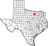
SealNickname(s): City by the Lake Location of The Colony in Denton County, Texas
Coordinates: 33°5′27″N 96°53′5″W / 33.09083°N 96.88472°WCoordinates: 33°5′27″N 96°53′5″W / 33.09083°N 96.88472°W Country  United States
State  Texas
TexasCounty Denton Government – Type Council-Manager – City Council Mayor Joe McCourry
Allen Harris
Richard Boyer
Jeff Connelly
David Terre
Perry Schrag
Joel Marks– City Manager Troy Powell Area – Total 15.7 sq mi (40.8 km2) – Land 13.7 sq mi (35.4 km2) – Water 2.1 sq mi (5.4 km2) Elevation 591 ft (180 m) Population (2009) – Total 44,704 – Density 1,942.2/sq mi (749.9/km2) Time zone CST (UTC-6) – Summer (DST) CDT (UTC-5) ZIP code 75056 Area code(s) 972
469FIPS code 48-72530[1] GNIS feature ID 1384043[2] Website http://www.thecolonytx.gov/ The Colony is a city in Denton County, Texas, United States, and a suburb of Dallas. The population was 26,531 at the 2000 census. The current population is estimated at just over 40,000 residents.
The Colony is home to the 5 Star Athletic Complex, which was completed in 2003. The Colony was named the Sports Illustrated 50th Anniversary Sports Town of The United States in that same year. The city is home to Pizza Inn's corporate headquarters,[3] as well as an Edward Don distribution center and a variety of small and medium-sized businesses.
Located on the southeast side of the city, across from Sam Rayburn Tollway, is Austin Ranch, a mixed-use development consisting of retail businesses, apartments and condominiums.
Contents
History
The Colony is located inside the original Peters Colony lands, on the site of the Hedgcoxe War.[4]
The Colony did not exist before 1969, when home developers Fox and Jacobs (owned by Centex) purchased most of the land located around State Highway 121 and Farm Market Road 423. They planned the development of a new "dream city" modeled after the city of Dallas, consisting primarily of single family homes grouped as a "colony". The homes were served by a municipal utility district formed to bring water, electricity (via Texas Power and Light), cable television (via Lakeside CATV) and telephone service (via Southwestern Bell).
In 1976, one of the original homeowners associations petitioned the city of Frisco to remove the area from its extraterritorial jurisdiction. A vote was held in January 1977, and the City of The Colony was officially incorporated at that time (the name Colony was already in use, and thus the current name with the definite article was chosen). In 1987, the small lakeside community of Eastvale and The Colony voted to merge. The town has grown significantly since then. The Colony High School Lady Cougars Soccer Team was the 2007 Class 4A State Champion. New Jersey Nets point guard and Olympic gold medalist Deron Williams played for The Colony High School, as did Los Angeles Angels outfielder Torii Hunter.
Politics
The Colony is considered a Home Rule municipality with the council-manager form of government. It has a six-member council, with two members elected at large, as well as a city Mayor.
Council Members
Name Place Term Expires Joe McCourry Mayor May 2012 Allen Harris One (at-large) May 2012 Richard Boyer Two (at-large)
Mayor Pro TemMay 2012 Jeff Connelly Three May 2014 David Terre Four May 2014 Perry Schrag Five May 2014 Joel Marks Six
Deputy Mayor Pro TemMay 2014 Geography
The Colony is located at 33°5′27″N 96°53′5″W / 33.09083°N 96.88472°W (33.090874, -96.884659)[5].
According to the United States Census Bureau, the city has a total area of 15.7 square miles (41 km2), of which, 13.7 square miles (35 km2) of it is land and 2.1 square miles (5.4 km2) of it (13.15%) is water.

Denton
(24 miles)Little Elm
(5 miles)Prosper
(15 miles)Lewisville
(8 miles)
Frisco
(2 miles) The Colony

Coppell
(4 miles)Carrollton
(2 miles)Plano
(3 miles)The city is bordered on the west by Lewisville Lake and Lewisville, Texas, on the north and east by Frisco, Texas and on the south by Carrollton, Texas and Plano, Texas. Approximately 23 miles of shoreline on Lake Lewisville are contained within the city's boundaries (the basis for one of the city's nicknames, "City by the Lake"), including two peninsulas.
Climate
The Colony is considered to be part of the humid subtropical region.
Major highways
- Main lanes:
 Sam Rayburn Tollway
- Service roads:
 State Highway 121
- Service roads:
 Farm to Market Road 423
Education
The Colony is located inside both the Lewisville Independent School District and Little Elm Independent School District. The Lewisville Independent School District has built six elementary schools, two middle schools and one high school inside the city limits. The elementary schools are Peters Colony Elementary, Camey Elementary, B.B. Owen Elementary, Stewart's Creek Elementary, Ethridge Elementary, and Morningside Elementary. The two middle schools are Griffin Middle School and Lakeview Middle School. The Colony High School is located just north of SH 121 on Blair Oaks Drive. The Lady Cougars soccer team won the 2007 Class AAAA soccer championship, the school's first in any sport. The Colony is home to the TopCats Drill Team, as well as a marching band that participated in the 1997 Tournament of Roses Parade.
The Colony High School is also the alma mater of NBA superstar Deron Williams.
Owing to its original history as part of Frisco, The Colony is located inside the community college district, Collin College, unlike all other places in Denton County. However, since residents of The Colony do not pay taxes to said district they must pay out-of-county tuition rates to attend the college.
In May 2009, Griffin Middle School student and The Colony resident Eric Yang won the National Geographic Bee, beating out 54 other state competition champions to win a scholarship and travel package valued at more than $25,000.
Future growth
Large areas of undeveloped land remain inside The Colony, but have not been developed by their owners. A contemporary new marina, developed by MarineQuest Corporation, opened in August, 2010 at the city's Hidden Cove Park. In addition, two residential/mixed-use developments are planned along 121 Toll Road and on Wynnwood Peninsula on Lewisville Lake. The completion of the conversion of Highway 121 from a four-lane highway to a six-lane tollway was expected to bring additional business to the city's main transportation corridor, but this has yet to materialize. Two commercial developments on the southbound service road (including one mixed-use property at the intersection of 121 and Blair Oaks) have stalled. Additionally, the vacant property at northbound 121 and Plano Pkwy, owned by the Maharishi Global Development Fund, remains available for the right buyer.
Demographics
As of the census[1] of 2000, there were 26,531 people, 8,462 households, and 7,141 families residing in the city. The population density was 1,942.1 people per square mile (749.9/km²). There were 8,812 housing units at an average density of 645.0 per square mile (249.1/km²). The racial makeup of the city was 84.46% White, 5.18% African American, 0.71% Native American, 1.68% Asian, 0.05% Pacific Islander, 5.30% from other races, and 2.62% from two or more races. Hispanic or Latino of any race were 13.26% of the population.
There were 8,462 households out of which 53.7% had children under the age of 18 living with them, 69.7% were married couples living together, 10.4% had a female householder with no husband present, and 15.6% were non-families. 11.4% of all households were made up of individuals and 1.8% had someone living alone who was 65 years of age or older. The average household size was 3.14 and the average family size was 3.41.
In the city the population was spread out with 34.0% under the age of 18, 7.4% from 18 to 24, 38.0% from 25 to 44, 17.8% from 45 to 64, and 2.9% who were 65 years of age or older. The median age was 31 years. For every 100 males there were 98.8 females. For every 100 males age 18 and over, there were 97.1 females.
The median income for a household in the city was $64,080, and the median income for a family was $66,203. Males had a median income of $44,208 versus $30,530 for females. The per capita income for the city was $22,903. About 1.6% of families and 2.8% of the population were below the poverty line, including 2.4% of those under age 18 and 5.8% of those age 65 or over.
Local government links
- City of The Colony, TX website
- The Colony Police Department
- GIS mapping system, provided by the city of The Colony
- The Colony Economic Development Corp, Information about Economic Development
- The Colony Community Development Corp, Enhancing the Quality of Life in The Colony
- The Colony Convention & Visitors Bureau, Your Playcation Destination
- The Colony Chamber of Commerce
- The Colony Town Guide Local information and business guide
- The Colony Public Library
References
- ^ a b "American FactFinder". United States Census Bureau. http://factfinder.census.gov. Retrieved 2008-01-31.
- ^ "US Board on Geographic Names". United States Geological Survey. 2007-10-25. http://geonames.usgs.gov. Retrieved 2008-01-31.
- ^ Pizza Inn Moves into New Headquarters
- ^ Texas State Historical Commission. "The Hedgcoxe War Historical Marker". http://www.stoppingpoints.com/texas/sights.cgi?marker=The+Hedgcoxe+War&cnty=denton. Retrieved August 8, 2009.
- ^ "US Gazetteer files: 2010, 2000, and 1990". United States Census Bureau. 2011-02-12. http://www.census.gov/geo/www/gazetteer/gazette.html. Retrieved 2011-04-23.
Municipalities and communities of Denton County, Texas Cities Argyle | Aubrey | Carrollton‡ | Celina‡ | Coppell‡ | Corinth | Dallas‡ | Denton | Fort Worth‡ | Frisco‡ | Grapevine‡ | Haslet‡ | Highland Village | Justin | Krugerville | Krum | Lake Dallas | Lakewood Village | Lewisville‡ | Oak Point | Pilot Point | Plano‡ | Roanoke | Sanger | Southlake‡ | The Colony
Towns Bartonville | Copper Canyon | Corral City | Cross Roads | DISH | Double Oak | Flower Mound‡ | Hackberry | Hebron‡ | Hickory Creek | Lincoln Park | Little Elm | Northlake | Ponder | Prosper‡ | Providence Village | Shady Shores | Trophy Club‡ | Westlake‡
Unincorporated
communitiesAlliance‡ | Bolivar | Lantana | Navo | Paloma Creek | Savannah
Ghost towns Alton | Elizabethtown | Mustang
Footnotes ‡This populated place also has portions in an adjacent county or counties
Dallas–Fort Worth–Arlington Counties Major cities Cities and towns
100k-300kCarrollton • Denton • Frisco • Garland • Grand Prairie • Irving • McKinney • Mesquite • Plano • RichardsonCities and towns
25k-99kAllen • Bedford • Cedar Hill • Cleburne • The Colony • Coppell • DeSoto • Duncanville • Euless • Farmers Branch • Flower Mound • Grapevine • Haltom City • Highland Village • Hurst • Keller • Lancaster • Lewisville • Mansfield • North Richland Hills • Rockwall • Rowlett • WylieCities and towns
10k-25kAddison • Balch Springs • Benbrook • Burleson • Colleyville • Corinth • Ennis • Forest Hill • Greenville • Saginaw • Seagoville • Southlake • Terrell • University Park • Watauga • Waxahachie • Weatherford • White SettlementCategories:- Dallas – Fort Worth Metroplex
- Populated places in Denton County, Texas
- Cities in Texas
- Main lanes:


Wikimedia Foundation. 2010.