- Azle, Texas
Infobox Settlement
official_name = City of Azle, Texas
other_name =
native_name =
nickname =
settlement_type =City
motto =
imagesize =
image_caption =
flag_size =
image_
seal_size =
image_shield =
shield_size =
image_blank_emblem =
blank_emblem_size =
imagesize =
image_caption =
flag_size =
image_
seal_size =
image_shield =
shield_size =
image_blank_emblem =
blank_emblem_size =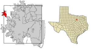
mapsize = 250px
map_caption = Location of Azle in Tarrant County,Texas
mapsize1 =
map_caption1 =
image_dot_
dot_mapsize =
dot_map_caption =
dot_x =
dot_y =
pushpin_
pushpin_label_position =
pushpin_map_caption =
pushpin_mapsize =
subdivision_type = Country
subdivision_name =United States
subdivision_type1 = State
subdivision_name1 =Texas
subdivision_type2 = Counties
subdivision_name2 = Tarrant, Parker
subdivision_type3 =
subdivision_name3 =
subdivision_type4 =
subdivision_name4 =
government_footnotes =
government_type =
leader_title =Mayor
leader_name = Russ Braudis
leader_title1 =City Manager
leader_name1 = Craig Lemin
leader_title2 =
leader_name2 =
leader_title3 =
leader_name3 =
leader_title4 =
leader_name4 =
established_title =
established_date =
established_title2 =
established_date2 =
established_title3 =
established_date3 =
area_magnitude =
unit_pref = Imperial
area_footnotes =
area_total_km2 = 21.3
area_land_km2 = 21.2
area_water_km2 = 0.1
area_total_sq_mi = 8.2
area_land_sq_mi = 8.16
area_water_sq_mi = 0.04
area_water_percent = 0.49
area_urban_km2 =
area_urban_sq_mi =
area_metro_km2 =
area_metro_sq_mi =
area_blank1_title =
area_blank1_km2 =
area_blank1_sq_mi =
population_as_of = 2000
population_footnotes =
population_note =
population_total = 9600
population_density_km2 = 452.0
population_density_sq_mi = 1170.8
population_metro =
population_density_metro_km2 =
population_density_metro_sq_mi =
population_urban =
population_density_urban_km2 =
population_density_urban_sq_mi =
population_blank1_title =
population_blank1 =
population_density_blank1_km2 =
population_density_blank1_sq_mi =
timezone = CST
utc_offset = -6
timezone_DST = CDT
utc_offset_DST = -5
latd = 32 |latm = 53 |lats = 34 |latNS = N
longd = 97 |longm = 32 |longs = 12 |longEW = W
elevation_footnotes =
elevation_m = 217
elevation_ft = 712
postal_code_type =ZIP code
postal_code = 76020
area_code = 817
blank_name = FIPS code
blank_info = 48-05168GR|2
blank1_name = GNIS feature ID
blank1_info = 1329893GR|3
website = http://azle.govoffice.com/
footnotes =Azle is a
city in Parker and Tarrant Counties in theU.S. state ofTexas . As of the 2000 census, the city population was 9,600.Popular tourist attractions include marine spectator sports at
Eagle Mountain Lake , classic American sports car contests of speed, creative horse trailer loading (and unloading), and competitive artistic lawn care showcases.Azle is the home of the Azle Marching Green Pride
marching band , The Emerald DazzlerDrill Team , the AzleHigh School Cheerleading team, and the Fighting Azle Hornets. The Azle High SchoolMath /Science andJournalism teams combined won the 2005 UIL State Academic Meet championship with a total of 110 points. This continues a tradition of dominance established by the Math and Science team dating to the 1970s and 1980s TMSCA state tournaments. In 2004 and 2008 the Marching Green Pride band of Azle advanced to the State Marching competition in San Antonio.Geography
Azle is located at coor dms|32|53|34|N|97|32|12|W|city (32.892653, -97.536789)GR|1.
According to the
United States Census Bureau , the city has a total area of 8.2 square miles (21.3 km²), of which, 8.2 square miles (21.2 km²) of it is land and 0.04 square miles (0.1 km²) of it (0.49%) is water.History
Azle is on State Highway 199, sixteen miles northwest of downtown Fort Worth, in the northwest corner of Tarrant County; the town extends partly into Parker County and Wise County. The first recorded settlement at the site occurred in 1846, when a young doctor named James Azle Steward moved into a cabin built by a
Dutchman named Rumsfeldt. Other settlers came and established themselves near the localstream s, Ash Creek, Silver Creek, and Walnut Creek. The firstpost office opened in 1881, and thetown took the name of O'Bar, in honor of the man who obtained the postal service. Soon, however, the name was changed at the request of Steward, who donated the land for a townsite, in order to have the town named Azle. The community's economy was based onagriculture . Severalcrops were grown, includingwheat ,corn ,peanut s,sorghum , andcotton .Watermelons ,cantaloupe s,peach es,plum s, andpear s were also produced.Dairy farming became important in the early decades of the twentieth century, when localmilk products were sold to creameries in Fort Worth. The population of Azle grew steadily, and by 1920, the census recorded 150 residents. By 1933, State Highway 34 (later State Highway 199), had reached Azle from Fort Worth, greatly improvingtransportation capabilities between the town and the city. Also, Eagle Mountain Lake was formed by adam on the TrinityRiver , east of Azle. In the late 1930s,electricity was supplied to Azle and the surrounding countryside. The population grew between 1940 and 1960 from 800 to 2,696. It was 5,822 by 1980. After the 1930s, agriculture gradually declined; fields were converted from wheat and corn production tohousing development s. Manufacturing increased, and in 1984, Azle had twenty-six businesses. In 1985, the population was estimated at more than 7,000. The town's proximity to Fort Worth and its position as the "Gateway to Eagle Mountain Lake" have made Azle a popular place to live. In 1990, the population was 8,868. The population grew to 9,600 by 2000.BIBLIOGRAPHY: Ruby Schmidt, ed., Fort Worth and Tarrant County (Fort Worth: Texas Christian University Press, 1984). Kathleen E. and Clifton R. St. Clair, eds., Little Towns of Texas (Jacksonville, Texas: Jayroe Graphic Arts, 1982).
Demographics
As of the
census GR|2 of 2000, there were 9,600 people, 3,716 households, and 2,701 families residing in the city. Thepopulation density was 1,170.8 people per square mile (452.0/km²). There were 3,957 housing units at an average density of 482.6/sq mi (186.3/km²). The racial makeup of the city was 95.90% White, 0.22% African American, 0.66% Native American, 0.51% Asian, 0.02% Pacific Islander, 1.41% from other races, and 1.29% from two or more races. Hispanic or Latino of any race were 4.20% of the population.There were 3,716 households out of which 35.3% had children under the age of 18 living with them, 57.5% were married couples living together, 11.2% had a female householder with no husband present, and 27.3% were non-families. 24.0% of all households were made up of individuals and 10.1% had someone living alone who was 65 years of age or older. The average household size was 2.54 and the average family size was 3.00.
In the city the population was spread out with 26.3% under the age of 18, 7.8% from 18 to 24, 29.3% from 25 to 44, 23.7% from 45 to 64, and 12.8% who were 65 years of age or older. The median age was 37 years. For every 100 females there were 92.2 males. For every 100 females age 18 and over, there were 88.1 males.
The median income for a household in the city was $43,304, and the median income for a family was $51,660. Males had a
median income of $37,522 versus $26,998 for females. Theper capita income for the city was $20,817. About 6.9% of families and 9.1% of the population were below thepoverty line , including 11.0% of those under age 18 and 13.3% of those age 65 or over.Education
The City of Azle is served by the
Azle Independent School District .References
External links
* [http://azle.govoffice.com/ City of Azle]
* [http://www.azlenews.net Local Paper: Azle News]
Wikimedia Foundation. 2010.