- Tatum, Texas
Infobox Settlement
official_name = Tatum, Texas
settlement_type =City
nickname =
motto =
imagesize =
image_caption =
image_
mapsize = 250px
map_caption = Location of Tatum, Texas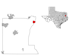
mapsize1 = 250px
map_caption1 =subdivision_type = Country
subdivision_name =United States
subdivision_type1 = State
subdivision_name1 =Texas
subdivision_type2 = Counties
subdivision_name2 = Rusk, Panolagovernment_footnotes =
government_type =
leader_title =
leader_name =
leader_title1 =
leader_name1 =
established_title =
established_date =unit_pref = Imperial
area_footnotes =
area_magnitude =
area_total_km2 = 9.8
area_land_km2 = 9.8
area_water_km2 = 0.0
area_total_sq_mi = 3.8
area_land_sq_mi = 3.8
area_water_sq_mi = 0.0population_as_of = 2000
population_footnotes =
population_total = 1175
population_density_km2 = 119.7
population_density_sq_mi = 309.9timezone = Central (CST)
utc_offset = -6
timezone_DST = CDT
utc_offset_DST = -5
elevation_footnotes =
elevation_m = 103
elevation_ft = 338
latd = 32 |latm = 18 |lats = 53 |latNS = N
longd = 94 |longm = 31 |longs = 8 |longEW = Wpostal_code_type =
ZIP code
postal_code = 75691
area_code = 903
blank_name = FIPS code
blank_info = 48-71924GR|2
blank1_name = GNIS feature ID
blank1_info = 1369625GR|3
website =
footnotes =Tatum is a city in Panola and Rusk Counties in the
U.S. state ofTexas . The population was 1,175 at the 2000 census.Geography
Tatum is located at coor dms|32|18|53|N|94|31|8|W|city (32.314853, -94.518875)GR|1.
According to the
United States Census Bureau , the city has a total area of 3.8square mile s (9.8km² ), all of it land.Major highways
*
*Demographics
As of the
census GR|2 of 2000, there were 1,175 people, 459 households, and 324 families residing in the city. Thepopulation density was 309.9 people per square mile (119.7/km²). There were 523 housing units at an average density of 137.9/sq mi (53.3/km²). The racial makeup of the city was 73.62% White, 16.43% African American, 0.51% Native American, 0.09% Pacific Islander, 7.15% from other races, and 2.21% from two or more races. Hispanic or Latino of any race were 17.62% of the population.There were 459 households out of which 35.3% had children under the age of 18 living with them, 52.1% were married couples living together, 13.5% had a female householder with no husband present, and 29.4% were non-families. 27.5% of all households were made up of individuals and 13.9% had someone living alone who was 65 years of age or older. The average household size was 2.56 and the average family size was 3.14.
In the city the population was spread out with 28.9% under the age of 18, 10.0% from 18 to 24, 27.3% from 25 to 44, 21.3% from 45 to 64, and 12.5% who were 65 years of age or older. The median age was 33 years. For every 100 females there were 90.4 males. For every 100 females age 18 and over, there were 84.7 males.
The median income for a household in the city was $25,000, and the median income for a family was $30,119. Males had a median income of $26,719 versus $19,063 for females. The
per capita income for the city was $13,181. About 20.4% of families and 25.4% of the population were below thepoverty line , including 34.8% of those under age 18 and 20.2% of those age 65 or over.History
Tatum was settled in the 1840s by Albert Tatum and his second wife, Mary C. (Rippetoe) Tatum. In 1848, they built a large plantation there. In 1885, the Santa Fe railroad came through, and the town was divided into individual lots. One of their sons, Paul "Uncle Fox" Tatum, who studied architecture in New York, laid out the streets. He became the postmaster in 1886. The city of Tatum lies along Trammel's Trace, an old trade route. A marker at the south end of town commemorates it. In the city park stands the restored Santa Fe depot.
Albert Tatum was born on August 12, 1810, in Hancock County, Georgia, the son of William Tatum and Alice B. (Dent) Tatum. Albert Tatum first married Rebecca Elizabeth Ann Menefee about 1837 in Chambers County, Alabama. They were the parents of one son, William C. Tatum, who was born on June 25, 1838 in Chambers County, Alabama.
After the death of his first wife on December 31, 1840 in Chambers County, Alabama, Albert Tatum married Mary C. Rippetoe on September 22, 1841, in Tallapoosa County, Alabama.At one time, Albert Tatum owned over 4,000 acres (16 km²) of land around the current town of Tatum.
Education
The City of Tatum is served by the
Tatum Independent School District .Attractions
Martin Creek Lake State Park is located four miles (6 km) southeast of Tatum. The park was deeded to the Texas Parks and Wildlife Department by Texas Utilities and opened to the public in 1976. The park is located on convert|5000|acre|km2|0|sing=on Martin Creek Lake, constructed to provide cooling water for a
lignite -fired power plant. Martin Creek Lake State Park provides excellent, year round fishing, camping, wildlife observation and photography, picnicking, boating, water skiing, unsupervised lake swimming, backpacking, and hiking. An annual perch fishing contest is held for children ages 4 to 12 the first Saturday in September.Notable Residents/Famous Natives
*
Larry Centers , New England Patriots running back
*Travian Smith , Oakland Raiders linebacker
*Bob Allen (1960s pitcher) , former pitcher for theCleveland Indians References
External links

Wikimedia Foundation. 2010.