- Truckee, California
Infobox Settlement
official_name = Truckee, California
settlement_type =Town 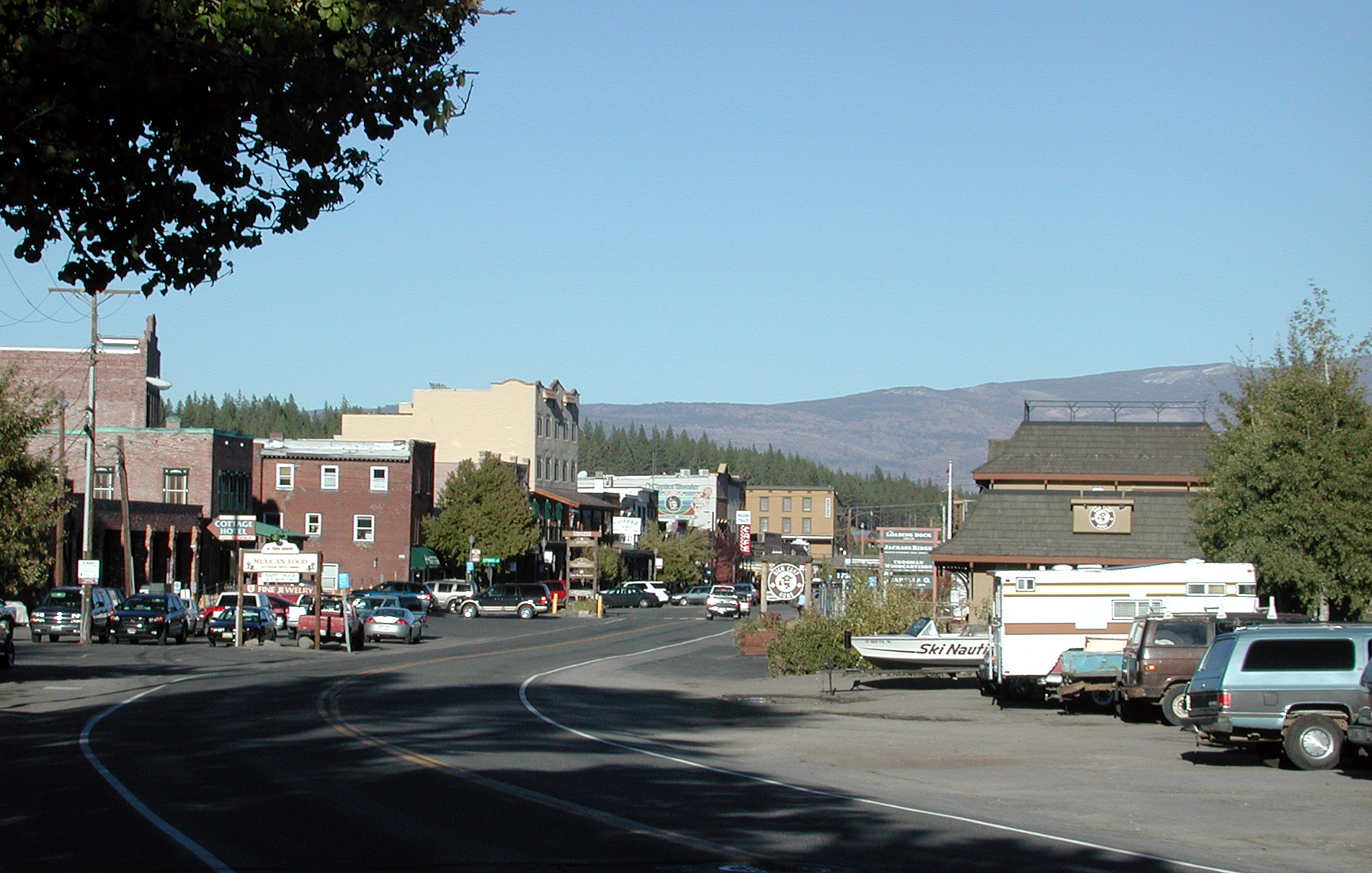
imagesize = 250px
image_caption = Donner Pass Road
image_
mapsize = 250x200px
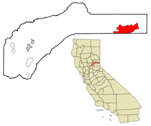
map_caption = Location in Nevada County and the state ofCalifornia
mapsize1 =
map_caption1 =
subdivision_type = Country
subdivision_type1 = State
subdivision_type2 = County
subdivision_name =United States
subdivision_name1 =California
subdivision_name2 = Nevada
government_type =
leader_title =
leader_name =
established_date =
area_magnitude =
area_total_km2 = 87.7
area_total_sq_mi = 33.8
area_land_km2 = 84.3
area_land_sq_mi = 32.5
area_water_km2 = 3.4
area_water_sq_mi = 1.3
elevation_ft = 5817
elevation_m = 1773
population_as_of = 2000
population_footnotes =
population_total = 13864
population_metro =
population_density_km2 = 158.1
population_density_sq_mi = 410.2
timezone = Pacific (PST)
utc_offset = -8
latd = 39 |latm = 20 |lats = 32 |latNS = N
longd = 120 |longm = 12 |longs = 13 |longEW = W
timezone_DST = PDT
utc_offset_DST = -7
postal_code_type =ZIP code s
postal_code = 96160-96162
area_code = 530
blank_name = FIPS code
blank_info = 06-80588
blank1_name = GNIS feature ID
blank1_info = 1667886
footnotes =
website =Truckee is an incorporated town in Nevada County,
California ,United States . The population was 13,864 at the 2000 census.Name
Truckee was named after aPaiute chief. His Paiute name was Tru-ki-zo. He was the father of Chief Winnemucca and grandfather of Sarah Winnemucca. The first people who came to cross the Sierra Nevada encountered his tribe. The friendly Chief rode toward them yelling "Tro-kay!", which is Paiute for "hello". The settlers assumed he was yelling his name. Chief Truckee later served as a guide forJohn C. Fremont . [http://truckeehistory.org/history4.htm]Geography
Truckee is located along
Interstate 80 at coor dms|39|20|32|N|120|12|13|W|city (39.342163, -120.203568).GR|1According to the
United States Census Bureau , the town has a total area of 33.8square mile s (87.7km² ), of which, 32.5 square miles (84.3 km²) of it is land and 1.3 square miles (3.4 km²) of it (3.87%) is water, mostly theTruckee River , the only outlet ofLake Tahoe .Climate
reports that Truckee's warmest month is July with an average maximum temperature of 82.7°F (28.2°C) and an average minimum temperature of 42.4°F (5.8°C). January is the coldest month with an average maximum temperature of 40.9°F (4.9°C) and an average minimum temperature of 16.3°F (-8.7°C). The record maximum temperature of 104°F (40°C) was on July 6, 2007. The record minimum temperature of -23°F (-30.6°C) was on February 27, 1962. Annually, there are an average of 8.4 days with highs of 90°F (32.2°C) or higher; there an average of 228.4 days with lows of 32°F (0°C) or lower and 6.0 days with lows of 0°F (-17.8°C) or lower. Freezing temperatures have been observed in every month of the year.
Normal annual precipitation in Truckee is 30.85 inches (78.36 cm); measurable precipitation (.01 inch (0.254 mm) or more) occurs on an average of 87.0 days annually. The most precipitation in one month was 19.02 inches (48.31 cm) in February 1986. The most precipitation in 24 hours was 5.21 inches (13.23 cm) on February 1, 1963.
Truckee has an average of 198.3 inches (503.68 cm) of snow annually. The most snow in one month was 113.0 inches (287.02 cm) in December 1992. The maximum 24-hour snowfall was 34.0 inches (86.36 cm) on February 17, 1990.
Demographics
As of the
census GR|2 of 2000, there were 13,864 people, 5,149 households, and 3,563 families residing in the town. Thepopulation density was 426.1 people per square mile (164.5/km²). There were 9,757 housing units at an average density of 299.8/sq mi (115.8/km²). The racial makeup of the town was 88.39% White, 0.25% African American, 0.59% Native American, 0.87% Asian, 0.17% Pacific Islander, 7.57% from other races, and 2.16% from two or more races. Hispanic or Latino of any race were 12.79% of the population.There were 5,149 households out of which 37.1% had children under the age of 18 living with them, 58.2% were married couples living together, 6.7% had a female householder with no husband present, and 30.8% were non-families. 18.7% of all households were made up of individuals and 3.2% had someone living alone who was 65 years of age or older. The average household size was 2.68 and the average family size was 3.09.
In the town the population was spread out with 26.7% under the age of 18, 7.0% from 18 to 24, 36.8% from 25 to 44, 24.0% from 45 to 64, and 5.5% who were 65 years of age or older. The median age was 35 years. For every 100 females there were 112.1 males. For every 100 females age 18 and over, there were 112.0 males.
The median
income for a household in the town was $58,848, and the median income for a family was $62,746. Males had a median income of $38,631 versus $29,536 for females. Theper capita income for the town was $26,786. About 2.8% of families and 4.6% of the population were below thepoverty line , including 5.3% of those under age 18 and 2.0% of those age 65 or over. Recent land clearing outside town limits may affect the population.Transportation
Amtrak , the national passenger rail system, provides service to Truckee. The city's passenger rail station is centrally located at 10000 East River Street in the heart of the historic downtown. Amtrak Train 5, the westboundCalifornia Zephyr , is scheduled to depart Truckee at 10:15am daily with service to Colfax, Roseville, Sacramento, Davis, Martinez, and Emeryville across the bay fromSan Francisco . Amtrak Train 6, the eastbound California Zephyr, is scheduled to depart Truckee at 2:43pm daily with service to Reno, Sparks, Winnemucca, Elko, Salt Lake City, Provo, Helper, Green River, Grand Junction, Glenwood Springs, Denver, Omaha, Galesburg, and Chicago.Politics
In the state legislature Truckee is located in the 1st Senate District, represented by Republican
Dave Cox , and in the 4th Assembly District, represented by RepublicanTed Gaines . Federally, Truckee is located inCalifornia's 4th congressional district , which has a Cook PVI of R +11 [cite web | title = Will Gerrymandered Districts Stem the Wave of Voter Unrest? | publisher = Campaign Legal Center Blog | url=http://www.clcblog.org/blog_item-85.html | accessdate = 2007-10-20] and is represented by RepublicanJohn Doolittle .History
The
Donner Party was snowbound and resorted tocannibalism near the site that would later become Truckee. Many of the area's place names come from this group. Truckee is the home ofDonner Lake and theDonner Memorial State Park .Truckee grew as a
railroad town originally named Colburn Station, starting with theTranscontinental Railroad . The railroad goes into downtown Truckee and the Amtrak passenger lines still stop there on the services fromChicago to San Francisco.In 1891 Truckee's famous lawman, Jacob Teeter, was killed in a violent gunfight with fellow lawman, James Reed (no relation to James Frazier Reed of the Donner Party). [http://truckeehistory.org/history7.htm]
References
Books
*Darabi, P., & Sparksworthy, L. (2002). [http://worldcatlibraries.org/oclc/51883866&referer=brief_results Women of Truckee making history: a collection of profiles of some of the exceptional and dedicated women in Truckee, California] . Truckee, Ca: Dr. Homa Darabi Foundation.
*Hagaman, W. R. (2004). [http://worldcatlibraries.org/oclc/59716161&referer=brief_results The Chinese must go!: the Anti-Chinese boycott, Truckee, California - 1886] . Nevada City, California: The Cowboy Press.
* Gianpaolo Zeni, "En Merica! L'emigrazione della gente diMagasa eValvestino in America", Cooperativa Il Chiese, Storo 2005.External links
* [http://www.townoftruckee.com/ Town of Truckee Official Website]
* [http://truckeehistory.org/ Truckee Donner Historical Society Website]
Wikimedia Foundation. 2010.