- Emeryville, California
Infobox Settlement
official_name = City of Emeryville, California
settlement_type =City
nickname =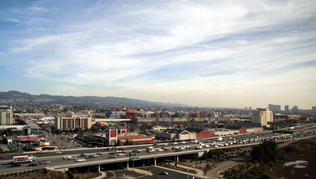
imagesize =
image_caption =
image_
image_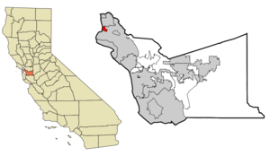
mapsize = 250x200px
map_caption = The city of Emeryville highlighted withinAlameda County
mapsize1 =
map_caption1 =
subdivision_type = Country
subdivision_name =United States
subdivision_type1 = State
subdivision_name1 =California
subdivision_type2 = County
subdivision_name2 = Alameda
government_type =
leader_title =Mayor
leader_name = Ken Bukowski [http://www.ci.emeryville.ca.us/gov/city_council.html]
leader_title1 = Senate
leader_name1 =Don Perata (D)
leader_title2 = Assembly
leader_name2 =Loni Hancock (D)
leader_title3 = U. S. Congress
leader_name3 =Barbara Lee (D)
established_date =
area_magnitude =
area_total_km2 = 5.0
area_total_sq_mi = 1.9
area_land_km2 = 3.2
area_land_sq_mi = 1.2
area_water_km2 = 1.8
area_water_sq_mi = 0.7
PCWater =
population_metro =
population_urban =
population_as_of = 2007
population_total = 9353
population_density_km2 = 1870.6
population_density_sq_mi = 4922.6
timezone =Pacific Standard Time Zone
utc_offset = -8
timezone_DST =Pacific Daylight Time
utc_offset_DST = -7
elevation_ft = 23
latd = 37 |latm = 50 |lats = 9 |latNS = N
longd = 122 |longm = 17 |longs = 14 |longEW = W
elevation_m = 7
website = http://www.ci.emeryville.ca.us/
postal_code_type =ZIP code s
postal_code = 94608
area_code = 510
blank_name = FIPS code
blank_info = 06-22594
blank1_name = GNIS feature ID
blank1_info = 1658499
footnotes =Emeryville is a small city located in
Alameda County, California , in theUnited States . It is located in a corridor between the cities of Berkeley and Oakland, extending to the shore ofSan Francisco Bay . Its proximity toSan Francisco , the Bay Bridge, theUniversity of California, Berkeley , andSilicon Valley has been a catalyst for recent economic growth. It is home toPixar Animation Studios ,Peet's Coffee & Tea andJamba Juice . In addition, several well known biotech and software companies have made their home in Emeryville, LeapFrog,Sendmail ,MobiTV , and Chiron (recently acquired byNovartis ). The population was 6,882 at the 2000 census.History
Before the colonization of the area by Spain in 1776, this area was the site of extensive native American settlements. Mudflats rich with clams and rocky areas with oysters, plus fishing, hunting, and acorns from the local
oak trees provided a rich and easily exploited food source for the residents, who disposed of theirclam andoyster shells in a single place, over time creating a huge mound, theEmeryville Shellmound [http://emeryville.wli.net/public_info/archaeology_history.htm] .During the Spanish and Mexican eras, Emeryville was the site of a small wharf near the mouth of
Temescal Creek adjacent to the shellmound. The wharf served the Peralta family's Rancho San Antonio, and was used for loading the principal produce of the ranch—cattle hides—onto lighters, and subsequently transferring them to ships, including New England-bound schooners.The handling of cattle continued into the American era with the establishment of numerous meat packing plants along the bayshore in Emeryville between 67th and 63rd Streets in an area called "Butchertown". The cattle processed here were raised in nearby ranches and farms, and brought in by rail or barge. The odors emanating from this district were notorious and often mentioned in local newspapers of the 19th and early 20th century.
The Town of Emeryville was incorporated
December 2 1896 . It was named after Joseph Stickney Emery who came during the Gold Rush and acquired large tracts of land in what became known as "Emery's". In 1884, Emery was president of anarrow-gauge railroad called theCalifornia and Nevada Railroad . The railroad originally intended to extend from Oakland, through Emery's (at the time, just an unincorporated settlement along the bayshore) and then east across theSierra Nevada Mountains to the gold mining town ofBodie, California . From Bodie the railroad would extend east through Nevada to a connection with theDenver & Rio Grande Railroad . Despite its grandiose intentions, the railroad only built from Oakland to Orinda and its right-of-way was sold to theSanta Fe Railway . [http://www.emeryvillechamber.com/community/History.htm] The Santa Fe then constructed a rail yard and passenger depot below San Pablo between 41st Street and Yerba Buena Avenue. Although located in Emeryville, the depot, which opened in 1902, was called "Oakland".The
Key System , a local transit company, acquired the general offices of the California and Nevada as well as their nascent pier into San Francisco Bay, which was quickly transformed into a long pier reaching nearly toYerba Buena Island . The Key System established its main rail yard adjacent to the yard of the Santa Fe in a large tract west of San Pablo Avenue in the vicinity of Yerba Buena Avenue (so named because the island was visible in line with the thoroughfare). The Key System's main power plant, used to energize its streetcars and commuter trains, was constructed adjacent to the city limits with Oakland. The immense smokestack was a local landmark for decades, surviving right through theLoma Prieta earthquake of 1989. It was demolished for safety reasons shortly thereafter. The old Key System mainline to the pier, and later, to the Bay Bridge, ran in a subway below Beach Street and the Southern Pacific mainline near the power plant. That subway survives and is today used as a private entrance to the main sewage treatment plant ofEBMUD (the water utility serving Oakland and many surrounding cities). The rail yards and shops of the Key System and Santa Fe were acquired by Santa Fe's real estate development arm, later known as theCatellus Development Corporation , and this firm proceeded with the development which is today, a sprawling shopping center and multiunit residential district.In the late 19th century, a large park was built around the shellmound. The park included two dance pavilions, one of which stood atop the shellmound. A trotting park (the Oakland Trotting Park) was built nearby at the junction of the Berkeley Branch line with the mainline of the Southern Pacific. On
February 22 1920 the first dog race track to employ an imitationrabbit opened in Emeryville.Emeryville used to be as well known for its gambling houses and bordellos as it was for its booming industrial sector; then Alameda County district attorney, later California governor and then Chief Justice of the Supreme Court
Earl Warren once famously called it "the rottenest city on the Pacific Coast". The popular local restaurant The Townhouse is one such trace, a location that once was a speakeasy during Prohibition. Today, this tradition is carried on to a degree by the Oaks Room Card Club, a legal gambling establishment on San Pablo Avenue.Emeryville was the site of Oaks Park, the home turf of the
Pacific Coast League 's Oakland Oaks. The ballpark was located on the block bounded by San Pablo, 45th Street and Park Street (the fourth side was Watts Street). The site is now partly an empty, fenced-off lot, and overlapped byPixar Studios. Pixar's main gate (on Park Street) lies directly on the old segment of Watts Street. The stadium did not front directly on San Pablo where a strip of various small commercial buildings stood, now replaced by a single one-story commercial building with several chain businesses.During
World War II , Emeryville was the southern terminus of theShipyard Railway , a specially constructed electric rail line operated by the Key System to transport workers to theKaiser Shipyards in Richmond. The station was located on the west side of San Pablo Avenue on the Key's yard property. The tracks led out to San Pablo Avenue where they were merged into existing streetcar tracks.From the late 19th into the early 20th century, Emeryville's development as an industrial city grew. Besides the meat-packing plants, other industries were added. Among these were the Judson Iron Works and the
Sherwin-Williams paint company. From 1939 until the 1970s, a massive animated neon sign showing a can of red paint tilting, spilling, and covering a globe of the earth, with the slogan "We Cover the Earth" sat on the roof of the plant's main building, a familiar sight to eastbound motorists on the Bay Bridge. It was also once the location of Shell Development, the research arm ofShell Oil Company , which relocated in 1972 toHouston, Texas . A large scrap metal yard (part of the Judson Iron Works) was visible from theEastshore Freeway for decades until the early 1970s. Also visible, a large facility of the Pacific Intermountain Express (PIE) trucking firm. A heavy truck manufacturing division of what was formerly IH (International-Harvester Company, later Navistar) was located in Emeryville. One of its more popular models in the late 1950s and early 1960s became commonly and affectionately known as "Emeryvilles". Today, if one were to query any astute trucker from the second half of the twentieth century, he would instantly think of an IH DCO-405 at the mention of the name "Emeryville".Fact|date=February 2007By the late 1960s, industries were beginning to move away from Emeryville and the appearance of the city seriously declined. This began to change in the mid 1970s starting with the development of the marina section of Emeryville. By the 1980s, a large shopping area began to take shape north and south of the Powell Street corridor. Additionally, the
Chiron Corporation (now Novartis), a major biotechnology company, established its headquarters just south of the old junction of the SP mainline tracks and the old Berkeley branchline (Shellmound Junction) at the end of Stanford Avenue, the site of the old Shellmound trotting course.Following the
Loma Prieta Earthquake in 1989, a newAmtrak depot was built in Emeryville to replace the old 16th Street Station in West Oakland, which had been deteriorating even before it was seriously damaged by the quake. The Emeryville station serves Amtrak'sCalifornia Zephyr ,Coast Starlight ,San Joaquin , andCapitol Corridor trains. The California Zephyr originates here with service daily to Chicago, Illinois viaSalt Lake City, Utah andDenver, Colorado . Buses link the station with San Francisco.By the 1990s, the old Santa Fe and Key System yards tracts were transformed into a large shopping and residential area, as was the Shellmound corridor. Development of these areas included major roadwork, with the extension of 40th Street, including the construction of a large overpass across the Southern Pacific (now Union Pacific) railroad tracks which connected 40th Street to an extension of Shellmound Street, creating a single thoroughfare linking two sections of the new Emeryville. On the northern stretch of Shellmound Street, the Emery Marketplace and a movie multiplex were built.
In 2001, the city contracted developer Madison Marquette to build a new shopping center (Bay Street Shopping Center) on the site of an
Ohlone village and burial ground. Madison Marquette worked with archaeologists and Ohlone tribe representatives in order to leave the human remains undisturbed. Some remains were reburied at an undisclosed location on the site. At the mall, there are pictures of the Shellmound, but no mention of the burial grounds. According to an Ohlone rep, the knowledge would make people uncomfortable shopping there. [citeweb|url = http://abclocal.go.com/kgo/story?section=assignment_7&id=3471921|title = East Bay Shopping Center Sits Atop Burial Ground|author = Willie Monroe|date = 2005-09-23|accessdate = 2007-01-25]Geography
According to the
United States Census Bureau , the city has a total area of 1.9square mile s (5.0km² ), of which, 1.2 square miles (3.2 km²) of it is land and 0.7 square miles (1.8 km²) of it (36.79%) is water.In the 1970s, one of the last man-made marinas in the San Francisco East Bay was built in Emeryvillefact|date=March 2008; named Watergate, the Emeryville marina is home to a mixed use development including two marinas (one public, the other private), a park, a residential condominium community known as Watergate, a business park with several office buildings, and several restaurants, including Hong Kong East Ocean and the historic Trader Vic's.
Demographics
As of the
census GR|2 of 2000, there were 6,882 people, 3,975 households, and 1,164 families residing in the city. Thepopulation density was 5,646.2 people per square mile (2,178.0/km²). There were 4,274 housing units at an average density of 3,506.5/sq mi (1,352.6/km²). The racial makeup of the city was 44.99% White, 25.57% Asian, 19.46% Black or African American, 0.49% Native American, 0.25% Pacific Islander, 5.06% from two or more races, and 4.18% from other races. 8.95% of Emeryville's population is Hispanics or Latinos of any race.There were 3,975 households out of which 10.7% had children under the age of 18 living with them, 18.0% were married couples living together, 8.3% had a female householder with no husband present, and 70.7% were non-families. 55.5% of all households were made up of individuals and 9.0% had someone living alone who was 65 years of age or older. The average household size was 1.71 and the average family size was 2.69.
In the city the population was spread out with 11.4% under the age of 18, 13.4% from 18 to 24, 42.2% from 25 to 44, 23.3% from 45 to 64, and 9.8% who were 65 years of age or older. The median age was 35 years. For every 100 females there were 100.2 males. For every 100 females age 18 and over, there were 100.0 males.
The median income for a household in the city was $45,359, and the median income for a family was $57,063. Males had a median income of $49,333 versus $39,527 for females. The
per capita income for the city was $33,260. About 6.3% of families and 13.2% of the population were below thepoverty line , including 4.5% of those under age 18 and 8.0% of those age 65 or over.It is very important to note that these numbers are 7 years old. Emeryville has had profound growth, particularly in housing, in recent years. Several housing developments capable of holding multiple hundreds, if not thousands of people have been completed and opened since the census.
Mudflats and other environmental features
At one time, the Emeryville Mudflats were famous for their stench. In the 19th and early 20th century, this was caused by the effluent from the several meat-packing plants along the bayshore called "Butchertown". Stripped carcasses were also dumped in the bay here. Later on, untreated sewage from Emeryville, Oakland, and Berkeley flowed directly into the bay over the mudflats producing hydrogen sulfide gas, particularly noticeable on warm days. In the 1950s the
East Bay Municipal Utility District constructed a regional sewage treatment plant near the eastern terminus of the San Francisco – Oakland Bay Bridge, which, for the most part, cured the noxious problem.The Emeryville Mudflats became famous in the 1960s and 1970s for public art, erected (with neither permission nor compensation) from
driftwood timbers and boards by professional and amateur artists and art students from local high schools, the UC Berkeley, theCalifornia College of Arts and Crafts and theFree University of Berkeley . The mudflats were even featured in the 1971 filmHarold and Maude . These unsanctioned works were admired by some drivers heading westbound on the San Francisco – Oakland Bay Bridge from Interstate 80.In the late 1990s, the sculptures and materials were removed in the interest of establishing a more natural and undisturbed marshland for the nurturing of wildlife. This process continues around the bay in many other wetlands, former diked grazing fields, and salt production evaporation ponds.
Historically, Emeryville had been the location of a number of heavy industrial uses such as
P.I.E , whose properties were developed by bringing in waste and construction debris fill fromSan Francisco in the early 1900s. Correspondingly much of the underlying soil containedheavy metals ,hydrocarbons and other soil contaminants. Much of this contamination was removed in the 1980s when the considerable wave of redevelopment occurred.Business and industry
Emeryville is home to extensive and burgeoning
biotechnology ,software andfilm industries, making it an exclave of theSilicon Valley regionFact|date=April 2007, which ranges geographically roughly between Convert| 30|mi|km| -1 to Convert|50|mi|km| -1 away south and west. It is a growing national hub for biofuel development research, headquartering the U.S. Department of Energy's $125 millionJoint BioEnergy Institute (JBEI) research center. [cite web | title = Emeryville Now National Hub for Biofuel Development | publisher = The Emeryville Connection: A news magazine published by the Emeryville Chamber of Commerce | url=http://www.emeryvilleconnection.com/news/november-2007/emeryville-now-national-hub-for-biofuel-development | accessdate = 2007-11-08|abbr=on]Companies include:
*Pixar Animation Studios — a majoranimation andcomputer graphics firm known for award-winning shorts, and feature films such as "Toy Story ", "A Bug's Life ", "Toy Story 2 ", "Monsters, Inc. ", "Finding Nemo ", "The Incredibles ", "Cars ", "Ratatouille", and "Wall-E ". In their movie "The Incredibles ", a map is shown on the dashboard of the hero's car, easily recognizable as part of Emeryville near Pixar's headquarters. Also, a "Welcome to Emeryville" sign is briefly seen in their 2006 film "Cars". Pixar was bought byThe Walt Disney Company in 2006 for $7.4 billion.
*Cetus Corporation (acquired by Chiron in 1991) - one of the firstbiotechnology companies. Working from the old Shell Development buildings on Horton Street, they produced two significant pharmaceuticals,Betaseron andProleukin . They also developed the PCR process, which won a Nobel Prize for its inventor in 1993.
*Chiron Corporation (recently acquired by Novartis International AG) — a globalbiotech leader and research company and manufacturer of biopharmaceuticals,vaccine s and blood testing kits, providing therapeutics againstmultiple sclerosis , vaccines againstmeningitis ,flu andrabies , and testing kits forhepatitis andHIV .
*Gracenote, Inc. - a company that maintains and licenses an Internet-accessible database containing information about the contents of audio compact discs (acquired by Sony, 2008 for $256 million).
*Alibris Inc. - an online supplier and retailer of used and rare books founded in 1997 by Martin Manley and Richard Weatherford.
*Leapfrog — an educational toy company best known for itsLeapPad , a paper-based electronic reading toy.
*Electronic Arts - the world's largest video game maker has Will Wright's "Spore" development teamMaxis based here
*Alternative Tentacles Records — a long-running independent record label, specializing in punk and alternative music, founded and run by formerDead Kennedys singer/songwriterJello Biafra . Home to the music of Biafra,Wesley Willis ,The Dicks , D.O.A., and many other acts. Although founded in San Francisco (where a post office box mailing address is maintained), the label's actual office and warehouse space are in Emeryville.
*Kodak Gallery (formerly Ofoto.com) - anInternet digital photo service whose product offerings include photo prints and gifts.
*Orb Networks - editor of Orb, a free streaming software andInternet service.
*Wham-O Toys — a toy company and an inventor's workshop, home of the originalfrisbee ,hacky sack andhula hoop .
*Sendmail . a software and services company that was founded by Eric Allman, the founder of Email itself
*Peet's Coffee & Tea - specialty coffee roaster and retailer, and inspiration forStarbucks Coffee andIntelligentsia Coffee & Tea Fact|date=April 2007
*Innovative Interfaces, Inc - a leading supplier ofintegrated library system software .
*Quantitative Medical Systems, Inc. - a software company providing billing and clinical systems for the dialysis industry.
* [http://www.allemeryville.com Emeryville Real Estate] - All Emeryville Properties, a local residential and commercial real estate sales and leasing company.
*Nextsport - an action sports company most recognized for the Fuzion scooter.As part of a huge
urban renewal project, several enormousshopping center s have opened next to the intersection of Interstate highways 80 and 580, capitalizing on Emeryville's unique access to San Francisco as well as East Bay customers. Among their anchor tenants is the firstIKEA store inNorthern California , as well as more familiar merchants such asHome Depot . A new retail and residential development namedBay Street Emeryville now sits along Highway 80 and is home to such merchants asBanana Republic , GAP, Coach and the Apple Store, and restaurants such asCalifornia Pizza Kitchen andPasta Pomodoro . The complex is anchored byAMC Theaters and is located next toIKEA .Transportation
Emeryville has an
Amtrak station, and also sits about two miles west of the MacArthur BART (Bay Area Rapid Transit) Station in Oakland. To supplement the bus service provided byAC Transit , the regional transit agency, the city runs a free shuttle service calledEmery Go Round that serves MacArthur BART, the Bay Street shops, the Marina and other places.As for
freeway access, it sits on a key section of Interstate 80, just north of where that freeway meets Interstate 880 and Interstate 580 in a gigantic interchange known as theMacArthur Maze . Highway 24 is also accessible from Emeryville, which connects southbound to Interstate 880 via Highway 980 and continues eastward to Highway 680, towards Walnut Creek and Concord.Emeryville also maintains a small
marina with limited services. There is a standing citizen Bicycle Pedestrian Advisory Committee.References
Bibliography
* C. Michael Hogan, Michael J. Johnson et al., "
Environmental Impact Report for the Eastshore Center Development in theRedevelopment Project Area of the City of Emeryville", prepared for the city of Emeryville by Earth Metrics Inc.,Burlingame , CA, July, 1986
* "Emeryville General Plan, volumes I and II" (1979)
* "Final Environmental Impact Report, Bay Center Development", prepared by the city of Emeryville (1985)External links
* [http://www.pandemonia.com/pandemonia/eville Pandemonia] - one person's impressions and photos of now-vanished places.
* [http://www.ci.emeryville.ca.us City of Emeryville official site]
*Emeryville Shellmound:
** [http://emeryville.wli.net/public_info/archaeology_history.htm City of Emeryville South Bayfront Project]
** [http://sscl.berkeley.edu/arf/publications/54.html Excavation of the Emeryville Shellmound, 1906:] Nels C. Nelson's Final Report
*History of U.S. Route 40 (San Pablo Avenue):
** [http://www.lincolnhighwayassoc.org/ca/traveler/2001-03/highway_nostalgia.html "Highway Nostalgia: San Pablo Avenue — Music Row"]
Wikimedia Foundation. 2010.