- Aliso Viejo, California
-
City of Aliso Viejo — City — 
SealMotto: "Live, Work, Learn, Shop and Play."[1] Location of Aliso Viejo within Orange County, California.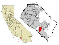
Coordinates: 33°34′30″N 117°43′32″W / 33.575°N 117.72556°WCoordinates: 33°34′30″N 117°43′32″W / 33.575°N 117.72556°W Country  United States
State  California
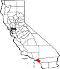
County Orange Government – Mayor Don Garcia – Mayor Pro Tem Phillip Tsunoda Area[2] – Total 7.472 sq mi (19.352 km2) – Land 7.472 sq mi (19.352 km2) – Water 0 sq mi (0 km2) 0% Elevation 417 ft (127 m) Population (2010) – Total 47,823 – Density 6,400.4/sq mi (2,471.2/km2) Time zone PST (UTC-8) – Summer (DST) PDT (UTC-7) ZIP code 92656, 92698 Area code(s) 949 FIPS code 06-00947 GNIS feature ID 0252532 Website http://ci.aliso-viejo.ca.us/ Aliso Viejo is a city in Orange County, California. It had a population of 47,823 as of the 2010 census, up from 40,166 as of the 2000 census. It became Orange County's 34th city on July 1, 2001, the only city in the county to incorporate since 2000. It is bordered by the cities of Laguna Beach on the west and southwest, Laguna Hills on the east, Laguna Niguel on the southeast, and Laguna Woods on the north.
Contents
History
Aliso Viejo had been an unincorporated community since around 1990, and incorporated as a city in 2001 due to the efforts of the Aliso Viejo Cityhood 2000 Committee, which was responsible for introducing an initiative on the ballot for the 2001 special election. Voters passed the initiative with 93.3% in favor of incorporation.[3] Carmen Vali-Cave, the co-founder and president of the Committee, became the new city's first mayor.
The original city council consisted of Carmen Vali-Cave, Cynthia Pickett, Bill Phillips, Karl Warkomski, and Greg Ficke.[3] The council selected Vali-Cave to serve as the city's first mayor, and Pickett as the city's first mayor pro tem. Vali-Cave and Pickett served as the mayor and mayor pro tem from 2001 to 2002. In 2003, Pickett became mayor with Phillips as mayor pro tem.
In 2004, City Councilmen Karl Warkomski, Bill Phillips, and Greg Ficke faced re-election. All three candidates were re-elected for four more years on council. Other candidates included Todd Gillespie and Don Garcia. In 2004, Phillips served as the city's mayor with Warkomski as mayor pro tem. In 2005, Warkomski served as mayor with Carmen Vali-Cave as mayor pro tem. In 2006, Vali-Cave served as mayor with Cynthia Pickett-Adams as mayor pro tem. In November 2006, Carmen Vali-Cave and Cynthia Pickett-Adams were re-elected to four-year terms.
In January 2007, Adams again assumed office as the city's mayor with Vali-Cave, again, as the city's mayor pro tem. In February 2007, Councilman Warkomski resigned from office unexpectedly and the council appointed Don Garcia to his position. In March 2007, Phillip Tsunoda was appointed to fill the vacancy left by the departure of Cynthia Adams. Vali-Cave was made mayor and Bill Phillips mayor pro tem after Adams' departure. In 2008, Bill Phillips assumed office as mayor with Don Garcia serving as mayor pro tem. Don Garcia became the mayor in 2009 with Phillip Tsunoda as mayor pro tem.
Government
Aliso Viejo is a general law city with a council-manager system of government. Day-to-day operations are handled by a professional city manager overseen by a volunteer city council.
The City Council of Aliso Viejo consists of five members serving staggered four-year terms. Each year, the Council votes for its next Mayor and Mayor pro tem.
The Seal of the City of Aliso Viejo was adopted in 2001 at incorporation. The seal features several mountains, a boat, a tree, and several buildings. Also, the seal features the slogan "Since 2001", in celebration of the city's incorporation date.
Geography
Aliso Viejo is located at 33°34′30″N 117°43′32″W / 33.575°N 117.72556°W (33.575096, -117.725431)[4] in the San Joaquin Hills of Orange County. According to the Censis Bureau, the city has a total area of 7.5 square miles (19 km2), all of which is land. Aliso Viejo is one of several cities bordering Aliso and Wood Canyons Regional Park. Aliso Creek forms part of the city's boundary with Laguna Niguel to the south, and Wood Canyon Creek forms part of the city's western boundary. Much of the city rests on the east slope of the San Joaquin Hills, which are a coastal mountain range extending for about 15 miles (24 km) along the Pacific coast.
Demographics
2010
The 2010 United States Census[5] reported that Aliso Viejo had a population of 47,823. The population density was 6,400.4 people per square mile (2,471.2/km²). The racial makeup of Aliso Viejo was 34,437 (72.0%) White, 967 (2.0%) African American, 151 (0.3%) Native American, 6,996 (14.6%) Asian, 89 (0.2%) Pacific Islander, 2,446 (5.1%) from other races, and 2,737 (5.7%) from two or more races. Hispanic or Latino of any race were 8,164 persons (17.1%).
The Census reported that 47,354 people (99.0% of the population) lived in households, 450 (0.9%) lived in non-institutionalized group quarters, and 19 (0%) were institutionalized.
There were 18,204 households, out of which 7,095 (39.0%) had children under the age of 18 living in them, 9,358 (51.4%) were opposite-sex married couples living together, 1,966 (10.8%) had a female householder with no husband present, 791 (4.3%) had a male householder with no wife present. There were 987 (5.4%) unmarried opposite-sex partnerships, and 206 (1.1%) same-sex married couples or partnerships. 4,416 households (24.3%) were made up of individuals and 638 (3.5%) had someone living alone who was 65 years of age or older. The average household size was 2.60. There were 12,115 families (66.6% of all households); the average family size was 3.16.
The population was spread out with 12,395 people (25.9%) under the age of 18, 3,739 people (7.8%) aged 18 to 24, 17,138 people (35.8%) aged 25 to 44, 12,003 people (25.1%) aged 45 to 64, and 2,548 people (5.3%) who were 65 years of age or older. The median age was 35.1 years. For every 100 females there were 92.8 males. For every 100 females age 18 and over, there were 89.2 males.
There were 18,867 housing units at an average density of 2,525.1 per square mile (974.9/km²), of which 11,049 (60.7%) were owner-occupied, and 7,155 (39.3%) were occupied by renters. The homeowner vacancy rate was 1.2%; the rental vacancy rate was 3.6%. 29,819 people (62.4% of the population) lived in owner-occupied housing units and 17,535 people (36.7%) lived in rental housing units.
2000
As of the census[6] of 2000, there were 40,166 people, 16,147 households, and 10,689 families residing in what was, at the time, a Census Designated Place (CDP). The population density was 3,927.7 inhabitants per square mile (1,516.0/km²). There were 16,608 housing units at an average density of 1,624.0 per square mile (626.8/km²). The racial makeup of the CDP was 78.16% White, 10.99% Asian, 2.06% Black or African American, 0.39% Native American, 0.22% Pacific Islander, 3.51% from other races, and 4.66% from two or more races. 11.65% of the population were Hispanic or Latino of any race.
There were 16,147 households out of which 37.7% had children under the age of 18 living with them, 52.7% were married couples living together, 10.2% had a female householder with no husband present, and 33.8% were non-families. 23.8% of all households were made up of individuals and 1.8% had someone living alone who was 65 years of age or older. The average household size was 2.49 and the average family size was 3.01.
The population was distributed with 26.1% under the age of 18, 5.5% from 18 to 24, 48.8% from 25 to 44, 16.3% from 45 to 64, and 3.4% who were 65 years of age or older. The median age was 33 years. For every 100 females there were 93.4 males. For every 100 females age 18 and over, there were 91.4 males.
According to a 2007 estimate, the median income for a household in the CDP was $92,280, and the median income for a family was $99,853.[7] Males had a median income of $61,316 versus $44,190 for females. The per capita income for the CDP was $35,244. About 2.3% of families and 2.8% of the population were below the poverty line, including 3.5% of those under age 18 and 2.8% of those age 65 or over.
Politics
In the state legislature Aliso Viejo is located in the 33rd Senate District, represented by Republican Dick Ackerman, and in the 70th and 73rd Assembly Districts, represented by Republicans Don Wagner and Diane Harkey respectively. Federally, Aliso Viejo is located in California's 48th congressional district, which has a Cook PVI of R +8[8] and is represented by Republican John Campbell.
Economy
Aliso Viejo is known for having the headquarters of many large companies, including:
- 3tera, a cloud computing software vendor
- AND1, an athletic shoe manufacturer
- Airbag Industries, a web design & development company
- Buy.com, an online retailer
- Centon Electronics, Inc., a computer Memory manufacturer as well as flash based storage devices
- eEye Digital Security, a digital security company
- Fluor Corporation, an international construction contractor for petrochemical, infrastructure, and environmental projects, headquartered in Aliso Viejo until it was relocated to the Dallas-Fort Worth Metroplex suburb of Irving, Texas in March 2006. Some divisions still reside in Aliso Viejo.
- Ketel One, a vodka company
- Marie Callender's, a restaurant chain
- Pacific Life, an insurance company
- QLogic, a network storage manufacturer
- Quest Software, a software manufacturer
- Smith Micro Software, a software developer
- Tamiya America, US subsidiary of the manufacturer of model cars Tamiya Corporation, headquartered in Aliso Viejo until it was relocated to Irvine, CA.
- UST Global, an IT services and business process outsourcing company
- USWeb, an Internet marketing company
- Valeant, a pharmaceutical company
Top employers
According to the City's 2009 Comprehensive Annual Financial Report,[9] the top employers in the city are:
# Employer # of employees 1 Fluor 1,000 2 UST Global 1,000 3 QLogic 900 4 Quest Software 607 5 Fluor Daniel 500 6 Merit Property Management 500 7 SafeGuard 355 8 MicroVention 270 9 Pacific Shore Funding 250 10 Pepsi Beverages Company 250 Points of interest
- Renaissance ClubSport, is a $65 million property which opened in July 2008. The Renaissance ClubSport is Marriott's second hotel and fitness resort created in conjunction with Leisure Sports, Inc. (ClubSport) to fulfill the growing demand by local residents and hotel guests for a healthier lifestyle.
- The Aliso Viejo Town Center is the main gathering place for both the young and old residents. It features a movie theater, a wide variety of casual dining restaurants, PetSmart, a Barnes & Noble, Ralphs as well as other shops.
Sports teams
The Orange County Gladiators are an American Basketball Association (ABA) expansion team starting in November 2007. They will play their home games at Aliso Niguel High School.
Controversy
"Dihydrogen monoxide" incident
Aliso Viejo city officials famously came close to banning polystyrene cups in 2004 after hearing that "dihydrogen monoxide" was used in their production, neglecting the fact that this substance is actually plain water. A paralegal working for the city found the dhmo.org website and subsequently proposed the ban.[10]
William Freund murder-suicide
In October 2005, the city gained national media attention once again when 19 year old resident William Freund donned a cape and mask and murdered two of his neighbors before killing himself. Freund was an alumnus of Aliso Viejo's only high school, Aliso Niguel High School. On November 17, 2006, the family of the two victims sued Freund's parents for "wrongful death and emotional distress."[11]
School dance ban
In September 2006, Charles Salter, the principal of Aliso Niguel High School, Aliso Viejo's high school, gained widespread media attention when he banned all school dances until further notice. Salter came under fire for his decision. His decision was based on the school's "Welcome Back Dance", at which several students arrived intoxicated, while others engaged in "freak dancing", which Salter views as inappropriate at a school dance. At the end of the month, Salter stood his ground and cancelled the school's annual Homecoming Dance, which gained both Salter and the school notoriety.[12] A story on the school was featured on the national television program, Geraldo at Large and the BBC also covered the dance ban. In late November, it was announced that the dances would return to the school, but under new rules that banned "freak dancing."[13]
Mail processing center
In 2008-early 2009, Aliso Viejo residents were protesting the postal service plan to build a large mail processing center. It was in the Aliso Viejo News often. It was then voted that the processing center would not go through due to environmental concerns and traffic in the area.
Emergency services
Fire protection in Aliso Viejo is provided by the Orange County Fire Authority with ambulance service by Doctor's Ambulance. Law enforcement is provided by the Orange County Sheriff's Department.
Education
The city is served by Capistrano Unified School District, which includes these schools:
Elementary
- Canyon Vista Elementary School
- Don Juan Avila Elementary School
- Oak Grove Elementary School
- Wood Canyon Elementary School
Middle school
High school
Aliso Viejo also has private schools, including VanDamme Academy, St. Mary and All Angels School, Aliso Viejo Christian School, and a university, Soka University of America.
Notable natives and residents
Main category: People from Aliso Viejo, California- Farzad Bonyadi, professional poker player
- Ryan Coiner, Major League Soccer player for the Columbus Crew
- Ryan Getzlaf, center for the Anaheim Ducks
- Jim Gilchrist, politician and founder of the Minuteman Project
- Kenneth Kizer, CEO and former Secretary of Health in the United States Department of Veterans Affairs
- Ivan Koumaev, contestant on the reality series So You Think You Can Dance
- Marc Maiffret, computer security expert/computer hacker
- Toni Turner, author
- Alisa Valdez-Rodriguez, author
- Alicia Leigh Willis, American actress who plays Courtney Matthews on General Hospital.
- Kyla Ross, USA Gymnastics Junior National Team member; 2009 Junior U.S. National Champion and 2009 Junior Pan American Games Champion
See also
Notes
- ^ [1]
- ^ U.S. Census
- ^ a b [2]
- ^ "US Gazetteer files: 2010, 2000, and 1990". United States Census Bureau. 2011-02-12. http://www.census.gov/geo/www/gazetteer/gazette.html. Retrieved 2011-04-23.
- ^ All data are derived from the United States Census Bureau reports from the 2010 United States Census, and are accessible on-line here. The data on unmarried partnerships and same-sex married couples are from the Census report DEC_10_SF1_PCT15. All other housing and population data are from Census report DEC_10_DP_DPDP1. Both reports are viewable online or downloadable in a zip file containing a comma-delimited data file. The area data, from which densities are calculated, are available on-line here. Percentage totals may not add to 100% due to rounding. The Census Bureau defines families as a household containing one or more people related to the householder by birth, opposite-sex marriage, or adoption. People living in group quarters are tabulated by the Census Bureau as neither owners nor renters. For further details, see the text files accompanying the data files containing the Census reports mentioned above.
- ^ "American FactFinder". United States Census Bureau. http://factfinder.census.gov. Retrieved 2008-01-31.
- ^ http://factfinder.census.gov/servlet/ACSSAFFFacts?_event=Search&geo_id=16000US0600394&_geoContext=01000US%7C04000US06%7C16000US0600394&_street=&_county=aliso+viejo&_cityTown=aliso+viejo&_state=04000US06&_zip=&_lang=en&_sse=on&ActiveGeoDiv=geoSelect&_useEV=&pctxt=fph&pgsl=160&_submenuId=factsheet_1&ds_name=ACS_2007_3YR_SAFF&_ci_nbr=null&qr_name=null®=null%3Anull&_keyword=&_industry=
- ^ "Will Gerrymandered Districts Stem the Wave of Voter Unrest?". Campaign Legal Center Blog. http://www.clcblog.org/blog_item-85.html. Retrieved 2008-02-10.
- ^ City of Aliso Viejo CAFR
- ^ "Local officials nearly fall for H2O hoax." MSNBC. March 15, 2004. Retrieved on September 4, 2008.
- ^ Tran, Mai. "Relatives sue over shotgun slayings in Aliso Viejo." Los Angeles Times. November 18, 2006. Retrieved on March 18, 2007.
- ^ Hernandez, Salvador. "Homecoming dance gets boot." The Orange County Register. September 29, 2006. Retrieved on March 18, 2007.
- ^ Hernandez, Salvador. "School dances return under new rules." The Orange County Register. November 29, 2006. Retrieved on March 18, 2007.
External links
- City of Aliso Viejo official website
- Around Aliso Viejo Webshow
- OrangeCounty.net City Guide
- Orange County Public Library, Aliso Viejo Branch
- Congressman John Campbell
- State Senator Mimi Walters
- State Assemblywoman Diane Harkey
Municipalities and communities of Orange County, California Cities Aliso Viejo | Anaheim | Brea | Buena Park | Costa Mesa | Cypress | Dana Point | Fountain Valley | Fullerton | Garden Grove | Huntington Beach | Irvine | La Habra | La Palma | Laguna Beach | Laguna Hills | Laguna Niguel | Laguna Woods | Lake Forest | Los Alamitos | Mission Viejo | Newport Beach | Orange | Placentia | Rancho Santa Margarita | San Clemente | San Juan Capistrano | Santa Ana | Seal Beach | Stanton | Tustin | Villa Park | Westminster | Yorba Linda
CDPs Unincorporated
communitiesAnaheim Island | Modjeska Canyon | Orange Park Acres | Santa Ana Heights | Santiago Canyon | Silverado | Trabuco Canyon
Categories:- Cities in Southern California
- Populated places established in 2001
- Aliso Viejo, California
- Cities in Orange County, California
- Former census-designated places in California
- Incorporated cities and towns in California


Wikimedia Foundation. 2010.