- Glendale, California
-
For the community in Humboldt County, see Glendale, Humboldt County, California.
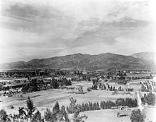
Glendale — City — View of Glendale from Forest Lawn Memorial Park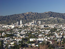
Flag
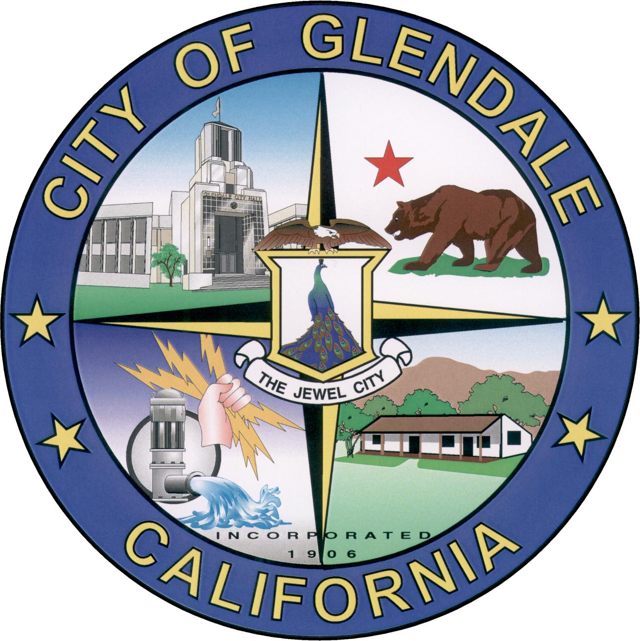
SealNickname(s): The Jewel City Location of Glendale within Los Angeles County and the State of California.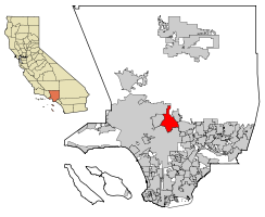 Location in California
 Glendale
Coordinates: 34°10′15″N 118°15′0″W / 34.17083°N 118.25°WCoordinates: 34°10′15″N 118°15′0″W / 34.17083°N 118.25°W Country United States State California County Los Angeles Incorporated February 15, 1906 Government - Type Council-Manager - City Council Mayor Laura Friedman
Frank Quintero
Rafi Manoukian
Ara Najarian
Dave Weaver- City Attorney Scott H. Howard - City Treasurer Ronald t. Borucki - City Manager James E. Starbird Area[1] - Total 30.583 sq mi (79.212 km2) - Land 30.453 sq mi (78.874 km2) - Water 0.130 sq mi (0.338 km2) 0.43% Elevation 522 ft (159 m) Population (2010) - Total 191,719 - Rank 3rd in Los Angeles County
22nd in California
120th in the United States- Density 6,268.6/sq mi (2,420.3/km2) Time zone PST (UTC-8) - Summer (DST) PDT (UTC-7) ZIP code 91201-91210, 91221, 91222, 91225, 91226 Area code(s) 818 FIPS code 06-30000 GNIS feature ID 1660679 Website ci.glendale.ca.us Glendale (
 /ˈɡlɛndeɪl/) is a city in Los Angeles County, California, United States. As of the 2010 Census, the city population is 191,719, down from 194,973 at the 2000 census.[2] making it the third largest city in Los Angeles County and the 22nd largest city in the state of California. It is also one of the two large cities in the United States that shares its name with a larger American city (Glendale, Arizona).
Glendale lies at the eastern end of the San Fernando Valley, bisected by the Verdugo Mountains, and is a suburb in the Greater Los Angeles Area. The city is bordered to the northwest by the Sun Valley and Tujunga neighborhoods of Los Angeles; to the northeast by La Cañada Flintridge and the unincorporated area of La Crescenta; to the west by Burbank and Griffith Park; to the east by Eagle Rock and Pasadena; to the south by the Atwater Village neighborhood of Los Angeles; and to the southeast by Glassell Park neighborhood of Los Angeles. The Golden State, Ventura, Glendale, and Foothill freeways run through the city.
Glendale's Forest Lawn Memorial Park Cemetery contains the remains of many noted celebrities and local residents. Glendale is also home to one of the largest communities of Armenians in the United States, with one in four people in Glendale being Armenian.
Contents
History
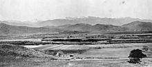 The Glendale area in the 1870s.
The area was long inhabited by the Tongva people (or "People of the Earth"), who were later renamed the Gabrieleños by the Spanish missionaries, after the nearby Mission San Gabriel Arcángel.
In 1798, José María Verdugo, a corporal in the Spanish army from Baja California, received the Rancho San Rafael from Governor Diego de Borica, formalizing his possession and use of land on which he had been grazing livestock and farming since 1784. Rancho San Rafael was a Spanish concession, of which 25 were made in California. Unlike the later Mexican land grants, the concessions were similar to grazing permits, with the title remaining with the Spanish crown.[3]
In 1860 His grandson Teodoro Verdugo built the Verdugo Adobe, which is the oldest building in Glendale. The property is the location of the Oak of Peace where early Californio leaders including Pio Pico met in 1847 and decided to surrender to Lieutenant Colonel John C. Frémont.
Verdugo's descendants sold the ranch in various parcels, some of which are included in present-day Atwater Village, Eagle Rock, and Highland Park neighborhoods of Los Angeles.
 Glendale, 1910.
In 1884, residents gathered to form a town and chose the name "Glendale". Residents to the southwest formed "Tropico" in 1887. The Pacific Electric Railway brought streetcar service in 1904.[citation needed]
Glendale incorporated in 1906, and annexed Tropico 12 years later. An important civic booster of the era was Leslie Coombs Brand (1859–1925), who built an estate in 1904 called El Miradero featuring an eye-catching mansion whose architecture combined characteristics of Spanish, Moorish, and Indian styles, copied from the East Indian Pavilion at the 1893 World's Columbian Exposition (World's Fair) held in Chicago, which he visited. Brand loved to fly, and built a private airstrip in 1919 and hosted "fly-in" parties, providing a direct link to the soon-to-be-built nearby Grand Central Airport. The grounds of El Miradero are now city-owned Brand Park and the mansion is the Brand Library, according to the terms of his will.[4] Brand partnered with Henry E. Huntington to bring the Pacific Electric Railway, or the "Red Cars," to the area. Today, he is memorialized by one of the city's main thoroughfares, Brand Boulevard.
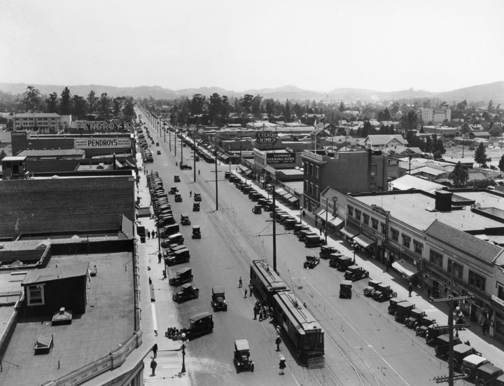
 Looking south on Brand Blvd, 1915.
The city's population rose from 13,756 in 1920 to 62,736 in 1930. The Forest Lawn Memorial Park opened in 1917. Pioneering endocrinologist and entrepreneur Dr. Henry R. Harrower opened his clinic in Glendale in 1920, which for many years was the largest business in the city. The American Green Cross, an early conservation and tree preservation society, was formed in 1926 (it disbanded three years later and the current organization of that name is unrelated). In 1964, Glendale was selected by George Lincoln Rockwell to be the West Coast headquarters of the American Nazi Party. Its offices, on Colorado Street in the downtown section of the city, remained open until the early 1980s.
In 1977 and 1978 ten murdered women were found in and around Glendale in what became known as the case of the Hillside Strangler. The murders were the work of Kenneth Bianchi and Angelo Buono, the latter of whom resided at 703 East Colorado Street where most of the murders took place.[5]
Geography
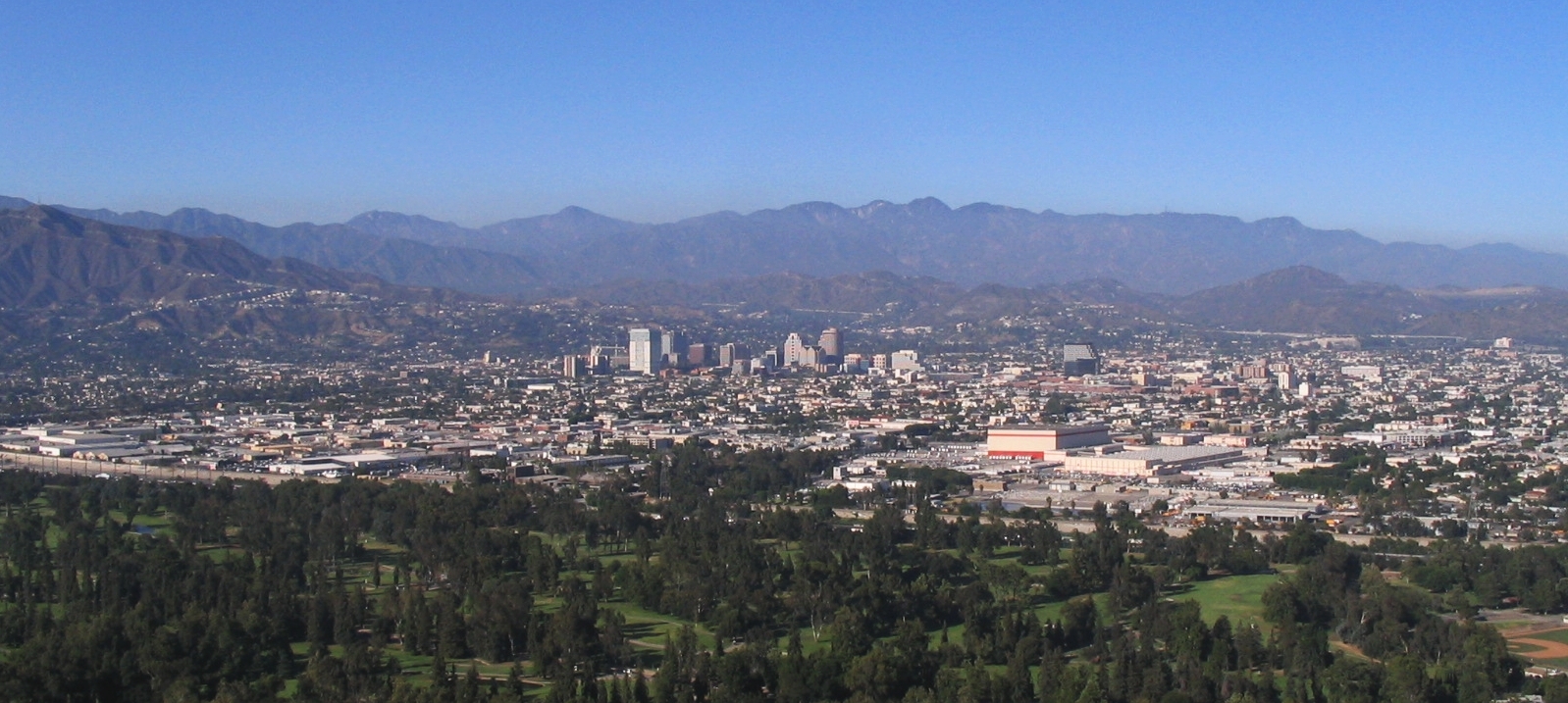
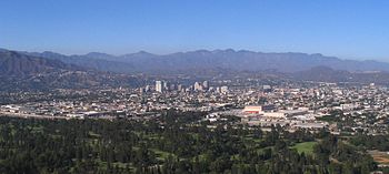 Glendale from the southwest, with the San Gabriel Mountains in the background.
Glendale is located at the juncture of two large valleys, the San Fernando and the San Gabriel. According to the United States Census Bureau, the city has a total area of 79.212 km2 (30.6 sq mi). 30.5 square miles (79 km2) of it is land and 0.13 square miles (0.34 km2) of it (0.43%) is water. It is bordered to the north by the foothill communities of La Canada Flintridge, La Crescenta, and Tujunga; to the south by the Atwater Village community incorporated by the city of Los Angeles; to the east by Pasadena and Eagle Rock (also incorporated within Los Angeles); and to the west by the city of Burbank.
Geology
Several known earthquake faults criss-cross the Glendale area and adjacent mountains, as they do most of southern California. Among the more recognized faults by seismologists are the Sierra Madre and Hollywood faults, which are situated in the city's northern and southwestern portions, respectively. Additionally, the Verdugo and Raymond faults intersect through the city's central and southeastern areas. The San Gabriel fault, meanwhile, is located northeast of the city. Roughly 75 miles (121 km) northeast of Glendale, there's a major part of the San Andreas Fault known as the "Big Bend," where quake-recurrence tracking shows major activity roughly every 140–160 years. The closest portion of the San Andreas is actually 29 miles (47 km) from Glendale. The last major quake along the southern San Andreas was recorded in 1857.
In the 1971 San Fernando earthquake, which took place along the western edge of the Sierra Madre fault, there were surface ruptures nearly 12 miles (19 km) long, including one portion a few miles northwest of Glendale. Most of the damage was in the northern San Fernando Valley, although 31 structures in Glendale suffered major damage and had to be demolished, plus dozens of chimneys were toppled. The 1994 Northridge earthquake had an epicenter about 18 miles (29 km) from Glendale. The city suffered severe damage to a public parking structure and sections of the Glendale Galleria parking structures and exterior columns incurred damages.[6]
Climate
Glendale has a Mediterranean climate (Köppen climate classification Csa). The highest recorded temperature in Glendale was 117°F (47°C) in September 2010. The lowest recorded temperature was 15 °F (−9 °C) in December 1968. The warmest month is August and the coolest month is January. The rainfall is highest in February and lowest in July. The hills and mountains of northern Glendale occasionally see snow and sleet, owing to its colder temperatures. Around every 5–10 years it snows. The last time it snowed was February 26, 2011, and snow accumulations around 2 inches were present. Sleet was present as well. Frost is common from late November to early March. Heavy rains are also common during the winter time. There are about 2 thunderstorms in Glendale per year, of which are occasionally severe and produce strong winds and hail. Every year, sometime from September to November, strong Santa Ana Winds produce 40-80 mph winds that sometimes damages property. Summers can be very warm with the highest temperature recorded at 112 degrees in 1990. Average summer temperature is 90 degrees. [7]
Climate data for Glendale Month Jan Feb Mar Apr May Jun Jul Aug Sep Oct Nov Dec Year Record high °F (°C) 93
(34)91
(33)97
(36)106
(41)102
(39)109
(43)111
(44)115
(46)117
(47)108
(42)99
(37)93
(34)117
(47)Average high °F (°C) 66.9
(19.4)70.0
(21.1)75.0
(23.9)77.0
(25.0)82.9
(28.3)89.1
(31.7)90.0
(32.2)87.1
(30.6)82.0
(27.8)73.9
(23.3)71.1
(21.7)68.0
(20.0){{{year high F}}}
(25.4)Average low °F (°C) 40.5
(4.7)42.8
(6.0)50.0
(10.0)54.0
(12.2)57.9
(14.4)62.1
(16.7)62.1
(16.7)60.1
(15.6)54.0
(12.2)46.0
(7.8)45.0
(7.2)39.2
(4.0){{{year low F}}}
(10.8)Record low °F (°C) 23
(−5)18
(−8)23
(−5)34
(1)37
(3)41
(5)45
(7)48
(9)45
(7)37
(3)28
(−2)16
(−9)16
(−9)Precipitation inches (mm) 3.56
(90.4)4.29
(109)3.88
(98.6)1.02
(25.9).37
(9.4).12
(3).02
(0.5).18
(4.6).3
(8).55
(14)1.05
(26.7)2.15
(54.6)17.49
(444.2)Source: [8] Economy
According to the City's 2009 Comprehensive Annual Financial Report,[9] the top employers in the city are as follows (with number of employees given): City of Glendale (2,216), Glendale Adventist Medical Center (2,126), Nestlé (1,521), Glendale Memorial Medical Center (1,433), Glendale Community College (1,408) Public Storage (1,111) Glendale Unified School District (1,085), Walt Disney Imagineering (928), Acco Engineering Systems (824) and Diagnostic Laboratories (740). Other companies based in Glendale include DineEquity, DreamWorks Animation, and PS Business Parks.
Industry and development
Grand Central Airport was a municipal airport developed from 1923 which became the largest employer in Glendale for many years, and contributed to the development of aviation in the United States in many important ways. The main terminal building still stands and includes both art deco and Spanish style architectural elements. The facility was the first official terminal for the Los Angeles area as well as the departure point for the first commercial west to east transcontinental flight flown by Charles Lindbergh. During World War II, the Grand Central Air Terminal building was camouflaged to protect it from enemy targeting. It was closed down in 1959, and made way for the Grand Central Business Park.
The Bob's Big Boy chain of hamburger restaurants started in Glendale on East Colorado in August 1936, and the Baskin-Robbins, "31 Flavors" chain of ice cream parlors started in Adams Square in 1945. The Glendale Public Library[10] on Harvard Street houses its "Special Collections" department which contains original documents and records on much of the history of Glendale. It also contains one of the largest collections of books on cats in the world, over 20,000 volumes.[11] It was donated to the library in the 1950s by the Jewel City Cat Fanciers Club, with the understanding that it would be made into a special collection and kept permanently for club members to use and enjoy.[12]
The city saw significant development in the 1970s, with the completion of the Glendale Freeway (HWY 2) and the Ventura Freeway (HWY 134).
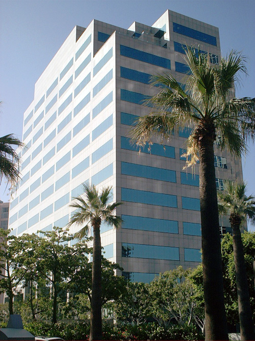
 The Central Public Library (1973)
Redevelopment of Brand Boulevard, renovation of the 1925 Alex Theatre, and construction of the Glendale Galleria shopping mall which opened in 1976.
Several large companies have offices in Glendale. The U.S. headquarters of the Swiss foods multinational Nestlé and International House of Pancakes are located in Glendale. The Los Angeles regional office of California's State Compensation Insurance Fund is in Glendale. Americas United Bank was formed here in 2006 and their headquarters are located in Glendale. Nero AG, the software company that makes Nero Burning ROM, also has its main North American subsidiary located in Glendale. Panda Security, a large antivirus software company, also has its principal U.S. office in Glendale. Neopets, Inc., a company that created the popular virtual pet website, Neopets, is located in the city (it was sold in 2005 to Viacom).
In 1994, Steven Spielberg, Jeffrey Katzenberg and David Geffen formed DreamWorks SKG, a diversified entertainment company. DreamWorks Animation remains located in the city's Grand Central Business Park on land formerly occupied by a helicopter landing base on the old air field. The Walt Disney Company also has a large campus located in the Grand Central Business Park that includes the headquarters for its Imagineering and Consumer Products divisions, The Muppets Holding Company, and also owns what's left of Grand Central Terminal. Part of KABC-TV has located there.
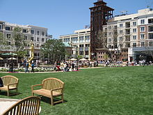 Americana at Brand (2008)
In 2005, construction began near to the Galleria of developer Rick Caruso's "Americana at Brand", a 15.5-acre (63,000 m2) outdoor shopping and residential community. Caruso had previously designed and built The Grove at Farmers Market. The new Glendale development was opened to the public on May 2, 2008, and features 75 shops and restaurants, 238 apartments, 100 condominiums, and a Pacific Theatres 18-plex Cinema which seats 3000 people.[13]
Shopping
Glendale has many options for shopping including; Glendale Galleria which is anchored by Nordstrom, Macy's, Target and J. C. Penney, the Americana at Brand, which is an up-scale outdoor mall (similar to The Grove in L.A.) some stores include, H&M, A/X Armani Exchange, True Religion, Michael Stars, Lacoste, Urban Outfitters[14] and the Glendale Fashion Center which is anchored by Ross, TJ Max, Nordstrom Rack, Staples, Petco and many others. Shopping can also be done at Montrose Shopping Park in North Glendale. The shopping park runs down Honolulu Ave and is filled with many stores and restaurants.
Demographics
Historical populations Census Pop. %± 1910 2,746 — 1920 13,536 392.9% 1930 62,736 363.5% 1940 82,582 31.6% 1950 95,702 15.9% 1960 119,442 24.8% 1970 132,664 11.1% 1980 139,060 4.8% 1990 180,038 29.5% 2000 194,973 8.3% 2010 191,719 −1.7% 2010
The 2010 United States Census[15] reported that Glendale had a population of 191,719. The population density was 6,268.6 people per square mile (2,420.3/km²). The racial makeup of Glendale was 136,226 (71.1%) White, 2,573 (1.3%) African American, 531 (0.3%) Native American, 31,434 (16.4%) Asian (6.9% Filipino, 5.4% Korean, 1.3% Chinese, 0.9% Indian, 0.6% Japanese, 0.4% Vietnamese, 0.9% Other Asian), 122 (0.1%) Pacific Islander, 12,146 (6.3%) from other races, and 8,687 (4.5%) from two or more races. Hispanic or Latino of any race were 33,414 persons (17.4%).
The Census reported that 190,290 people (99.3% of the population) lived in households, 223 (0.1%) lived in non-institutionalized group quarters, and 1,206 (0.6%) were institutionalized.
There were 72,269 households, out of which 21,792 (30.2%) had children under the age of 18 living in them, 37,486 (51.9%) were opposite-sex married couples living together, 8,908 (12.3%) had a female householder with no husband present, 3,693 (5.1%) had a male householder with no wife present. There were 2,359 (3.3%) unmarried opposite-sex partnerships, and 605 (0.8%) same-sex married couples or partnerships. 18,021 households (24.9%) were made up of individuals and 7,077 (9.8%) had someone living alone who was 65 years of age or older. The average household size was 2.63. There were 50,087 families (69.3% of all households); the average family size was 3.19.
The population was spread out with 35,732 people (18.6%) under the age of 18, 16,609 people (8.7%) aged 18 to 24, 54,518 people (28.4%) aged 25 to 44, 54,942 people (28.7%) aged 45 to 64, and 29,918 people (15.6%) who were 65 years of age or older. The median age was 41.0 years. For every 100 females there were 91.1 males. For every 100 females age 18 and over, there were 87.9 males.
There were 76,269 housing units at an average density of 2,493.8 per square mile (962.8/km²), of which 27,535 (38.1%) were owner-occupied, and 44,734 (61.9%) were occupied by renters. The homeowner vacancy rate was 1.3%; the rental vacancy rate was 5.5%. 76,769 people (40.0% of the population) lived in owner-occupied housing units and 113,521 people (59.2%) lived in rental housing units.
2000
As of the census[16] of 2000, there were 194,973 people, 71,805 households, and 49,617 families residing in the city. The population density was 6,362.2 inhabitants per square mile (2,456.1/km²). There were 73,713 housing units at an average density of 2,405.3 per square mile (928.6/km²). The racial makeup of the city was 63.6% White, 1.6% Black or African American, 0.3% Native American, 16.1% Asian American, 0.1% Pacific Islander, 8.6% from other races, and 10.1% from two or more races. 19.7% of the population were Hispanic or Latino of any race.
There were 71,805 households out of which 32.9% had children under the age of 18 living with them, 52.3% were married couples living together, 11.8% had a female householder with no husband present, and 30.9% were non-families. 25.7% of all households were made up of individuals and 8.7% had someone living alone who was 65 years of age or older. The average household size was 2.68 and the average family size was 3.27.
In the city the population was spread out with 22.4% under the age of 18, 8.4% from 18 to 24, 32.2% from 25 to 44, 23.1% from 45 to 64, and 13.9% who were 65 years of age or older. The median age was 38 years. For every 100 females there were 91.3 males. For every 100 females age 18 and over, there were 88.0 males.
The median income for a household in the city was $41,805, and the median income for a family was $47,633. Males had a median income of $39,709 versus $33,815 for females. The per capita income for the city was $22,227. About 13.6% of families and 15.5% of the population were below the poverty line, including 20.7% of those under age 18 and 11.9% of those age 65 or over.
Armenian population
File:Saint Gregory the Illuminator Armenian Catholic Church in Glendale, California (2001) crop.JPGThe Saint Gregory the Illuminator Armenian Catholic Church (2001) on Mountain StreetArmenian families have lived in the city since the 1920s, but the surge in immigration escalated in the 1970s. Armenian-Americans are well integrated into the city, with many businesses, several Armenian schools, and ethnic/cultural organizations serving this ethnic group. Glendale has the highest percentage of residents of Armenian descent, most of whom arrived in the city in the last two decades. The city of Glendale is home to the fourth largest Armenian community outside of Armenia, after Moscow, Beirut and Los Angeles. According to the United States 2000 Census Glendale is home to 53,854 Armenian-Americans[17] (making up 27.6% of the total population), increasing from 1990 when there were 31,402 Armenian-Americans in the city.[18] As of 2009, one of the five members of Glendale's city council is of Armenian descent—Ara J. Najarian. Former Armenian-American mayors of Glendale include Larry Zarian, Bob Yousefian, Rafi Manoukian, and Ara Najarian.
Some outspoken members of the highly successful Armenian-American rock band, System Of A Down, were based in Glendale at the time of formation. These include singer Serj Tankian and bassist Shavo Odadjian.
Government
Local government
According to the city’s most recent Comprehensive Annual Financial Report, the city’s various funds had $575.6 million in Revenues, $542.8 million in expenditures, $2,089.7 million in total assets, $480.9 million in total liabilities, and $460.4 million in cash and investments.[19]
County representation
The Los Angeles County Department of Health Services operates the Glendale Health Center in Glendale.[20]
Politics
The city of Glendale, along with neighboring Burbank and Pasadena, falls under California's 29th district in the United States House of Representatives. Congressman Adam Schiff has represented the district since 2000, and his vocal stances on issues regarding U.S.-Armenia relations reflect the large Armenian presence in the district.
In the state legislature Glendale is located in the 21st Senate District, represented by Democrat Carol Liu, and in the 38th (4%) and 43rd (96%) Assembly Districts, represented by Republican Cameron Smyth and Democrat Mike Gatto respectively. Federally, Glendale is located in California's 29th congressional district, which has a Cook PVI of D +12[21] and is represented by Democrat Adam Schiff.
Law enforcement and services
Main article: Crime in Glendale, CaliforniaGlendale maintains its own police department. The police department operates out of its main station in Downtown Glendale, its Downtown substation in the Glendale Galleria and the Montrose substation in Verdugo City. The California Highway Patrol has its Southern Division Headquarters in Downtown Glendale. Glendale also maintains its own class one fire department. Ambulance service is provied by Glendale fire paramedics and Glendale fire basic life support(BLS) ambulances.
Education
The Glendale Unified School District operates the public schools in Glendale. The GUSD high schools include Glendale High School, Herbert Hoover High School, Clark Magnet High School, Crescenta Valley High School located in La Crescenta and Allan F. Daily High School. A number of private schools also operate in Glendale, including Chamlian Armenian School,[22] Holy Family High School, Salem Lutheran School and Glendale Adventist Academy. Glendale is also home to Glendale College.
Transportation
See also: Glendale StationGlendale offers many transportation options. LADOT, Metro Local, Metro Rapid and Glendale Beeline all have buses that run in the city. Glendale Transportation Center (GTC) provides connections to Greyhound and three train lines. Glendale is also served by four freeways: the Glendale Freeway (State Route 2), the Ventura Freeway (State Route 134), the Foothill Freeway (Interstate 210) and the Golden State Freeway (Interstate 5). Major surface streets in the city include the following: Brand Boulevard, Broadway, Canada Boulevard, Central Avenue, Chevy Chase Drive, Colorado Boulevard, Foothill Boulevard, Glendale Avenue, Glenoaks Boulevard, Grandview Avenue, La Crescenta Avenue, Honolulu Avenue, Pennsylvania Avenue, Riverside Drive, Victory Boulevard, Pacific Avenue, Sonora Avenue, Western Avenue, San Fernando Road, Verdugo Road/Boulevard, Mountain Street, and Ocean View Boulevard.
Notable residents
A number of notable people are natives of or have lived in Glendale, including:
- Tatev Abrahamyan, chess player
- Tigran Arakelyan, flutist/conductor
- Allisyn Ashley Arm, actress/filmmaker
- Kimberly Beck, actress
- Captain Beefheart, musician
- Elvin Bishop, musician
- David Brin, author
- Clara Bryant, actress
- Angelo Buono, serial killer
- Armen Chakmakian, musician and composer
- John Cho, actor
- Doug Davidson, soap opera actor
- John Debney, Academy Award nominated film composer
- Emilio Delgado, actor, "Luis" on Sesame Street
- Doug Dohring, CEO of Neopets
- Nicole Eggert, actress
- Erika Eleniak, actress
- Robert Englund, actor, Nightmare on Elm Street
- Nick Evans, Major League Baseball player for the New York Mets
- Pat Flaherty, auto racing driver and winner of the 1956 Indianapolis 500
- Doug Forrester, businessman and politician from New Jersey
- Edward Furlong, actor
- Beverly Garland, actress
- Daryl Gates, former LAPD police chief
- Scott Gorham, musician
- Joe Hahn, musician
- Pamela Hensley, actress
- Taraji P. Henson, Academy Award–nominated actress
- Chris Holmes, lead guitarist, W.A.S.P.
- Ashlyne Huff, musician[23]
- Lux Interior and Kristy Wallace, musicians, The Cramps
- Jay-R, actor, TV host
- Maren Jensen, actress
- Julia Ann, pornographic actress[24]
- Nicole Jung of the Korean girl group Kara
- Ed King, guitarist, Strawberry Alarm Clock & Lynyrd Skynyrd
- Nathan Kress, teen actor
- Greg Kriesel, bassist, The Offspring
- Shia LaBeouf, actor
- Jonna Lee, actress
- Mike Lieberthal, Major League Baseball All Star catcher
- Mario Lopez, TV show host
- Benji Madden, lead guitarist, Good Charlotte
- Joel Madden, lead vocalist, Good Charlotte
- Daron Malakian, lead guitarist, System of a Down
- Rafi Manoukian, politician
- Vanes Martirosyan, boxer
- Tim Matheson, actor
- Rex Mays, National Champion Racing Driver[25]
- Brandon McCarthy, pitcher for the Texas Rangers
- Eva Mendes, actress
- Don Milan, NFL player
- Dennis Muren, special effects artist
- Taylor Negron, actor, comedian
- Florence Oberle actress
- Ken Osmond, actor from Leave It to Beaver
- Kelly Packard, actress
- Melissa Pastore (pastor)
- Paul Petersen, actor
- Sam Phillips, musician
- Jamie Pineda, front woman of the pop music project Sweetbox
- Scott Radinsky, MLB pitcher
- Archie Reynolds, MLB player for the Chicago Cubs, California Angels, and the Milwaukee Brewers
- Michael Richards, actor
- Nicole Richie, actress
- Debra Jo Rupp, actress
- Devin Sarno, composer
- Steven L. Sears American Writer/Producer
- T. Sean Shannon, SNL/comedy writer
- Bob Siebenberg, drummer of Supertramp
- Stirling Silliphant, screen-writer, producer
- Rick Springfield, musician
- Casey Stengel, MLB player and manager for the New York Yankees, Brooklyn Dodgers, New York Mets and Boston Braves, among others
- Joseph Stroud, poet and educator
- Gary Sutherland, MLB player for the Philadelphia Phillies, Montreal Expos, Houston Astros, Detroit Tigers, Milwaukee Brewers, San Diego Padres, and the St. Louis Cardinals
- Jayceon Terrell Taylor, rapper/musician The Game
- Ann Tyrrell, actress
- Ron Underwood, director
- Paul Walker, actor
- Gordon Waller, singer with Peter & Gordon
- John Wayne, actor
- Gregg Zaun, catcher for the San Diego Padres
Sister cities
Currently, Glendale has the following sister cities.[26][27]
 Kapan, Armenia
 Higashiosaka, Japan
 Tlaquepaque, Mexico
- Rosarito Beach, Baja California, Mexico
- Hiroshima, Japan
 Goseong, South Korea
See also
- List of cities in California
- Largest cities in Southern California
- M.V. Hartranft, early 20th century land developer in Glendale
Notes
- ^ U.S. Census
- ^ Census.gov
- ^ Beck, Warren A., Haase, Ynez D. (1974). Historical Atlas of California. Norman: University of Oklahoma Press.
- ^ "The Brand legacy, Mansion and Library". Brandlibrary.org. July 28, 2010. http://www.brandlibrary.org/brand_history.asp. Retrieved January 29, 2011.
- ^ Crime Figure, Los Angeles Times, http://articles.latimes.com/1992-08-17/local/me-5255_1_crime-figure/2, retrieved April 20, 2011
- ^ Ci.glendale.ca City of Glendale report
- ^ http://www.weather.com/weather/wxclimatology/monthly/graph/91205
- ^ "Glendale historic weather averages". Intellicast. http://www.intellicast.com/Local/History.aspx?location=USCA0423. Retrieved October 9, 2009.
- ^ "City of Glendale CAFR" (PDF). http://www.ci.glendale.ca.us/admin-svcs/CAFR/YearEnd6-09/statisticalsection.pdf. Retrieved January 29, 2011.
- ^ "City of Glendale, CA — Library". http://www.ci.glendale.ca.us/library/default.asp.
- ^ "The 20,000 books ... on cats is the largest such collection in the world." Pitt, Leonard; Dale Pitt (1997). "Glendale". Los Angeles A to Z (1 ed.). Los Angeles: University of California Press.
- ^ Personal communication by Wikipedia editor "JesseW" with Glendale head reference librarian, June 20, 2005 (UTC).
- ^ L.A. Times issue April 25, 2005
- ^ Americanabrand.com
- ^ All data are derived from the United States Census Bureau reports from the 2010 United States Census, and are accessible on-line here. The data on unmarried partnerships and same-sex married couples are from the Census report DEC_10_SF1_PCT15. All other housing and population data are from Census report DEC_10_DP_DPDP1. Both reports are viewable online or downloadable in a zip file containing a comma-delimited data file. The area data, from which densities are calculated, are available on-line here. Percentage totals may not add to 100% due to rounding. The Census Bureau defines families as a household containing one or more people related to the householder by birth, opposite-sex marriage, or adoption. People living in group quarters are tabulated by the Census Bureau as neither owners nor renters. For further details, see the text files accompanying the data files containing the Census reports mentioned above.
- ^ "American FactFinder". United States Census Bureau. http://factfinder.census.gov. Retrieved 2008-01-31.
- ^ American FactFinder, United States Census Bureau. "U.S. Census Bureau – Ancestry:2000 – Glendale city, California". Factfinder.census.gov. http://factfinder.census.gov/servlet/QTTable?_bm=y&-context=qt&-qr_name=DEC_2000_SF3_U_QTP13&-ds_name=DEC_2000_SF3_U&-CONTEXT=qt&-tree_id=403&-all_geo_types=N&-redoLog=false&-geo_id=16000US0630000&-search_results=16000US0630000&-format=&-_lang=en. Retrieved January 29, 2011.
- ^ "Armenian Population Up Valley, Glendale And Burbank Show Big Percentage Hikes". Thefreelibrary.com. September 8, 2002. http://www.thefreelibrary.com/ARMENIAN+POPULATION+UP+VALLEY,+GLENDALE+AND+BURBANK+SHOW+BIG...-a091245026. Retrieved January 29, 2011.
- ^ City of Glendale CAFR. Retrieved 2009-08-12.
- ^ "Glendale Health Center." Los Angeles County Department of Health Services. Retrieved on March 27, 2010.
- ^ "Will Gerrymandered Districts Stem the Wave of Voter Unrest?". Campaign Legal Center Blog. http://www.clcblog.org/blog_item-85.html. Retrieved February 10, 2008.
- ^ "Vahan & Anoush Chamlian Armenian School". Chamlian.org. March 24, 2010. http://www.chamlian.org. Retrieved January 29, 2011.
- ^ Leahey, Andrew. "Ashlyne Huff - Biography". Allmusic.com. http://www.allmusic.com/artist/p2121462. Retrieved 20 August 2010.
- ^ Dan Miller (August 21, 2009). "Up Close with Julia Ann". AVN. http://business.avn.com/articles/36143.html. Retrieved October 31, 2009.
- ^ Glick, Shav (October 20, 1987). "Auto Races Once Again Replacing Horse Races". Los Angeles Times. http://articles.latimes.com/1987-10-20/sports/sp-14564_1_del-mar. Retrieved July 22, 2010. ""Mays, a handsome 6-footer who was born and raised in Riverside and spent most of his adult years in Glendale,""
- ^ Sister Cities International
- ^ Hicken, Melanie, "Mayor Returns from Korea", Glendale News Press, Glendale, August 31, 2010. Retrieved 2010-08-31.
External links
Greater Los Angeles Area Central city Counties Satellite cities Cities
>200kCities and towns
100k–200kBurbank • Compton • Corona • Costa Mesa • Downey • East Los Angeles • El Monte • Fontana • Fullerton • Garden Grove • Inglewood • Lancaster • Mission Viejo • Moreno Valley • Murrieta • Norwalk • Ontario • Orange • Palmdale • Pasadena • Pomona • Rancho Cucamonga • Santa Clarita • Simi Valley • South Gate • Temecula • Thousand Oaks • Torrance • Ventura • Victorville • West CovinaArea regions Antelope Valley • Conejo Valley • Downtown Los Angeles • East Los Angeles • Gateway Cities • Greater Hollywood • Harbor Area • Inland Empire • Palos Verdes Hills • Pomona Valley • San Bernardino Valley • San Fernando Valley • San Gabriel Valley • Santa Ana Valley • Santa Clarita Valley • South Bay • South Los Angeles • Westside Los AngelesLandforms Los Angeles Basin • Baldwin Hills (range) • Calico Mountains • Catalina Island • Channel Islands • Coachella Valley • High Desert—Mojave Desert • Low Desert—Colorado Desert • San Fernando Valley • San Bernardino Mountains • San Gabriel Mountains • Santa Ana Mountains • Santa Monica Mountains • Santa Susana Mountains • Verdugo MountainsBodies of water Los Angeles River • Aliso Creek • Arroyo Seco • Ballona Creek • Bell Creek • Big Bear Lake • Coyote Creek • Lake Arrowhead • Lake Perris • Lake Piru • Malibu Creek • Pacific Ocean • Pyramid Lake • Rio Hondo • San Gabriel River • San Juan Creek • San Pedro Bay • Santa Ana River • Santa Clara River • Santa Margarita River • Santa Monica Bay State of California
Sacramento (capital) Topics Climate · Delegations · Deserts · Districts · Ecology · Elections · Environment · Geography · Government · History · Protected areas · Sports · Symbols · Transportation · Visitor attractions · Index of California-related articles
Society Californians · Culture · Crime · Demographics · Economy · Education · Politics
Regions Antelope Valley · Big Sur · Cascade Range · Central California · Central Coast · Central Valley · Channel Islands · Coachella Valley · Conejo Valley · Cucamonga Valley · Death Valley · East Bay (SF) · East County (SD) · Eastern California · Emerald Triangle · Gold Country · Great Basin · Greater Los Angeles · Greater Sacramento · Inland Empire · Lake Tahoe · Los Angeles Basin · Lost Coast · Metropolitan Fresno · Mojave · Mountain Empire · North Bay (SF) · North Coast · North County (SD) · Northern California · Owens Valley · Oxnard Plain · San Francisco Peninsula · Pomona Valley · Sacramento Valley · San Bernardino Valley · San Diego–Tijuana · San Fernando Valley · San Francisco Bay Area · San Gabriel Valley · San Joaquin Valley · Santa Clara Valley · Santa Clara River Valley · Santa Clarita Valley · Shasta Cascade · Sierra Nevada · Silicon Valley · South Bay (LA) · South Bay (SF) · South Bay (SD) · South Coast · Southern California · Southern Border Region · Tri-Valley · Upstate California · Victor Valley · Wine Country · Yosemite
Metro areas Bakersfield · Chico · El Centro · Fresno · Hanford–Corcoran · Los Angeles–Long Beach–Glendale · Madera · Modesto · Merced · Napa · Oakland–Fremont–Hayward · Oxnard–Thousand Oaks–Ventura · Redding · Riverside–San Bernardino–Ontario · Sacramento–Arden Arcade–Roseville · Salinas · San Diego–Carlsbad–San Marcos · San Francisco–San Mateo–Redwood City · San Jose–Sunnyvale–Santa Clara · San Luis Obispo–Paso Robles · Santa Ana–Anaheim–Irvine · Santa Barbara–Santa Maria–Goleta · Santa Cruz–Watsonville · Santa Rosa–Petaluma · Stockton · Vallejo–Fairfield · Visalia–Porterville · Yuba City
Micro areas Counties Alameda · Alpine · Amador · Butte · Calaveras · Colusa · Contra Costa · Del Norte · El Dorado · Fresno · Glenn · Humboldt · Imperial · Inyo · Kern · Kings · Lake · Lassen · Los Angeles · Madera · Marin · Mariposa · Mendocino · Merced · Modoc · Mono · Monterey · Napa · Nevada · Orange · Placer · Plumas · Riverside · Sacramento · San Benito · San Bernardino · San Diego · San Francisco · San Joaquin · San Luis Obispo · San Mateo · Santa Barbara · Santa Clara · Santa Cruz · Shasta · Sierra · Siskiyou · Solano · Sonoma · Stanislaus · Sutter · Tehama · Trinity · Tulare · Tuolumne · Ventura · Yolo · Yuba
Mayors of cities with populations exceeding 100,000 in California - Antonio Villaraigosa
(Los Angeles) - Jerry Sanders
(San Diego) - Chuck Reed
(San Jose) - Edwin M. Lee
(San Francisco) - Ashley Swearengin
(Fresno) - Kevin Johnson
(Sacramento) - Bob Foster
(Long Beach) - Jean Quan
(Oakland) - Harvey Hall
(Bakersfield) - Tom Tait
(Anaheim) - Miguel A. Pulido
(Santa Ana)
- Ronald O. Loveridge
(Riverside) - Ann Johnston
(Stockton) - Cheryl Cox
(Chula Vista) - Bob Wasserman
(Fremont) - Sukhee Kang
(Irvine) - Pat Morris
(San Bernardino) - Jim Ridenour
(Modesto) - Thomas E. Holden
(Oxnard) - Acquanetta Warren
(Fontana) - William H. Batey II
(Moreno Valley)^ - John Drayman
(Glendale)
- Cathy Green
(Huntington Beach)^ - Bob Kellar
(Santa Clarita)^ - William Dalton
(Garden Grove) - Susan Gorin
(Santa Rosa)^ - Jim Wood
(Oceanside) - Donald Kurth
(Rancho Cucamonga) - Paul S. Leon
(Ontario) - R. Rex Parris
(Lancaster) - Pat Hume
(Elk Grove) - James C. Ledford Jr.
(Palmdale) - Stan Skipworth
(Corona)^
- Dennis Donohue
(Salinas) - Elliot Rothman
(Pomona) - Frank Scotto
(Torrance) - Michael Sweeney
(Hayward) - Sam Abed
(Escondido) - Tony Spitaleri
(Sunnyvale) - Bill Bogaard
(Pasadena) - Carolyn Cavecche
(Orange) - F. Richard Jones
(Fullerton)^ - Jacqui Irwin
(Thousand Oaks)^ - Jesus Gamboa
(Visalia)
- Paul Miller
(Simi Valley) - William D. Shinn
(Concord)^ - Gina Garbolino
(Roseville) - Jamie L. Matthews
(Santa Clara) - Osby Davis
(Vallejo) - Rudy Cabriales
(Victorville) - Ernest Gutierrez
(El Monte) - Tom Bates
(Berkeley) - Rick Trejo
(Downey)^ - Eric R. Bever
(Costa Mesa)^ - James T. Butts, Jr.
(Inglewood)

^Mayor selected from city council
Other states: AL • AK • AZ • AR • CA • CO • CT • DE • FL • GA • HI • ID • IL • IN • IA • KS • KY • LA • ME • MD • MA • MI • MN • MS • MO • MT • NE • NV • NH • NJ • NM • NY • NC • ND • OH • OK • OR • PA • RI • SC • SD • TN • TX • UT • VT • VA • WA • WV • WI • WYArmenian diaspora Armenian populations by countryFormer Soviet Union Azerbaijan (Nakhichevan) · Belarus · Estonia · Georgia (Abkhazia / Javakheti / Tbilisi) · Kazakhstan · Kyrgyzstan · Latvia · Lithuania · Moldova · Russia · Tajikistan · Turkmenistan · Ukraine (Crimea) · UzbekistanAmericas Europe Middle East Asia Africa Oceania 
Los Angeles La Cañada Altadena Burbank 
Pasadena  Glendale

Hollywood Los Angeles South Pasadena Categories:- Armenian diaspora communities in the United States
- Cities in Los Angeles County, California
- Communities in the San Fernando Valley
- Populated places established in 1906
- Incorporated cities and towns in California


Wikimedia Foundation. 2010.