- Chula Vista, California
-
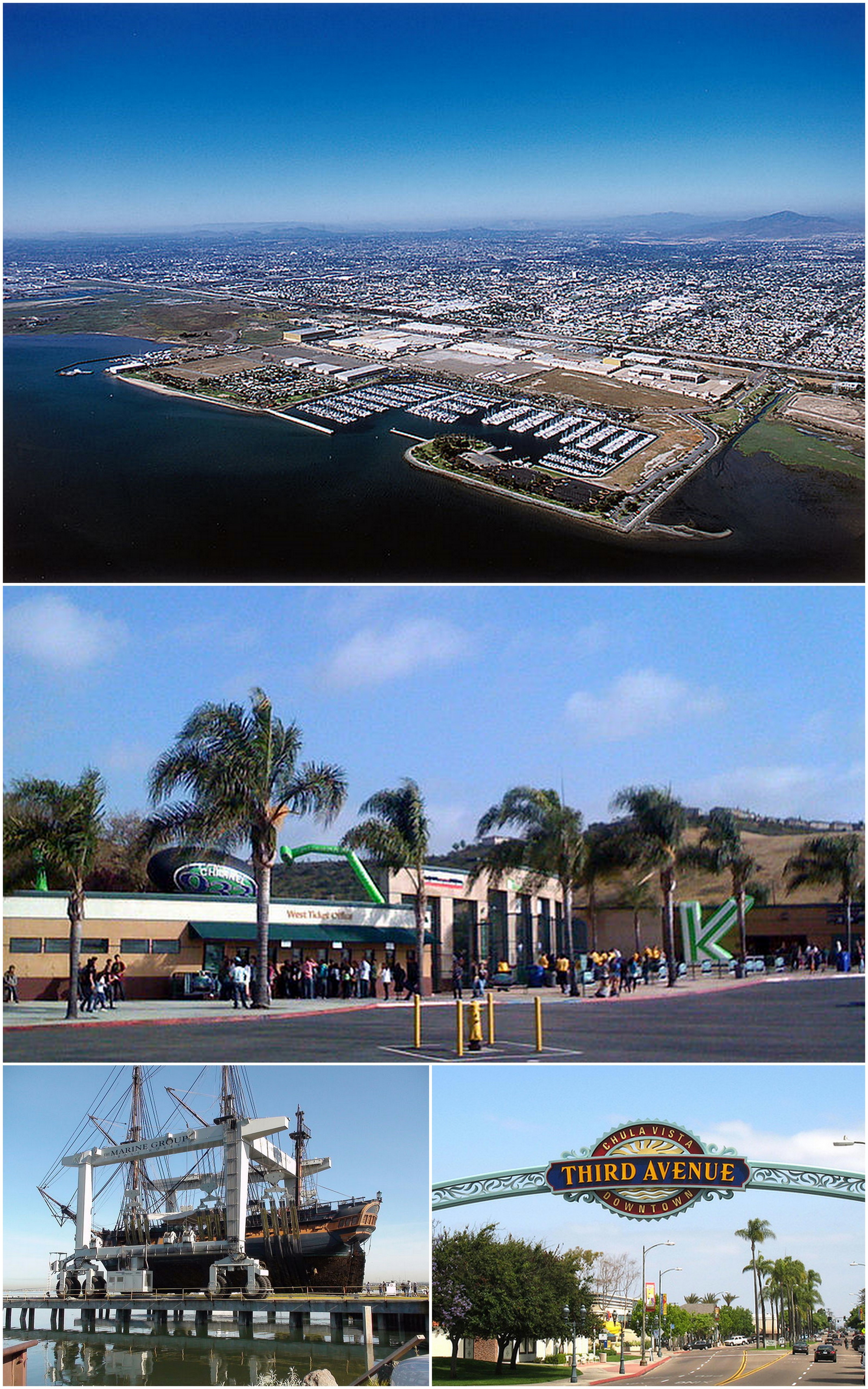
Chula Vista — City — City of Chula Vista Images from top, left to right: Chula Vista Bayfront, Cricket Wireless Amphitheatre, HMS Surprise, Third Avenue in Downtown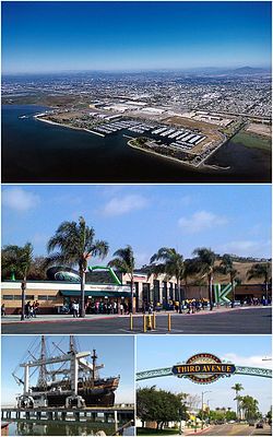

Flag
SealNickname(s): The City of Allure[1]
Chula-juana[2][3][4]Location of Chula Vista within San Diego County, California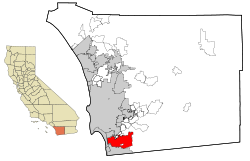 Location in the United States
 Chula Vista
Coordinates: 32°37′40″N 117°2′53″W / 32.62778°N 117.04806°WCoordinates: 32°37′40″N 117°2′53″W / 32.62778°N 117.04806°W Country United States State California County San Diego Government - Type Council-Manager - City Council Mayor Cheryl Cox
Rudy Ramirez
Patricia Aguilar
Pamela Bensoussan
Steve Castaneda- City Manager Jim Sandoval Area[5] - City 52.094 sq mi (134.925 km2) - Land 49.631 sq mi (128.545 km2) - Water 2.463 sq mi (6.380 km2) 4.73% Elevation 69 ft (21 m) Population (2010 Census)[6] - City 243,916 - Rank 2nd in San Diego County
14th in California
77th in the United States- Density 4,682.2/sq mi (1,807.8/km2) - Metro San Diego–Tijuana: 5,105,768 Time zone PST (UTC-8) - Summer (DST) PDT (UTC-7) ZIP codes 91909, 91910, 91911, 91912, 91913, 91914, 91915, 91921 Area code(s) 619 FIPS code 06-13392 GNIS feature ID 1660481 Website http://www.chulavistaca.gov/ Chula Vista (
 /ˌtʃuːlə ˈvɪstə/; Spanish: Beautiful View) is the second largest city in the San Diego metropolitan area, the seventh largest city in Southern California, the fourteenth largest city in the State of California, and the seventy seventh largest city in the U.S.. The population was 243,916 as of the 2010 census.
Located just 7 miles (11 km) from downtown San Diego and 7 miles (11 km) from the Mexican border in the South Bay region of the metropolitan area, the city is at the center of one of the richest economic and culturally diverse zones in the United States. Chula Vista is so named because of its scenic location between the San Diego Bay and coastal mountain foothills.
Founded in the early 19th century, fast population growth has recently been observed in the city. As the second largest city in San Diego County, Chula Vista has quickly become a destination popular to many tourists. Located in the city is one of Americas few year-round United States Olympic Training centers and popular tourist destinations include Cricket Wireless Amphitheater, Knott's Soak City USA, the Chula Vista marina, the Chula Vista Nature Center as well as golf courses and the region’s newest lifestyle center.
Contents
History
Early history
Prehistoric evidence, of both land and aquatic origin, date Chula Vista's history to millions of years back. In the year 3000 B.C. people speaking the Yuman (Quechan) language began movement into the region from the Lower Colorado River Valley and southwestern Arizona portions of the Sonoran desert. Later the Kumeyaay tribe came to populate the land, on which the city sits today, who lived in the area for hundreds of years.[7]
In the year 1542, a fleet of three Spanish Empire ships, commanded by Juan Rodríguez Cabrillo, sailed into San Diego Harbor. Early explorations by Spanish conquistadors, such as these, led to Spanish claims of the land. The historic land on which Chula Vista sits became part of the 1795 land grant known as Rancho del Rey or The King's Ranch. The land eventually was renamed Rancho del la Nacion.[7]
During the Mexican-American War, California was claimed by the United States, regardless of the California independence movement that had briefly swept the state. Though California was now under the jurisdiction of the United States, land grants were allowed to continue in the form of private property.[7]
The San Diego Land and Town Company developed lands of the Rancho de la Nación for new settlement. The town began as a five thousand acre development, with the first house being erected in 1887; by 1889, ten houses had been completed.[8] Chula Vista can be roughly translated from Spanish as "beautiful view."[7]
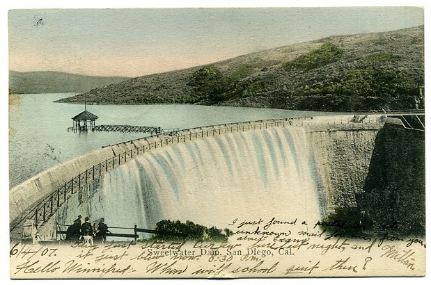
The 1888 completion of the Sweetwater Dam allowed for irrigation of Chula Vista farming lands. Chula Vista eventually became the largest lemon-growing center in the world for a period of time.[7]
20th century
The citizens of Chula Vista voted to incorporate on October 17, 1911. The State approved in November.[7]
In 1916, the Hercules Powder Company opened a 30-acre bayfront site, now known as Gunpowder point, which produced substances used to make cordite, which was used extensively by the British military during World War I.[9] Although the Great Depression affected Chula Vista significantly, agriculture still provided considerable income for the residents. In 1931, the lemon orchards produced $1 million in revenue and the celery fields contributed $600,000.[7]
The relocation of Rohr Aircraft Corporation to Chula Vista in early 1941, just months before the attack on Pearl Harbor, changed Chula Vista. The land never returned to being orchard groves again. The population of post-World War II Chula Vista tripled from 5,000 residents in 1940 to more than 16,000 in 1950.[7] After the war, many of the factory workers and thousands of servicemen stayed in the area resulting in the huge growth in population. The last of the citrus groves and produce fields disappeared as Chula Vista became one of the largest communities in San Diego County.[7]
In January 1986, Chula Vista annexed the unincorporated community of Montgomery which had previously rejected annexation in 1979 and 1982. At the time of the annexation the community was virtually surrounded by its larger neighbor.[10] Over the next few decades, Chula Vista continued to expand eastward. Plans called for a variety of housing developments such as Eastlake, Rancho del Rey and Otay Ranch neighborhoods.[9]
Camp Otay/Weber

During World War I and II The army maintained a base on what is now the corner of Main Street and Albany Avenue. It initially served as a border post during World War I, and was reestablished in December 1942. It was home to the 140th Infantry Regiment, 35th Infantry Division. The base was closed in February 1944, and the division went on to see combat in the European theater. All traces of the post have since been removed.[11]
21st century
In 2003, Chula Vista had 200,000 residents and was the second largest city in San Diego County.[12]
Chula Vista is growing at a fast pace,[9] with major developments taking place in the Otay Valley near the U.S. Olympic Training Center and Otay Lake Reservoir. Thousands of new homes have been built in the Otay Ranch, Lomas Verdes, Rancho Del Rey, Eastlake and Otay Mesa Areas.[13] The South Bay Expressway, a toll-road extension of state route 125, opened November 19, 2007, connecting freeways 805 and 905 with State Route 54.
On May 30, 2006 officials from Chula Vista and the San Diego Chargers met to potentially discuss building a new stadium that would serve as the home for the team. Yet, in June 2009 the Chargers removed Chula Vista as a possible location for a new stadium.[14] In 2009, Chula Vista - along with nine other second tier metropolitan area cities such as Hialeah and Southern California's Santa Ana - was ranked as one of the most boring cities in America by Forbes Magazine;[15] citing the large population but rare mentions of the city in national media. A current development plan in Chula Vista is to develop the bayfront.
Geography

Owning up to its Spanish name origins - beautiful view - Chula Vista is located in the South Bay region of San Diego County, between the foothills of the Jamul and San Ysidro Mountains (including Lower Otay Reservoir) and San Diego Bay on its east and west extremes, and the Sweetwater River and Otay River at its north and south extremes.[16] In South Bay Chula Vista has a large footprint, and aside from South San Diego, it is the largest geographic entity in the region.[citation needed]
According to the United States Census Bureau, the city covers an area of 52.1 square miles (135 km2), 49.6 square miles (128 km2) of it land, and 2.5 square miles (6.5 km2) or 4.73% of it water.
Ecological preserves
Chula Vista has within its city limits the Sweetwater Marsh unit of the San Diego Bay NWR.[17] It also maintains several city maintained open space areas.[18]
Climate
Chula Vista has a Mediterranean climate which it shares with San Diego County.[19]
Climate data for Chula Vista, California Month Jan Feb Mar Apr May Jun Jul Aug Sep Oct Nov Dec Year Average high °F (°C) 69
(21)68
(20)68
(20)68
(20)70
(21)73
(23)76
(24)78
(26)78
(26)76
(24)72
(22)69
(21)72.4 Average low °F (°C) 46
(8)48
(9)50
(10)53
(12)57
(14)60
(16)64
(18)65
(18)64
(18)58
(14)50
(10)46
(8)55 Precipitation inches (mm) 2.01
(51.1)2.01
(51.1)2.09
(53.1)0.71
(18)0.16
(4.1)0.08
(2)0.04
(1)0.08
(2)0.02
(0.5)0.39
(9.9)1.1
(28)1.18
(30)10.0
(254)Source: U.S. Climate Data[20] Neighborhoods
Chula Vista
The original Chula Vista encompasses the area west of Hilltop Drive and north of L Street.[9]
East Chula Vista
Beginning in the late 1980s the planned communities of Eastlake, Otay Ranch, and Rancho del Rey began to develop in the annexed areas east of Interstate 805. These communities expanded upon the eastern annexations of the 1970s, including the area around Southwestern College.[9]
Montgomery
The community of Montgomery was annexed by the city, after several failed attempts, in 1986.[10] The community consist of most of the area south of L Street, west of Hilltop Drive and north of the San Diego city limit.[9]
Government
Local government
According to the city’s most recent Comprehensive Annual Financial Report, the city’s various funds had $322.9 million in Revenues, $287.5 million in expenditures, $1,232.7 million in total assets, $258.6 million in total liabilities, and $181.0 million in cash and investments.[21]
Presently the City Council is led by Mayor Cheryl Cox. It has four other city councilmembers: Rudy Ramirez, Patricia Aguilar, Pamela Bensoussan, and Steve Castaneda.[22]
Politics
In the state legislature Chula Vista is located in the 40th Senate District, represented by Democrat Juan Vargas, and in the 78th and 79th Assembly District, represented by Democrats Martin Block and Ben Hueso respectively. Federally, Chula Vista is located in California's 51st congressional district, which has a Cook PVI of D +7[23] and is represented by Democrat Bob Filner.
As of March 2011[update], out of the city's total population, 99,248 are registered to vote, reduced from 103,985 in 2009. The three largest registered parties in the city are the Democratic Party with 42,456, Republican Party with 29,446, and Decline to State with 23,620.[24]
Demographics
Chula Vista population Year Population
(pop.)Change
in pop. (raw)Change
in pop. (%)2010 243,916[6] +70,360 +40.5% 2000 173,556[25] +38,393 +28.4% 1990 135,163[26] +51,236 +61.0% 1980 83,927[27] +16,026 +23.6% 1970 67,901[27] +25,867 +61.5% 1960 42,034[9] +26,107 +163.9% 1950 15,927[28] +10,789 +209.9% 1940 5,138[9] +1, 269 +32.7% 1930 3,869[9] +2,151 +125.2% 1920 1,718[9] +1,068 +164.3% 1910 650[9] - - 2010
The 2010 United States Census[29] reported that Chula Vista had a population of 243,916. The population density was 4,682.2 people per square mile (1,807.8/km²). The racial makeup of Chula Vista was (20.4%) White, (4.6%) African American, (0.8%) Native American, (14.4%) Asian, (0.6%) Pacific Islander, 49,171 (20.2%) from other races, and (5.8%) from two or more races. Hispanic or Latino of any race were (58.2%) of the population.
The Census reported that 242,180 people (99.3% of the population) lived in households, 656 (0.3%) lived in non-institutionalized group quarters, and 1,080 (0.4%) were institutionalized.
There were 75,515 households, out of which 36,064 (47.8%) had children under the age of 18 living in them, 42,153 (55.8%) were opposite-sex married couples living together, 12,562 (16.6%) had a female householder with no husband present, 4,693 (6.2%) had a male householder with no wife present. There were 3,720 (4.9%) unmarried opposite-sex partnerships, and 502 (0.7%) same-sex married couples or partnerships. 12,581 households (16.7%) were made up of individuals and 4,997 (6.6%) had someone living alone who was 65 years of age or older. The average household size was 3.21. There were 59,408 families (78.7% of all households); the average family size was 3.60.
The population was spread out with 68,126 people (27.9%) under the age of 18, 24,681 people (10.1%) aged 18 to 24, 70,401 people (28.9%) aged 25 to 44, 56,269 people (23.1%) aged 45 to 64, and 24,439 people (10.0%) who were 65 years of age or older. The median age was 33.7 years. For every 100 females there were 93.9 males. For every 100 females age 18 and over, there were 90.2 males.
There were 79,416 housing units at an average density of 1,524.5 per square mile (588.6/km²), of which 43,855 (58.1%) were owner-occupied, and 31,660 (41.9%) were occupied by renters. The homeowner vacancy rate was 2.4%; the rental vacancy rate was 4.5%. 143,330 people (58.8% of the population) lived in owner-occupied housing units and 98,850 people (40.5%) lived in rental housing units.
Late 20th century
In 2000, the city's population was 173,556. The racial make up of the city during the 2000 census was 55.1% White, 22.1% Other, 11% Asian, 5.8% of two or more races, 4.6% African American, 0.8% Native American, and 0.6% Pacific Islander. Hispanic or Latino of any race were 49.6%. Of these individuals, 28.7% were under the age of 18.[25][30]
In 1990, the city's population was 135,163. The racial make up of the city during the 1990 census was 67.7% White, 18.1% Other, 8.2% Asian, 4.5% African American, 0.6% Pacific Islander, and 0.6% Native American. Hispanic or Latino of any race were 37.2%. Of these individuals, 26% were under the age of 18.[26]
In 1980, the city's population was 83,927.[27] The racial make up of the city during the 1980 census was 83.1% White, 7.9% "Race, n.e.c.", 6.1% Asian and Pacific Islander, 2.1% African American, and 0.7% Native American. Persons of "Spanish Origin" made up 46.6% of the population.[31]
Economy
Chula Vista maintains a business atmosphere that encourages growth and development.[32] In the city, the small business sector amounts for the majority of Chula Vista's business populous.[32] This small business community is attributed to the city's growth and serves as a stable base for its economic engine.[32]
 The Chula Vista shopping center
Tourism
Tourism serves as an economic engine for Chula Vista. The city has numerous dining, shopping, and cinema experiences.[33] As with many California cities, Chula Vista features many golf courses.[34] Some of the city's notable attractions included the Chula Vista Nature Center, Otay Valley Regional Park, Cricket Wireless Amphitheatre, OnStage Playhouse, Knott's Soak City USA, the Chula Vista Marina, and the U.S. Olympic Training Center.[35] The Nature Center is home to interactive exhibits describing geologic and historic aspects of the Sweetwater Marsh and San Diego Bay. The Center has exhibits on sharks, rays, waterbirds, birds of prey, insects, and flora.[35] Otay Valley Regional Park is located partially within Chula Vista, where it covers the area of a natural river valley.
The marina at Chula Vista is located in South Bay including multiple marinas and being home to the Chula Vista Yacht Club. Sports fishing and whale watching charters operate the regional bay area. The Olympic Training Center assists current and future Olympic athletes in archery, rowing, kayaking, soccer, softball, field hockey, tennis, track and field, and cycling.[35]
Top employers
According to the City's 2010 Comprehensive Annual Financial Report[36], the top employers in the city are:
# Employer # of Employees 1 Sweetwater Union High School District 4,364 2 Chula Vista Elementary School District 2,616 3 Goodrich Aerostructures 1,903 4 Sharp Chula Vista Medical Center 1,810 5 Southwestern College 1,682 6 City of Chula Vista 1,215 7 Scripps Mercy Hospital Chula Vista 993 8 Wal-Mart 950 9 Vons 621 10 Target 604 Culture
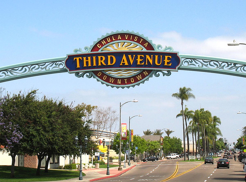
Chula Vista is home to OnStage Playhouse the only live theater in South Bay, San Diego. Other points of interest and events include the Chula Vista Nature Center,[37] the J Street Harbor,[38] the Third Avenue Village,[39] the Olympic Training Center,[40] and Knott's Soak City. Downtown Chula Vista hosts a number of cultural events, including the famous Lemon Festival, Starlight Parade, and Chula Vista Rose Festival.
Cricket Wireless Amphitheatre is a performing arts theatre that was the areas first major concert music facility. OnStage theater stages high quality productions;[35] serving as a large contributor to the cultural arts setting in Chula Vista. Knott's Soak City is a large waterpark representative of Chula Vista providing for both tourists and residents.
Media
Chula Vista is served by The Star-News (Chula Vista) and The San Diego Union-Tribune.
Transportation
Major freeways & highways
Chula Vista is served by multiple Interstates and California State Routes. Interstate 5 begins to the south of the city and runs through its western edge. Interstate 5 connects Chula Vista to North County and beyond to Greater Los Angeles and Northern California. Interstate 805 serves as a bypass to Interstate 5, linking to the latter interstate in Sorrento Valley. Interstate 905 runs from the Otay Mesa Port of Entry and is one of three auxiliary three-digit Interstate to meet an international border. State Route 54 and State Route 125 serve as highways to East County cities via north and northeastern corridors.
Education

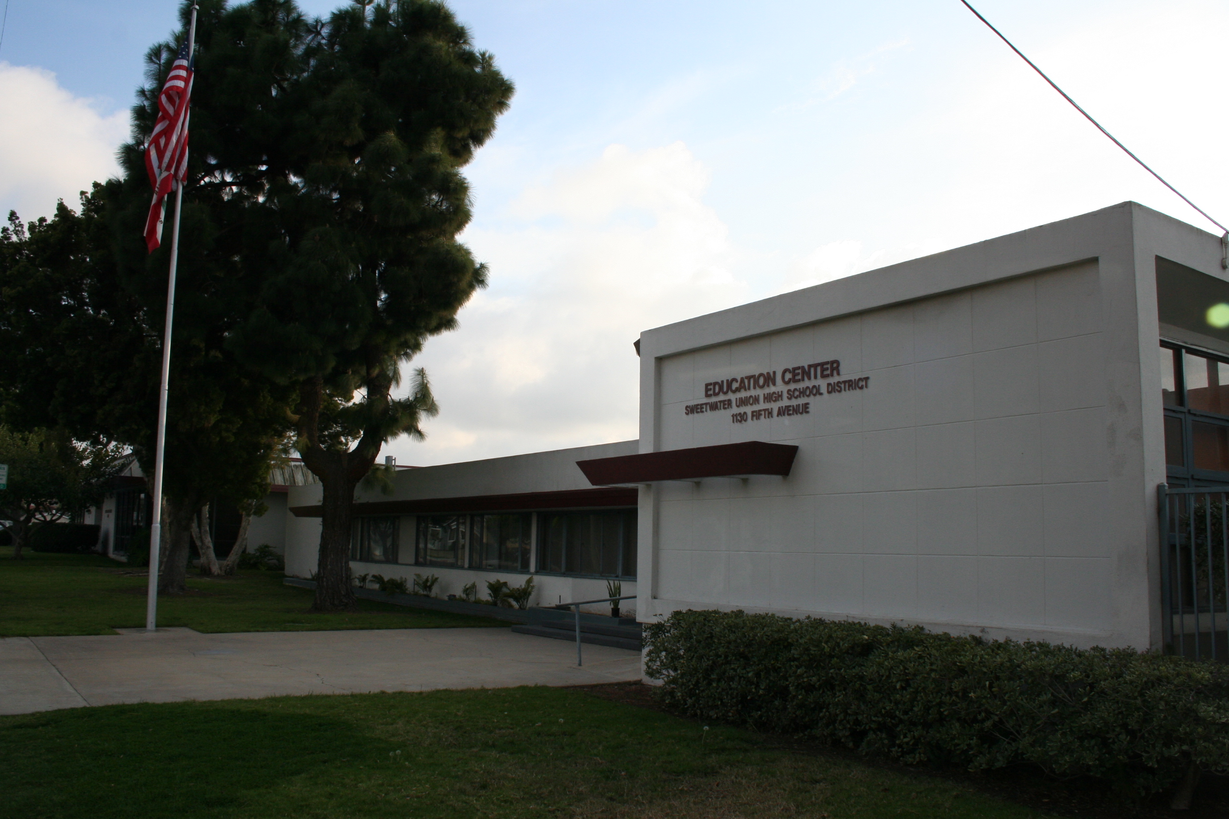
The Sweetwater Union High School District, headquartered in Chula Vista, serves as the primary secondary school district.[41] The Chula Vista Elementary School District, the largest K-6 district in the State of California with 44 campuses, serves publicly educated kindergarten through sixth grade students.[42]
Chula Vista is home to one of the four private colleges in San Diego County and is host to Southwestern College; a community college founded in 1961, that serves approximately 19,000 students annually.
Notable natives and residents
Main article: List of people from Chula Vista, CaliforniaSister cities
Chula Vista has two sister cities, as designated by Sister Cities International.[43]
City Country Year Cebu City  Philippines
Odawara  Japan
JapanGallery
-
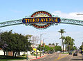
Third Avenue in Downtown Chula Vista
-
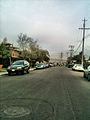
Ada Street in Chula Vista
-
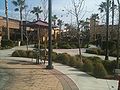
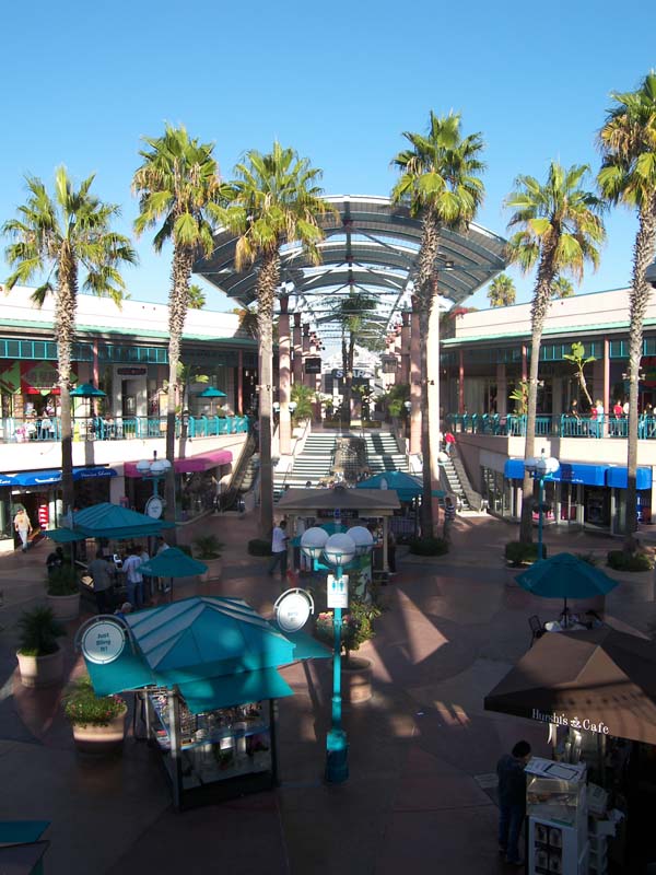
Otay Ranch Town Center Mall
-
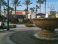
Otay Ranch Town Center Mall
-
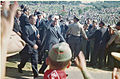
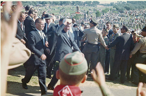
President Eisenhower visits Country Club
-
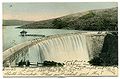
Postcard of the Sweetwater Dam
-

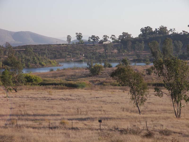
Proctor Valley in Chula Vista
-

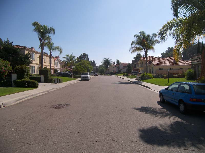
A neighborhood in eastern Chula Vista
References
- ^ "Welcome to Chula Vista, CA - City of Allure". chulavistacentennial.com. http://chulavistacentennial.com/. Retrieved 15 January 2011.
- ^ Bianca Bruno (6 October 2010). "Growing up in "Chula-juana"". The Vista. http://www.theusdvista.com/opinion-editorial/growing-up-in-chula-juana-1.1668810. Retrieved 23 January 2011.
- ^ Anne-Marie O'Connor (11 September 2002). "Cross-Border Lifestyle Requires Patience". Los Angeles Times. http://articles.latimes.com/2002/sep/11/local/me-border11/2. Retrieved 27 March 2011.
- ^ Tom Greeley (15 April 1985). "S.D. County's Cities Defy The Negatives, Accent The Positives". Los Angeles Times. http://articles.latimes.com/1985-04-15/local/me-14019_1_negative-image/2. Retrieved 27 March 2011.
- ^ U.S. Census
- ^ a b Karen Kucher (8 March 2011). "The faces of San Diego's changing demographics". San Diego Union Tribune. http://www.sduniontribune.com/news/2011/mar/08/faces-san-diegos-changing-demographics/. Retrieved 9 March 2011.
- ^ a b c d e f g h i "Brief History of Chula Vista". City of Chula Vista. City of Cula Vista. http://www.chulavistaca.gov/About/history.asp. Retrieved 27 October 2010.
- ^ Nancy Ray (26 May 1986). "Chula Vista, County's 2nd Largest City, Has Problem With Image". Los Angeles Times. http://articles.latimes.com/1986-05-26/local/me-7834_1_chula-vista. Retrieved 19 March 2011.
- ^ a b c d e f g h i j k "Chula Vista in Perspective, Chapter 3". Chula Vista General Plan. City of Chula Vista. 13 December 2005. http://www.ci.chula-vista.ca.us/city_services/development_services/planning_building/general_plan/documents/03_Perspective.pdf. Retrieved 9 March 2011.
- ^ a b Keith A. Owens (3 January 1986). "Montgomery Merging With City : Chula Vista Annexation Is Cause to Celebrate". Los Angeles Times. http://articles.latimes.com/1986-01-03/local/me-23931_1_chula-vista-official. Retrieved 19 March 2011.
- ^ Los Angeles District, Corps of Engineers. "Camp Otay". California State Military Museum. California State Military Department. http://www.militarymuseum.org/CpOtay.html. Retrieved 21 April 2011.
- ^ "Spotlight". Office of the City Manager. City of Chula Vista. 2003. http://www.ci.chula-vista.ca.us/city_services/Administrative_Services/City_Admin_Manager/Communications/spotlight/2003/2003-Holiday.pdf. Retrieved 19 March 2011.
- ^ "Horses Stampede Through Chula Vista Streets". KGTV. 24 March 2010. http://www.10news.com/news/22948374/detail.html. Retrieved 19 March 2011.
- ^ "Chula Vista Out As Possible Chargers Stadium Site". 10News.com (Internet Broadcasting Systems, Inc.). 24 June 2009. http://www.10news.com/news/19849294/detail.html. Retrieved 13 August 2009.
- ^ Zumbrun, Joshua. "America's Most Boring Cities". Forbes. http://www.forbes.com/media/2008/12/10/media-newspapers-news-biz-media-cx_jz_1210boringcities_slide.html?partner=canoe. Retrieved 2009-01-05.
- ^ "City of Chula Vista Drainage Basins". Geographic Information System. City of Chula Vista. 20 June 2009. http://www.ci.chula-vista.ca.us/City_Services/Administrative_Services/ITS/GIS/PDF/SDBasinsSM.pdf. Retrieved 19 March 2011.
- ^ "Sweetwater Marsh". U.S. Fish and Wildlife Service. United States Department of the Interior. 9 July 2010. http://www.fws.gov/sandiegorefuges/sweetwater.htm. Retrieved 19 March 2011.
- ^ "Open Space". Public Works Operations. City of Chula Vista. http://www.ci.chula-vista.ca.us/city_Services/Community_Services/Public_Works_Operations/Open_Space/default.asp. Retrieved 19 March 2011.
- ^ "Mediterranean Climate". County Television Network. County of San Diego. http://www.sdcounty.ca.gov/ctn/d2eoct03_climate.html. Retrieved 19 March 2011.
- ^ "Monthly averages for Chula Vista, California". http://www.usclimatedata.com/climate.php?location=USCA0219. Retrieved Feb 28 2009.
- ^ City of Chula Vista CAFR Retrieved 2009-08-07
- ^ "Chula Vista City Government". Office of Mayor & City Council. City of Chula Vista. http://www.chulavistaca.gov/city_Services/Mayor_Council/Default.asp. Retrieved 19 March 2011.
- ^ "Will Gerrymandered Districts Stem the Wave of Voter Unrest?". Campaign Legal Center Blog. http://www.clcblog.org/blog_item-85.html. Retrieved 2008-02-10.
- ^ "Report of Registration - State Reporting Districts". Registrar of Voters. County of San Diego. 8 March 2011. http://www.sdcounty.ca.gov/voters/Eng/reports/current_reg_report.pdf. Retrieved 11 March 2011.
- ^ a b "Chula Vista (city), California". State & County QuickFacts. U.S. Census Bureau. 8 July 20009. http://quickfacts.census.gov/qfd/states/06/0613392.html. Retrieved 9 March 2011.
- ^ a b "Detailed Tables". 1990 Census of Population and Housing. U.S. Bureau of the Census. http://factfinder.census.gov/servlet/DTTable?_bm=y&-context=dt&-ds_name=DEC_1990_STF1_&-CONTEXT=dt&-mt_name=DEC_1990_STF1_P001&-mt_name=DEC_1990_STF1_P008&-mt_name=DEC_1990_STF1_P009&-mt_name=DEC_1990_STF1_P010&-mt_name=DEC_1990_STF1_P035&-mt_name=DEC_1990_STF1_P006&-mt_name=DEC_1990_STF1_P007&-mt_name=DEC_1990_STF1_P011&-tree_id=100&-redoLog=true&-all_geo_types=N&-currentselections=DEC_1990_STF1_P006&-geo_id=16000US060525&-search_results=16000US060525&-format=&-_lang=en&-SubjectID=17477983. Retrieved 9March 2011.
- ^ a b c "Number of Inhabitants, California". 1980 Census of Population. U.S. Bureau of the Census. March 1982. http://www2.census.gov/prod2/decennial/documents/1980a_caAB-01.pdf. Retrieved 9 March 2011.
- ^ Katz, Bruce; Robert E. Lang (2003). Redefining urban and suburban America: evidence from Census 2000. Washington, D.C.: Brookings Institution Press. p. 106. ISBN 9780815748595. http://books.google.com/books?id=RhfBrybEDYAC&lpg=PA106&ots=uHTAADi_Iy&dq=1950%20population%20chula%20vista&pg=PA106#v=onepage&q=1950%20population%20chula%20vista&f=false. Retrieved 9 March 2011.
- ^ All data are derived from the United States Census Bureau reports from the 2010 United States Census, and are accessible on-line here. The data on unmarried partnerships and same-sex married couples are from the Census report DEC_10_SF1_PCT15. All other housing and population data are from Census report DEC_10_DP_DPDP1. Both reports are viewable online or downloadable in a zip file containing a comma-delimited data file. The area data, from which densities are calculated, are available on-line here. Percentage totals may not add to 100% due to rounding. The Census Bureau defines families as a household containing one or more people related to the householder by birth, opposite-sex marriage, or adoption. People living in group quarters are tabulated by the Census Bureau as neither owners nor renters. For further details, see the text files accompanying the data files containing the Census reports mentioned above.
- ^ "DP-1. Profile of General Demographic Characteristics: 2000". Census 2000. U.S. Census Bureau. http://factfinder.census.gov/servlet/QTTable?_bm=y&-qr_name=DEC_2000_SF1_U_DP1&-ds_name=DEC_2000_SF1_U&-_lang=en&-geo_id=16000US0613392. Retrieved 9 March 2011.
- ^ "General Social and Economic Characteristics". 1980 Census of Population. U.S. Bureau of the Census. July 1983. http://www2.census.gov/prod2/decennial/documents/1980a_caCs1-01.pdf. Retrieved 9 March 2011.
- ^ a b c "City of Chula Vista: Small Business". City of Chula Vista. http://www.chulavistaca.gov/City_Services/Development_Services/RedevHousing/SmallBusinesses/default.asp. Retrieved March 26, 2011.
- ^ "Shopping in Chula Vista". City of Chula Vista. http://www.chulavistaca.gov/Attraction/shopping.asp. Retrieved March 26, 2011.
- ^ "Golf Courses in Chula Vista". City of Chula Vista. http://www.chulavistaca.gov/Attraction/golf.asp. Retrieved March 26, 2011.
- ^ a b c d "Chula Vista Attractions". City of Chula Vista. http://www.chulavistaca.gov/Attraction/default.asp. Retrieved March 26, 2011.
- ^ "City of Chula Vista, California Comprehensive Annual Financial Report, for the Year ended June 30, 2010". http://www.chulavistaca.gov/City_Services/Administrative_Services/Finance/PDF/2010Reports/ChulaVista_CAFR2010_FINAL1.pdf. Retrieved Retrieved 2011-09-30.
- ^ "Nature Center". Community Services. City of Chula Vista. http://www.chulavistaca.gov/City_Services/Community_Services/Nature_Center/default.asp. Retrieved 9 November 2009.
- ^ "Chula Vista Launch Ramp". SD Boating.com. http://www.sdboating.com/chulav.htm. Retrieved 9 November 2009.
- ^ "Third Avenue Village". Third Avenue Village Association. http://www.thirdavenuevillage.com/. Retrieved 7 November 2009.
- ^ "Chula Vista Olympic Training Ctr". United States Olympic Committee. http://www.teamusa.org/pages/1375. Retrieved 9 November 2009.
- ^ "Sweetwater Union High School District". SUHSD. http://www.suhsd.k12.ca.us/. Retrieved March 30, 2010.
- ^ "Community". 2011 Membership & Resource Guide. Chula Vista Chamber of Commerce. http://www.chulavistachamber.org/PDF/CommunitySection.pdf. Retrieved 25 July 2011. "Located between the City of San Diego and United States/Mexico International Border, the Chula Vista Elementary School District is the largest K-6 district in the state"
- ^ "SCI: Sister City Directory". Sister Cities International. http://www.sister-cities.org/directory/USlistingsResults.cfm. Retrieved March 26, 2011.
External links
- Chula Vista Public Library website
- Official City of Chula Vista website
- Chula Vista Schools Location and Phone Directory
Articles Relating to Chula Vista and San Diego County San Diego metropolitan area Counties 
Global city
1.2 millionLarge cities
100k - 250kCities and towns
20k - 99kEl Cajon • Vista • San Marcos • Encinitas • La Mesa • Santee • National City • Poway • La Presa • Imperial Beach • Spring Valley • Lemon Grove • Coronado • Fallbrook • Rancho San DiegoBodies of water Regions San Diego–Tijuana History • Geography • Geology • Populace • Economy • Transportation • Education • Communication • Other Infrastructure • Culture Counties and
Municipalities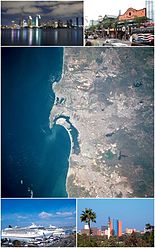
Global cities Large cities
100k - 250kCities and towns
20k - 99kCoronado • El Cajon • El Refugio • Encinitas • Fallbrook • Imperial Beach • La Joya • La Mesa • La Presa • Lemon Grove • National City • Pórticos de San Antonio • Poway • Rancho San Diego • Rosarito Beach • San Marcos • Santee • Spring Valley • Tecate • Terrazas del Valle • VistaCities and towns
10k-19kAlpine • Bonita • Bostonia • Casa de Oro-Mount Helix • Las Delicias • Ramona • Rancho San Diego • San Diego Country Esates • Solana Beach • Villa del Campo • Villa del Prado • Winter GardensBodies of water Agua Hedionda Lagoon • Batiquitos Lagoon • El Capitan Lake • Abelardo L. Rodriguez • Lake Hodges • Lake Sutherland • Lower Otay Reservoir • Loveland Reservoir • Mission Bay • Pacific Ocean • San Elijo Lagoon • San Diego Bay • San Vicente Reservoir • Sweetwater Reservoir • Tijuana River EstuarySub-regions Anza Borrego • Coronado Peninsula • Cuyamaca • East County • Mountain Empire • North County • Palm Valley • Rosarito • San Diego • South Bay • Tecate • TijuanaCategory · Images · Portal Southern Border Region Counties 
Global City
1.2 millionMajor Cities
100k-200kCities and towns
25k-100kEl Cajon • El Centro • Encinitas • Calexico • Fallbrook • Imperial Beach • La Mesa • La Presa • National City • Poway • San Marcos • Santee • Spring Valley • VistaCities and towns
under 25kAlpine • Bombay Beach • Bonita • Bostonia • Brawley • Casa de Oro-Mount Helix • Calipatria • Coronado • Desert Shores • Heber • Holtville • Imperial • Lakeside • Lemon Grove • Niland • Ocotillo • Palo Verde • Ramona • Rancho San Diego • Salton City • Salton Sea Beach • Seeley • Solana Beach • Westmorland • Winter Gardens • WinterhavenBodies of water Alamo River • Colorado River • Mission Bay • New River • Salton Sea • San Diego Bay • San Diego River • San Luis Rey River • Santa Margarita River • Sweetwater River • Tijuana RiverLandforms Regions North County • Borrego • South Bay • East County • San Diego • Imperial Valley • Southern Border RegionMayors of cities with populations exceeding 100,000 in California - Antonio Villaraigosa
(Los Angeles) - Jerry Sanders
(San Diego) - Chuck Reed
(San Jose) - Edwin M. Lee
(San Francisco) - Ashley Swearengin
(Fresno) - Kevin Johnson
(Sacramento) - Bob Foster
(Long Beach) - Jean Quan
(Oakland) - Harvey Hall
(Bakersfield) - Tom Tait
(Anaheim) - Miguel A. Pulido
(Santa Ana)
- Ronald O. Loveridge
(Riverside) - Ann Johnston
(Stockton) - Cheryl Cox
(Chula Vista) - Bob Wasserman
(Fremont) - Sukhee Kang
(Irvine) - Pat Morris
(San Bernardino) - Jim Ridenour
(Modesto) - Thomas E. Holden
(Oxnard) - Acquanetta Warren
(Fontana) - William H. Batey II
(Moreno Valley)^ - John Drayman
(Glendale)
- Cathy Green
(Huntington Beach)^ - Bob Kellar
(Santa Clarita)^ - William Dalton
(Garden Grove) - Susan Gorin
(Santa Rosa)^ - Jim Wood
(Oceanside) - Donald Kurth
(Rancho Cucamonga) - Paul S. Leon
(Ontario) - R. Rex Parris
(Lancaster) - Pat Hume
(Elk Grove) - James C. Ledford Jr.
(Palmdale) - Stan Skipworth
(Corona)^
- Dennis Donohue
(Salinas) - Elliot Rothman
(Pomona) - Frank Scotto
(Torrance) - Michael Sweeney
(Hayward) - Sam Abed
(Escondido) - Tony Spitaleri
(Sunnyvale) - Bill Bogaard
(Pasadena) - Carolyn Cavecche
(Orange) - F. Richard Jones
(Fullerton)^ - Jacqui Irwin
(Thousand Oaks)^ - Jesus Gamboa
(Visalia)
- Paul Miller
(Simi Valley) - William D. Shinn
(Concord)^ - Gina Garbolino
(Roseville) - Jamie L. Matthews
(Santa Clara) - Osby Davis
(Vallejo) - Rudy Cabriales
(Victorville) - Ernest Gutierrez
(El Monte) - Tom Bates
(Berkeley) - Rick Trejo
(Downey)^ - Eric R. Bever
(Costa Mesa)^ - James T. Butts, Jr.
(Inglewood)

^Mayor selected from city council
Other states: AL • AK • AZ • AR • CA • CO • CT • DE • FL • GA • HI • ID • IL • IN • IA • KS • KY • LA • ME • MD • MA • MI • MN • MS • MO • MT • NE • NV • NH • NJ • NM • NY • NC • ND • OH • OK • OR • PA • RI • SC • SD • TN • TX • UT • VT • VA • WA • WV • WI • WYCategories:- San Diego metropolitan area
- Cities in Southern California
- 1887 establishments in the United States
- Populated places established in 1887
- Cities in San Diego County, California
- Incorporated cities and towns in California
- Populated places in California with Hispanic majority populations
-


Wikimedia Foundation. 2010.