- Interstate 5 in California
Infobox road
state=CA
type=I
route=5
alternate_name=San Diego Freeway,Santa Ana Freeway ,Golden State Freeway , West Side Freeway
section=305
maint=Caltrans 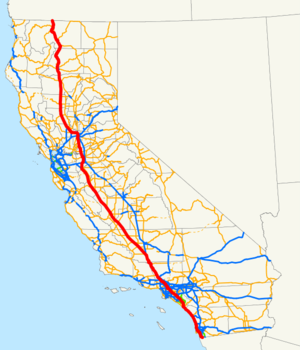
length_mi=796.432
length_ref=
length_round=3
established=August 7 ,1947 by FHWA [http://cahighways.org/itypes.html California Highways: Interstate Highway Types and the History of California's Interstates] ]July 1 ,1964 byCaltrans [http://cahighways.org/009-016.html#010 California Highways: Interstate 10] ]
direction_a=South
terminus_a=Mexican border atTijuana
junction=jct|state=CA|I|8 in San Diego jct|state=CA|I|10 in Los Angeles jct|state=CA|SR|99 near Bakersfield jct|state=CA|I|580 near Tracy jct|state=CA|I|80 in Sacramento jct|state=CA|SR|299 in Redding
direction_b=North
terminus_b=jct|state=OR|I|5 atOregon state line
previous_type=SR
previous_route=4
next_type=US
next_route=6
commons=categoryIn theU.S. state ofCalifornia ,Interstate 5 , a major north-south route of theInterstate Highway System , has its southern terminus at theUnited States-Mexico border at the San Ysidro crossing. It heads north across the length ofCalifornia before it crosses intoOregon south of the Medford-Ashland metropolitan area.This highway links the major California cities of San Diego, Los Angeles, Sacramento, and Redding. Among the major cities not directly linked by Interstate 5 is
San Francisco , which is about 80 miles (130 km) west of the highway.This route is part of the
California Freeway and Expressway System [http://www.leginfo.ca.gov/cgi-bin/displaycode?section=shc&group=00001-01000&file=250-257 CA Codes (shc:250-257)] ] and is eligible for the State Scenic Highway System [http://www.leginfo.ca.gov/cgi-bin/displaycode?section=shc&group=00001-01000&file=260-284 CA Codes (shc:260-284)] ] .Route description
outhern California
Interstate 5 starts at the
United States-Mexico border at the San Ysidro border crossing, one of the busiest in the world. [ [http://www.interstate-guide.com/i-005.html Busiest border crossing] ] Interstate 5 meetsMexican Federal Highway 1 at the border withBaja California , and this highway is the toll road fromTijuana toEnsenada . Interstate 805 begins here, bypassing the bulk of the San Diego metropolitan area..
At Dana Point, I-5 turns inland and heads due north through Mission Viejo to the
El Toro Y interchange in southeastern Irvine. From that point, Interstate 405 takes over the San Diego Freeway designation, while I-5 becomes theSanta Ana Freeway as it runs southeast to northwest, passing through major cities and suburbs in Orange and Southern Los Angeles counties.When the freeway reaches the
East Los Angeles Interchange one mile (1.6 km) east of downtown Los Angeles, I-5 becomes theGolden State Freeway . The route continues through theSan Fernando Valley and then crosses theNewhall Pass through theSanta Susana Mountains into theSanta Clarita Valley . From there, the Golden State Freeway sharply rises to the north through the Grapevine to eventually cross theTejon Pass through theTehachapi Mountains withPath 26 power lines generally paralleling the freeway. The freeway then sharply descends for 12 miles (19 km) from over 4,100 feet (1,250 m) at Tejon Pass to around 1,600 feet (488 m) at Grapevine near the southernmost point of theSan Joaquin Valley , approximately 30 miles (50 km) south of Bakersfield and 4 miles (6 km) south from where State Route 99 splits away from it in Wheeler Ridge.Central and Northern California
From Highway 99 to south of Tracy, I-5 parallels Highway 33, skirting along the far more remote western edge of the great Central Valley, and thus here is removed from population centers such as Bakersfield and Fresno with other state highways providing connections. For most of this section, the
Path 15 electrical transmission corridor follows the highway, forming an infrastructure corridor along with theCalifornia Aqueduct .Interstate 580 splits off from I-5 at a point south of Tracy, providing a loop-route connection to the
San Francisco Bay Area . After passing Tracy, I-5 heads due north through Stockton and Sacramento before turning due west to Woodland. At Woodland, the interstate heads northwest again towards Dunnigan, where it converges with Interstate 505.From Dunnigan, I-5 skirts north along the western edge of the
Sacramento Valley to Red Bluff. I-5 then enters theShasta Cascade region, passing through Redding andShasta Lake before climbing up to near the foot ofMount Shasta . The interstate then travels to Weed and Yreka before reaching the Oregon border.History
Historical naming in California
The portion of this highway from
Los Angeles , toSan Diego , was also co-signed as U.S. Route 101 until late 1964.The portion of this highway from Lebec to Red Bluff roughly follows old US 99W.
In
California , the former western branch of Interstate 5 (the northern end of the spur into the Bay Area) connecting Interstate 80 out of Vacaville to near Dunnigan, previously known as Interstate 5W, was renamed Interstate 505. Interstate 580 running between I-5 and I-80 was also once designated 5W; what is now I-5 (the stretch that runs through Sacramento) had been originally designated Interstate 5E.October 12, 2007 tunnel fire
In the evening of
October 12 ,2007 , two trucks collided in the southbound tunnel that takes thetruck bypass roadway under the main lanes near theNewhall Pass interchange . Fifteen trucks caught fire, killing three people and injuring 10. [ [http://cbs2.com/local/local_story_286115312.html cbs2.com - I-5 Closure May Last Until Tuesday ] ] [ [http://www.cnn.com/2007/US/10/13/tunnel.fire/index.html Investigators advance into tunnel after deadly inferno - CNN.com ] ]'Boat Section' repair
Repair of the "Boat Section" in Sacramento began in May 2008. The construction was to take 40 days to complete and would require complete northbound and southbound closures on an alternating schedule. This section had major problems since being built, including being flooded in convert|15|ft|m of water in 1980.
Exit list
:"Note: Except where prefixed with a letter,
postmile s were measured in 1964, based on the alignment as it existed at that time, and do not necessarily reflect current mileage. The numbers reset at county lines; the start and end postmiles in each county are given in the county column."Business routes
National City loop
ibus
banner=Loop
route=5
location=National City, California
active=1960s-1990sBusiness Loop 5 was a
business route of I-5 in San Ysidro, National City, and Chula Vista,California . Business Loop 5 followed the original routing of U.S. Route 101 along Beyer Boulevard, Broadway, Harbor Drive, and Pacific Highway. The route terminated at I-5 at both ends.The designation was assigned in the 1960s and removed in the 1990s.
an Diego loop
ibus
banner=Loop
route=5
location=San Diego, California
active=Unknown-2000sBusiness Loop 5 was a
business route of I-5 in San Diego,California . Business Loop 5 followed the original routing of U.S. Route 101 along Mission Bay Drive and terminated at I-5 at both ends. The designation was removed in late2004 and early2005 ; however, a lone sign still stands on southbound I-5 promoting the route.References
External links
* [http://www.scvhistory.com/scvhistory/ridge.htm History of the Northern Los Angeles County section of Interstate 5] (Photos, text, TV shows)

Wikimedia Foundation. 2010.