- Interstate 10 in California
-
This article is about the section of Interstate 10 in California. For the entire length of the highway, see Interstate 10.
Interstate 10
Route information Defined by S&HC § 310 Maintained by Caltrans Length: 241.595 mi[3] (388.809 km)
I-10 is broken into pieces, and the length does not reflect the I-5 overlap that would be required to make the route continuous.Existed: August 7, 1947 by FHWA[1]
July 1, 1964 by Caltrans[2] – presentMajor junctions West end:  SR 1 in Santa Monica
 I-405 in Los Angeles
 I-110 in Los Angeles


 I-5 / US 101 / SR 60 in Los Angeles
 I-710 in Monterey Park
 I-605 in Baldwin Park
 I-15 in Ontario
 I-215 in Colton
 US 95 in Blythe
East end: 
 I-10 / US 95 at Arizona state line
Highway system Main route of the Interstate Highway System
Main • Auxiliary • BusinessState highways in California(list • pre-1964)
History • Unconstructed • Deleted • Freeway • Scenic←  SR 9
SR 9SR 12  →
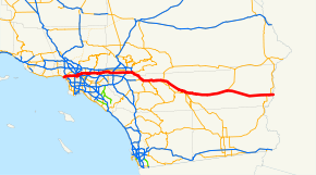
→Interstate 10 (I-10), the major east–west Interstate Highway in the Southern United States, runs in the U.S. state of California east from Santa Monica, on the Pacific Ocean, through Los Angeles and San Bernardino to the border with Arizona. In the greater Los Angeles area, it is known as the Santa Monica Freeway and the San Bernardino Freeway, linked by a short concurrency on Interstate 5 (the Golden State Freeway) at the East Los Angeles Interchange. At the East LA Interchange, a short piece of the San Bernardino Freeway west of I-5 is part of the legislative definition of Route 10, but does not carry Interstate 10.[clarification needed] This section of freeway, once a short Interstate 110 until 1968, is signed for I-10 eastbound and for U.S. Route 101 (its terminus, at the Santa Ana Freeway) westbound.
Contents
Route description
I-10 is part of the California Freeway and Expressway System and is eligible for the State Scenic Highway System.[4][5] However, it is not actually a scenic highway as designated by Caltrans.[6] The Santa Monica Freeway is Route 10 from Route 1 to Route 5, as named by the State Highway Commission on April 25, 1957.[7] The section between the Harbor and San Diego freeways is also signed as the Rosa Parks Freeway. This freeway is signed as the Christopher Columbus Transcontinental Highway in Santa Monica.
The Rosa Parks Freeway is Route 10 from Route 110 to Route 405, as named by Assembly Concurrent Resolution 134, Chapter 2 in 2002.[8]
Santa Monica Freeway
The Santa Monica Freeway is the westernmost segment of Interstate 10, beginning at the western terminus of I-10 at the Pacific Coast Highway in Santa Monica, California and ending southeast of downtown Los Angeles at the East Los Angeles Interchange.
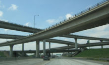
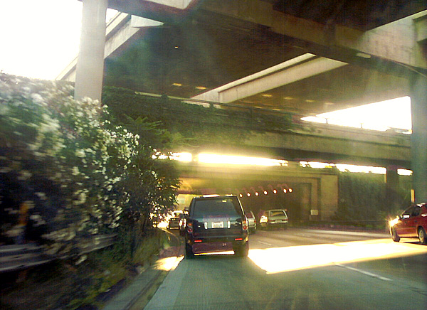
 The Santa Monica Freeway interchange with the Harbor Freeway, as seen by traffic going westbound on the Santa Monica
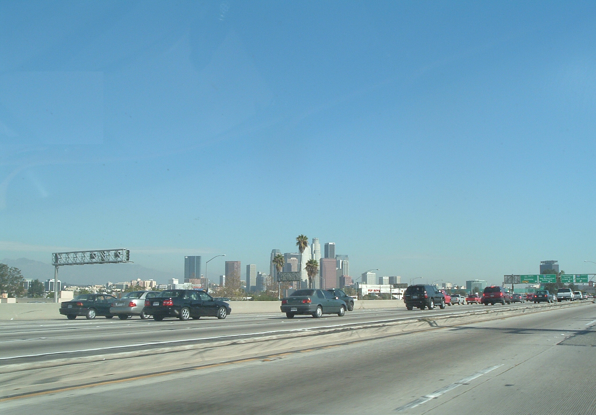
 Downtown Los Angeles skyline as seen from the freeway. A slight (smaller than usual rush hour) traffic jam is ahead.
Interstate 10 begins in the city of Santa Monica when State Route 1 turns into a freeway and heads east. SR 1 exits onto Lincoln Boulevard and heads south while I-10 continues east. Soon after it enters the city of Los Angeles, I-10 has a four-level interchange with Interstate 405. Interstate 10 then continues through Jefferson Park into downtown Los Angeles. On the western edge of downtown, I-10 has an interchange with Interstate 110 to the south and State Route 110 to the north. I-10 then travels along the southern edge of downtown to the East Los Angeles Interchange.[9][10]
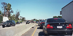 A typical traffic jam on the Santa Monica Freeway, at 2:30 p.m. on a Wednesday afternoon
At the East Los Angeles Interchange, State Route 60 diverges east towards Riverside and Pomona. I-10 then turns north, running concurrently with Interstate 5 for a few miles. Then, Interstate 10 heads east and merges with the traffic from the spur to US 101 onto the San Bernardino Freeway.[9][10]
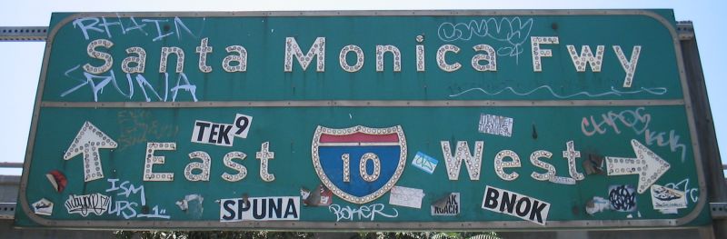
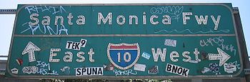 Historic, heavily-vandalized button copy sign marking an entrance to the Santa Monica Freeway.
The freeway is 14 lanes wide (two local, five express in each direction) from the Harbor Freeway (Interstate 110) interchange to the Arlington Avenue off-ramp, Most of these lanes are full at peak travel times (even on Saturdays). The remainder of the freeway varies between eight and 10 lanes in width. The whole freeway (much smaller than) was opened in 1964[citation needed].
While the construction of the Century Freeway several miles to the south reduced traffic congestion to a considerable amount by creating an alternate route from downtown to the Los Angeles International Airport, the Santa Monica Freeway is still one of the busiest freeways in the world. All three freeway-to-freeway interchanges along its length are notorious for their congestion, and they are routinely ranked among the top 10 most congested spots in the United States[citation needed].
Due to the high traffic volume, car accidents are so common that Caltrans has constructed special Accident Investigation Sites separated from the freeway by fences. These enable the California Highway Patrol to quickly clear accidents from the through traffic lanes, and the fences reduce congestion by preventing rubbernecking (where cars slow so their occupants may watch the accident investigation)[citation needed].
Spur to US 101
The legislative definition of Route 10 includes a spur from Interstate 5 (the Golden State Freeway) west to U.S. Route 101 (the Santa Ana Freeway) near downtown Los Angeles. This section of roadway, the westernmost part of the San Bernardino Freeway, was part of the original San Benardino Freeway, carrying U.S. Route 60, U.S. Route 70 and U.S. Route 99 long before the Golden State Freeway opened. It was added to the Interstate Highway System by 1958 as Interstate 110, but in 1968 it was removed from the system, becoming a Route 10 spur.
This road is signed only for the roads it feeds into — US 101 North westbound and I-10 East eastbound. It has no interchanges except its ends, although there is a westbound exit off of the spur at Mission Rd. immediately before merging with U.S. Route 101. The exit numbers for I-10 is to follow the signed route of I-10 West along with I-5 South, but one exit on Route 10 - the eastbound for State Street and Soto Street before it merges onto I-10 Eastbound — is numbered (as exit 19).[11]
There is no access from this spur eastbound to I-5 Northbound or from I-5 Southbound to the westbound spur.[10]
San Bernardino Freeway
 The San Bernardino Freeway near the interchange with the Ontario Freeway (I-15)
Interstate 10 heads east from Los Angeles, with two HOV lanes paralleling it on the north side called the El Monte Busway. These roadways extend to Alameda Street on US 101, following the spur west to where I-10 passes California State University Los Angeles. However, after the Interstate 710 interchange, these lanes merge back into the typical left lanes of each roadway.
East of Interstate 710, I-10 continues through Monterey Park, Alhambra, Rosemead, San Gabriel, El Monte, and Baldwin Park before intersecting with Interstate 605. It then travels through West Covina and Covina before heading up Kellogg Hill into San Dimas, where I-10 intersects with State Route 57 (formerly part of Interstate 210) and State Route 71. I-10 then heads east through Pomona and Claremont into San Bernardino County.[9][10]
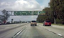
 Interchange with the Ontario Freeway (I-15) as seen by west-bound traffic on the San Bernardino Freeway.
In San Bernardino County, Interstate 10 travels through Montclair, Upland, and Ontario, providing access to Ontario International Airport. I-10 then has a four-level interchange with Interstate 15 before traveling through Fontana, Rialto, and Colton. I-10 then intersects with Interstate 215 before briefly entering San Bernardino city proper and traveling through Loma Linda and Redlands. In Redlands, I-10 intersects with the State Route 210 freeway (future Interstate 210) and with State Route 38 before entering Yucaipa and eventually Riverside County.[9][12]
Riverside County

In Riverside County, I-10 goes through Calimesa before entering Beaumont and merging with the eastern end of State Route 60 (itself formerly the California segment of US 60). In Banning, I-10 has a diamond intersection with State Route 243 before passing through San Gorgonio Pass between the San Bernardino Mountains and the San Jacinto Mountains and entering Palm Springs. I-10 intersects with the western end of State Route 111, whereas I-10 bypasses the town and connects to State Route 62, a major east–west route through the Mojave Desert. I-10 cuts through Cathedral City and passes just outside the city limits of Rancho Mirage, Palm Desert, and Indian Wells before entering Indio and running concurrently with State Route 111. I-10 then has an interchange in Coachella with the northern end of the State Route 86S freeway, which also carries the routing of SR-111. Past Coachella, I-10 traverses the Mojave Desert, with few junctions and no cities. Several miles east and roughly halfway between Indio and Blythe, in the community of Desert Center, I-10 intersects with State Route 177, a turnoff that connects to SR-62. Near the Arizona state line, I-10 meets the terminus of State Route 78. In the city of Blythe, I-10 runs concurrently with U.S. Route 95 as both routes cross the Colorado River into Arizona.[9][12]
I-10 westbound is usually signed as towards San Bernardino and/or Los Angeles in the Mojave Desert. Eastbound, in the San Gorgonio Pass, the signage indicates "Indio, Other Desert Cities", and indicates "Blythe" after Indio — the first sign for Phoenix does not occur until after the SR 86S exit in Coachella.[citation needed]
History
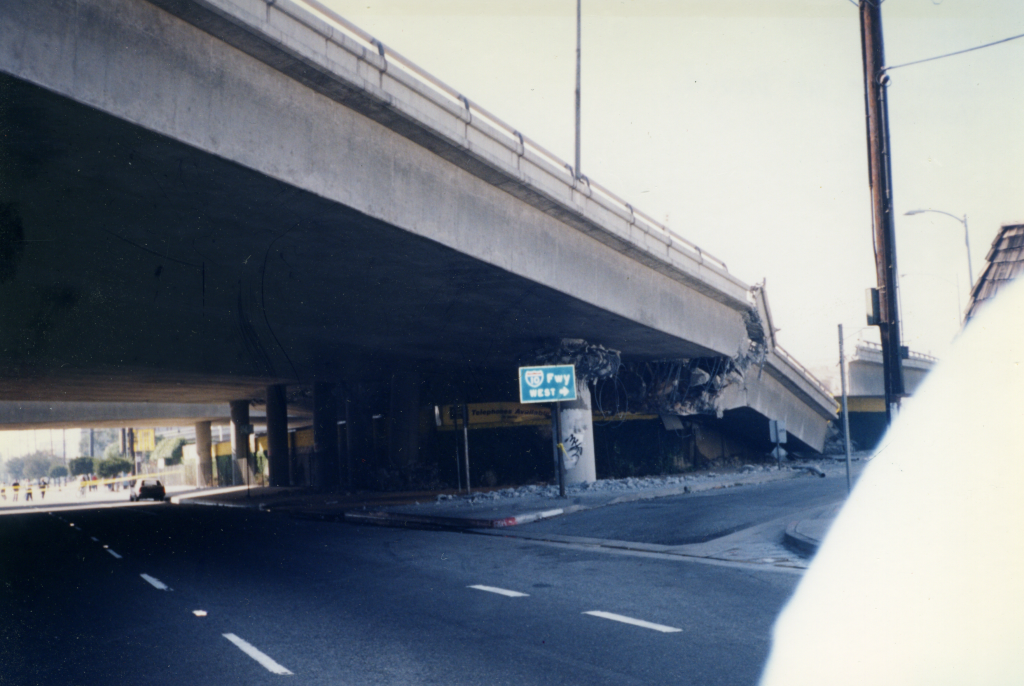
 Interstate 10 after the 1994 collapse.
What is now Interstate 10 east of Los Angeles was generally part of the Atlantic and Pacific Highway, one of many transcontinental national auto trails. By 1926, when the United States Numbered Highways were assigned, the road across the desert east of Indio was unimproved, while the road from Indio west to San Bernardino (as well as various roads west to Los Angeles) was paved.[13] In late 1926, U.S. Route 99 was designated along the section of road from San Bernardino to Indio, where it turned south along present State Route 86 on the west side of the Salton Sea.[14] West of San Bernardino, US 99 ran to Los Angeles concurrent with U.S. Route 66 (via Pasadena) before turning north; this route to Los Angeles is north of the later alignment of Interstate 10.[15] The piece of this between San Bernardino and Indio was defined in 1915 as Legislative Route 26. (It continued south from Indio via El Centro to Heber; see U.S. Route 99 and State Route 86 for details. A 1931 extension took it south to Calexico on present State Route 111.)[16]
The route from Indio via Mecca to the Arizona state line near Blythe was defined in 1919 as pre-1964 Legislative Route 64. (Later extensions took LR 64 west along present State Route 74; a 1931 cutoff bypassed Mecca to the north.) LR 26 was extended west from San Bernardino to Los Angeles in 1931, running along an alignment south of the existing US 66/US 99.[16] Neither of these was a signed route until ca. 1932, when U.S. Route 60 was extended west from Arizona to Los Angeles, running along LR 64 to Indio, LR 26 (with US 99) to Beaumont, pre-1964 Legislative Route 19 to Pomona, and LR 26 to Los Angeles. (The original alignment of LR 26 ran roughly where State Route 60 now is west of Pomona, but an alignment close to present I-10 opened ca. 1934.[17][18]
Thus, in 1931, what is now I-10 east of Los Angeles had been defined as LR 26 from Los Angeles to Indio and LR 64 from Indio to Arizona. It was signed as US 99 from San Bernardino to Indio, and US 60 came along ca. 1932 from Los Angeles to Pomona and from Beaumont to Arizona. U.S. Route 70 was extended west from Arizona ca. 1936 along the whole route to Los Angeles,[17] and, between 1933 and 1942,[19] US 99 moved from US 66 to present I-10 between San Bernardino and Los Angeles, forming a three-way concurrency between Pomona and Los Angeles. Old alignments and names include Valley Boulevard, Ramona Boulevard and Garvey Avenue.
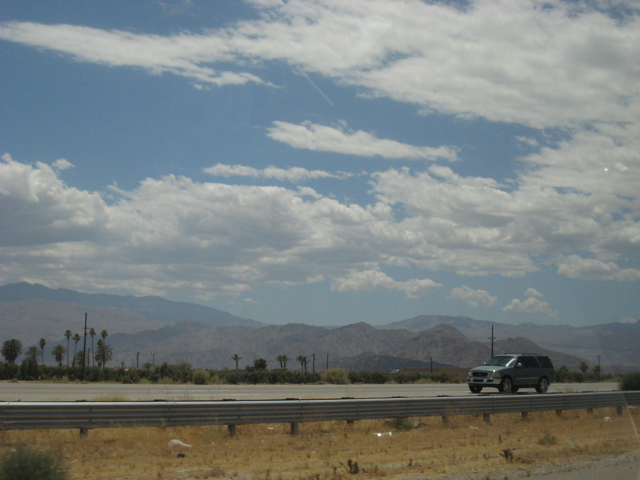
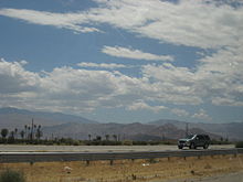 Interstate 10 eastbound near Indio
The route east from Los Angeles was added to the Interstate Highway System on August 7, 1947. It was assigned the I-10 number on August 14, 1957, and the short piece west of I-5 was approved as I-110 on November 10, 1958.[1] By then, most if not all of the San Bernardino Freeway had been completed, and I-10 was signed along the existing freeway along with US 70, US 99, and part of US 60. Those three routes were all removed in the 1964 renumbering, leaving only I-10.
The part west of downtown Los Angeles was pre-1964 Legislative Route 173, defined in 1933 from Santa Monica to downtown Los Angeles.[20] It was signed as State Route 26 by 1942, running along Olympic Boulevard.[19] It was later replaced by the Santa Monica Freeway, and added to the Interstate Highway System on September 15, 1955. It too was assigned the I-10 number on August 14, 1957.[1] It was completed ca. 1964,[21] and became Route 10 in the 1964 renumbering.
Portions of the Santa Monica Freeway going over La Cienega Boulevard collapsed after the Northridge earthquake on January 17, 1994, and were rebuilt using new Seismic-Resistant bridge designs.[22]
Juan Bautista de Anza National Historic Trail
The U.S. I-10 Highway is part of the auto tour route of the Juan Bautista de Anza National Historic Trail, a National Park Service unit in the United States National Historic Trail and National Millennium Trail programs. A Brochure Map for driving and detailed Anza Maps by County, with a Historical destinations-events Guide, an Anza Trail Guide for hiking , and the official NPS: Juan Bautista de Anza National Historic Trail website are all available for information.[23]
In 2005, Caltrans began posting signs on roads that overlap with the historic 1776 Juan Bautista de Anza trail route, so that California drivers can now follow the trail.
Future
With the increasing high traffic volume between Los Angeles and the San Bernardino, Caltrans has a few projects on the books to relieve the traffic congestion. A plan to add high-occupancy vehicle lanes between Ontario and Redlands, and a project to widen I-10 from Yucaipa to Redlands (which has been completed), are both being funded in part by San Bernardino County's Measure I, which established a half-cent transportation sales tax.[24]
Exit list
Note: Except where prefixed with a letter, postmiles were measured on the road as it was in 1964, and do not necessarily reflect current mileage. The numbers reset at county lines; the start and end postmiles in each county are given in the county column.
County Location Postmile
[3][25][26]Exit[27] Destinations Notes Los Angeles
LA R2.16–48.27Santa Monica 35.18[a] SR 1 north (Pacific Coast Highway) – OxnardR34.89[a] 1A 4th Street, 5th Street Westbound exit and eastbound entrance R34.58[a]
R2.161B  SR 1 south (Lincoln Boulevard) to SR 2 east
Signed as exit 1B westbound R3.07 1C 20th Street Eastbound exit and westbound entrance R3.34 2A Cloverfield Boulevard Westbound exit and eastbound entrance R4.24 2B Centinela Avenue Los Angeles R4.46–
R4.512C Bundy Drive Westbound exit and eastbound entrance; signed as exits 2B (south) and 2C (north) R5.27–
R5.453 I-405 (San Diego Freeway) – Sacramento, LAX Airport, Long BeachSigned as exits 3A (north) and 3B (south); former SR 7 R6.40 4 National Boulevard, Overland Avenue Signed as just "Overland Avenue" westbound R7.21 5 National Boulevard Westbound exit and eastbound entrance R7.92 6 Robertson Boulevard – Culver City R8.97 7A La Cienega Boulevard, Venice Boulevard (SR 187 west) R9.16 7B Fairfax Avenue, Washington Boulevard R10.43 8 La Brea Avenue R11.39 9 Crenshaw Boulevard R12.32 10 Arlington Avenue R12.82 11 Western Avenue R13.30 11 Normandie Avenue R13.80 12 Vermont Avenue 14.25 12 Hoover Street 14.84–
14.8913  I-110 south (Harbor Freeway) / SR 110 north (Harbor Freeway) / Pico Boulevard – San Pedro, Pasadena, Downtown Los Angeles
Signed as exits 13A (south) and 13B (north) eastbound 13C Grand Avenue No westbound exit 15.80 14A Los Angeles Street – Convention Center Westbound exit and eastbound entrance 15.80 14B Maple Avenue Eastbound exit and westbound entrance 16.38 15A San Pedro Street No westbound entrance 16.71 15B Central Avenue 17.35 15C Alameda Street 17.71 16A Mateo Street, Santa Fe Avenue 18.39
16.90[b]16B I-5 south (Santa Ana Freeway) / SR 60 east (Pomona Freeway) – Santa Ana, PomonaWest end of I–5 overlap; no exit number westbound 16.23 17 Boyle Avenue Eastbound exit only 17.56[b] 135A Fourth Street 18.06[b] 135B Cesar Chavez Avenue Eastbound exit and westbound entrance 18.45[b]
18.3919B I-5 north (Golden State Freeway) – SacramentoEast end of I–5 overlap; no exit number eastbound 18.39 19B US 101 north (Santa Ana Freeway via San Bernardino Freeway) – Los Angeles, HollywoodWestbound exit and eastbound entrance 18.52 19A State Street No eastbound exit 19.07 19C Soto Street Signed as exit 19 eastbound 20.22 20A City Terrace Drive Eastbound exit and westbound entrance 20.85 20B Eastern Avenue Westbound exit is part of exit 21; serves CSU Los Angeles Monterey Park 21.38 21 I-710 (Long Beach Freeway) / Valley Boulevard – Long BeachAlhambra 22.31 22 Fremont Avenue – South Pasadena 23.33 23A Atlantic Boulevard – Monterey Park 23.99 23B Garfield Avenue – Alhambra Rosemead,
San Gabriel24.83 24 New Avenue – Monterey Park 25.33 25A Del Mar Avenue – San Gabriel 25.84 25B San Gabriel Boulevard Rosemead 26.34 26A Walnut Grove Avenue El Monte,
Rosemead26.86 26B  SR 19 (Rosemead Boulevard) – Pasadena
27.96 27 Baldwin Avenue, Temple City Boulevard – Rosemead El Monte 28.67 28 Santa Anita Avenue – El Monte 29.50–
29.5529 Peck Road, Valley Boulevard Signed as exits 29A (Peck Road south) and 29B (Peck Road north, Valley Boulevard) 29.83 29C Peck Road north Westbound exit and eastbound entrance 30.58 30 Garvey Avenue, Durfee Avenue Westbound exit and eastbound entrance Baldwin Park 31.15–
31.2031A I-605 (San Gabriel River Freeway)Signed as exits 31A (south) and 31B (north) eastbound 31.54 31C Frazier Street Signed as exit 31C eastbound; no eastbound entrance 32.22 32A Baldwin Park Boulevard – Baldwin Park 32.66 32B Francisquito Avenue – La Puente No eastbound entrance 33.35 33 Puente Avenue – Industry West Covina 34.46 34A Pacific Avenue, West Covina Parkway Signed as exit 34 eastbound 34.85 34B Sunset Avenue – West Covina Westbound exit only 35.39 35 Vincent Avenue, Glendora Avenue 36.50 36  SR 39 (Azusa Avenue, CR N8 south)
37.48 37A Citrus Street – Covina 38.01 37B Barranca Street 38.51 38A Grand Avenue 39.00 38B Holt Avenue 40.46 40 Via Verde 42.02 41 Kellogg Drive No eastbound entrance; serves Cal Poly Pomona Pomona,
San Dimas42.44 42A 
 SR 57 (Orange Freeway) to I-210 – Santa Ana
Signed as exit 42 westbound; SR 57 north was former I–210 west 42.68 42B  SR 71 south (Chino Valley Freeway, I–10 Bus. east) / Campus Drive – Corona
Westbound exit is via exit 44 Pomona 43.66 43 Westbound exit is part of exit 44; serves Los Angeles County Fair 44.19 44 Dudley Street 45.28 45A White Avenue Westbound exit is via exit 45 45.73 45B Garey Avenue, Orange Grove Avenue – Pomona Signed as exit 45 westbound 46.41 46 Towne Avenue Claremont 47.74 47 Indian Hill Boulevard – Claremont San Bernardino Montclair 0.68 48 Monte Vista Avenue 1.23 49 Central Avenue Ontario,
Upland2.37 50 Mountain Avenue – Mount Baldy 3.47 51  SR 83 (Euclid Avenue) – Ontario, Upland
Ontario 5.24 53 4th Street 6.10 54 Vineyard Avenue 6.80 55A Holt Boulevard (I–10 Bus. west) West end of I–10 Bus. overlap; eastbound exit is via exit 54 7.16 55B Archibald Avenue – Ontario Airport Signed as exit 55 eastbound 8.17 56 Haven Avenue 9.18 57 Milliken Avenue 9.94 58 I-15 (Ontario Freeway) – Corona, San Diego, Barstow, Las VegasSigned as exits 58A (north) and 58B (south) eastbound 11.13 59 Etiwanda Avenue, Valley Boulevard (I–10 Bus. east) East end of I–10 Bus. overlap Fontana 13.17 61 Cherry Avenue 15.18 63 Citrus Avenue 16.22 64 Sierra Avenue – Fontana Bloomington R18.49 66 Cedar Avenue – Bloomington Rialto 19.97 68 Riverside Avenue – Rialto Colton 20.97 69 Pepper Avenue R21.96 70A Rancho Avenue R22.62 70B 9th Street – Downtown Colton R23.25 71 Mt. Vernon Avenue, Valley Boulevard (I–10 Bus. west), Sperry Drive R24.24 72 I-215 (Riverside Freeway, San Bernardino Freeway) – San Bernardino, Barstow, RiversideFormer I–15E / US 91 / US 395 San Bernardino 25.26 73 Waterman Avenue Signed as exits 73A (south) and 73B (north) eastbound Loma Linda 26.27 74 Tippecanoe Avenue, Anderson Street – San Bernardino International Airport 27.30 75 Mountain View Avenue – Bryn Mawr Redlands 28.30 76 California Street 29.31 77A Alabama Street 29.63 77B 
 SR 210 west (Foothill Freeway) to SR 330 north – Pasadena, Running Springs
Former SR 30 west 29.79 77C Tennessee Street 30.90 79  SR 38 (Orange Street) / 6th Street – Downtown Redlands
31.87 80 University Street Eastbound exit and westbound entrance 32.11 80 Cypress Avenue Westbound exit and eastbound entrance 33.13–
33.2981 Ford Street, Redlands Boulevard Yucaipa 34.29 82 Wabash Avenue Westbound exit and eastbound entrance 35.50 83 Yucaipa Boulevard – Yucaipa R37.03 85 Oak Glen Road, Live Oak Canyon Road Riverside
RIV R0.00–R156.49Calimesa R0.02 87 County Line Road R0.86 88 Calimesa Boulevard – Calimesa R1.92 89 Singleton Road Westbound exit and eastbound entrance R3.05 90 Cherry Valley Boulevard – Cherry Valley R5.53 92 Oak Valley Parkway Beaumont 6.67 93 SR 60 west (Moreno Valley Freeway) – RiversideLeft exit westbound; no westbound entrance; former US 60 west 6.67 93 Beaumont Eastbound exit and westbound entrance 7.57 94  SR 79 (Beaumont Avenue)
8.21 95 Pennsylvania Avenue Westbound exit and eastbound entrance Banning 9.31 96 Highland Springs Avenue 11.33 98 Sunset Avenue R11.96 99 22nd Street – Downtown Banning 12.85 100  SR 243 (8th Street) – Idyllwild
13.86 101 Hargrave Street – Idyllwild R14.76 102 Ramsey Street Westbound exit and eastbound entrance; former US 60 / US 99 R16.54 103 Fields Road R17.66 104 Apache Trail – Cabazon Former US 99 R19.40 106 Main Street – Cabazon Former US 99 R24.55 111 Haugen–Lehmann Way – Whitewater R25.20 112  SR 111 south – Palm Springs
Eastbound exit and westbound entrance 27.23 114 Whitewater 29.69 117  SR 62 east – Twentynine Palms, Yucca Valley
33.13 120 Indian Avenue – North Palm Springs 36.14 123 Palm Drive – Desert Hot Springs 39.49 126 Date Palm Drive 43.36 130 Ramon Road, Bob Hope Drive – Palm Springs Palm Desert 44.51 131 Monterey Avenue – Thousand Palms 46.89 134 Cook Street 50.45 137 Washington Street Indio R52.34 139 Indio Boulevard (I–10 Bus. east), Jefferson Street – Indio Indio Boulevard was former SR 86 south R54.74 142 Monroe Street – Central Indio R55.74 143 Jackson Street R56.95 144 SR 111 (Golf Center Parkway)Coachella R57.83 145  SR 86S south (Expressway) – Brawley, El Centro
Westbound exit is via exit 146 R58.89 146 Dillon Road (I–10 Bus. west) – Coachella R75.12 162 Frontage Road R81.55 168 Mecca, Twentynine Palms Former SR 195 R86.07 173 Chiriaco Summit R90.12 177 Hayfield Road R95.05 182 Red Cloud Road R102.01 189 Eagle Mountain Road R105.10 192  SR 177 (Desert Center Rice Road, CR R2 north)
R114.40 201 Corn Springs Road R129.94 217 Ford Dry Lake Road R135.05 222 Wiley's Well Road R145.12 232 Mesa Drive – Blythe Airport, Mesa Verde Former US 60 east R149.15 236  SR 78 (Neighbours Boulevard, I–10 Bus. east) – Brawley
Blythe R152.15 239 Lovekin Boulevard – Blythe R153.16 240 7th Street – Blythe R154.17 241 US 95 north (Intake Boulevard) – NeedlesWest end of US 95 overlap R156.10 243 Riviera Drive (I–10 Bus. west) Former US 60 west R156.49 Arizona state line 1.000 mi = 1.609 km; 1.000 km = 0.621 mi
Concurrency terminus • Closed/Former • Incomplete access • UnopenedSee also
- Lloyd G. Davies, Los Angeles City Council member, 1943–51, urged rail transportation on the Santa Monica Freeway
References
- ^ a b c California Highways: Interstate Highway Types and the History of California's Interstates
- ^ California Highways: Interstate 10
- ^ a b California Department of Transportation, State Truck Route List (XLS file), accessed February 2008
- ^ CA Codes (shc:250-257)
- ^ CA Codes (shc:260-284)
- ^ California Department of Transportation, Officially Designated Scenic Highways, accessed 2009-12-18
- ^ 2007 Named Freeways, Highways, Structures and Other Appurtenances in California. Caltrans. p. 63. http://www.dot.ca.gov/hq/tsip/hseb/products/Named_Freeways.pdf. Retrieved 2007-03-28.
- ^ 2006 Named Freeways, Highways, Structures and Other Appurtenances in California. Caltrans. p. 62. http://www.dot.ca.gov/hq/tsip/hseb/products/2006_Named_Freeways.pdf. Retrieved 2007-03-28.
- ^ a b c d e Rand McNally (2008). The Road Atlas (Map). p. 15, 17, 18–19.
- ^ a b c d Thomas Brothers (1999). Los Angeles and Orange Counties Street Guide and Directory (Map). p. 671, 631, 632, 633, 634, 635, 636, 596, 597, 637, 638, 598, 599, 639, 640, 600, 641.
- ^ Cal-NExUS Interchange Exit Numbering
- ^ a b Thomas Brothers (1999). San Bernardino and Riverside Counties Street Guide and Directory (Map). p. 601, 602, 603, 604, 605, 606, 607, 608, 648, 649, 689, 690, 720, 721, 722, 723, 724, 725, 726, 756, 757, 758, 788, 390, 819, 5410, 5471, 391, 392, 5491.
- ^ 1926 Rand McNally California map
- ^ American Association of State Highway Officials, United States Numbered Highways, 1927
- ^ 1926 Rand McNally Los Angeles and vicinity map
- ^ a b California Highways: Chronology of California Highways 1915-1932
- ^ a b U.S. Highways: east–west Routes
- ^ 1933 Rand McNally Los Angeles and vicinity map
- ^ a b 1942 Gousha Los Angeles and vicinity map
- ^ California Highways: Chronology of California Highways 1933-1946
- ^ January 1, 2006 California Log of Bridges on State Highways
- ^ PUBLIC ROADS On-Line (Summer 1994): The Northridge Earthquake: Progress Made, Lessons learned in Seismic-Resistant bridge Design
- ^ http://www.nps.gov/juba/ de Anza National Historic Trail . 9/9/2010
- ^ "SANBAG: Measure I Freeway Projects". http://www.sanbag.ca.gov/projects/mi_freeway.html. Retrieved 2009-02-28.
- ^ California Department of Transportation, Log of Bridges on State Highways, July 2007
- ^ California Department of Transportation, All Traffic Volumes on CSHS, 2005 and 2006
- ^ California Department of Transportation, California Numbered Exit Uniform System, Interstate 10 Freeway Interchanges, Retrieved on 2009–02–05.
External links
- California @ WestCoastRoads - Interstate 10
- California Highways: I-10
- Cal-NExUS: Route 10 West
- Cal-NExUS: Route 10 East
- official U.S. National Park Service Juan Bautista de Anza National Historic Trail website
 Interstate 10
Previous state:
TerminusCalifornia Next state:
ArizonaFreeways in Greater Los Angeles Radial Hollywood (US 101/SR 170) • Golden State (I-5) • Antelope Valley (SR 14) • Glendale (SR 2) • Pasadena/Arroyo Seco Pkwy (SR 110) • San Bernardino (I-10) • Pomona (SR 60) • Santa Ana (I-5/US 101) • Laguna (SR 133) • Corona del Mar (SR 73) • Long Beach (I-710) • Seaside (SR 47) • Terminal Island (SR 103) • Harbor (I-110/SR 110) • Marina (SR 90) • Santa Monica (I-10)Circumferential Inland Empire Chino Valley (SR 71) • Foothill (SR 210) • Moreno Valley (SR 60) • Riverside (SR 91) • San Bernardino (I-10/I-215) • I-10 • I-15 • I-215 • SR 259 • SR 330Toll Interstate Highways in California Signed Unsigned Business Loops Former Categories:- Interstate Highways in California
- Interstate 10
- Juan Bautista de Anza National Historic Trail
- Southern California freeways
- Roads in Los Angeles County, California
- Roads in San Bernardino County, California
- Roads in Riverside County, California
- Monuments and memorials in California
- Blue Star Memorial Highways
- U.S. Route 99


Wikimedia Foundation. 2010.