- Blythe, California
Infobox Settlement
official_name = Blythe, California
settlement_type =City 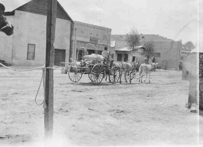
imagesize =
image_caption = Blythe street scene, circa 1900
image_
mapsize = 250x200px
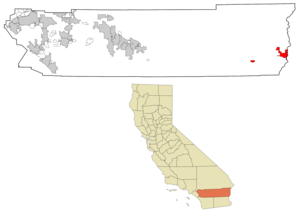
map_caption = Location in Riverside County and the state ofCalifornia
mapsize1 =
map_caption1 =
subdivision_type = Country
subdivision_type1 = State
subdivision_type2 = County
subdivision_name =United States
subdivision_name1 =California
subdivision_name2 = Riverside
government_type =
leader_title =
leader_name =
established_date =
area_magnitude =
area_total_km2 = 64.8
area_total_sq_mi = 25
area_land_km2 = 62.8
area_land_sq_mi = 24.2
area_water_km2 = 2
area_water_sq_mi = 0.8
elevation_ft = 272
elevation_m = 83
population_as_of = 2007
population_footnotes =
population_total = 22775
population_metro =
population_density_km2 = 187.6
population_density_sq_mi = 486.2
timezone = PST
utc_offset = -8
latd = 33 |latm = 37 |lats = 2 |latNS = N
longd = 114 |longm = 35 |longs = 21 |longEW = W
timezone_DST = PDT
utc_offset_DST = -7
postal_code_type =ZIP code s
postal_code = 92225-92226
area_code = 760
blank_name = FIPS code
blank_info = 06-07218
blank1_name = GNIS feature ID
blank1_info = 1660349
footnotes =
website =Blythe is a city in Riverside County,
California ,United States , in theColorado River Valley (in California, the "Palo Verde Valley"), an agricultural area along theColorado River . Blythe was named afterThomas Blythe , agold prospector who established primary water rights to the Colorado River in the region in 1877. The city was incorporated on July 21, 1916, and has a population of approximately 21,500 as of 2003.Regional Features and Geography
Blythe is located at coor dms|33|37|2|N|114|35|21|W|city (33.617157, -114.589241)GR|1, near the
California /Arizona border in theSonoran Desert , at the junction of Interstate 10 and US 95. According to theUnited States Census Bureau , the city has a total area of 25.0 square miles (64.8 km²), of which 24.2 square miles (62.8 km²) is land and 0.8 square miles (2.0 km²) (3.12%) is water.Nearby communities include Lost Lake and Vidal to the north, Ripley to the south, and
Ehrenberg, Arizona , to the east. Major cities in the region include Yuma, AZ (85 miles), Riverside, CA (172 miles), Las Vegas, Nevada (200 miles), Phoenix, AZ (150 miles) and San Bernardino, CA (140 miles). Blythe is within 4 hours via car of 10% of the United States’ population.Also notable is the geological history of Blythe - despite California's reputation for earthquakes, according to geologists Blythe has not had an earthquake centered in the city for over 500,000 years. [http://www.paloverdevalleylibrary.com/about_blythe,_ca.htm About Blythe, Ca ] ]
Local Features
Tourism is a major component of the local economy. Blythe is a stopover city with full services for travelers between any of the nearby regions, in particular the major cities of Los Angeles and Phoenix, since it is approximately midway between those two metropolitan areas. The winter months bring visitors avoiding the colder climates of the north, when the population of the area within 50 miles (80 km) of Blythe has been known to exceed 500,000. [http://www.paloverdevalleylibrary.com/about_blythe,_ca.htm ABOUT Blythe, Ca ] ]
Blythe Airport (FAA designator: BLH) is just west of town on Interstate 10 and has a convert|6500|ft|m|sing=on runway. Health facilities in Blythe include "
Palo Verde Hospital", a General Acute CareHospital with 55 total beds and 24-hour standby emergency services, 23 physicians/surgeons, 2 dentists, 2 optometrists, 3 chiropractors, and 1 podiatrist. [California Department of Health Services]Blythe area public elementary and secondary schools comprise the
Palo Verde Unified School District , which contains 3 elementary schools, 1 middle school, 1 high school, and a continuation/adult education school. Palo Verde Commnity College District is part of theCalifornia Community College system and includesPalo Verde Community College , a campus in Blythe, a center in Needles and an extension for Adult Basic education and non-credit classes located on Spring Street in downtown Blythe.Con-Way freight has a large facility here. It is used mainly at night for cross dock operations, as there is seldom a need to make deliveries here.Blythe also contains 24 churches, one library, one newspaper, one museum, two radio stations, three banks, a three-screen movie theater, and an 18,500 sq ft (1,720 m²). recreation center. The area is popular with campers and hikers and has six parks, seven campgrounds, seven R.V. parks, 3 boat ramps onto the Colorado River, and an 18-hole public (city-owned) golf course.
State facilities in the town include the following.
* Resources Agency,California Department of Fish and Game office at 150 S. Main Street.
*California Highway Patrol office at 430 S. Broadway Street.
*California Department of Motor Vehicles office at 430 S. Broadway Street.
*California Department of Food and Agriculture office.
* California Department of Corrections and Rehabilitation-Chuckawalla Valley State Prison
* California Department of Corrections and Rehabilitation-Ironwood State PrisonBlythe has its own police department and has an all volunteer fire department.
Demographics
As of the
census GR|2 of 2000, there were 12,155 people, 4,103 households, and 2,974 families residing in the city. Thepopulation density was 501.5 people per square mile (193.6/km²). There were 4,891 housing units at an average density of 201.8/sq mi (77.9/km²). The racial makeup of the city was 55.41% White, 8.34% Black or African American, 1.43% Native American, 1.38% Asian, 0.20% Pacific Islander, 28.79% from other races, and 4.45% from two or more races. 45.83% of the population were Hispanic or Latino of any race.There were 4,103 households out of which 41.4% had children under the age of 18 living with them, 50.0% were married couples living together, 16.6% had a female householder with no husband present, and 27.5% were non-families. 22.9% of all households were made up of individuals and 7.1% had someone living alone who was 65 years of age or older. The average household size was 2.91 and the average family size was 3.45.
In the city the population was spread out with 33.9% under the age of 18, 8.7% from 18 to 24, 28.4% from 25 to 44, 19.0% from 45 to 64, and 9.9% who were 65 years of age or older. The median age was 31 years. For every 100 females there were 99.2 males. For every 100 females age 18 and over, there were 97.0 males.
The median
income for a household in the city was $35,324, and the median income for a family was $40,783. Males had a median income of $32,342 versus $26,671 for females. Theper capita income for the city was $14,424. About 19.0% of families and 20.9% of the population were below thepoverty line , including 24.9% of those under age 18 and 21.6% of those age 65 or over.The largest and second largest employers in the city are the Ironwood State Prison (a level III
prison ) and the Chuckawalla State Prison (a level II prison), respectively, which employ roughly 54% of the labor force.Politics
In the state legislature Blythe is located in the 40th Senate District, represented by Democrat
Denise Moreno Ducheny , and in the 80th Assembly District, represented by RepublicanBonnie Garcia . Federally, Blythe is located inCalifornia's 45th congressional district , which has a Cook PVI of R +3 [cite web | title = Will Gerrymandered Districts Stem the Wave of Voter Unrest? | publisher = Campaign Legal Center Blog | url=http://www.clcblog.org/blog_item-85.html | accessdate = 2008-02-10] and is represented by RepublicanMary Bono Mack .Some locals petitioned for a proposed state connecting easternmost parts of California and western half of Arizona to represent the Colorado River Valley and wants to make Blythe the future state capital of the proposed state of "Riviera", but the effort proved unsuccessful.
Water transfers to urban areas
In a 2005 agreement, Metropolitan Water District of Southern California (MWD) negotiated with Palo Verde Irrigation District (PVID) in Blythe to fallow, or idle, farm land for 35 years. The deal will transfer water that would have been used for farming in the area of Blythe, Ripley and Palo Verde to MWD.
According to a 1990 pilot study, water diversions and fallowed farm land reduced farming employment. The MWD provided $6 million in a development fund to reimburse the community for losses caused by shifting water to urban areas. [* [http://www.usbr.gov/LC/region/programs/AAC/refdocs/Reclamation1994b.pdf Bureau of Reclamation PDF file on water situation.] ]
California currently uses more than its allotted share of water from the
Colorado River . The transfer agreement also seeks to address over-use of river water. It is partly designed to reduce overall diversions from the river.ports
* The Blythe Heat is a winter professional minor league baseball team of the
Arizona Winter League . They play on Alexander Field in Todd Park. Some games of theLake Havasu Heat of the semi-proPacific Southwest Baseball League play in Blythe during the summer months.References
ee also
*
Blythe Intaglios
*Chuckawalla Valley State Prison
*Chuckawalla Valley
*Chuckwalla
*Chuckwalla Mountains
*Chocolate Mountains
*Desert Center
*Big Maria Mountains
*McCoy Mountains
*Midland, California
*Mule Mountains (California)
*Palo Verde, California
*Winterhaven, California
*Westmorland, California External links
* [http://alic.arid.arizona.edu/sonoran/General/overview.html The Sonoran Desert]
* [http://alic.arid.arizona.edu/sonoran/documents/mcginnies/mcginniesmap.html Map of the Sonoran Desert]
Wikimedia Foundation. 2010.