- Twentynine Palms, California
Infobox Settlement
official_name = Twentynine Palms, California
settlement_type =City
imagesize =
image_caption =
image_
imagesize =
image_caption =
image_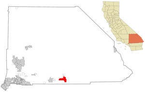
mapsize = 250x200px
map_caption = Location in San Bernardino County and the state ofCalifornia
mapsize1 =
map_caption1 =
subdivision_type = Country
subdivision_type1 = State
subdivision_type2 = County
subdivision_name =United States
subdivision_name1 =California
subdivision_name2 = San Bernardino
government_type =
leader_title =
leader_name =
established_date =
area_magnitude =
area_total_km2 = 142
area_total_sq_mi = 54.8
area_land_km2 = 142
area_land_sq_mi = 54.8
area_water_km2 = 0
area_water_sq_mi = 0
elevation_ft = 1991
elevation_m = 607
population_as_of = 2000
population_footnotes =
population_total = 14764
population_metro =
population_density_km2 = 104
population_density_sq_mi = 269.4
timezone = PST
utc_offset = -8
latd = 34 |latm = 8 |lats = 18 |latNS = N
longd = 116 |longm = 4 |longs = 21 |longEW = W
timezone_DST = PDT
utc_offset_DST = -7
postal_code_type =ZIP code s
postal_code = 92277-92278
area_code = 760
blank_name = FIPS code
blank_info = 06-80994
blank1_name = GNIS feature ID
blank1_info = 1652804
footnotes =
website =Twentynine Palms (also 29 Palms) is a city in San Bernardino County,
California ,United States . The population was 14,764 at the 2000 census.Geography
Twentynine Palms is located at coor dms|34|8|18|N|116|4|21|W|city (34.138277, -116.072409)GR|1.
According to the
United States Census Bureau , the city has a total area of 142.0km² (54.8 mi²), all land.Twentynine Palms is a desert and mountain area. It is home of
Joshua Tree National Park and Park Headquarters, andMarine Corps Air Ground Combat Center Twentynine Palms , the world's largest Marine Base. It is located approximately half way between Los Angeles and Las Vegas using the 10 and 15.Located at an elevation of 1950 feet (595 m) in the Mojave desert of Southern California, Twentynine Palms is recognized for its extreme
temperature s. OnJuly 17 ,2005 the high temperature hit 119 degrees Fahrenheit (48.3°C), which is a new record. The previous record was 118 degrees Fahrenheit (47.8°C), set onJuly 11 ,1961 . The record low temperature is 9 degrees Fahrenheit (-12.2°C), set onDecember 23 ,1990 .History
Twentynine Palms was named for the
palm trees located in theOasis of Mara , at theJoshua Tree National Park headquarters. When the area was settled by gold miners in the late nineteenth century, there were 29 palm trees growing in the oasis, most of which are still standing today.After decades as a rest stop for wagon travelers on what's called the "Utah Trail" named for a group of
Mormon discoverers, the town was established in the 1920s.There's a small Indian reservation belonging to the Twentynine Palms band of
Mission Indians . The nearbyMarine Corps Air Ground Combat Center Twentynine Palms was founded in 1952.The Willie Boy Story
Carlota, the daughter of William Mike, a Twentynine Palms
Chemehuevi Indian who had moved his family to the Gilman Ranch in the Coachella Valley near Banning, figured in a tragedy that rocked Southern California in 1909, and has since been the subject of books and a movie. A cousin named Willie Boy, who had fallen in love with her, persuaded her to elope with him, their marriage having been forbidden because they were cousins. Her father tracked them and brought them back. Accounts vary with respect to what followed, but agree that Willie Boy shot and killed William Mike, perhaps by accident, escaped with Carlota into the desert, was tracked by a posse, and left Carlota hidden in a wash with his coat and waterskin. She died, either shot by the posse by mistake, or died from exposure. According to Chemehuevi tradition, Willie Boy escaped, but has not been seen again [Trafzer et al. 1997:86-90)]Demographics
As of the
census GR|2 of 2000, there were 14,764 people, 5,653 households, and 3,855 families residing in the city. Thepopulation density was 104.0/km² (269.3/mi²). There were 6,952 housing units at an average density of 49.0/km² (126.8/mi²). The racial makeup of the city was 71.02% White, 9.35% African American, 1.46% Native American, 3.81% Asian, 10.17% Pacific Islander, 6.24% from other races, and 6.36% from two or more races. Hispanic or Latino of any race were 14.91% of the population.The
Hispanic population has increased 50% since the 2000census .There were 5,653 households out of which 39.1% had children under the age of 18 living with them, 49.8% were married couples living together, 13.7% had a female householder with no husband present, and 31.8% were non-families. 25.1% of all households were made up of individuals and 7.4% had someone living alone who was 65 years of age or older. The average household size was 2.60 and the average family size was 3.12.
In the city the population was spread out with 31.2% under the age of 18, 15.2% from 18 to 24, 28.4% from 25 to 44, 16.7% from 45 to 64, and 8.6% who were 65 years of age or older. The median age was 27 years. For every 100 females there were 101.8 males. For every 100 females age 18 and over, there were 98.7 males.
The median income for a household in the city was $31,178, and the median income for a family was $32,251. Males had a median income of $25,081 versus $25,141 for females. The
per capita income for the city was $14,613. About 13.6% of families and 16.8% of the population were below thepoverty line , including 25.3% of those under age 18 and 10.0% of those age 65 or over.Politics
In the state legislature Twentynine Palms is located in the 18th Senate District, represented by Republican
Roy Ashburn , and in the 65th Assembly District, represented by RepublicanPaul Cook . Federally, Twentynine Palms is located inCalifornia's 41st congressional district , which has a Cook PVI of R +9 [cite web | title = Will Gerrymandered Districts Stem the Wave of Voter Unrest? | publisher = Campaign Legal Center Blog | url=http://www.clcblog.org/blog_item-85.html | accessdate = 2008-02-10] and is represented by Republican Jerry Lewis.Education
*
Copper Mountain College , local community college serving 29 Palms and the entire Morongo Basin [ [http://www.cmccd.edu Copper Mountain College ] ]
*Morongo Unified School District [ [http://www.morongo.k12.ca.us Morongo Unified School District - Home ] ]Athletics
Twentynine Palms High School won the 2007 Division IV-A Boys Basketball CIF Southern Section Championship. This was their first team CIF championship since 1982 (Small Schools Girls Basketball) and their eight CIF championship overall (the other 6 were in track and field).The school competes in theDe Anza League .Media
*The Desert Trail newspaper is published weekly [ [http://www.deserttrail.com/about_us Desert Trail - Yucca Valley, CA: About Us ] ]
*The Sun Runner Magazine of California Desert Life and Culture is published bi-monthly [ [http://thesunrunner.com/ The Sun Runner Arts & Entertainment Magazine of 29 Palms, California ] ]Controversies
The city is the setting of a controversial book entitled "Twentynine Palms: A True Story of Murder, Marines, and the Mojave". It deals with a murder of a local young woman.
Religion
There is a Samoan language branch (similar to a Ward) in
The Church of Jesus Christ of Latter Day Saints designated the Buena Vista branch.In popular culture
Music
A song titled "The Lady from Twentynine Palms" was recorded by several artists, including
Frank Sinatra in 1939. [Alphabetical List of Songs recorded by Frank Sinatra]The town is referred to in two different Sublime songs (April 29th, 1992 and Thanx).
Former
Led Zeppelin singerRobert Plant had a hit single called "29 Palms", from his solo albumFate of Nations in 1993.The town of Twentynine Palms is also referred to repeatedly in the song 'Broken Parakeet Blues' written by
Ike Reilly and appearing on the album titled "We Belong to the Staggering Evening," by the Ike Reilly Assassination (2007).Films
It was briefly mentioned in the movie
Independence day A futuristic
Marine Corps Air Ground Combat Center Twentynine Palms is featured at the start of the movieDoom (film) ."29 Palms" is a 2002 murder mystery direct-to-video film that takes place on an Indian casino near town [ [http://www.imdb.com/title/tt0283090 IMDB.com] retrieved April 26, 2008]
"Twentynine Palms" was a 2003 drama/horror movie [ [http://www.imdb.com/title/tt0315110 IMDB.com] retrieved April 26, 2008]
Part of the crazy driving scenes in the 1963 comedy filmIt's a Mad Mad Mad Mad World take place in Twentynine Palms.Television
When the hit TV show
Home Improvement was about to be sold into syndication, the producers decided to kick off the syndicated episodes with a brand new episode not shown on prime time. Much of that episode was taped aboard the Marine Corps Air Ground Combat Center in Twentynine Palms.Fact|date=January 2008Books
In Janet Fitch's novel "Paint it Black", Michael Faraday kills himself in a motel in Twentynine Palms
Footnotes
External links
* [http://www.ci.twentynine-palms.ca.us/ City of Twentynine Palms Official Website]
* [http://www.mbtabus.com/ Morongo Basin Transit Authority]
Wikimedia Foundation. 2010.