- California State Route 33
-
"CA 33" redirects here. For the congressional district, see California's 33rd congressional district.
State Route 33

Route information Defined by S&HC § 333 Maintained by Caltrans Length: 289.699 mi[1] (466.225 km)
This route is broken into pieces, and the length does not reflect the overlaps that would be required to make the route continuous.Major junctions South end: 
 SR 1 / US 101 in Ventura
 SR 119 in Taft
 SR 269 in Avenal
 SR 152 near Los Banos
North end:  I-5 near Tracy
Highway system State highways in California(list • pre-1964)
History • Unconstructed • Deleted • Freeway • Scenic←  SR 32
SR 32SR 34  →
→State Route 33 (SR 33) is a north–south state highway in the U.S. state of California. SR 33 replaced part of U.S. Route 399 in 1964 during the "great renumbering" of routes. In the unincorporated sections of Kern County it is known as the West Side Highway. In addition, the California Legislature designated the entire Kern County portion as the Petroleum Highway in 2004. The southernmost portion is a freeway known as the Ojai Freeway.
Contents
Route description
Several segments of this route are part of the California Freeway and Expressway System;[2] also, several are eligible to be included in the State Scenic Highway System.[3] However, only the portion from 6.4 miles north of the SR 150 junction to the Ventura - Santa Barbara county line is a scenic highway as designated by Caltrans.[4]
Beginning in Ventura as a short freeway (the "Ojai Freeway"), Route 33 continues north as an undivided surface road through Ojai, follows Matilija Canyon past the easternmost extremity of the Santa Ynez Mountains, and passes over the Transverse Ranges at Pine Mountain Summit, coming down into the Cuyama Valley to an eventual junction with SR 166. Route 33 continues with Route 166 for about 20 miles (32 km) to Maricopa where the routes separate. In Maricopa, Route 33 turns northwest, following the western side of the San Joaquin Valley. Between Taft and Avenal it roughly parallels Interstate 5; for the first 15 miles (24 km) of this portion it follows the axis of the Midway-Sunset Oil Field. Northwest of Avenal, it turns due west to enter Coalinga, then turns northeast and soon becomes concurrent with I-5 for 13 miles (21 km). Thereafter, it departs due north near Cantua Creek, turns northwest at Mendota, and meets State Route 152 in Dos Palos, with which it runs concurrently for approximately ten miles. It departs again to the northwest near Los Banos, turns north at Santa Nella (where it has an interchange with I-5), and roughly parallels I-5 and the San Joaquin River until its final terminus at I-5 at Yarmouth.
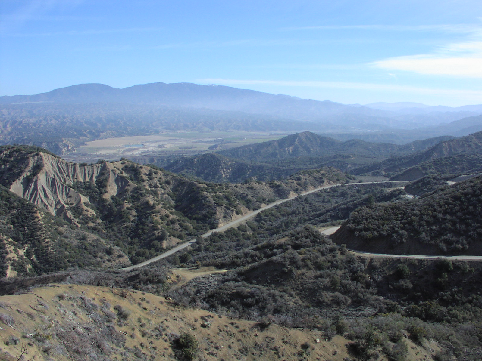
 View northeast from near Pine Mountain Summit on SR 33, the highest elevation on the route; the Lockwood Valley and Mount Pinos are in the distance
When passing through the Avenal/Coalinga area travelers pass near a series of prisons and government facilities. They include: Avenal State Prison, Pleasant Valley State Prison, and the new Coalinga Mental Hospital.
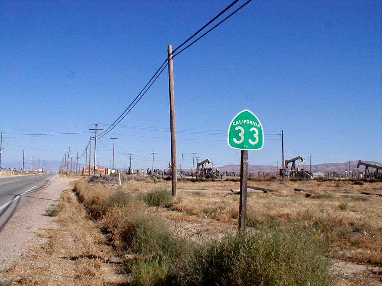
 SR 33 heading south through Kern County.
In the portions of the route in Kern and Fresno Counties, SR 33 passes through one of the United States' largest petroleum extraction fields, with hundreds of nodding oil pumps along the highway. Some of the fields visible from the highway include the Midway-Sunset, South and North Belridge, Cymric, McKittrick, Lost Hills, and Coalinga oil fields.
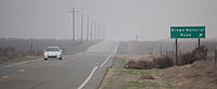 A foggy winter day looking northbound south of Brown Material Road near Blackwells Corner.
Most of SR 33's route is through sparsely populated, relatively desolate portions of the San Joaquin Valley. Travelers along it should use caution, since emergency services are typically dozens of miles away. Carrying extra water and coolant is especially advised, since summertime temperatures in the area routinely surpass 100 °F (37 °C).
History
Before the US 399 designation was deleted in 1964, SR 33 followed SR 166 east from US 99 at Wheeler Ridge to Maricopa in lieu of the segment from Ventura to Maricopa, and followed the old US highway from Taft to Maricopa. Today, SR 166 remains on the segment between Wheeler Ridge and Maricopa.
Major intersections
- Note: Except where prefixed with a letter, postmiles were measured in 1964, based on the alignment as it existed at that time, and do not necessarily reflect current mileage. The numbers reset at county lines; the start and end postmiles in each county are given in the county column.
County Location Postmile
[1][5][6]Destinations Notes Ventura
VEN 0.00-57.51Ventura 0.00 US 101 (Ventura Freeway, SR 1) – Los Angeles, San FranciscoSouthbound exit and northbound entrance 0.17 Main Street – Ventura Southbound exit and northbound entrance 1.57 Stanley Avenue Southbound exit and entrance are on the left 2.65 Shell Road R4.49 Cañada Larga Road R5.64 Casitas Vista Road North end of freeway Mira Monte 11.21
R14.41[N 1] SR 150 west (Baldwin Road) – Lake Casitas, Carpinteria, Santa Barbara
South end of SR 150 overlap Ojai 16.58[N 1]
11.21 SR 150 east (Ojai Avenue) – Ojai, Santa PaulaNorth end of SR 150 overlap 48.50 Lockwood Valley Road to I-5 – Lockwood ValleySanta Barbara
SB 0.00-8.18No junctions San Luis Obispo
SLO 0.00-4.952.80  SR 166 west – Cuyama, Santa Maria
South end of SR 166 overlap Kern
KER 0.00-73.74Cerro Noroeste Road – Mount Abel Recreation Area Soda Lake Road – Soda Lake, California Valley Serves Carrizo Plain National Monument Maricopa R11.56 SR 166 east (Poso Street) to I-5 south – Los AngelesNorth end of SR 166 overlap Taft 17.89 SR 119 (Taft Highway)Former US 399 north 23.41 Midway Road – Fellows McKittrick 33.45  SR 58 west – California Valley, Santa Margarita
South end of SR 58 overlap 34.29 SR 58 east to I-5 – Buttonwillow, BakersfieldNorth end of SR 58 overlap Lerdo Highway – Shafter Brown Material Road Blackwells Corner 60.09  SR 46 – Lost Hills, Wasco, Bakersfield, Paso Robles
Former US 466 Kings
KIN 0.00-18.997.80  SR 41 – Kettleman City, Fresno, Paso Robles
Avenal 17.14 SR 269 (Skyline Boulevard) to I-5 – Huron, Lemoore NASFresno
FRE 0.00-R83.05Jayne Avenue – Stratford Coalinga 15.37  Polk Street to SR 198 west – King City
15.71 SR 198 west (Elm Avenue) / Coalinga Plaza (Fifth Street) – King CitySouth end of SR 198 overlap 24.32 SR 198 east (Dorris Avenue) / Shell Road – Lemoore, HanfordNorth end of SR 198 overlap R29.02
17.96[N 2] I-5 south (West Side Freeway) / SR 145 north (Fresno-Coalinga Road) – Los Angeles, Kerman
Interchange; south end of I-5 overlap South end of freeway on I-5 North end of freeway on I-5 29.96[N 2]
R39.82 I-5 north (West Side Freeway) / Derrick Avenue – San Francisco, SacramentoInterchange; north end of I-5 overlap Manning Avenue – San Joaquin 53.40 Adams Avenue – Tranquillity 59.43  California Avenue, Panoche Road to SR 180 east – Fresno
Mendota 61.45  CR J1 (Belmont Avenue)
62.25 SR 180 east (Oller Street) – FresnoFirebaugh 13th Street – Madera 70.19 12th Street to I-5 northMerced
MER R0.00-30.30Dos Palos R1.17 Blossom Street – South Dos Palos, Central District R5.64
R32.37[N 3] SR 152 east / Elgin Avenue – MercedInterchange; south end of SR 152 overlap Los Banos 21.27[N 3]  SR 165 (Mercey Springs Road) to I-5 south – Turlock
13.85[N 3] I-5 (West Side Freeway) – San Francisco, Sacramento, Los AngelesInterchange 11.27[N 3]
R13.24 SR 152 west / San Luis Drive (to Gonzaga Road) – GilroyInterchange; north end of SR 152 overlap Santa Nella R16.26 Henry Miller Avenue – Volta R16.64 I-5 (West Side Freeway) – San Francisco, Sacramento, Los AngelesInterchange Gustine 26.46
4.35[N 4] SR 140 west (Sullivan Road) to I-5
South end of SR 140 overlap 6.06[N 4]
27.11 SR 140 east / First Avenue – MercedNorth end of SR 140 overlap Stanislaus
STA 0.00-27.09Newman 0.68 Merced Street – Livingston 2.06  CR J18 (Stuhr Road) to I-5 – Livingston, Turlock
Crows Landing 6.84 Crows Landing Road, Fink Road to I-5Patterson 12.57  CR J17 west (Sperry Avenue) to I-5
South end of CR J17 overlap 13.18 CR J17 east (Las Palmas Avenue) – TurlockNorth end of CR J17 overlap Westley 19.55  CR J16 (Grayson Road, Howard Road) to I-5
San Joaquin
SJ 0.00-5.00Vernalis 0.82  SR 132 / Vernalis Road – Modesto, San Francisco
Interchange 4.83 I-5 (West Side Freeway) – Stockton, Sacramento, Los AngelesInterchange 5.00 Ahern Road – Tracy Continuation beyond I-5; former SR 33 north 1.000 mi = 1.609 km; 1.000 km = 0.621 mi
Concurrency terminus • Closed/Former • Incomplete access • Unopened- ^ a b Indicates that the postmile represents the distance along SR 150 rather than SR 33.
- ^ a b Indicates that the postmile represents the distance along I-5 rather than SR 33.
- ^ a b c d Indicates that the postmile represents the distance along SR 152 rather than SR 33.
- ^ a b Indicates that the postmile represents the distance along SR 140 rather than SR 33.
References
- ^ a b California Department of Transportation, State Truck Route List (XLS file), accessed February 2008
- ^ CA Codes (shc:250-257)
- ^ CA Codes (shc:260-284)
- ^ "Officially Designated State Scenic Highways and Historic Parkways". California Department of Transportation. December 7, 2007. http://www.dot.ca.gov/hq/LandArch/scenic_highways/. Retrieved June 22, 2011.
- ^ California Department of Transportation, Log of Bridges on State Highways, July 2007
- ^ California Department of Transportation, All Traffic Volumes on CSHS, 2005 and 2006
Additional reading
- King, Peter H. (July 7, 2008). "A workaday road that cuts through the state's back story: Two-lane Highway 33 isn't a fabled route, but it's rugged and real". Los Angeles Times: A1, A8. http://www.latimes.com/news/local/la-me-oncal7-2008jul07,0,624210.story.
External links
Freeways in Greater Los Angeles Radial Hollywood (US 101/SR 170) • Golden State (I-5) • Antelope Valley (SR 14) • Glendale (SR 2) • Pasadena/Arroyo Seco Pkwy (SR 110) • San Bernardino (I-10) • Pomona (SR 60) • Santa Ana (I-5/US 101) • Laguna (SR 133) • Corona del Mar (SR 73) • Long Beach (I-710) • Seaside (SR 47) • Terminal Island (SR 103) • Harbor (I-110/SR 110) • Marina (SR 90) • Santa Monica (I-10)Circumferential Ventura (US 101/SR 134) • Foothill (I-210) • San Gabriel River (I-605) • Orange (SR 57) • Costa Mesa (SR 55) • Artesia (SR 91) • Garden Grove (SR 22) • Century (I-105) • Gardena (SR 91) • San Diego (I-405) • Moorpark (SR 23) • Ojai (SR 33) • Ronald Reagan (SR 118) • Santa Paula (SR 126)Inland Empire Chino Valley (SR 71) • Foothill (SR 210) • Moreno Valley (SR 60) • Riverside (SR 91) • San Bernardino (I-10/I-215) • I-10 • I-15 • I-215 • SR 259 • SR 330Toll Categories:- State highways in California
- Scenic highways in California
- Southern California freeways
- Roads in Ventura County, California
- Roads in Santa Barbara County, California
- Roads in San Luis Obispo County, California
- Roads in Kern County, California
- Roads in Kings County, California
- Roads in Fresno County, California
- Roads in Merced County, California
- Roads in Stanislaus County, California
- Roads in San Joaquin County, California
- Los Padres National Forest


Wikimedia Foundation. 2010.