- Merced, California
-
City of Merced — City — 
Flag
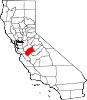
SealLocation in the state of California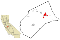
Coordinates: 37°18′N 120°29′W / 37.3°N 120.483°WCoordinates: 37°18′N 120°29′W / 37.3°N 120.483°W Country  United States
State  California
County Merced County Incorporated 1889 Government – Type Council-Manager – Mayor Bill Spriggs – Senate Anthony Cannella (R) – Assembly Cathleen Galgiani (D) – U. S. Congress Dennis A. Cardoza (D) Area[1] – Total 23.316 sq mi (60.389 km2) – Land 23.316 sq mi (60.389 km2) – Water 0 sq mi (0 km2) 0% Elevation[2] 171 ft (52 m) Population (2010) – Total 78,958 – Density 3,386.4/sq mi (1,307.5/km2) Time zone Pacific (PST) (UTC−8) – Summer (DST) Pacific (PDT) (UTC−7) ZIP code 95340-95344, 95348 Area code(s) 209 FIPS code 06-46898 GNIS feature ID 1659751 Website http://www.cityofmerced.org Merced /mərˈsɛd/ is a city in, and the county seat of, Merced County, California in the San Joaquin Valley of Northern California. As of the 2010 census, the city had a population of 78,958. Incorporated in 1889, Merced is a charter city that operates under a council-manager government. It is named after the Merced River, which flows nearby.
Merced, known as the "Gateway to Yosemite", is less than two hours by automobile from Yosemite National Park to the east and Monterey Bay, the Pacific Ocean, and several beaches to the west. The community is served by the rail passenger service Amtrak, a major airline through Merced Regional Airport, and three bus lines. It is approximately 110 miles (180 km) from Sacramento, 130 miles (210 km) from San Francisco, 45 miles (72 km) from Fresno, and 270 miles (430 km) from Los Angeles.
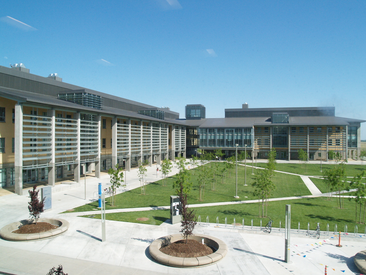
In 2005, the city became home to the tenth University of California campus, University of California, Merced (UCM), the first research university built in the U.S. in the 21st century.[3]
Contents
Community
Merced is home to University of California, Merced. Current recreational opportunities in the city include Applegate Park and zoo, Bear and Black Rascal Creeks and their bike trails, a skate park located in Applegate, a live stage theater downtown, two first run movie theaters, The Mainzer Theater which is known for its historic and architectural value, County Courthouse Museum circa 1889, the Merced Multicultural Arts Center and the County Library. Though still growing, Merced has several shopping areas including the Merced Mall, anchored by Target, Sears, JCPenney and Kohl's, a strip mall located on the city's northwest side which includes Best Buy, Barnes & Noble, Lowe's, Wal-Mart, and several restaurants. Merced's Main Street contains several restaurants, a movie theater, and other assorted shops.
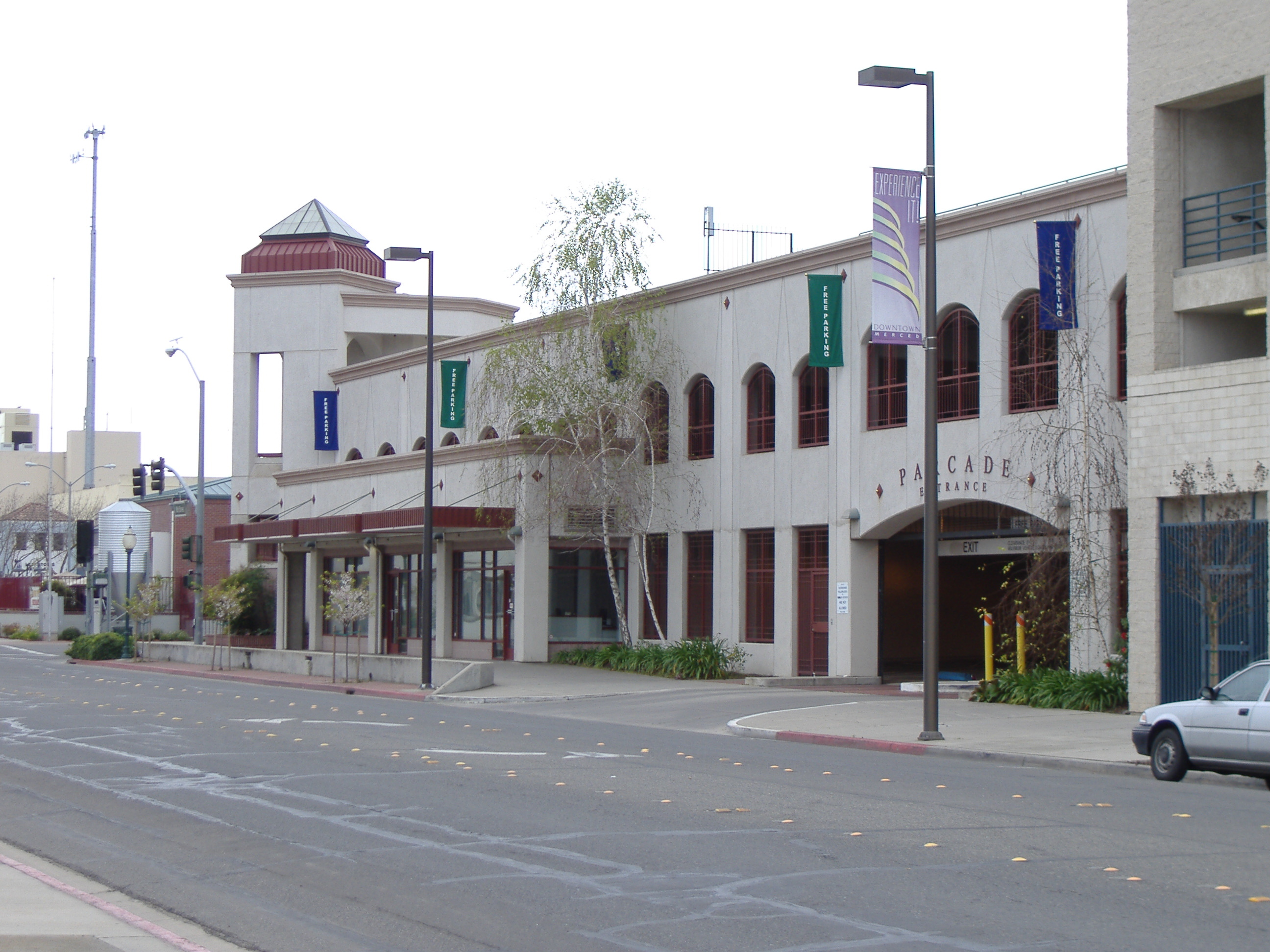
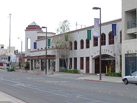 Merced Downtown
Also within a short distance from the city limits are the Castle Air Museum, Challenger Learning Center, Castle Science and Technology Museum, Lake Yosemite, and Merced Falls. Merced is also the headquarters of Malibu Boats, a manufacturer of inboard boats. The city of Merced along with its surrounding cities are serviced by the Merced Sun-Star and the Merced County Times. The Sun-Star daily newspaper has a circulation of over 20,000 in the Merced area and the Times weekly newspaper has a circulation of over 5,000.
Homes at the median level in Merced have lost 62% of their value from the second quarter of 2006, when they peaked at $336,743, the biggest drop anywhere in the country, according to data provided to Forbes by Local Market Monitor, a Cary, North-Carolina-based real-estate research firm. Earlier, home building and buying grew exponentially in Merced, but the metro now suffers from a 19.8% unemployment rate, according to a recent article in USA Today.[4]
In the 2007 version of the book "Cities Ranked & Rated" by authors Bert Sperling and Peter Sander, Merced was ranked 370th of 373 cities nationwide. The factors that determined the ranking of the cities within the book include the quality of life, cost of living in the area, availability and type of jobs, education, health care, climate, crime, commute times, and leisure activities.[5] However, the entry in the book states that the town may not stay in this place for long, since the authors stated that "Merced is definitely on an upward path and offers potential not found in other Valley towns. This potential is clearly not shown in today's numbers."[5]
Merced has suffered one of the greatest property price collapses in the country and house prices at the end of 2009 had returned to 1998 levels, according to Zillow, making housing affordable compared to many other California locations.
Merced's population has grown faster than the state average since 1980. Over the past nine years, the annualized growth rate is about 3.4%. This rapid expansion of population has stimulated significant retail growth since 1992. Several major retail chain stores have entered Merced, adding over 750,000 square feet (70,000 m2) of new retail space in that time and increasing the City's sales tax receipts by over $500,000 annually.
The economy has traditionally relied upon agribusiness and upon the presence of Castle Air Force Base. Over the past twenty years, more diversified industry has entered the area, including printing, fiberglass boat building, warehousing and distribution, and packaging industries.
In September 1995, Castle Air Force Base closed after phasing down over the previous three years. This has affected residential real estate and some sectors of the retail and service economies, but overall retail has continued to increase. No significant increase in unemployment has been noted. Re-use of the former base is actively proceeding. Industrial development is increasing in the area.
Since 1992, more than 400,000 square feet (37,000 m2) of new industrial activity has started. In May 1995, Merced was selected as the home of the next University of California campus. UC Merced opened with its first 1,000 students in September 2005. Local planning is underway to accommodate campus development, which will eventually accommodate about 25,000 students.
History
The first Merced post office opened in 1870.[6] Merced incorporated in 1889 [6] and now operates under the Council-Manager form of government.
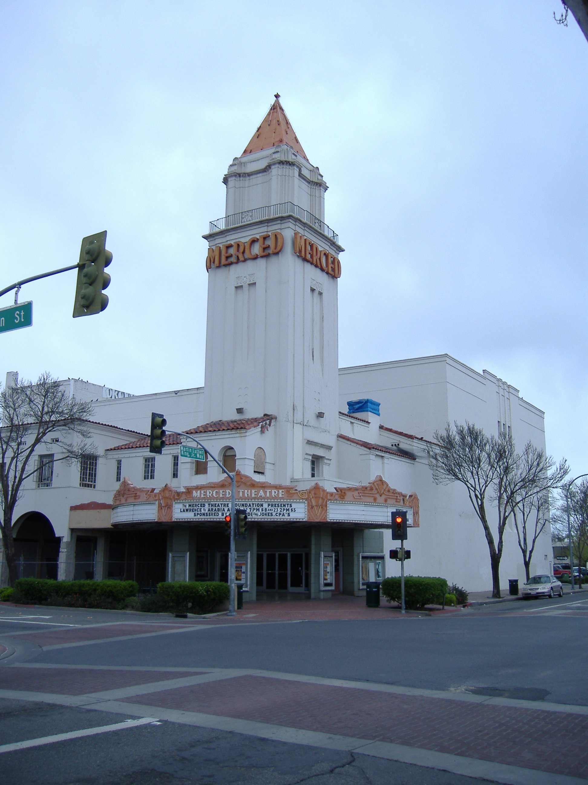
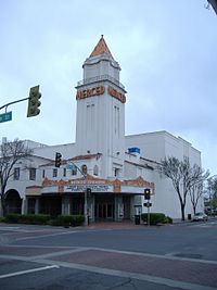 Merced Theater
During World War Two, the Merced County fairgrounds was the site of a temporary civilian assembly center for Japanese concentration camp.
Transportation
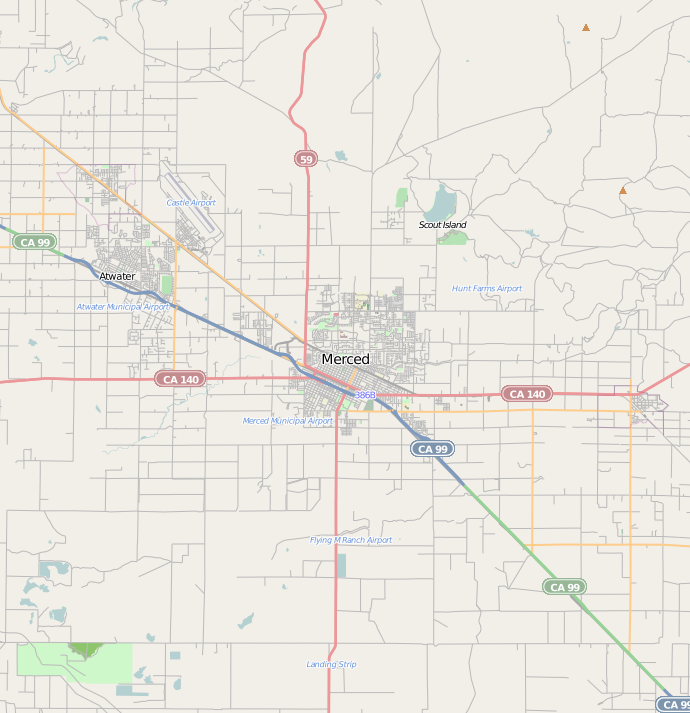
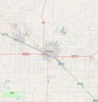 Major highways near Merced
Major highways
Air
- Merced Regional Airport. Passenger service provided by Great Lakes Airlines.
- Castle Airport in nearby Atwater, California.
Bus
- Greyhound serves Merced.
- YARTS provides scheduled service into Yosemite National Park.
- Merced County Transit, "The Bus", operates both regularly scheduled fixed route bus service and Dial-A-Ride (demand response) transportation services throughout Merced County.
- Cattracks is UCM's bus service, which connects students, staff and faculty at the university to off-campus apartments, the off-campus Castle facilities, local amenities, the Amtrak station, and the downtown area.
Rail
- Amtrak San Joaquin provides passenger service.[7]
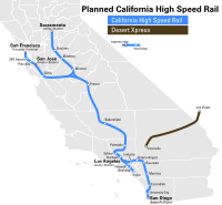
California High-Speed Rail
Officials of the California High-Speed Rail Authority say a flat, straight stretch through the San Joaquin Valley connecting Merced and Bakersfield will likely be the first completed. Regional Manager Thomas Tracy told the Visalia City Council March 2 that the 800-mile (1,300 km) project will be built in eight phases. The first segment, due by 2015, would stretch from Bakersfield to Merced on an initial run from San Diego to Sacramento. At its full 220 mph speed, the normally three-hour car trip from Merced to Bakersfield would take 45 minutes.[citation needed]
Sample trips in the California High Speed rail would include:
- Merced to Sacramento – 43 minutes
- Merced to San Jose – 45 minutes
- Merced to San Francisco – 1 hour and 15 minutes
- Merced to Los Angeles – 1 hour and 40 minutes
Climate
Merced has wet, cool winters and hot, dry summers. Although thunderstorms may linger into the valley during the summer, they are normally dry. Average January temperatures are a maximum of 55.0°F and a minimum of 36.0°F. Average July temperatures are a maximum of 97.1°F and a minimum of 60.9°F. There are an average of 98.7 days with highs of 90°F (32°C) or higher and an average of 33.6 days with lows of 32°F (0°C) or lower. The record highest temperature of 114°F was recorded on July 24, 1902, and August 8, 1905. The record lowest temperature of 13°F was recorded on January 13, 2007.
Most of the rainfall occurs during the winter and averages 12.21 inches (310 mm) annually. There are an average of 48 days annually with measurable precipitation. The wettest year was 1998 with 21.66 inches (550 mm) and the driest year was 1947 with 5.50 inches (140 mm). The most rainfall in one month was 8.00 inches (203 mm) in January 1909. The most rainfall in 24 hours was 2.20 inches (56 mm), which occurred on January 30, 1911, and March 9, 1911. Although snow is relatively rare in Merced, averaging only 0.6-inch (15 mm) annually, the city's proximity to the Sierra Nevada has resulted in some instances of remarkably heavy snowfall. The record 24 hour snowfall was 13.9 inches (35 cm) on February 16, 1946. The most snowfall in one month was 39.0 inches (99 cm) in December 1906.[8]
Climate data for Merced Regional Airport Month Jan Feb Mar Apr May Jun Jul Aug Sep Oct Nov Dec Year Record high °F (°C) 77.0
(25.0)84.0
(28.9)88.0
(31.1)98.0
(36.7)109.0
(42.8)111.0
(43.9)114.0
(45.6)114.0
(45.6)110.0
(43.3)102.0
(38.9)91.0
(32.8)76.0
(24.4)114.0
(45.6)Average high °F (°C) 55.0
(12.8)61.6
(16.4)67.2
(19.6)74.3
(23.5)82.6
(28.1)90.8
(32.7)97.1
(36.2)95.3
(35.2)90.0
(32.2)79.8
(26.6)66.2
(19.0)55.6
(13.1)76.3 Average low °F (°C) 36.0
(2.2)38.7
(3.7)41.2
(5.1)44.8
(7.1)50.6
(10.3)56.4
(13.6)60.9
(16.1)58.9
(14.9)54.8
(12.7)47.2
(8.4)39.6
(4.2)35.7
(2.1)47.1 Record low °F (°C) 13.0
(−10.6)20.0
(−6.7)20.0
(−6.7)22.0
(−5.6)30.0
(−1.1)37.0
(2.8)39.0
(3.9)35.0
(1.7)32.0
(0.0)28.0
(−2.2)21.0
(−6.1)15.0
(−9.4)13.0
(−10.6)Precipitation inches (mm) 2.47
(62.7)2.17
(55.1)1.94
(49.3)1.10
(27.9)0.44
(11.2)0.09
(2.3)0.01
(0.3)0.02
(0.5)0.15
(3.8)0.60
(15.2)1.37
(34.8)1.90
(48.3)12.27
(311.7)Source: [8] Geography and geology
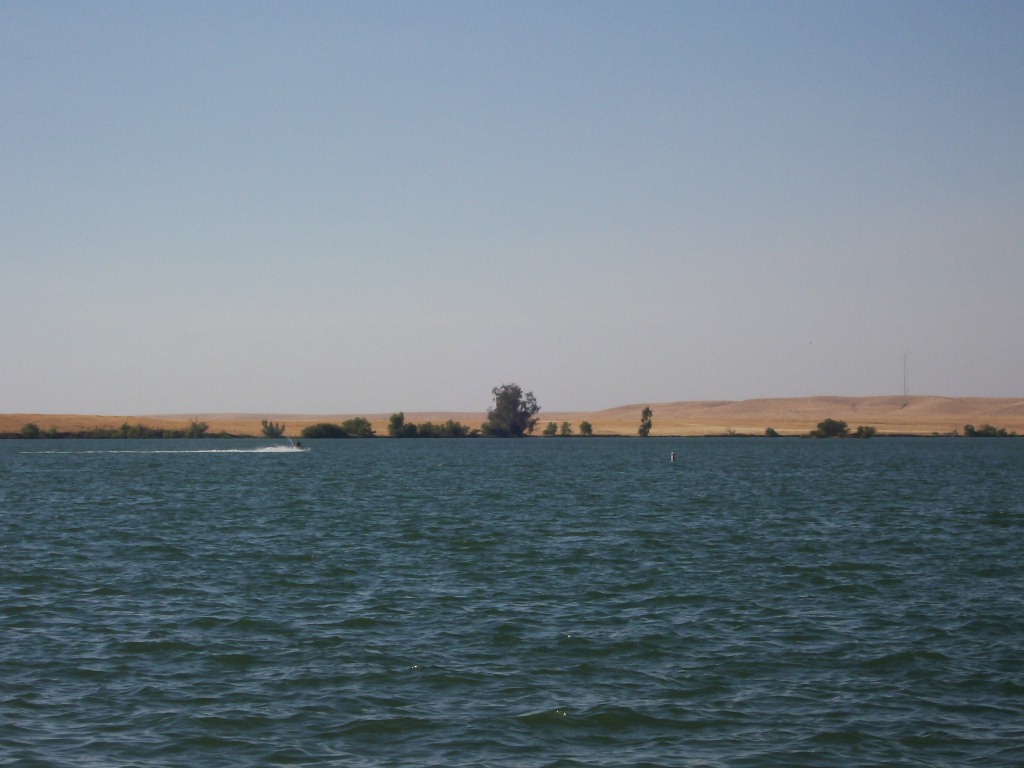
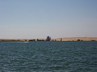 Lake Yosemite
Merced is located at 37°18′N 120°29′W / 37.3°N 120.483°W.[2] According to the United States Census Bureau, the city has a total area of 23.3 square miles (60 km2).
Merced is approximately 110 miles (180 km) southeast of San Francisco and 310 miles (500 km) northwest of Los Angeles.[9]
A major groundwater plume containing the contaminant PCE was discovered in Merced in the year 1987.[10] Subsequently drilling of new water wells was severely restricted.[11]
Economy
Top Employers
According to the City's 2010 Comprehensive Annual Financial Report,[12] the top employers in the city are:
# Employer # of Employees 1 County of Merced 2,028 2 University of California, Merced 1,602 3 Mercy Medical Center Merced 1,200 4 Merced City School District 1,141 5 Merced Union High School District 949 6 AT&T Mobility 900 7 Merced College 900 8 City of Merced 584 9 Quad/Graphics 564 10 Wal-Mart 311 Education
The Merced area has access to several institutions of higher learning. Within a one-hour radius, close to 100,000 students attend colleges and universities, including: University of California, Merced, California State University, Stanislaus, California State University, Fresno and the University of the Pacific. Schools of Engineering, Business, and Computer Science are readily at hand. The University of California, Merced campus opened in late 2005 northeast of the city limits. UC Merced for the 2009 academic year has an enrollment of about 3,400 students. Merced is served by the Merced Union High School District and two major public high school campuses, Merced High School and Golden Valley High School, as well as a few smaller campuses offering alternative education. Merced has one community college, Merced College, which has an enrollment of more than 10,000 full-time equivalent students (FTES).[citation needed]
In May 2008, The UC Board of Regents endorsed continued planning for a UC Merced School of Medicine.
Portfolio magazine rated 200 American cities ranked by earnings and education attainment, and Merced came last.[13]
Demographics
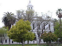 Historic County Courthouse, now serving as a museum.
2010
The 2010 United States Census[14] reported that Merced had a population of 78,959 . The population density was 3,386.4 people per square mile (1,307.5/km²). The racial makeup of Merced was 41,177 (52.2%) White, 4,958 (6.3%) African American, 1,153 (1.5%) Native American, 9,342 (11.8%) Asian, 174 (0.2%) Pacific Islander, 17,804 (22.5%) from other races, and 4,350 (5.5%) from two or more races. Hispanic or Latino of any race were 39,140 persons (49.6%).
The Census reported that 77,878 people (98.6% of the population) lived in households, 492 (0.6%) lived in non-institutionalized group quarters, and 588 (0.7%) were institutionalized.
There were 24,899 households, out of which 11,484 (46.1%) had children under the age of 18 living in them, 10,958 (44.0%) were opposite-sex married couples living together, 4,921 (19.8%) had a female householder with no husband present, 1,941 (7.8%) had a male householder with no wife present. There were 2,156 (8.7%) unmarried opposite-sex partnerships, and 167 (0.7%) same-sex married couples or partnerships. 5,356 households (21.5%) were made up of individuals and 1,823 (7.3%) had someone living alone who was 65 years of age or older. The average household size was 3.13. There were 17,820 families (71.6% of all households); the average family size was 3.65.
The population was spread out with 25,091 people (31.8%) under the age of 18, 10,475 people (13.3%) aged 18 to 24, 20,986 people (26.6%) aged 25 to 44, 15,484 people (19.6%) aged 45 to 64, and 6,922 people (8.8%) who were 65 years of age or older. The median age was 28.1 years. For every 100 females there were 96.3 males. For every 100 females age 18 and over, there were 93.6 males.
There were 27,446 housing units at an average density of 1,177.1 per square mile (454.5/km²), of which 10,637 (42.7%) were owner-occupied, and 14,262 (57.3%) were occupied by renters. The homeowner vacancy rate was 3.5%; the rental vacancy rate was 8.5%. 31,690 people (40.1% of the population) lived in owner-occupied housing units and 46,188 people (58.5%) lived in rental housing units.
2000
As of the census[15] of 2000,[16] there were 63,893 people, 20,435 households, and 14,631 families residing in the city. The population density was 3,216.7 people per square mile (1,242.2/km²). There were 21,532 housing units at an average density of 1,084.0 per square mile (418.6/km²). The racial makeup of the city was 57.4% White, 6.3% African American, 1.3% Native American, 12.4% Asian (mostly Hmong), 0.2% Pacific Islander, 23.2% from other races, and 5.2% from two or more races. Hispanic or Latino of any race were 26.4% of the population.
There were 20,435 households, out of which 42.9% had children under the age of 18 living with them, 47.2% contained married couples living together, 18.2% had a female householder with no husband present, and 28.4% were "nonfamilies." 22.6% of all households were made up of individuals and 8.5% had someone living alone who was 65 years of age or older. The average household size was 3.06 and the average family size was 3.62.
In the city the population was spread out, with 34.7% under the age of 18, 11.4% from 18 to 24, 27.4% from 25 to 44, 17.1% from 45 to 64, and 9.4% who were 65 years of age or older. The median age was 28 years. For every 100 females there were 95.6 males. For every 100 females age 18 and over, there were 92.3 males.
The median income for a household in the city was $30,429, and the median income for a family was $32,470. Males had a median income of $31,725 versus $24,492 for females. The per capita income for the city was $13,115. About 22.4% of families and 27.9% of the population were below the poverty line, including 36.9% of those under age 18 and 10.1% of those age 65 or over.
Hmong community
Main article: History of the Hmong in Merced, CaliforniaAnne Fadiman, author of The Spirit Catches You and You Fall Down, said that Merced was "most intensely Hmong place in the United States." As of 1997 Fresno, California and the Minneapolis – Saint Paul area have larger Hmong populations than Merced, but Merced has a higher concentration of Hmong residents than those two places. Blia Yao Moua, a Hmong leader in the area, said that the concentration "lets us keep more Hmong culture here than in Vientiane."[17]
Politics
In the state legislature Merced is located in the 12th Senate District, represented by Republican Anthony Cannella, and in the 17th Assembly District, represented by Democrat Cathleen Galgiani. Federally, Merced is located in California's 18th congressional district, which has a Cook PVI of D +4[18] and is represented by Democrat Dennis Cardoza.
Sister cities
Merced has two sister cities, as designated by Sister Cities International:
Notable past and present residents
- Ray Allen – NBA basketball player for the Boston Celtics
- Summer Bartholomew – Former hostess of the US game show Sale of the Century, and winner of the 1975 Miss USA beauty pageant
- Michael Basinger – Former NFL football player for the Green Bay Packers
- Bruce Bowen – NBA basketball player for the San Antonio Spurs
- Tom Cable – Former head coach of the NFL's Oakland Raiders
- Margaret Dingeldein – Member of the US Women's Olympic Waterpolo team during the 2004 Summer Olympics
- Tommy Duncan - Buried in Merced
- Marvin Eastman – Mixed martial arts fighter
- Doug Fister – MLB baseball player for the Detroit Tigers
- John Flinn – MLB baseball player for the Baltimore Orioles and Milwaukee Brewers
- Brian Fuentes – MLB baseball player for the Oakland Athletics
- Katie Gallagher – Finalist on the reality television show Survivor: Palau
- Salar Kamangar – Creator of Google's first business plan, and vice president of Google's web applications
- Janet Leigh – Actress
- Bill Mooneyham – Former MLB baseball player for the Oakland Athletics
- Dwayne Murphy - Former MLB baseball player for the Oakland Athletics
- Charles Ogletree – Harvard Law School professor, and public intellectual
- Dusty Ryan – MLB baseball player for the New York Mets
- Daniel Silva – Bestselling novelist [19]
- Tony Slaton – Former NFL football player for the Los Angeles Rams and Dallas Cowboys
- Cary Stayner – Serial killer
- Steven Stayner – Kidnap victim
References and notes
- ^ U.S. Census
- ^ a b U.S. Geological Survey Geographic Names Information System: Merced, California
- ^ UC Merced – Mission Statement
- ^ Cauchon, Dennis; Welch, William M. (February 18, 2010). "USA Today". Recession Sometimes Takes Uneven Toll. http://www.usatoday.com/news/nation/2010-02-17-two-cities-recession_N.htm. Retrieved February 19, 2010.
- ^ a b "Merced Sun Star". New book ranks Merced fourth worst place to live in U.S.. Archived from the original on September 27, 2007. http://web.archive.org/web/20070927224352/http://www.mercedsunstar.com/local/story/13578197p-14178145c.html. Retrieved May 14, 2007.
- ^ a b Durham, David L. (1998). California's Geographic Names: A Gazetteer of Historic and Modern Names of the State. Quill Driver Books. p. 801. ISBN 9781884995149.
- ^ Merced's Amtrak station
- ^ a b "Merced Regional Airport - Period of Record General Climate Summary". Western Regional Climate Center. http://www.wrcc.dri.edu/cgi-bin/cliMAIN.pl?ca5532. Retrieved July 20, 2011.
- ^ "History of Merced." City of Merced. Retrieved on September 18, 2010.
- ^ Paul M. Santi1, John E. McCray2 and Jamie L. Martens, Hydrogeology Journal, Issue Volume 14, Numbers 1–2, January, 2006, Springer Berlin /Heidelberg
- ^ Environmental Site Assessment for proposed development, Merced, California, Earth Metrics Inc, October 17, 1989
- ^ City of Merced, California Comprehensive Annual Financial Report, for the Year ended June 30, 2010 Retrieved 2010-09-24
- ^ http://www.portfolio.com/special-reports/2010/12/01/methodology-of-portfolio-2010-survey-of-smartest-places
- ^ All data are derived from the United States Census Bureau reports from the 2010 United States Census, and are accessible on-line here. The data on unmarried partnerships and same-sex married couples are from the Census report DEC_10_SF1_PCT15. All other housing and population data are from Census report DEC_10_DP_DPDP1. Both reports are viewable online or downloadable in a zip file containing a comma-delimited data file. The area data, from which densities are calculated, are available on-line here. Percentage totals may not add to 100% due to rounding. The Census Bureau defines families as a household containing one or more people related to the householder by birth, opposite-sex marriage, or adoption. People living in group quarters are tabulated by the Census Bureau as neither owners nor renters. For further details, see the text files accompanying the data files containing the Census reports mentioned above.
- ^ "American FactFinder". United States Census Bureau. http://factfinder.census.gov. Retrieved 2008-01-31.
- ^ http://quickfacts.census.gov/qfd/states/06/0646898.html
- ^ Fadiman, Anne. "Why Did They Pick Merced?" The Spirit Catches You and You Fall Down. Farrar, Straus and Giroux. 1997. 227.
- ^ "Will Gerrymandered Districts Stem the Wave of Voter Unrest?". Campaign Legal Center Blog. http://www.clcblog.org/blog_item-85.html. Retrieved 2007-10-20.
- ^ Novelist takes on Vatican secrecy with new spy thriller[dead link]
External links
- City of Merced
- UC Merced Official site
- The Merced Sun-Star official site
- The Merced County Times official site
Municipalities and communities of Merced County, California Cities Atwater | Dos Palos | Gustine | Livingston | Los Banos | Merced
CDPs Ballico | Bear Creek | Cressey | Delhi | Dos Palos Y | El Nido | Franklin | Hilmar-Irwin | Le Grand | McSwain | Planada | Santa Nella | Snelling | South Dos Palos | Stevinson | Tuttle | University of California Merced | Volta | Winton
Unincorporated
communitiesAmsterdam | Arena | Athlone | Brito | Buhach | Calpack | Castle Gardens | Cortez | Fergus | Fluhr | Hamburg Farms | Hilmar | Hopeton | Ingomar | Irwin | Kadota | Lingard | Merced Falls | Plainsburg | Santa Rita Park | The Grove | Trent
Ghost towns Abbato | Agatha | Aladdin | Alcant | Alexandria | Arundel | Bellevue | Brickville | Burchell | Central Point | Charleston | Chester | Colony Center | Cuba | Dickenson | Edendale | Elgin | Ferrin | Gadwall | Gracey | Gwin | Hoff | La Branza | Linora | Marguerite | Nairn | Ortigalito | Plainsburg | Sturgeon | Tenger | Union | Yam
California county seats Consolidated city-county Municipalities Alturas | Auburn | Bakersfield | Colusa | Crescent City | El Centro | Eureka | Fairfield | Fresno | Hanford | Hollister | Jackson | Lakeport | Los Angeles | Madera | Martinez | Marysville | Merced | Modesto | Napa | Nevada City | Oakland | Oroville | Placerville | Red Bluff | Redding | Redwood City | Riverside | Sacramento | Salinas | San Bernardino | San Diego | San Jose | San Luis Obispo | San Rafael | Santa Ana | Santa Barbara | Santa Cruz | Santa Rosa | Sonora | Stockton | Susanville | Ukiah | Ventura | Visalia | Willows | Woodland | Yreka | Yuba City
CDPs Bridgeport | Downieville | Independence | Mariposa | Markleeville | Quincy | San Andreas | Weaverville
Categories:- Incorporated cities and towns in California
- Merced, California
- County seats in California
- Cities in Merced County, California
- Populated places in the United States with Hispanic plurality populations


Wikimedia Foundation. 2010.