- Napa, California
-
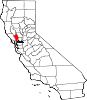
City of Napa — City — Location in Napa County and the state of California
Coordinates: 38°18′17″N 122°17′56″W / 38.30472°N 122.29889°WCoordinates: 38°18′17″N 122°17′56″W / 38.30472°N 122.29889°W[1] Country  United States
State  California
County Napa Government – Mayor Jill Techel Area[2] – Total 18.147 sq mi (47.000 km2) – Land 17.839 sq mi (46.203 km2) – Water 0.308 sq mi (0.797 km2) 1.69% Elevation 20 ft (6 m) Population (2010) – Total 76,915 – Density 4,345.5/sq mi (1,697.9/km2) Time zone Pacific (PST) (UTC-8) – Summer (DST) PDT (UTC-7) ZIP codes 94558, 94559, 94581 Area code(s) 707 FIPS code 06-50258 GNIS feature ID 0277561 Website Official website Napa is the county seat of Napa County, California. It is the principal city of the Napa county Metropolitan Statistical Area, which encompasses Napa county. As of the 2010 census, the city had a total population of 76,915. The area was settled in the 1830s. It was incorporated as a city in 1872.
Contents
Geography and environment
According to the United States Census Bureau, the city has a total area of 18.1 square miles (47 km2). 17.8 square miles (46 km2) of it is land and 0.3 square miles (0.78 km2) of it (1.69%) is water. The Napa River traverses the city on its journey to the San Pablo Bay. The city has conducted a variety of waterfront development along the banks of the river including certain fill operations governed by the United States Army Corps of Engineers regulations.[3] The Napa River Flood Project has been in progress since the late 1990s with the goal of mitigating the risk of flooding along a 6-mile (9.7 km) stretch of the River and 1-mile (1.6 km) of Napa Creek.
Climate
Napa has a Mediterranean climate (Köppen climate classification Csa), with cool, wet winters and very warm, dry summers. In January, average temperatures range from 58.5 °F (14.7 °C) to 38.9 °F (3.8 °C). In July, average temperatures range from 82.1 °F (27.8 °C) to 55.0 °F (12.8 °C). There are an average of 25.3 days with highs of 90 °F (32 °C) or higher and an average of 6.4 days with lows of 32 °F (0 °C) or lower. The record high temperature was 113 °F (45 °C) on June 14, 1961. The record low temperature was 14 °F (−10 °C) on December 22, 1990.
Average annual precipitation in Napa is 24.84 inches (631 mm) and there are an average of 64 days annually with measurable precipitation. The wettest year was 1983 with 51.29 inches (1,303 mm) and the dryest year was 1939 with 10.37 inches (263 mm). The most rainfall in one month was 16.13 inches (410 mm) in December 1955, when major flooding occurred in the area. The most rainfall in 24 hours was 5.85 inches (149 mm) on November 21, 1977. Although snow is rare, 1.0 inch fell on March 22, 1987.[4]
Climate data for Napa, California Month Jan Feb Mar Apr May Jun Jul Aug Sep Oct Nov Dec Year Average high °F (°C) 55
(13)61
(16)63
(17)68
(20)73
(23)79
(26)82
(28)82
(28)81
(27)75
(24)63
(17)55
(13)69.8
(21.0)Average low °F (°C) 37
(3)41
(5)41
(5)43
(6)48
(9)52
(11)54
(12)54
(12)52
(11)48
(9)43
(6)37
(3)45.8
(7.7)Rainfall inches (mm) 6.18
(157)4.53
(115)3.82
(97)1.85
(47)0.55
(14)0.2
(5)0.04
(1)0.12
(3)0.39
(10)1.61
(41)3.94
(100)5
(127)28.23
(717)Avg. rainy days 10 9 10 6 3 2 1 1 2 4 9 10 67 Source: http://worldclimateguide.co.uk/climateguides/california/napaca.php History
The name Napa was probably derived from the name given to a southern Nappan village whose people shared the area with elk, deer, grizzlies and cougars for many centuries, according to Napa historian Kami Santiago. At the time of the first recorded exploration into Napa Valley in 1823, the majority of the inhabitants consisted of Native American Indians. Padre José Altimira, founder of Mission San Francisco Solano in Sonoma, led the expedition. Spanish and then later Mexican control remained until the Bear Flag Revolt, and American farmers began arriving in the 1830s.
When California was granted statehood in 1849, Napa Valley was in the Territory of California, District of Sonoma. In 1850 when counties were first organized, Napa became one of the original counties of California. At the time, its boundaries also included Lake County to the north. In 1851, the first courthouse was erected. By 1870, the Native American demographics changed significantly, probably due to disease.
The City of Napa was founded by Nathan Coombs in 1847.[5] It was not the plan of General Mariano G. Vallejo. He had paid to survey for a township down river at Soscol Landing where riverboats could turn around. The Napa townsite was surveyed by James M. Hudspeth on property Coombs had received from Nicolas Higuera, original holder of the Rancho Entre Napa Mexican land grant. The first business establishment in the town was a saloon built by Harrison Pierce, a former miller at the Bale Grist Mill. Napa's first general store was opened a year later in 1848 by Joseph P. Thompson. The first record of a ship navigating the river was the Susana in 1842. John Sutter's schooner the Sacramento landed in 1844 to pick up a load of lime and deliver passengers.[6] By 1850 the Dolphin became the first passenger steamship to navigate the Napa River in order to open another path of commerce.
In the mid 1850s, Napa's Main Street rivaled that of many larger cities, with as many as 100 saddle horses tied to the fences on an average afternoon. Hotels were crowded, cash slugs and California coinage were plentiful. Saloons and gambling emporiums were numerous. John Patchett opened the first commercial winery in the county in 1859. The vineyard and wine cellar were located in an area that is now within the city limits of Napa.[7] The Lyceum movement established a facility and reading room and an agricultural society was started. Two newspapers began publication in the 1850s. The Napa Valley Register made its debut in 1853 and Alexander J. Cox published the Napa County Reporter for the first time on July 4, 1856. Nathan Coombs and many other important city founders and builders are buried nearby in Tulocay Cemetery. Near the entrance is the tomb of Mary (Mammy) Pleasant who is considered the Mother of Civil Rights in California.
The California Gold Rush of the late 1850s expanded Napa City. After the first severe winter in the gold fields, miners sought refuge in the young city from snow, cold, floods and disease. A tent city was erected along Main Street. There was plenty of work in the valley for disillusioned miners. Many cattle ranches were maintained, and the lumber industry had mushroomed. Sawmills in the valley were in operation cutting up timber that was hauled by team to Napa City, then shipped out on the river to Benicia and San Francisco.
In 1858 the great silver rush began in Napa Valley, and miners eagerly flocked to the eastern hills. In the 1860s, mining carried on, in a large scale, with quicksilver mines operating in many areas of Napa County. The most noted mine was the Silverado Mine, near the summit of Mt. St. Helena. The mine was immortalized by Robert Louis Stevenson in his classic The Silverado Squatters. At this time, the first wave of rural, foreign laborers from coastal villages of China's Canton province arrived in California, and at Napa County mines. Global investment bankers and national trading companies, especially British, imported this first wave of "cheap" workers to do the manual "dirty" jobs needed to build a country. In contrast, the 49ers were often literate, Anglo-Americans "from the East" concerned about the rights of labor. Gold rush wages were high with California enjoying an "island" demand for workers. This condition set in motion a clash that resulted in the White Workingman's Party movement. Napa Valley vintner Charles Krug was treasurer. The opportunistic "Socialist" Kearny led the Party to control the State government in the 1870s. These predominately "Irish-German" born newcomers eventually passed the "anti-stick" legislation that led to the Chinese Exclusion Act. The racial "difference" against the Chinese, the end of slavery in Brazil, and the civil war in the United States, saw the need to recruit a new group for doing the dirty work to expand global trade and commerce for the "Whitening of America". For investors (especially in Northern Europe), this reality changed the source of labor to Southern Europeans, mostly Catholic. The next wave of cheap laborers also came from coastal provinces; but close to the Port of Genova in Italy. In the 1880s, these illiterate young men from the hillside villages of Valbrevenna signed contracts as "bracianti" with shipping companies for passage to work in Napa County silver mines at Knoxville, Oat Hill, the Sierra foothills and on ranches in Uruguay-Argentina. "America" was continents of opportunity for young people to own good land. The wives and family came later. In the history of Napa, the names of Arata, Banchero, Borreo, Rossi, Navone, Bartolucci, Massa are surnames of many families who re-planted their roots as a separate community at "Spanish Town" around the St. John's Catholic Church, and Napa "Little Italy" on East First Street, Juarez, and Third Street.[8]
In 1869 F. A. Sawyer established Sawyer Tanning Company in Napa and was joined in the business by his father B. F. Sawyer a year later. It went on to become the largest tannery west of the Mississippi River. The world famous Nappa leather or Napa leather was invented by Emanuel Manasse in Napa in 1875 while working at the Sawyer Tanning Company.
Napa was incorporated on March 23, 1872 and reincorporated again in 1874 as the City of Napa. Louis Bruck of Bremen, Germany was elected the first mayor, according to historian Riccardo Gaudino Mayacamas History 1989. He was the Napa Valley pioneer (having arrived in California before 1850) that married Lolita Bale, oldest daughter of mill owner Captain Bale. In 1848, Captain Bale died and Bruck became the executor of Bale Grist Mill and the lands of Rancho Carne Humana.
The Napa State Asylum for the Insane located just south of Napa received its first patients in 1876. The Napa Valley Opera House became popular after its debut on February 13, 1880 with a production of Gilbert and Sullivan’s HMS Pinafore but, it later languished and was closed for many years.[9] In the 1980s, a popular movement was started by Riccardo Gaudino, Penny Dizmang and Veronica DiRosa to re-establish and rebuild the building. Today, it currently hosts many popular entertainers.
The Napa Journal began publication on May 16, 1890 and was succeeded by the Napa Daily Morning Journal on November 19, 1922.[10] The paper continued publishing until June 29, 1941.
Napa had become the primary business and economic center for the Napa Valley by the dawn of the 20th century. As agricultural and wine interests developed north of the city limits much of the light industry, banking, commercial and retail activity in the county evolved within the city of Napa and in earlier times along the Napa River through the historic downtown. Napa Glove Factory was established in 1903 and was the largest plant of its kind west of Chicago. Napans wore sandwich boards at Gloversville, New York by Niagara Falls to encourage the relocation of immigrant southern Italian workers. The surnames Greco, Lui, Altamura are some of the many Napa families that followed this chain migration to work at factory jobs in town, not to own land for farming. In 1915 Edwin Pridham and Peter L. Jensen invented the moving-coil loudspeaker in their Napa workshop while working on an improvement for the telephone receiver. Pridham and Jensen went on to found the Magnavox Company in 1917. In the late 19th century and early 20th century Napa was known for having the largest red-light district for a California city of its size. In 1905, Napa had over twenty brothels primarily concentrated on and around Clinton Street. [11]
Flooding of the river in downtown Napa during winter storms has been common since the town was first established. Records dating from 1862 describe twenty-seven significant flooding events. Following studies made by The United States Department of the Interior in the late 1930s and early 1940s, The United States Congress authorized channel improvements on the course of the Napa River and construction of a dam on Conn Creek as part of the Flood Control Act of 1944, however funding for the projects was never approved. The City of Napa funded and built the dam in order to create the water conservation reservoir Lake Hennessey in 1948, however flooding continued to be a problem. A large flood in February of 1986 revived public interest in finding a remedy. After a traditional plan to widen the river channel proposed by the United States Army Corps of Engineers was presented in 1995 and roundly rejected, a group of special interests called Friends of the River formed. From January 1996 until May 1997, this coalition representing business, agricultural and environmental concerns met and achieved a consensus on a "living river" plan. Voters in the County of Napa narrowly approved an increase of .5 percent of the sales tax in a March 1998 election to fund the Napa River Flood Project.[12] Although revenues from the increased sales tax have outpaced expectations, the project has progressed slowly. Current projections show the remaining phases of the project being completed in 2015.[13] On December 31, 2005, the Napa River again overflowed and flooded the entire downtown area and thousands of acres all over Napa County. More than 4,000 residents were evacuated and 1,000 homes were flooded or destroyed.[14] The 2005 flood was the 23rd most serious flood of the Napa River on record since 1865.
An ambitious redevelopment plan encompassing several blocks of downtown Napa's retail property was undertaken by the city in the early 1970s. The project failed to produce a satisfactory return on investment as most residents took their shopping to regional shopping malls in Fairfield, Concord and Santa Rosa while much of the downtown redevelopment area was under utilized. Meanwhile, other cities and towns to the north within the county flourished due to the rapidly expanding popularity of the county's wine industry. While the region gained worldwide fame as a desirable tourist destination, Napa languished in the shadows while tourists and their money bypassed the city. Downtown Napa finally began to recover and emerge from a long economic slumber by the mid 2000's following the opening of COPIA, The Oxbow Marketplace, and other development along the renovated Napa riverfront as the city began to reinvent itself as a tourist destination. Several restaurants and luxury hotels opened, such as the River Terrace Inn in 2003. The longtime-shuttered Art Deco Uptown movie theater (originally opened in 1937) reopened as a live entertainment venue in 2010 following extensive restoration.
Demographics
2010
The 2010 United States Census[15] reported that Napa had a population of 76,915. The population density was 4,238.5 people per square mile (1,636.5/km²). The racial makeup of Napa was 57,754 (75.1%) White, 486 (0.6%) African American, 637 (0.8%) Native American, 1,755 (2.3%) Asian, 144 (0.2%) Pacific Islander, 13,256 (17.2%) from other races, and 2,883 (3.7%) from two or more races. Hispanic or Latino of any race were 28,923 persons (37.6%).
The Census reported that 75,678 people (98.4% of the population) lived in households, 568 (0.7%) lived in non-institutionalized group quarters, and 669 (0.9%) were institutionalized.
There were 28,166 households, out of which 9,826 (34.9%) had children under the age of 18 living in them, 13,862 (49.2%) were opposite-sex married couples living together, 3,201 (11.4%) had a female householder with no husband present, 1,571 (5.6%) had a male householder with no wife present. There were 1,694 (6.0%) unmarried opposite-sex partnerships, and 221 (0.8%) same-sex married couples or partnerships. 7,457 households (26.5%) were made up of individuals and 3,278 (11.6%) had someone living alone who was 65 years of age or older. The average household size was 2.69. There were 18,634 families (66.2% of all households); the average family size was 3.25.
The population was spread out with 18,848 people (24.5%) under the age of 18, 6,724 people (8.7%) aged 18 to 24, 20,933 people (27.2%) aged 25 to 44, 19,919 people (25.9%) aged 45 to 64, and 10,491 people (13.6%) who were 65 years of age or older. The median age was 37.4 years. For every 100 females there were 97.4 males. For every 100 females age 18 and over, there were 94.8 males.
There were 30,149 housing units at an average density of 1,661.4 per square mile (641.5/km²), of which 16,148 (57.3%) were owner-occupied, and 12,018 (42.7%) were occupied by renters. The homeowner vacancy rate was 2.3%; the rental vacancy rate was 5.7%. 41,591 people (54.1% of the population) lived in owner-occupied housing units and 34,087 people (44.3%) lived in rental housing units.
2000
As of the census[16] of 2000, there were 74,966 people, 20,001 households, and 12,453 families residing in the city. The population density was 4,101.4 inhabitants per square mile (1,234.5/km²). There were 27,776 housing units at an average density of 1,569.5 per square mile (605.9/km²).
There were 26,978 households out of which 32.9% had children under the age of 18 living with them, 50.7% were married couples living together, 11.1% had a female householder with no husband present, and 33.5% were non-families. 26.8% of all households were made up of individuals and 12.1% had someone living alone who was 65 years of age or older. The average household size was 2.64 and the average family size was 3.20.
In the city the population was spread out, with 25.7% under the age of 18, 8.5% from 18 to 24, 29.6% from 25 to 44, 22.4% from 45 to 64, and 13.8% who were 65 years of age or older. The median age was 36 years. For every 100 females there were 96.4 males. For every 100 females age 18 and over, there were 93.5 males.
The median income for a household in the city was $49,154, and the median income for a family was $58,788. Males had a median income of $41,046 versus $31,334 for females. The per capita income for the city was $23,642. About 6.1% of families and 8.9% of the population were below the poverty line, including 11.4% of those under age 18 and 5.5% of those age 65 or over.
Economy
Major employers in Napa include:[17]
- Queen of the Valley Medical Center
- Treasury Wine Estates
- Walmart
- The Carneros Inn
- The Doctors Company
- Nova Group
- Napa Valley Marriott Hotel & Spa
- The Meritage Resort and Spa
- Kaiser Permanente
- The Hess Collection
- Wells Fargo
- Central Valley Builders Supply
- Bell Products
Politics
In the state legislature, Napa is located in the 2nd Senate District, represented by Democrat Noreen Evans, and in the 7th Assembly District, represented by Democrat Michael Allen. Federally, Napa is located in California's 1st congressional district, represented by Democrat Mike Thompson.
Transportation
Road
CA-29 runs through Napa, connecting to Vallejo and the East Bay Area to the south and the Napa Wine Country to the north. CA-12 runs to the south of the city, connecting to Fairfield and Interstate 80 to the east and Sonoma and US-101 to the west.
Air
Napa is served by Oakland International Airport, 50 miles to the south, or by Sacramento International Airport, 65 miles northeast. Napa County Airport to the south, serves as a public airport also.
Sister cities
Napa has four sister cities, as designated by Sister Cities International:
- Fairfield, California, USA
 Iwanuma, Japan (1973)
 Telavi, Georgia (1987)
 Launceston, Tasmania, Australia (1988)
Notable residents
- Jerry Bohlander, professional MMA (mixed martial arts) fighter
- Phil Bonifield, NASCAR driver
- Warren Brusstar, former MLB player
- Michael Chiarello, celebrity chef
- Francis Ford Coppola, film director
- Cristina García, novelist
- Mike Gibson, NFL player for the Seattle Seahawks
- Adam Housley, Fox News Correspondent
- Joe Kmak, MLB player for the Milwaukee Brewers and Chicago Cubs
- Jim Landis, former MLB player
- Eugene Levy, actor
- Ray Manzarek, The Doors keyboard player
- Peter Menzel, photographer
- Joe Montana, former NFL player
- Robert Redford (part time), actor
- Donny Robinson, 2008 Summer Olympics BMX bronze medalist
- Robin Williams (part time), actor
- John Boyett, Safety for the University of Oregon Ducks football team
See also
- Napa Valley AVA
- Wine Country
- KVON, an AM radio station
- Wine Country Broadcasting, an FM radio station
- Napa Valley Register
- Napa City-County Library
References
- ^ "US Gazetteer files: 2010, 2000, and 1990". United States Census Bureau. 2011-02-12. http://www.census.gov/geo/www/gazetteer/gazette.html. Retrieved 2011-04-23.
- ^ U.S. Census
- ^ Section 404 (b) 1 Alternatives Analysis Pursuant to 40 CFR 230.10 for the Safeway Longs Center, Napa, Ca., Earth Metrics Inc., U.S. Army Corps of Engineers Document, August, 1989
- ^ Western Regional Climate Center website
- ^ [1]|Napa County Historical Society website
- ^ Yerger, Rebecca (August 22, 2010). "Reflecting on Napa's busy riverfront history". Napa Valley Register (Napa, CA: Lee Enterprises, Inc.). http://napavalleyregister.com/lifestyles/real-napa/article_64863452-ad96-11df-967f-001cc4c002e0.html. Retrieved August 29, 2010.
- ^ Brennen, Nancy (November 21, 2010). "John Patchett: Introducing one of Napa’s pioneers". Napa Valley Register (Napa, CA: Lee Enterprises, Inc.). http://napavalleyregister.com/lifestyles/real-napa/article_b2750390-f509-11df-9ea4-001cc4c03286.htmll. Retrieved September 30, 2011.
- ^ Villatoro, Carlos (August 9, 20010). "Old Little Italy neighborhood in East Napa revitalized during popular walking tour". Napa Valley Register (Napa, CA: Lee Enterprises, Inc.). http://napavalleyregister.com/news/local/article_7eb72714-a37d-11df-b71c-001cc4c03286.html. Retrieved August 29, 2010.
- ^ "The early Opera House". Napa Valley Register (Napa, CA: Lee Enterprises, Inc.). October 24, 2010. http://napavalleyregister.com/lifestyles/real-napa/article_a0fdf30e-defe-11df-b716-001cc4c002e0.html. Retrieved October 24, 2010.
- ^ http://chroniclingamerica.loc.gov/lccn/sn93051433/ Library of Congress
- ^ Pogue, Lindsey (March 3, 2010). "Bawdy babes and brothels in Napa's infamous red light-district". Napa Valley Register (Napa, CA: Lee Enterprises, Inc.). http://www.napavalleyregister.com/lifestyles/real-napa/article_1bc4c97e-347c-11df-ab28-001cc4c002e0.html. Retrieved March 21, 2010.
- ^ http://www.countyofnapa.org/Pages/DepartmentContent.aspx?id=4294968277 Napa County Flood Control and Water Conervation District
- ^ http://www.countyofnapa.org/Pages/DepartmentContent.aspx?id=4294968278 Project Construction Schedule
- ^ Kevin Courtney (2005). "Severe flooding hits the Napa Valley". Napa Valley Register. http://www.napavalleyregister.com/articles/2005/12/31/news/local/doc43b7347fbd757312594498.txt. Retrieved 2005-12-31.
- ^ All data are derived from the United States Census Bureau reports from the 2010 United States Census, and are accessible on-line here. The data on unmarried partnerships and same-sex married couples are from the Census report DEC_10_SF1_PCT15. All other housing and population data are from Census report DEC_10_DP_DPDP1. Both reports are viewable online or downloadable in a zip file containing a comma-delimited data file. The area data, from which densities are calculated, are available on-line here. Percentage totals may not add to 100% due to rounding. The Census Bureau defines families as a household containing one or more people related to the householder by birth, opposite-sex marriage, or adoption. People living in group quarters are tabulated by the Census Bureau as neither owners nor renters. For further details, see the text files accompanying the data files containing the Census reports mentioned above.
- ^ "American FactFinder". United States Census Bureau. http://factfinder.census.gov. Retrieved 2008-01-31.
- ^ Private-sector employers -- Napa County
External links
Municipalities and communities of Napa County, California Cities and towns American Canyon | Calistoga | Napa | St. Helena | Yountville
CDPs Angwin | Deer Park | Moskowite Corner | Oakville | Rutherford | Silverado Resort
Unincorporated
communitiesAetna Springs | Atlas | Bale | Barro | Brazos | Buchli | Circle Oaks | Collins | Creston | Cuttings Wharf | Enchanted Hills | Howell Mountain | Imola | Knoxville | Krug | Larkmead | Lokoya | Lombard | Lowell | Merazo | Middleton | Napa Junction | Napa Soda Springs | Oak Knoll | Pope Valley | Ratto Landing | Rocktram | Salvador | Sanitarium | Spanish Flat | Spanish Flat Resort | Squab | Stanley | Steel Canyon Resort | Suscol | Thoman | Thompson | Union | Veteran Heights | Vichy Springs | Walter Springs | Woodleaf | Zinfandel
Ghost towns Carneros | Caymus | Guthrie | Kelly | Monticello | Napa Wye | Redbud Park | Shipyard Acres | Spruce Hill | Tuluka
California county seats Consolidated city-county Municipalities Alturas | Auburn | Bakersfield | Colusa | Crescent City | El Centro | Eureka | Fairfield | Fresno | Hanford | Hollister | Jackson | Lakeport | Los Angeles | Madera | Martinez | Marysville | Merced | Modesto | Napa | Nevada City | Oakland | Oroville | Placerville | Red Bluff | Redding | Redwood City | Riverside | Sacramento | Salinas | San Bernardino | San Diego | San Jose | San Luis Obispo | San Rafael | Santa Ana | Santa Barbara | Santa Cruz | Santa Rosa | Sonora | Stockton | Susanville | Ukiah | Ventura | Visalia | Willows | Woodland | Yreka | Yuba City
CDPs Bridgeport | Downieville | Independence | Mariposa | Markleeville | Quincy | San Andreas | Weaverville
 State of California
Topics - Climate
- Delegations
- Deserts
- Districts
- Ecology
- Elections
- Environment
- Geography
- Government
- History
- Protected areas
- Sports
- Symbols
- Transportation
- Visitor attractions
- Index of California-related articles
Society Regions - Antelope Valley
- Big Sur
- Cascade Range
- Central California
- Central Coast
- Central Valley
- Channel Islands
- Coachella Valley
- Conejo Valley
- Cucamonga Valley
- Death Valley
- East Bay (SF)
- East County (SD)
- Eastern California
- Emerald Triangle
- Gold Country
- Great Basin
- Greater Los Angeles
- Greater Sacramento
- Inland Empire
- Lake Tahoe
- Los Angeles Basin
- Lost Coast
- Metropolitan Fresno
- Mojave
- Mountain Empire
- North Bay (SF)
- North Coast
- North County (SD)
- Northern California
- Owens Valley
- Oxnard Plain
- San Francisco Peninsula
- Pomona Valley
- Sacramento Valley
- San Bernardino Valley
- San Diego–Tijuana
- San Fernando Valley
- San Francisco Bay Area
- San Gabriel Valley
- San Joaquin Valley
- Santa Clara Valley
- Santa Clara River Valley
- Santa Clarita Valley
- Shasta Cascade
- Sierra Nevada
- Silicon Valley
- South Bay (LA)
- South Bay (SF)
- South Bay (SD)
- South Coast
- Southern California
- Southern Border Region
- Tri-Valley
- Upstate California
- Victor Valley
- Wine Country
- Yosemite
Metro areas - Bakersfield
- Chico
- El Centro
- Fresno
- Hanford–Corcoran
- Los Angeles–Long Beach–Glendale
- Madera
- Modesto
- Merced
- Napa
- Oakland–Fremont–Hayward
- Oxnard–Thousand Oaks–Ventura
- Redding
- Riverside–San Bernardino–Ontario
- Sacramento–Arden Arcade–Roseville
- Salinas
- San Diego–Carlsbad–San Marcos
- San Francisco–San Mateo–Redwood City
- San Jose–Sunnyvale–Santa Clara
- San Luis Obispo–Paso Robles
- Santa Ana–Anaheim–Irvine
- Santa Barbara–Santa Maria–Goleta
- Santa Cruz–Watsonville
- Santa Rosa–Petaluma
- Stockton
- Vallejo–Fairfield
- Visalia–Porterville
- Yuba City
Micro areas Counties - Alameda
- Alpine
- Amador
- Butte
- Calaveras
- Colusa
- Contra Costa
- Del Norte
- El Dorado
- Fresno
- Glenn
- Humboldt
- Imperial
- Inyo
- Kern
- Kings
- Lake
- Lassen
- Los Angeles
- Madera
- Marin
- Mariposa
- Mendocino
- Merced
- Modoc
- Mono
- Monterey
- Napa
- Nevada
- Orange
- Placer
- Plumas
- Riverside
- Sacramento
- San Benito
- San Bernardino
- San Diego
- San Francisco
- San Joaquin
- San Luis Obispo
- San Mateo
- Santa Barbara
- Santa Clara
- Santa Cruz
- Shasta
- Sierra
- Siskiyou
- Solano
- Sonoma
- Stanislaus
- Sutter
- Tehama
- Trinity
- Tulare
- Tuolumne
- Ventura
- Yolo
- Yuba

Glen Ellen Yountville Winters Sonoma 
Vacaville  Napa
Napa 

Novato American Canyon
VallejoFairfield Categories:- Napa, California
- Populated places established in 1872
- Cities in Napa County, California
- Cities in the San Francisco Bay Area
- County seats in California
- Incorporated cities and towns in California


Wikimedia Foundation. 2010.