- Milpitas, California
-
City of Milpitas — City — Milpitas City Hall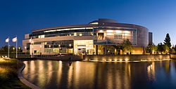
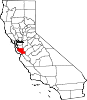
SealLocation in Santa Clara County and the state of California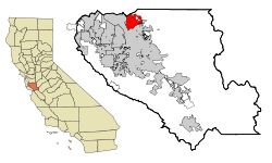
Coordinates: 37°26′5″N 121°53′42″W / 37.43472°N 121.895°WCoordinates: 37°26′5″N 121°53′42″W / 37.43472°N 121.895°W Country United States State California County Santa Clara Settled 1852 Incorporated January 26, 1954 Government - Mayor Jose "Joe" Esteves Area[1] - Total 13.641 sq mi (35.328 km2) - Land 13.591 sq mi (35.200 km2) - Water 0.050 sq mi (0.128 km2) 0.36% Elevation 16 ft (5 m) Population (2010) - Total 66,790 - Density 4,896.3/sq mi (1,890.6/km2) Time zone PST (UTC-8) - Summer (DST) PDT (UTC-7) ZIP codes 95035-95036 Area code(s) 408 FIPS code 06-47766 GNIS feature ID 1659759 Website http://www.ci.milpitas.ca.gov/ Milpitas (
 /mɪlˈpiːtəs/) is a city in Santa Clara County, California. It is a suburb of the major city of San Jose, California. It is located with San Jose to its south and Fremont to its north, at the eastern end of State Route 237 and generally between Interstates 680 and 880 which run roughly north/south through the city. With Alameda County bordering directly on the north, Milpitas sits in the extreme northeast section of the South Bay, bordering the East Bay and Fremont. Milpitas is also located within the Silicon Valley. The corporate headquarters of Maxtor, LSI Corporation, Flextronics, Adaptec, Intersil, Cisco Systems, JDSU and SanDisk sit within the industrial zones of Milpitas. The population was 66,790 at the 2010 census.
Contents
History
Milpitas was first inhabited by the Tamyen (also spelled Thomien, Tamien, Thamien, or Tamiayn), a linguistic subgroup of the Muwekma Ohlone people who had resided in the San Francisco Bay Area for thousands of years. The Ohlone Indians lived a traditional life based on everyday hunting and gathering. Some of the Ohlone lived in various villages within what is now modern-day Milpitas, including sites underneath what are now the Calvary Assembly of God Church and Higuera Adobe Park.4 Archaeological evidence gathered from Ohlone graves at the Elmwood Correctional Facility in 1993 revealed a rich trade with other tribes from Sacramento to Monterey.
During the Spanish expeditions of the late 18th century, several missions were founded in the San Francisco Bay Area. During the mission period, Milpitas served as a crossroads between Mission San José de Guadalupe in modern-day Fremont and Mission Santa Clara de Asis, in present Santa Clara. The land in modern-day Milpitas was divided between the 6,353-acre (25.71 km2) Rancho Rincon de Los Esteros granted to Ygnacio Alviso; the 47,738-acre (193.19 km2) Rancho Milpitas (Spanish for "little corn fields") granted to José María Alviso; and the 26,581-acre (107.57 km2) Rancho Los Tularcitos granted to José Higuera. Jose Maria Alviso was the son of Francisco Xavier Alviso and Maria Bojorquez, both of whom arrived in San Francisco as children with the de Anza Expedition. (A son of Ygnacio Alviso was also named Jose Maria Alviso, this has led to some confusion by researchers.) Due to Jose Maria Alviso's descendents' difficulty securing his claims to the Rancho Milpitas property, much of his land was either swindled from the Alviso family or had to be quickly sold to American settlers.[2]
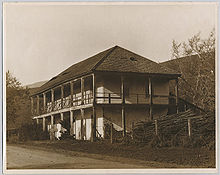 Jose Maria Alviso Adobe, ca. 1920
Both landowners had built prominent adobe homes on their properties. Today, both adobes still exist and are the oldest structures in Milpitas. The seriously eroded walls of the Jose Higuera Adobe, now in Higuera Adobe Park, are encapsulated in a brick shell built c.1970 by Marian Weller, a descendant of pioneer Joseph Weller.[3]
The Alviso Adobe can be seen mostly in its original form with one kitchen addition made by the Cuciz family c.1920. Prior to the city acquiring the Alviso Adobe it was the oldest continuously occupied adobe house in California dating from the Mexican period and is gradually being restored and undergoing seismic upgrades by the City of Milpitas. Alviso Adobe History Park is to be opened, after the restoration is completed, as an educational museum with historic items, trees, buildings, and documents.
 Monument Peak is the most visible landmark in Milpitas and has long been a symbol of Milpitas. (Click on the image for a detailed description)
In the 1850s, large numbers of Americans of English, German, and Irish descent arrived to farm the fertile lands of Milpitas. The Burnett, Rose, Dempsey, Jacklin, Trimble, Ayer, Parks, Wool, Weller, Minnis, and Evans are among the early settlers of Milpitas. 1 (Today many schools, streets, and parks have been named in honor of these families.) These early settlers farmed the land and set up many businesses on a section of what was then called Mission Road, which by the late 20th century became known as the "Midtown" district. Yet another influx of immigration came in the 1870s and 1880s as Portuguese sharecroppers from the Azores came to farm the Milpitas hillsides. Many of the Azoreans had such locally well-known surnames like Coelho, Covo, Mattos, Nunes, Spangler, Serpa, and Silva.
There is a local legend that during the late 19th century, when the U.S. Postal Service wanted to locate a Post Office in the town, there was some support for naming the town Penitencia, after the small Roman Catholic confessional building that served local Indians and ranchers and that stood near Penitencia Creek which ran along the Mission Road. Prominent land owner and civic leader, Joseph Weller, felt the Spanish word Penitencia might be confused with the English word "penitentiary." Instead of choosing Penitencia, he suggested another popular name for the area, Milpitas, after the name of Alviso's property, Rancho Milpitas.[4]
For over a century, Milpitas served as a popular rest stop for travelers on the old Oakland–San Jose Highway. At the intersection of that road with the Milpitas-Alviso Road, Smith's Corners, which still stands, was built in 1895 as a saloon that served beer and wine to thirsty travelers for a century before becoming a restaurant in 2001. Around this central core, grocery and dry goods stores, blacksmithys, service stations, and, in the 1920s, one of America's earliest "fast food" chain restaurants, "The Fat Boy", opened nearby. Another of Milpitas' most popular restaurants was the "Kozy Kitchen" established in 1940 by the Carlo family in the former "Central Market" building. Kozy Kitchen was demolished soon after Jimmy Carlo sold the restaurant in 1999.[5] Even in the early 1950s, Milpitas served a farming community of 800 people who walked a mere one or two blocks to work.
 The new Milpitas Library (2009) integrates the historic Milpitas Grammar School building (1915).
On January 26, 1954, faced with getting swallowed up by a rapidly expanding San Jose, Milpitas residents incorporated as a city that included the recently built Ford Auto Assembly plant. When San Jose attempted to annex Milpitas barely seven years later, the "Milpitas Minutemen" were quickly organized to oppose annexation and keep Milpitas independent. An overwhelming majority of Milpitas registered voters voted "No" to annexation in the 1961 election as a result of a vigorous anti-annexation campaign. Following the election, the anti-annexation committee, who had compared themselves to the Revolutionary War Minutemen who fought the British on Lexington Green - a role filled in this case by the neighboring city of San Jose - adopted the image of Daniel Chester French's Minuteman statue, that stands near the site of the Old North Bridge in Concord, MA, as part of the official city seal. In the 1960s, the city approved the construction of the Calaveras overpass. Formerly at a junction with the Union Pacific railroad, Calaveras Boulevard had a bridge passing over six sets of railroad tracks after the construction was completed. Though the result was that local residents could now drive over the train tracks without waiting for a slow freight to pass, it resulted in the loss of the historical residential area. Here houses owned by city leaders had to be purchased by the city at full market value and either moved or demolished. 2
Starting in 1955, with the construction of the Ford Motor Mustang/Mustang Shelby Assembly Plant, and accelerating in the 1960s and 1970s, extensive residential and retail development took place. Hayfields in Milpitas rapidly disappeared as industries and residential housing developments spread. Soon, the once rural town of Milpitas found itself a San Jose suburb. In only 30 years, the population jumped from about 20,500 in 1970 to 62,698 in 2000. Slightly less than half (47.3%) of Milpitas' residents are foreign-born in contrast to a California state average of 26.2%. Much of its computer industries' increased labor demand was met by workers from China, Taiwan, Vietnam, and the Philippines. As a result, the percentage of Asian American residents more than tripled from 12% of the population in 1980 to 37% in 1990 and 51% in 2000.[6] The Ford Mustang/Mustang Shelby factory closed in 1984, being converted into a shopping mall, "The Great Mall of the Bay Area", which opened in 1994.
In the early 21st century, Milpitas light rail transit system station was added, making it the northeasternmost light rail destination in the region. On January 26, 2004, the city celebrated its 50th anniversary of incorporation and issued the book Milpitas: Five Dynamic Decades to commemorate 50 years of Milpitas' history as a busy, exciting crossroads community.
Etymology of the name Milpitas
The name Milpitas is a variation of the plural diminutive of milpa, a Mexican Spanish word for "garden where maize is grown." The word milpa is a word derived from Nahuatl milli, meaning "agricultural field," and pan, meaning "on." In a milpa, several crops are grown simultaneously in the same location. The combination of crops provides complete nutrition for humans, and the method of growing them preserves the soil's quality better than what generally results from industrial agriculture.[7] So the name Milpitas as used by Jose Maria Alviso to name his land grant, Rancho Milpitas, thus most likely meant "little or precious garden where many crops can be grown," reflecting the rich alluvial soils of the area. As a 19th century California Spanish idiomatic expression, the reason Alviso used Milpitas to name his rancho, occupying more than 4,000 acres (16.2 km2), is, for the present, lost to us. Given the extended meaning attached to milpa, however, the most reasonable modern American equivalent expression to Milpitas might be "backyard vegetable garden." [8]
Geography
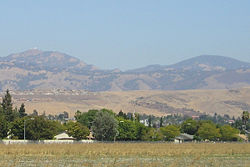
 The southeastern foothills of Milpitas
Milpitas is located at 37°26′5″N 121°53′42″W / 37.43472°N 121.895°W (37.434586, -121.895059).[9] Milpitas lies in the northeastern corner of the Santa Clara Valley, which is south of San Francisco. [1] [2]. Milpitas is generally considered to be a San Jose suburb in the South Bay, a term used to denote the southern part of the San Francisco Bay Area.
According to the United States Census Bureau, the city has a total area of 13.6 square miles (35.3 km²). 13.6 square miles (35.2 km²) of it is land and 0.05 square miles (0.13 km²) of it (0.36%) is water.
The median elevation of Milpitas is 19 feet (6 m). At Piedmont Road, Evans Road, and North Park Victoria Avenue, the elevation is generally about 100 feet (30 m), while the western area is almost at sea level. The highest point in Milpitas is a 1,289-foot (393 m) peak in the southeastern foothills.
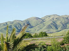
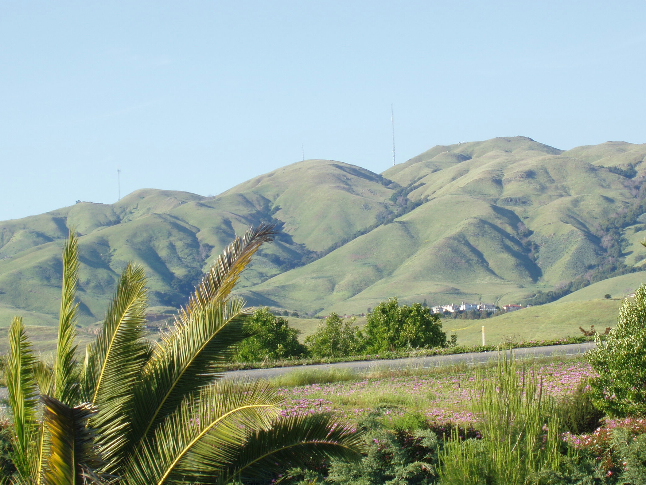
To the east of Milpitas is a range of high foothills and Mountains, part of the Diablo Range which runs along the east side of San Francisco Bay. Monument Peak, the most prominent summit in the eastern Milpitas hills, is one of the oldest and most well-known symbols of Milpitas. It currently has a broadcasting antenna which provides several television channels to the San Francisco Bay Area.
Although not within Milpitas' city limits, Monument Peak, Calaveras Reservoir, Arroyo Hondo, Laguna Valley, and the surrounding region are culturally and historically considered part of Milpitas. (Loomis, Patricia - Milpitas: A Century of Little Cornfields) Many Portuguese farmers from the Azores have settled there, including the Coelho, Covo, Mattos, Serpa, and Silva families. They are often nicknamed by longtime Milpitans as the "hill people." These Azorean families still own the undeveloped lands in the Milpitas foothills, such as the Silvas living on Old Calaveras Road. 4 The southeasternmost hills belong to the City of Milpitas, which then leases the lands to cattle livestock companies.
There are also many creeks in Milpitas, most of which are part of the Berryessa Creek watershed. Calera Creek, Arroyo de los Coches, Penitencia Creek and Piedmont Creek are some of the creeks that flow from the Milpitas hills and empty into the San Francisco Bay. (See Berryessa Creek)
Urban layout
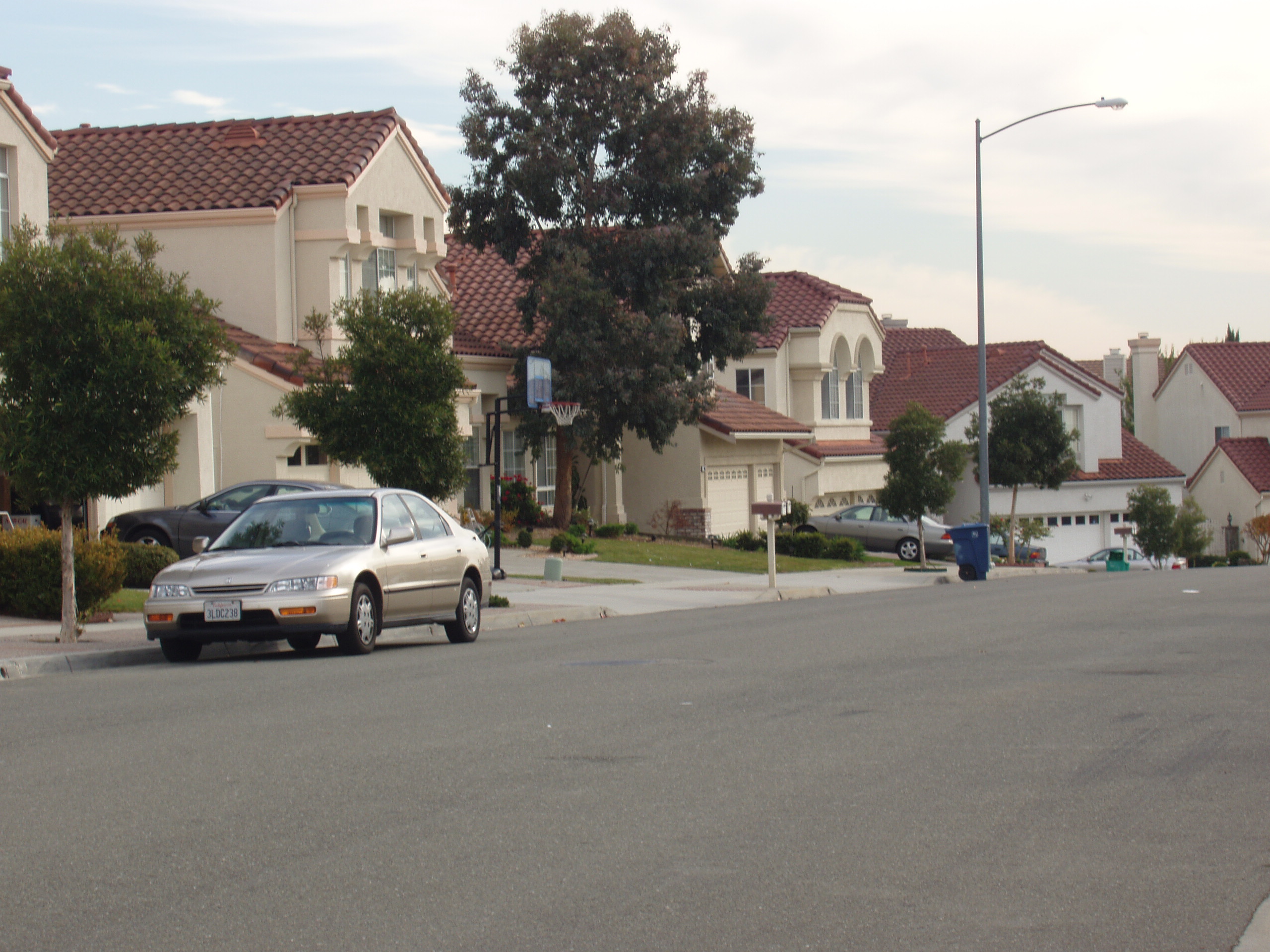
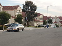 Large, new homes on Kristinridge Way, Milpitas. Located south of the Parktown development and adjacent to Hillcrest.
Milpitas is divided into three sections by Interstates 680 and 880. To the west of I-880 is a largely industrial and commercial area. Between I-880 and its eastern counterpart freeway, I-680, is an industrial zone in the south and residential neighborhoods in the north. Other residential neighborhoods and undeveloped mountains lie east of I-680.
In reality, Milpitas has no concentrated downtown "center," but instead has several small retail centers generally located near residential developments and anchored by a supermarket. The so-called "Midtown" area, the oldest part of Milpitas, has few remaining historic residences and was the only commercial district that existed before 1945. Midtown is situated in the region where Main and Abel Streets run parallel to each other bordered by Montague Expressway in the south and Weller Street at the north end. A USPS post office, Saint John the Baptist Catholic Church, Elementary & Junior High Catholic School, the Milpitas Public Library (which incorporates the old Milpitas Grammar School building), the Smith/DeVries mansion, the Senior Center, and Elmwood Correctional Facility are all in the Midtown section of Milpitas. The Milpitas Civic Center, which includes City Hall, is not located in Midtown, but stands at the intersection of Milpitas and Calaveras Boulevards. The Civic Center is separated from Midtown by the Calaveras overpass. The boundaries that divide major Milpitas neighborhoods and districts include Calaveras Boulevard running from east to west and the Union Pacific railroad, which runs from north to south. The newest retail centers are west of Interstate 880. There are several predominantly Asian retail centers with store signs written in Chinese, Vietnamese, and Korean.
Climate
 Typical oak savannah landscape. Photo of Mount Hamilton, a peak southeast of Milpitas.See also: San Jose's climate
Set within a warm Mediterranean climate zone in Santa Clara County, Milpitas enjoys warm, sunny weather with only some extreme temperatures and very little snow fall. Having one of the mildest climates in the United States, the city's temperature seldom drops below 35 °F (2 °C) and very rarely experiences snow. The ice storms, or blizzards found in the eastern US are unknown in Milpitas. During the winter, temperatures are relatively warm at an average of 40 °F (4 °C) to 58 °F (4 °C to 14 °C). Showers and cloudy days are frequent during this season dropping most of the city's annual 18 inches (460 mm) of precipitation, and as spring approaches, the gentle rains gradually dwindle. In summer, the grasslands on the hillsides dehydrate rapidly and form bright, golden sheets on the mountains set off by stands of oak. As opposed to Milpitas' rainy, cool winters, the summer is dry and warm but not hot like in other parts the Bay Area. Temperatures infrequently reach over 100 °F (38 °C) with most days in the mid 70s to the high 70's. From June to September, Milpitas experiences little rain, and as autumn approaches, the weather gradually cools down. Many temperate-climate trees drop their leaves during fall in the South Bay but the winter temperature is warm enough for evergreens like date palms to thrive.
Climate data for Milpitas, CA Month Jan Feb Mar Apr May Jun Jul Aug Sep Oct Nov Dec Year Record high °F (°C) 79
(26)81
(27)87
(31)95
(35)101
(38)109
(43)108
(42)105
(41)104
(40)101
(38)85
(29)79
(26)109
(43)Average high °F (°C) 59
(15)63
(17)67
(19)72
(22)77
(25)82
(28)84
(29)84
(29)82
(28)76
(24)65
(18)59
(15)73 Average low °F (°C) 42
(6)45
(7)46
(8)48
(9)52
(11)55
(13)58
(14)58
(14)57
(14)52
(11)46
(8)41
(5)50 Record low °F (°C) 24
(−4)26
(−3)30
(−1)35
(2)37
(3)42
(6)47
(8)47
(8)42
(6)36
(2)21
(−6)19
(−7)19
(−7)Precipitation inches (mm) 3.03
(77)2.84
(72.1)2.69
(68.3)1.02
(25.9)0.44
(11.2)0.10
(2.5)0.06
(1.5)0.07
(1.8)0.23
(5.8)0.87
(22.1)1.73
(43.9)2.00
(50.8)15.08
(383)Source: [10] Demographics
2010
The 2010 United States Census[11] reported that Milpitas had a population of 66,790. The population density was 4,896.5 people per square mile (1,890.6/km²). The racial makeup of Milpitas was 13,725 (20.5%) White, 1,969 (2.9%) African American, 309 (0.5%) Native American, 41,536 (62.2%) Asian, 346 (0.5%) Pacific Islander, 5,811 (8.7%) from other races, and 3,094 (4.6%) from two or more races. Hispanic or Latino of any race were 11,240 persons (16.8%).
The Census reported that 64,092 people (96.0% of the population) lived in households, 104 (0.2%) lived in non-institutionalized group quarters, and 2,594 (3.9%) were institutionalized.
There were 19,184 households, out of which 8,616 (44.9%) had children under the age of 18 living in them, 12,231 (63.8%) were opposite-sex married couples living together, 2,279 (11.9%) had a female householder with no husband present, 1,105 (5.8%) had a male householder with no wife present. There were 760 (4.0%) unmarried opposite-sex partnerships, and 100 (0.5%) same-sex married couples or partnerships. 2,470 households (12.9%) were made up of individuals and 742 (3.9%) had someone living alone who was 65 years of age or older. The average household size was 3.34. There were 15,615 families (81.4% of all households); the average family size was 3.61.
The population was spread out with 15,303 people (22.9%) under the age of 18, 5,887 people (8.8%) aged 18 to 24, 21,827 people (32.7%) aged 25 to 44, 17,434 people (26.1%) aged 45 to 64, and 6,339 people (9.5%) who were 65 years of age or older. The median age was 36.1 years. For every 100 females there were 104.5 males. For every 100 females age 18 and over, there were 104.6 males.
There were 19,806 housing units at an average density of 1,452.0 per square mile (560.6/km²), of which 12,825 (66.9%) were owner-occupied, and 6,359 (33.1%) were occupied by renters. The homeowner vacancy rate was 1.2%; the rental vacancy rate was 3.1%. 42,501 people (63.6% of the population) lived in owner-occupied housing units and 21,591 people (32.3%) lived in rental housing units.
2000
As of the census[12] of 2000, there were 62,698 people,[13] 17,132 households, and 13,996 families residing in the city. The population density was 1,785.2/km² (4,622.9/mi²). There were 17,364 housing units at an average density of 494.4/km² (1,280.3/mi²). The racial makeup of the city was 51.81% Asian, 30.87% White, 3.66% African American, 0.62% Native American, 0.63% Pacific Islander, 7.48% from other races, and 4.94% from two or more races. Hispanic or Latino of any race were 16.61% of the population.
There were 17,132 households out of which 43.0% had children under the age of 18 living with them, 65.1% were married couples living together, 10.9% had a female householder with no husband present, and 18.3% are nonfamilies. 11.5% of all households were made up of individuals and 2.9% had someone living alone who was 65 years of age or older. The average household size was 3.47, and the average family size was 3.72.
In the city, the population was spread out with 24.6% under the age of 18, 9.5% from 18 to 24, 38.0% from 25 to 44, 20.9% from 45 to 64, and 7.0% who were 65 years of age or older. The median age was 33 years. For every 100 females, there are 110.8 males. For every 100 females age 18 and over, there were 111.4 males.
The median income for a household in the city was $84,429, and the median income for a family was $84,827 (these figures had risen to $85,186 and $91,232 respectively as of a 2007 estimate[14]). Males had a median income of $51,316 versus $36,681 for females. The per capita income for the city was $27,823. About 3.3% of families and 5.0% of the population were below the poverty line, including 5.5% of those under age 18 and 6.4% of those age 65 or over. [3]
Compared to rural parts of California, living in Milpitas is more expensive, as it is throughout Silicon Valley. Compared to other South Bay bedroom communities Milpitas is considered affordable. For example, a regular one-story, detached single-family home with a 1,300-square-foot (140 m²) size sells for between $600,000 to $700,000 in the city. These prices are slightly more affordable than the rest of the San Francisco Bay Area, as a similar sized house may cost well over a million dollars in more affluent cities such as Palo Alto, Cupertino or Saratoga. Reasons for the expensive housing in the South Bay Area include the regional high tech industries, mild climate, strong foreign investment in the West Coast's housing, and a huge demand for limited homes. With the decline in the housing market , however, median sales prices in Milpitas have declined from nearly $700,000 to less than $500,000, and single-family new house construction building permits have plummeted from a 2004 average price of $949,900 to $269,400 in 2007.
Law and government
Local
The city is headed by one mayor, one vice mayor, and three council members. Currently, Milpitas is served by mayor Jose "Joe" Esteves, vice mayor Pete McHugh, and council members Armando Gomez, Jr., Althea Polanski, and Debbie Giordano. The city manager is Thomas C. Williams; the police chief is Dennis Graham; the Fire Chief is Brian Sturdivant; the Finance Director is Emma Karlen; and the city clerk is Mary Lavelle. The city's seal shows Daniel Chester French's Minuteman statue, musket in hand, standing in the Santa Clara Valley, with the golden hills of Milpitas rising to the east. He faces defiantly south toward San Jose because early residents of Milpitas considered themselves like minutemen when they defeated efforts by San Jose to annex newly incorporated Milpitas.
The Milpitas Police Department has a long tradition of reaching out to the community and its citizens. Most recently, in the Spring of 2007, the police department conducted a youth academy, in which teenagers were able to experience various aspects of policing, including the K-9 program, use of force issues and Internet safety.[15]
State and Federal
In the state legislature Milpitas is located in the 10th Senate District, represented by Democrat Ellen Corbett, and in the 20th Assembly District, represented by Democrat Bob Wieckowski. Federally, Milpitas is located in California's 15th congressional district, which has a Cook PVI of D +14[16] and is represented by Democrat Mike Honda.
Economy
 Headquarters of the electronics manufacturing company, Solectron.
Most people who live in Milpitas work out of the city, while most of the workers employed in Milpitas come from other cities. This results in heavy traffic commutes along key arterial roads twice each day.[citation needed]
The computer industry, which includes computer equipment manufacturing and software programming, is the largest source of employment in Milpitas.[citation needed]
Milpitas is home to the headquarters of Adaptec, Intersil, JDSU, KLA-Tencor, Linear Technology, LSI Logic, LTX-Credence, Sandisk,[17] Sigma Designs, and Solectron. Many other companies have offices in Milpitas including Quantum, Maxtor, Cisco Systems, Avaya, Seagate Technology, LifeScan, Phoenix Technologies and International Microsystems Inc. Creative Technology's well-known U.S. subsidiary, Creative Labs, is based in Milpitas.[citation needed]
Milpitas is also home to one of Santa Clara County's two correctional facilities, the Elmwood Correctional Facility,[18] which houses 3,035 inmates.[19]
Top Employers
According to the City's 2010 Comprehensive Annual Financial Report,[20] the top employers in the city are:
# Employer # of Employees 1 Cisco Systems 4,339 2 Great Mall 3,380 3 KLA Tencor 2,000 4 Flextronics 5 LSI 1,320 6 SanDisk 1,200 7 Linear Technology 1,100 8 LifeScan 1,000 9 Milpitas Unified School District 833 10 JDSU 800 Education
Primary and secondary schools
Milpitas' public schools are run by the Milpitas Unified School District (MUSD).[21] The school district was originally Milpitas Elementary S.D. when it was started as a separate district in the 1950s. Formerly, James Lick High School in Alum Rock was the closest high school to Milpitas. Samuel Ayer High School (now the Milpitas Sports Center, Teen Center, Calaveras Hills HS., and Adult Education Center) on Calaveras Road was built as the only high school located in the city. In the late 1960s MUSD was formed and included Ayer High which had previously been part of East Side Union High School District. In 1970s, Milpitas High School was built on Escuela Parkway and, due to declining enrollment, Samuel Ayer High School closed. Currently Milpitas High is one of the biggest high schools in the county, with approximately 3000 students. The continuation school, Calaveras Hills High School is one of the best schools for "at risk" students in the state. CHHS was designated a California Model Continuation High School.[22]
Milpitas unified API score for 2011 is 849, higher than the county average of 827.[23] From 2003 to 2011, the district API has risen by 87 points.[24] Additionally, Milpitas schools have consistently attained API growth year over year. In 2011, two Milpitas Elementary schools, Sinnot and Curtner achieved scores of 900 and 913 respectively.[23]
Elementary School 2010-2011 API Score Sinnott 900 Curtner 913 Burnett 880 Pomeroy 877 Spangler 874 Zanker 869 Weller 864 Rose 827 Randall 780 Middle School 2010-2011 API Score Russell 880 Rancho 870 High School 2010-2011 API Score Milpitas 812 Public libraries
Santa Clara County Library operates the Milpitas Library.[25]
Issues and concerns
Milpitas is a suburban community in the South Bay of the San Francisco Bay Area, and like all cities it has a few areas of concern to its citizens. Dominant among these are overcrowded schools, lack of adequate open parkland, traffic congestion, and air quality. Seekers of public offices typically face stiff competition at election time.
Pollution
Milpitas occasionally experiences odorous air traveling downwind from bay salt marshes from the Newby Island landfill and from the San Jose sewage treatment plant's percolation ponds. Most malodorous during the autumn, it is especially pungent west of Interstate 880 because of its close location to the San Francisco Bay and the direction of the prevailing winds out of the north-northwest. The City of Milpitas would like to remedy this air quality problem to the extent it can and encourages its residents to file odor complaints.[26]
Local creeks and the nearby San Francisco Bay suffer somewhat from water pollution originating from street water runoff and industrial wastes. The creeks in Milpitas, especially Calera, Scott, and Berryessa Creeks, used to be prime fishing spots for native steelhead until pollutants from urban development and industry killed the fish starting in the 1950s. While small populations of steelhead and even salmon still may be seen in area streams these cannot legally be fished and consumption of legal catches is limited by mercury contamination.
The I880 corridor has experienced relatively elevated levels of air pollution from freeway traffic. For example eight hour standards for carbon monoxide have been near to maximum levels for the last two decades.[27]
Controversy
Hillside Open Space Initiative
In the late 20th and early 21st centuries, Milpitas voters enacted measures to protect the west-facing hillsides east of the city from development.
Culture and recreation
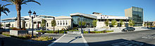
 The future new Milpitas Senior Center (formerly Milpitas Public Library) is to the right of Milpitas City Hall, and Milpitas Community Center is on the left edge of the panorama.
Milpitas residents enjoy various visual and performing arts. The Milpitas Alliance for the Arts, founded in 1997, is an organization which promotes and funds murals, plays, sculptures, and many other forms of art. The "Art in Your Park" project has put many sculptures in local Milpitas parks, including a ceramic tower in Hillcrest Park, a sundial in Augustine Park, and a historical memorial in Murphy Park. The Celebrate Milpitas Festival is held annually every August, featuring vendors of crafts-type merchandise and providing local talent with a performance venue while selling visitors samplings of exotics like garlic fries or lumpia and even offerings from one or two Californian wineries. The suburb offers a rich variety of food options, including sit-down restaurants and fast food.
The city has many athletic and educational recreational programs which are located in several city buildings, including the city's sports center, teen center, library, community center, and senior center.
Shopping Super Centers
Milpitas is also home to the largest Bay Area enclosed shopping mall (in terms of land area), the Great Mall of the Bay Area. The Great Mall is a part of the Simon mall branch and is the biggest mall/outlet shopping center in northern California. There are approximately 200 stores within the mall, with a total of 1,357,000 square feet (126,100 m2) of retail area.
A large outdoor shopping center called Milpitas Square is anchored by the 99 Ranch Market west of Interstate 880.
Other Milpitas shopping centers and plazas include Ulferts Center, Milpitas Town Center, Jacklin Square, McCarthy Ranch, Parktown Plaza, Beresford Square, and the City Square.
There are two car dealerships in Milpitas that are located on the east side of Interstate 880, near Great Mall Parkway.
In the past, Milpitas had a very different culture from that of its modern suburban state. As late as the 1950s, Milpitas was an unincorporated rural town with the Midtown district on Main Street as its main center of business and social activities. Many old businesses include Main Street Gas (operated by the Azorean Spangler brothers), Smith's Corner Saloon, and Kozy Kitchen. The Cracolice Building was one of the oldest commercial buildings in Milpitas and was the site of many political conventions and meetings. "As Milpitas Goes, So Goes the State" used to be a popular slogan around the town. Most of the land now within modern-day Milpitas' boundaries was used for strawberry, asparagus, apricot, and potato cultivation until the postwar boom during the 1950s and 1960s.
Parks
 Ed R. Levin County Park is nestled in the foothills of Milpitas.
Ed R. Levin County Park is the largest county regional park near Milpitas. The County of Santa Clara Parks and Recreation Department runs the park. Monument Peak can be accessed through trails that lead north through the county park. The park also provides facilities for hang gliding and paragliding and includes a newly built dog park that was a joint effort by the county and the city of Milpitas. Two golf courses, Spring Valley Golf Course and Summitpointe Golf Course, are located in the Milpitas foothills. Both have expensive gated residential developments located adjacent to them. Milpitas itself has 17 traditional neighborhood parks which are generally 3 to 10 acres (12,000 to 40,000 m²). There also is a sports complex and sports parks with baseball and tennis play areas fenced off. There are also smaller parks of less than 3 acres (12,000 m2) scattered in newer developments. Milpitas has begun to develop the San Francisco Water District's Hetch Hetchy right-of-way as park land in lieu of using land from new high density residential developments adjacent to it. Together, these parks total 166 acres (670,000 m2) of land area or less than 2% of the city's acreage.
Media
Newspapers
- Milpitas Post
- San Jose Mercury News
- East Bay Express
- Oakland Tribune
- San Francisco Chronicle
- Metro Newspapers
- Wave Magazine
- San Francisco Bay Guardian
- SF Weekly
- Singtao Daily Bay Area edition
- World Journal Bay Area edition
Radio
Country:
- KRTY, 95.3 - "San Jose Hot Country" (Empire Broadcasting)
News/Talk:
- KCBS, 740 - "KCBS All News 740 and 106.9" (CBS Radio)
- KFRC-FM, 106.9 - "KCBS All News 740 and 106.9" (CBS Radio)
- KGO, 810 - "KGO Newstalk 810" (ABC)
- KLIV, 1590 - "Silicon Valley News 1590 KLIV" (CNN) (Empire Broadcasting)
- KNEW, 910 - "Fox Newsradio 910"
- KKGN, 960 - "The Green 960"
- KDOW, 1220 - "Bay Area's Business Leader"
- KSFO, 560 - "Hot Talk 560 KSFO"
Christian Rock:
- K265CY, 100.9 - rebroadcast of KSRI
- K257BE, 99.3 - rebroadcast of KLVM
- K205BN, 88.9 - rebroadcast of KLVM
- K220BV, 91.9 - rebroadcast of KLVM
Sports:
- KNBR, 680 - "KNBR 680 and 1050 The Sports Leader"
- KTCT, 1050 - "KNBR 680 and 1050 The Sports Leader"
- KTRB, 860 - "ESPN Deportes 860"
- KGMZ, 95.7 - "95.7 The Game" "Yahoo Sports Radio"
Light rock/Adult alternative:
- KBAY, 94.5 - "The Bay Area's Soft Rock"
- KOIT, 96.5 - "Lite Rock, Less Talk"
Modern Rock:
- KITS, 105.3 "Live 105"
- KSAN-FM, 107.7 - "107.7 The Bone"
Hip-hop/R&B:
Pop:
- KREV, 92.7 - "92.7 The Revolution"
- KMVQ, 99.7 - "Movin 99.7"
Urban AC/R&B:
Rock/Classic rock:
- KUFX, 98.5 - "KFOX"
- KUZX, 102.1 - simulcast of KUFX 98.5
- KFOG, 104.5 - "104.5 and 97.7 KFOG World Class Rock"
- KFFG, 97.7 - "104.5 and 97.7 KFOG World Class Rock"
- KKSF, 103,7 - "103.7 The Band"
- KSFH, 87.9 - "Music Revolution"
Children's:
- KMKY, 1310 - Radio Disney
Hot Adult Contemporary
Classical:
- KDFC, 90.3 - "Classical 90.3 KDFC"
Variety/Public:
- KPFA, 94.1 - "Listener's Sponsored Radio"
- KPOO, 89.5
- KKUP, 91.5
- KPFB, 89.3 - simulcast of 94.1 KPFA
- KQED-FM, 88.5
- KALW, 91.7 - San Francisco Unified School District
- K212AA, 90.3 - rebroadcast of KUSP
Jazz:
- KCSM, 91.1 (noncommercial)- "Jazz 91"
Spanish:
- KRZZ, 93.3 - "La Raza 93.3"
- KSOL, 98.9 - "Estereo Sol 98.9"
- KZSF, 1370 - "La Kaliente 1370"
- KCNL, 104.9 - "La Preciosa 104.9"
- KBRG, 100.3 - "Recurdo 100.3"
- KVVZ, 100.7 - "Viva 100.7 and 105.7"
- KVVF, 105.7 - "Viva 100.7 and 105.7"
- KIQI, 1010 - "Radio Unica 1010"
- K265DI, 100.9 - rebroadcast of KVVZ
Religious:
- KEAR, 610 - "The Sound of the New Life"
- KSFB, 1260 - "Catholic Radio 1260"
- KFAX, 1100 - "The Spirit of the Bay"
- KDIA, 1640 - "The Light for San Francisco"
- KDYA, 1190 - "1190 The Light"
Asian:
- KEST, 1450 - "Personal Programming for the Bay Area"
- KLOK, 1170 - "San Francisco's International Community Radio Station"
- KSFN, 1510 - "Chinese Radio"
- KSJO, 92.3, "Bay Area Chinese Radio"
- KSJX, 1500 - "Radio Station in Your Language"
- KSQQ, 96.1 - "Q96 FM"
- KVTO, 1400 - "Voice of the Orient"
- KVVN, 1430 - "San Jose's Asian Voice"
- KZDG, 1550 - "Radio Zindagi"
College/School:
- KMTG, 89.3 - San Jose Unified School District
- KFJC, 89.7 - Foothill College
- KZSU, 90.1 - Stanford University
- KALX, 90.7 - University of California Berkeley
- KCEA, 89.1 - Sequoia Union High School District
- KECG, 88.1 - El Cerrito High School
- KOHL, 89.3 - Ohlone College
- KCRH, 89.9 - Chabot College
- KSJS, 90.5 - San Jose State University
- KSCU, 103.3 - Santa Clara University
Television
Digital television service available to Milpitas includes:[28]
- KAXT, 01 - "Que Hoang"
- KTVU, 02 - Fox affiliate
- KRON, 04 - My Network TV news station
- KPIX, 05 - CBS affiliate
- KGO, 07 - ABC affiliate
- KQED, 09 - PBS
- KNTV, 11 - NBC, "NBC 11," broadcast from San Bruno Mountain in San Mateo County.
- KDTV, 14 - Univision (broadcast from Mount Allison in Fremont)
- KOFY, 20 - independent, "Your TV20"
- KTSF, 26 - San Francisco Asian TV
- KFTL, 28 - Home Shopping Network
- KMTP, 32 - European (German, Italian) and Asian TV
- KICU, 36 - independent, "Action 36, Cable 6" (broadcasted from Monument Peak in Milpitas)
- KCNS, 38 - independent, "Sino TV"
- KBCW, 44 - The CW
- KSTS, 48 - Telemundo (broadcast from Mount Allison in Fremont; shares same antenna as KDTV)
- KQEH, 54 - PBS (broadcast from Monument Peak in Milpitas; shares same antenna as KICU)
- KCSM, 60 - College of San Mateo
- KKPX, 65 - Ion Television
- KFSF, 66 - Telefutura
- KTLN, 68 - Total Living Network
Infrastructure
Communications
Like most other Bay Area cities, USPS, UPS, FedEx, and DHL are readily available to Milpitas. The USPS post office on Abel Street is Milpitas' main office for postal mail and is the only USPS post office in the city. ZIP code 95035 is exclusively for Milpitas and is the only standard ZIP code for the city. 95036 is a new ZIP that is used sometimes for post office boxes in Milpitas. Until the merge with SBC, Milpitas had relied on Pacific Bell for its telecommunications services. American Telegraph and Telephone (AT&T) acquired Southern Bell (SBC) in 2006 and became the land-line telephone provider in the city. As part of the agreement for the merger of AT&T with SBC, Milpitas residents were offered high speed DSL internet access with AT&T for only $10 per month until December, 2009, although few residents are aware of the offer.
On Earth Day, April 22, 2009, the public-private partnership Silicon Valley Unwired announced the implementation of a free municipal WiFi wireless network for the entire City.[29] It joins the Google WiFi network in Mountain View as the second fully operational municipal wireless network, providing free Internet access to all citizens.
Transportation
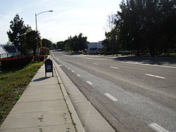 Yosemite Drive in Milpitas
From north to south, the major east-west roads in Milpitas are Dixon Landing Road, Jacklin Road, Calaveras Boulevard, and Landess Avenue/Montague Expressway. From east to west, the major north-south roads are Piedmont Road, Evans Road, Park Victoria Drive, Milpitas Boulevard, Main Street, Abel Street, and McCarthy Boulevard. Milpitas roads that reach into the hills are, from north to south, Country Club Drive, Old Calaveras Road, Calaveras Road, and a private ranch drive, the historic Urridias Ranch Road.
As with many other Californian suburbs, Milpitas has divided roads that are maintained well by the local city government. Street signs are in green, as opposed to San Jose's blue ones. Like the San Jose public works system, all pedestrians must manually press a button in order to turn the pedestrian signal lights on (unlike the South Bay cities, San Francisco has automatic pedestrian lights at intersections and does not have "press to cross" buttons for pedestrians).
Not all streets in Milpitas have bicycle lanes or sidewalks. Piedmont Road, Evans Road, and Jacklin Road have excellent bike lanes and sidewalks with ample spacing, but Montague Expressway and South Milpitas Boulevard have limited sidewalks and narrow bike lanes, which causes some problems for workers commuting by bike or on foot. The roads most favorable for recreational jogging and biking are Evans and Piedmont Roads.
State Route 237, Interstate 680, and Interstate 880 link Milpitas to the rest of the Bay Area. Interstates 680 and 880 lead north to Fremont and south to downtown San Jose. On the other hand, Highway 237 begins at Milpitas and goes west to Sunnyvale and Mountain View.
The Santa Clara Valley Transportation Authority (VTA) runs light rail (high-speed transit) and local buses for public transportation. VTA bus routes in Milpitas are 46, 47, 66, 70, 71, 77. [6]
The Altamont Commuter Express provides 3 morning express train service towards Milpitas from neighboring cities in San Joaquin and Alameda County, and 3 returning evening trips. Although the nearest stop is located near Great America Park, in San Jose, shuttle busses are provided with stops in Milpitas.
The nearest airports to the city are the Norman Y. Mineta San Jose International Airport (SJC) and Reid-Hillview Airport in East San Jose, the latter which is for small private airplanes. Although Milpitas is bordered by the San Francisco Bay in the extreme northwest, that area is not accessible to ships and boats. Being landlocked, the city depends on the Port of Oakland for oceangoing freight and on the Union Pacific Railroad for cargo transport.
An extension of Bay Area Rapid Transit from Fremont to San Jose is being constructed, and will include a major multi-modal station in Milpitas that will begin being built in Summer 2012 and open in 2018.[30]
In addition, China Airlines operates bus services to San Francisco International Airport from Lion Food Center at 1838 North Milpitas Boulevard to feed its flight to Taipei, Taiwan.[31]
Notable Movies featuring Milpitas
The Milpitas Monster was filmed in the town in 1976. Originally started as a high school project it developed into a feature length film. In the quiet town of Milpitas, California, a gigantic creature is spawned in a polluted, overflowing waste disposal site. The townspeople rally to destroy the creature, which has an uncontrollable desire to consume large quantities of garbage cans.
The movie River's Edge was inspired by the true story of a murder that happened in Milpitas in 1981. It is a story about a teenage boy that murders a classmate and shows off the body to his friends. The names and races of the individuals involved were changed. The story was "Hollywood-ized" for dramatic purposes. The filmmakers added stories that did not occur and characters that did not exist. It starred some relatively unknown actors at the time, including Keanu Reeves, Crispin Glover and Ione Skye, as well as veteran actor Dennis Hopper. The movie was inspired by the murder of Marcy Renee Conrad who was killed by a fellow teen named Anthony Broussard. He later dumped her body in a ditch in the East foothills of Milpitas.
See also
Physical features:
- Monument Peak
- Calaveras Reservoir
- Oak Ridge (California)
- Arroyo Hondo (Santa Clara County, California)
- Black Mountain (near Milpitas, California)
- Berryessa Creek
Similar name:
- Milpitas Ranchhouse, an historic hotel in Monterey County
References
- ^ U.S. Census
- ^ A brief history of Milpitas, California
- ^ Jose Higuera Adobe
- ^ Joseph Weller Palm
- ^ kozy kitchen
- ^ Census
- ^ Mann, Charles G. (2005). 1491: New Revelations of the Americas Before Columbus. New York: Alfred A. Knopf. pp. 197–199.
- ^ The Milpitas History Homepage, by Steve Munzel, 2010
- ^ "US Gazetteer files: 2010, 2000, and 1990". United States Census Bureau. 2011-02-12. http://www.census.gov/geo/www/gazetteer/gazette.html. Retrieved 2011-04-23.
- ^ "weather.com". http://www.weather.com/outlook/recreation/outdoors/wxclimatology/monthly/graph/USCA0706. Retrieved September 14, 2010.
- ^ All data are derived from the United States Census Bureau reports from the 2010 United States Census, and are accessible on-line here. The data on unmarried partnerships and same-sex married couples are from the Census report DEC_10_SF1_PCT15. All other housing and population data are from Census report DEC_10_DP_DPDP1. Both reports are viewable online or downloadable in a zip file containing a comma-delimited data file. The area data, from which densities are calculated, are available on-line here. Percentage totals may not add to 100% due to rounding. The Census Bureau defines families as a household containing one or more people related to the householder by birth, opposite-sex marriage, or adoption. People living in group quarters are tabulated by the Census Bureau as neither owners nor renters. For further details, see the text files accompanying the data files containing the Census reports mentioned above.
- ^ "American FactFinder". United States Census Bureau. http://factfinder.census.gov. Retrieved 2008-01-31.
- ^ Milpitas, California Demographics
- ^ Milpitas 2007 Income Estimates
- ^ [The Milpitas Post, March 15, 2007 issue]
- ^ "Will Gerrymandered Districts Stem the Wave of Voter Unrest?". Campaign Legal Center Blog. http://www.clcblog.org/blog_item-85.html. Retrieved 2008-02-10.
- ^ "Contact Us." SanDisk. Retrieved on December 7, 2009.
- ^ Go Milpitas - Elmwood Jail
- ^ Santa Clara County Department of Correction - Administration
- ^ of Milpitas 2010 Comprehensive Annual Financial Report Retrieved 2010-09-24
- ^ http://www.musd.org/dept/MUSD_Schools.html
- ^ https://chhs.musd.org/cms/page_view?d=x&piid=&vpid=1213914537233
- ^ a b http://milpitas.patch.com/articles/api-scores-up-for-milpitas-schools
- ^ https://www.musd.org/cms/block_view?d=x&piid=1286004364784&block_id=1288857920233
- ^ "Welcome to the Milpitas Library." Santa Clara County Library. Retrieved on March 27, 2010.
- ^ Report to the Mayor and City Council on Odor Control in Milpitas January 18, 2011, by: Kathleen Phalen, Utility Engineer
- ^ C.Michael Hogan, Marc Papineau, Ballard George et al., Environmental Assessment of the I880/Dixon Landing Road Interchange Improvement Project, Cities of Fremont and Milpitas, Earth Metrics Incorporated, Federal Highway Administration Publication, March, 1989
- ^ FCC Video Services Division (2010-01-11). "TV Query - TV Technical Information - Video Division - MB (FCC)". Fcc.gov. http://www.fcc.gov/mb/audio/tvq.html. Retrieved 2011-03-25.
- ^ Silicon Valley Unwired
- ^ "de beste bron van informatie over svrtc vta. Deze website is te koop!". svrtc-vta.org. http://www.svrtc-vta.org. Retrieved 2011-03-25.
- ^ "South Bay- SFO Int'l Airport Bus Service," China Airlines
Bibliography
The following books on Milpitas have been used as significant references for this article. Many of the books are not available at a regular store or are out of print, but all are available at the Milpitas branch of the Santa Clara County Library. These books are also recommended as resources for further reading.
- Milpitas: A Century of Little Cornfields. By Patricia Loomis. ISBN 0-935089-07-1 Available from the Milpitas Historical Society.
- Milpitas: Five Dynamic Decades. By Mort Levine, et al. Available at the Milpitas city hall or call the City of Milpitas. Note: Some of the information in this article is derived from this reference.
- History of Milpitas. By Madge Craig.
- Historic Sites Inventory. Prepared by Judith Marvin-Cunningham
- Images of America: Milpitas By Robert Burrill. ISBN 0-7385-2910-9 Available from the Milpitas Historical Society.
External links
- City of Milpitas
- Milpitas Historical Society
- Milpitas Chamber of Commerce
- Wikitravel guide to Milpitas
- Milpitas, California at the Open Directory Project
Municipalities and communities of Santa Clara County, California County seat: San Jose Cities and towns Campbell | Cupertino | Gilroy | Los Altos | Los Altos Hills | Los Gatos | Milpitas | Monte Sereno | Morgan Hill | Mountain View | Palo Alto | San Jose | Santa Clara | Saratoga | Sunnyvale
CDPs Alum Rock | Burbank | Cambrian Park | East Foothills | Fruitdale | Lexington Hills | Loyola | San Martin | Stanford
Unincorporated
communitiesBell Station | Casa Loma | Chemeketa Park | Coyote | Holy City | Loma Chiquita | Old Gilroy | New Almaden | Redwood Estates | Rucker | San Antonio Valley | Sargent | Sveadal
Ghost towns San Francisco Bay Area Bodies of water Bodega Bay · Carquinez Strait · Clifton Forebay · Golden Gate · Grizzly Bay · Guadalupe River · Half Moon Bay · Lake Berryessa · Napa River · Oakland Estuary · Petaluma River · Richardson Bay · Richmond Inner Harbor · Russian River · San Francisco Bay · San Leandro Bay · San Pablo Bay · Sonoma Creek · Suisun Bay · Tomales Bay

Counties Alameda · Contra Costa · Marin · Napa · San Francisco · San Mateo · Santa Clara · Solano · Sonoma
Major cities Cities and towns
100k–250kCities and towns
25k–99kAlameda · Belmont · Benicia · Brentwood · Burlingame · Campbell · Castro Valley · Cupertino · Danville · Dublin · East Palo Alto · Foster City · Gilroy · Livermore · Los Altos · Los Gatos · Martinez · Menlo Park · Milpitas · Morgan Hill · Mountain View · Napa · Newark · Novato · Oakley · Pacifica · Palo Alto · Petaluma · Pittsburg · Pleasant Hill · Pleasanton · Redwood City · Rohnert Park · San Bruno · San Carlos · San Leandro · San Mateo · San Pablo · San Rafael · San Ramon · Saratoga · South San Francisco · Suisun City · Union City · Vacaville · Walnut Creek · Windsor
Cities and towns
5k–25kAlamo · Albany · Alum Rock · American Canyon · Ashland · Atherton · Bay Point · Blackhawk-Camino Tassajara · Cherryland · Clayton · Discovery Bay · Dixon · El Cerrito · El Sobrante · Emeryville · Fairview · Half Moon Bay · Healdsburg · Hercules · Hillsborough · Lafayette · Larkspur · Los Altos Hills · Millbrae · Mill Valley · Moraga · North Fair Oaks · Orinda · Piedmont · Pinole · San Anselmo · San Lorenzo · Sonoma · Stanford · Tamalpais-Homestead Valley
Sub-regions Categories:- Milpitas, California
- Populated places established in 1954
- Incorporated cities and towns in California
- Cities in Santa Clara County, California
- Cities in the San Francisco Bay Area
- Populated places in the United States with Asian American majority populations


Wikimedia Foundation. 2010.