- Benicia, California
Infobox Settlement
official_name = City of Benicia, California
other_name =
native_name =
nickname =
settlement_type =City
motto =
imagesize =
image_caption =
flag_size =
image_
seal_size =
image_shield =
shield_size =
image_blank_emblem =
blank_emblem_type =
blank_emblem_size =
imagesize =
image_caption =
flag_size =
image_
seal_size =
image_shield =
shield_size =
image_blank_emblem =
blank_emblem_type =
blank_emblem_size =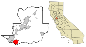
mapsize = 250x200px
map_caption = Location in Solano County and the state ofCalifornia
mapsize1 =
map_caption1 =
image_dot_
dot_mapsize =
dot_map_caption =
dot_x =
dot_y =
pushpin_
pushpin_label_position =
pushpin_map_caption =
pushpin_mapsize =
subdivision_type = Country
subdivision_name =United States
subdivision_type1 = State
subdivision_name1 =California
subdivision_type2 = County
subdivision_name2 = Solano
subdivision_type3 =
subdivision_name3 =
subdivision_type4 =
subdivision_name4 =
government_footnotes =
government_type =
leader_title =Mayor
leader_name =Elizabeth Patterson
leader_title1 =
leader_title1 = Senate
leader_name1 =Pat Wiggins (D)
leader_title2 = Assembly
leader_name2 =Lois Wolk (D)
leader_title3 = U. S. Congress
leader_name3 = George Miller (D)
leader_title4 =
leader_name4 =
established_title =
established_date =
established_title2 = Incorporated
established_date2 = 1850
established_title3 =
established_date3 =
area_magnitude = 1 E8
unit_pref =
area_footnotes =
area_total_km2 = 40.4
area_land_km2 = 33.4
area_water_km2 = 7.0
area_total_sq_mi = 15.6
area_land_sq_mi = 12.9
area_water_sq_mi = 2.7
area_water_percent =
area_urban_km2 =
area_urban_sq_mi =
area_metro_km2 =
area_metro_sq_mi =
area_blank1_title =
area_blank1_km2 =
area_blank1_sq_mi =
population_as_of = 2000
population_footnotes =
population_note =
population_total = 26865
population_density_km2 = 315.7
population_density_sq_mi = 2082.6
population_metro =
population_density_metro_km2 =
population_density_metro_sq_mi =
population_urban =
population_density_urban_km2 =
population_density_urban_sq_mi =
population_blank1_title =
population_blank1 =
population_density_blank1_km2 =
population_density_blank1_sq_mi =
timezone = PST
utc_offset = −8
timezone_DST = PDT
utc_offset_DST = −7
latd = 38 |latm = 3 |lats = 48 |latNS = N
longd = 122 |longm = 9 |longs = 22 |longEW = W
elevation_footnotes =
elevation_m = 8
elevation_ft = 26
postal_code_type =ZIP code
postal_code = 94510
area_code = 707
blank_name = FIPS code
blank_info = 06-05290
blank1_name = GNIS feature ID
blank1_info = 0277472
website = [http://www.ci.benicia.ca.us/]
footnotes =
incorporation_date =May 19 ,1847
other =Benicia is a waterside city in Solano County,
California ,United States . It was the first city in California to be founded by Anglo-Americans, and briefly served as thestate capital for nearly thirteen months. The population was 26,865 at the 2000 census. The city lies in theSan Francisco Bay Area near San Francisco and next to Vallejo. Benicia is located on the north side of theCarquinez Strait , directly facing the city of Martinez.The town can be divided into three areas: Southampton (north of Military), East Benicia (east of First Street), and West Benicia (west of First Street). Most of the town's HI older homes are on the east and west sides. The far east side has an industrial park, where the town's many local artists have rented out studio space. Also in or near the industrial park are the Valero oil refinery, the 1859 Clock Tower and the 1850s Camel Barns. The Benicia State Recreation Area is on the far west edge of the city. Southampton contains primarily stucco family homes, most of which were built between 1970 and 2000.
The main retail area in Benicia is First Street, which attracts out-of-town antique and boutique shoppers and those seeking small-town charm.
Connections to Benicia include Interstate 680 from Martinez to the south and Cordelia Junction (Fairfield) to the north, and Interstate 780, Columbus Parkway, and other local roads from Vallejo to the west.
Amtrak also runs past the city north towards Sacramento, but the train station lies in Martinez across the Carquinez Strait. Railroad tracks carrying Amtrak andUnion Pacific Railroad lines cross the strait alongside theBenicia-Martinez Bridge .History
Benicia was founded on
May 19 ,1847 by Robert Semple,Thomas O. Larkin , and Comandante GeneralMariano Guadalupe Vallejo , on land sold to them by General Vallejo, and named for the General's wife, Francisca Benicia Carillo de Vallejo. The first intended name "Francisca" was dropped due to then Yerba Buena changing its name to "San Francisco", so Mrs. Vallejo's second given name was used instead. Benicia was sixth site selected as theCalifornia state capital fromFebruary 11 ,1853 toFebruary 25 ,1854 , but the capital was then moved to Sacramento. The restored capitol building is part of theBenicia Capitol State Historic Park . Benicia was also the county seat of Solano County until 1858 when that was moved to Fairfield.From 1860-1861, Benicia was indirectly involved in the
Pony Express . When riders missed their connection with a steamer inSacramento , they would continue on to Benicia and cross over to Martinez via the ferry. [ [http://www.beniciahistoricalmuseum.org/benhist_1860.htm Benicia History and the Pony Express] ] One of the earliest companies in California, thePacific Mail Steamship Company , established a major shipyard in Benicia in the 19th century. Benicia became an important wheat storage and shipping site. It was also the site of theUnited States Army 'sBenicia Arsenal . In 1879, theCentral Pacific Railroad re-routed the Sacramento-Oakland portion of its transcontinental line, establishing a major railroadferry across the Carquinez Strait from Benicia toPort Costa . The world's largest ferry, the Solano, later joined by the even larger Contra Costa, carried entire trains across the Carquinez Strait from Benicia to Port Costa, from whence they continued on to theOakland Pier . After California's wheat output dropped in the early 20th Century and especially after the Southern Pacific (which took over the operations of the Central Pacific) constructed a railroad bridge atMartinez in 1930 to replace the ferry crossing, Benicia declined until the economic boom ofWorld War II , which doubled the population to about 7,000 residents.Two developments in the early 1960s would completely change Benicia: The closing of the Benicia Arsenal in 1960–64, and the completion of the
Benicia-Martinez Bridge in 1962. The closing of the Arsenal removed Benicia's traditional economic base, but allowed city leaders to create anindustrial park on Arsenal land which eventually provided more revenue for the city than the Army had. The completion of the Benicia-Martinez Bridge made it possible for the city to become asuburb of San Francisco and Oakland, and suburban development in the Benicia hills began in the late 1960s.Between 1970 and 1995, the population of Benicia grew steadily at a rate of about 1,000 people per year, and the city changed from a poor, blue-collar town of 7,000 to a white-collar bedroom suburb of 28,000.
The town is also the location of the Valero
Refinery . The refinery was completed in 1969 byExxon Corporation , and bought by Valero Refining, aSan Antonio based oil company in 2000. The U.S. Environmental Protection Agency listed the Exxon refinery in Benicia among the top five facilities for toxic chemical releases to the environment in California in 1997. Flaring, most commonly associated with vapor plumes coming from tall stacks at the refineries is the process used to burn off gases during "upsets," when something goes wrong and equipment must be shut down rapidly to avert an explosion or fire. Those emergencies can produce thick black clouds of unburned hydrocarbons, which in turn produce six-figure fines from the air district and local governments. Refineries face possible fines if they flare for more than three minutes.Activities
There is a
Farmers' market on Thursday evenings during the summer months May through October. According to the Benicia Main Street commerce organization, this tradition began in 1992. There is no entry fee for this event.First Fridays on First. On the first Friday of each month, May through October, participating shops and restaurants encourage a festival atmosphere with balloons and live music on First Street. During the summer months, outdoor movies are shown at 9 p.m. at the Benicia State Capitol. There is no entry fee for this event.
Torchlight Parade & Dance. Traditionally held on the
July 3 , Benicia’s 4th of July parade stretches all the way down First Street and typically includes music, dancing, floats, horses, clowns, and live entertainment. A street dance and live entertainment traditionally follow the parade on First Street. There is no entry fee for this event.Picnic in the Park & Fireworks. On
July 4 , there is a large community picnic at Benicia’s City Park traditionall starting at noon. Shortly after dark (approximately 9pm) there is a fireworks display that originate at the foot of First Street. There is no entry fee for this event.Benicia Peddler's Fair. This outdoor event began in 1963 with a few collectable and antique stores displaying their items on tables outside St. Paul's Church. Today, over 300 antique and collectable dealers as well as other vendors display their wares in booths that span approximately 11 blocks of First Street. Unverified sources cite attendance in 2006 at approximately 20,000. This event is sponsored by
St. Paul's Episcopal Church in Benicia. There is no entry fee for this event.Sailing . Benicia is an active sailing community. In additional to individual sailing out of the Benicia Marina, there are several organized events and competitions. During the summer months, there is ayacht racing competition on Thursday evenings sponsored by the Benicia Yacht Club.Youth Sailing Program. The Benicia Yacht Club sponsors a Youth Sailing Program that offers 5 Tuesday training sessions of approximately 4 hours each. These classes are an introduction to sailing for those with little or no small boat sailing experience. The classes cover parts of the boat, rigging and the basic elements of boat handling and seamanship. Participants successfully completing the class will be able to rig and sail a dinghy on a protected body of water in light to moderate winds.
Common activities for the high school population include organized games and events such as La Migra, a somewhat more complicated version of tag involving cars, dances at the local Clocktower, and High School football games.
Zodiac murders
On
December 20 ,1968 near the Benicia water pumping station, theZodiac Killer made his debut by killing Vallejo natives David Faraday and Betty Lou Jensen as they rested, or "necked", in Faraday's car. Near the same area onJuly 4 of the following year, the killer struck again killing Darlene Ferrin and injuring Michael Mageau at the Blue Rock Springs Park in Vallejo, immediately next to Benicia.Geography
According to the
United States Census Bureau , the city has a total area of 15.6square mile s (40.4km² ), of which, 12.9 square miles (33.4 km²) of it is land and 2.7 square miles (7.0 km²) of it (17.31%) is water. Benicia is located on the north side of theCarquinez Strait .Demographics
As of the
census GR|2 of 2000, there were 26,865 people, 10,328 households, and 7,239 families residing in the city. Thepopulation density was 2,082.6 people per square mile (804.1/km²). There were 10,547 housing units at an average density of 817.6/sq mi (315.7/km²). The racial makeup of the city was 78.89% White, 4.82% Black or African American, 0.60% Native American, 7.56% Asian, 0.29% Pacific Islander, 2.65% from other races, and 5.18% from two or more races. 9.02% of the population were Hispanic or Latino of any race.There were 10,328 households out of which 36.7% had children under the age of 18 living with them, 54.2% were married couples living together, 11.9% had a female householder with no husband present, and 29.9% were non-families. 23.6% of all households were made up of individuals and 6.7% had someone living alone who was 65 years of age or older. The average household size was 2.60 and the average family size was 3.10.
In the city the population was spread out with 27.1% under the age of 18, 6.5% from 18 to 24, 28.3% from 25 to 44, 28.8% from 45 to 64, and 9.3% who were 65 years of age or older. The median age was 39 years. For every 100 females there were 94.7 males. For every 100 females age 18 and over, there were 90.1 males.
The median
income for a household in the city was $67,617, and the median income for a family was $77,974. Males had a median income of $59,628 versus $39,893 for females. Theper capita income for the city was $31,226. About 3.1% of families and 4.3% of the population were below thepoverty line , including 4.4% of those under age 18 and 2.9% of those age 65 or over.Transportation
Benicia has no transit by train, but there is transit by a bus service named Benicia Breeze. Different routes notably go to
Pleasant Hill (BART station) , Suisun, Fairfield, Concord, Vallejo, the Martinez Amtrak station and Northwest Benicia City Ride. TheBenicia-Martinez Bridge provides an automobile and rail link over Carquinez Strait. Two blocks from the main downtown district, the Benicia Marina is a full-service marina, offering a fuel dock, pump-out station, launch ramp, general store, laundry, restrooms and showers. [ [http://www.beniciachamber.com/guide/marina.html Benicia Marina] ]ites of interest
* Third capitol of California, with restored building and interpretive historic materials
* A unique beach called Glass Beachchools
* [http://www.beniciaunified.org/ Benicia School District] Elementary
* Matthew Turner Elementary School
* Robert Semple Elementary School
* Mary Farmar Elementary School
* Joe Henderson Elementary SchoolMiddle Schools
* Benicia Middle School High Schools
* Benicia High School
* Liberty High SchoolNotable residents
*
Robert Arneson , artist
*Jack London , author
*Addison Mizner , architect
*Wilson Mizner , playwright, raconteur and entrepreneur
*Clifford Ray , basketball coach
*John C. Heenan , boxerReferences
External links
* [http://www.ci.benicia.ca.us City of Benicia, California]
* [http://www.cityofbenicia.com City of Benicia.com Social Network]
* [http://www.beniciachamber.com Benicia Chamber of Commerce]
* [http://www.beniciahistoricalmuseum.org/ Benicia Historical Museum]
* [http://capitolmuseum.ca.gov/virtualtour.aspx?Content1=1482&content2=1462&content3=344/ History of California State Capital]
Wikimedia Foundation. 2010.