- Fairfield, California
-
City of Fairfield — City — The "Welcome to Fairfield" roadside sign along Interstate 80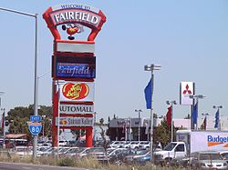

SealNickname(s): The Flats, Jelly Belly Land Location in Solano County and the state of California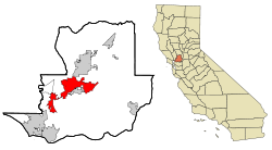
Coordinates: 38°15′28″N 122°3′15″W / 38.25778°N 122.05417°W Country  United States
State  California
County Solano Incorporated 1903 Government – Mayor Harry T. Price – Senate Lois Wolk (D) – Assembly Mariko Yamada (D) – U. S. Congress John Garamendi (D) Area[1] – Total 37.635 sq mi (97.475 km2) – Land 37.390 sq mi (94.839 km2) – Water 0.245 sq mi (2.635 km2) 3.65% Elevation 13 ft (4 m) Population (2010) – Total 108,321 – Rank 2nd in Solano County
60th in California
257th in the United States– Density 2,878.2/sq mi (1,111.3/km2) Time zone PST (UTC−8) – Summer (DST) PDT (UTC−7) ZIP codes 94533, 94534 Area code(s) 707 FIPS code 06-23182 GNIS feature ID 1656005 Website http://www.ci.fairfield.ca.us/ 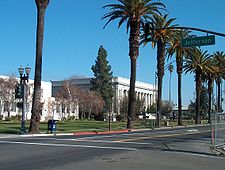 West Texas Street in Downtown
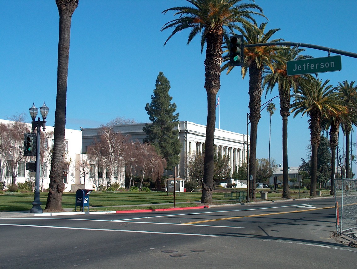
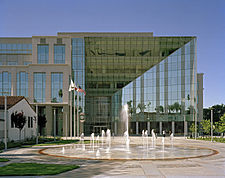 The Solano County Government Center in Downtown Fairfield
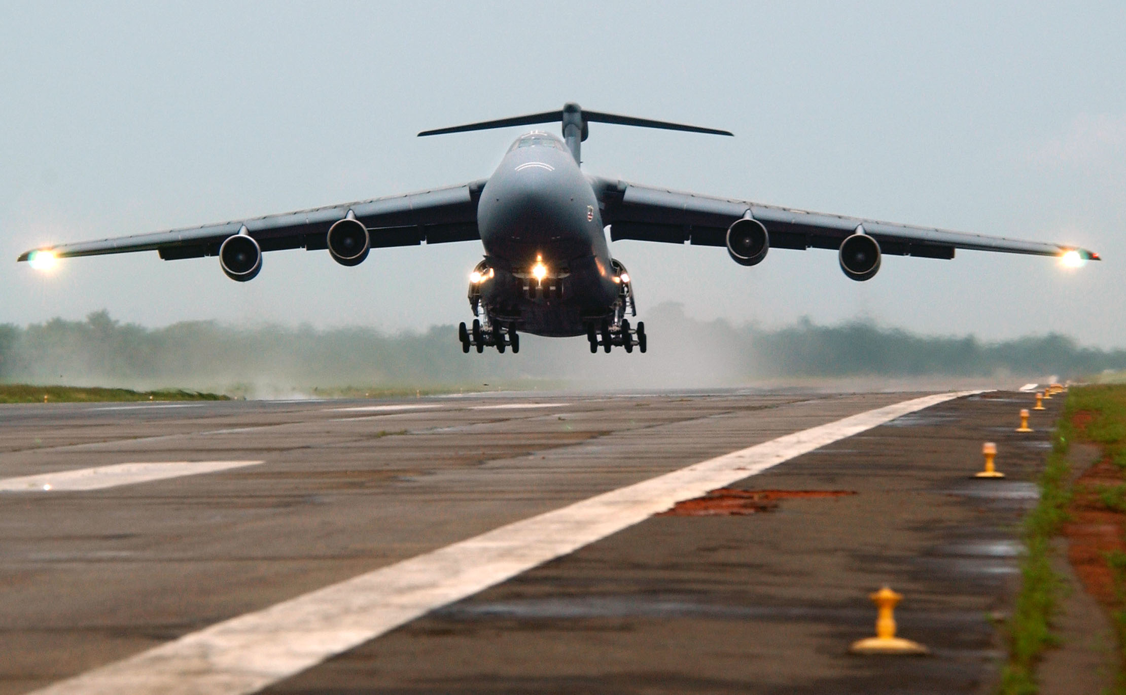
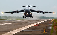 Military C-5 Aircraft from Travis Air Force Base takes off in Sierra Leone
Fairfield is a city located in Solano County in Northern California, USA. It is generally considered the midpoint between the cities of San Francisco and Sacramento, approximately 44 miles (71 km) from the city center of both cities, approximately 41 miles (66 km) from the city center of Oakland, less than 20 miles (32 km) from Napa Valley, 18 miles from the Carquinez Bridge, and 15 miles from the Benicia Bridge. Fairfield was founded in 1859 by clippership captain Robert H. Waterman, and named after his former hometown of Fairfield, Connecticut.
It is the home of Travis Air Force Base and the Jelly Belly jelly bean factory. With a population of 108,321 at the 2010 census, it is slightly smaller in population than Vallejo, which is the Bay Area's ninth-largest city.[2] It shares a border with its sister city, Suisun City. Other nearby cities include Vacaville, Benicia, and Napa. Fairfield is the county seat of Solano County.
Contents
Geography
According to the United States Census Bureau, the city has a total area of 37.6 square miles (97 km2), of which, 37.4 square miles (97 km2) of it is land and 0.2 square miles (0.52 km2) of it is water. The total area is 3.65% water.
The city is located within the California Coastal Ranges. The city is centered directly north of the Suisun Bay and northeast of the San Pablo Bay. Much of the Suisun Bay contains the Suisun Marsh, the largest saltwater marsh on the west coast of the United States. The Sacramento Valley lies east of Fairfield.
History
According to the City of Fairfield website,[3] Native Americans, such as those from the Ion culture, settled in the Rockville and Green Valley areas. Artifacts that have been found from some of the earliest human inhabitants of the Fairfield area are dated to be around five to six thousand years old, making them some of the oldest Native American settlements in Northern California.
The first European contact came in 1810 when the Spanish army was ordered to attack the Suisin Indians. In 1835 the Mexican General Vallejo was so magnanimous in victory over the Indian Chief Sem Yeto that the chief later became his ally in conflicts against other tribes. In 1837 the Indian Chief Solano received the Rancho Suisun Mexican land grant. This grant eventually came into the hands of a clipper ship captain from Connecticut named Robert H. Waterman. He not only parceled out the town in 1856, but also, in a commercially shrewd move, arranged to have the county seat moved here in 1858 from Benicia. As an inducement he granted 16 acres (65,000 m2) of land for the construction of county buildings. In 1903 Fairfield was incorporated as a city.
Demographics
2010
The 2010 United States Census[4] reported that Fairfield had a population of 105,321. The population density was 2,798.5 people per square mile (1,080.5/km²). The racial makeup of Fairfield was 48,407 (46.0%) White, 16,586 (15.7%) African American, 869 (0.8%) Native American, 15,700 (14.9%) Asian (9.1% Filipino, 1.8% Indian, 1.0% Chinese, 0.6% Vietnamese, 0.6% Japanese, 0.4% Korean, 0.3% Laotian, 0.2% Thai, 0.1% Pakistani), 1,149 (1.1%) Pacific Islander, 13,301 (12.6%) from other races, and 9,309 (8.8%) from two or more races. Hispanic or Latino of any race were 28,789 persons (27.3%); 21.2% of Fairfield is Mexican, 1.1% Puerto Rican, 1.0% Salvadoran, 0.5% Nicaraguan, 0.3% Guatemalan, 0.2% Cuban, and 0.2% Peruvian.
The Census reported that 102,832 people (97.6% of the population) lived in households, 1,221 (1.2%) lived in non-institutionalized group quarters, and 1,268 (1.2%) were institutionalized.
There were 34,484 households, out of which 14,725 (42.7%) had children under the age of 18 living in them, 18,461 (53.5%) were opposite-sex married couples living together, 5,203 (15.1%) had a female householder with no husband present, 2,179 (6.3%) had a male householder with no wife present. There were 2,052 (6.0%) unmarried opposite-sex partnerships, and 237 (0.7%) same-sex married couples or partnerships. 6,802 households (19.7%) were made up of individuals and 2,500 (7.2%) had someone living alone who was 65 years of age or older. The average household size was 2.98. There were 25,843 families (74.9% of all households); the average family size was 3.42.
The population was spread out with 28,499 people (27.1%) under the age of 18, 11,246 people (10.7%) aged 18 to 24, 28,917 people (27.5%) aged 25 to 44, 25,884 people (24.6%) aged 45 to 64, and 10,775 people (10.2%) who were 65 years of age or older. The median age was 33.7 years. For every 100 females there were 97.0 males. For every 100 females age 18 and over, there were 94.6 males.
There were 37,184 housing units at an average density of 988.0 per square mile (381.5/km²), of which 20,835 (60.4%) were owner-occupied, and 13,649 (39.6%) were occupied by renters. The homeowner vacancy rate was 2.5%; the rental vacancy rate was 7.1%. 61,652 people (58.5% of the population) lived in owner-occupied housing units and 41,180 people (39.1%) lived in rental housing units.
2000
As of the census[5] of 2000, there are 96,178 people, 30,870 households, and 24,016 families residing in the city. The population density is 986.3/km² (2,554.2/mi²). There are 31,792 housing units at an average density of 326.0/km² (844.3/mi²). The racial makeup of the city is 56.21% White, 15.02% Black or African American, 0.77% Native American, 10.89% Asian, 0.93% Pacific Islander, 8.77% from other races, and 7.41% from two or more races. 18.77% of the population are Hispanic or Latino of any race.
There are 30,870 households out of which 43.1% have children under the age of 18 living with them, 58.4% are married couples living together, 14.2% have a female householder with no husband present, and 22.2% are non-families. 17.0% of all households are made up of individuals and 5.5% have someone living alone who is 65 years of age or older. The average household size is 2.98 and the average family size is 3.33.
In the city the population is spread out with 29.8% under the age of 18, 11.1% from 18 to 24, 31.3% from 25 to 44, 18.8% from 45 to 64, and 9.0% who are 65 years of age or older. The median age is 31 years. For every 100 females there are 99.1 males. For every 100 females age 18 and over, there are 97.4 males.
The median income for a household in the city is $51,151, and the median income for a family is $55,503. Males have a median income of $38,544 versus $30,616 for females. The per capita income for the city is $20,617. 9.3% of the population and 7.1% of families are below the poverty line. Out of the total population, 12.1% of those under the age of 18 and 5.2% of those 65 and older are living below the poverty line.
Industry and major employers
Fairfield has a diversified economy, with government, manufacturing, health care, retail, professional and commercial construction sectors.[6] Anheuser-Busch operates a large regional Budweiser brewery, Clorox produces bleach products, and the Jelly Belly Candy Company confects its specialty jelly beans in Fairfield.[6]
Top employers
According to the City's 2009 Comprehensive Annual Financial Report,[7] the top employers in the city are:
# Employer # of Employees 1 Travis Air Force Base 14,353 2 County of Solano 2,850 3 Fairfield-Suisun Unified School District 2,000 4 NorthBay Medical Center 1,115 5 Solano Community College 650 6 City of Fairfield 608 7 Sutter Health 475 8 Jelly Belly 461 9 Copart 450 10 Westamerica Bank 407 Schools
Area high schools
- Armijo High School;
- Fairfield High School; Best School as of ^2011
- Angelo Rodriguez High School;
- Sem Yeto Continuation School;
- Mary Bird Community Day School;
- Vanden High School;
Area middle schools (FSUSD)
- Crystal Middle School;
- Dover Middle School Recently Closed
- Grange Middle School;
- Green Valley Middle School;
- Sullivan Middle School;
- Sem Yeto Continuation School and Mary Bird Community Day School are part of the FSUSD. Vanden High School is part of the TUSD, and is located near Travis Air Force Base. All others are part of the FSUSD.
Universities nearby include California Maritime Academy, UC Davis, UC Berkeley, Sacramento State, CSU East Bay, Sonoma State, Trinity College of Massage, St. Mary's College, University of Phoenix and Chapman University.[8] The main campus of Trinity Biblical University and Solano Community College are located in Fairfield.
Recreation
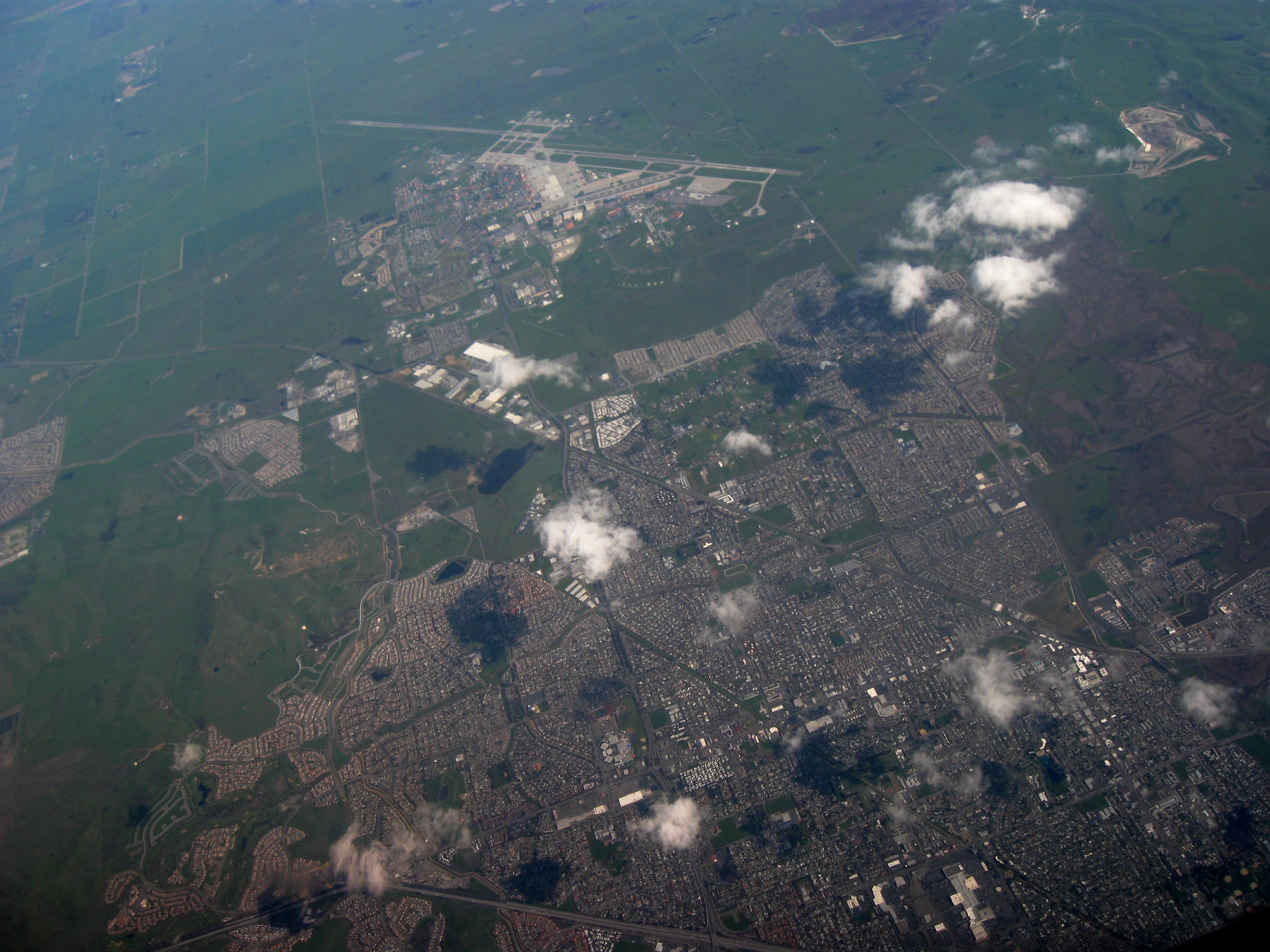
 Aerial view of Fairfield, with Travis Air Force Base in the upper center.
- Downtown Fairfield;
- Offers shopping, community festivals and entertainment.
- Westfield Solano Mall;
- Suisun Valley Harvest Trails
Parks
- Rockville Hills Regional Park
- The Park is located on Rockville Road approximately 3/4 of a mile from the corner of Suisun Valley and Rockville Roads. Allows bicycling, hiking, and provides walking trails.
- Fairfield Linear Park
- The Linear Park stretches through the city along a former railroad right-of-way. Picnic tables and play equipment can be found along the route. Runners, walkers, and bicyclists enjoy this park.
- Alan Witt Park
- Contains a brand new Aquatics Complex, the Fairfield Sports Center, and Fairfield-Suisun Rotary Skate Park. The new Aquatics Complex includes water slides, toddler play area, youth play pool, lap swimming, indoor activity pool, and a "lazy river" current for water walking or floating. The park also offers tennis courts, a recreation building, picnic area, ball fields, basketball courts, volleyball courts, a skate park, and horse shoe pits. Restroom facilities are available.
- Dover Park
- Sunrise Park
- Laurel Creek Park *Contains a newly renovated Park and Bathrooms. This park contains an eating area and baseball stadiums. Recently voted best park Of Fairfield as of 2011.
- Wood Creek Park
Golf courses
- Fairfield is home to three golf courses, two public and one private. Paradise Valley and Rancho Solano Golf Courses, both public, are rated in the Zagat Survey of “America’s Best Golf Courses,” rated 3 ½ stars by Golf Digest Magazine in 2010 and voted #1 & #2 golf courses in Solano County for consecutive years.
Sister cities
References
- ^ U.S. Census
- ^ Vallejo mayor's race in dead heat
- ^ About Fairfield
- ^ All data are derived from the United States Census Bureau reports from the 2010 United States Census, and are accessible on-line here. The data on unmarried partnerships and same-sex married couples are from the Census report DEC_10_SF1_PCT15. All other housing and population data are from Census report DEC_10_DP_DPDP1. Both reports are viewable online or downloadable in a zip file containing a comma-delimited data file. The area data, from which densities are calculated, are available on-line here. Percentage totals may not add to 100% due to rounding. The Census Bureau defines families as a household containing one or more people related to the householder by birth, opposite-sex marriage, or adoption. People living in group quarters are tabulated by the Census Bureau as neither owners nor renters. For further details, see the text files accompanying the data files containing the Census reports mentioned above.
- ^ "American FactFinder". United States Census Bureau. http://factfinder.census.gov. Retrieved 2008-01-31.
- ^ a b Fairfield balances on the edge as housing prices plunge
- ^ City of Fairfield CAFR
- ^ Chapman University Fairfield Campus
External links
Coordinates: 38°15′28″N 122°03′15″W / 38.257763°N 122.054256°W
Municipalities and communities of Solano County, California County seat: FairfieldCities 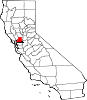
CDPs Allendale | Elmira | Green Valley | Hartley
Unincorporated
communitiesBahia | Batavia | Birds Landing | Bucktown | Collinsville | Montezuma | Rockville | Yolano
California county seats Consolidated city-county Municipalities Alturas | Auburn | Bakersfield | Colusa | Crescent City | El Centro | Eureka | Fairfield | Fresno | Hanford | Hollister | Jackson | Lakeport | Los Angeles | Madera | Martinez | Marysville | Merced | Modesto | Napa | Nevada City | Oakland | Oroville | Placerville | Red Bluff | Redding | Redwood City | Riverside | Sacramento | Salinas | San Bernardino | San Diego | San Jose | San Luis Obispo | San Rafael | Santa Ana | Santa Barbara | Santa Cruz | Santa Rosa | Sonora | Stockton | Susanville | Ukiah | Ventura | Visalia | Willows | Woodland | Yreka | Yuba City
CDPs Bridgeport | Downieville | Independence | Mariposa | Markleeville | Quincy | San Andreas | Weaverville
 State of California
Topics - Climate
- Delegations
- Deserts
- Districts
- Ecology
- Elections
- Environment
- Geography
- Government
- History
- Protected areas
- Sports
- Symbols
- Transportation
- Visitor attractions
- Index of California-related articles
Society Regions - Antelope Valley
- Big Sur
- Cascade Range
- Central California
- Central Coast
- Central Valley
- Channel Islands
- Coachella Valley
- Conejo Valley
- Cucamonga Valley
- Death Valley
- East Bay (SF)
- East County (SD)
- Eastern California
- Emerald Triangle
- Gold Country
- Great Basin
- Greater Los Angeles
- Greater Sacramento
- Inland Empire
- Lake Tahoe
- Los Angeles Basin
- Lost Coast
- Metropolitan Fresno
- Mojave
- Mountain Empire
- North Bay (SF)
- North Coast
- North County (SD)
- Northern California
- Owens Valley
- Oxnard Plain
- San Francisco Peninsula
- Pomona Valley
- Sacramento Valley
- San Bernardino Valley
- San Diego–Tijuana
- San Fernando Valley
- San Francisco Bay Area
- San Gabriel Valley
- San Joaquin Valley
- Santa Clara Valley
- Santa Clara River Valley
- Santa Clarita Valley
- Shasta Cascade
- Sierra Nevada
- Silicon Valley
- South Bay (LA)
- South Bay (SF)
- South Bay (SD)
- South Coast
- Southern California
- Southern Border Region
- Tri-Valley
- Upstate California
- Victor Valley
- Wine Country
- Yosemite
Metro areas - Bakersfield
- Chico
- El Centro
- Fresno
- Hanford–Corcoran
- Los Angeles–Long Beach–Glendale
- Madera
- Modesto
- Merced
- Napa
- Oakland–Fremont–Hayward
- Oxnard–Thousand Oaks–Ventura
- Redding
- Riverside–San Bernardino–Ontario
- Sacramento–Arden Arcade–Roseville
- Salinas
- San Diego–Carlsbad–San Marcos
- San Francisco–San Mateo–Redwood City
- San Jose–Sunnyvale–Santa Clara
- San Luis Obispo–Paso Robles
- Santa Ana–Anaheim–Irvine
- Santa Barbara–Santa Maria–Goleta
- Santa Cruz–Watsonville
- Santa Rosa–Petaluma
- Stockton
- Vallejo–Fairfield
- Visalia–Porterville
- Yuba City
Micro areas Counties - Alameda
- Alpine
- Amador
- Butte
- Calaveras
- Colusa
- Contra Costa
- Del Norte
- El Dorado
- Fresno
- Glenn
- Humboldt
- Imperial
- Inyo
- Kern
- Kings
- Lake
- Lassen
- Los Angeles
- Madera
- Marin
- Mariposa
- Mendocino
- Merced
- Modoc
- Mono
- Monterey
- Napa
- Nevada
- Orange
- Placer
- Plumas
- Riverside
- Sacramento
- San Benito
- San Bernardino
- San Diego
- San Francisco
- San Joaquin
- San Luis Obispo
- San Mateo
- Santa Barbara
- Santa Clara
- Santa Cruz
- Shasta
- Sierra
- Siskiyou
- Solano
- Sonoma
- Stanislaus
- Sutter
- Tehama
- Trinity
- Tulare
- Tuolumne
- Ventura
- Yolo
- Yuba
Mayors of cities with populations exceeding 100,000 in California - Antonio Villaraigosa
(Los Angeles) - Jerry Sanders
(San Diego) - Chuck Reed
(San Jose) - Edwin M. Lee
(San Francisco) - Ashley Swearengin
(Fresno) - Kevin Johnson
(Sacramento) - Bob Foster
(Long Beach) - Jean Quan
(Oakland) - Harvey Hall
(Bakersfield) - Tom Tait
(Anaheim) - Miguel A. Pulido
(Santa Ana)
- Ronald O. Loveridge
(Riverside) - Ann Johnston
(Stockton) - Cheryl Cox
(Chula Vista) - Bob Wasserman
(Fremont) - Sukhee Kang
(Irvine) - Pat Morris
(San Bernardino) - Jim Ridenour
(Modesto) - Thomas E. Holden
(Oxnard) - Acquanetta Warren
(Fontana) - William H. Batey II
(Moreno Valley)^ - John Drayman
(Glendale)
- Cathy Green
(Huntington Beach)^ - Bob Kellar
(Santa Clarita)^ - William Dalton
(Garden Grove) - Susan Gorin
(Santa Rosa)^ - Jim Wood
(Oceanside) - Donald Kurth
(Rancho Cucamonga) - Paul S. Leon
(Ontario) - R. Rex Parris
(Lancaster) - Pat Hume
(Elk Grove) - James C. Ledford Jr.
(Palmdale) - Stan Skipworth
(Corona)^
- Dennis Donohue
(Salinas) - Elliot Rothman
(Pomona) - Frank Scotto
(Torrance) - Michael Sweeney
(Hayward) - Sam Abed
(Escondido) - Tony Spitaleri
(Sunnyvale) - Bill Bogaard
(Pasadena) - Carolyn Cavecche
(Orange) - F. Richard Jones
(Fullerton)^ - Jacqui Irwin
(Thousand Oaks)^ - Jesus Gamboa
(Visalia)
- Paul Miller
(Simi Valley) - William D. Shinn
(Concord)^ - Gina Garbolino
(Roseville) - Jamie L. Matthews
(Santa Clara) - Osby Davis
(Vallejo) - Rudy Cabriales
(Victorville) - Ernest Gutierrez
(El Monte) - Tom Bates
(Berkeley) - Rick Trejo
(Downey)^ - Eric R. Bever
(Costa Mesa)^ - James T. Butts, Jr.
(Inglewood)
 ^Mayor selected from city council
Other states: AL • AK • AZ • AR • CA • CO • CT • DE • FL • GA • HI • ID • IL • IN • IA • KS • KY • LA • ME • MD • MA • MI • MN • MS • MO • MT • NE • NV • NH • NJ • NM • NY • NC • ND • OH • OK • OR • PA • RI • SC • SD • TN • TX • UT • VT • VA • WA • WV • WI • WY
Vacaville Napa 
Travis AFB  Fairfield

Vallejo Benicia • Suisun City Rio Vista Categories:- Incorporated cities and towns in California
- Cities in Solano County, California
- Cities in the San Francisco Bay Area
- County seats in California


Wikimedia Foundation. 2010.