- Markleeville, California
-
Markleeville — census-designated place — Location in Alpine County and the state of California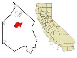
Coordinates: 38°41′42″N 119°46′49″W / 38.695°N 119.78028°WCoordinates: 38°41′42″N 119°46′49″W / 38.695°N 119.78028°W Country  United States
State  California
County Alpine Government - N/A - State Senate Ted Gaines (R) - State Assembly Beth Gaines (R) - U. S. Congress Dan Lungren (R) Area[1] - Total 6.531 sq mi (16.915 km2) - Land 6.531 sq mi (16.915 km2) - Water 0 sq mi (0 km2) 0% Elevation 5,531 ft (1,686 m) Population (2010) - Total 210 - Density 32.2/sq mi (12.4/km2) Time zone Pacific (PST) (UTC-8) - Summer (DST) PDT (UTC-7) ZIP code 96120 Area code(s) 530 FIPS code 06-45988 GNIS feature ID 1659065 Markleeville (formerly, Markleville)[2] is a census-designated place (CDP) and the county seat of Alpine County, California. The population was 210 at the 2010 census, up from 197 at the 2000 census.
The CDP of Markleeville also includes Woodfords.[citation needed]
Contents
History
Markleeville traces its beginnings to the land claim of Jacob Marklee who established a toll bridge across a tributary of the Carson River in 1861 during the height of the silver mining boom at nearby Silver Mountain City. He recorded his land claim of 160 acres (0.65 km2) on June 23, 1862, in Douglas County, Nevada, but after the boundary survey, his claim was in California. During the rush to the Comstock Lode, the town of Markleeville was built upon Marklee's land. Marklee hoped to prosper from the freight and supplies headed to the mining camps, but was instead killed in a gunfight in 1863, his killer going free on a plea of self-defense.
A post office opened in Markleeville in 1863.[2]
When the mines shut down, Markleeville assumed the county seat and remains the center of government services for Alpine County — the Alpine County Courthouse now occupies the site of Marklee's cabin, which is California Historical Landmark #240.
Geography
According to the United States Census Bureau, the CDP has a total area of 6.5 square miles (17 km2), all land. The region comprising Markleeville is Alpine in appearance, with lush grassy valley areas. There is a hot spring, and a state park with a campground. Excellent hiking trails abound.
Climate
Markleeville has warm summers with only occasional rainfall, mostly from afternoon and evening thunderstorms; nights are usually well below 50 °F (10 °C). Winters are cold and often snowy. The average January temperatures are a maximum of 45.7 °F (7.6 °C) and a minimum of 17.4 °F (−8.1 °C). The average July temperatures are a maximum of 84.5 °F (29.2 °C) and a minimum of 43.1 °F (6.2 °C). There are an average of 15.7 days with highs of 90 °F (32 °C) or higher and an average of 221.7 days with lows of 32 °F (0 °C) or lower. The record high temperaure was 102 °F (39 °C) on July 11, 1931. The record low temperature was −25 °F (−32 °C) on December 22, 1990.
Average annual precipitation is 19.16 inches (48.7 cm). There are an average of 59 days with measurable precipitation. The wettest year was 1996 with 38.35 inches (97.4 cm) and the driest year was 1917 with 11.74 inches (29.8 cm). The most precipitation in one month was 16.13 inches (41.0 cm) in 1996. The most precipitation in 24 hours was 4.72 inches (12.0 cm) on December 3, 1950. Average annual snowfall is 82.9 inches (211 cm). The snowiest year was 1916 with 144.0 inches (366 cm), including 99.0 inches (251 cm) in January 1916.[3]
Demographics
2010
The 2010 United States Census[4] reported that Markleeville had a population of 210. The population density was 32.2 people per square mile (12.4/km²). The racial makeup of Markleeville was 192 (91.4%) White, 0 (0.0%) African American, 4 (1.9%) Native American, 2 (1.0%) Asian, 0 (0.0%) Pacific Islander, 6 (2.9%) from other races, and 6 (2.9%) from two or more races. Hispanic or Latino of any race were 11 persons (5.2%).
The Census reported that 210 people (100% of the population) lived in households, 0 (0%) lived in non-institutionalized group quarters, and 0 (0%) were institutionalized.
There were 100 households, out of which 19 (19.0%) had children under the age of 18 living in them, 47 (47.0%) were opposite-sex married couples living together, 5 (5.0%) had a female householder with no husband present, 5 (5.0%) had a male householder with no wife present. There were 9 (9.0%) unmarried opposite-sex partnerships, and 1 (1.0%) same-sex married couples or partnerships. 32 households (32.0%) were made up of individuals and 8 (8.0%) had someone living alone who was 65 years of age or older. The average household size was 2.10. There were 57 families (57.0% of all households); the average family size was 2.67.
The population was spread out with 39 people (18.6%) under the age of 18, 3 people (1.4%) aged 18 to 24, 42 people (20.0%) aged 25 to 44, 92 people (43.8%) aged 45 to 64, and 34 people (16.2%) who were 65 years of age or older. The median age was 50.8 years. For every 100 females there were 101.9 males. For every 100 females age 18 and over, there were 101.2 males.
There were 194 housing units at an average density of 29.7 per square mile (11.5/km²), of which 63 (63.0%) were owner-occupied, and 37 (37.0%) were occupied by renters. The homeowner vacancy rate was 1.6%; the rental vacancy rate was 9.8%. 133 people (63.3% of the population) lived in owner-occupied housing units and 77 people (36.7%) lived in rental housing units.
2000
As of the census[5] of 2000, there were 197 people, 92 households, and 57 families residing in the CDP. The population density was 10.3 people per square mile (4.0/km²). There were 173 housing units at an average density of 9.1 per square mile (3.5/km²). The racial makeup of the CDP was 97.5% White, 1.5% Native American, 1.0% from other races. 1.5% of the population were Hispanic or Latino of any race.
There were 92 households out of which 20.7% had children under the age of 18 living with them, 51.1% were married couples living together, 7.6% had a female householder with no husband present, and 38.0% were non-families. 30.4% of all households were made up of individuals and 8.7% had someone living alone who was 65 years of age or older. The average household size was 2.14 and the average family size was 2.63.
In the CDP the population was spread out with 17.3% under the age of 18, 3.6% from 18 to 24, 30.5% from 25 to 44, 34.0% from 45 to 64, and 14.7% who were 65 years of age or older. The median age was 45 years. For every 100 females there were 95.0 males. For every 100 females age 18 and over, there were 101.2 males.
The median income for a household in the CDP was $46,563, and the median income for a family was $63,750. Males had a median income of $49,375 versus $25,972 for females. The per capita income for the CDP was $40,774. About 7.0% of families and 15.3% of the population were below the poverty line, including 25.0% of those under the age of eighteen and 13.0% of those sixty five or over.
Markleeville Death Ride
Markleeville hosts an annual bicycle ride called the Death Ride. The route goes over five passes for a total distance of 129 miles and over 15,000 feet of elevation gain. In 2009 3,000 riders participated and 2,200 completed the full course.
References
- ^ U.S. Census
- ^ a b Durham, David L. (1998). California's Geographic Names: A Gazetteer of Historic and Modern Names of the State. Quill Driver Books. p. 1182. ISBN 9781884995149.
- ^ http://www.wrcc.dri.edu/cgi-bin/cliMAIN.pl?ca5356
- ^ All data are derived from the United States Census Bureau reports from the 2010 United States Census, and are accessible on-line here. The data on unmarried partnerships and same-sex married couples are from the Census report DEC_10_SF1_PCT15. All other housing and population data are from Census report DEC_10_DP_DPDP1. Both reports are viewable online or downloadable in a zip file containing a comma-delimited data file. The area data, from which densities are calculated, are available on-line here. Percentage totals may not add to 100% due to rounding. The Census Bureau defines families as a household containing one or more people related to the householder by birth, opposite-sex marriage, or adoption. People living in group quarters are tabulated by the Census Bureau as neither owners nor renters. For further details, see the text files accompanying the data files containing the Census reports mentioned above.
- ^ "American FactFinder". United States Census Bureau. http://factfinder.census.gov. Retrieved 2008-01-31.
Municipalities and communities of Alpine County, California County seat: MarkleevilleCDPs Alpine Village | Bear Valley | Kirkwood‡ | Markleeville | Mesa Vista
Unincorporated
communitiesCape Horn | Fredericksburg | Lake Alpine | Loope | Marklee Village | Paynesville | Peaceful Pines | Shay Creek Summer Home Area | Sorensens | Woodfords
Ghost towns Centerville | Fays Camp | Mount Bullion | Silver Creek | Silver Mountain
Footnotes ‡This populated place also has portions in an adjacent county or counties
California county seats Consolidated city-county Municipalities Alturas | Auburn | Bakersfield | Colusa | Crescent City | El Centro | Eureka | Fairfield | Fresno | Hanford | Hollister | Jackson | Lakeport | Los Angeles | Madera | Martinez | Marysville | Merced | Modesto | Napa | Nevada City | Oakland | Oroville | Placerville | Red Bluff | Redding | Redwood City | Riverside | Sacramento | Salinas | San Bernardino | San Diego | San Jose | San Luis Obispo | San Rafael | Santa Ana | Santa Barbara | Santa Cruz | Santa Rosa | Sonora | Stockton | Susanville | Ukiah | Ventura | Visalia | Willows | Woodland | Yreka | Yuba City
CDPs Bridgeport | Downieville | Independence | Mariposa | Markleeville | Quincy | San Andreas | Weaverville
Categories:- Census-designated places in Alpine County, California
- County seats in California


Wikimedia Foundation. 2010.