- Loope, California
-
Coordinates: 38°39′55″N 119°41′46″W / 38.66528°N 119.69611°W
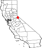
Loope — Unincorporated community — Location in California
 Loope
LoopeCoordinates: 38°39′55″N 119°41′46″W / 38.66528°N 119.69611°W Country United States State California County Alpine County Elevation[1] 6,188 ft (1,886 m) Loope (formerly, Loopeville and Monitor) is an unincorporated community in Alpine County, California. It is located on Monitor Creek,[2] at an elevation of 6188 feet (1886 m).
A post office operated at Monitor from 1863 to 1888.[2] The Loope post office operated from 1898 to 1908.[2]
The place was originally named from the nearby Monitor Mine, which in turn was named for the Civil War naval vessel.[2] It was renamed in honor of a Dr. Loope who resurrected the mining industry locally with the influx of investments from the east coast.[2]
References
Municipalities and communities of Alpine County, California CDPs Alpine Village | Bear Valley | Kirkwood‡ | Markleeville | Mesa Vista
Unincorporated
communitiesCape Horn | Fredericksburg | Lake Alpine | Loope | Marklee Village | Paynesville | Peaceful Pines | Shay Creek Summer Home Area | Sorensens | Woodfords
Ghost towns Centerville | Fays Camp | Mount Bullion | Silver Creek | Silver Mountain
Footnotes ‡This populated place also has portions in an adjacent county or counties
Categories:- Populated places in Alpine County, California
- Unincorporated communities in California
- Sierra Nevada geography stubs


Wikimedia Foundation. 2010.