- Yreka, California
Infobox Settlement
official_name = Yreka
other_name =
native_name =
nickname =
settlement_type =City
motto =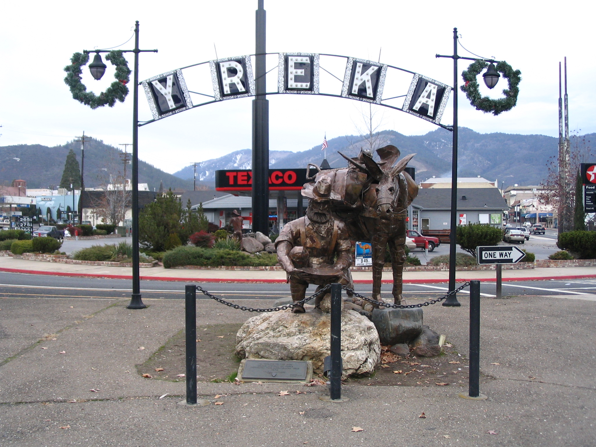
imagesize = 250x200px
image_caption = Statue at entrance to Yreka Historic District
flag_size =
image_
seal_size =
image_shield =
shield_size =
image_blank_emblem =
blank_emblem_type =
blank_emblem_size =
flag_size =
image_
seal_size =
image_shield =
shield_size =
image_blank_emblem =
blank_emblem_type =
blank_emblem_size =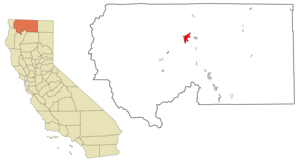
mapsize = 250x200px
map_caption = Location in Siskiyou County and the state ofCalifornia
mapsize1 =
map_caption1 =
image_dot_
dot_mapsize =
dot_map_caption =
dot_x =
dot_y =
pushpin_
pushpin_label_position =
pushpin_map_caption =
pushpin_mapsize =
subdivision_type = Country
subdivision_name =United States
subdivision_type1 = State
subdivision_name1 =California
subdivision_type2 = County
subdivision_name2 = Siskiyou
subdivision_type3 =
subdivision_name3 =
subdivision_type4 =
subdivision_name4 =
government_footnotes =
government_type =
leader_title =
leader_name =
leader_title1 =
leader_name1 =
leader_title2 =
leader_name2 =
leader_title3 =
leader_name3 =
leader_title4 =
leader_name4 =
established_title =
established_date =
established_title2 =
established_date2 =
established_title3 =
established_date3 =
area_magnitude =
unit_pref =
area_footnotes =
area_total_km2 = 26.0
area_land_km2 = 25.8
area_water_km2 = 0.2
area_total_sq_mi = 10.0
area_land_sq_mi = 10.0
area_water_sq_mi = 0.1
area_water_percent =
area_urban_km2 =
area_urban_sq_mi =
area_metro_km2 =
area_metro_sq_mi =
area_blank1_title =
area_blank1_km2 =
area_blank1_sq_mi =
population_as_of = 2003
population_footnotes =
population_note =
population_total = 7204
population_density_km2 = 282.2
population_density_sq_mi = 730.8
population_metro =
population_density_metro_km2 =
population_density_metro_sq_mi =
population_urban =
population_density_urban_km2 =
population_density_urban_sq_mi =
population_blank1_title =
population_blank1 =
population_density_blank1_km2 =
population_density_blank1_sq_mi =
timezone = Pacific (PST)
utc_offset = -8
timezone_DST = PDT
utc_offset_DST = -7
latd = 41 |latm = 43 |lats = 36 |latNS = N
longd = 122 |longm = 38 |longs = 15 |longEW = W
elevation_footnotes =
elevation_m = 787
elevation_ft = 2582
postal_code_type =ZIP code
postal_code = 96097
area_code = 530
blank_name = FIPS code
blank_info = 06-86944
blank1_name = GNIS feature ID
blank1_info = 1652661
website =
footnotes =Yreka (pronEng|waɪˈriːkə "wye-REE-ka") is the
county seat ofSiskiyou County, California ,United States . The population was 7,290 at the 2000 census.History
In March 1851 Abraham Thompson, a mule train packer, discovered gold near Black Gulch while traveling along the
Siskiyou Trail from southern Oregon. This discovery sparked an extension of theCalifornia Gold Rush from California's Sierra Nevada intoNorthern California . By April 1851, 2,000 miners had arrived in "Thompson's Dry Diggings" to test their luck, and by June 1851, a gold rush "boomtown" of tents, shanties, and a few rough cabins had sprung up. Several name changes occurred until the little city was called Yreka, apparently taken from a Shasta Indian word meaning "north mountain" or "white mountain," a reference to nearbyMt. Shasta . [ [http://www.yrekachamber.com/history.html Origin of name] Accessed June 4, 2007.] [ [http://www.snowcrest.net/siskiyoulibrary/cities.html Origin of name] Accessed June 4, 2007.]Mark Twain , in his "Autobiography" (p. 162, Harper/Perennial Literary, 1990), tells a different story::Harte had arrived in California in the fifties, twenty-three or twenty-four years old, and had wandered up into the surface diggings of the camp at Yreka, a place which had acquired its mysterious name--when in its first days it much needed a name--through an accident. There was a bakeshop with a canvas sign which had not yet been put up but had been painted and stretched to dry in such a way that the word BAKERY, all but the B, showed through and was reversed. A stranger read it wrong end first, YREKA, and supposed that that was the name of the camp. The campers were satisfied with it and adopted it.Well-known poet
Joaquin Miller described Yreka during 1853-54 as a bustling place with ". . . a tide of people up and down and across other streets, as strong as if a city on the East Coast." Incorporation proceedings were completed on April 21, 1857.In November
1941 , Yreka was designated as the capital of the proposedState of Jefferson , a secession movement along theOregon andCalifornia border that has gained cultural traction in the following decades.Commerce and tourism
Located at the northern edge of the
Shasta Cascade area ofNorthern California , Yreka sees many tourists. Yreka is home to the Siskiyou County Museum, [http://www.co.siskiyou.ca.us/museum/ Siskiyou County Museum website] accessed 2008-02-21. ] and to a number of Gold Rush-era monuments and parks. Visitors also come to enjoy trout fishing in the nearby Klamath, [http://www.visitsiskiyou.org/fish.htm Siskiyou County information site] accessed 2008-02-21. ] Sacramentocite book | last = Ross | first = John | title = Trout Unlimited's Guide to America's 100 Best Trout Streams, Updated and Revised | publisher = The Lyons Press | location = Guilford, CT | date = 2005 | isbn = 1592285856 ] cite book | last = Brooks | first = Wade | title = Fly fishing and the meaning of life | publisher = Voyageur Press | date = 2006 | location = St. Paul, MN | isbn = 0760325758 , p. 92. Excerpts of the text of this book are available [http://books.google.com/books?id=xa2Wah_PmOIC&pg=PA92&dq=upper+%22sacramento+river%22+trout+fishing&lr=&sig=EAI_YC8wgG0ArCJyK8A7afuXkUs#PPA92,M1 here] courtesy of [http://books.google.com/ Google Books] . ] and McCloud Rivers, or come to see and climbMount Shasta , Castle Crags or theTrinity Alps . [http://gorp.away.com/gorp/location/cities/regions/ca_shasta.htm Outdoor recreational activities in area] accessed 2008-02-24.] Visitors also engage in nearby skiing (both alpine and cross-country), or bike or hike to the waterfalls, streams and lakes in the area, including nearby Falls of the McCloud River,Burney Falls ,Mossbrae Falls ,Lake Siskiyou , Castle Lake andShasta Lake . In addition, because of its status as the county seat of Siskiyou County, there are a number of businesses related to the County courts, County Recorder, and other official county functions.Geography
Yreka is located at coor dms|41|43|36|N|122|38|15|W|city (41.726617, -122.637568)GR|1.
According to the
United States Census Bureau , the city has a total area of 10.0 sq mi (26.0km² ). 10.0 sq mi (25.8 km²) of it is land, and 0.1 sq mi (0.2 km²) of it (0.70%) is water.The elevation of Yreka is approximately Convert|2500|ft|m|-1 above sea level. It is nestled in the Shasta Valley south of the
Siskiyou Mountains and north ofMount Shasta , a dormant volcano towering above the valley at just over Convert|14000|ft|m|-2|abbr=on|abbr=on above sea level.Demographics
As of the
census GR|2 of 2000, there were 7,290 people, 3,114 households, and 1,880 families residing in the city. Thepopulation density was 730.8/sq mi (282.0/km²). There were 3,303 housing units at an average density of 331.1/sq mi (127.8/km²). The racial makeup of the city was 86.56% White, 0.48% African American, 6.04% Native American, 1.82% Asian, 0.07% Pacific Islander, 1.70% from other races, and 3.33% from two or more races. Hispanics or Latinos of any race were 5.38% of the population.There were 3,114 households, out of which 29.4% had children under the age of 18 living with them, 43.8% were married couples living together, 13.0% had a female householder with no husband present, and 39.6% were non-families. 34.8% of all households were made up of individuals and 17.2% had someone living alone who was 65 years of age or older. The average household size was 2.27 and the average family size was 2.92.
In the city, the population was spread out, with 25.5% under the age of 18, 7.8% from 18 to 24, 23.5% from 25 to 44, 23.8% from 45 to 64, and 19.4% who were 65 years of age or older. The median age was 41 years. For every 100 females, there were 88.3 males. For every 100 females, age 18 and over, there were 83.9 males.
The median
income for a household in the city was $27,398, and the median income for a family was $37,448. Males had a median income of $31,632 versus $23,986 for females. Theper capita income for the city was $16,664. About 17.5% of families and 21.2% of the population were below thepoverty line , including 33.6% of those under age 18 and 8.8% of those age 65 or over.Politics
In the state legislature Yreka is located in the 4th Senate District, represented by Republican
Sam Aanestad , and in the 2nd Assembly District, represented by RepublicanDoug LaMalfa . Federally, Yreka is located inCalifornia's 2nd congressional district , which has a Cook PVI of R +13 [cite web | title = Will Gerrymandered Districts Stem the Wave of Voter Unrest? | publisher = Campaign Legal Center Blog | url=http://www.clcblog.org/blog_item-85.html | accessdate = 2007-10-20] and is represented by RepublicanWally Herger .General information
The city is the seat of Siskiyou County and has many services that support the many small communities in the area. The high school buses carry students from towns that would not otherwise be able to fund a secondary education.
In Yreka, the gold-mining era is commemorated with a gold museum, as well as with a remnant of a silver mining operation in Greenhorn Park. The high school sports mascot is a gold miner. School colors are red and gold.
Trivia
*"Yreka Bakery" is a popular
palindrome , but no such business currently exists, although sources indicate that there was one as early as 1886 [ [http://www.snopes.com/language/placenames/yreka.asp Legendary origins of Yreka] ,] which may have been the foundation of Mark Twain's story; it is possible that the business existed until 1960. [ [http://members.aol.com/gulfhigh2/words5.html Palindrome bakery] ]
*Yreka is mentioned inAnn Rule 'strue crime novel, "The I-5 Killer".References
See also
*
Yreka Western Railroad External links
* [http://www.yrekachamber.com Yreka Chamber of Commerce]
* [http://www.museumsiskiyoutrail.org Museum of the Siskiyou Trail]
Wikimedia Foundation. 2010.