- Sacramento River
Geobox River | river_name = Sacramento River
geobox_width = 300
name = Sacramento River
native_name =
other_name =
other_name1 =
image_size = 300
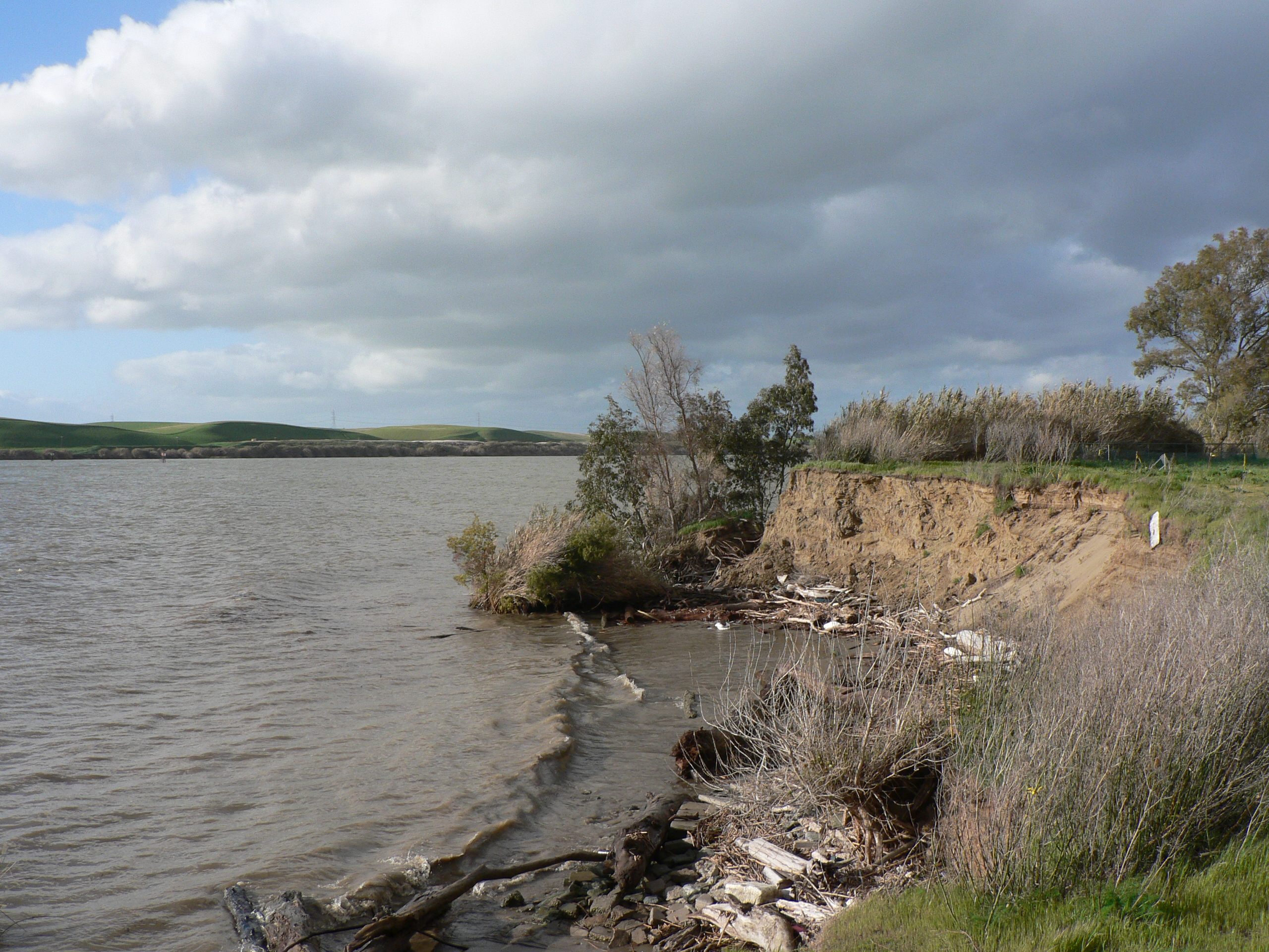
image_caption = California's Sacramento River
country =United States
country1 =
state =California
state1 =
region =
region1 =
district =
district1 =
city = Redding
city1 = Sacramento
length_imperial = 447
length_note = [Gnis|1654949|Sacramento River, USGS GNIS (the given length is in error, not being measured from 1:24,000 quads despite USGS's claim)]
watershed_imperial = 27000
watershed_note = [ [http://pubs.usgs.gov/circ/circ1215/introduction.htm USGS - NAWQA - Water Quality in the Sacramento River Basin - Introduction ] ]
discharge_location =
discharge_imperial = 30215
discharge_max_imperial =
discharge_min_imperial =
discharge_note = [ [http://pubs.usgs.gov/circ/circ1215/introduction.htm USGS - NAWQA - Water Quality in the Sacramento River Basin - Introduction ] ]
discharge1_location =
discharge1_imperial =
source_name = South Fork Sacramento River
source_location =
source_district =
source_region = Siskiyou County
source_state =California
source_country =
source_lat_d = 41
source_lat_m = 12
source_lat_s = 22
source_lat_NS = N
source_long_d = 122
source_long_m = 30
source_long_s = 2
source_long_EW = W
source_coordinates_note = [Gnis|267499|South Fork Sacramento River, USGS GNIS]
source_elevation_imperial = 5912
source_elevation_note = [Google Earth elevation forGNIS source coordinates. Retrieved on April 28, 2007.]
source_length_imperial =
source1_name = Middle Fork Sacramento River
source1_location =
source1_district =
source1_region = Siskiyou County
source1_state =California
source1_country =
source1_lat_d = 41
source1_lat_m = 15
source1_lat_s = 22
source1_lat_NS = N
source1_long_d = 122
source1_long_m = 29
source1_long_s = 48
source1_long_EW = W
source_coordinates_note = [Gnis|263535|Middle Fork Sacramento River, USGS GNIS]
source1_elevation_imperial = 6359
source_elevation_note = [Google Earth elevation forGNIS source coordinates. Retrieved on April 28, 2007.]
source1_length_imperial =
source_confluence_location = NearLake Siskiyou
source_confluence_district =
source_confluence_region = Siskiyou County
source_confluence_state =California
source_confluence_country =
source_confluence_lat_d = 41
source_confluence_lat_m = 16
source_confluence_lat_s = 24
source_confluence_lat_NS = N
source_confluence_long_d = 122
source_confluence_long_m = 24
source_confluence_long_s = 5
source_confluence_long_EW = W
source_confluence_coordinates_note = [Gnis|910506|Sacramento River, USGS GNIS]
source_confluence_elevation_imperial = 3858
source_confluence_elevation_note = [Google Earth elevation forGNIS source coordinates. Retrieved on April 28, 2007.]
mouth_name =Suisun Bay
mouth_location =Sacramento County, California
mouth_district =
mouth_region =Solano County, California
mouth_state =California
mouth_country =
mouth_lat_d = 38
mouth_lat_m = 3
mouth_lat_s = 48
mouth_lat_NS = N
mouth_long_d = 121
mouth_long_m = 51
mouth_long_s = 10
mouth_long_EW = W
mouth_coordinates_note = [Gnis|910506|Sacramento River, USGS GNIS]
mouth_elevation_imperial = 9
mouth_elevation_note = [Google Earth elevation forGNIS source coordinates. Retrieved on April 28, 2007.]
tributary_left =Pit River
tributary_left1 =Feather River
tributary_left2 =American River
tributary_right =
tributary_right1 =
free_name =
free_value =
map_size = 300px
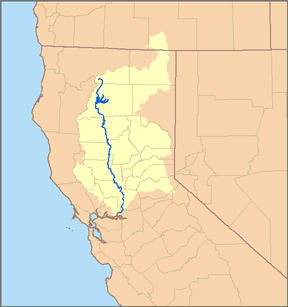
map_caption = Map of the Sacramento River watershed.The Sacramento River is the longestriver entirely within the U.S. state ofCalifornia . Starting at the confluence of the South Fork and Middle Fork Sacramento River, nearMount Shasta in theCascade Range , the Sacramento flows south for convert|447|mi|km [ http://www.swrcb.ca.gov/rwqcb5/tentative/0708/ilp-wkshp/introduction.pdf CA EPA State Water Resource Control Board. Various other sources list the river length from 320 to convert|450|mi|km. Measured by the USGS utilizing the standard 1:24,000 scale quadrangle sources, the river is convert|375|mi|km from its mouth in Suison Bay at Broad Slough to the confluence with thePit River inLake Shasta . The distance from there to the confluence of the Middle and South Forks of the Sacramento is an additional convert|72|mi|km for a total of convert|447|mi|km. (The slightly longer South Fork adds convert|11|mi|km for a grand total of convert|458|mi|km.) When the convert|315|mi|km|sing=on Pit River is added to the convert|375|mi|km|sing=on Sacramento River length below their confluence, the Sacramento-Pit River system totals convert|690|mi|km, the third longest river enitirely within one state after theKuskokwim River inAlaska and theTrinity River in Texas. ] , through the northern Central Valley of California, between thePacific Coast Range and the Sierra Nevada.Not far downstream from its confluence with the
American River , the Sacramento River joins theSan Joaquin River in theSacramento River Delta , which empties into Suisun Bay, the northern arm ofSan Francisco Bay . It is the third largest river by volume emptying into the Pacific Ocean in the Continental United States, behind only the Columbia River and the Colorado River.The chief tributaries of the Sacramento River are the Pit, Feather, McCloud and American rivers. The Pit River is the longest of these, but the Feather and American rivers carry larger volumes of water. The Pit River's watershed formerly included Goose Lake, and still does during rare periods of high water. [cite web | url=http://www.pitriveralliance.net | title= Pit River Watershed Alliance ]
Course
According to Mt. Shasta Recreation & Parks District, the designated headwaters of the Sacramento River are at about 3600 feet (1100 m) elevation in Mount Shasta City Park (coord|41.32874|N|122.32711|W) [cite web |url= http://www.msrec.org/headquarters.htm |title= Mt. Shasta Recreation & Parks District ] . The
USGS cites the river's source as the confluence of the South Fork Sacramento River and Middle Fork Sacramento River. [Gnis|1654949|Sacramento River, USGS GNIS]Big Springs feeds Big Springs Creek which flows south into
Lake Siskiyou . However, feeding Lake Siskiyou from the west are the North, Middle, and South Forks of the Sacramento River which bring water from much higher elevations, including from Castle Lake (elevation convert|5440|ft|m|abbr=ongnis|220688|Castle Lake).] The South Fork originates at 5,912 feet (1,802 m) at Cedar Lake (coord|41.20791|N|122.49601|W), the Middle Fork originates at 6,359 feet (1,938 m) in several headwater streams near Chipmunk Lake (coord|41.25234|N|122.49415|W), and the North Fork originates from springs at about 7,900 feet (2,408 m) near coord|41.20791|N|122.49601|W.. The Pit River and McCloud River tributaries join the Sacramento in Shasta Lake.
Below Shasta Dam, the Sacramento River continues to flow south, passing Redding and collecting many small streams. The river passes by Red Bluff and near Chico. It bends slightly west around
Sutter Buttes , then collects the tributary waters of the Feather River just north of the City ofSacramento . In Sacramento, the American River joins the Sacramento River.During the Memorial Day weekend, and again in mid summer each year Red Bluff Diversion Dam creates Lake Red Bluff. Lake Red Bluff supplies water to the Tehama-Colusa and Corning Canals providing water for 100,019 acres, and $88,529,000 worth of crops. Lake Red Bluff also provides recreational opportunities in the form of sailing, jet skiing, water skiing, and drag boat racing. Tourism and recreation revenues are important part of the region’s economy. Lake Red Bluff is of great environmental importance since the Tehama-Colusa Canal supplied water for 20,000 acres of the Sacramento Valley (wildlife) Refuges.
Below Sacramento, the river enters the Sacramento River Delta, where it is joined by the
San Joaquin River . The combined waters then exit intoSuisun Bay ,San Pablo Bay , andSan Francisco Bay , before finally entering the Pacific Ocean at theGolden Gate .Natural history
Every year in October, California's native King Salmon (Chinook) return to the river from the Pacific Ocean to migrate upstream to spawning grounds. This migration attracts thousands of sport fisherman from all over America. Yearly salmon runs can stretch all the way through December.Marine animals such as
whale s andsea lion s are occasionally found far inland after navigating the river for food or refuge and then losing track of how to get back to thePacific Ocean . In October 1985 a humpback whale affectionately named "Humphrey the humpbacked whale " by television media traveled convert|69|mi|km up the Sacramento River before being rescued. Rescuers downstream broadcast sounds of humpback whales feeding to draw the whale back to the ocean. [cite book | first=Wendy | last=Tokuda | coauthors=Richard Hall | year=1992 | month=June | title=Humphrey the Lost Whale: a true story | id=ISBN 0893463469 ]On May 14, 2007, two
humpback whales were spotted by media and onlookers traveling the deep waters near Rio Vista. The duo, generally believed to be mother and calf (Delta, the mother and Dawn, her calf [ "See" "Delta Dawn ," the popular song recorded by Helen Reddy (1973), among other recording artists.] ), continued to swim upstream to the deep water ship channel near West Sacramento, about convert|90|mi|km inland. There was concern because the whales had been injured, perhaps by a boat's propeller or keel, leaving a gash in each whale's skin. The whales were carefully inspected by biologists and injected with antibiotics to help prevent infection. [ [http://www.canada.com/topics/news/world/story.html?id=7aa5f2d0-606b-42dc-a131-1bfae29d9319&k=96560 canada.com | Article ] ] After days of efforts to lure (or frighten) the whales in the direction of the ocean, the whales eventually made their way south into San Francisco Bay, where they lingered for several days. By May 30, 2007, the cow and calf apparently slipped out unnoticed under theGolden Gate Bridge into the Pacific Ocean, likely under cover of night. [ [http://origin.mercurynews.com/news/ci_6026633] Sulek, Julia Prodis; San Jose Mercury News; "Whales vanish with morning fog;" published May 31, 2007. Accessed June 2, 2007] [cite news | url = http://www.sfgate.com/cgi-bin/article.cgi?f=/c/a/2007/05/31/BAGHHQ4ENF1.DTL | title = Whales' enriching diversion | author = Glen Martin | date = Thursday, May 31, 2007 | pages = B-1 | work = San Francisco Chronicle ]Rio Vista, California hosts an annualBass Festival each October to celebrate the return of bass to the river.History
The Sacramento River helped form the track of a trade and travel route known as the
Siskiyou Trail , which stretched from California's Central Valley to thePacific Northwest . The Siskiyou Trail closely paralleled the Sacramento River and took advantage of the valleys and canyons carved by the river through the rugged terrain ofNorthern California . Based on the original footpaths of Native Americans, the Siskiyou Trail was expanded byHudson's Bay Company trappers in the 1820s, and expanded further byCalifornia Gold Rush "Forty-Niners" in the 1850s. Today,Interstate 5 and theUnion Pacific Railroad occupy the path of the ancient Siskiyou Trail.Economy and control
Man-made channels make the river navigable for convert|180|mi|km upstream of San Francisco Bay; ocean-going ships travel as far inland as the City of Sacramento.
The Sacramento Area Flood Control Agency is a Joint Powers agency tasked with keeping the Sacramento River within its banks and levees. [ [http://www.safca.org/floodRisk/index.html Sacramento Flood History ] ] California Governor Schwarzenegger declared a State of Emergency in February 2006 in an attempt to repair the levees, whose failure could impact the drinking water quality of two-thirds of California residents.
See also
*
List of California rivers References
External links
* [http://www.watershedportal.org/ Sacramento River Portal]
* [http://pubs.usgs.gov/circ/circ1215/introduction.htm USGS Introduction to the Sacramento River]
* [http://www.riverexchange.org/ Upper Sacramento River Exchange]
* [http://www.museumsiskiyoutrail.org Museum of the Siskiyou Trail]
* [http://www.kvie.org/programs/kvie/viewfinder/cityatrisk/default.htm Sacramento River Flooding] - Online Video from KVIE Public Television
Wikimedia Foundation. 2010.