- Downieville, California
-
Downieville — census-designated place — Location within the state of California
 Downieville
Coordinates: 39°34′03″N 120°48′44″W / 39.5675°N 120.81222°WCoordinates: 39°34′03″N 120°48′44″W / 39.5675°N 120.81222°W Country  United States
State  California
County Sierra Area[1] – Total 3.187 sq mi (8.252 km2) – Land 3.181 sq mi (8.238 km2) – Water 0.006 sq mi (0.014 km2) 0.17% Elevation[2] 3,888 ft (1,185 m) Population (2010) – Total 282 – Density 88.5/sq mi (34.2/km2) Time zone Pacific (PST) (UTC-8) – Summer (DST) PDT (UTC-7) ZIP codes 95936 Area code(s) 530 FIPS code GNIS feature ID 2583000 U.S. Geological Survey Geographic Names Information System: Downieville, California Downieville is a census-designated place in and the county seat of Sierra County, California, United States.[2] Downieville sits at an elevation of 3,888 feet (1,185 m).[2] The 2010 United States census reported Downieville 's population was 282.
Contents
History
Downieville was settled in late 1849 during the California Gold Rush and was first known as "The Forks" for its geographical location and shortly thereafter was renamed after Major William Downie (1820-1893), a Scotsman who led the expedition up the North Fork of the Yuba River and who was the town's first mayor. Major Downie's travels are documented in his 1893 autobiography, "Hunting for Gold." Downieville reached a peak population of over 5,000 people in 1851 but declined sharply by 1865. Downieville is situated at the confluence of the Downie River and North Fork of the Yuba River. Downieville was vying to become the state capital of California along with fifteen other California communities in 1853 before the capital was moved to Benicia, and then shortly thereafter its current location in Sacramento. In July 1851 Downieville gained a distinction it may not have wanted when a mob lynched a Mexican woman, known as Juanita, for the murder of a white miner. It remains the only lynching of a female in California history.
The northern mines area was populated by a number of gold rush camps with colorful names, places like Brandy City, Whiskey Diggins, Poverty Hill, and Poker Flat. While many of these camps entirely disappeared after the gold rush, Downieville survived due both to its geographical location and status as the seat of Sierra County government.
Activities
Downieville is a popular mountain biking destination, hosting the world famous race, the Downieville Classic, a two day event consisting an Enduro style or Super-D downhill race as well as an extremely challenging cross country race. The Single Speed World Championship was also held in Downieville in 2003.
Other popular outdoor activities include off-road motorcycling, kayaking, hiking, and gold panning. Fishing for planted rainbow trout and for German browns also is an attraction.
The Downieville Museum is housed in a building converted from a store originally built by Chinese immigrants circa 1852. Today, the museum contains objects that depict life from the Gold Rush era to the present.
There are a variety of lodging options in the area, ranging from campgrounds to motels to on-the-river cabins such as those at Sierra Shangri-la and The Lure.
Downieville is home to the state's oldest weekly newspaper, the Mountain Messenger. Default wired telephone numbers for the town follow the format (530) 289-xxxx. In a typical year, the high school graduates about a half-dozen students. Downieville has its own post office (on Main Street) and its ZIP code is 95936. The elevation is around 2,900 feet (880 m).
Geography
According to the United States Census Bureau, the CDP covers an area of 3.2 square miles (8.3 km²), 99.83% of it land and 0.17% of it water.
Demographics
The 2010 United States Census[3] reported that Downieville had a population of 282. The population density was 88.5 people per square mile (34.2/km²). The racial makeup of Downieville was 269 (95.4%) White, 0 (0.0%) African American, 4 (1.4%) Native American, 2 (0.7%) Asian, 0 (0.0%) Pacific Islander, 0 (0.0%) from other races, and 7 (2.5%) from two or more races. Hispanic or Latino of any race were 12 persons (4.3%).
The Census reported that 282 people (100% of the population) lived in households, 0 (0%) lived in non-institutionalized group quarters, and 0 (0%) were institutionalized.
There were 147 households, out of which 25 (17.0%) had children under the age of 18 living in them, 59 (40.1%) were opposite-sex married couples living together, 13 (8.8%) had a female householder with no husband present, 4 (2.7%) had a male householder with no wife present. There were 6 (4.1%) unmarried opposite-sex partnerships, and 3 (2.0%) same-sex married couples or partnerships. 61 households (41.5%) were made up of individuals and 32 (21.8%) had someone living alone who was 65 years of age or older. The average household size was 1.92. There were 76 families (51.7% of all households); the average family size was 2.59.
The population was spread out with 40 people (14.2%) under the age of 18, 20 people (7.1%) aged 18 to 24, 42 people (14.9%) aged 25 to 44, 104 people (36.9%) aged 45 to 64, and 76 people (27.0%) who were 65 years of age or older. The median age was 56.5 years. For every 100 females there were 104.3 males. For every 100 females age 18 and over, there were 106.8 males.
There were 225 housing units at an average density of 70.6 per square mile (27.3/km²), of which 102 (69.4%) were owner-occupied, and 45 (30.6%) were occupied by renters. The homeowner vacancy rate was 3.8%; the rental vacancy rate was 14.8%. 198 people (70.2% of the population) lived in owner-occupied housing units and 84 people (29.8%) lived in rental housing units.
Government
Local
Because Loyalton is Sierra County's most populous municipality and its only incorporated city, generally half of the meetings of the county's board of supervisors are held in Downieville and the other half are held in Loyalton.[4]
State and Federal
In the state legislature Loyalton is located in the 1st Senate District, represented by Republican Ted Gaines, and in the 3rd Assembly District, represented by Republican Dan Logue. Federally, Loyalton is located in California's 4th congressional district, which has a Cook PVI of R +11[5] and is represented by Republican Tom McClintock.
References
- ^ U.S. Census
- ^ a b c U.S. Geological Survey Geographic Names Information System: Downieville, California
- ^ All data are derived from the United States Census Bureau reports from the 2010 United States Census, and are accessible on-line here. The data on unmarried partnerships and same-sex married couples are from the Census report DEC_10_SF1_PCT15. All other housing and population data are from Census report DEC_10_DP_DPDP1. Both reports are viewable online or downloadable in a zip file containing a comma-delimited data file. The area data, from which densities are calculated, are available on-line here. Percentage totals may not add to 100% due to rounding. The Census Bureau defines families as a household containing one or more people related to the householder by birth, opposite-sex marriage, or adoption. People living in group quarters are tabulated by the Census Bureau as neither owners nor renters. For further details, see the text files accompanying the data files containing the Census reports mentioned above.
- ^ "Sierra County Government Directory". http://www.sierracounty.ws/index.php?module=pagemaster&PAGE_user_op=view_page&PAGE_id=4&MMN_position=5:5. Retrieved 2011-03-05.
- ^ "Will Gerrymandered Districts Stem the Wave of Voter Unrest?". Campaign Legal Center Blog. http://www.clcblog.org/blog_item-85.html. Retrieved 2007-10-20.
External links
- Sierra County website
- Highway 49 information
- Major Downie Web site
- Panorama of Downieville, Calif., ca. 1860-ca. 1870, The Bancroft Library
Municipalities and communities of Sierra County, California County seat: DownievilleCity 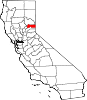
CDPs Alleghany | Calpine | Downieville | Goodyears Bar | Pike | Sattley | Sierra Brooks | Sierra City | Sierraville | Verdi
Unincorporated
communitiesBassetts | Brandy City | Cal-Ida | Campbell Hot Springs | Carvin Creek Homesites | Forest | Gibsonville | Grass Flat | Haskell Creek Homesites | Loganville | Plumbago
Ghost towns Brandy City | Chandlerville | Craig's Flat | Deadwood | Eureka City | Hepsidam | Howland Flat | McMahon | Morristown | Pine Grove | Poker Flat | Poverty Hill | Port Wine | Potosi | Queen City | Shady Flat | Scales | St. Louis | Whiskey Diggings
California county seats Consolidated city-county Municipalities Alturas | Auburn | Bakersfield | Colusa | Crescent City | El Centro | Eureka | Fairfield | Fresno | Hanford | Hollister | Jackson | Lakeport | Los Angeles | Madera | Martinez | Marysville | Merced | Modesto | Napa | Nevada City | Oakland | Oroville | Placerville | Red Bluff | Redding | Redwood City | Riverside | Sacramento | Salinas | San Bernardino | San Diego | San Jose | San Luis Obispo | San Rafael | Santa Ana | Santa Barbara | Santa Cruz | Santa Rosa | Sonora | Stockton | Susanville | Ukiah | Ventura | Visalia | Willows | Woodland | Yreka | Yuba City
CDPs Bridgeport | Downieville | Independence | Mariposa | Markleeville | Quincy | San Andreas | Weaverville
Categories:- County seats in California
- Census-designated places in Sierra County, California
- Unincorporated communities in California
- Populated places established in 1849


Wikimedia Foundation. 2010.