- Yuba City, California
Infobox Settlement
official_name = Yuba City
other_name =
native_name =
nickname = Prune Capital of the World
settlement_type =City
motto =_000_0091.jpg)
imagesize =
image_caption = This sign can be seen heading east on highway 20 from colusa toward Yuba City at Township Road. It marks the city's general planning boundary.
flag_size =
image_
seal_size =
image_shield =
shield_size =
image_blank_emblem =
blank_emblem_type =
blank_emblem_size =
flag_size =
image_
seal_size =
image_shield =
shield_size =
image_blank_emblem =
blank_emblem_type =
blank_emblem_size =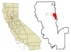
mapsize = 250x200px
map_caption = Location in Sutter County and the state ofCalifornia
mapsize1 =
map_caption1 =
image_dot_
dot_mapsize =
dot_map_caption =
dot_x =
dot_y =
pushpin_
pushpin_label_position =
pushpin_map_caption =
pushpin_mapsize =
subdivision_type = Country
subdivision_name =United States
subdivision_type1 = State
subdivision_name1 =California
subdivision_type2 = County
subdivision_name2 = Sutter
subdivision_type3 =
subdivision_name3 =
subdivision_type4 =
subdivision_name4 =
government_footnotes =
government_type = Council-Manager
leader_title =Mayor
leader_name = John Miller
leader_title1 =
leader_name1 =
leader_title2 =
leader_name2 =
leader_title3 =
leader_name3 =
leader_title4 =
leader_name4 =
established_title = Founded
established_date = 1849
established_title2 = Incorporated
established_date2 =January 23 1908
established_title3 =
established_date3 =
area_magnitude =
unit_pref =
area_footnotes =
area_total_km2 = 24.4
area_land_km2 = 24.3
area_water_km2 = 0.2
area_total_sq_mi = 13.887
area_land_sq_mi = 9.4
area_water_sq_mi = 0.1
area_water_percent =
area_urban_km2 =
area_urban_sq_mi =
area_metro_km2 =
area_metro_sq_mi =
area_blank1_title =
area_blank1_km2 =
area_blank1_sq_mi =
population_as_of = 2006
population_footnotes =
population_note =
population_total = 36,758
population_density_km2 = 1515.2
population_density_sq_mi = 3924.4
population_metro = 165,080
population_density_metro_km2 =
population_density_metro_sq_mi =
population_urban = 97,645 [http://www.citypopulation.de/USA-UA.html]
population_density_urban_km2 =
population_density_urban_sq_mi =
population_blank1_title =
population_blank1 =
population_density_blank1_km2 =
population_density_blank1_sq_mi =
timezone = PST
utc_offset = -8
timezone_DST = PDT
utc_offset_DST = -7
latd = 39 |latm = 8 |lats = 5 |latNS = N
longd = 121 |longm = 37 |longs = 34 |longEW = W
elevation_footnotes =
elevation_m = 18
elevation_ft = 59
postal_code_type = ZIP codes
postal_code = 95991-95993 (P.O.Box 95992)
area_code = 530
blank_name = FIPS code
blank_info = 06-86972
blank1_name = GNIS feature ID
blank1_info = 1660222
website = [http://www.yubacity.net]
footnotes =Yuba City is a
Northern California city, founded in 1849. It is thecounty seat of Sutter County,California ,United States . As of2006 , Yuba City had an estimated total population of 60,360 [ [http://quickfacts.census.gov/qfd/states/06/0686972.html Yuba City Quickfacts from US Census Bureau] ] .Yuba City is the principal city of the
Yuba City Metropolitan Statistical Area which encompasses all of Sutter County and Yuba County. The metro area's population is 164,138 [ [http://factfinder.census.gov/servlet/ADPTable?_bm=y&-context=adp&-qr_name=ACS_2007_1YR_G00_DP2&-ds_name=ACS_2007_1YR_G00_&-tree_id=307&-redoLog=false&-_caller=geoselect&-geo_id=05000US06115&-format=&-_lang=en Yuba County 2007 Census Estimate] ] [ [http://factfinder.census.gov/servlet/ADPTable?_bm=y&-context=adp&-qr_name=ACS_2007_1YR_G00_DP2&-ds_name=ACS_2007_1YR_G00_&-tree_id=307&-redoLog=false&-_caller=geoselect&-geo_id=05000US06101&-format=&-_lang=en Sutter County 2007 Census Estimate] ] . It is the 21st largest metropolitan area in California ranked behind Redding and Chico.History
The
Maidu people were settled in the region when they were first encountered by Spanish and Mexican scouting expeditions in the early 1800s. One version of the origin of the name "Yuba" is that during one of these expeditions, wild grapes were seen growing by a river, and so it was named "Uba", a variant spelling of the Spanish word "uva" (grape).The Mexican government granted a large expanse of land which included the area in which Yuba City is situated to
John Sutter , the same John Sutter upon whose land gold was subsequently discovered in 1848. He sold part of this tract to some enterprising men who wished to establish a town near the confluence of theYuba River and theFeather River , tributaries of theSacramento River , with an eye to developing a commercial center catering to the thousands of gold miners headed upstream to the gold fields. At the same time, another town was developing on the eastern bank of the Feather River, the beginnings of what later would become Marysville.By 1852 Yuba City had one hotel, a grocery store, a post office, approximately 20 dwelling homes with a population of about 150.
The
county seat for Sutter County, CA was chosen to be Yuba City in 1854. The same year, however, voters decided that Nicolaus, CA would be a better location, and the county seat was moved there. County voters returned to their first choice of Yuba City two years later, in 1856, and it has remained the county seat since. [cite web |url=http://www.yubacity.net/100/history.aspx |title=History of Yuba City |accessdate=2008-10-11]Yuba City saw its first major influx of population after The Second World War, pushing residential areas west and south from the city's original center. Orchards were turned into residential areas as new homes were built to provide the amount of people migrating to the city. [cite web |url=http://www.yubacity.net/documents/Finance/2007-2009-Biennial-Budget/Chapter-23.pdf |title=Yuba City At A Glance |accessdate=2008-10-11]
In December, 1955, a series of storms dropped torrential rain throughout northern California. The deluge caused all the rivers in the region to overflow their banks and to break through levees. The Christmas Eve levee break at Yuba City was particularly disastrous, with 38 people losing their lives, [cite web |url=http://www.yubacity.net/100/history.aspx |title=History of Yuba City |accessdate=2008-10-11] and heavy damage occurring in the downtown section. According to Dick Brandt, manager of the Yuba County airport in 1955, between 550 and 600 Sutter County residents were rescued from the floodwater by helicopter.
On March 14, 1961, a
B-52 Stratofortress carrying nuclear weapons, flying near Yuba City encountered a pressurization problem, and had to drop to a lower altitude. As such, more fuel than expected was used, and the aircraft ran out of fuel. It crashed before meeting with a tanker aircraft. The pilot gave the bailout command, and the crew egressed at 10,000 ft, except for the pilot, who ejected at 4,000 ft, while avoiding a populated area. The aircraft was destroyed. The weapons, two Mark 39 thermonuclear bombs (identified from declassified Department of Energy films and photographs) were destroyed on impact though no explosion took place, and there was no release of radioactive material as a result. [cite book
last = Maggelet
first = Michael H.
coauthors= James C. Oskins
title = Broken Arrow - The Declassified History of U.S. Nuclear Weapons Accidents
publisher =Lulu.com
year = 2008
isbn = 9781435703612 ]Geography
Yuba City is located at 39°8'5" North, 121°37'34" West (39.134792, -121.626201)GR|1. The
Feather River lies at the edge of Yuba city.According to the
United States Census Bureau , the city has a total area of 9.4square mile s (24.4km² ), of which, 9.4 square miles (24.3 km²) of it is land and 0.1 square miles (0.2 km²) of it is water. The total area is 0.64% water.The Yuba City area is 40 minutes north of Sacramento and is part of the
Sacramento Valley . Sutter County is also home to the smallest mountain range in the world (theSutter Buttes [http://tapestry.usgs.gov/features/33sutter.html] ). The area is sometimes called the "Feather River Valley" named for the river that divides Yuba City from its neighbor Marysville. An example is the minor league baseball team, the Feather River Mudcats of theWestern Baseball League in the late 1990s.Demographics
As of the
census GR|2 of 2000, there are 36,758 people (60,507 as of 1/1/2006), 13,290 households, and 8,944 families residing in the city. Thepopulation density is 3,924.4 people per square mile (1,514.7/km²). There are 13,912 housing units at an average density of 1,485.3/sq mi (573.3/km²). The racial makeup of the city is 67.0% White, 2.8% African American, 0.9% Native American, 3.6%Asian American , 0.1% Pacific Islander, 5.5% from other races, and 2.4% from two or more races. 12.5% of the population are Hispanic or Latino of any race. The European population in Yuba City is 0.5% Romanian, 0.7% Portugal, 1.6% Spaniards, 0.3% Italian, and 1.6% GermanFact|date=June 2008.There are 13,290 households out of which 36.7% have children under the age of 18 living with them, 47.6% are married couples living together, 14.3% have a female householder with no husband present, and 32.7% are "non-families." 26.5% of all households are made up of individuals and 9.7% have someone living alone who is 65 years of age or older. The average household size is 2.70 and the average family size is 3.28.
In the city the population is spread out with 29.0% under the age of 18, 10.7% from 18 to 24, 29.4% from 25 to 44, 18.7% from 45 to 64, and 12.2% who are 65 years of age or older. The median age is 32 years. For every 100 females there are 95.5 males. For every 100 females age 18 and over, there are 91.7 males.
The median
income for a household in the city is $32,858, and the median income for a family is $39,381. Males have a median income of $34,303 versus $23,410 for females. Theper capita income for the city is $15,928. 18.1% of the population and 14.5% of families are below thepoverty line . Out of the total population, 24.8% of those under the age of 18 and 9.5% of those 65 and older are living below the poverty line.Agricultural economy
The Yuba-Sutter area is not developed as a tourist location as the wine-producing counties to the southwest, but it has some of the best agricultural land in the United States, placed between the Sierra Nevada mountains to the east and the Coast Range to the west.
John Sutter
Yuba City's agricultural history dates back to the 1840s when
John Sutter started a stock ranch that was later set on fire by vandals. However, since then people have continued to move to and cultivate crops due to the fertile soil and great climate. The ten leading crops in cultivation are rice, beans, tomatoes, melons, alfalfa, hay, tree crops of peaches, almonds, walnuts, and plums.unsweet Inc. headquarters
Yuba City is home to the largest
dried fruit processing plant in the world [http://www.sunsweet.com/about/] ,Sunsweet Growers Incorporated , so it isn't surprising that beginning in 1988 Yuba City was home to the California Prune Festival. In 2001 the name was changed to theCalifornia Dried Plum Festival and in early 2003 directors announced the end of the festival's 15 year run in the Yuba-Sutter area. This was primarily due to rise in costs, difficulty in securing sponsors, and competition from other festivals.Arts and Culture
Annual Events
ikh Parade
Yuba City is known for its sizable
Sikh community. [http://www.tribuneindia.com/2005/20051106/spectrum/main1.htm] The Punjabi population in theYuba-Sutter Area has grown to be one of the largest in the United States and one of the largest Sikh populations outside of the Punjab state of India. Each year on the first Sunday of November, Sikhs from the United States, Canada, India, the United Kingdom and throughout the world attend the Sikh parade in Yuba City, which commemorates the receipt by Sikhs of their Holy scripture, the Guru Granth Sahib, in 1708. The 4.5-mile-long parade features floats and a procession of parade participants. The 2005 parade, the 26th to be held, drew an estimated 56,000 Sikhs. The parade provides economic benefits to Punjabi culture sections of the city as well. The 2007 parade, the 28th annual Sikh parade, drew approximately 75,000 to 85,000 people of both Sikh and non- Sikh background. It is believed that the 2007 Sikh parade broke a record for having the most people attend the parade as compared to the previous Sikh parades. [http://www.kcra.com/news/1041002/detail.html]Museums and other points of interest
*
Community Memorial Museum of Sutter County Politics
In the state legislature Yuba City is located in the 4th Senate District, represented by Republican
Sam Aanestad , and in the 2nd Assembly District, represented by RepublicanDoug LaMalfa . Federally, Yuba City is located inCalifornia's 2nd congressional district , which has a Cook PVI of R +13chools
Public schools are part of the
Yuba City Unified School District [ [http://www.ycusd.k12.ca.us/ Yuba City Unified School District] ] .
*Yuba City High School
*Faith Christian High School
*River Valley High School
*Albert Powell Continuation High School
*Riverbend k-8
*Gray Avenue Middle School
*Andros Karperos Middle School: It has an enrollment of approximately 1,200 students and has been running since the early to mid 1990s. It is often called simply AK and is within the Yuba City Unified School District.
*Park Avenue Elementary School
*King Avenue Elementary School
*Tierra Buena Elementary School
*Barry Elementary School
*Butte Vista Elementary School
*St Isidores School
*Grace Christian School
*Lincrest Elementary School
*Lincoln Elementary School: It is located at the corner of Lincoln Road and Walton Avenue.
*Bridge Street Elementary School: The principal is Frank Alverez, a former elementary school teacher. It is the oldest elementary school still open in Yuba City.
*April Lane Elementary School
*Central Gather Elementary School
*Yuba City Charter School
*Franklin Elementary SchoolParks
Community parks:
*Sam Brannan Park
*Blackburn-Talley Sports Complex/Park
*Gauche ParkNeighborhood parks:
*Bogue Park
*Greenwood Park
*Happy Park
*Hillcrest Park
*Kingwood Park
*Lloyd Park
*Maple Park
*Moore Park
*Nakwhal Park
*Northridge Park
*Patriot Park
*Regency Park
*Shanghai Garden Park
*Southside Park Passive parks:
*Clark-Ainsley Mini Park
*Plumas Tower Plaza Mini Park
*Veterans Memorial ParkOther recreational facilities:
*April Lane School/Park
*Geweke Field
*City Hall
*Senior Center
*Feather River Levee Bike TrailNotable residents and natives
*
Guy Branum , TV writer.
*Michael P. Moran ,actor and screenplay writer
*Charlie Peacock , award-winning songwriter, recording artist, record producer.
*Charlotte Stewart , film and television actress.ister/twin cities
*flagicon|Japan -
Fujishiro, Ibaraki ,Japan as determined bySister Cities International .ee also
*
Yuba County, California
*Yuba-Sutter Area
*Marysville, California References
External links
* [http://www.punjabiheritage.org Punjabi American Heritage Society of Yuba City]
* [http://www.yubacity.net City of Yuba City]
* [http://www.ycpd.org Yuba City Police Department]Geographic Location
Centre =Yuba City, California
North = Live Oak
Northeast =
East =Marysville
Linda
Southeast =Olivehurst, California
South =Sacramento, California
Southwest = South Yuba City
West = Tierra Buena
Northwest =
Wikimedia Foundation. 2010.