- Yuba County, California
-
County of Yuba — County — 
SealLocation in the state of California California's location in the United States
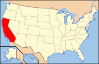
Country  United States
State  California
Region Sacramento Valley Metro area Greater Sacramento Incorporated 1850 County seat Marysville Area – Total 1,667.3 km2 (643.73 sq mi) – Land 1,633.5 km2 (630.69 sq mi) – Water 33.8 km2 (13.04 sq mi) Population (2010) – Total 72,155 – Density 43.3/km2 (112.1/sq mi) Time zone Pacific Standard Time (UTC-8) – Summer (DST) Pacific Daylight Time (UTC-7) Website www.co.yuba.ca.us Yuba County is a county located in the U.S. state of California's Central Valley, north of Sacramento, along the Feather River. As of the 2010 census, its population was 72,155. The county seat is Marysville. Yuba County is part of the Greater Sacramento area.
Contents
History
Yuba County was one of the original counties of California, formed in 1850 at the time of statehood. Parts of the county's territory were given to Placer County in 1851, to Nevada County in 1851 and to Sierra County in 1852.
The county was named after the Yuba River by Captain John Sutter for the Native American village Yubu, Yupu or Juba near the confluence of the Yuba and Feather rivers. General Mariano Vallejo stated that the river was named Uba by an exploring expedition in 1824 because of the quantities of wild grapes (uvas silvestres in Spanish) which they found growing on its banks.
Geography
According to the 2000 census, the county has a total area of 643.73 square miles (1,667.3 km2), of which 630.69 square miles (1,633.5 km2) (or 97.97%) is land and 13.04 square miles (33.8 km2) (or 2.03%) is water.[1] The county lies along the western slope of the Sierra Nevada, the steep slopes making it prime territory for the siting of hydroelectric power plants.
A portion of the county, where Marysville (the county seat) and most of the population lives, is west of the mountains on the valley floor. There is a great deal of agriculture business in this part of the county, especially fruit orchards, rice fields, and cattle grazing.[2]
Incorporated cities
Census-designated places (CDPs)
- Beale Air Force Base
- Camptonville
- Challenge-Brownsville
- Dobbins
- Linda
- Loma Rica
- Olivehurst
- Plumas Lake
- Smartsville
Other unincorporated communities
- Alicia
- Arboga
- Binney Junction
- Browns Valley
- Brownsville
- Challenge
- Dantoni
- Eagleville
- East Arboga
- Frenchtown
- Greenville
- Hammonton
- Horstville
- Iowa City
- Mello
- North Star
- Oak Valley
- Olive Hill
- Oregon House
- Ostrom
- Pearson
- Rackerby
- Ramirez
- Rancho Loma Rica
- Sharon Valley
- Sicard Flat
- South Yuba
- Stanfield Hill
- Strawberry Valley
- Sucker Flat
- Tambo
- Timbuctoo
- Waldo Junction
- Weeds Point
- West Linda
- Woodleaf
These are additional placenames in Yuba county. Some of these are viable communities, others are historic places that are now just a spot off the highway. Some of these are in the mountains, others in the valley. Many are old mining communities which have long since disappeared. Some of these locations have been integrated into larger, adjacent communities as the current rate of growth does not favor the small detached locale.
- Abbott House
- Algodon
- Bartons House
- Bliss
- Bullards Bar
- California House
- Camp Pendola
- Cape Horn Bar
- Condemned Bar
- Coombs
- Cordua Bar
- Depot Hill
- Egan
- Empire House
- English Bar
- Erle
- Foster Bar
- Frenches Ravine
- Galena Hill
- Galena House
- Garden Valley
- Golden Ball
- Honkut
- Huntington
- Hutchins
- Kentucky Ranch
- Landers Bar
- Lasslys
- Lewis
- Malay Camp
- Marigold
- Martins House
- Mission
- Mount Hope House
- New York Flat
- New York House
- New York House Flat
- New York Ranch
- Newbert
- Oak Grove
- Oakland
- Oliver
- Oso
- Plumas
- Plumas Landing
- Prairie Diggings
- Prairie House
- Prairie House
- Rail Road Hill
- Reed Junction
- Round Tent
- Seneca House
- Sweet Vengeance
- Taisida
- Youngs Hill
- Yuba
- Yuba County House
Adjacent counties
- Placer County, California - south
- Sutter County, California - west
- Butte County, California - north
- Plumas County, California - northeast
- Sierra County, California - northeast
- Nevada County, California - east
Ecology
National protected areas within Yuba County include portions of the Plumas National Forest and the Tahoe National Forest. In addition to these identified protected areas the county has extensive natural areas consisting of forestation, grassland, riparian area, grassland and other habitats. The county exhibits a considerable diversity of flowering plant species, among which is the Yellow Mariposa Lily, Calochortus luteus.[3]
Transportation Infrastructure
Major highways
Public transportation
Yuba Sutter Transit operates local bus service, as well as commuter runs to Downtown Sacramento. Greyhound buses stop in Marysville.
Airports
Yuba County Airport is located three miles (5 km) south of Marysville. It is a general aviation airport.
Brownsville Aero Pines Airport is located off La Porte Rd in Brownsville.
Education
Higher education is available at the county's Junior College, Yuba Community College. The county also has a Yuba County Library system with one branch in Marysville.
Yuba County schools have a 66.4% suspension rate with 9256 students receiving suspensions out of 13928 students enrolled in Yuba County schools.[4]
Politics
Yuba County vote
by party in presidential electionsYear GOP DEM Others 2008 56.2% 12,007 41.5% 8,866 2.3% 492 2004 67.0% 12,076 31.6% 5,687 1.5% 261 2000 61.0% 9,838 28.7% 2,498 4.6% 743 1996 51.5% 7,971 37.4% 5,789 11.1% 710 1992 43.4% 7,333 34.2% 5,785 22.4% 3,777 1988 61.4% 8,937 37.4% 5,444 1.3% 182 1984 63.5% 9,780 34.7% 5,339 1.8% 278 1980 56.3% 7,942 34.7% 4,896 9.0% 1,273 1976 44.7% 5,496 52.5% 6,451 2.8% 338 1972 57.0% 6,623 38.1% 4,435 4.9% 572 1968 48.2% 5,371 40.0% 4,461 11.8% 1,318 1964 42.3% 4,964 57.6% 6,766 0.1% 9 1960 51.7% 5,293 47.7% 4,882 0.6% 58 1956 55.8% 4,782 43.9% 3,767 0.3% 27 1952 60.4% 5,840 38.9% 3,762 0.7% 63 1948 46.9% 3,403 49.7% 3,608 2.5% 252 1944 42.1% 2,379 57.6% 3,254 0.2% 13 1940 34.2% 2,471 64.6% 4,660 1.2% 86 1936 24.0% 1,332 74.2% 4,125 1.9% 104 1932 26.2% 1,176 69.8% 3,138 4.0% 179 1928 50.0% 2,022 49.2% 1,990 0.7% 30 1924 45.9% 1,735 11.3% 426 42.9% 1,621 1920 70.7% 2,012 24.5% 696 4.9% 138 Yuba is a strongly Republican county in Presidential and congressional elections. The last Democrat to win a majority in the county was Jimmy Carter in 1976. Yuba is part of California's 2nd congressional district, which is held by Republican Wally Herger. In the state legislature Yuba is in the 3rd Assembly district, which is held by Republican Dan Logue, and the 4th Senate district, which is held by Republican Doug LaMalfa.
Demographics
2010
The 2010 United States Census reported that Yuba County had a population of 72,155. The racial makeup of Yuba County was 49,332 (68.4%) White, 2,361 (3.3%) African American, 1,675 (2.3%) Native American, 4,862 (6.7%) Asian, 293 (0.4%) Pacific Islander, 8,545 (11.8%) from other races, and 5,087 (7.1%) from two or more races. Hispanic or Latino of any race were 18,051 persons (25.0%).[5]
Population reported at 2010 United States Census The County Total
PopulationWhite African
AmericanNative
AmericanAsian Pacific
Islanderother
racestwo or
more racesHispanic
or Latino
(of any race)Yuba County 72,155 49,332 2,361 1,675 4,862 293 8,545 5,087 18,051 Incorporated
citiesTotal
PopulationWhite African
AmericanNative
AmericanAsian Pacific
Islanderother
racestwo or
more racesHispanic
or Latino
(of any race)Marysville 12,072 8,576 522 298 498 38 1,247 893 2,920 Wheatland 3,456 2,633 41 58 203 5 278 238 620 Census-designated
placesTotal
PopulationWhite African
AmericanNative
AmericanAsian Pacific
Islanderother
racestwo or
more racesHispanic
or Latino
(of any race)Beale AFB 1,319 949 117 32 45 8 50 118 191 Camptonville 158 117 0 15 2 0 4 20 5 Challenge-Brownsville 1,148 1,006 10 31 5 3 10 83 90 Dobbins 624 517 5 52 6 0 9 35 28 Linda 17,773 9,973 722 361 2,304 80 3,029 1,304 5,779 Loma Rica 2,368 2,085 20 60 20 2 52 129 211 Olivehurst 13,656 8,534 322 399 772 61 2,623 945 4,994 Plumas Lake 5,853 3,923 372 73 474 44 451 516 1,312 Smartsville 177 157 0 5 0 0 9 6 18 Unincorporated
communitiesTotal
PopulationWhite African
AmericanNative
AmericanAsian Pacific
Islanderother
racestwo or
more racesHispanic
or Latino
(of any race)All others not CDPs (combined) 13,551 10,862 230 291 533 52 783 800 1,883 2000
As of the census[6] of 2000, there were 60,219 people, 20,535 households, and 14,805 families residing in the county. The population density was 96 people per square mile (37/km²). There were 22,636 housing units at an average density of 36 per square mile (14/km²). The racial makeup of the county was 70.64% White, 3.16% Black or African American, 2.61% Native American, 7.50% Asian, 0.20% Pacific Islander, 9.95% from other races, and 5.94% from two or more races. 17.35% of the population were Hispanic or Latino of any race. 11.2% were of German, 10.4% American, 7.6% Irish and 7.5% English ancestry according to Census 2000. 78.8% spoke English, 13.2% Spanish and 4.7% Hmong as their first language.
There were 20,535 households out of which 38.1% had children under the age of 18 living with them, 53.2% were married couples living together, 13.3% had a female householder with no husband present, and 27.90% were non-families. 21.7% of all households were made up of individuals and 8.2% had someone living alone who was 65 years of age or older. The average household size was 2.87 and the average family size was 3.34.
In the county the population was spread out with 31.0% under the age of 18, 10.7% from 18 to 24, 28.0% from 25 to 44, 19.6% from 45 to 64, and 10.6% who were 65 years of age or older. The median age was 31 years. For every 100 females there were 101.6 males. For every 100 females age 18 and over, there were 99.4 males.
The median income for a household in the county was $30,460, and the median income for a family was $34,103. Males had a median income of $27,845 versus $21,301 for females. The per capita income for the county was $14,124. About 16.3% of families and 20.8% of the population were below the poverty line, including 27.6% of those under age 18 and 7.8% of those age 65 or over.
Media
MySYtv.com provides television coverage of local events in the area.
Line notes
- ^ "Census 2000 U.S. Gazetteer Files: Counties". United States Census. http://www.census.gov/tiger/tms/gazetteer/county2k.txt. Retrieved 2011-02-13.
- ^ Caroline M. Olney. 1902
- ^ C. Michael Hogan. 2009. Yellow Mariposa Lily: Calochortus luteus, GlobalTwitcher.com, ed. N. Stromberg
- ^ "California State - Expulsion, Suspension, and Truancy Information for 2009-10". http://dq.cde.ca.gov/dataquest/Expulsion/ExpReports/StateExp.aspx?cYear=2009-10&cChoice=ExpData1a&Pageno=1. Retrieved 25 June 2011.
- ^ "2010 Census P.L. 94-171 Summary File Data". United States Census Bureau. http://www2.census.gov/census_2010/01-Redistricting_File--PL_94-171/California/.
- ^ "American FactFinder". United States Census Bureau. http://factfinder.census.gov. Retrieved 2008-01-31.
See also
- Hiking trails in Yuba County
- National Register of Historic Places listings in Yuba County, California
Sources
- Caroline M. Olney (December 1902). Mountains and Valleys of Yuba County. XL. pp. 567–588. http://books.google.com/?id=1gYNAQAAIAAJ&pg=RA8-PA567.
External links

Butte County Plumas County and Sierra County Sutter County 
Nevada County  Yuba County, California

Placer County Municipalities and communities of Yuba County, California Cities 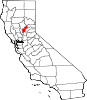
CDPs Beale AFB | Camptonville | Challenge-Brownsville | Dobbins | Linda | Loma Rica | Olivehurst | Plumas Lake | Smartsville
Unincorporated
communitiesAlicia | Arboga | Binney Junction | Browns Valley | Brownsville | Challenge | Dantoni | Eagleville | East Arboga | Frenchtown | Greenville | Hammonton | Horstville | Iowa City | Mello | North Star | Oak Valley | Olive Hill | Oregon House | Ostrom | Pearson | Rackerby | Ramirez | Rancho Loma Rica | Sharon Valley | Sicard Flat | South Yuba | Stanfield Hill | Strawberry Valley | Sucker Flat | Tambo | Timbuctoo | Waldo Junction | Weeds Point | West Linda | Woodleaf
Ghost towns Abbott House | Algodon | Bartons House | Bliss | Bullards Bar | California House | Camp Pendola | Cape Horn Bar | Condemned Bar | Coombs | Cordua Bar | Depot Hill | Egan | Empire House | English Bar | Erle | Foster Bar | Frenches Ravine | Galena Hill | Galena House | Garden Valley | Golden Ball | Honkut | Huntington | Hutchins | Kentucky Ranch | Landers Bar | Lasslys | Lewis | Malay Camp | Marigold | Martins House | Mission | Mount Hope House | New York Flat | New York House | New York House Flat | New York Ranch | Newbert | Oak Grove | Oakland | Oliver | Oso | Plumas | Plumas Landing | Prairie Diggings | Prairie House | Prairie House | Rail Road Hill | Reed Junction | Round Tent | Seneca House | Sweet Vengeance | Taisida | Youngs Hill | Yuba | Yuba County House
Greater Sacramento Counties Douglas (NV) · El Dorado · Nevada · Placer · Sacramento · Sutter · Yolo · Yuba
Major City Cities
and
towns100k–200k25k–100kArden Arcade · Auburn · Carmichael · Citrus Heights · Davis · Folsom · Florin · Laguna · Lincoln · North Highlands · Orangevale · Parkway-South Sacramento · Rancho Cordova · Rocklin · West Sacramento · Woodland · Yuba City
10k–25kCameron Park · El Dorado Hills · Fair Oaks · Foothill Farms · Galt · Gardnerville Ranchos (NV) · Granite Bay · Grass Valley · La Riviera · Linda · Marysville · North Auburn · Olivehurst · Placerville · Rosemont · Rio Linda · South Lake Tahoe · South Yuba City · Truckee · Vineyard
Sub-regions Gold Country · Lake Tahoe · Sacramento Valley · Sierra Nevada · Yuba-Sutter Area
Categories:- California counties
- Yuba County, California
- Sacramento metropolitan area


Wikimedia Foundation. 2010.