- Madera County, California
-
County of Madera — County — 
SealLocation in the state of California California's location in the United States
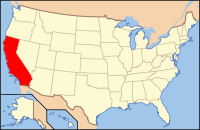
Country  United States
State  California
Region San Joaquin Valley/Sierra Nevada Metro Area Metropolitan Fresno Incorporated 1893 County seat Madera Area – Total 2,153.32 sq mi (5,577.1 km2) – Land 2,135.86 sq mi (5,531.9 km2) – Water 17.46 sq mi (45.2 km2) Population (2010) – Total 150,865 – Density 70.6/sq mi (27.3/km2) Time zone Pacific Standard Time (UTC-8) – Summer (DST) Pacific Daylight Time (UTC-7) Website www.madera-county.com Madera County is a county of the U.S. state of California, located in the Central Valley and the Sierra Nevada north of Fresno County. It comprises the Madera-Chowchilla, CA Metropolitan Statistical Area. As of the 2010 census the population was 150,865. The county seat is Madera.
The southernmost part of Yosemite National Park is located in the county's northeast.
Contents
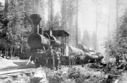
History
 Logging in the Sierra, Madera County, about 1901
Madera County was formed in 1893, from the southern part of Mariposa County during a special election held on May 16, 1893. Citizens residing in the area that was to become Madera County voted 1,179 to 358 for establishment of the new county.[1]
Madera is the Spanish term for wood.[2] The county derives its name from the town of Madera, named when the California Lumber Company built a log flume to carry lumber to the Central Pacific Railroad there in 1876.[citation needed]
Geography
According to the 2000 census, the county has a total area of 2,153.32 square miles (5,577.1 km2), of which 2,135.86 square miles (5,531.9 km2) (or 99.19%) is land and 17.46 square miles (45.2 km2) (or 0.81%) is water.[3] The total area is 0.81% water.
Cities and towns
- Ahwahnee
- Bass Lake
- Bonadelle Ranchos-Madera Ranchos
- Chowchilla
- Coarsegold
- Knowles
- Madera
- Madera Acres
- North Fork
- O'Neals
- Oakhurst
- Parksdale
- Parkwood
- Raymond
- Ripperdan
- Sugar Pine
- Yosemite Lakes
Adjacent counties
- Fresno County, California - south, west
- Merced County, California - northwest
- Mariposa County, California - north
- Tuolumne County, California - northeast
- Mono County, California - northeast
National protected areas
- Devils Postpile National Monument
- Inyo National Forest (part)
- Sierra National Forest (part)
- Yosemite National Park (part)
Transportation infrastructure
Major highways
Other roads
The eastern side of Madera County, which includes Devil's Postpile National Monument and part of Minaret Summit, is unconnected to the rest of Madera County by road. This only road into this area is Minaret Summit Road which becomes State Route 203 at the Mono County border, connecting this area to Mammoth Lakes. Red's Meadow Road is a further extension of this route.
The gap between Minaret Road (not to be confused with Minaret Summit Road), which runs northeast into the Sierras from North Fork, and the end of the Red's Meadow Road is less than 10 miles, and plans for a highway (or tunnel) connecting the Eastern Sierra and the San Joaquin Valley via Minaret Summit had often been discussed. An area southwest of Minaret Summit was not included in the Wilderness Act of 1964 in order to leave a corridor for this possibility. During his time as Governor of California, Ronald Reagan made a horse packing trip into the area. Afterwards he supported conservationists' efforts to prevent this highway. Reagan continued his efforts after being elected President in 1980 and the area was eventually designated wilderness by the California Wilderness Act of 1984.
Public transportation
- Madera County Connection provides service between the cities of Madera and Chowchilla. Routes also run to eastern Madera County. A connection to Fresno can be made at Children's Hospital Central California near the county line.
- The cities of Madera and Chowchilla also have their own local transit services.
- Greyhound buses and Amtrak trains stop in Madera.
Airports
- Madera Municipal Airport and Chowchilla Airport are general aviation airports.
Demographics
Historical populations Census Pop. %± 1900 6,364 — 1910 8,368 31.5% 1920 12,203 45.8% 1930 17,164 40.7% 1940 23,314 35.8% 1950 36,964 58.5% 1960 40,468 9.5% 1970 41,519 2.6% 1980 63,116 52.0% 1990 88,090 39.6% 2000 123,109 39.8% 2010 150,865 22.5% [4][5] 2010
The 2010 United States Census reported that Madera County had a population of 150,865. The racial makeup of Madera County was 94,456 (62.6%) White, 5,629 (3.7%) African American, 4,136 (2.7%) Native American, 2,802 (1.9%) Asian, 162 (0.1%) Pacific Islander, 37,380 (24.8%) from other races, and 6,300 (4.2%) from two or more races. Hispanic or Latino of any race were 80,992 persons (53.7%).[6]
Population reported at 2010 United States Census The County Total
PopulationWhite African
AmericanNative
AmericanAsian Pacific
Islanderother
racestwo or
more racesHispanic
or Latino
(of any race)Madera County 150,865 94,456 5,629 4,136 2,802 162 37,380 6,300 80,992 Incorporated
cityTotal
PopulationWhite African
AmericanNative
AmericanAsian Pacific
Islanderother
racestwo or
more racesHispanic
or Latino
(of any race)Chowchilla 18,720 11,533 2,358 376 395 37 3,313 708 7,073 Madera 61,416 30,640 2,069 1,933 1,369 72 22,603 2,730 47,103 Census-designated
placeTotal
PopulationWhite African
AmericanNative
AmericanAsian Pacific
Islanderother
racestwo or
more racesHispanic
or Latino
(of any race)Ahwahnee 2,246 2,064 6 30 16 0 38 92 196 Bass Lake 527 503 1 10 1 0 2 10 22 Bonadelle Ranchos-Madera Ranchos 8,569 7,034 114 120 207 4 811 279 2,305 Coarsegold 1,840 1,617 11 50 32 6 47 77 156 Fairmead 1,447 764 88 23 7 0 497 68 984 La Vina 279 117 3 0 0 0 150 9 265 Madera Acres 9,163 5,838 241 161 114 5 2,448 356 5,985 Nipinnawasee 475 422 2 9 0 0 3 39 50 Oakhurst 2,829 2,532 22 61 44 3 66 101 473 Parksdale 2,621 1,155 56 65 18 3 1,231 93 2,278 Parkwood 2,268 1,138 123 48 22 0 814 123 1,784 Rolling Hills 742 642 16 11 25 2 34 12 143 Yosemite Lakes 4,952 4,408 38 91 51 8 131 225 517 Unincorporated
communitiesTotal
PopulationWhite African
AmericanNative
AmericanAsian Pacific
Islanderother
racestwo or
more racesHispanic
or Latino
(of any race)All others not CDPs (combined) 32,771 24,049 481 1,148 501 22 5,192 1,378 11,658 2000
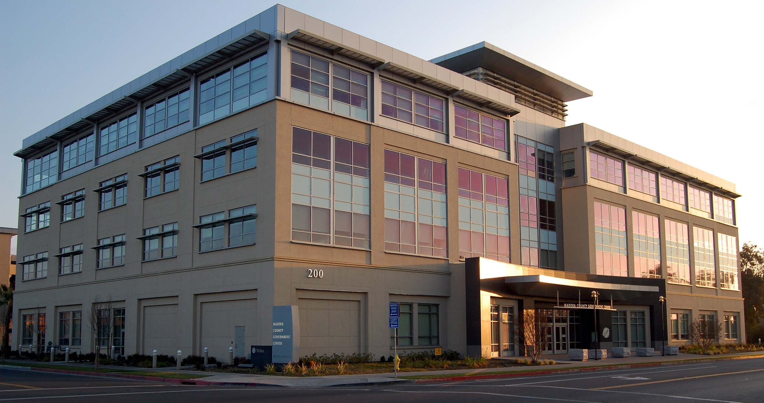
 County government office building.
As of the census[7] of 2000, there are 123,109 people in the county, organized into 36,155 households, and 28,598 families. The population density is 58 people per square mile (22/km²). There are 40,387 housing units at an average density of 19 per square mile (7/km²). The racial makeup of the county is 62.23% White, 4.12% Black or African American, 2.61% Native American, 1.27% Asian, 0.17% Pacific Islander, 24.35% from other races, and 5.25% from two or more races. 44.28% of the population are Hispanic or Latino of any race. 8.0% were of German, 5.9% English, 5.4% American and 5.3% Irish ancestry according to Census 2000. 63.6% spoke English and 33.7% Spanish as their first language.
There are 36,155 households out of which 40.2% have children under the age of 18 living with them, 60.9% are married couples living together, 12.2% have a female householder with no husband present, and 20.9% are non-families. 16.5% of all households are made up of individuals and 7.7% have someone living alone who is 65 years of age or older. The average household size is 3.18 and the average family size is 3.52.
In the county the population is spread out with 29.6% under the age of 18, 9.9% from 18 to 24, 29.1% from 25 to 44, 20.4% from 45 to 64, and 11.0% who are 65 years of age or older. The median age is 33 years. For every 100 females there are 91.8 males. For every 100 females age 18 and over, there are 86.0 males.
The median income for a household in the county is $36,286, and the median income for a family is $39,226. Males have a median income of $33,658 versus $24,415 for females. The per capita income for the county is $14,682. 21.4% of the population and 15.9% of families are below the poverty line. Out of the total population, 28.6% of those under the age of 18 and 9.0% of those 65 and older are living below the poverty line.
Government and politics
Presidential election results Year GOP DEM Others 2008 56.4% 20,251 41.8% 14,997 1.8% 652 2004 64.0% 24,871 34.7% 13,481 1.3% 498 2000 60.7% 20,283 34.9% 11,650 4.4% 1,462 1996 53.8% 16,510 36.7% 11,254 9.5% 2,898 1992 43.2% 13,066 35.9% 10,863 20.9% 6,316 1988 54.6% 13,255 43.8% 10,642 1.6% 384 1984 60.0% 13,954 38.7% 8,994 1.3% 293 1980 53.6% 10,599 39.3% 7,783 7.1% 1,398 1976 46.0% 6,844 51.2% 7,625 2.8% 423 1972 52.6% 7,835 44.2% 6,580 3.2% 477 1968 43.5% 6,229 48.5% 6,932 8.0% 1,142 1964 32.2% 4,461 67.7% 9,391 0.1% 10 1960 41.8% 5,869 57.8% 8,126 0.4% 62 Madera is a strongly Republican county in Presidential and congressional elections. The last Democrat to win a majority in the county was Jimmy Carter in 1976.
The vast majority of Madera is part of California's 19th congressional district, which is held by Republican Jeff Denham; a tiny part of Madera is in the 18th district, which is held by Democrat Dennis Cardoza. In the State Assembly, most of Madera is in the 25th district with a small part in the 19th district. Both districts are held by Republicans, Kristin Olsen and Linda Halderman respectively. In the State Senate, Madera is part of the 12th and 14th districts, which are held by Republicans Anthony Cannella and Tom Berryhill respectively.
On November 4, 2008 Madera County voted 73.4 % for Proposition 8 which amended the California Constitution to ban same-sex marriages.
The county is one of three counties in California to establish a separate department to deal with corrections pursuant to California Government Code §23013, the Madera County Department of Corrections, along with Napa County and Santa Clara County. The officers receive their powers under 831 and 831.5 of the California Penal Code.
See also
- Sierra National Forest
- Nelder Grove
- Fresno Dome
- List of school districts in Madera County, California
- Madera Community Hospital
- National Register of Historic Places listings in Madera County, California
- USS Madera County (LST-905)
References
- ^ Madera County GenWeb, Madera County History. Accessed 2010.04.11.
- ^ Madera County, County History. Accessed 2009.10.09.
- ^ "Census 2000 U.S. Gazetteer Files: Counties". United States Census. http://www.census.gov/tiger/tms/gazetteer/county2k.txt. Retrieved 2011-02-13.
- ^ http://www.census.gov/population/www/censusdata/cencounts/files/ca190090.txt
- ^ http://factfinder2.census.gov
- ^ "2010 Census P.L. 94-171 Summary File Data". United States Census Bureau. http://www2.census.gov/census_2010/01-Redistricting_File--PL_94-171/California/.
- ^ "American FactFinder". United States Census Bureau. http://factfinder.census.gov. Retrieved 2008-01-31.
External links
- Madera County GenWeb - Genealogy
- Official Madera County website
- Madera County History -- Transcription of 1933 document on the county's history
- Oakhurst Area Chamber of Commerce
- Yosemite Sierra Visitors Bureau
- Madera Tribune, newspaper for the county founded March 31, 1892
- Superior Court of Madera County
- Madera County Library
- Madera Community Hospital
- Madera Values Quarterly Magazine

Merced County Mariposa County Tuolumne County and Mono County Fresno County 
 Madera County, California

Fresno County Municipalities and communities of Madera County, California Cities 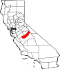
CDPs Ahwahnee | Bass Lake | Bonadelle Ranchos-Madera Ranchos | Coarsegold | Fairmead | La Vina | Madera Acres | Nipinnawasee | Oakhurst | Parksdale | Parkwood | Rolling Hills | Yosemite Lakes
Unincorporated
communitiesAhwahnee Estates | Bass Lake Annex | Berenda | Bonadelle Ranchos | Bonadelle Ranchos Five | Bonadelle Ranchos Nine | Bonita | Borden | Cascadel Woods | Central Camp | Dairyland | Daulton | Fine Gold | Fresno Crossing | Gregg | Hildreth | Indian Lakes Estates | Indian Springs | Irrigosa | Italian Swiss Colony | Kismet | Knowles | Knowles Junction | Lake Madera Country Estates | Madera Country Club Estates | Madera Highlands | Madera Ranchos | Minturn | North Fork | Notarb | Old Corral | O'Neals | Raymond | Ripperdan | River Road Estates | San Joaquin River Estates | Sharon | Sierra Vista | South Fork | Storey | Sugar Pine | Sumner Hill | The Pines | Trigo | Valley Lake Ranchos | Whisky Falls | Yosemite Forks | Yosemite Lakes Park
Indian
reservationsGhost towns Ash | Bailey Flats | Bethel | Birch | Buchanan | Califa | Cascadel | Femmon | Fort Miller | Gertrude | Gold | Grub Gulch | Herbert | Hillside | Jesbel | Lankershim | Lincoln | Magnet | Medano | Miami | Millerton | Minarets | Narbo | Oak | Ovejo | Plains | Rallsville | Starville | Talbot | Tharsa | Tillman | Tyler | Watt | Willow Glen | Wishon
Categories:- Madera County, California
- San Joaquin Valley
- California counties
- Metropolitan areas of California
- 1893 establishments in the United States
- Populated places established in 1893
- Counties of the United States with Hispanic majority populations


Wikimedia Foundation. 2010.